 |
Outdoor Adventure While RV Camping |
 |
 |
If you are an outdoor person there is much to do at our RV park resort. The most popular activity this time of the year is fishing . Neither Gwen nor I fish. In fact, I jokingly say that I've given the fish a chance, I throw in my line and tell them they have 15 minutes and if they haven't taken a bite, I'm "out-a-here". There is much that Gwen and I DO like in the outdoors. You will see that as I continue to build this page of the story. Fortunately it has not stopped raining since we moved into our fifth wheel. We need the rain because 2005 has been a drought year and most of the reservoirs are very low. You can check the level here. They have begun filling in the valley but still need much more in the mountains. Rain has slowed our outdoor recreation although rain does not usually stop sea kayaking . Neither Gwen nor I fish. In fact, I jokingly say that I've given the fish a chance, I throw in my line and tell them they have 15 minutes and if they haven't taken a bite, I'm "out-a-here". There is much that Gwen and I DO like in the outdoors. You will see that as I continue to build this page of the story. Fortunately it has not stopped raining since we moved into our fifth wheel. We need the rain because 2005 has been a drought year and most of the reservoirs are very low. You can check the level here. They have begun filling in the valley but still need much more in the mountains. Rain has slowed our outdoor recreation although rain does not usually stop sea kayaking . . |
|
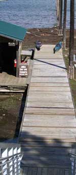 |
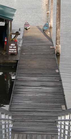
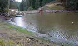
We have been waiting for the water. When we first got here, the water was not yet to the dock. We had to walk through the mud to get our sea kayaks into the water. It wasn't bad, the mud was solid. We have been sea kayaking for about three years. Our first big trip was to the islands between the mainland British Columbia coast and Vancouver Island. We both need to spend much more time in our boats to become use to them again and to get fit again.
So of the outdoor activities at the resort, sea kayaking will be one that both Gwen and I will participate every chance we get.
Note: it doesn't look like it in this photo but Gwen's kayak, the one on the left is 17 feet long and my kayak is 18.5 feet long. Both boats are about 22 inches wide. This makes for good speed at the sacrifice of stability, hence the need to become use to them again. There IS a learning curve. Of course we have practiced self-rescue and partner rescue techniques just in case. Gwen has never tipped over unintentionally while I have three times, but never in this boat. It's embarrassing but you must be ready at all times. |

|
 |
|
| |
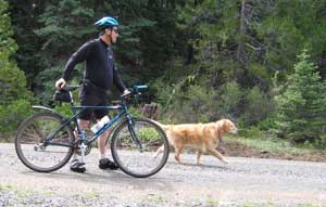
| At Howard Prairie Lake Resort, we are surrounded by the southern Oregon Cascade Mountains. Morgan and I intend to do a lot of mountain biking as we find the remote trails and roads. You |
 |
|
| |
can read Morgan's story of her mountain bike ride to Buck Prairie Meadow. We expect to have many advertures while biking like meeting bears. |
|
| |
There is something special about a campfire while at an RV resort such as Howard Prairie Lake Resort. |
|
|
|
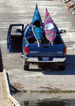 |
October 20, 2005: It's time to load the kayaks for the return trip to Grants Pass, 1.5 hours from Howard Prairie Lake Resort. You can see this has to be done before connecting to the fifth wheel since I have not spent the money to purchase the racks necessary to carry the kayaks and tow the fifth wheel at the same time. There is a kayak rack on the roof of the cab but only foam pads on the tailgate. I've used rachet straps to secure the bow and stern of the boats. They've been |
| successfully transported back to Grants Pass today. Gwen returned them while I was at work. She combined her trip with meeting Gordon, the "pump-man". You see, we live in rural Grants Pass and must pump our own water from our own well. I discovered the last time I visited our home that we had no water. As it turns out, the pump has failed and had to be replaced. Final bill, $1025. I guess if you spread that out over the 5-1/2 years we've owned that property, it's not so bad but I keep thinking I could buy a nice Yamaha generator for that price. Gordon said the broken pump looked old and it may be the original pump. The house was built in 1976 so it's lasted a lot of good years. When I lived in the town of Grants Pass, I had to filter the city water it was so bad. I don't have to do that with our well water, it's very tasty. I will certainly appreciate this good tasting water much more now that it has cost me $1025 to have it. We are only 10 days from returning to "city" life. |
|
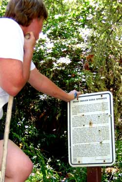
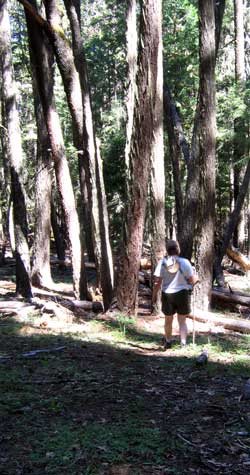
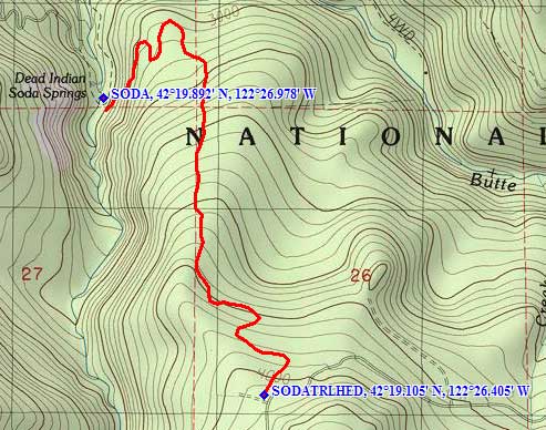
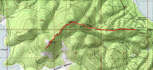
| July 5, 2007: For our hike yesterday, I chose a short trail (2.25 miles) to Dead Indian Soda Springs. The upper trailhead is less than 10 miles from our Howard Prairie Resort camp. Our trailhead begins at 4,080 feet and steadily drops to 2,800 feet in 2.25 miles. That's a pretty steep trail. As you can see from the TOPO map below, the trail hikes along the ridge much of the way and there are a few spots with some good views of the valley. As it turns out, this was the hottest day for 2007 so far. We got an early start so the hike down the trail was not uncomfortable. The trail begins in a heavily wooded area so that helped to keep us cool but the terrain changed as we lost altitude. At 4,080 feet, there is no need to watch for Poison Oak, but we began to see it begin to appear at about 3,500 feet. |
 |
|
 |
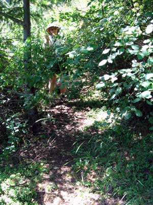 |
As we descended, we had to hike through a "re-growth" area about 1/2 mile long. The trail was overgrown with deer brush. We not only could not find the trail under the brush but had to push the brush out of our way as we struggled toward our path. This appears to be an area that was either logged and new growth had begun or an area that was first burned and replanted. |
|
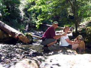
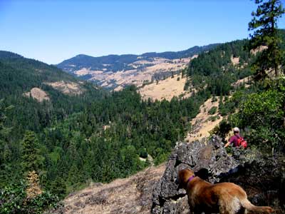
| As we made our final turn toward the spring, we got some good views of the valley below and into the distance. Below, we finally arrive at the spring. You can click either photo below to get a larger view or to be able to read the sign. |
 |
|
|
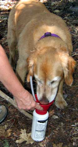 |
We had to be sure Morgan stayed hydrated on this hot trail. I brought Morgan's water bottle to be sure she got enough water. As it turns out, she drank the entire bottle on the way down the hill so I refilled the bottle at the spring. She drank the whole bottle again on the way up the hill. She was very grateful when we arrived at the spring. She was able to lay in the creek to cool off and get plenty of water for the trip back up the mountain.
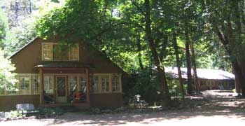
I learned that the spring was only about 1/4 mile from the Camp Latgawa Methodist Church camp. I have previously volunteered at the camp to help with maintenance duties during the off season. The camp has several historic buildings from the early 1900's when this area was a Rogue Valley recreation area. Now, all buildings |
|
| are used to house students when they attend summer camp. The building in the foreground is for the camp office and manager's residence. The building to the right is the camp cafeteria. Pass your cursor through the photo to see the camp swimming pool. |
 |
|
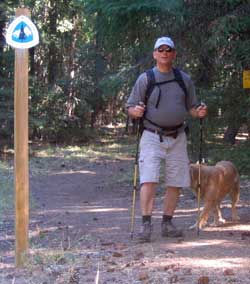 |
September 9, 2007: Morgan takes me for a hike on the Pacific Crest Trail. The trail passes only 100 yards from the south shore of Howard Prairie Lake. This is the same Mexico to Canada trail that Mindy and I were hiking at Donner Summit only a few weeks ago. Morgan and I are hiking only a 2.5 mile section of the trail (5 miles round trip) with 1,000 feet of elevation gain. The trail passes between Howard Prairie and Hyatt Lakes with several peeks at both lakes from the trail. Hyatt Lake is 500 feet higher than Howard Prairie Lake. |
|
 |
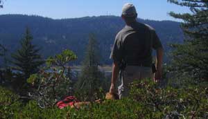
| At the highest point of the trail, Morgan and I look across Hyatt Lake to Table Mountain. Morgan is getting tired and her leg may be bothering her from the injury two weeks ago. I make sure she is hydrated and have already decided to let her swim, then I'll re-bandage her wound. Click the photo to enlarge. |
 |
|
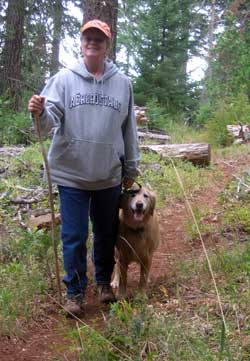 |
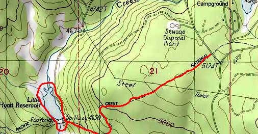
September 14, 2007: Today was special because Morgan and I got to take Gwen on a hike to Little Hyatt Lake on the Pacific Crest Trail. We began at the south end of Hyatt Lake. You can see a tip of the south shore of Hyatt Lake in the top right of the map below. This is a relatively easy hike about 4 miles round trip. Our goal is to reach Little Hyatt Lake Reservoir. The Bureau of Land Management has decided to drain the lake because the dam is unstable. The dam was built of concrete in 1923 and expected to last 75 years, it's now 84 years old. |
|
|
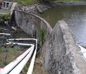
| The dam is crumbling. When you click the photo to enlarge, you can see many leaks which have created holes in the dam. The large PVC pipes are in place to drain the water from the lake. The draining was begun only a week ago and most of the water is gone. |
 |
|
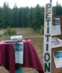 |
The BLM is wanting to dismantle the damn and not replace it, eliminating a popular fishing spot for the locals. Nearly 1,000 petitioners have signed a recommendation to repair or replace the damn to keep the lake. The petition has convinced the BLM to ask for a new study of it's options. |
|
| The view from the east end of the lake toward the dam shows all the silt which has collected since 1923. Click the photo to enlarge. Even from this distance you can see how eroded the dam is. We circled around the lake, crossed the creek, and headed back up hill to the waiting car. |
 |
|
| Continue to Page 2 |
|


