 |
|
RVeCycling.com:
Cycling While Full Time RVing |
|

|
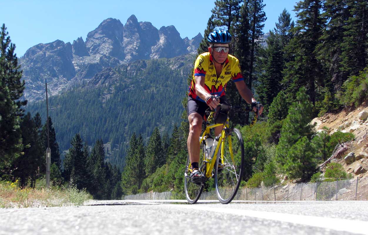
Long distance road cycling is a sport I've been participating in since I was eleven years old. I suppose most kids graduate to motorcycles as two wheel transportation when they reach 20 but I never did. There are many of us who still ride long distance on a bicycle as sport and as a method to stay fit, control weight, get cardiovascular conditioning and promote physical and mental health. Now that I'm retired you'd |
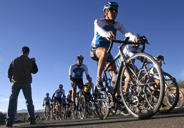
| think I have plenty of time to go for a bicycle ride but there is so much to do each day I must set aside time or combine a bike ride with other activities like meeting my wife at a distant location where she drives to a grocery store, movie or for lunch while I ride my bike to that location. Recently it was my pleasure to ride with the Santa Fe Seniors on Bikes (SOBs), a bicycle club in Santa Fe, New Mexico. I rode with the "A" group which did the more difficult rides. All the riders in the group were older than me and they all beat me to top of each climb. This gave me hope that I would be continuing with this sport for many more years and it was a challenge to get into better |
 |
| condition and to make changes to my road bike which would improve my cycling. This site is the story to staying fit with cycling along with the challenges of keeping a riding routine while traveling the USA full time in an RV. |
|
 |
 |
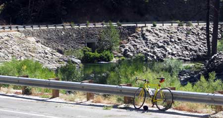
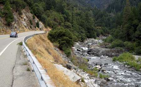
Wednesday, September 15, 2010: I'm currently workamping at six campgrounds near Downieville, California. I expect to be in this location until the end of October. There is only one road through the area, Hwy 49, the famous California gold rush hwy which begins only a hundred miles to the northeast of us and follows the Sierra foothills to the south past Yosemite. All the little 1849 gold rush towns branch off of this hwy. In this area, Hwy 49 is two lanes, mostly rough pavement with little or no shoulder. It would not be a good road for road cycling except that traffic is light during the week. |
 |
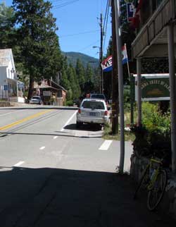
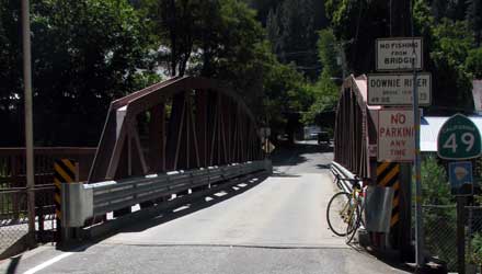
Yesterday I did a longer training ride from Indian Valley Campground to our friends Ralph and Janet in Little Bear RV Park, Graeagle, California. You can check my route by clicking here. Following Hwy 49 to the east I come to Downieville, the Sierra County Seat with a population of 350 in 11 miles. As 49 enters the town it narrows to about 1-1/2 lanes and makes a sharp right turn onto a single lane bridge across the North Yuba River. Downieville is an interesting town with a few gift shops, hardware store, a couple of motels, a couple of restaurants but only |
|
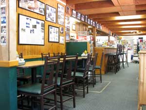
| one is open reliably, the pizza restaurant (and they have great pizza too). There is virtually NO grocery store however, the store which use to have groceries is for sale. Downieville is very popular for mountain biking. There are great |
 |
| mountain biking trails from the top of the mountain leading back to Downieville. A couple of the sport shops offer van rides for mountain bikers and their bikes to the top of the mountain. Just past Downieville, I pass the 3,000 foot marker which |
 |
means I've climbed 800 feet. I know I will pass the 4000 foot marker before reaching Sierra City in 12 miles. So the ascent on this part of the route is not too steep and I can make pretty good time. I'm riding next to the North Yuba River all the way to Bassetts, past Sierra City, where I will have lunch and turn north off of Hwy 49 to reach Gold Lake. I should not need |
|
|
| to stop for refreshments on a 65 mile ride but I was humbled a couple of weeks ago when I first rode to Gold Lake with the intention of returning to Indian Valley Campground. I did not stop at Bassetts Station. By the time I reached Gold Lake at 6,700 feet, my legs were completely hammered and had given out. It was all I could do to descend back to Downieville where Gwen was doing laundry and I caught a truck ride back to the campground. I didn't complete my goal. I've done this ride more than once since and I've learned that adding the lunch stop aids leg recovery. Besides, this is a |
 |
|
 |
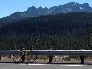
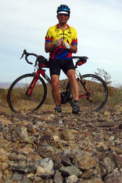
"training ride" for the century ride I have planned. A century is 100 miles and often the goal of long distance cyclists as a marathon is the goal for runners. Bassetts Station is on my century ride route and will definitely be a refreshment stop. The photo above is on the Gold Lake ascent where I get to climb with the view of the Sierra Buttes to the west. The Gold Lake loop is a popular weekend ride for hearty road cyclists. My current training goal is 600 miles in 30 days. I use MapMyRide.com to keep track of my training rides, create maps showing an elevation profile and to set training goals. So I get an email each day telling me what percentage of the goal I have met and how many days I have left to meet that goal. Currently I have ridden 283 miles with 19 days left in my goal so I'm on schedule. The photo to the left is of old town Portola in Plumas County.  |
|
This is my second time to ride to Graeagle where my friends Ralph and Janet are camped for the summer. Last week, I arrived with lots of energy to spare so I added on the Portola loop to the ride which added some additional climbing and about 20 miles to the ride. On Tuesday nights, the local Elks club has a spaghetti feed which we all enjoy and gives us a good reason to make the long drive (ride) to Graeagle. Our friend Eddie came with Gwen in the truck for the spaghetti and the visit along the way. I've created a video of this ride to help give you the experience of long distance riding.
It has been about eight years since I last rode a century ride. I've done many before that so I know what it takes. Like marathon runners talk about "hitting the wall" at about 18 miles, a cyclist hits "the wall" at about 80 miles. |
 |
|
 |
So I had to ask myself at the end of this 66 mile ride with 5,300 feet of climbing, could I do another 34 miles and climb Yuba Pass to get back to my starting point at Indian Valley Campground? I think the answer is that I need more leg strength, endurance and a quicker recovery time. I use to ride a century in about seven hours, six and a half on a good day. That won't happen with the ride I'm planning. At this point, I'll be happy to finish it and still be able to walk the next day.
I began seriously riding again last May. When I first started, ten miles was a challenge. I knew it was going to take several months of a steady routine to get me back in shape. I also needed to lose weight, 195 pounds was the heaviest I had weighed. I'm now at 163 pounds and expect to loose even more. I'm feeling much better and with more energy than last May. At the very least, I don't have to carry that extra 32 pounds up these climbs. |
|
| Friday, September 17, 2010: We chose today to make a grocery run to Yuba City, California, about 1.25 hours driving time from our campground. We like Yuba City because it has a Winco grocery store and a Super Walmart. Gwen wanted to check out the Sunflower Natural Foods Market so while she was shopping, I turned on my laptop hoping for a stray WiFi signal. You see, I made a video of the 66 mile ride I did on Tuesday and had uploaded it to YouTube Tuesday evening but then decided the video needed some editing. |
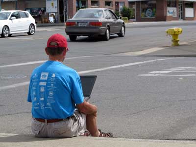 |
| The video was working fine on YouTube but I deleted it for the edited version. For some reason I could NOT get it to upload a second time. I tried five times but failed each time. I brought my laptop with me today thinking I should try uploading from a faster WiFi connection than what I have at the campground shooting between the trees. Yes, I found a WiFi signal on the corner of the Sunflower Natural Foods Market so I sat on the curb (not knowing where the signal was coming from) and uploaded my cycling video. This time, it worked and the video is now online. Please check it out above. I think it's pretty funny. If you aren't a cyclist, it will give you some idea of what it's like to ride for distance. Also, today, I've ordered a camera mount for my helmet so I can video record while riding my bicycle much easier. That means I will likely be uploading more videos in the future. I hope that will be a treat. |
|
 |
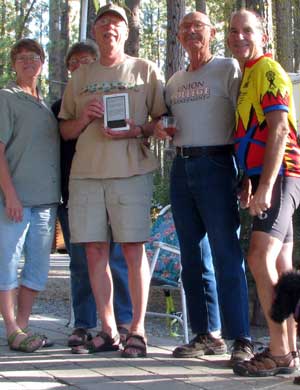
Monday, September 20, 2010: Remember a couple of months ago I announced I had won prizes on the virtual Tour de France posting rides at MapMyRide.com? Those prizes arrived today. I got 24 packages of Perky Jerky and a Polar Heart Rate Monitor
 . Both will help with my training rides and cycling events. I won the prizes by riding my usual training rides, I was in New Mexico at the time, then posting the mileage and ride details on MapMyRide diabetes site. My mileage added to the many other riders participating and provided benefits to the diabetes association through fund raising by the riders. I donated to the cause myself but many of the other riders had sponsors donating also. Next year, I'll start participating far in advance of the race and ask for sponsors myself. I've been reading the instruction manual for the Polar heart rate monitor much of the evening and this monitor will do much more than the one I rode with 20 years ago. . Both will help with my training rides and cycling events. I won the prizes by riding my usual training rides, I was in New Mexico at the time, then posting the mileage and ride details on MapMyRide diabetes site. My mileage added to the many other riders participating and provided benefits to the diabetes association through fund raising by the riders. I donated to the cause myself but many of the other riders had sponsors donating also. Next year, I'll start participating far in advance of the race and ask for sponsors myself. I've been reading the instruction manual for the Polar heart rate monitor much of the evening and this monitor will do much more than the one I rode with 20 years ago. |
|
| Tuesday, September 21, 2010: While exploring bicycling Web pages using Stumbleupon I came upon this delightful story of two 21 year old college graduates touring the eastern United States by bicycle in 1944. The adventure takes Thelma Popp and Doris Ray from New York west, down the Mississippi on a river boat and over some tough mountain climbs by truck. Then a return to New York along the Atlantic coast. They make journals along the way which Thelma Popp Jones turns into this easy reading book in 2007 available free on the Internet. The title of the book is The Lure of the Open Road. Since I'm 63, Thelma's book describes a bicycling adventure 3 years before I was born. She describes a United States, and the citizens of those states which I have never known. Besides the life and characters she details in her stories, I'm amazed that these two bicycles, one single speed and the other two speed, are up to the task. The book reads quickly and will hold your interest so I can highly recommend that you visit the link above and read the stories yourself. |
 |
|
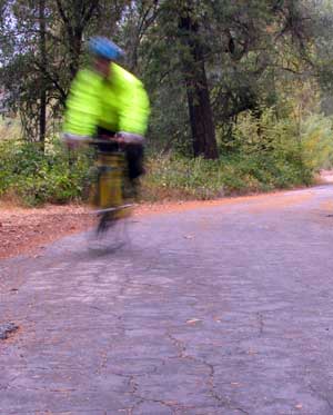 |
Sunday, October 3, 2010: I guess I better explain the photo first. Today was a dark, overcast and wet day. I set the camera on a tripod and made two passes at the camera on a custom timer setting which took three photos with each pass for a total of six photos. I didn't notice the slow shutter speed and the photos looked OK in the little camera screen but all six look just like this, background nice and sharp but since I'm moving, blurred. This was my first day to need to wear full rain gear (everything expect a helmet cover and my winter riding gloves). I wore my Endura rain jacket, new Pearl iZUMi cycling rain pant which I purchased on sale at 70% discount, booties to keep my feet dry and warm and my new Craft Pro Race Bib Short
 which I purchased yesterday at 40% discount. I'd have to say, I'm sold on bib shorts
 |
| now. It was my first time to ride with bib shorts and I like them over the regular shorts and like the "Craft" brand (made in Sweden). Gwen left early this morning on a trip to Oregon with our friend Kathy. They both had some Oregon errands which needed to be completed this year. That leaves me without a vehicle and a meeting to attend today at Sardine Lake, 5,600 feet with me at 2,200 feet. That's OK, I do that ride all the time for training but today I did it for work. It was a total of 61 miles with more than 4,000 feet of climbing. The first half of the ride took 3 hours but I was rewarded with bratwurst, sour kraut, potato salad, baked beans and lots of olives plus dessert. It's a good thing I burned nearly 3,500 calories on my ride today. The weather wasn't all that cold but wet at the 2,200 foot level plus colder and wetter at the 5,600 foot level, hence the rain gear. Since my photo is fuzzy, that will give me another reason to add a photo later in all my rain gear. |
|
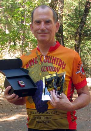
Wednesday, October 6, 2010: My Cateye heart rate monitor cycling computer died a few months ago. I replaced it with the Cateye Strada Wireless Computer shown at the right. I wanted something reliable yet not too expensive. You can get computers which will give heart rate, altitude, climbing rate and a hundred other functions. This one keeps track of total mileage, speed, clock, elapsed time, maximum speed, average speed and has two settings for distance so could be used on a second bike. The photo shows kilometers per hour but I have mine set to miles per hour. One thing which was important to me was that it is wireless. I no longer have a need to run a wire from my handlebars to my fork. That made installation very simple. It also takes the same size batteries used by my previous Cateye computer and since I had some shown at the right. I wanted something reliable yet not too expensive. You can get computers which will give heart rate, altitude, climbing rate and a hundred other functions. This one keeps track of total mileage, speed, clock, elapsed time, maximum speed, average speed and has two settings for distance so could be used on a second bike. The photo shows kilometers per hour but I have mine set to miles per hour. One thing which was important to me was that it is wireless. I no longer have a need to run a wire from my handlebars to my fork. That made installation very simple. It also takes the same size batteries used by my previous Cateye computer and since I had some |
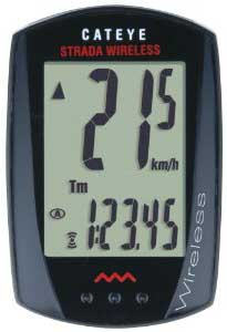 |
| on hand, it was a bonus. I don't wear my reading glasses while cycling and the display is large enough for me to see while riding. Finally, it was inexpensive with free shipping. |
|
 |
Thursday, October 7, 2010: I did a nice training ride for 33 miles today along the North Yuba River on Hwy 49. It was my first day to ride with a long sleeve jersey and my first day to ride with my new little compact Canon camera which was used to take this photo. It was also my first time to try that camera in video format with it attached to my helmet. I will need to practice to perfect the use of the camera. This was one of only two |
| days in a month I could mark this ride as "great". Great because of the 56 degree weather, little traffic, no wind, I was wearing the right riding clothing, and a strong feeling of conditioning. I will show you the camera and videos later as I learn how to use it. |
|
| Saturday, October 9, 2010: I struggled today to get the campground rounds done, score college assignments from 22 students, prepare the financial reports for tomorrow's campground meeting AND edit this video. The movie format this little miniature camera uses to take videos is different from my other Canon camera so I've had to learn new tricks to work with it. The video was taken in about a 4 mile stretch of Hwy 49 showing 3 of the six campgrounds we host. I mounted the camera sideways on my helmet to take the video and rode east on Hwy 49 past three campgrounds you |
 |
| can see and the entrance to Indian Valley campground where we are camped. I originally did this hoping I could narrate the movie as I rode along. With the camera facing forward, all you will hear is the moving air as it passes over the microphone. Unfortunately, it's not much better with the camera facing to the side. I've decided I can only dub the audio after I bring the camera back to my computer. So the movie is CRUDE but my first try with this format. I'll get better at it and so will the videos. Click here to see the video. |
|
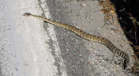 |
Wednesday, October 13, 2010: On my training ride today near Downieville I came across a "stick", then the stick moved. Not a simple Garter snake, it was a baby rattlesnake about 2 feet long and only a few rattles. Pass your pointer through the photo. When I visited New Mexico from March to August, I was constantly aware of my surrounding when hiking, watching for this little guys |
| cousins. I never saw one. I have been relaxed in camp and while caring for all six campgrounds yet this fellow was only a few miles from where I'm camped and at a higher elevation. I'm sure there are more around. I chased the reptile back off the road, the next vehicle undoubtedly would have crushed it. I hope all his relatives will take that into consideration if they come across me in the woods. |
|
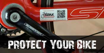
| Sunday, October 17, 2010: Why not use the Internet to help protect your bike. Bike Revolution is a new bike security service. You can register your bike free including a photo of the bike. The security stickers for your bike help too and provide income to this nonprofit organization. You can participate in stolen bike recovery with your smartphone. As more cyclists get involved, I see this as a valuable use of the Internet to help protect our investment and discourage thieves. Both my bikes are registered. |
 |
|
 |
Wednesday, October 20, 2010: Today I pressure washed the exterior of the fifth wheel, but you don't want to hear about that. You want to know that yesterday I finally completed my first century ride in eight years. I've done many century rides but it's taken 5 months of preparation for this one. I created my own route from our campground in Indian Valley, California. You can see the route here. Be sure to check mark "show elevation" to see the elevation profile. I began the ride at 8:15 am |
|
| at a temperature of 42 degrees so I used my arm and leg warmers. My goal was to reach Bassetts Station before 11am since they stopped serving breakfast at 11am. It normally takes me 2 hours and 40 minutes to reach Bassetts. I had to push the last two miles to be in the Bassetts Station parking lot by 10:58am. They served me breakfast. After breakfast, I finished the climb to Gold Lake at 6,800 feet. After 36 miles of climbing I finally got to descend 8 miles to Hwy 89 then head south toward Sattley. Right around Calpine, I reached the 50 mile mark and began a slow countdown of miles. From Sattley I climbed Yuba Pass to the summit at 6,701 feet. From Yuba Pass I got to descend 4,500 feet for 35 miles back to Indian Valley. Total climbing was 7,333 feet with the same |
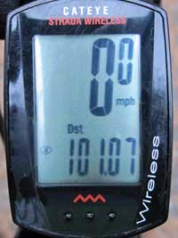 |
| amount of descent. It was a tough century, one I created because I couldn't do the Tahoe-Sierra Century in September which was organized by the North Lake Tahoe middle school and high school bands as a fund raising event. I had to work instead. I DID buy their jersey and wore it for the first time on this century ride. Since it was a music century, I whistled: "Whistle a Happy Tune" for 101.07 miles. You can view a short video here. I actually finished this ride feeling really good. For some of the other centuries I've done, I can remember feeling pretty awful and one even gave me heat stroke many years ago. This time, the weather was perfect and I did the ride at my pace stopping to take photos along the way. It was a total of 7 hours 39 minutes in the saddle which was one of my longest times for a century, perhaps the more than 50 miles of climbing had something to do with that. What's next? Oh! Click the Sierra Buttes photo above to enlarge it. |
|
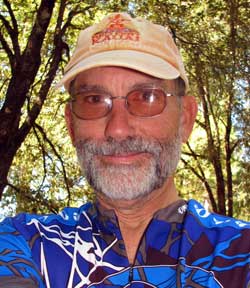 |
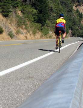
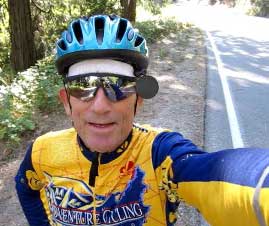
Thursday, October 21, 2010: I've made another video. This time it's using the camera mount to my helmet as I descend Cal Ida Road. CI Road is off Hwy 49, 12 miles west of Downieville, California. It's a single lane, paved road, climbing from the Indian Valley Recreation Area into the wilderness of the Sierra Foothills. The summit is 15 miles from Hwy 49. It's a wonderful climb of about 6% grade with very little traffic, EXCEPT, without a breeze, I can't climb fast enough to keep the cloud of mosquitoes behind me. So I must pick the right COLD day or a day with a breeze. On those days, it's a great ride both up and down the mountain. The video shows the last 4.5 miles in the descent off the mountain. Click here to see the video. The guy at the left is me with a beard which lasted only a month. |
|
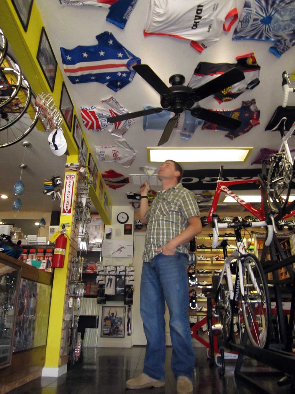
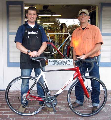
| Thursday, November 18, 2010: I was in central California for ten days helping do odd jobs around my parents home. While in the area I visited the Lodi Bicycle Cafe owned by Jon Tallerico. I had been reading about this bike shop on their Web site for a few months while completing my contract with camp hosting. I honestly did not expect to find anything in the shop which I could afford since this is a "high-end road bike shop". Instead, I found Jon easy to work with, very knowledgeable and he had the bike which fit me perfectly at a very good price. In addition, Jon made all the changes to the drive train that I wanted without additional fees. The bike without water bottles and cages weighs just over 15 lbs so it is super lightweight. The bike |
 |
|
| is a Torelli Montefalco with all Shimono Ultegra drive train, compact double (here is a discussion of the compact double) with ten speed cluster. I was surprised to get an eleven to twenty-eight gear range in the cluster. That means, an eleven tooth tiny gear increasing to a twenty-eight tooth large gear. That should give me the range of gears I need for those 36 mile climbs I was doing on highway 49 near Downieville. The wheels, tires, stem, handlebars and seat post are all Torelli brand. What a pleasure it was to shop at the Bicycle Cafe which specializes in road bikes. Most shops these days sell mostly mountain bikes or cruisers and generally don't know the "road-bike talk". Jon's credentials come from the road-bike world where he has raced and served as head mechanic to some of the bicycling superstars. He has a huge collection of jerseys which he wore in races or which where given to him by racers he served as a mechanic. Click the photo to see part of the collection which he has mounted to the ceiling of his bike shop. You might be wondering what a "bicycle cafe" is. Jon explains that many cyclists love to come to his shop to "talk riding". He serves a great cup of coffee so now customers and cycling enthusiasts can enjoy a cup-o-joe while exploring all the new equipment. |
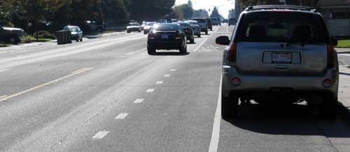 |
Saturday, November 20, 2010: Lindsay, this is for you. Lindsay asked a very good question, why do some road cyclists NOT ride in the bike lane? My answer was that a bike lane is at the edge of the road where all the broken glass and gravel live when blown by passing cars from |
| the car lanes. Since a road bike tires are very delicate, they get flats easily. I would still pull over into the bicycle lane when cars are passing and I believe most cyclists would too unless the glass was obvious which is often the case. After Lindsay returned home I came across the situation in the photo. In this case the bicycle lane is next to the car lane but a parking lane is to the right of the bicycle lane. If a cyclist rides in the bicycle lane they are taking a chance of getting creamed by a car door or pushed into traffic if someone in the car opens the door. This is called a "Door Zone" accident and several cyclists have been killed by such accidents. In this case the cyclist must ride on the very outside of the bicycle lane near moving traffic in order to avoid opening car doors. So this is another situation where a cyclist may ride outside a bike lane. |
|
 |
| Friday, November 26, 2010: This is the ride I want to do next year. It's the El Tour de Tucson which happened this year on November 20. The ride is 109 miles around the perimeter of Tucson, Arizona. This year more than 9,000 riders showed up even with a wind of 30 mph. I better start preparing right NOW. For more information and photos, click here. The above photo was published in the Arizona Star, 11/21/10. The El Tour de Tucson is sponsored by the Perimeter Bicycle Club and a benefit for the University of Arizona, University Medical Center. |
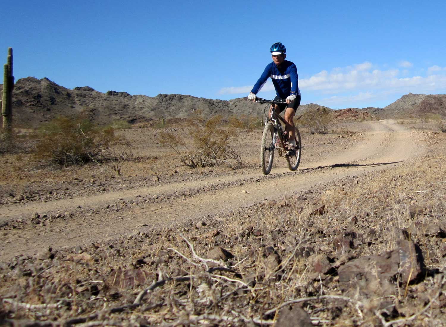
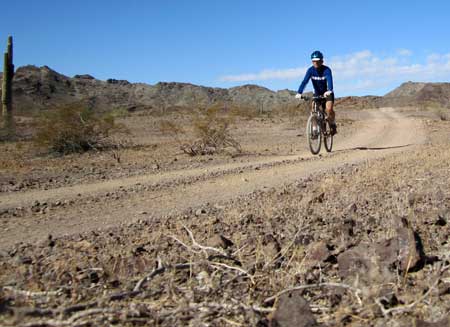
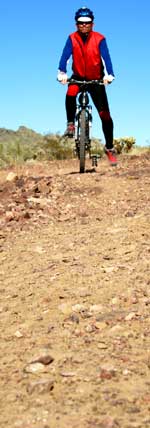
| Sunday, November 28, 2010: There is great mountain biking in this part of the Arizona desert. The day was clear, 50° but a 25 mph wind made it a cool ride. Notice the long sleeve jersey and cycling cap. Pass your pointer through the photo then click the photo for an enlarged view. This part of the road looks easy but this road disappears and turns into a rocky path with the rocks rolling under the tires throwing the bike one direction or another. I've had three "warning falls" which has caused me to change pedals and ride more conservatively. |
 |
|
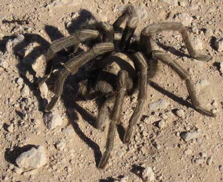 |
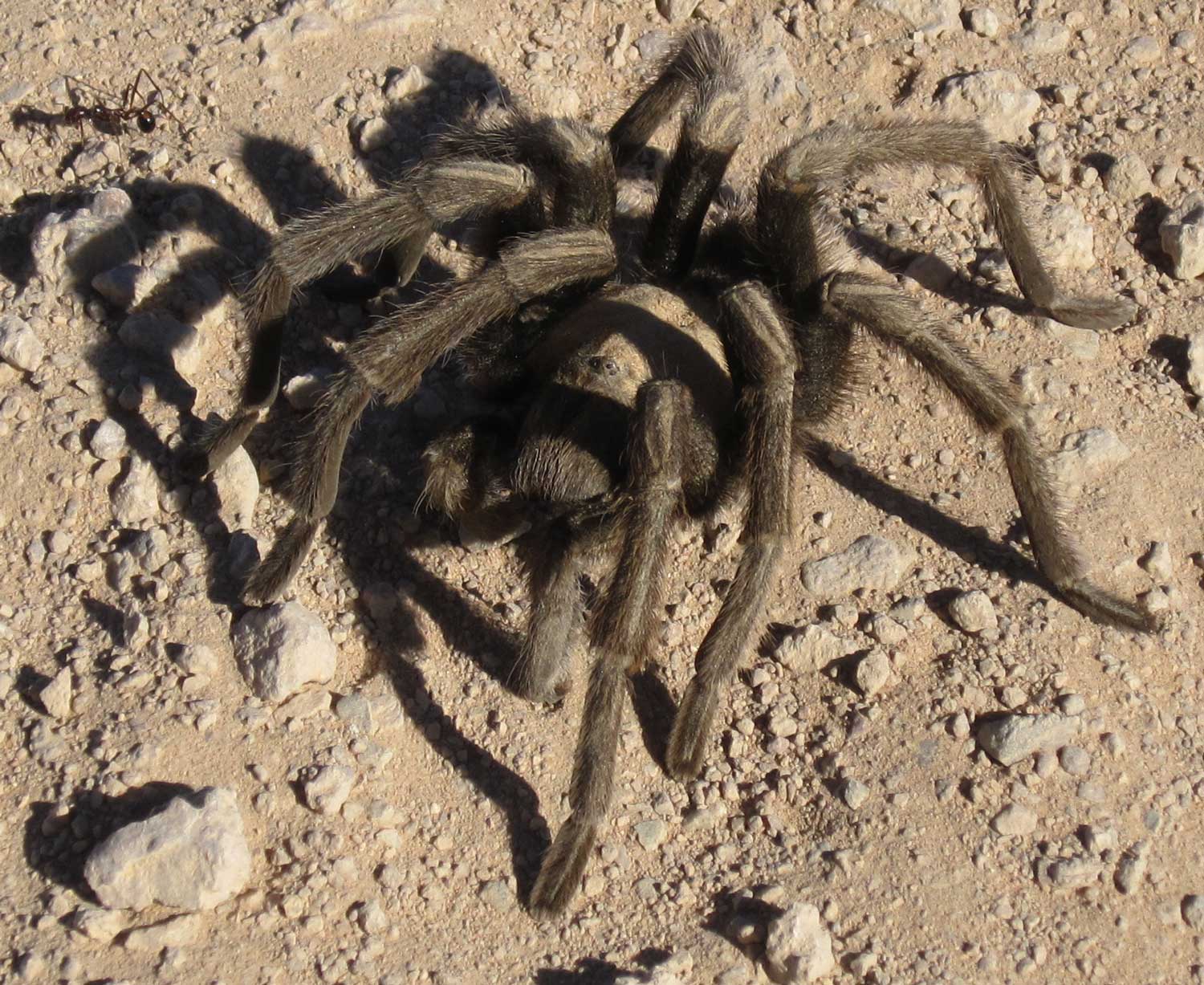
While on today's ride I came across this little guy waiting for me on the path. He looks very healthy and is ignoring the ant to his right. You must click the photo to get a better view of the ant and to peer into this guy's eyes. When I was doing my student teaching in a junior high school science class, the master teacher kept a pet tarantula which everyone, including me, held. I chose to leave this guy where he sat. This guy measures about 6 inches from end to end. |
|
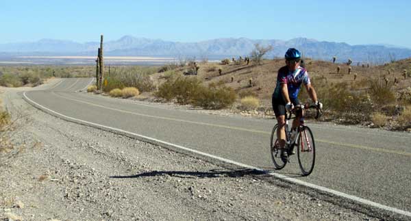 |
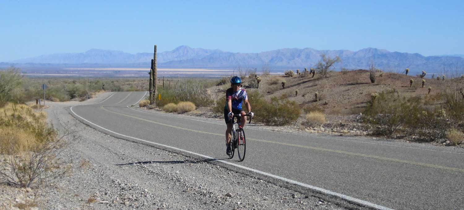
| Thursday, December 2, 2010: Today was a great day for a rode over Quinn Pass to Quartzsite from Bouse. The route includes 1220 feet of gentle climbing and is only 25 miles one way. The route would make a great out and back ride of 50 miles except for a 5 mile section on Highway 95 which is heavily used and only a 6 inch shoulder. The majority of the ride is on Plomosa Road, good pavement and lightly traveled. I generally see fewer than a dozen cars in both directions when riding Plomosa Road. Compare the desert views to the mountain views near Downiville. There is NO water here but it's December and notice I'm still riding in a short sleeve jersey and shorts. Click the photo for a wider view. The Bouse valley and Highway 72 is in the distance. High winds can be a factor here in the Arizona but no wind today which made for a very pleasant ride. Click here to see a map of the route. |
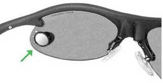
Saturday, December 4, 2010: I've ridden with a helmet mounted rearview mirror for at least 30 years but I'm ready to try something new to eliminate the negatives. The Cycleaware Viewpoint Eyewear Mirror is reported to have the rearview benefits without the negatives. Click the link to see what others have to say. I'll give it a try then report back.
 |
 |
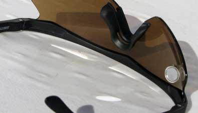 |
Sunday, January 2, 2011: I'm reporting on the Viewpoint use on my glasses. My glasses happen to be the "wrap-around" style which is NOT recommended for the Viewpoint but I've found this little mirror to be good enough that I've removed the large helmet-mounted mirror which I used for the last 30 years. The view is not quite as good as the helmet mirror but close enough that I'm able to keep an eye on rear |
| approaching traffic without having a mirror post mounted to my helmet (which has always been annoying). I am learning to put my glasses arms on the outside of the helmet straps to help keep the straps out of the view. On a cold day, I'm wearing a skull cap with a chin strap which cuts the view in half so reduces the view. Still, I'm liking the Viewpoint and expect to improve the use with practice and time. |
|
|
 |
Tuesday, December 7, 2010: After 41.6 miles of riding and a long time since breakfast, I stopped at the top of Quinn Pass for a snack and a closer look at the desert view. The weather is improving, a strange thing to say on December 7. The forecast for the next week shows warming to nearly 80 and little or no wind. I'm looking forward to continuing my riding in summer riding conditions in Arizona. |
|
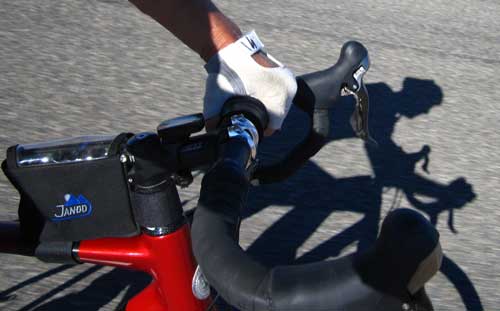
| Tuesday, December 28, 2010: Yes, it's still sunny in Arizona and I'm riding in summer shorts and jersey. I liked the shadow while climbing toward Quinn Pass. The sun is low in the sky, even at 1:30 pm, so there are long shadows. Little wind today made for a nice ride. The temperature was just into the short sleeve weather for me, any colder and I would have been into a long sleeve jersey. The JanDD pouch behind my stem is where my camera rides, easy to get to. |
 |
|
 |
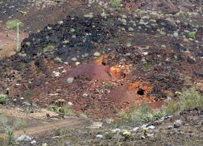
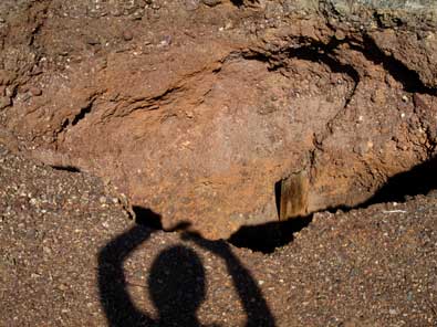
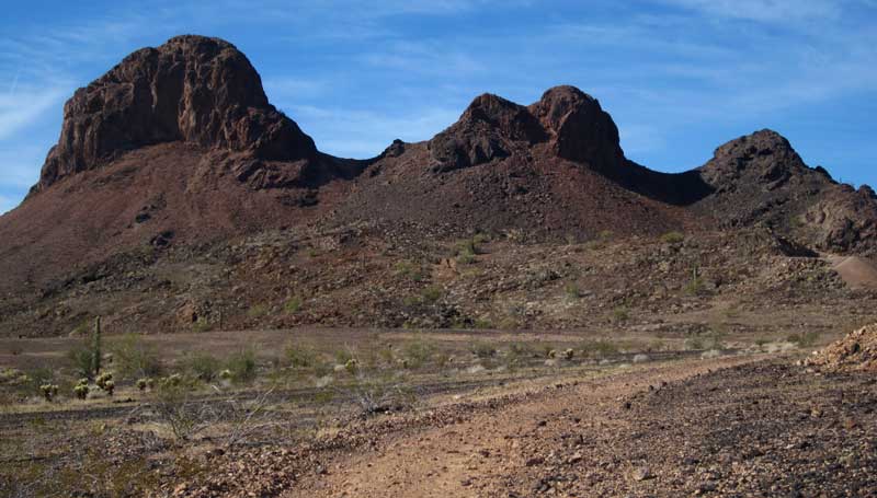
Tuesday, January 4, 2011: I decided to ride around the Three Peaks on this cold day. The Three Peaks are only 7 miles from our campsite with good mountain bike roads the whole way. It was also a continuation of my searching the area for optional camp sites. The three peaks are 5 miles off the nearest paved road and a mountain bike or ATV is needed to access them. The "front view" (view from the paved road) of the Three Peaks is pictured below. Click the photo to see the "back view" (from the opposite side of the mountains. There is obvious mining activity all around the area (see the photos below). The photo on the right with my shadow in the photo is of a "glory hole". I took the photo purposely with my shadow to give you an idea of the size of the hole. I did NOT venture closer to the hole knowing the area around it could be unstable. I threw a rock into the hole and I could hear it bouncing down for at least ten seconds. The entire loop ride around the Three Peaks took 2.5 hours and about 20 miles. |
|
 |
|
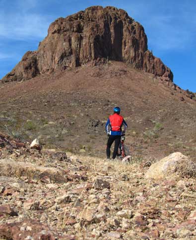
This photo shows me taking in the view of the largest of the Three Peaks from the front side. Click the photo for a larger view.
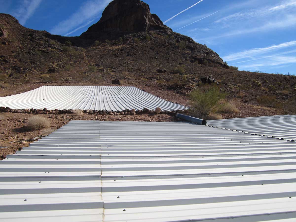
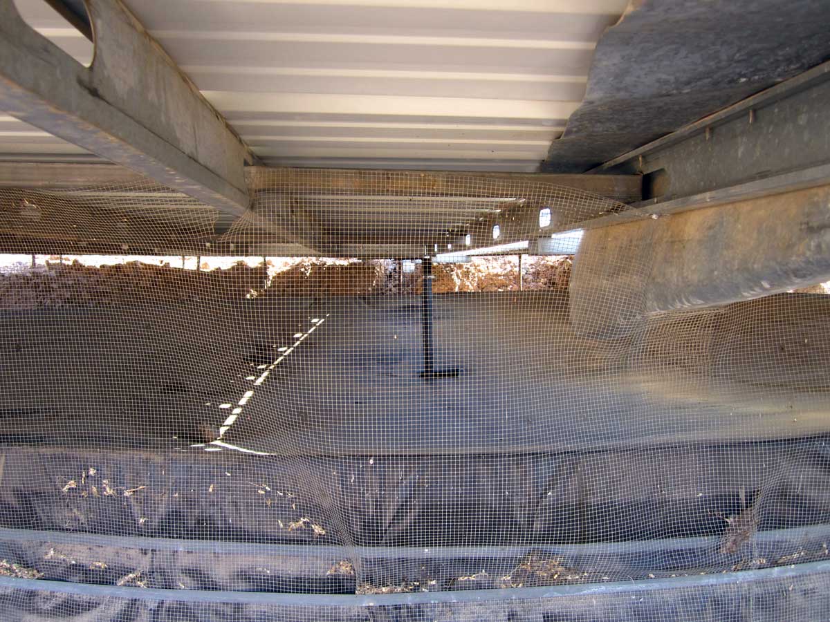
On the back side of the mountains is a water collection device. This device will collect rain water and heavy dew. Click each photo for additional views. Behind the left photo is a view of the collection panels slanted to force the water into a trough then drained into a large covered holding tank.
Behind the Sportsmen sign is a view of the holding tank under the collection panels. All water drains into the covered holding tank. The tank is surrounded with a net to keep animal from climbing into the tank. The believe dew is very heavy in the summer months so I imagine water is present even during the very hot summer days.
I did find a nice gravel road toward the mountains good enough for much of the route to bring the trailer if we decide to change locations next year. |
 |
|
|
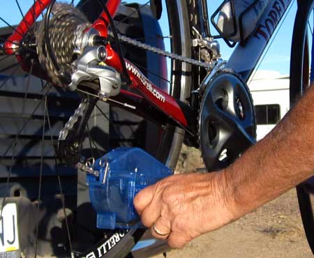 |
Wednesday, January 12, 2011: I've decided to use the Park Tool Chain Gang Chain Cleaning System to clean the chain on my bike. The bike store showed me a different method for chain cleaning but I don't often have access to a water hose so I decided it's much easier to use this chain cleaning system regularly than to depend upon finding a high pressure hose regularly. A small amount of cleaning agent is added to the cleaning chamber, the chamber is snaped over the chain then the chain is run backwards through the cleaning solution. It still makes a mess but the mess is much smaller than the alternative to chain cleaning. I generally clean my chain every 200 miles. to clean the chain on my bike. The bike store showed me a different method for chain cleaning but I don't often have access to a water hose so I decided it's much easier to use this chain cleaning system regularly than to depend upon finding a high pressure hose regularly. A small amount of cleaning agent is added to the cleaning chamber, the chamber is snaped over the chain then the chain is run backwards through the cleaning solution. It still makes a mess but the mess is much smaller than the alternative to chain cleaning. I generally clean my chain every 200 miles. |
|
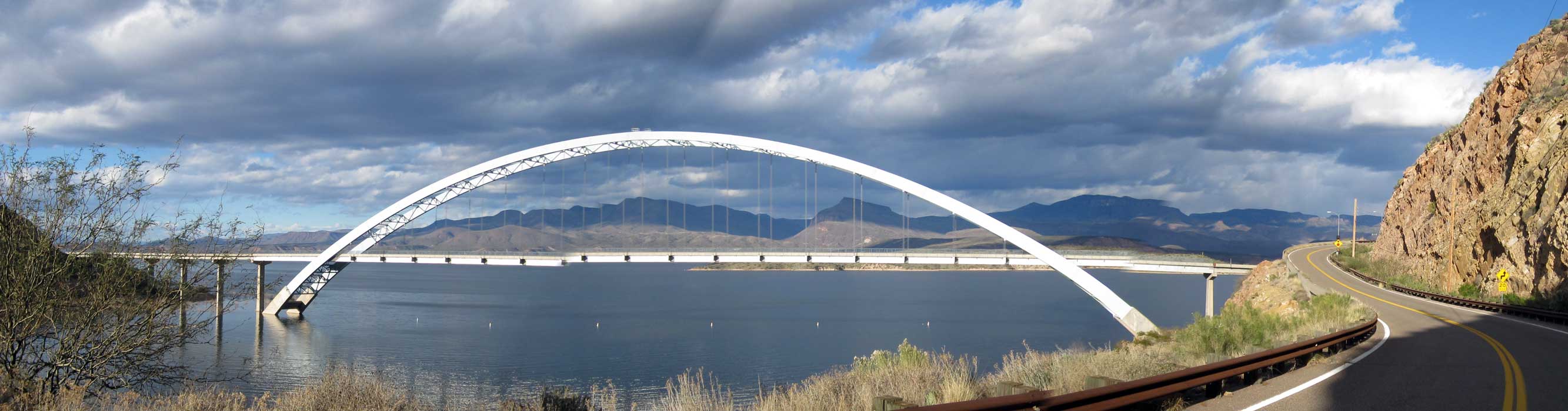
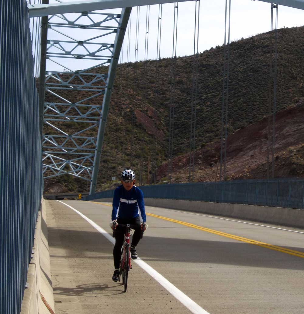
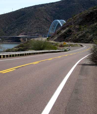
Tuesday, February 8, 2011: What a great area to road ride. This is the shore of Roosevelt Lake, Arizona, northeast of Phoenix at 2,200 feet elevation. Hi way 188 is wide with good shoulders and little traffic this time of year. We'll be leaving here soon so I don't know what the traffic is like during the rest of the year. The ride temperatures have been a little low lately, high 40s to high 50s, hence the long sleeve jersey and leg warmers. I believe you can expect 60s normally this time of year.
The Theodore Roosevelt Bridge was constructed in the early 90s and is impressive. In 1995 it was designated one of the top 12 bridges in the nation for "overall design, size, eye-appeal and design challenge". |
 |
|
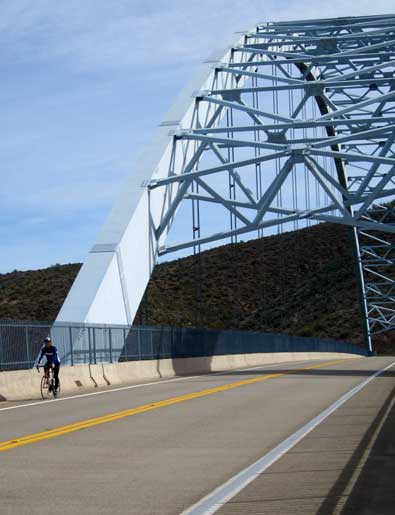 |
Be sure to click both these photos to see additional views of the ride and bridge.
From this location, the Roosevelt Lake visitor center is only about 3/4 mile where area history can be explored. In addition you can visit the gift shop for area souvenirs. A good ride is to park at the visitor center, ride east to the Tonto National Monument visitor center, do the hike to the "Lower Cliff Dwellings", hop back on the bike and continue east to the tiny town of Roosevelt (about 10 miles), turn around, ride back to the visitor center. For a longer ride, continue riding west to Punkin, turn around and ride back. You can grab snacks or lunch in Roosevelt or Punkin. Doing this route will take you most of a day and give you the chance to ride the Roosevelt Bridge twice. |
|
| Continue to page 2 |
| |
|
|