 |
|
Cycling While Full Time RVing
Page 2
|
|

|
|
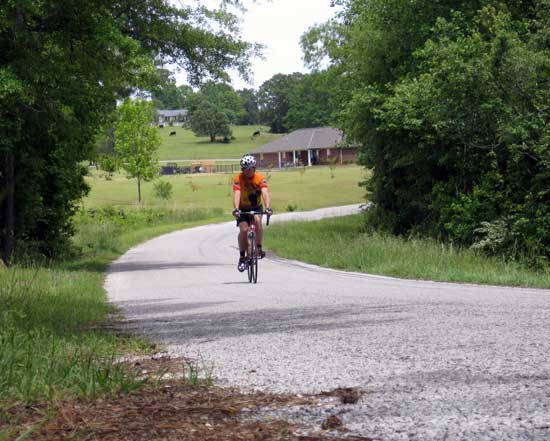
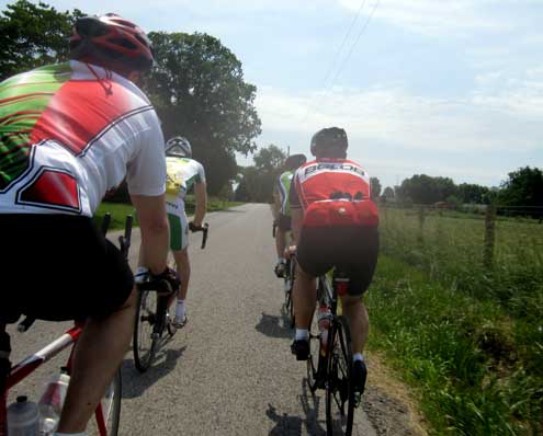
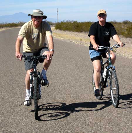
| Thursday, February 17, 2011: We are camped eight miles west of Safford, Arizona on BLM land adjacent to a paved, single lane road, Haekel Road. You can see the road behind Ralph and Gwen as they ride with me before going off to search for a Geocache. Ralph is trying out my mountain bike. |
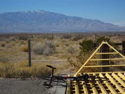 |
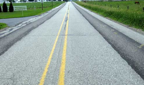
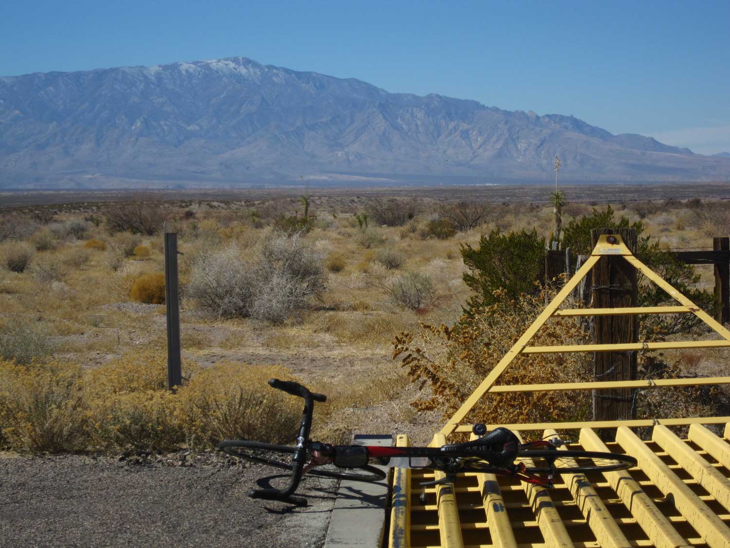
I went on to ride 32 miles on Haekel Road. What a great ride. I spent two hours on the road and was passed by only one vehicle going in the opposite direction so this road must have been made especially for road cyclists. It's not the smoothest pavement, in fact it's rough in sections with lots of cattle guards (enough so I lost count). But I was able to ride on whatever side of the road I chose (looking for the smoothest ride) because I could see in booth directions for a mile. Probably the only danger is there is so little traffic, ANY traffic would be a surprise, hence, dangerous. Mt. Graham is in the background, over 10,000 feet but very little snow compared to last year. Click the photo to enlarge. |
|
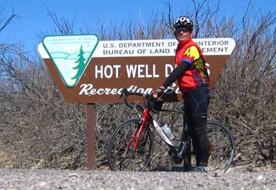
| Monday, February 21, 2011: Only 24 miles from our campsite on Haekel Road is the Hot Well Dunes Recreation Area. Haekel Road is great for road riding with very little traffic through open desert. Today was cool when I began the ride but after arriving at Hot Well Dunes, I removed the vest and arm warmers and was comfortable on the return trip. I can highly recommend this road for riding. Since this was a three day weekend, probably more traffic than normal, still only ten vehicles passed me in 3 hours. |
 |
|
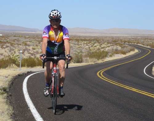 |
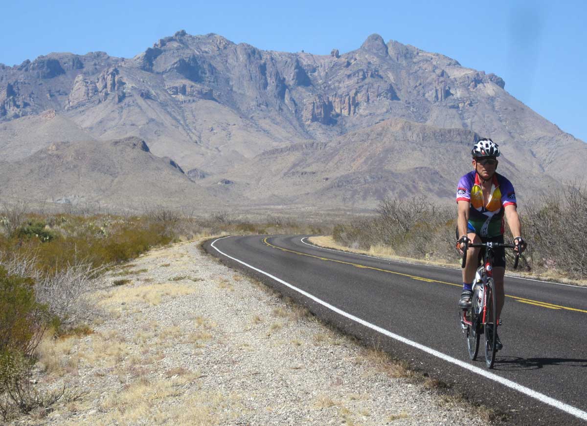
Wednesday, March 2, 2011: My first full day in Big Bend National Park, Texas was to climb from our campsite at the Rio Grande Village to the park headquarters at Panther Junction. This was 21 miles (42 miles round trip) with 2,000 feet of elevation increase. The road was good pavement with light traffic, no wind and warming during the whole ride. I was back to camp before the maximum temperature of 97° was reached. There hasn't been any rain in this desert for months so you get the feeling of a typical southwestern desert. I drained three large water bottles during the ride (I refilled at Panther Junction) while touring the park visitor's center. I'm struggling to keep any kind of riding routine with so much to do each day. The ride felt good but it's easy to tell that I need to ride more often. Click the photo to see another view. This is my Tahoe Sierra Century jersey which I haven't worn since the October century. |
|
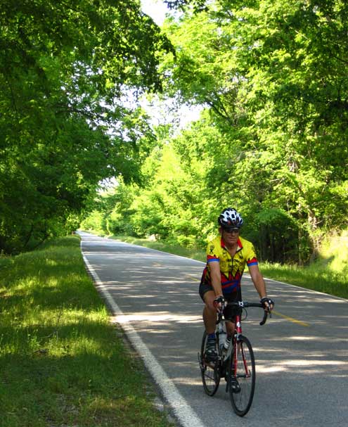
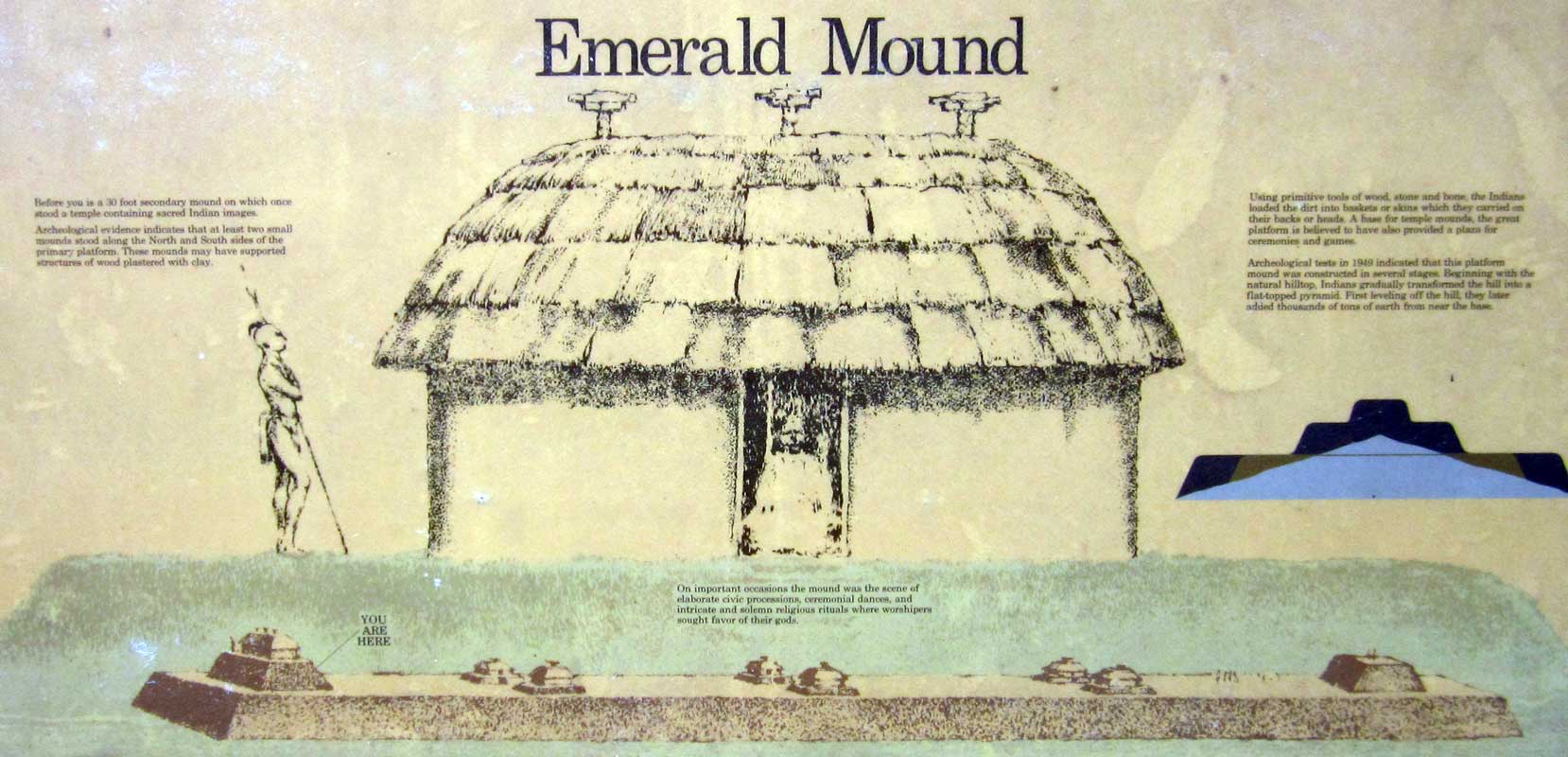
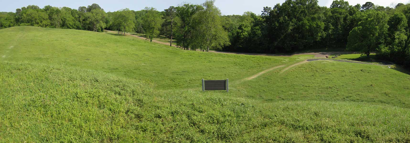
Sunday, April 17, 2011: This was a wonderful day for a ride in rural Mississippi. Compare the riding scene here to west Texas above and to Arizona then to mountain climbing in northern California. It was a perfect temperature today for cycling and undetectable humidity. The scenery is not only different but the sounds are different too. Here in Mississippi I am treated to a concert the whole ride by the many birds inhabiting the tree canopy surrounding me. Today I was on two lane roads the whole ride with no shoulder but the traffic was so light, it was very comfortable riding. From my camping site, I rode to the "Emerald Mound", a national historic site where the Mississippians (1250 - 1600AD) held ceremonial activities. The Mississippians were the ancestors of the Natchez Indians. There are some Emerald Mound photos behind these photos, just click the photos to see them.
I did not plan well so ended up running out of water mid-ride. Fortunately I arrived at the oldest Episcopal church in Mississippi about the time they were exiting the church. I was told the congregation actually dated back to 1790 but the physical building was built in the 1800s. Like many of the local churches, they have a cemetery dating back to the beginning of the church. |
 |
|
|
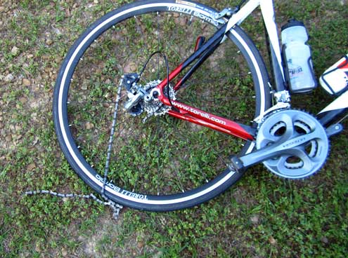 |
Only three miles from the end of my ride, my chain broke. I've always carried a chain breaker tool with me but this was the first time I've needed it. This was the original chain which came with the bike, I'm not impressed with this Shimano chain. Without the tool, I'd have to walk three miles. It only took a few minutes for the repair. However, I had nothing to clean my greasy fingers when the repair was complete. The lawn nearby served the purpose fairly well. |
|
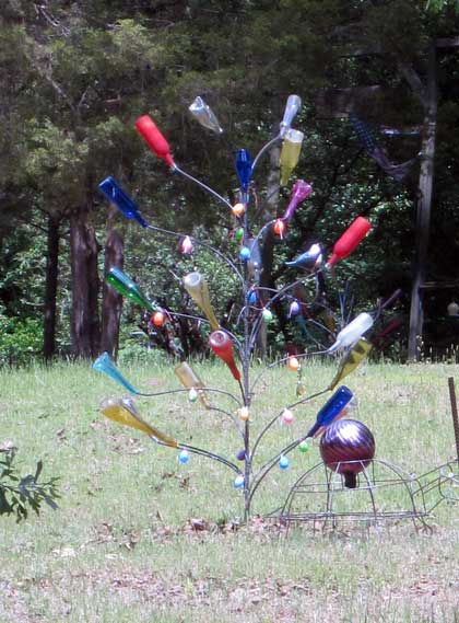
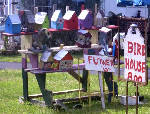
| Thursday, May 5, 2011: One thing about cycling while you're touring the USA in an RV is that you get to see geography you would not normally see. Today was a good example in northern rural Mississippi. I passed many fine brick homes with huge lawns to mow, a few older abandoned homes and lots of manufactured homes. This ride was along the Tenn-Tom Waterway from Fulton, Mississippi north for 19 miles and return. Many of these rural roads had zero traffic which was wonderful riding. The hills were rolling and short so a relaxing ride. Relaxing except for the number of fine home with dogs who like to chase strangers on bicycles. Having said that however, I never felt like one of them was going to take a hunk of my leg. The photos below are a couple of oddities I found along the route. The bottle tree is to keep evil spirits away from the area. I DID notice the boot birdhouse but did NOT notice the apple core birdhouse until seeing the photo. Maybe I'll revisit this backyard salesman. |
 |
|
|
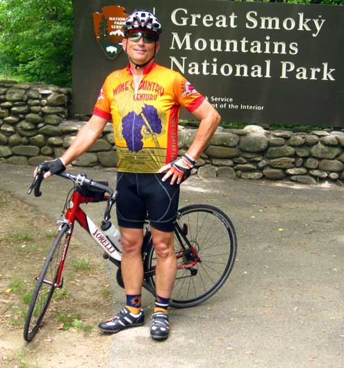 |
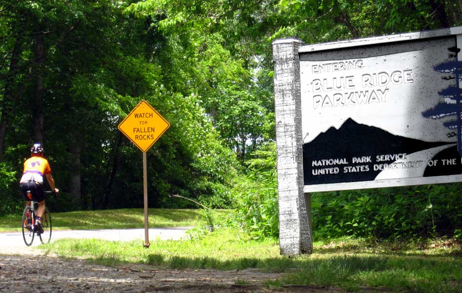
Thursday, May 19, 2011: We are in the Great Smokey Mountains only three more days, today was my chance to ride some of the narrow, busy roads in the park. There are some steep grades in this park too. Although the top of the mountain is only ten miles, you must climb 3,000 feet in that distance. Staying here for any length of time would be like our stay at Indian Valley Campground last summer ... the only place to go is UP. Fortunately, the traffic was not heavy this morning and the drivers are generally driving slowly anyway in the park. They all gave me plenty of room. I rode toward the summit then turned around toward the town of Cherokee, NC. I explored some of the town then started back toward my campground. The Blue Ridge Parkway ends at the Smokey Mountain park so I was able to ride some of the parkway too. Click the photo to see the southern most end of the parkway. Like the Natchez Trace, the parkway is managed by the National Parks. Here the speed limit is 45 for the entire length of the parkway. You must climb 3,000 feet on the parkway to exit the park in this direction too. It was nice riding weather today. |
|
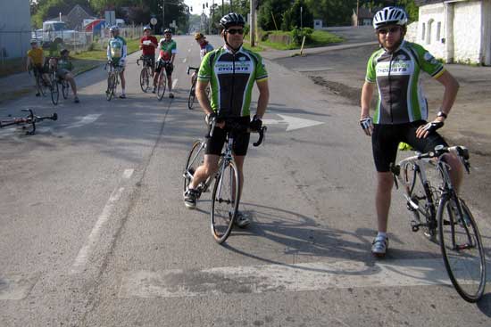
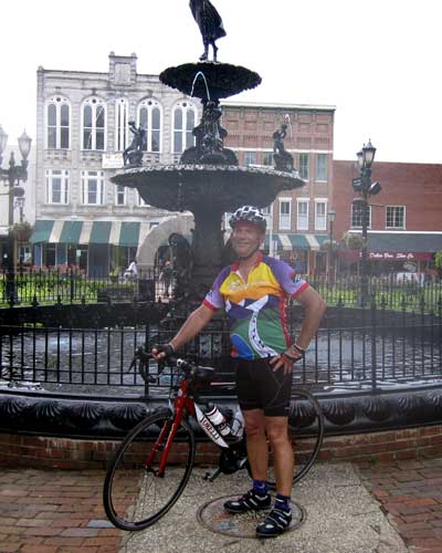
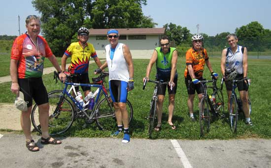
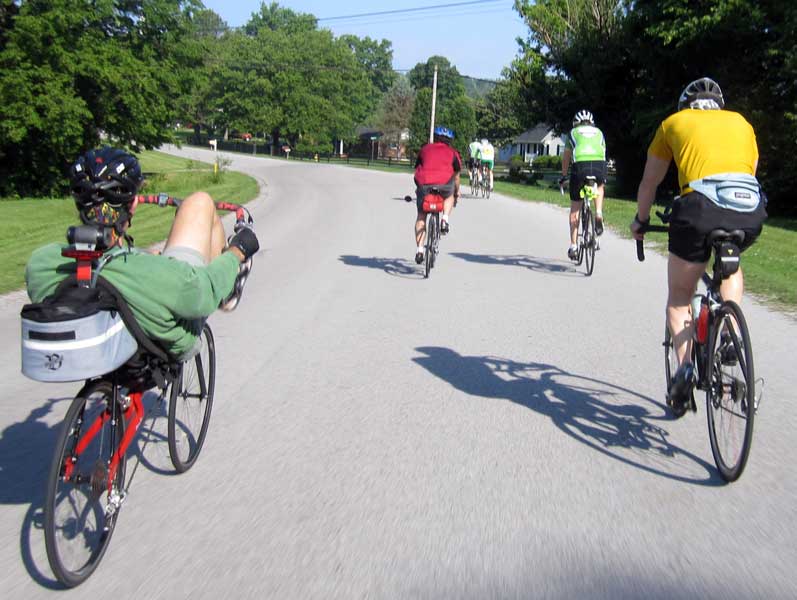
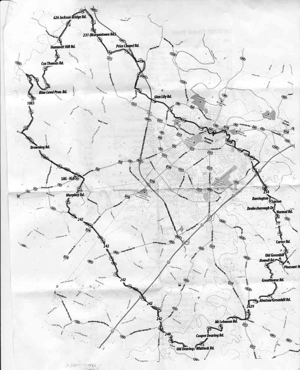
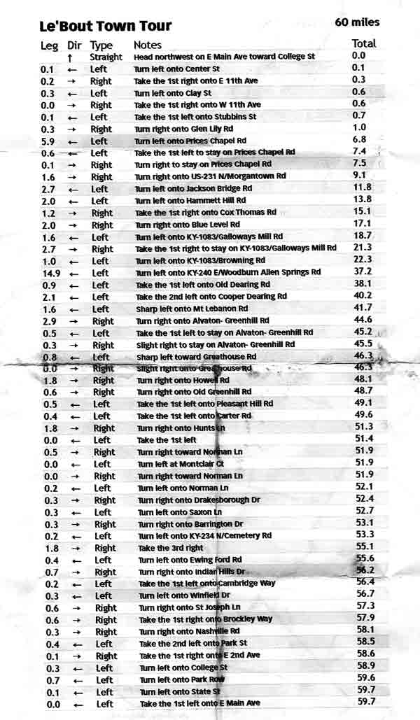
| Saturday, May 28, 2011: While visiting Bowling Green, Kentucky I picked up a SOKY Happenings (pronounced So-key) at a local store. It's a beautiful, free magazine publish once each month to announce happenings in Southern Kentucky (hence SOKY). I noticed an announcement by the BGLOB (Bowling Green League of Bicyclists) of their Saturday ride to be 40 - 50 miles. I haven't been riding as much as I should because Ralph, Janet and Gwen keep me so busy doing tourist things. But, I have a century ride to do in three weeks so 40 - 50 miles would be a good training ride. It was to start at 8am at the Fountain Square Park. I learned WHERE "FSP" was, left our campground at 7 am arriving in plenty of time to join the group. The BGLOB (on this ride) turned out to be all men, younger than me and all with bicycles |
 |
|
 |
equal to or better than mine ... so serious riders. As it turned out, most were MUCH more serious than me. Steve, the leader of the ride greeted me with a map which looked like a BIG loop on the country roads around Bowling Green. "Perfect", I thought. I'd see lots of Kentucky that I would not have seen otherwise. Then I turned over the map to see the backside. In big letters at the top, "60 Miles". Wow! These guys looked pretty fit and I'm 64 YEARS old. Steve explained, this won't be a "hard ride", we'll keep a pace of 15 - 16 MPH. I knew I'd been training at 14.5 MPH and have easily averaged 16+ in the past. "You can't keep an OLD bicyclist down", I thought ... I'll do it. Our ride was less than a mile before we were stopped by a passing train. That's when I took the photo above (click the photo to see another view). The feeling was great to be riding with others who were at my level or better. |
|
| I learned quickly that several of the riders were much stronger than I was so this was only a "recreational ride" for them, not really a training ride. But, there were a couple of riders with less experience so I wasn't going to be the rider who held the rest of the group back. Kentucky (at least this part) is full of rolling hills with steep descents and climbs. That type of terrain (I already knew) can really sap the strength of a cyclist so I paced myself well. When riding with a group, I'm often the last to the top of the hill (it seems it's always been that way), so the group passed me while climbing. Still, if I spent a month with these guys, I'll bet I could be staying with a "recreational ride" pretty well. It felt incredibly good to be in a tight group to benefit from drafting the stronger riders. It's been quite a few years since I've had that experience. The guys asked me about Oregon riding. I described living last summer in a valley where the riding was all uphill and the pass was 38 miles distant. Apparently there is no place to experience a ride like that in Kentucky because they asked, "how do you do that?" "You just set up a pace you can hold, just like you do on flat land", I replied. I don't know if they really believed me or not. It turned out to be an easy paced ride (15.5 MPH average) with lots of stops to collect the group and major route changes. Originally, I had plans to meet Ralph, Gwen and |
 |
| Janet to tour the Corvette Museum. I tried calling several times to tell them to go without me but my phone would not work in the country. At fifty-two miles, my phone began ringing. I pulled the phone from my rear pocket and answered while continuing my ride. It was Ralph wondering where to meet me. That's when I got to explain the "40-50 mile" ride had turned into 60 miles and they should go ahead. "This ride was SO great I would sacrifice anything to get to do it", I proclaimed. I completed the ride and felt great and wasn't the last to finish. Note: I was also concerned about my weight. I'll bet I've gained 10 pounds (I'm afraid to check my weight) but maybe rides like this one will help take it off. I have three weeks to do that before the Century ride out of Goshen, Indiana. |
|
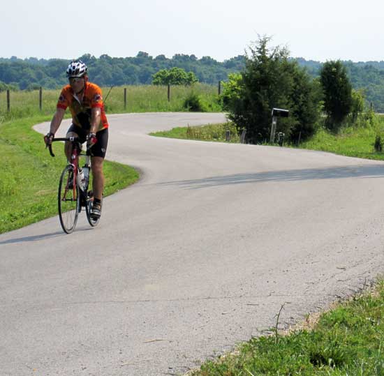 |
Saturday, June 4, 2011: A morning ride on a very hot, humid day in Kentucky. It seems Kentucky has a criss-cross of single lane, paved roads around the state in what I would call a rural area. Unlike Oregon, however, there are homes everywhere in the "rural" area. I'm beginning to think rather than rural, these homes are really in a "residential" area with front and back yards of 5 to 200 acres. Much of the time the mowed lawn is 5 to 10 acres so these folks must spend most of their spare time on a riding lawn mower. This was a 42 mile ride (including wrong way travel) around Taylorsville Lake in north central Kentucky. I began the ride at 8:30am with tempertures in the 90s by the time I finished. Kentucky saves money by not putting street signs in the "rural" areas so I got lost twice and had to study the map at several intersections. I did some pre-planning at MapMyRide but many of the street names did not exist or could not be found. Still, after riding in the wrong direction a couple of times, I found my way around the lake. |
|
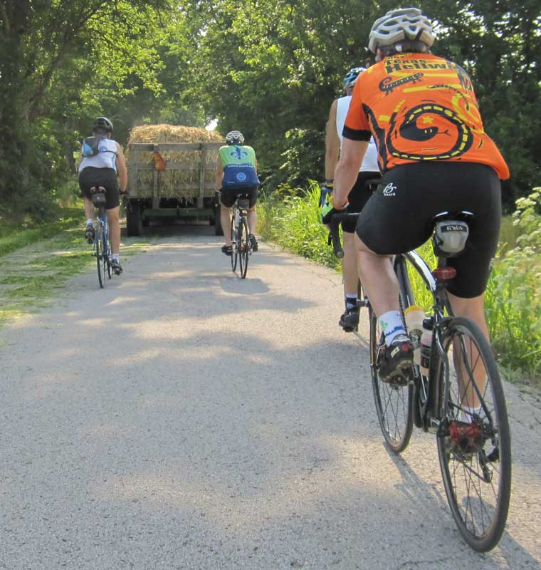
| Tuesday, June 7, 2011: The Louisville, Kentucky Cycling club is one of the most active bicycle clubs I've come across. Their ride calendar is full. I noticed a 59 mile ride on the schedule for this morning with ride captain Jim (in the photo). When I showed up I was told the ride was shortened because the weather was to be SO hot. In some ways it was a relief, because the high temperatures and high humidity has been uncomfortable. There were about 25 riders showing up for the ride. The group did not stay together for the ride but broke into groups. As it turns out, I fit in well with 4 other riders and they wanted to do more than the planned 44 miles. We ended up doing 53 miles. Click this photo to see us riding behind a load of hay. The entire ride was on rural, mostly single land roads to the east of Louisville. |
 |
|
 |
These are the guys I rode with. They really worked me hard on the rolling hills around Louisville. My average speed for the ride was the highest yet. I usually ask riders when I'm in a new area for their recommendation of the best bike shops in the area. I had already made a list of four in the area and expected one of them to be recommended. But everyone suggested a bike shop across the Ohio River into Indiana, the Clarkville Schwinn. This must be a great shop since these riders are passing up a lot of shops in Louisville. By the time my group returned to our starting point, we were all soaked due to the humidity and heat. Bill is in the orange, second from the right. He rides ultra distance. His next big ride is August in France, 750 miles in 3 days. Now 53 miles doesn't sound so bad does it. Click the photo to enlarge. |
|
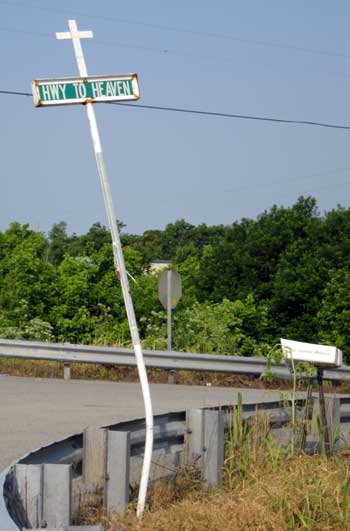
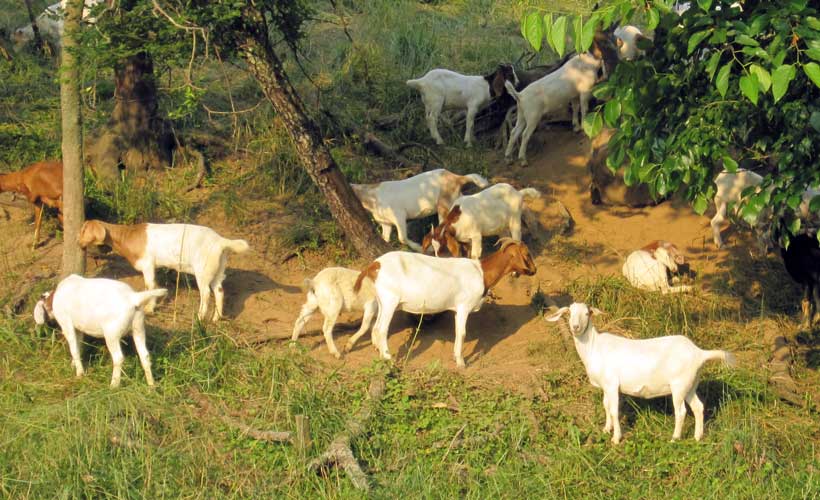
| Saturday, June 11, 2011: While riding around Taylorsville Lake I came across what many are looking for ... and here it is, in Kentucky. It's the Highway to Heaven. The sign looks a little beat up but I decided to follow the highway to learn what's at the end. The Highway to Heaven is narrow but paved. It began with a nice decent then an easy climb as the road narrowed. It was a pleasant feeling along the way. One curiosity were the goats lining the road (not sheep). The pavement dead ended into gravel. |
 |
|
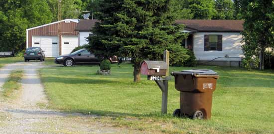 |
The Highway to Heaven ended at a doublewide with a detached two car garage. The good news is that heaven has mail delivery and garbage collection plus a private pond for fishing. Click the photos for additional views. |
|
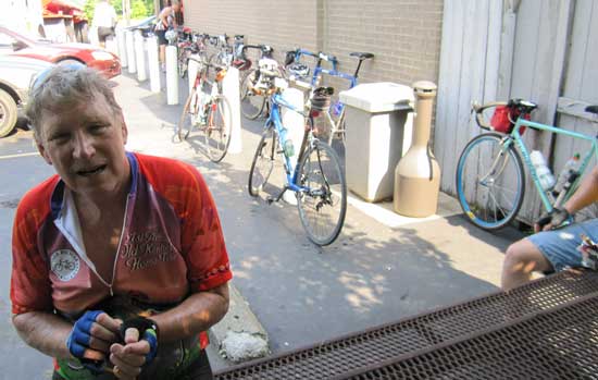
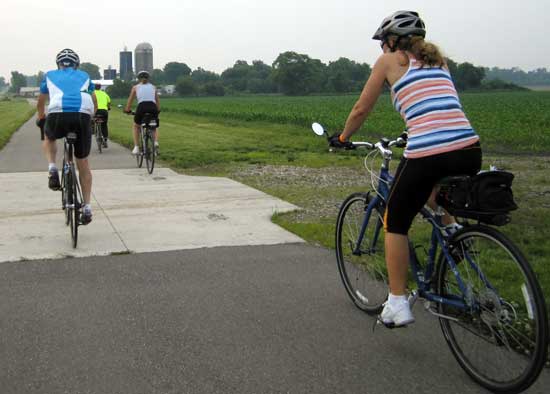
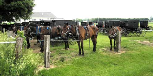
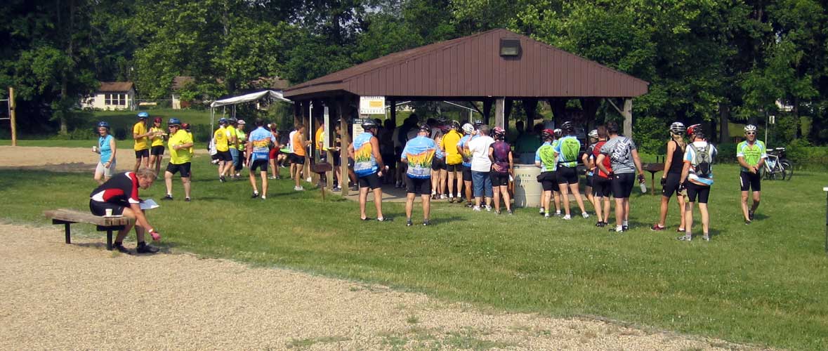
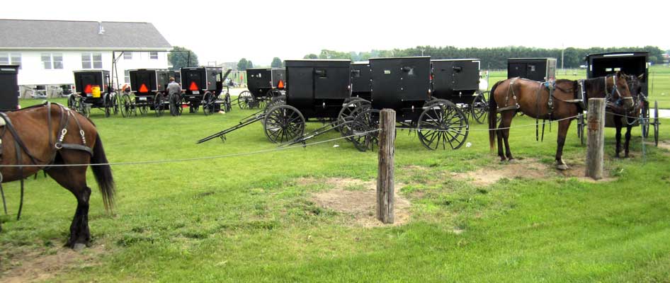
| Saturday, June 18, 2011: Today, a very enjoyable ride on the Pumpkinvine Bike Ride, a ride with many choices for length of ride and route. I chose the 100 mile route. I was on the route at 7:22 am to get as much riding completed in the cool morning air. This is my first chance to ride with Amish/Mennonite carriages. I learned that some have drum brakes and others don't. They all seem to look identical, black and polished. The horses seem the same type of trotting horse. The carriage move at 12 - 14 MPH as measured by my cycling computer when I was following them. I ride faster than 14 so I passed many of them. When I lived at Lake Tahoe, the asphalt was always warn in two places on each side of the road where tire change wear away at the asphalt. I noticed ONE ware mark on each side of the road and many roads repaired with replacement asphalt. |
 |
|
|
 |
|
| The carriage horses wear away the asphalt with their shoes and the county repairs the roads with a row of new asphalt on each side of the road. I came across about thirty carriage parked at a church softball field. The men were preparing for a Saturday afternoon softball game. This was a pleasant century ride with a few hills but nothing like my last century. It was a good thing, too, I hadn't prepared as well for this century as for the last one. I didn't finish until later in the day. The weather man had promised 50% chance of showers and a high of 78. Instead, the skies were clear with high in the mid-80s. Humidity was also high so I was soaked and uncomfortable for the last 20% of the ride. Still, I saw much we need to explore. Lots of home businesses as well as small towns like Shipshewana which we need to explore. Click each of the photos for another view. Be sure to notice the child's leg dangling from the carriage in the photo behind the carriage and riders above. |
|
|
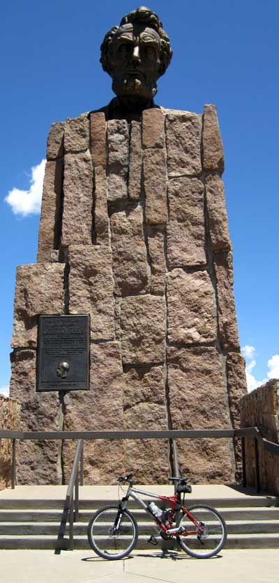 |
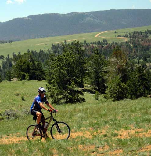
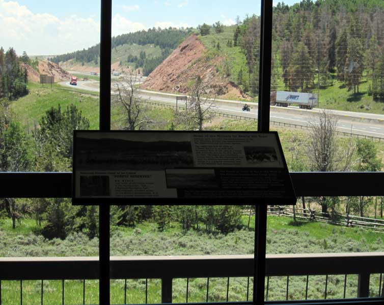
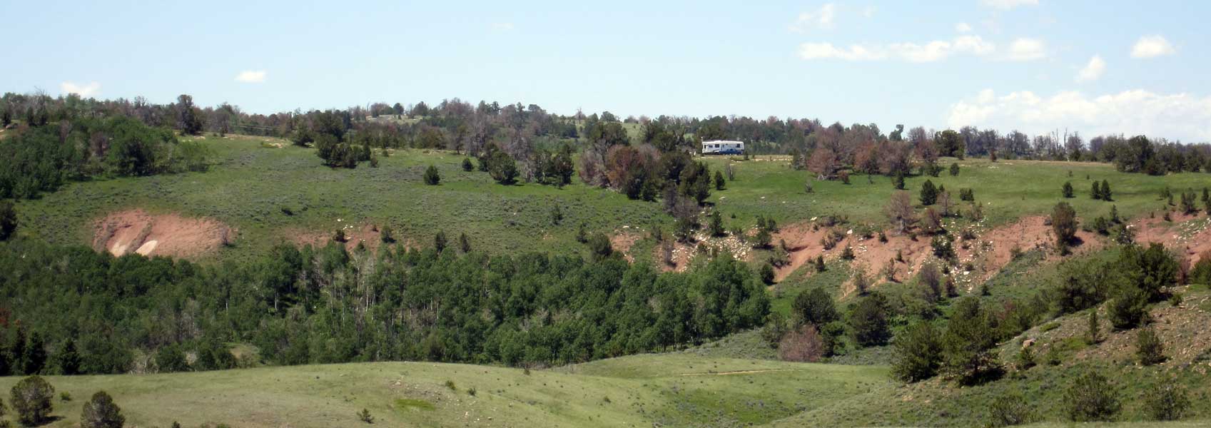
Saturday, July 2, 2011: We are camped about 3 miles off Interstate 80 at the highest point (of I-80) in Wyoming, 8,700 feet. Abraham Lincoln overlooks I-80 at the top of Wyoming (click Abe to see what he sees from the visitor center). There are many miles of well maintained gravel roads plus many miles of smaller, not so well maintained roads. This area can have strong winds which would help to keep off the clouds of mosquitoes this time of year. Pleasant ride temperatures today. Click the ride photo to see our camping location in the Pole Mountain area.
|
|
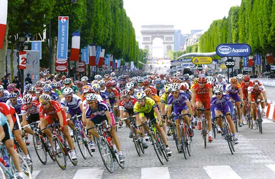
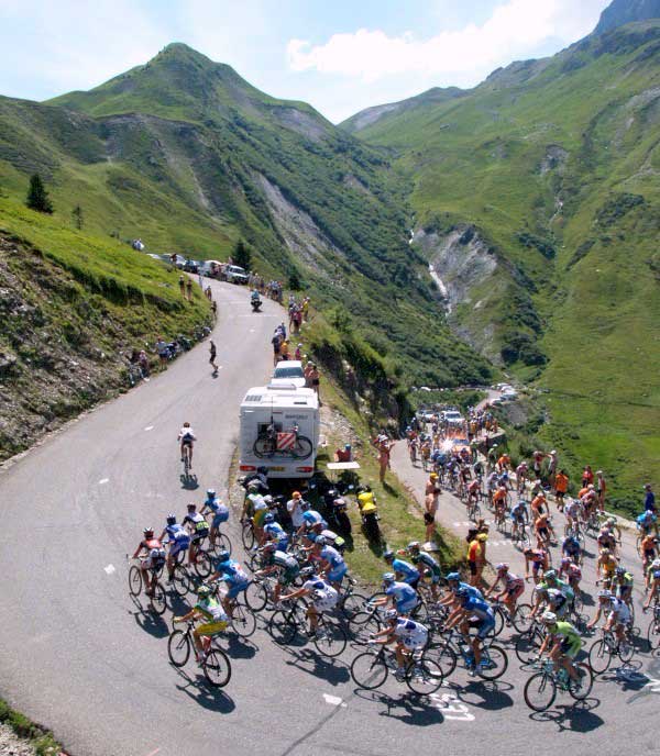
| Sunday, July 3, 2011: Along with the gentleman's Wimbledon Tennis Championship today, this was the second day of the three week 2011 Tour de France (TDF). The TDF is the premier cycling event of the year and to make it more exciting for those of us like me who will never participate or see it live, Map My Ride has created a "virtual" tour for the rest of us. You must ride each day of the tour and record your ride at MapMyRide.com. The sponsors use a formula to estimate your placement in the REAL TDF and publish it along with the placement of other riders registered in the game. One of the benefits of riding and playing the game is the chance of winning prizes at random. Last year I did this same event and won two prizes. I'm hoping to win some new Smith riding glasses this year. Click the photo for another TDF view. |
 |
|
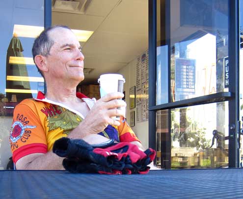 |
Thursday, August 18, 2011: I try to keep to a riding routine. Part of that routine is to ride with my Dad's physical therapist on Tuesday and Thursday mornings. It's an early morning ride, usually 6:15 but I got an email yesterday evening saying 6 am instead. I knew that would be tough. Since we are parked within 25 feet of four lanes of traffic, I must wear ear plugs to get any sleep. That means I can't hear an alarm. So this morning I awoke at 6:04. I got up any way thinking I would see my riding partners on there return as I was riding out. On my ride yesterday, I picked up two goat heads but quickly knocked them off the front wheel with my gloved hand. The tire still went flat by the time I got home. I found the hole and patched it for this morning's ride. However, the tire was flat again. I found a second hole this time, apparently one I missed yesterday which makes sense, after all, I had knocked TWO goat heads off the tire. By the time the wheel was back on the bike I knew I wasn't |
| going to see my riding partners. I rode the regular route anyway except at the far end of the loop I turned right instead of left and ended up in Lockford, a small rural town to the east of Lodi. I knew I had $2 in my under-seat bag so went looking for a coffee shop. I found a good one, very small but really good decaf. Those are my riding gloves sitting on the table in front of me. I'm wearing my "Wine Country Century" jersey from a century ride in Santa Rosa, California. The coffee break made the ride even better. |
|
|
Monday, January 9, 2012: While on the Oregon coast, I intend to ride as often as the weather will allow. There is plenty of good road riding around Gold Beach, although every road is uphill from here even if you try to parallel the ocean.
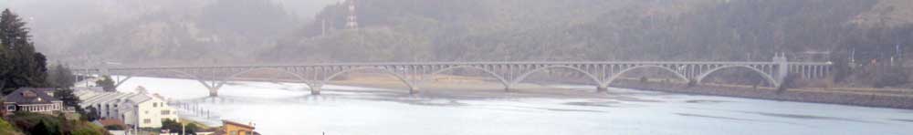
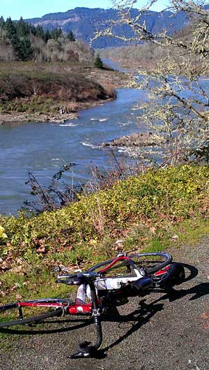
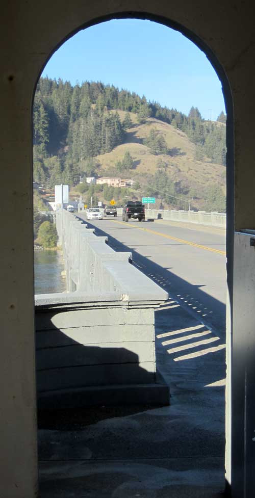
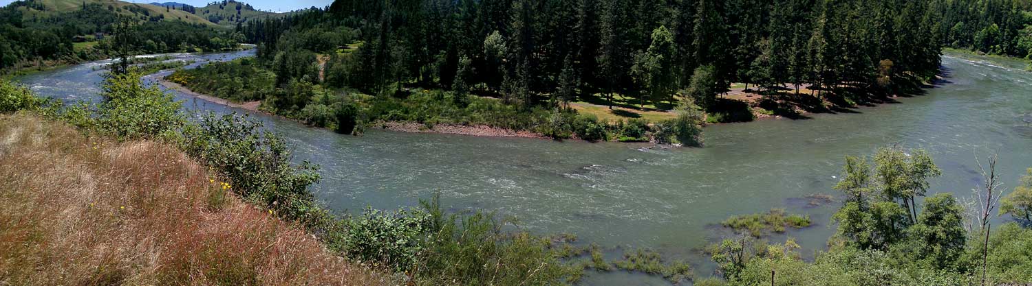
This ride is along both sides of the Rogue River riding east for about ten miles then crossing the Rogue on a one lane bridge and return west to Gold Beach. After being off the bike for a month, it was tough riding just this short 26 mile route with an outside air temperature of 50 degrees. I caught views of the Rogue River riding up river and down. I returned on the south side of the river which is the cooler side because the surrounding mountains block the afternoon sun from hitting the road. There are lots of RV parks along the north side (warm side) of the river. I was surprised at how full the parks along the river were. The parks in Gold Beach where we are parked are nearly empty. I have to wonder if the rates are significantly different or if it's the weather which drives the RV units to be a few mile inland from the winter coast. The traffic was very light which made for a nice ride. The bridge is about ten miles east of the coast, click the photo to see the Rogue and bridge. The Rogue River is the River I would ride while living in Grants Pass, about 100 miles upstream beyond the Rogue Wild River designation. |
|
|
 |
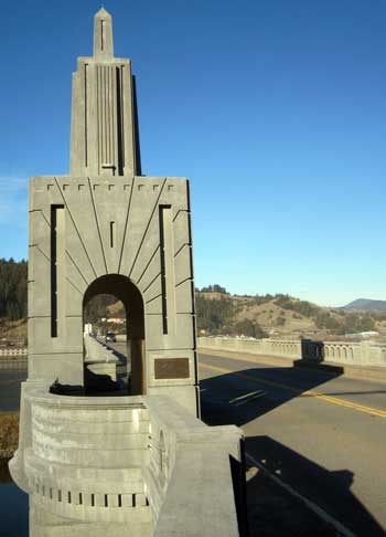 Friday, January 13, 2012: Another great ride along the Oregon Coast. This time across the refurbished Patterson Bridge at the mouth of the Rogue River on Highway 101 at Gold Beach. This highway is the major north/south road along the Oregon Coast, heavily traveled in the summer months by tourists but very lightly traveled in the winter. I thought this route was an "Oregon Bikeway", however I've learned differently. The Oregon Coast is one of the most heavily traveled bike routes in the world. There are many state and national parks along the Oregon Coast with bicycle campgrounds and even though Highway 101 is heavily traveled in the summer months, the shoulders are wide and this is a "designated" bicycle route marked the entire length with signs and alternate routes in the most heavily traveled areas. Oregon publishes a map for riders which is well done and valuable. I have ridden the entire route three times using a mountain bike and panniers to carry my camping gear. I've also ridden it on a tandem with little gear, staying in motels and eating in restaurants along the way. On that trip I returned to the beginning of the route for my car using Greyhound bus. I'm not sure the bus still travels the coast but I do see other buses along the route which might be an alternative. You generally want to ride from north to south because that's the direction the wind generally blows. I do see a number of winter riders who are prepared for cold, wet weather and have the advantage of very light traffic. Today's riding was very pleasant, low 50s, little wind. Click each photo for additional views. Friday, January 13, 2012: Another great ride along the Oregon Coast. This time across the refurbished Patterson Bridge at the mouth of the Rogue River on Highway 101 at Gold Beach. This highway is the major north/south road along the Oregon Coast, heavily traveled in the summer months by tourists but very lightly traveled in the winter. I thought this route was an "Oregon Bikeway", however I've learned differently. The Oregon Coast is one of the most heavily traveled bike routes in the world. There are many state and national parks along the Oregon Coast with bicycle campgrounds and even though Highway 101 is heavily traveled in the summer months, the shoulders are wide and this is a "designated" bicycle route marked the entire length with signs and alternate routes in the most heavily traveled areas. Oregon publishes a map for riders which is well done and valuable. I have ridden the entire route three times using a mountain bike and panniers to carry my camping gear. I've also ridden it on a tandem with little gear, staying in motels and eating in restaurants along the way. On that trip I returned to the beginning of the route for my car using Greyhound bus. I'm not sure the bus still travels the coast but I do see other buses along the route which might be an alternative. You generally want to ride from north to south because that's the direction the wind generally blows. I do see a number of winter riders who are prepared for cold, wet weather and have the advantage of very light traffic. Today's riding was very pleasant, low 50s, little wind. Click each photo for additional views. |
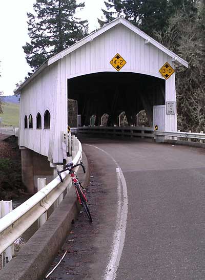
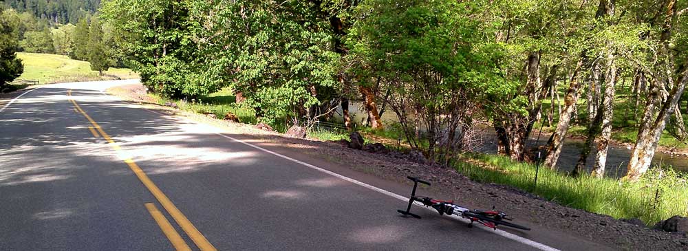
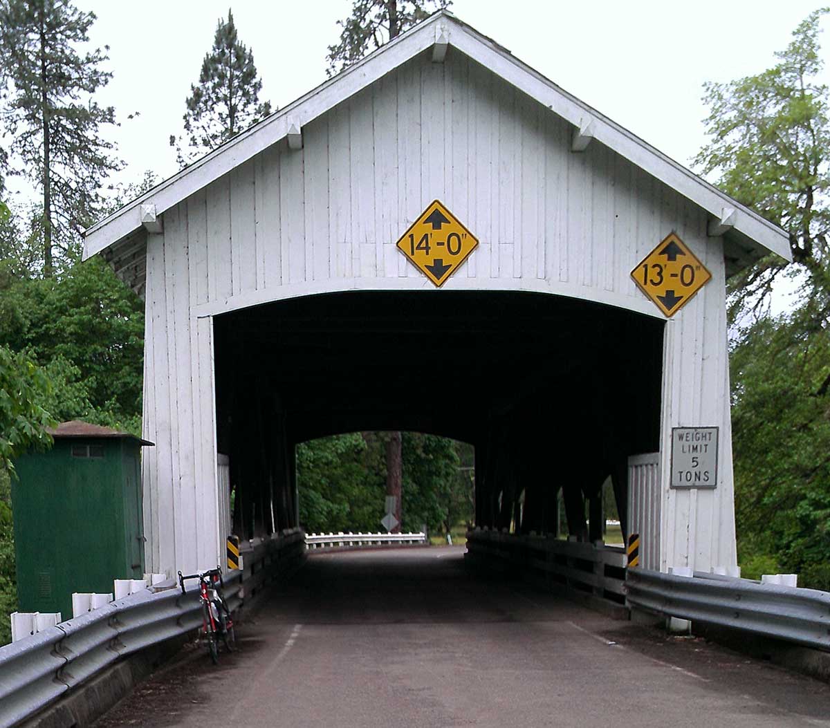
Wednesday, February 1, 2012: During my last ride, I pinched my front tube on a rock in the road and ended up with a flat. Since that tube already had two patches I decided to discard the tube and start over with a new tube (spare tube to carry with me). After driving to the Canyon Creek Bike Shop in Roseburg to retrieve the tube. I ended up with a purchase of three tubes plus two new tires to have on hand for the next tire change. Now, with a spare tube, I feel secure enough to go biking again. I hate the idea of patching a punctured tube while on a ride especially with the air temperature is barely 50 and the clouds are thick and looking like rain. So I took myself on my first ride in the Sutherlin, Oregon area. I did not study any maps before hand but knew which road would take be to the historic town of Oakland and started that direction. After wandering around Oakland I rode west hoping the road would turn south and join another road for a loop back into Sutherlin. It was great riding, temperature was perfect for a rider with a long sleeved jersey and vest plus leg warmers. I continued to make my turns hoping my choices would take me back to Sutherlin. I rounded a treed curve and came upon the Rochester Covered Bridge over the Calapooya River. What a treat. I had to stop to take a photo. You can get an aerial view here. The ride was not quite as log as I had hoped so I toured parts of Sutherlin to add a few miles. You can see the route here. |
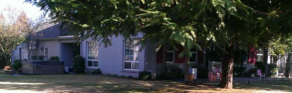
Monday, February 6, 2012: I've been riding as many routes around Sutherlin Oregon to learn the area before leaving this week. Several routes took me along the North Umpqua River, the second largest 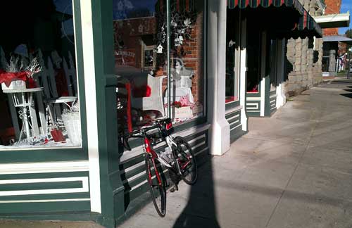 river in Oregon. This rural riding is my favorite. The country side is full of small farms and horse ranches. We learned last week that the veterinarian we took Annie spent most of her time caring for horses and there are plenty of them around this area. Many of the routes pass through the historic town of Oakland. My bike is parked in front of Tolly's restaurant which is a famous landmark in Oakland and one enjoyed by everyone in the area. Tolly's is in the process of changing owners so not currently open or we would have visited for a meal. Click either photo for another view. river in Oregon. This rural riding is my favorite. The country side is full of small farms and horse ranches. We learned last week that the veterinarian we took Annie spent most of her time caring for horses and there are plenty of them around this area. Many of the routes pass through the historic town of Oakland. My bike is parked in front of Tolly's restaurant which is a famous landmark in Oakland and one enjoyed by everyone in the area. Tolly's is in the process of changing owners so not currently open or we would have visited for a meal. Click either photo for another view. |
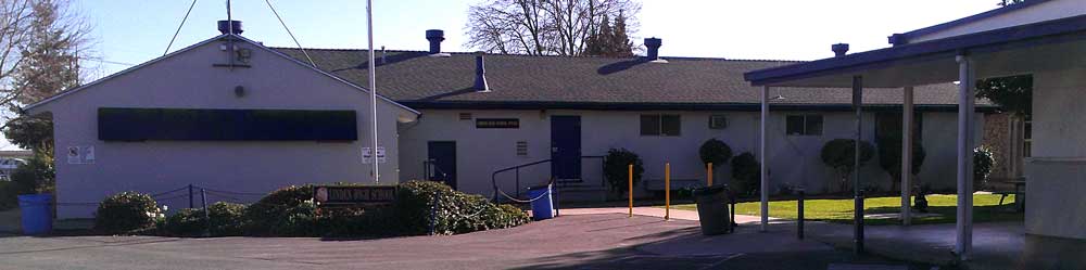 |
 Sunday, March 4, 2012: I'm in Lodi, California today visiting my Mother. Lodi is in central California and my Mother has lived here since 1963. I graduated from Lodi High School so attended LHS 1963 - 65. However, I attended Linden High School from 1961-63. Linden is a small town and when I attended Linden High School, my class was about 80 students. I was never quite at home in Lodi but really enjoyed Linden. In small high schools you are able to Sunday, March 4, 2012: I'm in Lodi, California today visiting my Mother. Lodi is in central California and my Mother has lived here since 1963. I graduated from Lodi High School so attended LHS 1963 - 65. However, I attended Linden High School from 1961-63. Linden is a small town and when I attended Linden High School, my class was about 80 students. I was never quite at home in Lodi but really enjoyed Linden. In small high schools you are able to |
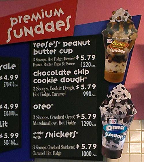 participate in everything so I was on the football team, track team, band, in a play and several clubs. I'm mentioning all this because today I began a ride into the countryside around Lodi but was feeling so good I extended my ride. I ended up in Linden. The old school office is STILL the office today (top photo). I also found the Linden house where my family lived those two years. Click the photo for another view of the house. The ride turned out to be 40 miles and burned 2000 calories. That would have been a wonderful addition to my calorie counting and weight reduction except my Mother had a coupon for Baskin Robins. It stated a second sundae for 99¢ after buying the first sundae. Mom wanted an Oreo sundae because she learned today was the 100 year anniversary for the Oreo cookie. I chose the Reese's peanut butter cup sundae, 1220 calories ... YIKES! Oh well, I didn't eat that brown stuff (peanut butter) in the bottom of the cup. participate in everything so I was on the football team, track team, band, in a play and several clubs. I'm mentioning all this because today I began a ride into the countryside around Lodi but was feeling so good I extended my ride. I ended up in Linden. The old school office is STILL the office today (top photo). I also found the Linden house where my family lived those two years. Click the photo for another view of the house. The ride turned out to be 40 miles and burned 2000 calories. That would have been a wonderful addition to my calorie counting and weight reduction except my Mother had a coupon for Baskin Robins. It stated a second sundae for 99¢ after buying the first sundae. Mom wanted an Oreo sundae because she learned today was the 100 year anniversary for the Oreo cookie. I chose the Reese's peanut butter cup sundae, 1220 calories ... YIKES! Oh well, I didn't eat that brown stuff (peanut butter) in the bottom of the cup.
It was a great riding day with little wind and temperatures in the low 70s. Today was the first day of riding without wearing tights or a long sleeve jersey. Here is a link to the ride description and map. |
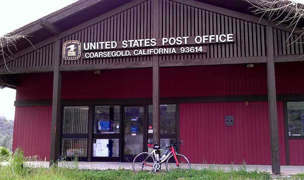
Wednesday, March 14, 2012: We are parked near Coursegold, California in the Park Sierra Escapee RV park. Coursegold is in the foothills above 2000 feet in the Sierra foothills east of Fresno. Park Sierra is one of the best parks of the Escapee parks, its only problem (for us) is that it is in the state of California. California has great geography and weather but far too crowded and one of the worst taxed states. The laugh is even though they have income tax, sales tax, property tax, city and county taxes, they STILL miss-manage the money so badly, they can't pay the bills. They are about to close many of the state parks and the fee to visit a state park is so high, few can afford to visit. This is the state where we managed six national forest campgrounds where campers were happy to pay $22/day for nothing but a fire ring, table and dirt to pitch a tent. This was so much lower than a state park fee, the Californian's thought it a bargain. Anyway, we love Park Sierra and it seems to be an excellent place to spend the month of March and part of April. You can view our location here, we are on the right. You can see the open space to the right in the photo and behind our location is a ravine with the Coursegold Creek deep enough for Morgan to take a swim. The park is only 8 miles from the Coarsegold Post Office but it is a tough 8 miles compared to the flat riding around Lodi. The hills around the park are steep, two lanes and a very small shoulder. Today was my first ride in the area. I was not surprised by the steep climbs and descents but I was surprised by the heavy traffic on the back roads. Click the post office to see the Coarsegold Market and, even better, the Frosty next door. |
|
| Sunday, May 6, 2012: I'm back riding in Oregon, areas around Sutherlin. I'm often out riding past crops, I love riding in the rural areas. It's sure nice with the farmers help out those who aren't farmers by labeling their crops so we know what we are looking at. This was a huge Hazelnut orchard and I certainly would not have know had this farmer not labeled the deer fence surrounding his orchard. Click the photo for another view of what I believe to be blueberries but the blueberry farmer had no sign so I'm not sure. Both these photos will give you an idea of what I saw today on my ride. Click here for a map of the route. |
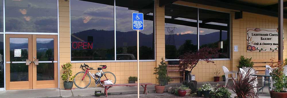 |
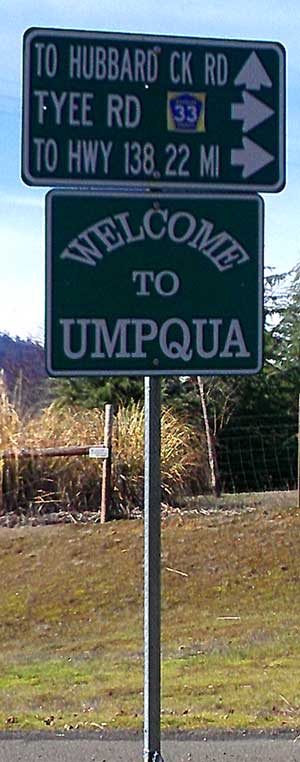
| Wednesday, May 9, 2012: For my ride today, I decided to make it practical and visit the Lighthouse Center Bakery which is 6 miles west of Sutherlin. They have bread to-die-for and only $4 per loaf. The bread is baked in a brick oven which took a year to build and is far better than Panera's Bread (which is more expensive). Today I purchased sourdough Rye for the first time which was marvelous. I took a round-about-mountain-route to get to the bakery so it was much more than 6 miles one way. Fortunately, Gwen remembered that they package in only a brown paper bag so I brought the white plastic bag you see on the bench. That was much easier to carry. If you are driving Interstate 5, this bakery is only 6 miles west and worth the drive. Take the Sutherlin exit, Road 138 west for only about half a mile, then angle left onto Fort McKay Rd. to the tiny community of Umqua. The bakery is closed on Monday. |
 |
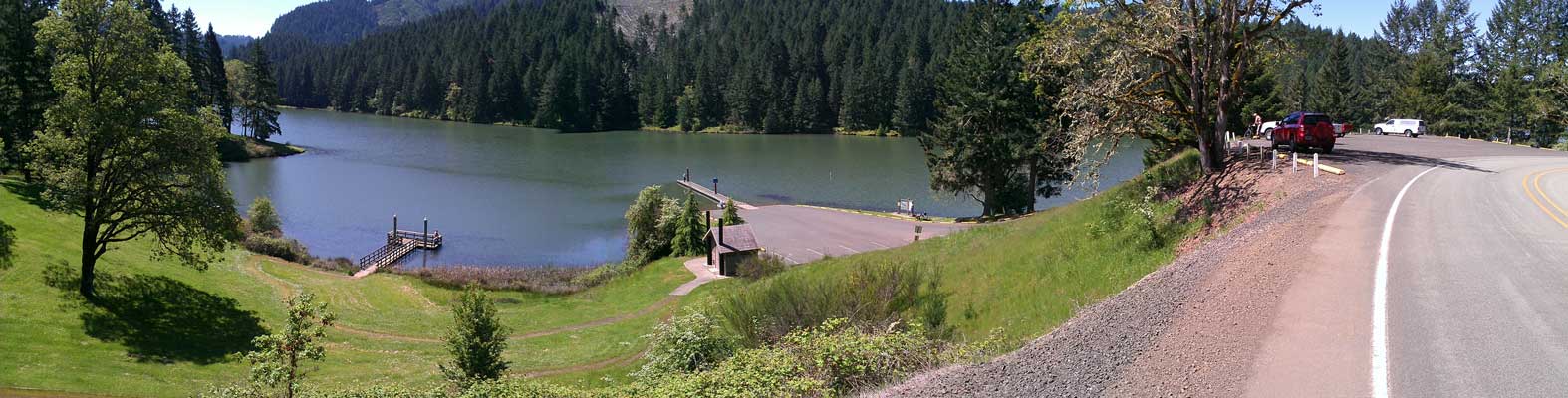
| Tuesday, May 15, 2012: My most favorite kind of riding is rural riding and nothing can beat the riding here in Oregon. The rural roads around Sutherlin have a variety of terrain, very light traffic and really nice riding weather this time of year. This scene is about 12 miles east of Sutherlin next to a creek which flows through the city. Just above Sutherlin, to the south, is Cooper Creek Reservoir, a nice, quick ride with some elevation increase. Click the photo for a view of the reservoir seen just before exploring the ride in the photo above. |
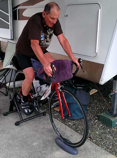
Wednesday, May 23, 2012: It does rain in Oregon and I don't choose to ride in the rain when I can ride the trainer. I have rain gear but I hate getting water and road grime all over the bike so today was one of those days. My son, Ben, loaned me the trainer while I decide if I like it. I use to ride rollers which require balancing as if your are riding the road. I liked rollers but they are bulky and not a portable at this little trainer. I ride with my bluetooth headset listing to "riding music". Today it was "The Who" and I especially like "The Music Must Change", absolutely great for motivating hard trainer riding. The towel is to catch the sweat which pours off my face while riding. Under the towel is my smart phone acting as an MP3 player broadcasting the music over bluetooth so I don't have any wires connecting my headset to the phone. I can increase or decrease pedal pressure by shifting to a higher or lower gear. I rode for an hour today which is equal (in my opinion) to two hours of road riding since there is NO coasting. I plan to add a temporary shelf to the handlebars to hold a small fan to blow on me while I'm riding. It was only about 55 today but the sweat still pours. The one thing I'm missing is a record of the riding on my computer. I tried moving the computer transmitter to the rear wheel but it would not work, just too far from the computer. |
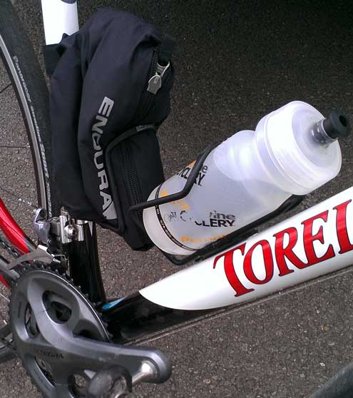
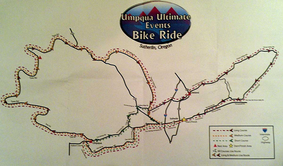
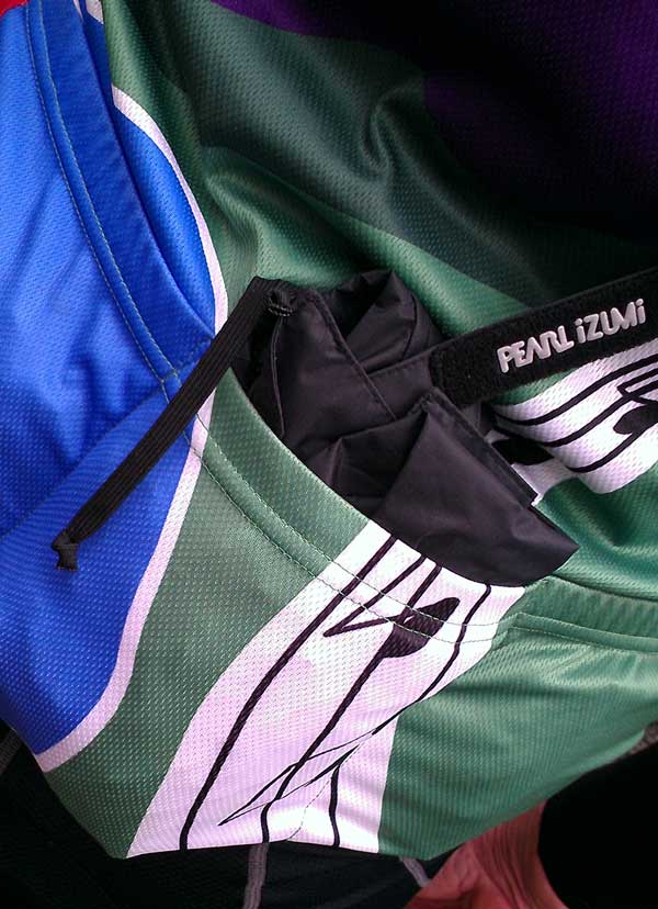
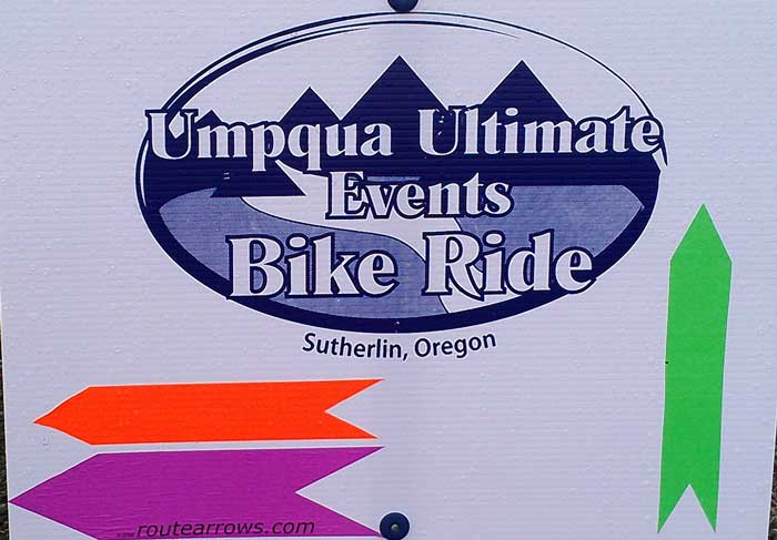
Saturday, May 26, 2012: This is a big day for Sutherlin, Oregon and for me, it's the day of the Umpqua Ultimate Bike Ride. You can see the route by clicking the photo or for an even better view, click here, to see the route along with elevation change. If you drag your pointer along the elevation graphic, you'll see the direction of the ride along the route on the map graphic. I signed up for the longest route, a metric century (65 miles in this case), so it wasn't a threat with the distance since I've not been spending as much time on the bike as I should. What was a threat was the weather, it has been raining all week but the promised forecast was for "partly cloudy" today with a high of 67, perfect cycling weather. However, the rain woke us at 5:40 am and it continued to rain until 7am and looked threatening. I hate riding my bike in the rain because that gets sand and other road crud all over the bike. However, it wasn't raining at the start of the ride but threatening. I removed one water bottle and stuck my rain jacket in the bottle cage instead. When you click that photo, you'll see that I carried my rain pants in my back pocket. Fortunately, I didn't have to use either. |
 |
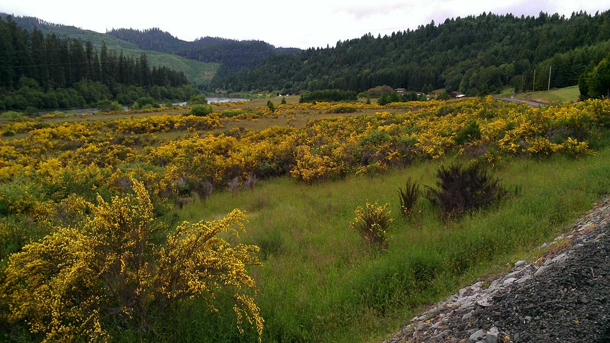
Our first rest stop was at the Lighthouse center bakery which I have visited before and one of my favorite places to visit. The ladies at the stop were ready with fruit and cookies to hand out to all three route riders because all three routes stopped here at one time or another. They had cranberry cookies from Subway which I couldn't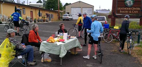 resist but I really wanted a cup of coffee to go with my cookie so I walked into the bakery. What a great cup of coffee they served for only $1.25 and free refills. There were lots of (what I call) turtles on this ride, those who steadily plug along at a relatively slow pace, but who take the sport seriously enough, they spend little or no time at the rest stops. I don't mean this term to be derogatory, since I am a turtle on many of these rides. I had passed most getting to this stop (today was a great day for me so I was doing 16 - 23 mph depending upon the grade), but the turtles passed by while I was enjoying my coffee. Great for riding motivation because that gave me someone to chase (someone I might actually catch) for the next leg of the route. Click the photo above for a view of some of the fantastic scenery I saw today. resist but I really wanted a cup of coffee to go with my cookie so I walked into the bakery. What a great cup of coffee they served for only $1.25 and free refills. There were lots of (what I call) turtles on this ride, those who steadily plug along at a relatively slow pace, but who take the sport seriously enough, they spend little or no time at the rest stops. I don't mean this term to be derogatory, since I am a turtle on many of these rides. I had passed most getting to this stop (today was a great day for me so I was doing 16 - 23 mph depending upon the grade), but the turtles passed by while I was enjoying my coffee. Great for riding motivation because that gave me someone to chase (someone I might actually catch) for the next leg of the route. Click the photo above for a view of some of the fantastic scenery I saw today. |
|
Much of the ride was along the Umpqua River. It is the second largest river in the state of Oregon, after the Willamette River which passes through Eugene then through Portland joining the giant Columbia. I guess the Columbia isn't counted because it spans two states. The Rochester covered bridge over the Calapooia Creek, is behind the Umpqua River photo, just click to see it. 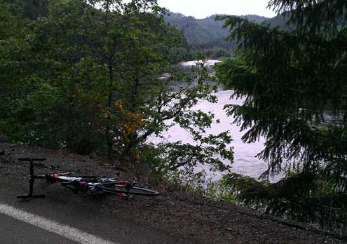
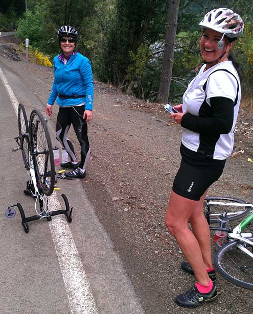
While chasing some turtles, I came upon these two ladies along side the road looking perplexed. I believe one of them was actually checking her iPhone for instructions to fix a flat tire. "Do you need any help?" I asked. "Well, we've never done this before they responded, the lady in |
 |
|
| blue was actually trying to remove the tire while it was still on the bike. "I took tire changing lessons last spring," she said, "but that was a long time ago." She had all the right tools and an extra tube so she had learned well. I had passed them before but they passed me while I was taking photos, they were both strong riders with high quality bikes. I love to help ladies in distress with bicycles so I showed them the proper way to fix a flat and had them back on the road again in about ten minutes. They were well ahead of me when I got back onto the road but I caught them climbing on Oregon Route 138. The lady in white was a particularly strong rider and I told her so as I was passing, she responded, "I love this sport". Click their photo for another view. |
|
The photo on the left is the last rest stop and one for the long route riders only. The lady in charge of the stop had fruit and cookies ... yes another cranberry cookie for me. She also had watermelon, so I told her the story of one of my first long rides when I was eleven living in Ontario, California. She said she moved here eight years ago from Burbank, California so knew where Ontario was. I told her my buddy, Peter and I took off one Saturday with no plans but a bike ride. We ended up riding into Los Angeles (35 miles, 70 miles round trip), the only way we knew where we were was because we had seen pictures of the Los Angeles City Hall on the TV. We turned around and started back but neither of us had any water and very little money so we were dehydrated and hungry. On the return ride we came across an outdoor fruit stand, pooled our money and bought a whole watermelon for fifty cents. That saved the both of us from dehydration and hunger until we got home. I told her I doubted that our parents knew where we were and I doubt either of us got permission to ride that day. She said, "I was a different time then." Behind this photo is a photo of rural residents curious of all the strange bicycle riders.
I ride for T-shirts, this one came with the ride. Click the photo to see the signs we followed today. The purple arrow is for the long route. The course was well marked. To tell the truth, there is something about riding which is "spiritual" for me. Spiritual meaning "uplifting", "devotional", "inspiring", "reliable" (I'd have to think more about it to come up with other examples), surely anyone who spends time seeking personal goals in sports, such as running, swimming, hiking, and other aerobic sports know what I'm talking about. Perhaps the lady in white knows what I mean when she exclaimed, "I love this sport". It has been that way for me since I was eleven and has saved my spirit many times during personal trials. Today was especially good for me. I rode better/stronger than I have in a long time through some of the most scenic country in the USA in perfect weather. It all added up to an "Ah-Ha" moment for me. I can't wait for the next ride. |
|
| Wednesday, June 6, 2012: Nice 53 mile ride today on North Bank Road from Sutherlin to Glide, Oregon and return. Perfect weather with climbing in both directions, only a slight advantage to the return from Glide. The beautiful North Umpqua River is always on the south side of the road. More traffic in the afternoon than morning. Nice lunch stop at the Illahee Family Restaurant. Click the photo to see this giant U turn on the North Umpqua. |
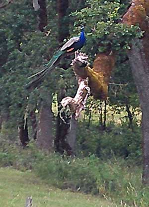
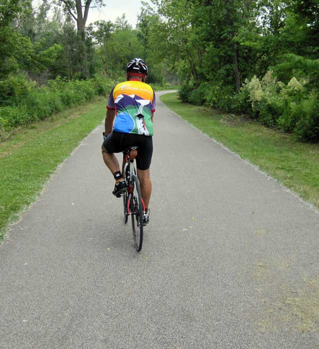
Friday, June 29, 2012: Today was my third two hour ride in the last three days. So I've been riding too hard and today I could feel the weakness in my legs. It was excellent weather for riding, overcast and low 70s. My route today included some climbing around the rural road northeast of Oakland, Oregon with the ride beginning in Sutherlin. This route took me past the Mildred Kanipe Memorial Park, a good place to get water on a hot day or just stop to relax and watch the wildlife. For some reason the park is full of exotic birds such as this Peacock perched in the tree as I rode by today. The Marsh Anne Landing Winery is also on this route but I didn't stop for a sample. I would be dripping sweat all over their beautiful tasting room. Even with weakness in my legs, the ride was a good one with very little traffic, great views of the Oregon countryside, some challenging ascending and thrilling descending. This would be a good route for a daily workout once my leg strength has caught up. |
| |
| |
| |
| |
|
|


 Friday, January 13, 2012: Another great ride along the Oregon Coast. This time across the refurbished Patterson Bridge at the mouth of the Rogue River on Highway 101 at Gold Beach. This highway is the major north/south road along the Oregon Coast, heavily traveled in the summer months by tourists but very lightly traveled in the winter. I thought this route was an "Oregon Bikeway", however I've learned differently. The Oregon Coast is one of the most heavily traveled bike routes in the world. There are many state and national parks along the Oregon Coast with bicycle campgrounds and even though Highway 101 is heavily traveled in the summer months, the shoulders are wide and this is a "designated" bicycle route marked the entire length with signs and alternate routes in the most heavily traveled areas. Oregon publishes a map for riders which is well done and valuable. I have ridden the entire route three times using a mountain bike and panniers to carry my camping gear. I've also ridden it on a tandem with little gear, staying in motels and eating in restaurants along the way. On that trip I returned to the beginning of the route for my car using Greyhound bus. I'm not sure the bus still travels the coast but I do see other buses along the route which might be an alternative. You generally want to ride from north to south because that's the direction the wind generally blows. I do see a number of winter riders who are prepared for cold, wet weather and have the advantage of very light traffic. Today's riding was very pleasant, low 50s, little wind. Click each photo for additional views.
 river in Oregon. This rural riding is my favorite. The country side is full of small farms and horse ranches. We learned last week that the veterinarian we took Annie spent most of her time caring for horses and there are plenty of them around this area. Many of the routes pass through the historic town of Oakland. My bike is parked in front of Tolly's restaurant which is a famous landmark in Oakland and one enjoyed by everyone in the area. Tolly's is in the process of changing owners so not currently open or we would have visited for a meal. Click either photo for another view.
 Sunday, March 4, 2012: I'm in Lodi, California today visiting my Mother. Lodi is in central California and my Mother has lived here since 1963. I graduated from Lodi High School so attended LHS 1963 - 65. However, I attended Linden High School from 1961-63. Linden is a small town and when I attended Linden High School, my class was about 80 students. I was never quite at home in Lodi but really enjoyed Linden. In small high schools you are able to

 resist but I really wanted a cup of coffee to go with my cookie so I walked into the bakery. What a great cup of coffee they served for only $1.25 and free refills. There were lots of (what I call) turtles on this ride, those who steadily plug along at a relatively slow pace, but who take the sport seriously enough, they spend little or no time at the rest stops. I don't mean this term to be derogatory, since I am a turtle on many of these rides. I had passed most getting to this stop (today was a great day for me so I was doing 16 - 23 mph depending upon the grade), but the turtles passed by while I was enjoying my coffee. Great for riding motivation because that gave me someone to chase (someone I might actually catch) for the next leg of the route. Click the photo above for a view of some of the fantastic scenery I saw today.
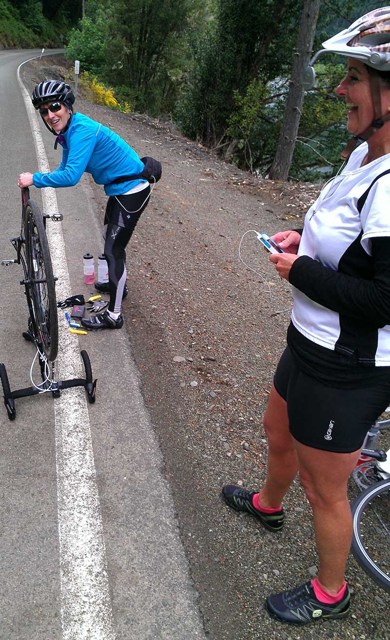
