 |
|
Natchez Trace Parkway
Spring - 2011
|

|
|
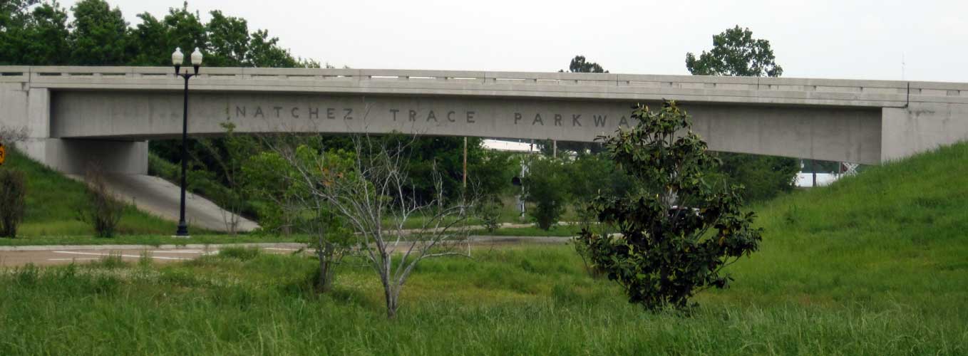
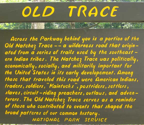
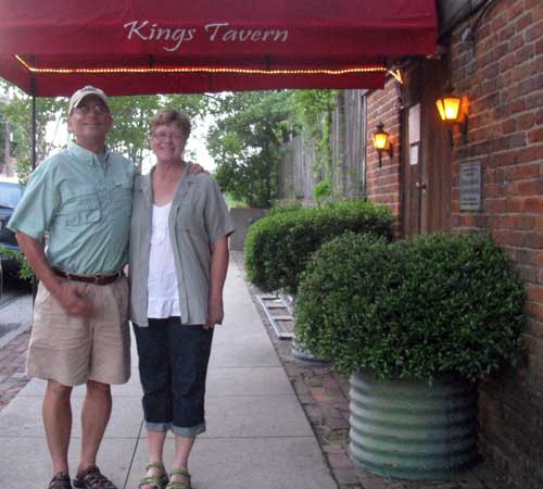
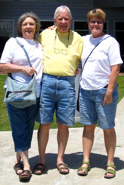
| Wednesday, April 20, 2011: We been visiting Natchez for a week but now it's time to start north on the Natchez Trace Parkway. The Parkway is a National Park which is 444 miles long stretching from Natchez, Mississippi to Nashville, Tennessee. This historic trail was first used by the native indians, then by the Spanish, French and British. Finally, the Trace became most popular by "Kaintucks" returning home after delivering produce to Natchez by flatboat. The Kaintucks would sell their flatboats for lumber then walk home (or ride a horse) using the Trace as the route. Often, these treks would begin at the Kings Tavern in Natchez. Kings Tavern is one of the oldest buildings in Natchez. Returning boatmen would form groups to discourage robbery or worse on the trip back to Nashville. Gwen and I visited the Tavern so we could say we began our trip on the Trace from the very beginning. (Be sure to click the photos for another view.) Be sure to check Gwen's report too. |
 |
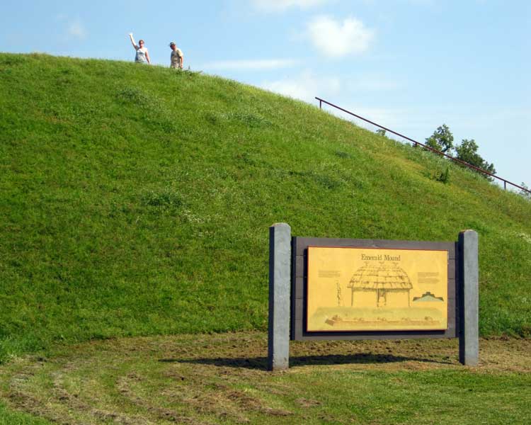
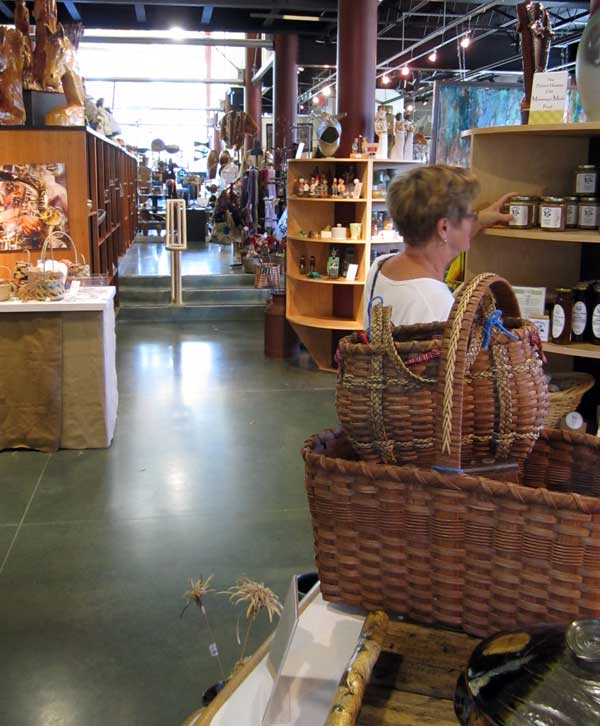
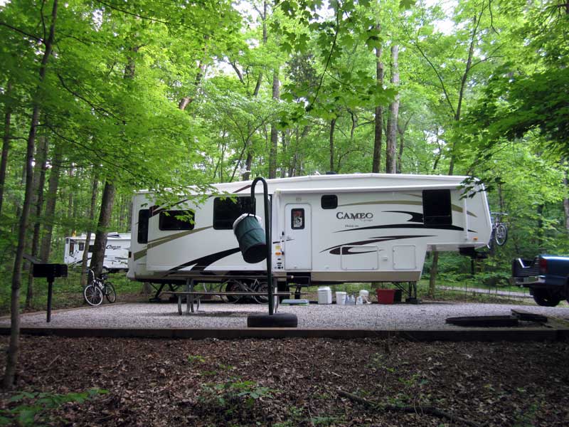
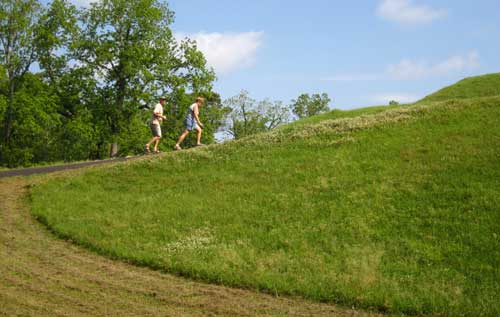
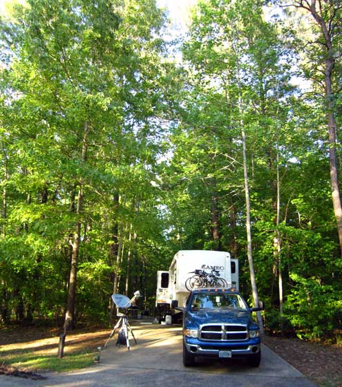
| Today's adventure began with a visit to the Emerald Mound, the historic location I visited a few days ago on my bicycle. This was Gwen, Ralph and Janet's first visit to the mound and we visited while towing our rigs because today was our first day on the Trace. The Emerald Mound was built as ceremonial ground for the Mississippians, in this area before the Natchez Indians. This is likely to be a slow trip. The maximum speed limit on the Trace is 50 MPH with turn-outs, picnic tables, nature trails, plus historic locations to see all along the Trace. Our first day will take us only about 40 miles, just past Port Gibson, Mississippi. |
 |
|
 |
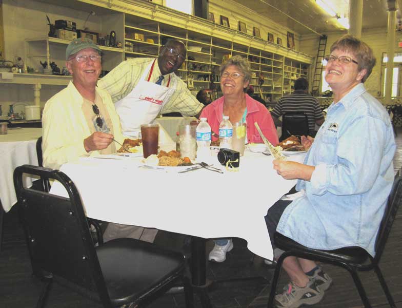
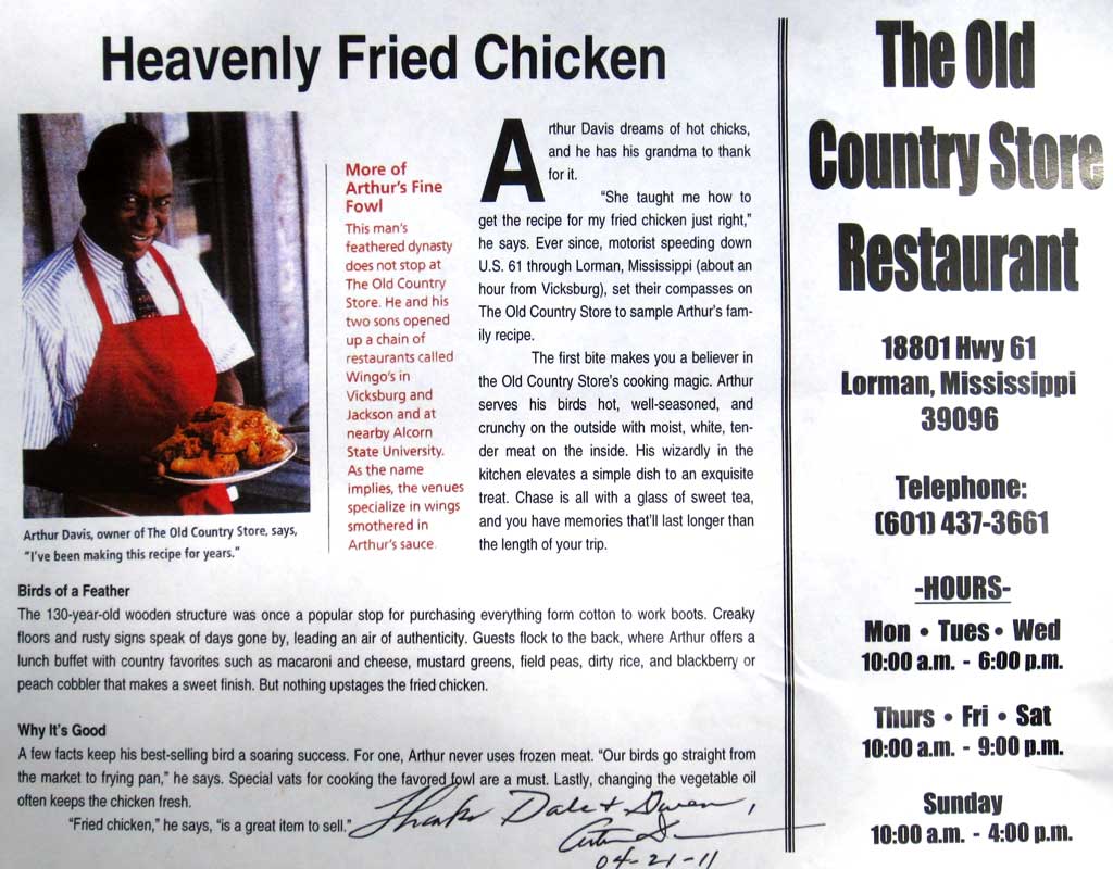
Thursday, April 21, 2011: We are parked at the Grand Gulf Military Monument Park near Port Gibson, Mississippi. The gnats are bad and we had a thunderstorm this morning but what a great lunch we enjoyed at the Old Country Store Restaurant. It was recommended by a fellow RVer staying at the park. It is an unusual buffet with home cooked Mississippi style food. Arthur Davis, the owner, is what makes |
|
|
| it so good. We later learned that Alton Brown (from food network) has visited his restaurant and probably helped to make it famous. Arthur brags that his fried chicken is the best. It was pretty good but the real reason to be here is to meet Arthur. He was friendly fun to talk with and obviously selling his restaurant and "picking our tourist pockets" so to speak (charged us $1.89 for our bottled water) but we didn't mind because we enjoyed being with Arthur. Arthur signed an advertising sheet to us. You can see it by clicking the photos above. You can also see a short video of him singing for his customers. |
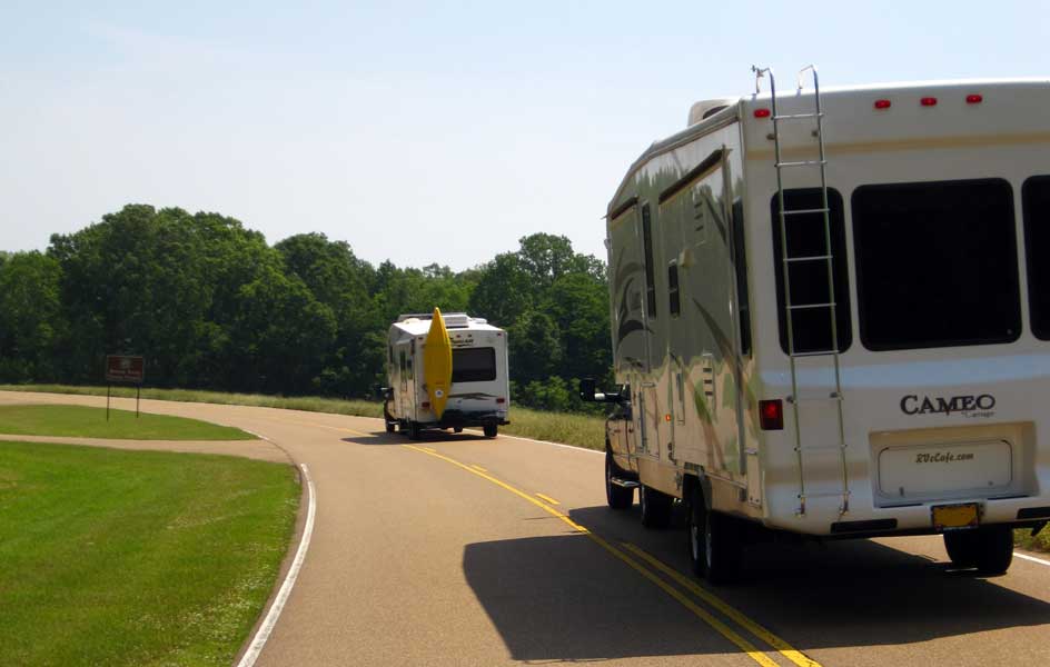
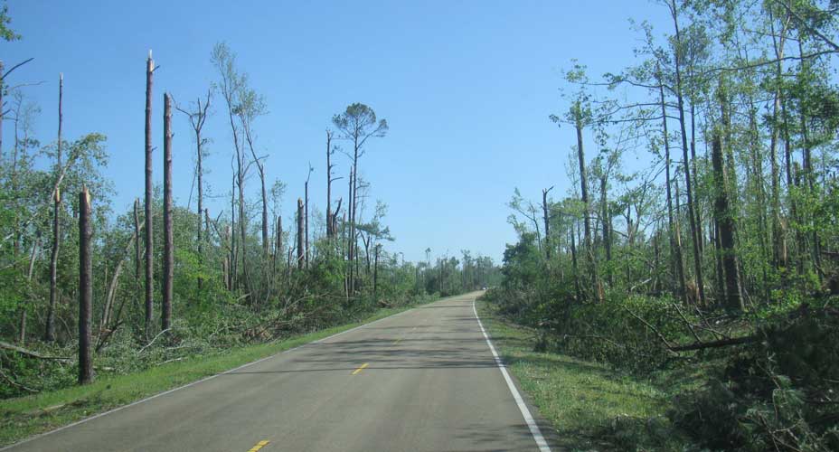
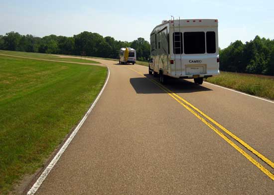
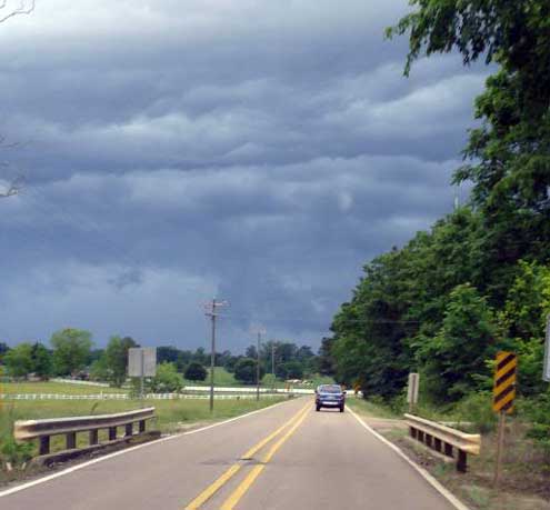
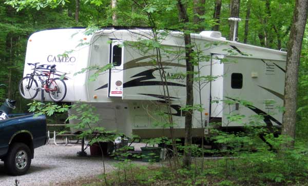
Friday, April 22, 2011: We are on the move again up the Natchez Tract to Jackson, Mississippi. So far all the Trace looks just like the photo, two lane road, no shoulders, good asphalt, mowed green grass on both sides, gentle rolling hills. Ralph and Janet are usually in the lead but we stay in communication with each other using CB radios.
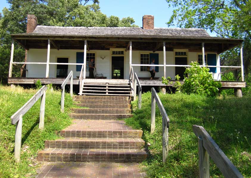
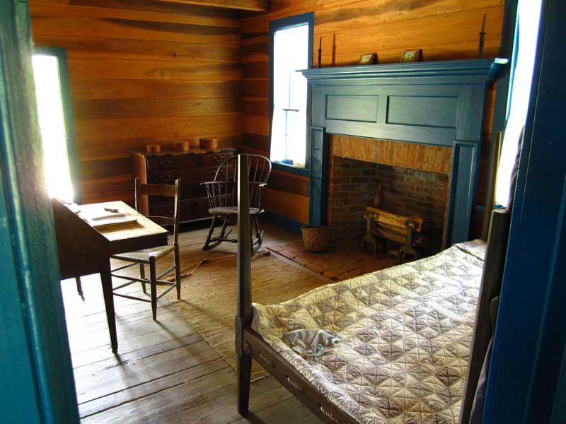
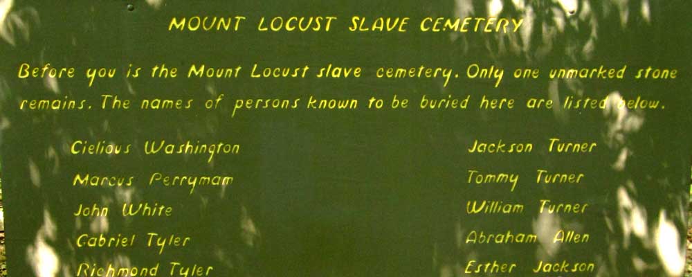
We stopped at the only "stand" of the original 50 stands still viewable. A "stand" is an Inn or at least some sort of accommodation (dirt floor) to stay the night while travelers were returning to Nashville. Mt. Locust was one day walking time from Natchez. A park ranger was at Mt. Locust to answer questions. The photos show the dining room and the owner's portion of the inn. Travelers would stay in a separate building behind the inn. Gwen and I were able to walk the original Trace just as a traveler would have walked to the Inn. Be sure to click the photos for additional views. |
 |
|
|
|
 |
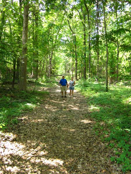
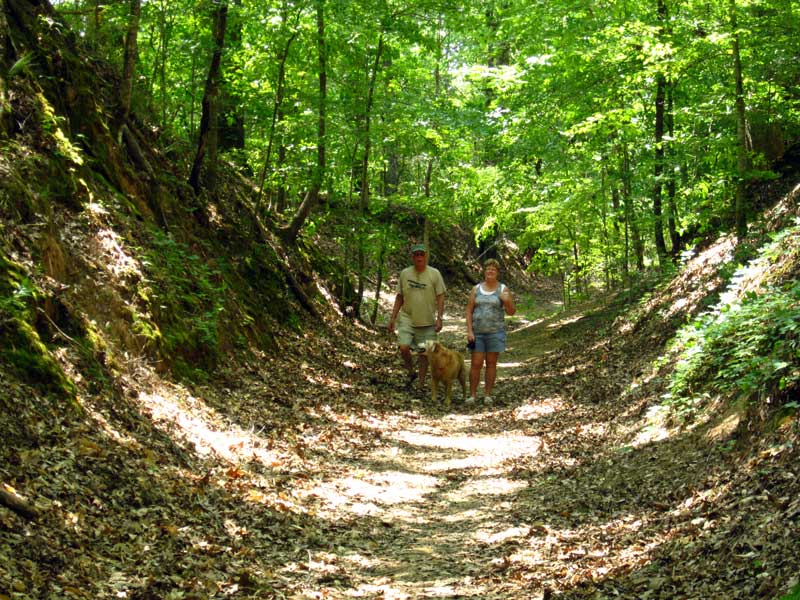
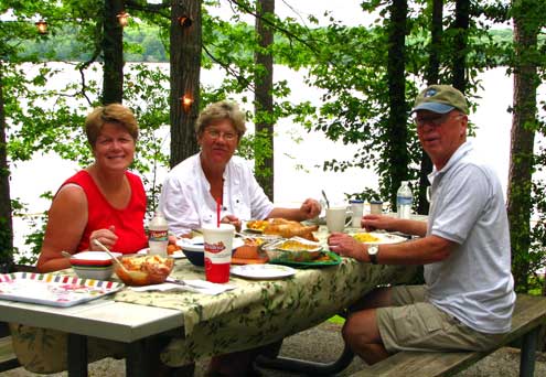
Saturday, April 23, 2011: We are enjoying lunch at the "Sunken Trace" picnic area. This is a roadside pull out in a area of the Natchez Trace where the soil has been traveled so much the level of the soil sunk as much as 20 - 30 feet below the surrounding area. This is one of the few areas of the "Old Trace" which is very visible and photographed more than the rest of the Trace. Click the picnic photo to see Ralph, Gwen and Morgan walking the historic trail. For our picnic, Ralph got out his barbeque so we could have hot dogs with all the condiments for lunch. Much cheaper than the usual $20 we must spend when we try a restaurant. |
|
| Meanwhile, here we are camped at LeFleurs Bluff State Park in Jackson, Mississippi. This is an interesting park because it is so close to downtown Jackson but a rough park with no pavement and I'm sure muddy during a rainstorm. We are camped in space #1 next to Mayes Lake and next to the Pearl River which is subject to flooding. In fact, the restrooms and laundry are located in a building about 20 feet off the ground on "stilts". Fortunately, no rain is expected while we are camped here. It was only ONE week ago that several tornados did a great deal of damage in this area. Since tornados never hit the same place twice, I'm sure we are safe (I just made that up). Setting up the satellite dish was tough due to the thick tree coverage. I had to put the dish nearly into the lake. If the water level rises, it WILL be in the lake. |
 |
|
 |
Sunday, April 24, 2011 (Easter):
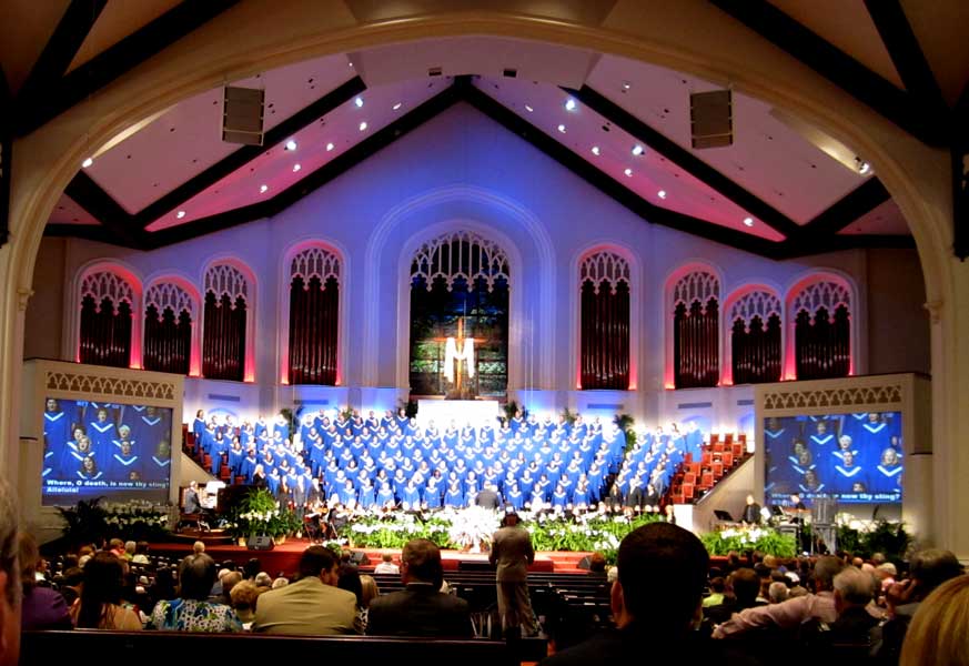
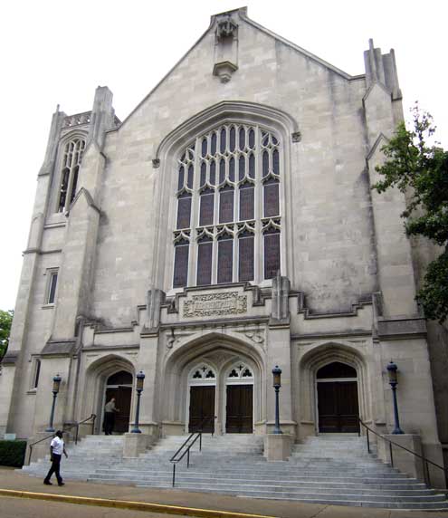
If God had a beginning, it must be here. At least that’s what it feels like and the reason I chose to visit the First Baptist Church of Jackson this morning. Since arriving in Texas, Louisiana and Mississippi, we seem to see a Baptist church every other mile. The First Baptist of Jackson is directly across from the state Capitol building (click the photo to see the Capitol) and seems to stretch as large as the Capitol. I arrived early so I could choose a seat toward the center. The sanctuary looked like it would seat 1,000 and eventually filled at the early morning service. The first thing I noticed was the full orchestra in front of the podium. Each instrument was practicing a different part so the sanctuary was filled with random melody. Next I noticed the TV crew of 5, three stationary cameras, then one portable camera with a additional crew person to keep the cord from tangling. The choir loft looked to seat 200 with about a hundred organ pipes behind the choir. I was looking forward to the music. The service began on time (9 am) but the sanctuary was only half full. I didn’t notice people coming in during the music prelude but within about 10 minutes, the sanctuary was full. If this is where God began, he must love music |
|
| because the orchestra and choir did a fabulous job of filling the four story sanctuary with a wonderful performance. It’s nice to see how technology is balanced with tradition. I saw wireless microphones, electronic music, video projection, a super sound system and power point presentations. We still had to manually register our attendance but all the song lyrics were projected on screens, no need for the hymnal. The congregation included a healthy mix of all ages. Finally, all visitors were invited to a side room for more information. I had to wonder what God’s message would be on Easter Sunday, 2011. The message from Jackson FBC was "life does not end with death". Click here for a short video with a sample of the musical experience. |
 |
|
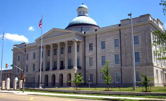 |
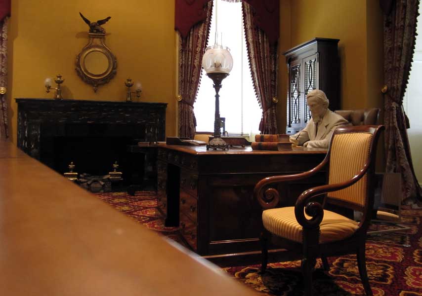
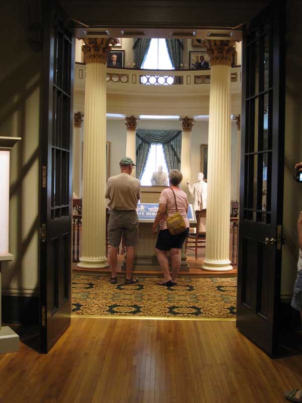
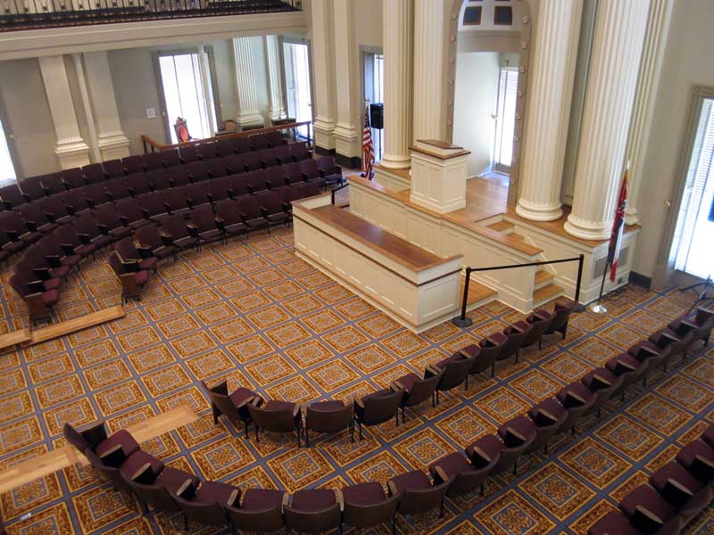
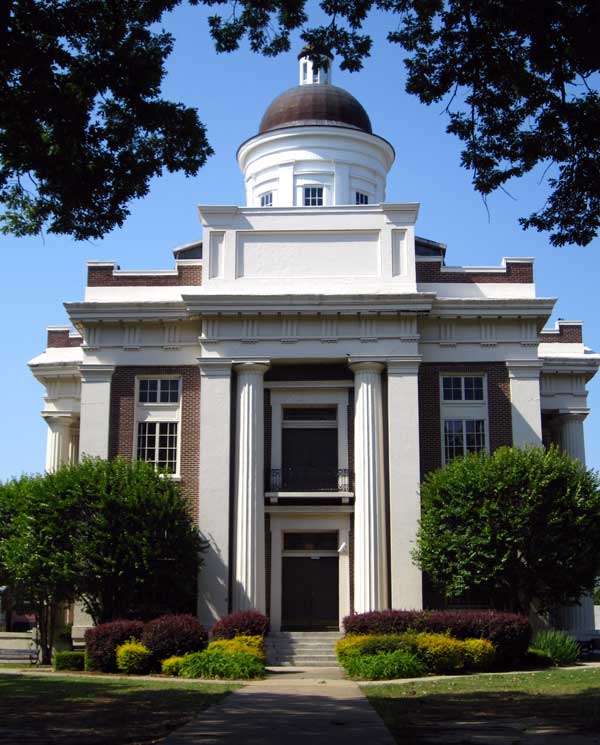
Monday, April 25, 2011: The Old Capitol Building is now the Mississippi Museum. (The "new" Capitol building was built in 1903.) The Old Capitol Building was damaged in hurricane Katrina and just reopened a couple of years ago. The remodel was done well. This looks like gray stone but it's really stucco over red brick. Bobby from the tourism department made a special effort to get us brochures and maps when everything was closed and told us about the museum. The state building where we waited for Bobby to meet us out front is pictured behind the museum (just click to see). This is the building where the secession convention was held. Mississippi was the second state to seceed from the USA. Click any photo for another view. |
|
|
|
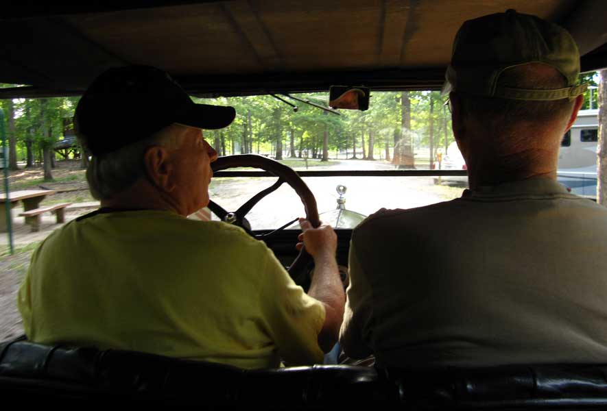
Tuesday, April 26, 2011: This was a special day with Ronnie and Anne. Anne is one of Gwen's friends on her online crafts group. They have lived in Jackson for many years so what a treat it was when they took us for a tour of their favorite places. After an enjoyable lunch at Cherokee Inn (a local favorite) we drove directly to the Mississippi Craft Guild showroom and gift shop. We admired the many craft items made by Mississippi artists (note the bottle tree). Then, on to Canton, Mississippi just north of Jackson and a town with a central square surrounded by many small shops. We walked the square and visited the shop where Anne goes to "hook" rugs. What a wonderful, artistic craft rug hooking is. Both Gwen and I found a few special items we are going to use for gifts while shopping today. Ronnie has owned a 1926 Model T Ford since 1979 so at the end of the day we returned to Ronnie and Anne's home where we switched vehicles and drove back to camp in the Model T. What fun that was. Be sure to click the photos for additional views. Finally, we are currently under a tornado watch in Jackson, MS. It's only been two weeks since tornados came through Jackson destroying homes. Last night a wind storm brought down several large trees in our camp, the nearest was about 200 yards from us. Additionally, I just learned from the local TV news, that the Mississippi River is at it's highest level in 74 years. The Mississippi River won't bother us in Jackson but the rivers which empty into the Mississippi are backing up because the Mississippi is so high so rivers like the Pearl River which is a couple of miles from us may top their banks. We plan to leave on Thursday to drive north (where the tornado risk is even worse). |
 |
|
|
|
 |
Wednesday, April 27, 2011: If you live in the west, we periodically get that strange annoying whine on radio and TV stations and the announcers says, "This has been a test of the emergency broadcast system, had this been an actual emergency it would have been followed by instructions." We've never heard anything but the "practice" tones which interrupt regular programming for about a minute. Today, listening to our radio in Jackson, Mississippi, we heard the tone multiple times followed by tornado watches and tornado warnings. A tornado warning was defined by the announcer as "a tornado is ON THE GROUND and if your county is one of those listed you are to proceed immediately to your storm shelter. If you don't have a storm shelter, go to the lowest part of the center of your home in a narrow room such as a closet and stay there. If you are in a vehicle, abandon the vehicle, go to a culvert or ditch, lay flat, face down with your hands over your head." When we arrived at our campsite, and exited our truck, we heard the warning sirens coming from |
| every direction. Afraid of the trees crashing around us we left the campground in search of a brick building to wait out the storm. We drove west away from the storm cell ending up at a MacDonald's about 10 miles to the west. By that time, the sun was out and the threat had moved on to the east. Later we watched the TV coverage as the station tracked two tornados to the east of us announcing which towns they were headed. We dodged the tornado bullet. We are headed further north tomorrow and the weather forecast is improving for the time being. |
|
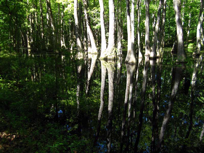
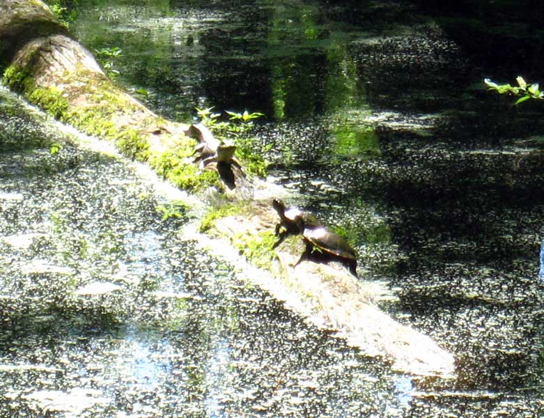
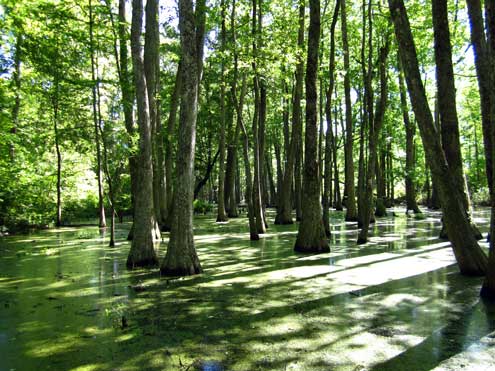
| Thursday, April 28, 2011: We are on our way north on the Natchez Trace today ... leaving Jackson, Mississippi. First stop was the Cypress Swamp because the park ranger told us we would find alligators there. What beauty in the swamp. We've actually been seeing these swamps since entering Louisiana but this is the first one we could walk through. We really did see an alligator but it was only about 2 feet long, still it was fun to see one in the wild. Turtles are also fun to see ... neither exist in Oregon. We didn't get very far, maybe 60 miles when we stopped at the Jeff Busby Park, a free place to camp along the Trace. It's free but no hookups ... the weather is cooler so we don't need air conditioning. We have a spot but it's difficult for both solar and satellite so we will be spending only one night and headed to Tupelo tomorrow. Be sure to click the photos for other views. |
 |
|
|
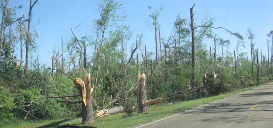 |
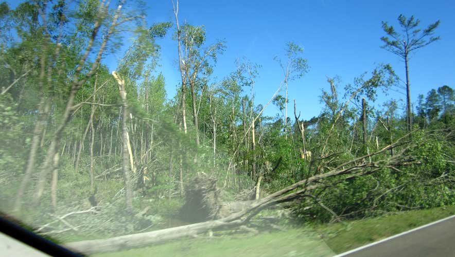
Friday, April 29, 2011: What does this look like to you? It looks like a huge lawn mower about 1/2 mile wide mowed a path of trees at about 30 feet off the ground. It looks this way for about ten miles down the Trace with an occasional path leading away from the trace. We figure this is what it looks like after a tornado has passed this area two days earlier. Imagine what this road must have looked like two days ago before the road crew cleared it. We've been seeing trees uprooted all along the trace but these were snapped off. |
|
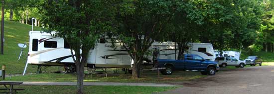
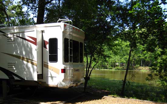
| This is our new camping location at the Corp of Engineers Whitten Park. It's a wonderful, lake front park with power and water at each site for only $9 per night with the Senior Access Pass. The sites are on concrete with a nice aluminum picnic table. We hope to stay here for a while. We've been seeing photos of what tornados did in Alabama and in Smithville, Mississippi, only a few miles from our current location. Now I can imagine what our current campsite would look like if a huge lawnmower cuts all these trees at 30 feet. We are watching the weather, tomorrow is clear but Sunday, strong thunderstorms are predicted. After that, it should be clear for a week or more. What would YOU do? Click the photos to more views. |
 |
|
 |
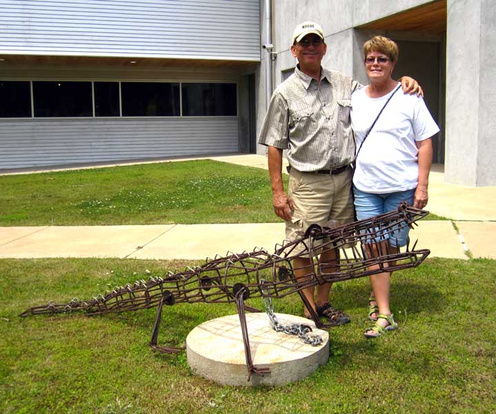
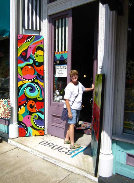
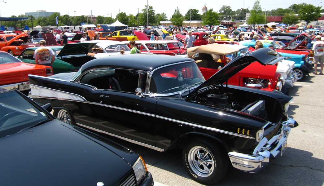
Saturday, April 30, 2011: Ralph and I visited the "Blue Suede Cruise" in Tupelo today while the girls stayed home to relax. Ralph is much more of a vintage car enthusiast than I am so I learned much from Ralph as we walked around looking at the cars. I took photos of some of my favorites. You have to click the photos to see the 1960 VW bug with the surfer roof rack, and my all-time favorite (other than the 1958 Corvette), the Cobra. After our day in Tupelo, I went for a short bike ride into Fulton, Mississippi and discovered the campus of the Itawamba Community College. It a beautiful college campus with dorms so students must come for a distance to attend here. I also rode to the Fulton Lock on the Tennessee River. We had a picnic dinner with Ralph and Janet at their picnic table site overlooking the Tennessee River. |
|
|
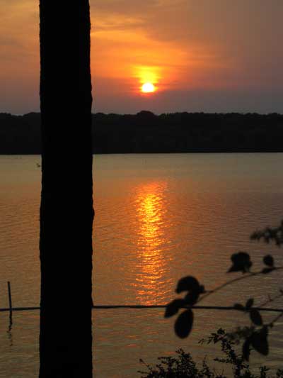
| Sunday, May 1, 2011: We were expecting a thunderstorm today and in Mississippi (at least this year) that means threats of hail the size of golf balls and/or tornados. As it turns out, we only experienced overcast skies. We didn't even get rain. I spent the day making gifts then ended the day with this scene of the sunset over the Tennessee-Tombigbee Waterway just 30 feet from Janet and Ralph's campsite. Storms are predicted for tomorrow and Tuesday but I'm not seeing threatening clouds at this time. |
 |
|
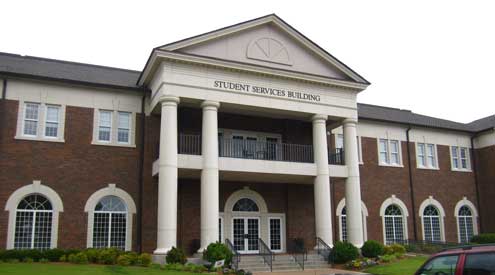 |
Monday, May 2, 2011: I like to visit college and university campuses as we travel. This is the Itawamba Community College Student Services Building. What a beautiful campus in Fulton, Mississippi. I LOVE the name, "Itawamba" so I was hoping for something with the Itawamba name that I could buy. I found a great hat and while looking around the bookstore I found a 75% OFF rack with hooded sweatshirts. Gwen loves hoodies so I found a really nice hooded sweatshirt for $33 but got it for only $8.25 with the discount. My shopping success did not stop there. Janet told me of discounts at the Goody department store. I found a Van Heusen long |
| sleeve fleece shirt (retail $45) on sale for $13.50. However, when I got to the cash register and asked for additional discounts (knowing additional discounts were listed in the newspaper), I got another 40% THEN another 30% off that price. The final sale was $6.07 for a $45 shirt. This was a fun day in Fulton. |
|
| Tuesday, May 3, 2011: It was raining today so I took the day to score assignments then went to lunch with Ralph to the Itawamba Community College cafeteria (just for the fun of it). I then spent much of the afternoon planning since we needed to know where we were going before the Mammoth Caves during Memorial Day. We decided to spend a week in Nashville then head to the Great Smoky Mountains National Park, "just because we are so close to it". Nashville is only 200 miles from the park. Here is how the planning went. |
 |
|
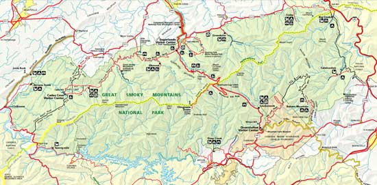
| I learned from the GSMNP Website that there was only one campground where the sites were long enough to accommodate our big RV fifth wheels, Smokemont. So both Ralph and I made reservations before looking at the actual location of Smokemont. As it turns out, Smokemont is on the southeast side of the park considerably farther than 200 miles and over a 5,000 pass if we drive through the park (click the map above for a larger view). Secondly, when looking at the reservation conformation, we will be in North Carolina, much further east than we had ever intended ... what a surprise. We soon found that Interstate 40 will take us around the park to the southeast side and will likely be much easier driving that trying to tow our trailers over the narrow park road with the 5,000 foot pass. Next I noticed we would get to drive on the "Blue Ridge Parkway", which is much like the Natchez Trace (managed by the National Park Service), to the GSMNP entrance and only a few miles from our Smokemont campsite. Except! I checked the Blue Ridge Parkway National Park Service map and learned there are three tunnels with a clearance of only 11 feet or less on that section of the parkway. Neither of our fifth wheels will fit that low clearance. So much for that short cut. So, ready or not, we will be spending 5 days in North Carolina, mostly at the GSMNP. |
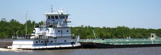 |
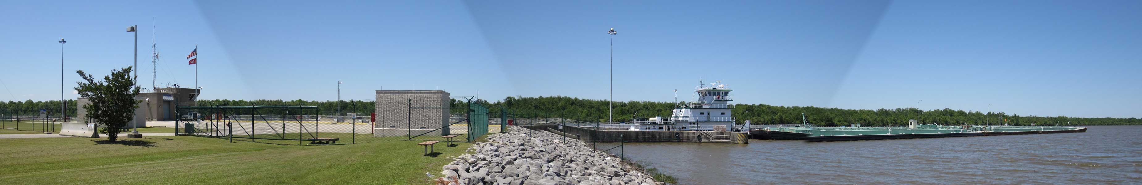
Wednesday, May 4, 2011: We drove to Tupelo today but we got only 3 miles when we noticed a tug in the Fulton Lock. It is one of ten locks between the Gulf of Mexico and Nashville. We arrived in time to see the tug and barges in the lock but the horn blew just as we arrived, the gates opened and the tug and load were on the way up river. You can click the photo to get a wider view. |
|
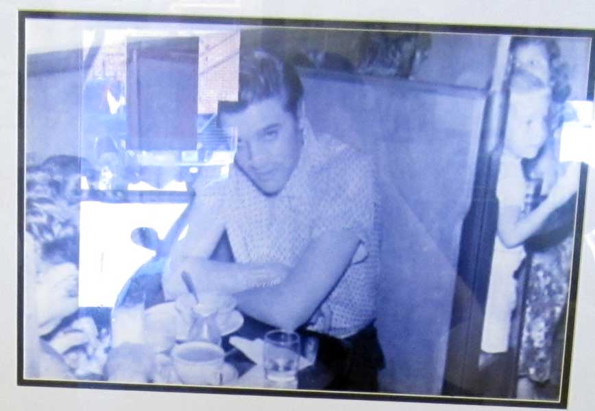
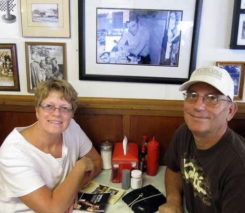
| Gwen chose to have lunch at Johnnie's Drive-in because it was an Elvis location in Tupelo. Note the photo in our booth. It's a photo of Elvis in our booth in 1956. He had returned to his home town for a concert. I had barbeque (pulled pork) while Gwen had a hot dog (split on a hamburger bun). Everyone in the dining room including all the other customers knew we were from Oregon because we have "accents". The owner and waitress did a lot of visiting with us and one of the customers came over to welcome us to Mississippi. We told her we had never been to Mississippi. She said it was a beautiful state and we agreed. She went on to say she had never been to Oregon but heard it was a beautiful state ... we agreed with that too. The owner says he wants to go to Oregon sometime. We told him to visit Johnnie's Drive-in in Grants Pass. It has the same 50's decor. When you click the photo, you'll see a larger view of the Elvis photo although it has a reflection from the glass. We then visited the Tupelo Hardware Store where Elvis bought his first |
 |
| guitar. The story goes like this, Elvis and his Mother came to the hardware store where Elvis wanted to buy a 22 rifle. His Mother wanted him to have a guitar. The hardware clerk let Elvis play with the guitar for quite a while but Elvis decided he did not have enough money to buy the guitar. At this point, Elvis' Mother told Elvis, if he would choose the guitar over the gun, she would pay the difference. That decision created the King of Rock and Roll. Check Gwen's report of the day. I ended the day by riding my bike back to camp. It turned out to be about 12 miles further than I had expected, a total of 30 miles which was a perfect length for me. |
|
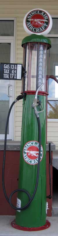 |
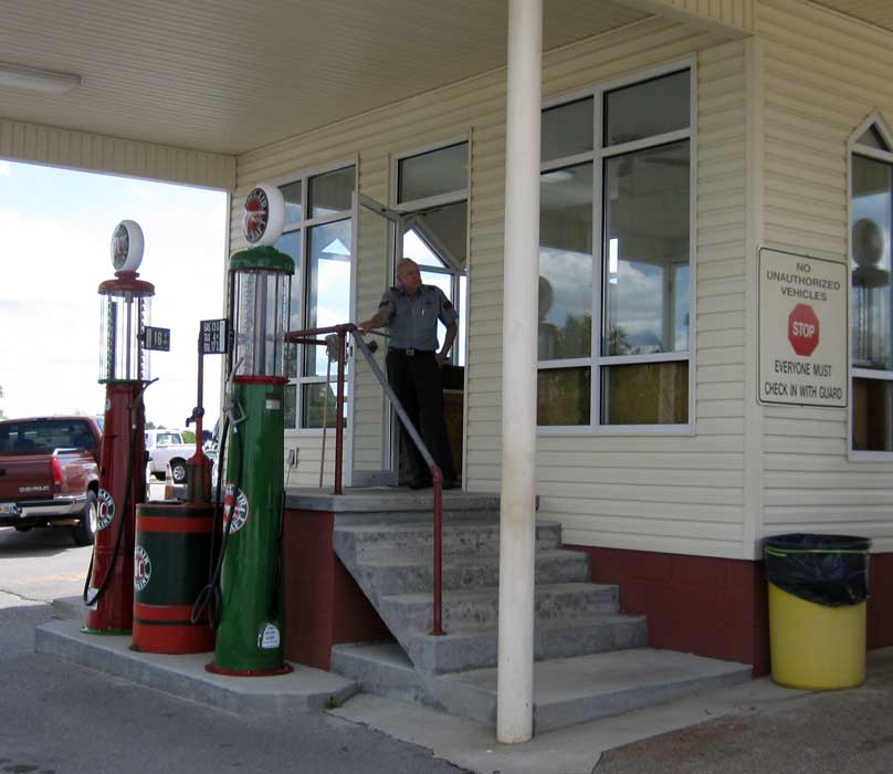
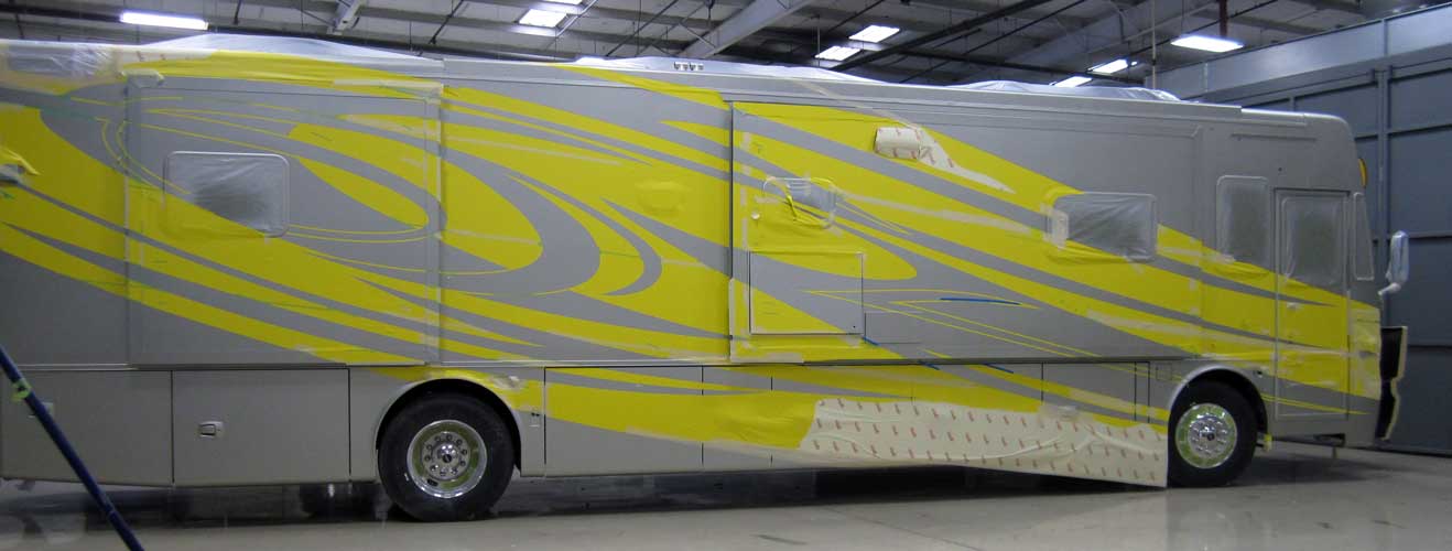
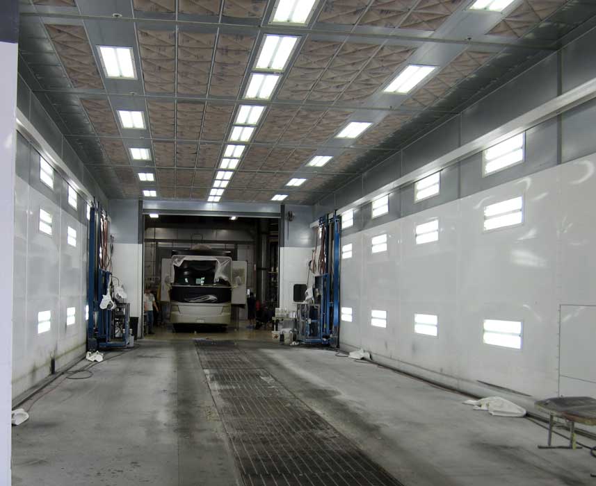
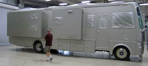
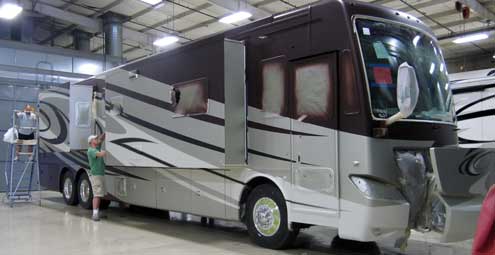
Friday, May 6, 2011: After a morning 29 mile ride north on the Natchez Trace, Ralph and I visited the Tiffen Motor Company in Belmont, Mississippi only a few miles from our campsite. The diesel pump at the left is in front of the guard building to the entrance. I joked with the guard asking that he "fill us up with the 17 cent fuel". He turned to his companion and remarked, "I told you!" I continued, "You hear that 20 times each day don't you?" Ralph and I thought we would see the Allego and Phaeton manufacturing plant. We were given protective eye glasses and hearing protection then told to take ourselves into the door marked with the company name. We walked into the building then the office expecting a guided tour but were told just to take ourselves for a selfguided tour. So we walked toward the end of the building where we thought the manufacturing took place only to see more paint booths. I finally approached a young woman who was removing paint tape from one of the motor homes and asked if this facility only finished the coaches. She replied, "Yes". "Where are they manufactured?" I asked. "I don't know", she continued, "this is my first day on the job." Ralph and I continued exploring finding where the "raw" motor home entered the facility then following it one step at a time to the "final finish" bay. Be sure to click the photos to see additional views.
 |
|
 |
 |
 |
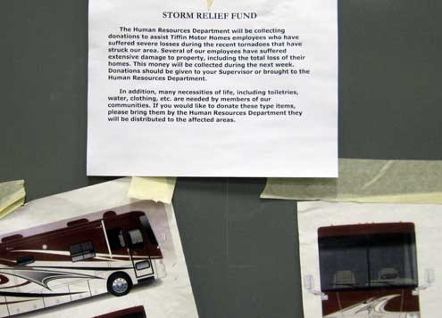
This area of Mississippi and much of Alabama (where these motor homes are manufactured) have been hard hit by tornadoes. I saw the above note tacked to one of the walls inside this facility. |
|
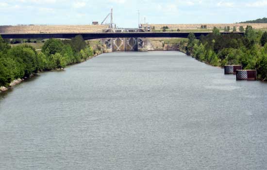
| Saturday, May 17, 2011: Today is our last day in Northern Mississippi. I spent the day preparing for our move tomorrow, checking tire pressure, putting the barbeque, propane tank, chairs, picnic table cloth and hose away. I also spent most of the afternoon cleaning and lubricating our three bicycles. Hopefully I've gotten the last of the negative effects of camping on the Gulf beach off the bicycles. The photo to the right is of a lock on the Tenn-Tom Waterway running 450 miles from the Tombigbee River in Alabama to the Tennessee River in Tennessee. This is a series of ten locks to improve water transportation for southern to mid-western states both for business and recreation. We have enjoyed camping next to the Fulton Lock. Tomorrow we drive north on the Trace toward Nashville. |
 |
|
 |
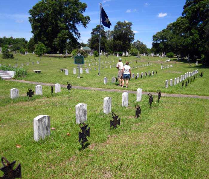
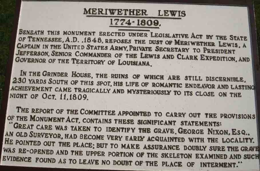
Sunday, May 8, 2011: We traveled in three states today on our way north on the Natchez Trace. We began in Fulton, Mississippi then crossed into northwest Alabama. We continued across the Tennessee River into Tennessee arriving at the Meriwether Lewis Park for a free night in the campground. This was only 120 miles of driving but we stopped several locations along the Trace to read the signs and see the views. The Meriwether Lewis Park is the location of his death. Lewis is famous for the Lewis and Clark expedition in 1804 - 1806 to explore the Louisiana Purchase and locate a water route to the Pacific. He died here under mysterious circumstance but according to "Undaunted Courage" (the book I read about the journey), he basically was driven crazy with depression and killed himself. His journal of the expedition was not published until much later. You can read the signs which accompany the two views below by clicking the photos. |
|
|
 |
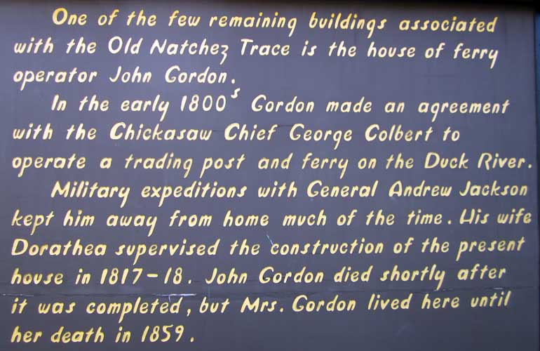
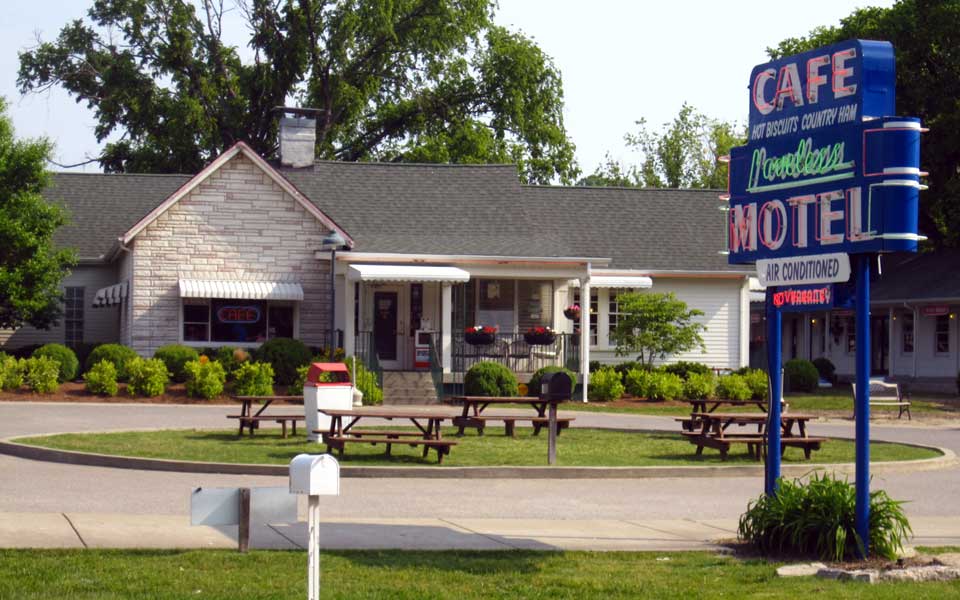
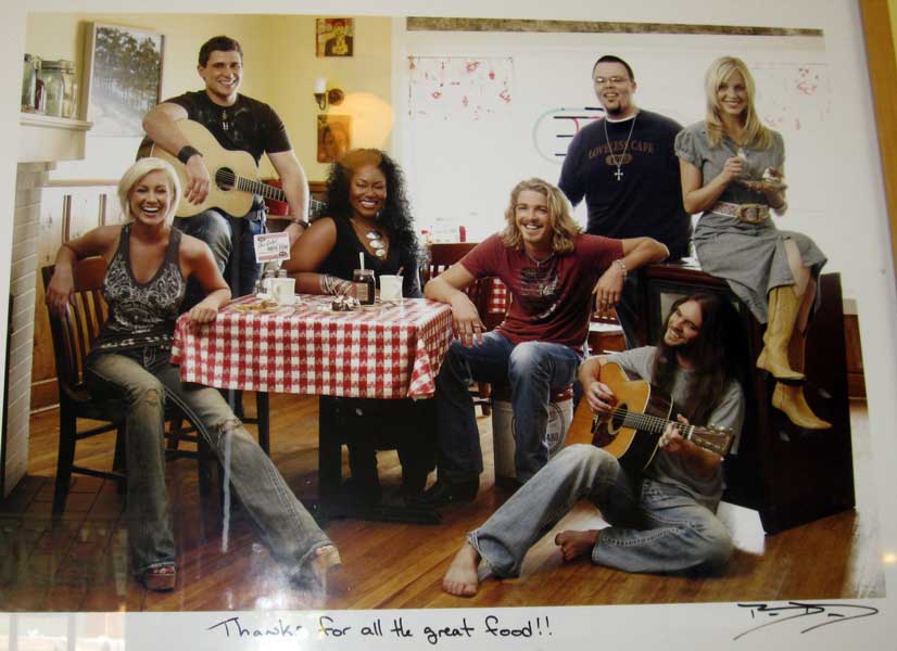
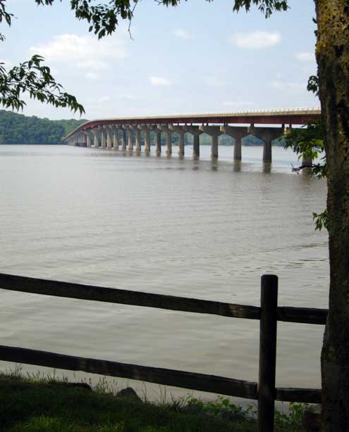
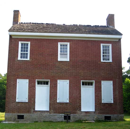
| Monday, May 9, 2011: Another moving day north on the Natchez Trace. This day will finish our travels on the Trace. The total distance is 444 miles on a two lane road without a single stop sign. The Gordon house on the right is the second of only two buildings dating back to the original Trace. This was a family house where the Gordon's operated a ferry only a few miles from Nashville. The double arch bridge below is another of the Trace landmarks. This bridge has won several awards, one for the architectural beauty of the bridge. Be sure click the photos for additional views. We finished the Trace by having breakfast at the Loveless Cafe, a tradition with Trace travelers. The guide books suggest this cafe has the best biscuits. They were good and we were served many of them with homemade jelly. We were set at a booth where the American Idol entertainment team was photographed while eating at the Loveless. Ralph noticed the photograph and had to take a photo. Click on his photo to see what he's taking a photo of. Our campsite for the next week will be at the Poole Knobs Army Corp of Engineers Campground in LaVergne, Tennessee. This is only about 15 miles from Nashville and a nice spot with power (for air conditioning). Unfortunately, the trees are so thick, I can't use my satellite dish to get either TV or Internet. |
 |
|
|
 |
| Return to the Mid-West Report |
|
|