 |
|
Winter Traveling, 2013-2014
Page 1
|
| Return to Timber Valley, 2013-2014 |
|
|
| |
|
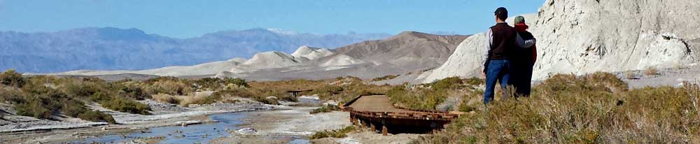
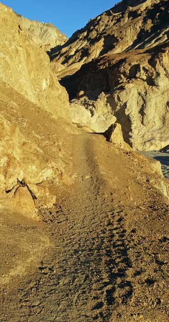
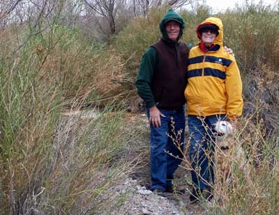
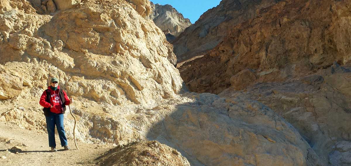
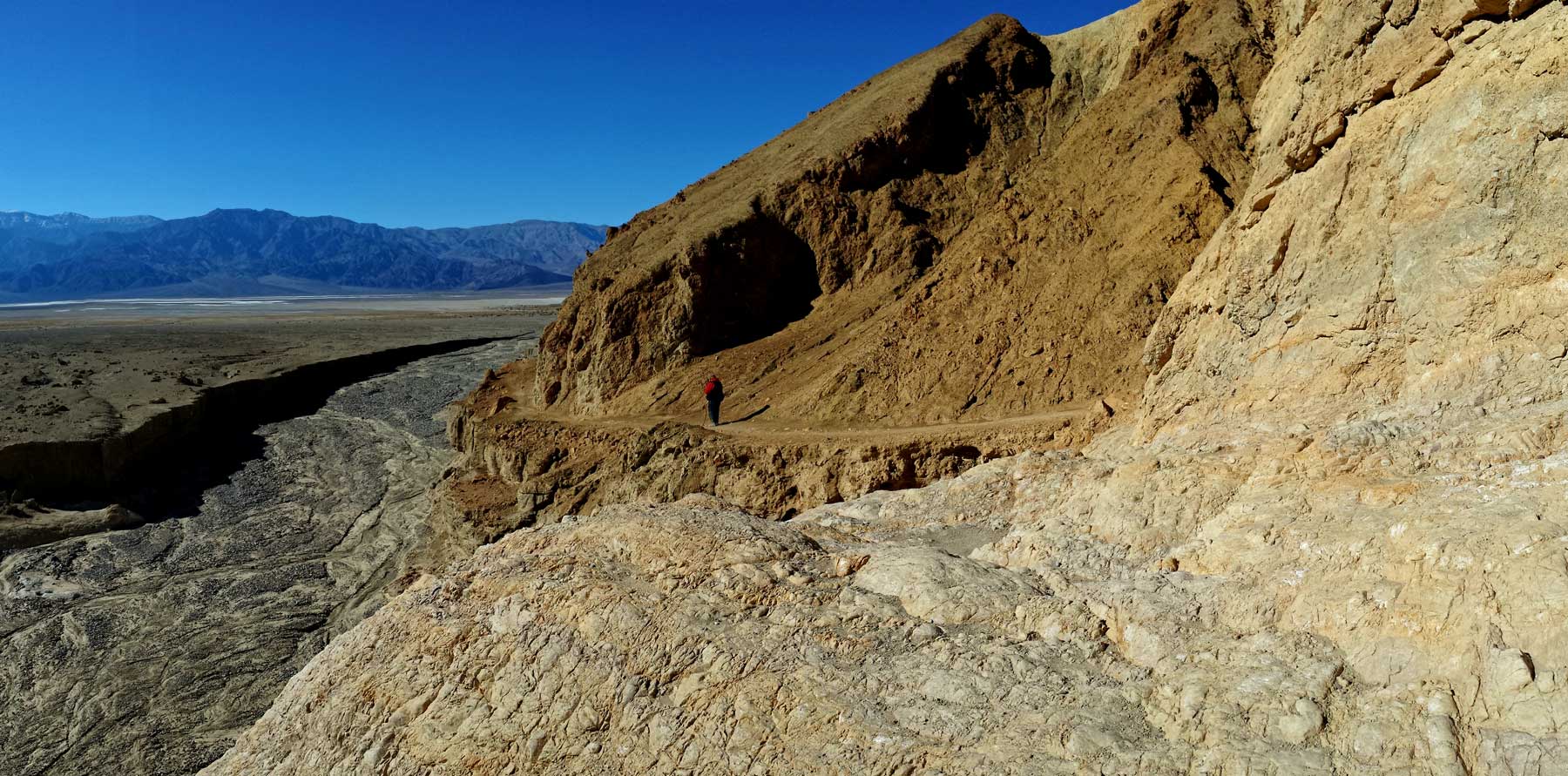
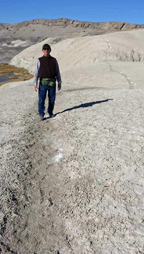
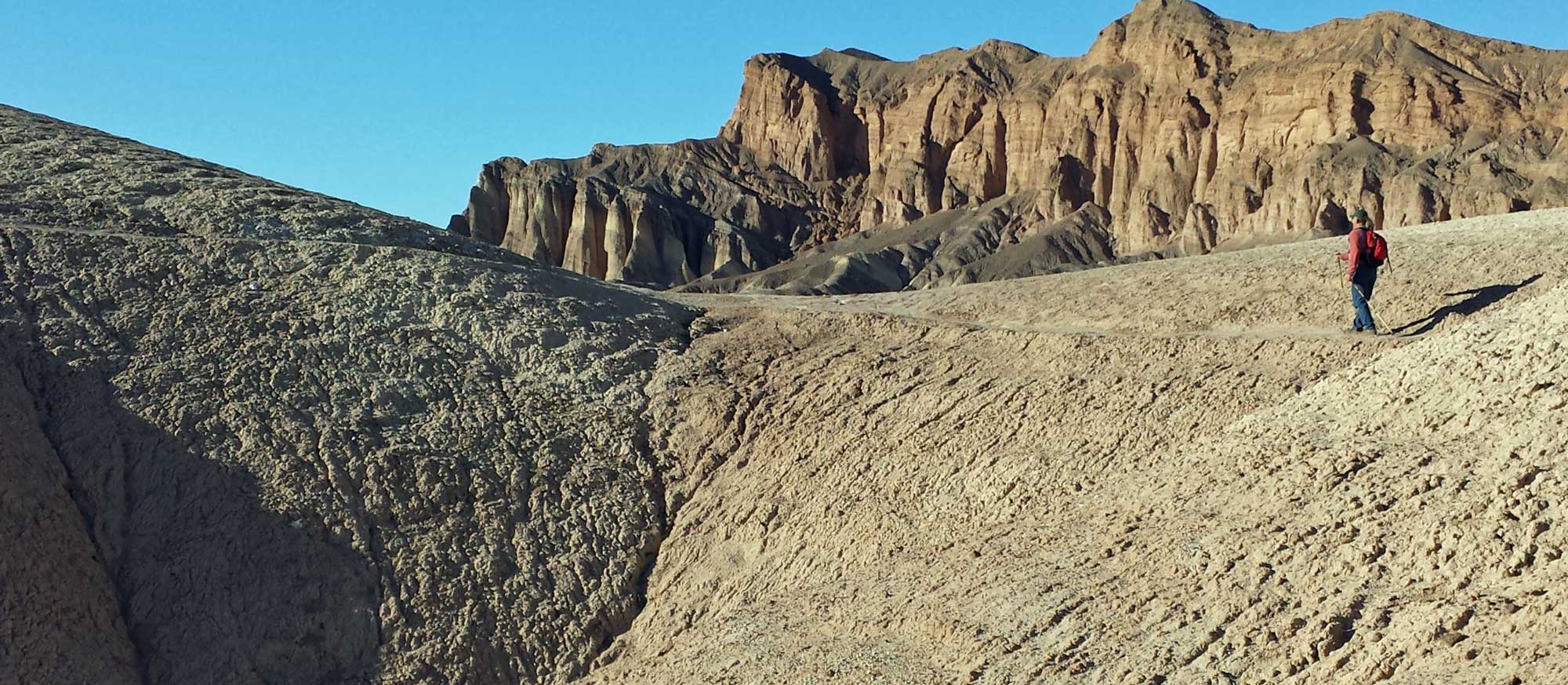
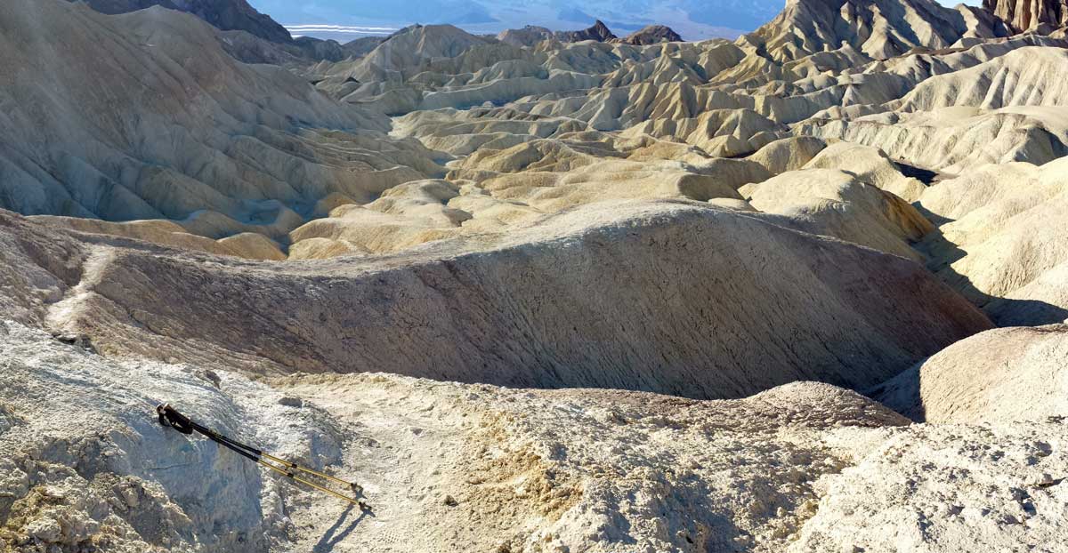
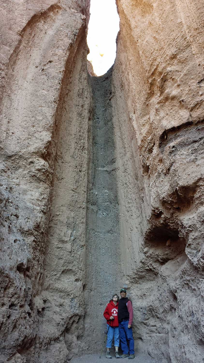
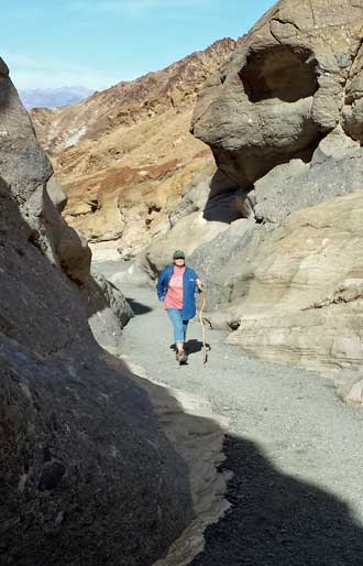
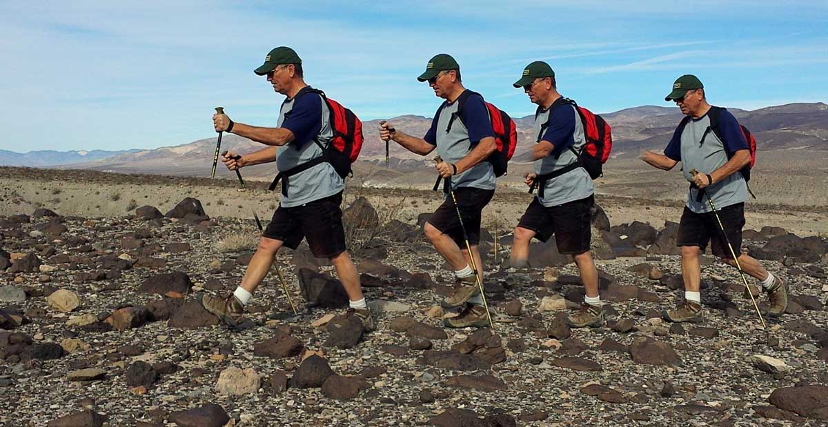
| Monday, December 9, 2013: Gwen wanted to experience what Eric and I called the best hike in Death Valley, Gower Gulch. The day is mid-50s but with a 15 - 20 mph wind, made it cold so that's why we are dressed so warmly. The hike begins with a scramble up some narrow passages after entering the Gower Gulch mouth along the edge of a 40 foot drop into the wash (click my photo on the left). There are hundreds of mines in Death Valley but this is the only one we found. It has a bat door allowing bats to enter and leave but keeping humans out. Behind that photo is one of Gwen and me hiking through another narrow passage in the Gulch. The photo on the right is one of my favorites (here is a larger view). You see my left foot at the bottom of the photo. I'm standing at the top of the dry fall at the mouth of the Gulch. Then the photo pans down the wash toward the open desert with the Panamint Mountains at the far side of the valley. This was a fun day of exploring and we were back in time for a lunch of veggie-dogs and veggie-chili. |
|
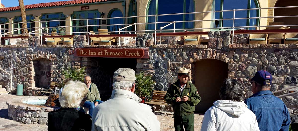
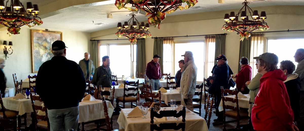
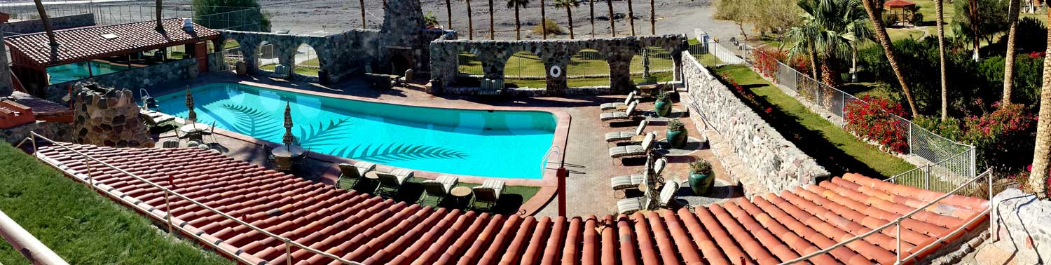
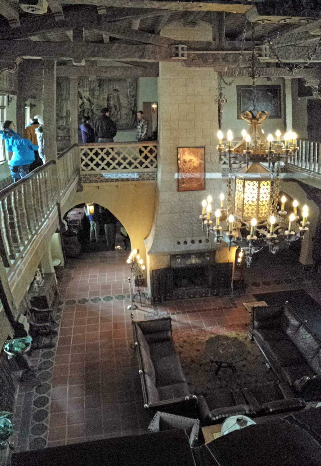
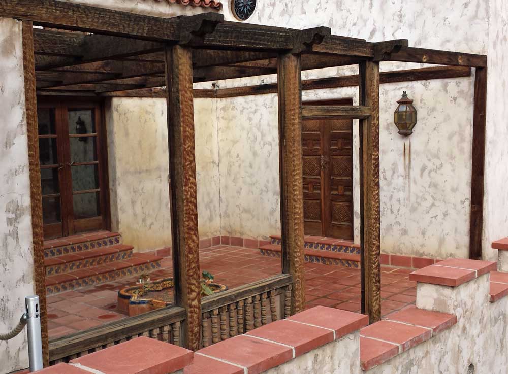
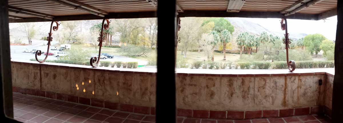
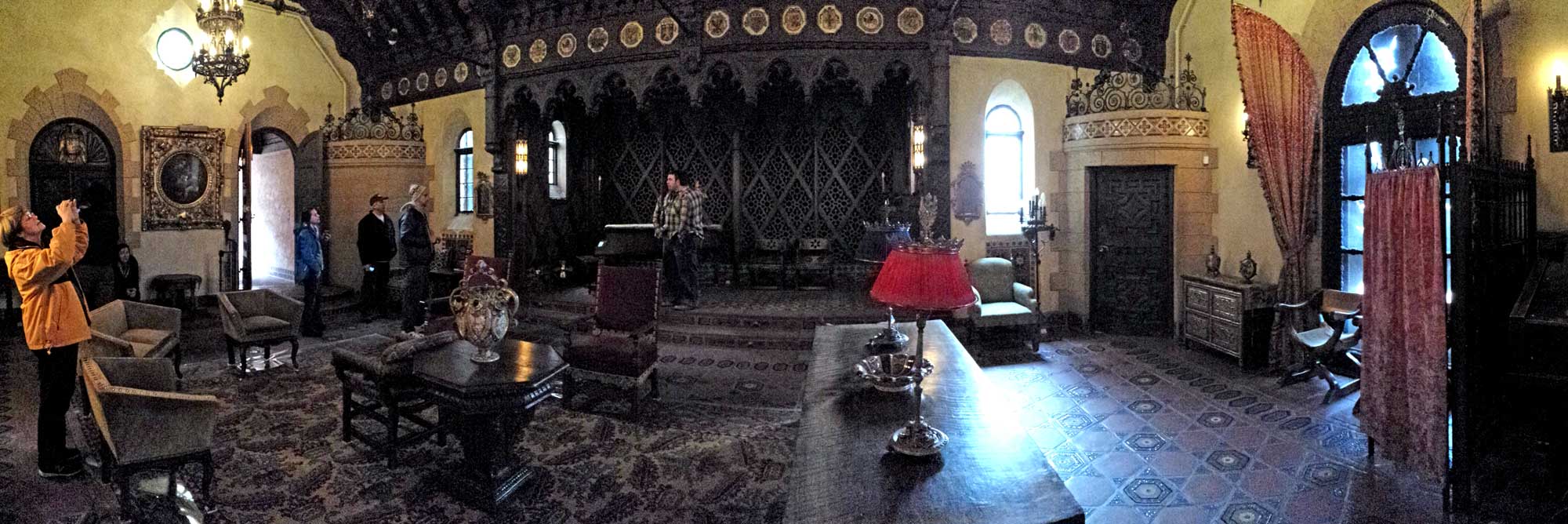
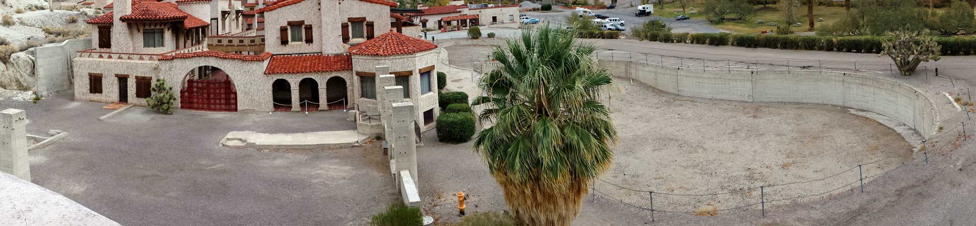
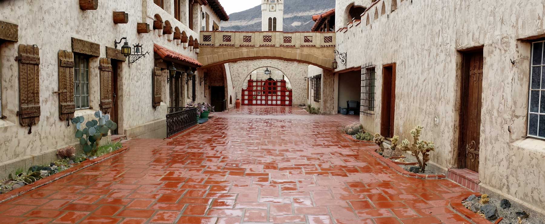
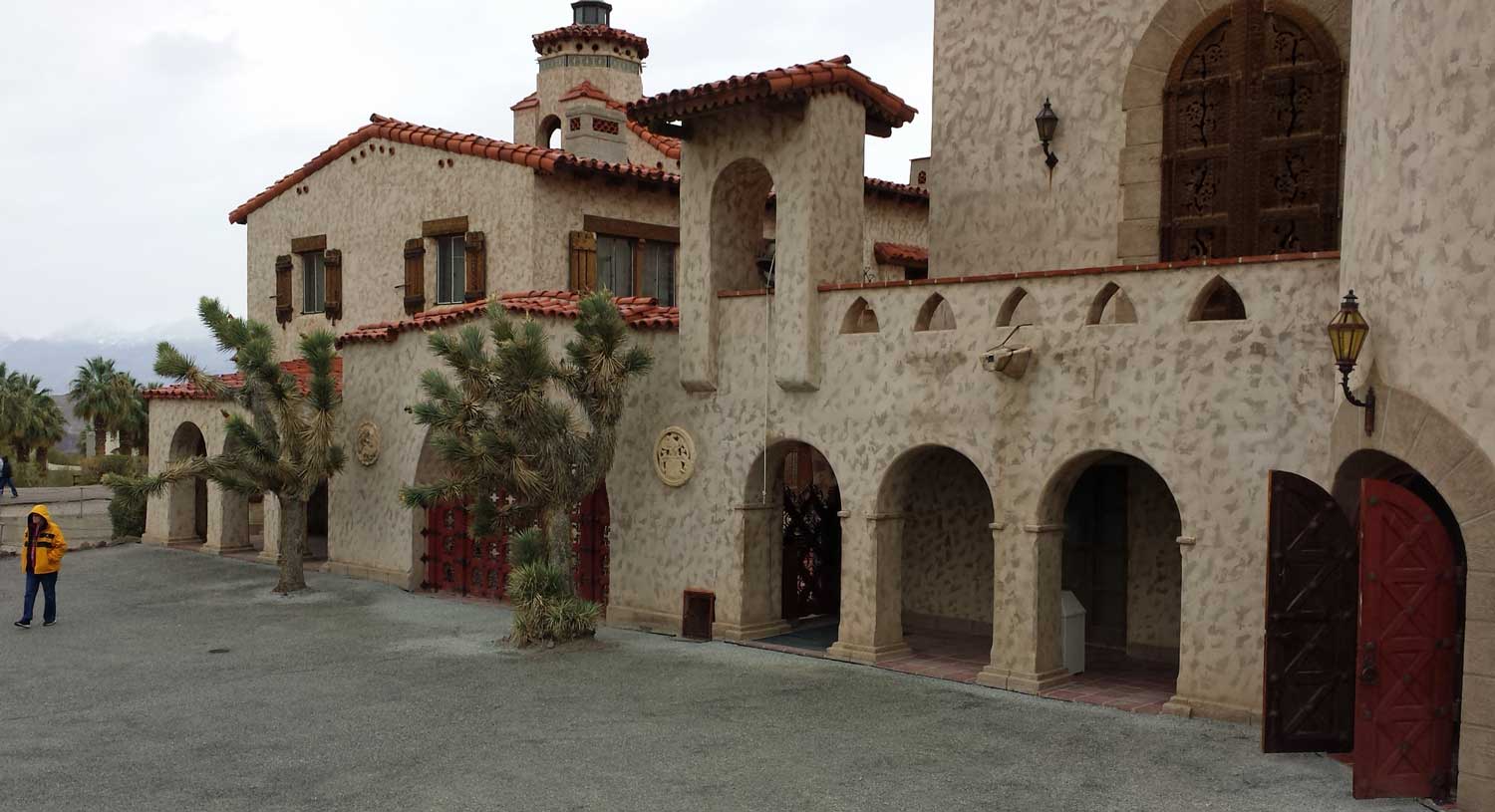
| Sunday, December 8, 2013: Ranger Allen took us on a tour of the Furnace Creek Inn, the luxury hotel on the hill overlooking Furnace Creek Ranch. The Inn opened in 1927 by the Borax mining company to attact winter visitors to Death Valley. The Borax mining had become unprofitable after the company had invested in a railroad to Death Valley so the company was looking for a method of making a profit from the railroad. The hotel was a success so the contractors continued the building until 1937 when the hotel was finished. Click the photos for additional views. The hotel rooms rent for $350 - $400 with meals from $15 - $50. The builders did a great job of blending the construction into the desert surrounding. |
 |
|
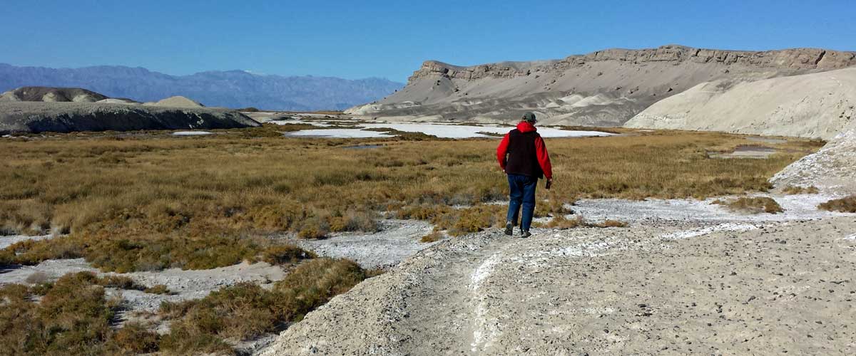
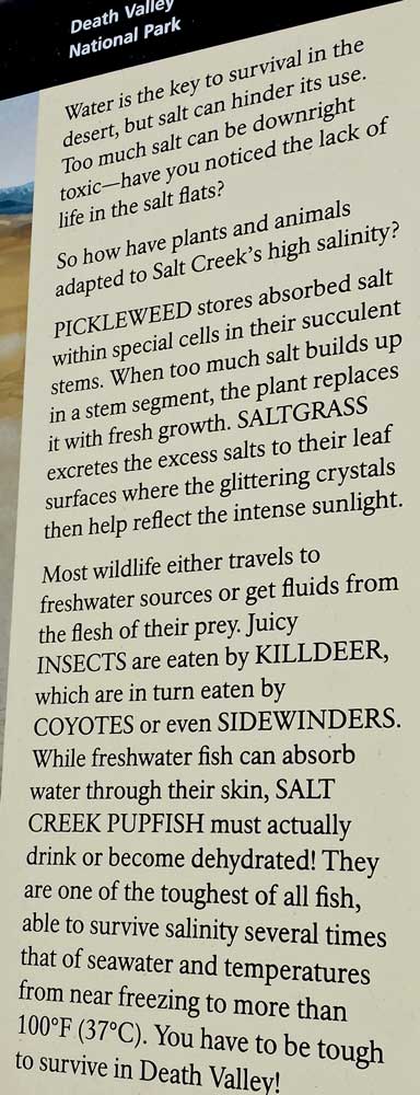
| Saturday, December 7, 2013: We learned about the Death Valley "Pupfish" at a ranger talk who told us to hike beyond the wood boardwalk to the spring of Salt Creek to see them. So we took off the boardwalk and continued to follow the creek to find the spring. The trail was a perfect amount of flat and technical hiking. We saw evidence of wildlife all along salt creek but only a few "live" sightings. We saw a lizard, coots, ducks, killdeer, and a few Pupfish. This was a great thing to do after we treated ourselves to breakfast at the Furnace Creek Inn. Click each photo for additional views. |
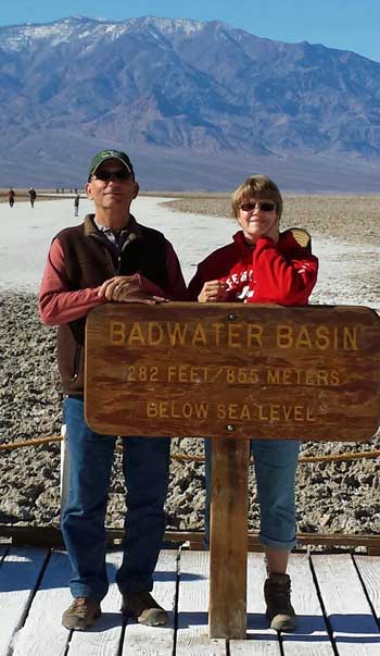 |
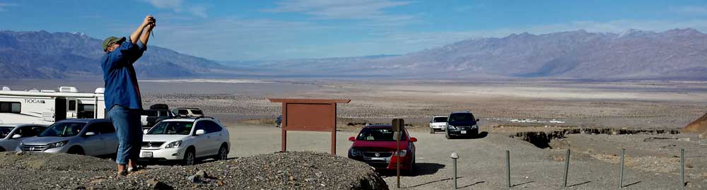
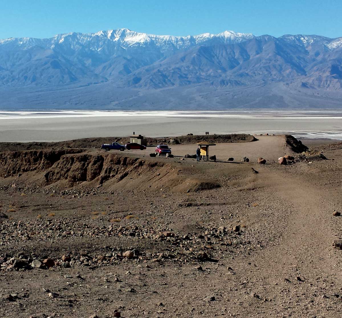
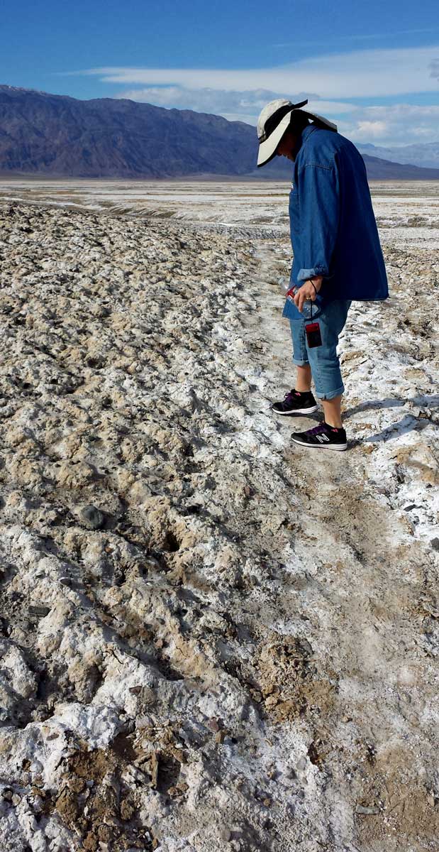
Friday, December 6, 2013: If you are a Death Valley tourist the first thing you do is head to Badwater Basin to get your photo taken at 282 feet below sea level. That's the lowest location in the United States. It is also the eighth lowest in the world (the Dead Sea is the lowest in the world). So we did the tourist thing and here is the photo to prove it. The temperature is the low 50s so that's why we are dressed warmly. Last week we could dress in shorts and T-shirt but not this week.
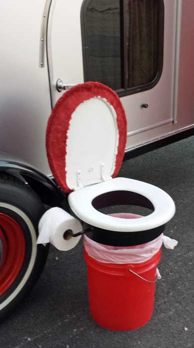
The photo at the right is how a creative tear-drop camper adds a bathroom to his camper. For the full story and four more photos, visit the RVeCafe Facebook page. While there, click "like" to stay in touch. |
 |
|
|
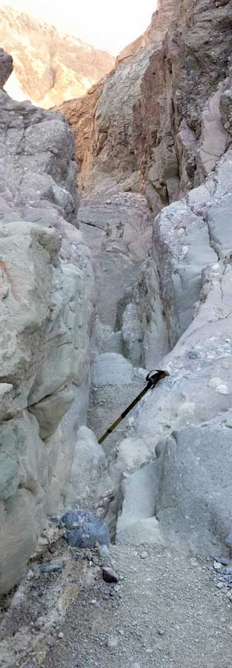 |
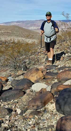
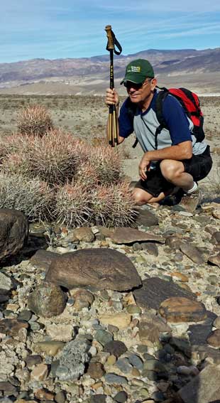
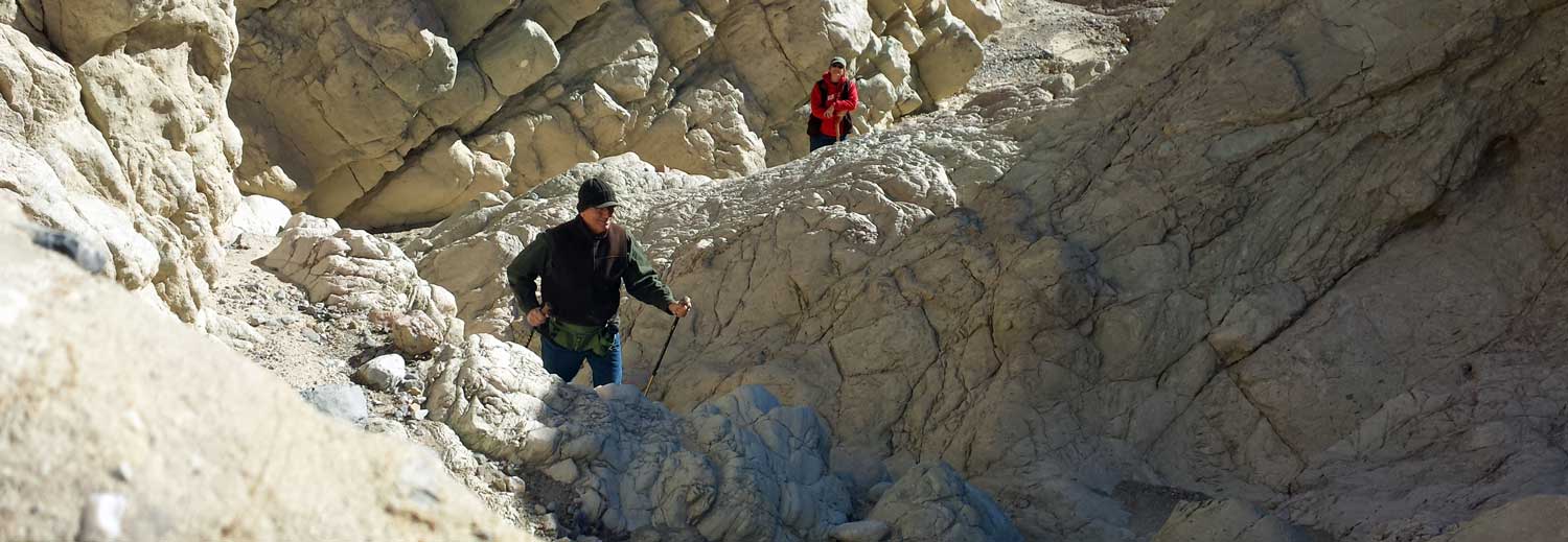
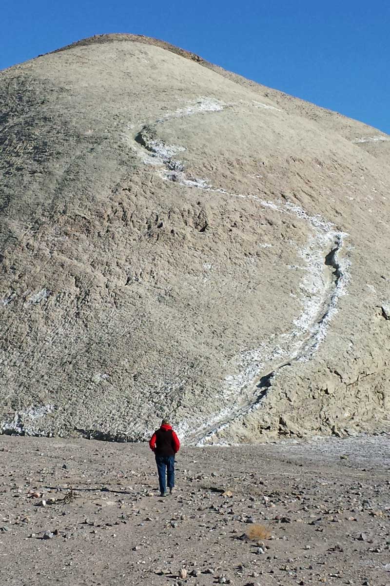
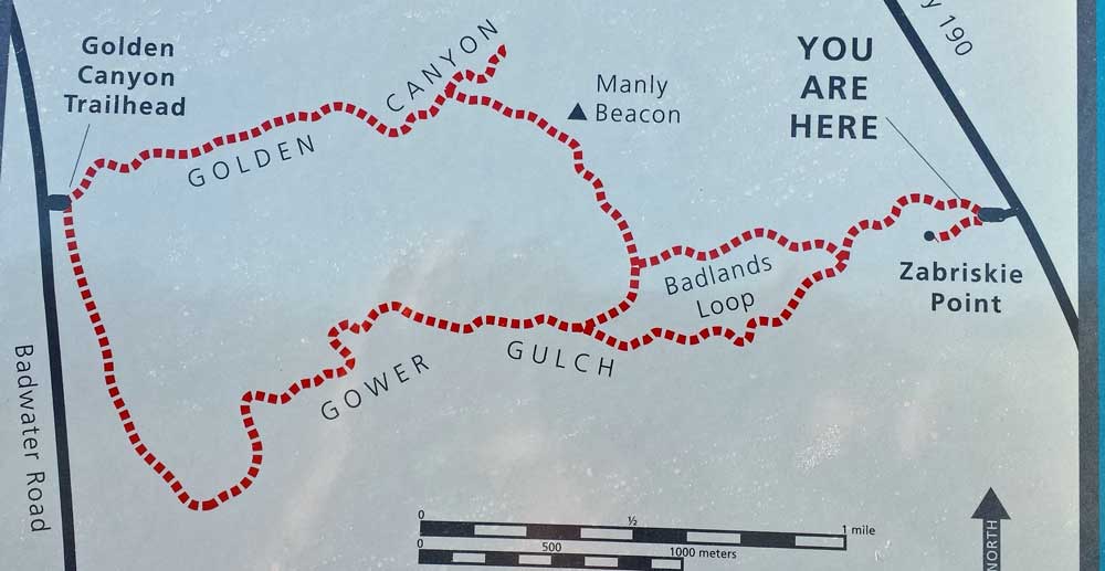
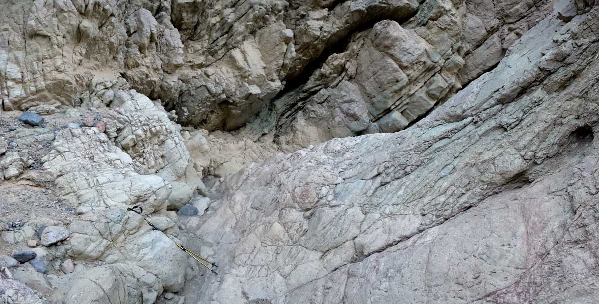
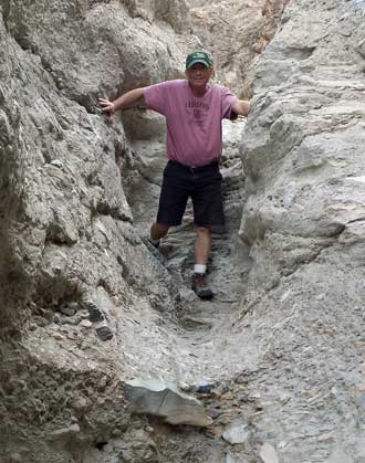
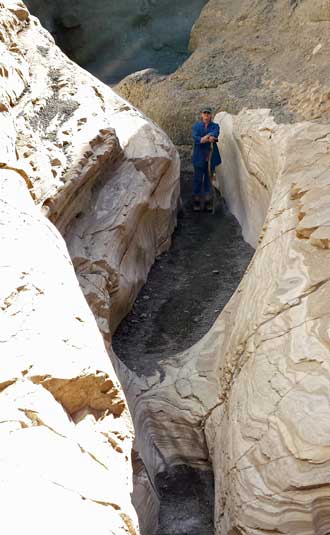
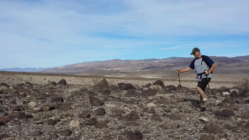
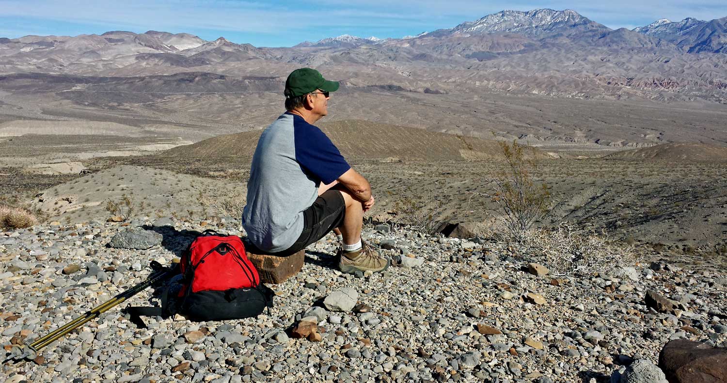
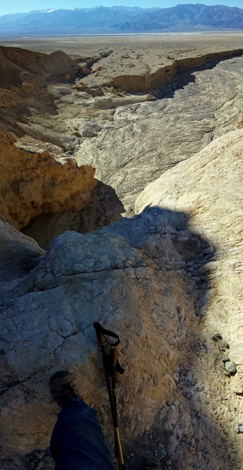
Thursday, December 5, 2013: Today was a solo hike from Zabriskie Point to Manly Beacon then a U-turn to hike down Gower Gulch back to the Golden Canyon Parking Area. The map of the hike is behind my photo on the left above. This turned out to be one of the most enjoyable hikes due to the scenery and the technical nature of the gulch as it left the mountains. The large white mountains at the beginning of the hike were soft (trekking pole points sunk into the trail) while the rest of the hike was rocky. The white mounds seemed like huge piles of baked mud. This must be a popular hike, I passes several other hikers, all traveling in the opposite direction. I first hiked to Manly Beacon, a colorful peak next to the Red Cathedral mountains. Gower Gulch was a large, wide, wash in most places but narrowed as I approached the mouth of the gulch. It got so narrow, hikers would need to pass through in single file. It was also at this point where I was dropping steeply down slope in solid rock. Once I finally reached the mouth of the gulch, the wash dropped suddenly about 40 feet to my left and the trail continued on the edge of this 40 foot drop to the right. This led to the trail across the alluvial fan back to the Golden Canyon Trail head and parking area where Gwen picked me up. Click all the photos for additional, fantastic views. Timing was perfect. I reached the parking lot just as the sun dipped behind Telescope Peak to the west. |
 |
|
|
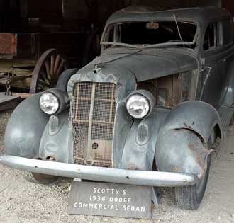
| Wednesday, December 4, 2013: This was a very busy day. Our plan was to drive south to see the sights in a direction we have not gone yet. Only a few yards down the south road Gwen stopped to pick up a hitchhiker (she was driving). It turned out to be Eric, a mechanical engineering student from Montreal, Canada. Eric went with us to the Devil's Golf Course. Gwen is taking a photo on the golf course on the left. Telescope peak (11,049 ft.) is in the background. From there, the three of us went to Natural Bridge Canyon in search of the natural bridge (center photo). While in the canyon, we also discovered a well formed dry fall. Gwen and Eric are standing in the fall in the right photo. Click that photo to see a larger photo of the entire fall. Click each of the photos for additional views. In the afternoon Gwen decided she wanted to drive to Pahrump, Nevada for groceries and I figured we could "break-even" on the driving costs by re-filling an empty propane tank in Pahrump and refueling the car there too. I was partially correct. We saved $11.88 on fuel but only $1.68 on propane. I got ripped off on the propane because it was available at the right locations for $1.10 per gallon LESS than what I paid. I just didn't find the right location. |
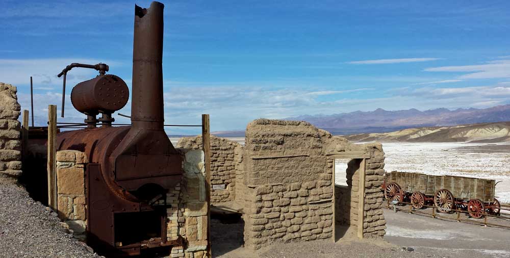 |
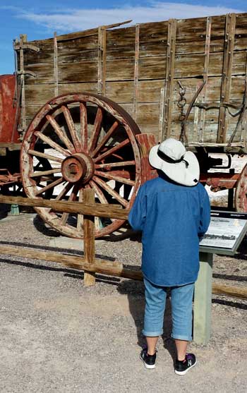
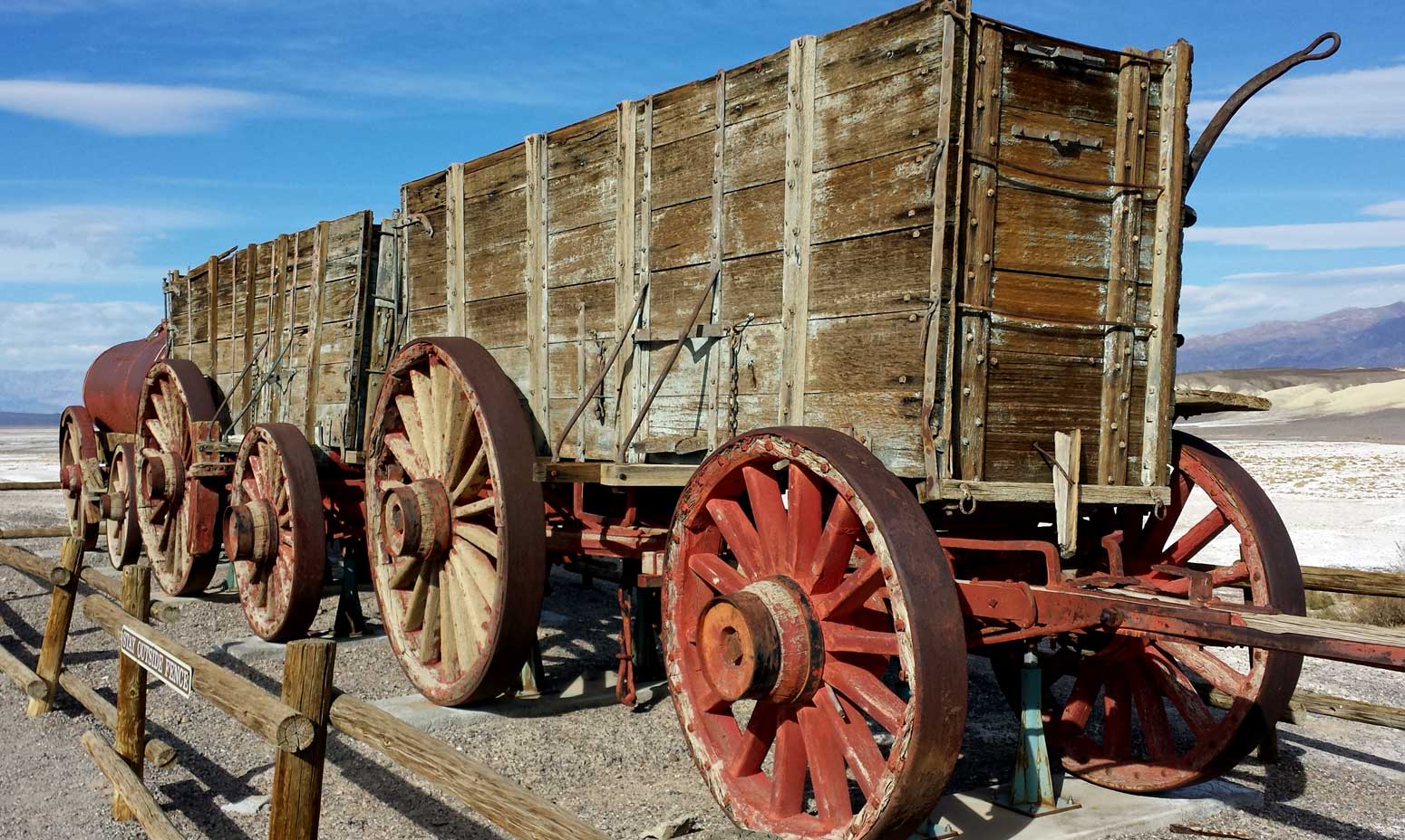
Tuesday, December 3, 2013: Gwen and I visited the Harmony Borax Works before I walked to the visitor center to listen to a presentation about solar astronomy. The Harmony Borax Works was in operation from 1883-1888, only five years. Chinese laborers would drag borax from the fields to the boiler. The boiler would concentrate the borax and eliminate other salts and mud. The concentrated borax was loaded onto twenty mule team wagons then transported to Mohave, 165 miles distant to meet the trains for further transportation. The wagon load was as much at 30 tons including a 1300 gallon tank of fresh water for the mules and drivers. The largest wheel on the wagon was seven feet tall. The market for borax would fluctuate greatly making it unprofitable to continue after the first five years Harmony was in operation. Borax was used in making glass, pottery, soap and laundry detergent. This is another example of a difficult way to make a living in Death Valley but borax was one of the few materials brought out of the valley which actually made a profit. Click both photos for additional views. |
|
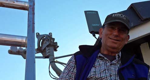
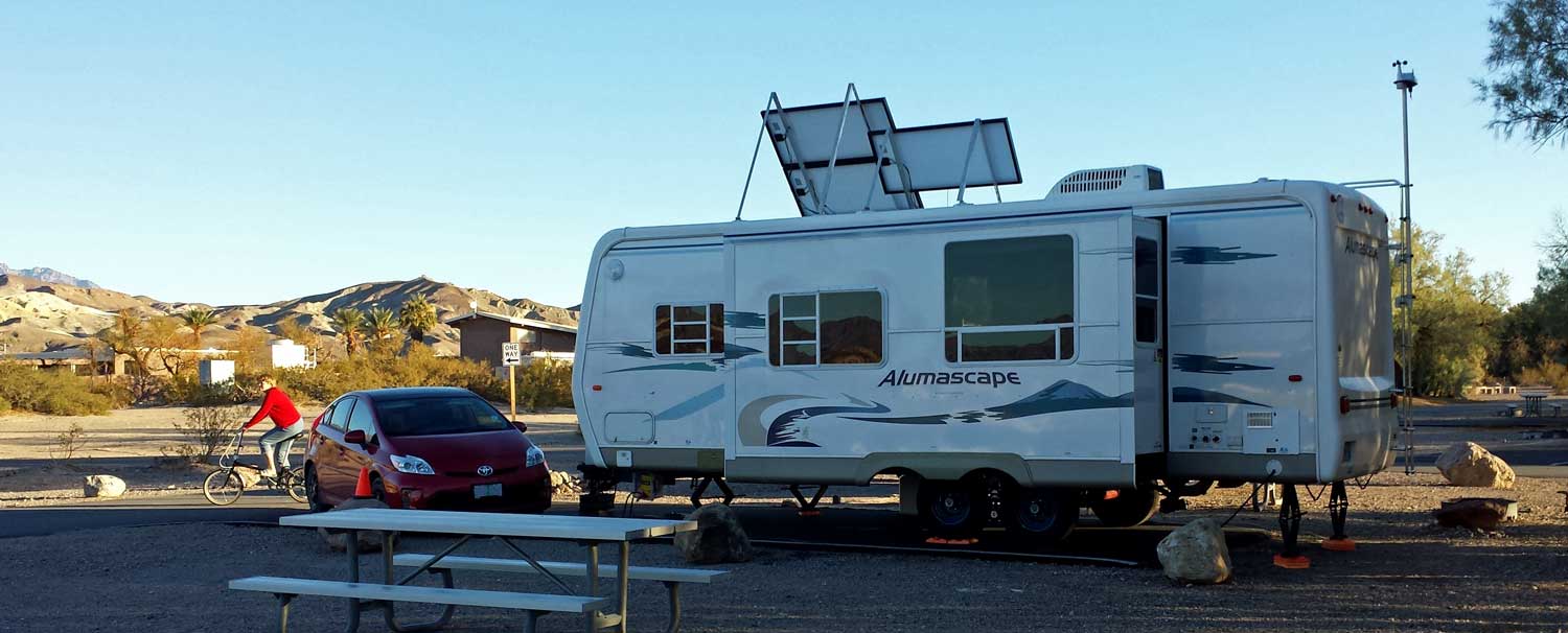
| Sunday, December 1, 2013: We have moved to Furnace Creek Campground in Furnace Creek, California in the center of Death Valley National Park. Nice and warm in Furnace Creek which we appreciate after only reaching the low 60s at Mesquite Springs Campground. We are at elevation -196 feet. I had to look up the instructions online to learn how to set my weather station to a negative elevation ... easy to do when you know how to do it. The campground "standard non-electric" spaces are mostly empty while the RVs are lined up in the electric spaces. These folks must be mostly weekend travelers. I have elevated my solar panels to catch the low sun in the southern sky. The campers who have walked by have stopped to look and seem amazed at our solar ability. If we were camped at the Imperial Dam LTVA, we would be only ONE of a thousand RVs taking advantage of solar energy and everyone would just think we are "ordinary". Click the photo to see the Great Blue Heron Edition after the panels have been erected. This would be ideal except that we have a camper behind us running his generator. It's not annoying when friends must run a generator but certainly annoying when strangers do it. If parked in the desert, we'd be far enough away it wouldn't be a bother. We still have much to see in Death Valley so plan to be here another week. |
 |
|
| Saturday: November 30, 2013: Mosaic Canyon is located just to the south and above Stove Pipe Wells (the white buildings in the distance in the top photo). This is a popular hike in Death Valley with monsoon rains carving the marble walls of the canyon just wide enough for hikers to make their way deeper into the canyon. I've made these photos react differently, pass your pointer quickly through and out of each photo to see the action in the photo. The marble walls of the canyon are polished to a shiny finish by monsoon waters full of sand and debris when it rushes out of the canyon. This was a fun hike, long enough to pack in a lunch. It looks like asphalt in the photos through the canyon but it is gravel washed down from higher in the canyon. I'm looking at the marble in the canyon and wondering why it was never mined but then notice all the cracks in the marble. Perhaps that's why it's never been disturbed. |
|
| Friday: November 29, 2013: When wandering around we noticed that Beatty, Nevada was only 26 miles one way from our location so we decided to visit out of curiosity and for Prius fuel thinking we could save $1 per gallon if purchased in Beatty (we were right). Only four miles from Beatty is the ghost town of Rhyolite, the site of an earlier gold mine. Gold was discovered in 1904 and by 1906 a real town existed. The town continued to grow quickly so by 1908 the population was 8,000 but now the mine struggled to support the town. By 1910, the mine no longer showed a profit and the town population was only 675, it was a ghost town by 1920. Click the photos above to see a couple more remaining buildings. Behind the Rhyolite Mercantile is the three store school building which was completed in 1909. Apparently the end of the gold was not anticipated because by the time the school building was completed there were no children left in the town. At one time, three trains supported the town. The above is the depot for the Las Vegas and Tonopah Railroad. Behind the depot photo is the Tom Kelley bottle house, the only restored building in the town and more of a novelty than anything else. The life of this town was barely five years. It's hard to imagine how quickly merchants made the investment in inventory then moved on so quickly. As a business person, it's hard to visualize such a quick transition with the hope of making a profit. Having said that, I DID, in a previous life, setup then liquidate a bike shop over a three year period. I never felt like I lost money in the venture but if I had to do it over, I would not have opened the bike shop because it was a distraction from my business that was making a REAL profit for me. |
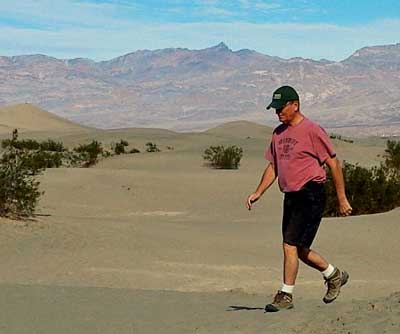
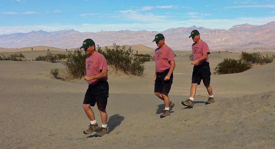
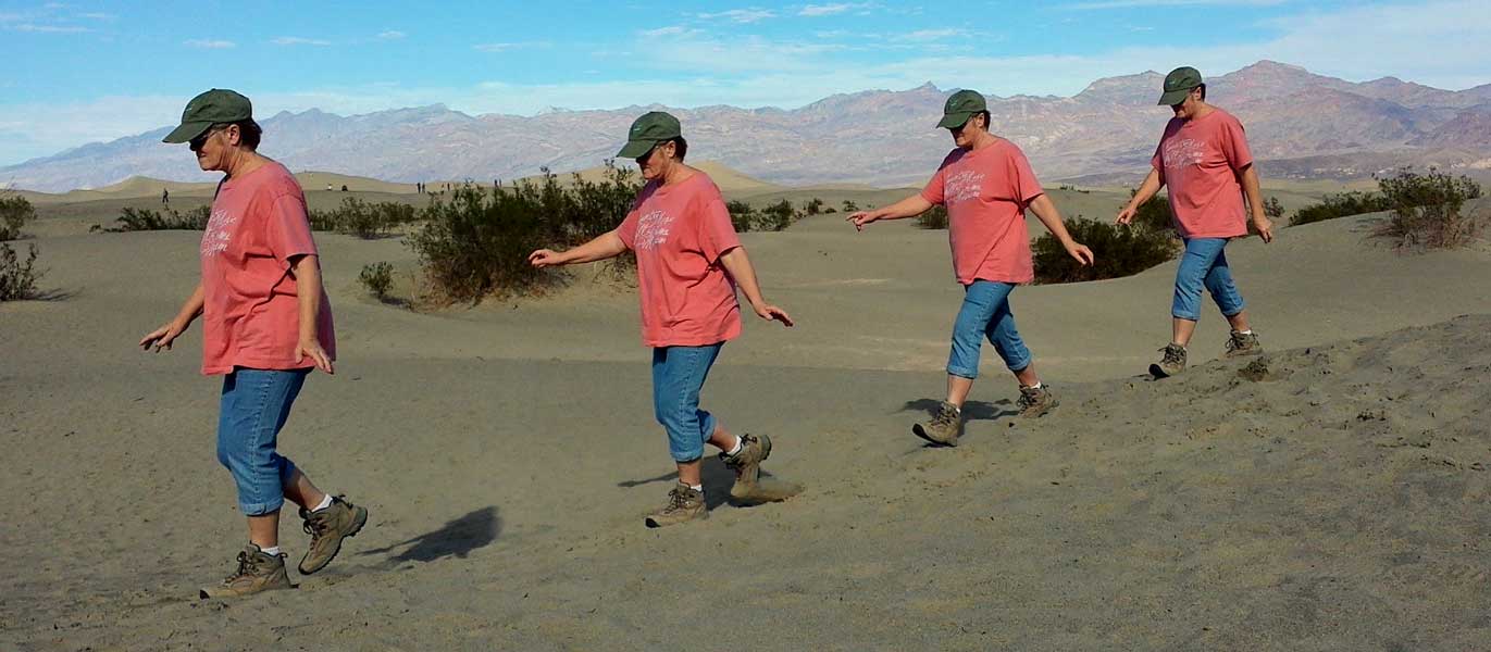
Thursday: November 28, 2013: About 30 miles from our campsite toward the center of Death Valley is the Mesquite Flat Sand Dunes area which is a popular place to explore and hike onto the dunes. We were surprised at the number of other hikers and families enjoying the dunes. Some hiked to the highest dune, a mile from the parking area while I saw others with small children walking only a short way onto the dunes with the kids sand toys (buckets and spades plus Tonka trucks). We did some hiking but mostly played with our camera settings. Click my photo so see what I mean. You can check out the same effect with Gwen here. |
|
 |
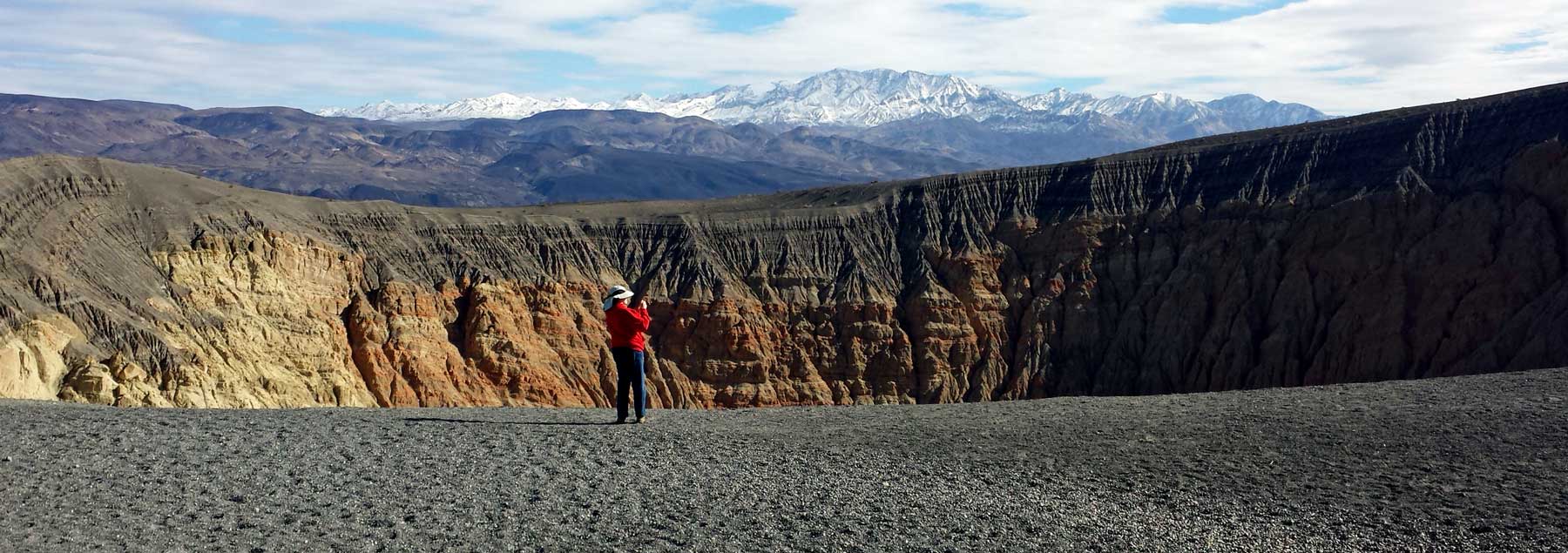
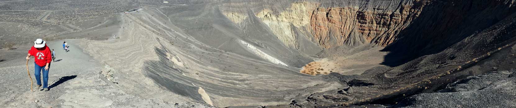
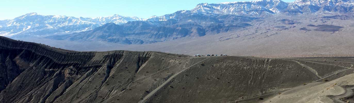
Wednesday: November 27, 2013: I did some exploring into the desert today to the west of Mesquite Springs Campground. There was a short trail only in widely spread sections, otherwise, it was hiking through rough, rocky desert. I can imagine what the temperature is like here during the summer months but today it was low 60s for my hike. Lots of interesting rocks and a few cactus but mostly lava rock or basalt. I first thought the widely spread chunks of basalt were blown here from the Ubehebe Crater, about 4 miles distant, but then noticed lava flows in some of the canyons so perhaps the scattered basalt was not from a distant explosion. I was hoping to see something alive in the desert like a tarantula, scorpion, big horn sheep, coyote, kangaroo rat or snake but saw only one small lizard and no insects. I did see evidence of kangaroo rats but could not find a den which looked active. I experimented with my Samsung S4 smart phone camera |
 |
| function. Click the photos to see some effects as well as the "animated" photo above. I won't be doing more animated "GIF" files until I figure out how to reduce their size. This one is 11 megabytes so it may take a while to download unless you have a very fast connection. During my college days, I worked part time as a news photographer for the local newspaper. I learned much about photography from that experience and have had an interest in photography since then. Even though my news photography experience was short, I had enough interest to build my own darkroom which followed me from one life to another for more than 25 years (until digital photography came along). I used my photography experience to develop a successful mail order business during one of those "lifetimes". It's that photography interest that still keeps me playing with the photo functions of my Samsung S4 phone. |
|
|
|
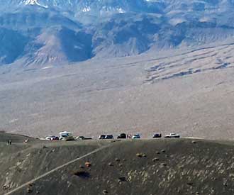
Tuesday: November 26, 2013: This was our first serious hike and our first chance to see the sun since arriving at Death Valley. Near our Mesquite Springs campground is the Ubehebe Crater, an old volcanic crater. There is a trail around the crater and we chose to hike the trail stopping halfway for a picnic lunch. It was an easy paved road to the crater. Gravel and ash surrounded the crater which made the climbs difficult. Some of the tourists chose to hike down 600 feet into the crater rather than hike the rim. The crater and desert views were awesome as we walked the rim. We stopped at the halfway point for a picnic lunch before completing the hike. We were actually back to our trailer in time to hear the Arizona Cardinals defeat the Indianapolis Colts. Since we are slowly working our way toward Arizona, we have to be Cardinal fans. |
|
|
 |
Monday, November 25, 2013: Today is a description of the interior of Scotty's Castle. We took a guided tour with Tom as our guide dressing in 1939 period clothing. The explanation of "1939", it was then that the Johnson's and Walter Scott would invite tours and rent rooms in the castle for income toward the end of the great depression. The room are kept dark, I assume to minimize the effect sunlight has on the original furniture and decorations. There is another photo behind each photograph so click each to |
 |
|
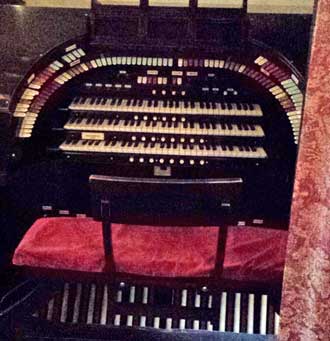
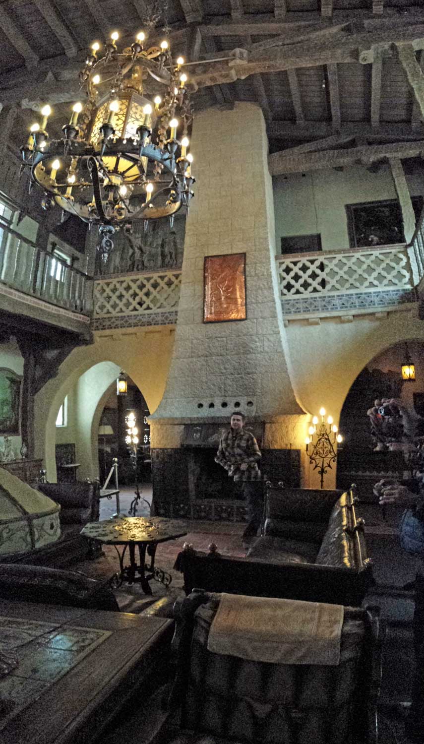
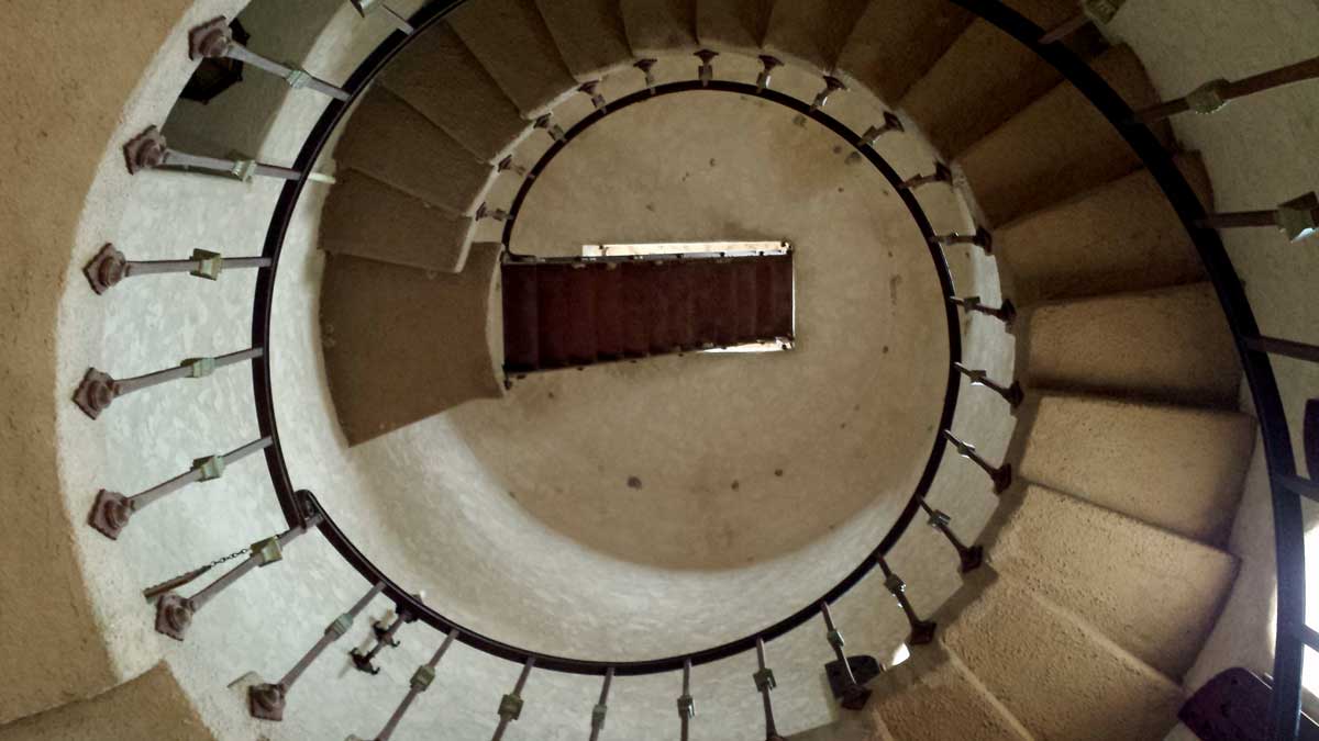
| see additional views. We entered into the courtyard through a side entrance. Tom began in the courtyard then into the great hall. The Johnson's staying in the castle only during the winter months so the castle is filled with fireplaces and radiator heaters. Each day a staff person would climb the spiral stairs into the tower to raise the flag. Since the castle is at 3,000 feet it can actually get snow. It was very cold the day we toured. Construction of the castle began in 1922 and ended before completion in 1931 due to confusion over property ownership. No further construction was done after 1931. By 1939 the property ownership was secured by Johnson. Due to the great depression, Johnson's estate decreased from 60 million to 3 million so he, his wife "Bessie" and Walter Scott would lead tours through the castle and rent rooms. The organ Johnson purchased for the ranch is on the left. The diesel generator system had to be installed to power this organ. Over 1,000 organ pipes were installed for the organ. The music was demonstrated in the "music room" which can be seen behind the organ photo. The organ pipes are behind the woodwork on the opposite side of the room. Upon Johnson's death, the castle was given to a religious foundation Johnson had established which ran tours and rented rooms at the castle until the National Park Service purchased the property in the 1970s. |
|
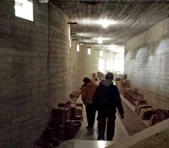
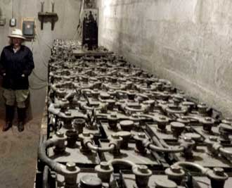
| Sunday, November 25, 2013: We take the "Underground tour" at Scotty's castle. A huge quantity of concrete is used to make utility tunnels under the castle. Electric and plumbing utilities are guided through these tunnels rather than buried in the ground. We were told the reason was the seismic activity, plumbing and electrical repairs could be made easier if tunnels were built. These photos are different, just pass your pointer through each photo to see a second photo. Tiles are stored along the concrete walls. These were purchased for future building projects but never used. The battery room shows Thomas A. Edison batteries charged by generators connected to the Pelton Wheels run by hydraulic pressure from a spring located 300 feet higher and 1 mile distant. Johnson purchased a large organ which could not be powered by this hydraulic system so he installed a diesel generator to provide power to the organ. The diesel power room is on the right. |
|
|
| Saturday, November 23, 2013: We toured the exterior of Scotty's Castle today built by Albert Johnson in 1922 - 1931. The castle is located inside the Death Valley National Park. But the park is known for the lowest point in the USA, -282 and world high temperature records. The castle is located in the north of Death Valley National Park at 3,000 feet with a good source of spring water used not only for hydration but also to generate electricity for the castle. The average November temperatures in Death Valley is 77 degrees, but the weather has been unusually cold and wet these last three days. Walter Scott perpetrated a con to generate cash from wealthy Americans telling them he owned a gold mine in Death Valley. He used the cash to get more investments. One of those investors was Albert Johnson, a Chicago Insurance man. When Johnson's investment saw no income, he investigated and soon became a friend of Walter Scott. Johnson's wife convinced him to build a comfortable desert home as a winter retreat. So Scotty's castle was designed and built by Albert Johnson. The castle was never finished due to confusion over property ownership. Once the ownership question was settled it was 1939 and Johnson's estate had suffered from the depression. He chose not to continue investment in the castle but use the castle as a winter retreat plus generate income by renting rooms and leading tours. Click these photos for additional views. |
|
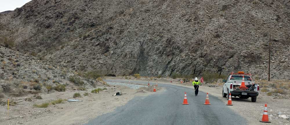
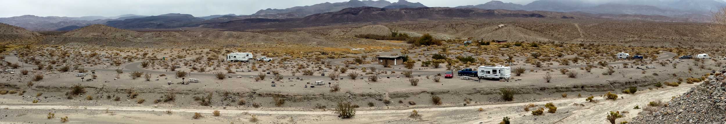
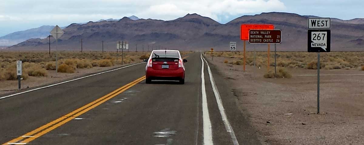
Friday, November 22, 2013: Our Death Valley access narrows to a single lane with road construction making it even more narrow. The plan is to close this road for the month of December for construction. From what we can tell, it needs a great deal of improvement. Click the road photo for another view. We did find Mesquite Spring Campground which was recommended to us by our friends Jay and Anita as a private area with few other campers. They are right. They reported it perfect for their lifestyle and it appears perfect for ours too. The fee was $6 per night with a Senior Access Pass. This gets the camper a picnic table, fire ring, barbeque stand, garbage pickup, flush toilets nearby, fresh water nearby, dump station and paved access roads. We don't have cell phone or Internet access but do have our solar power to provide the power we need to recharge tablets, cell phones, laptops and Gwen's sewing machine. Click our campsite photo for a panorama of the Mesquite Springs Campground. We plan to stay here a week or more to rest, explore this area of Death Valley and hike. We thought ahead and made tour ticket reservations for Scotty's Castle tomorrow. It's only 6 miles from the campground. This was a cold, windy day so we went only for a short hike around the campground then stood in a gully to get protection from the wind for this photo. I also made a short video of our first day experience in Death Valley. |
|
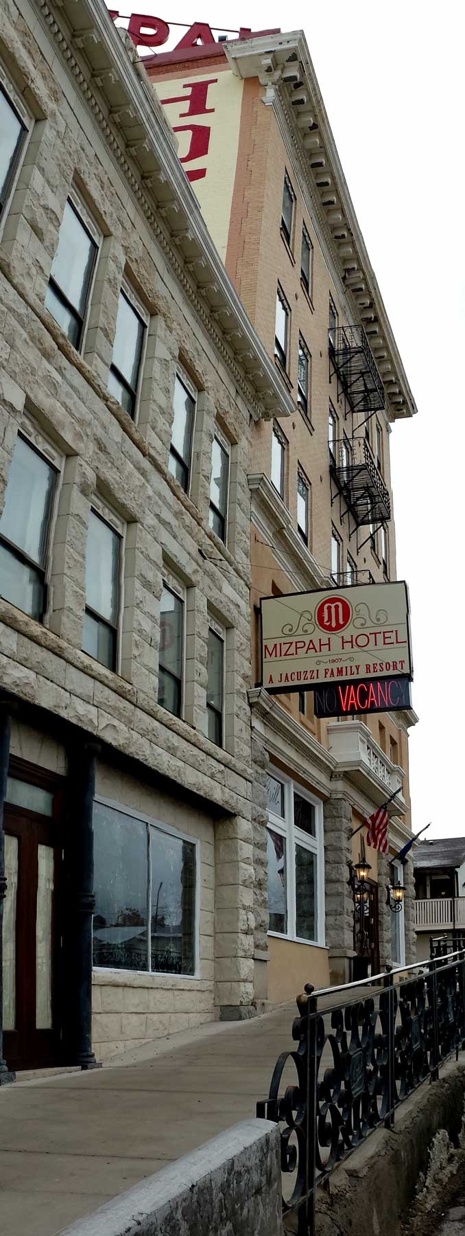
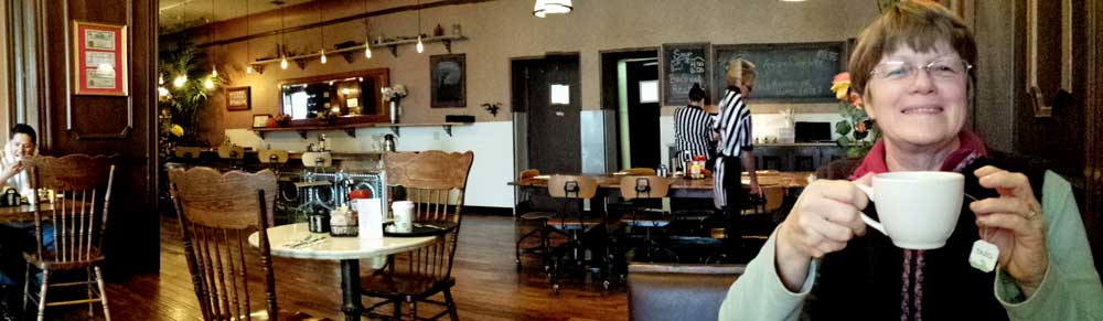
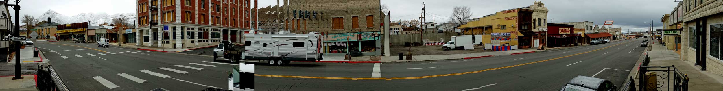
| Thursday, November 21, 2013: The Mizpah Hotel was built in 1907 and was once the tallest building in Nevada. Tonopah is the site of the second largest silver mine in Nevada but once the silver mining ended, the life of the city turned to tourism and as a supply point for the nearby military activities. The Mizpah was rebuilt to it's original splendor in 2011 and is now a destination point for those looking to visit Nevada history. The Pittman Cafe is located inside the Mizpah so Gwen and I visited the cafe to have breakfast with history. Click the left photo to view the exterior of the hotel. Click the right photo to see Gwen enjoying fresh brewed tea before her breakfast is delivered. After breakfast we explored the hotel and found many photographs of celebrities who had visited the hotel. This was a very cold day, below freezing with a strong wind making it feel even colder. I stepped outside anyway and took a photo of US95 as it passes in front of the Mizpah. After breakfast, we filled both vehicles with fuel knowing it would be a lot of driving before the next fuel station. Surprisingly, the fuel price was less than I paid in Reno. Driving south, we soon reached "Scotty's Junction" with Nevada road 267 into Death Valley. This was an adventure when the road turned to a single lane plus road construction. |
|
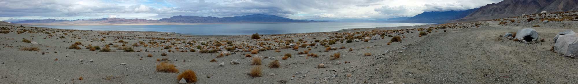
| Wednesday, November 20, 2013: We are on the road again. Today's drive from Verdi, Nevada to Tonopah, Nevada, about 200+ miles. Our first stop was in Fernley, Nevada to see my son Joe who works for the Amazon Fulfillment Facility. He gave us a tour of this huge facility. Having been a mail order business owner in a previous life, I was amazed at the operation and double amazed knowing that this is only one of many such facilities. Another interested fact is the inability to attract employees to a wage of $13.40+. Joe is the manager of all seasonal employees and he tells me they are short 1000 people. They would rather draw unemployment than to work. Another problem is employees must pass a drug test. This is also a great RV workamper opportunity where Amazon pays for the RV space. After this tour, we drove south on US95 to Walker Lake for a lunch stop. We parked in the dispersed camping area called 20 Mile Beach and considered staying the night. However, we were being chased by a significant winter storm and decided to drive further south to Tonopah hoping to stop at a recreation area reported to be 10 miles west of Tonopah. However, I didn't see this camping area so drove on to the Banc Club Casino parking area in downtown Tonopah (photo above). Click this photo for a panorama of our parking situation. I think we are sorry we didn't stay at Walker Lake, but now we are only a little more than 100 miles from our Death Valley destination. |
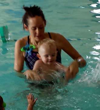 |
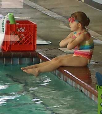
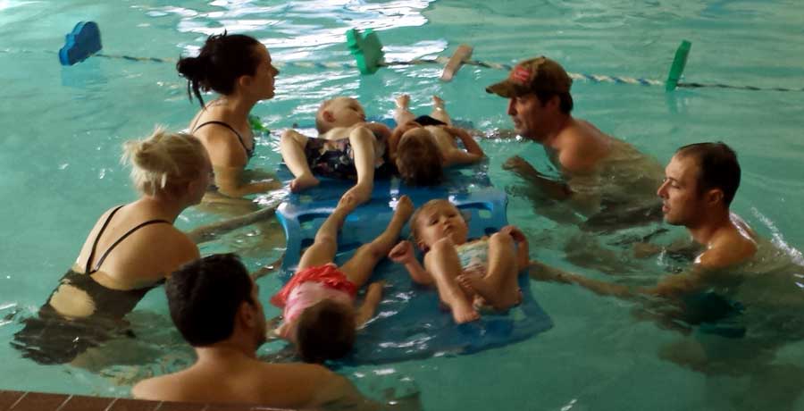
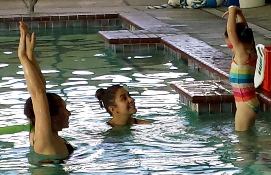
Tuesday, November 19, 2013: Today was swim lesson day so we followed Kim and the kids across Reno to the swim club. Both kids love their swim lessons and I could see why after watching the lesson. The lessons are kept fun and interesting with the activities changing every 4 minutes. Noah is on the left and Chloe is on the right. Click the photos for additional views. |
 |
|
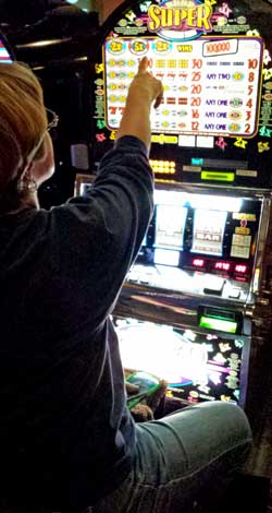
Monday, November 18, 2013: Today was a play day so it began with Gwen spending the $25 in Gold Ranch Casino "Free Play" money given to us by the RV park. Gwen was able to turn $25 free-play into $27 cash and we walked out the door. Next, we drove to the theater and watched the new movie, "Last Vegas". It was cute and funny for those who are 60 and older. The RV park also gave us a $25 meal ticket for the restaurant which we used the other day. Finally, we were given a $25 discount certificate for our next RV park visit. It's fun to spend the "free" certificates. |
Sunday, November 17, 2013: "Dad, can you be at my house by 10 am?" Sure. I'm thinking taking care of the kids while Ben checks out a problem he's having with his iPhone at the Apple Store. So I got to play with the kids for a while until Chloe left for a birthday party and Noah went down for a nap. Then Ben says, "I've got this little project!" As it turns out, Ben needs to install a satellite dish heater onto his DirecTV satellite dish. It's a "simple project". After Ben removed the dish he drilled a hole through the house wall "into the attic". However, after pushing six feet of sire into the hole and not finding it on the other end, I searched for a solution. I ended on the roof with the wire pushing through a tiny gap near a rafter. The wire showed up in the attic and Ben completed the installation and I got off the roof safely. After the TV was working again, we watched the Denver Broncos beat the Kansas City Chiefs. |
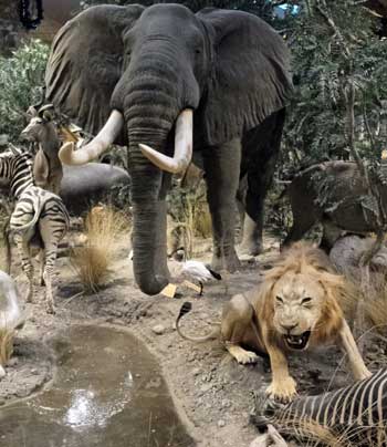
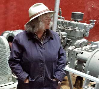
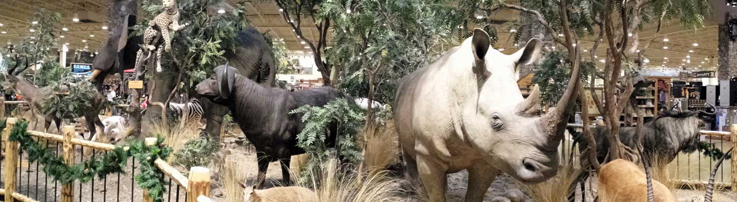
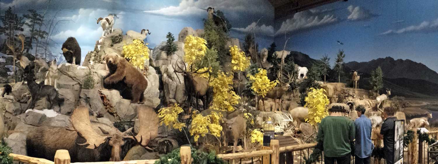
Saturday, November 16, 2013: Gwen and I had a very early day today to arrive at my grand kids to babysit while their parents went to a conference. We spent most of the day playing games... lots of games, and flying toy airplanes. Noah, age 2, likes to fly his toy airplanes around the house so he and I had airplane races for an hour. He's flying and laughing at the same time. After caring for the grand kids I dropped Gwen at the trailer and switched vehicles to the truck to refuel because "GasBuddy" reported Safeway diesel at $3.58. However, when I arrived at Safeway, the sign showed $3.93. Someone reported the premium fuel price as the diesel price. I chose to fill up anyway rather than driving around looking for a better price. On the return trip I stopped at Cabela's hoping for a good sale but no such luck. They do have an impressive wild animal display of world animals, click to see more. They also have a large display of domestic wild animals, click this link to see that display. |
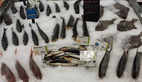
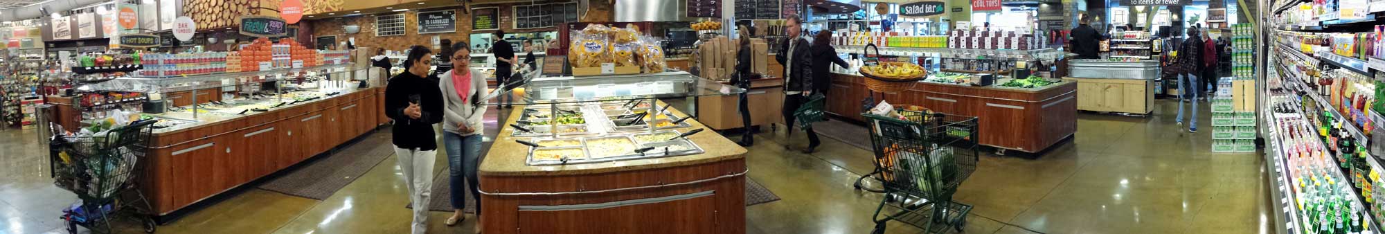
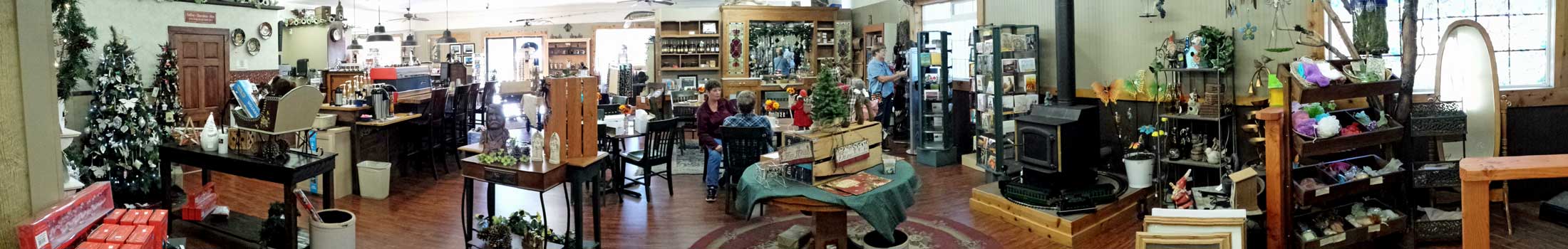
Friday, November 15, 2013: This day began early with a quick trip to the grand kids pre-school to watch an assembly where Chloe sang and animated the "Five Ducks" song. After the assembly we went to the Reno Costco so Gwen could ask questions about her new phone. Then off to our last stop at Whole Foods Market for a healthy lunch and healthy groceries. I came across the fish display which I thought was special but click that photo to see a panorama of the buffet serving tables voted the "Best Salad Bar in Reno". It's not just salad but hot food and soup too. Unlike other salad bars, the cost at Whole Foods is $8.49/lb so I chose my lunch carefully. |
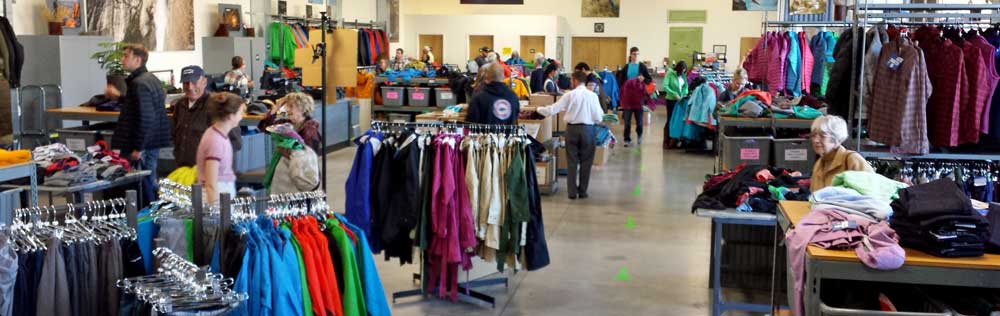 |
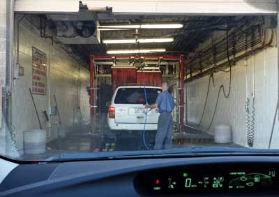 Thursday, November 14, 2013: We came looking for the sun and there was plenty of it today. I rode my bike for more than an hour and passed the Patagonia Outlet Store in Reno. The parking lot was full and cars were parked down the street so I knew something special was happening. Later in the day I drove back to the store to find 40% off on everything in the store. There was still lots of merchandise (see above photo) but I soon learned that even with 40% off, I still didn't want to pay their price. Apparently I've been spoiled by Fred Meyer in Oregon. From the Patagonia Outlet I drove to a nearby car wash to give Miss Scarlet a bath. The operator asked, "do you know how to put your Prius in neutral?", I moved the shift lever to the "N" position but it stayed in "drive". "You must HOLD the shift lever in "N" to get it into neutral." he said. That worked so the car was moved forward into the wash by the conveyor mechanism. Since I didn't have anything to do I took a video of the process. Toward the end of the video, the car wash turns off and I was stranded in the middle for about a minute. Thursday, November 14, 2013: We came looking for the sun and there was plenty of it today. I rode my bike for more than an hour and passed the Patagonia Outlet Store in Reno. The parking lot was full and cars were parked down the street so I knew something special was happening. Later in the day I drove back to the store to find 40% off on everything in the store. There was still lots of merchandise (see above photo) but I soon learned that even with 40% off, I still didn't want to pay their price. Apparently I've been spoiled by Fred Meyer in Oregon. From the Patagonia Outlet I drove to a nearby car wash to give Miss Scarlet a bath. The operator asked, "do you know how to put your Prius in neutral?", I moved the shift lever to the "N" position but it stayed in "drive". "You must HOLD the shift lever in "N" to get it into neutral." he said. That worked so the car was moved forward into the wash by the conveyor mechanism. Since I didn't have anything to do I took a video of the process. Toward the end of the video, the car wash turns off and I was stranded in the middle for about a minute. |
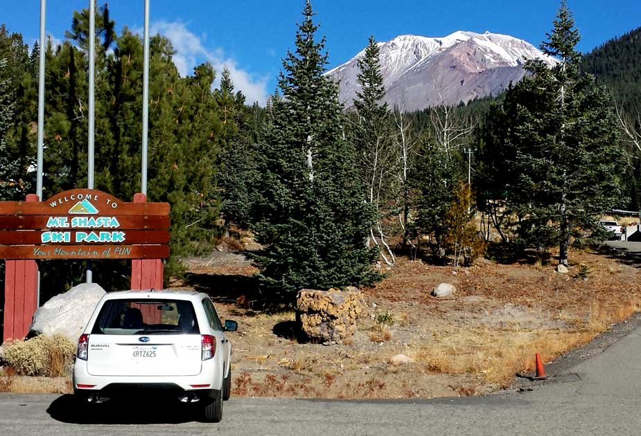
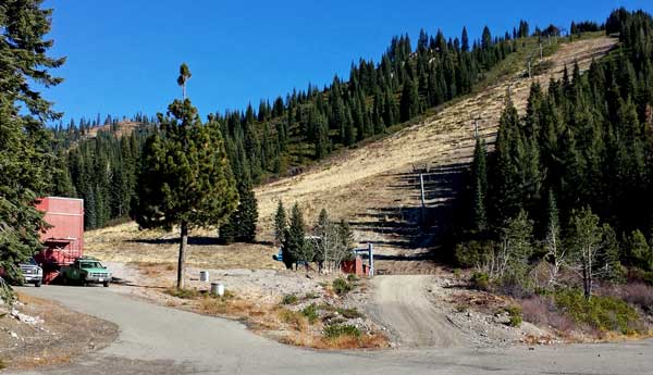 Wednesday, November 13, 2013: This was another travel day from our campsite near the base of Mt. Shasta to Verdi, Nevada. Before leaving, we drove to the Mt. Shasta Ski Area where they are hoping for a huge storm so they can open before Thanksgiving. They do have snow making machines but it's not cold enough for snow making. The view of the mountain from the ski area is awesome. The lifts do not actually ascend Mt. Shasta but the smaller hills at the base of the mountain. This is a small area with only three lifts but that can sometimes make for much shorter lines or no lines and much cheaper lift tickets too. Click the photo for a view of the mountain. Next we drove only a few miles to McCloud and I was looking for a cup of coffee. We found the McCloud General Store which is the home of the McCloud Coffee shop. It is a store with a little bit of everything including gift items, hardware, sporting goods, fishing gear, lumber, and coffee plus bakery items. Wednesday, November 13, 2013: This was another travel day from our campsite near the base of Mt. Shasta to Verdi, Nevada. Before leaving, we drove to the Mt. Shasta Ski Area where they are hoping for a huge storm so they can open before Thanksgiving. They do have snow making machines but it's not cold enough for snow making. The view of the mountain from the ski area is awesome. The lifts do not actually ascend Mt. Shasta but the smaller hills at the base of the mountain. This is a small area with only three lifts but that can sometimes make for much shorter lines or no lines and much cheaper lift tickets too. Click the photo for a view of the mountain. Next we drove only a few miles to McCloud and I was looking for a cup of coffee. We found the McCloud General Store which is the home of the McCloud Coffee shop. It is a store with a little bit of everything including gift items, hardware, sporting goods, fishing gear, lumber, and coffee plus bakery items. |
|
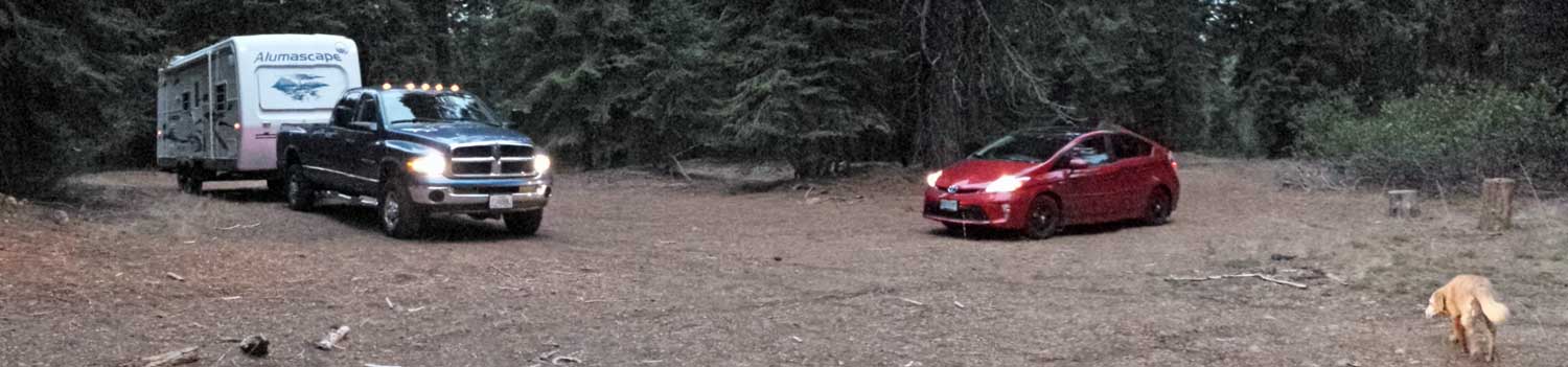
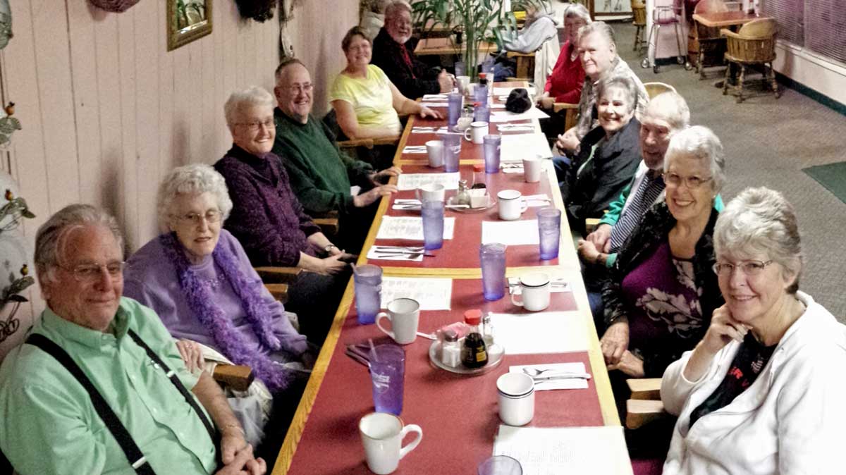
| Tuesday, November 12, 2013 (11-12-13): Last night was a celebration dinner with friends before we left Timber Valley for the winter. We visited the Migado Restaurant. They have an Asia menu with inexpensive prices plus good food. This was a slow travel day, about 211 miles south of Sutherlin. We started at 10 am with a goal of reaching Grants Pass by noon to have lunch with our friend Alice who caught us up on all the new gossip in Grants Pass. Our lunch was at the Laughing Clam, a restaurant we have not visited for 6 years. It was crowded and good food so must be doing well. It opened about the time we left Grants Pass in 2006. Traveling south from Grants Pass, Gwen mentioned the Prius was showing 275 miles of fuel left in the tank and was unsure we could reach Reno so we stopped in Medford to pick up the last Oregon fuel fill-up. The Prius only took 4.1 gallons so that added another 200 miles of range. The Dodge needed no fuel. I filled both tanks yesterday for a total of $258 with Fred Meyer discounts. Just over the Oregon/California border is a Mt. Shasta view rest stop. Mt. Shasta is partially obscured with clouds on the left. Click that photo for a panorama of the rest area next to Interstate 5. On the south side of Mt. Shasta is a ski area (no snow yet). Half way up Ski Run Road is a favorite boondock location we like to visit (photo on the right). This is very private so we can let Morgan and Annie explore with no worries. Click the photo for a panorama of our camping location. |
|
|
|
|


 Wednesday, November 13, 2013: This was another travel day from our campsite near the base of Mt. Shasta to Verdi, Nevada. Before leaving, we drove to the Mt. Shasta Ski Area where they are hoping for a huge storm so they can open before Thanksgiving. They do have snow making machines but it's not cold enough for snow making. The view of the mountain from the ski area is awesome. The lifts do not actually ascend Mt. Shasta but the smaller hills at the base of the mountain. This is a small area with only three lifts but that can sometimes make for much shorter lines or no lines and much cheaper lift tickets too. Click the photo for a view of the mountain. Next we drove only a few miles to McCloud and I was looking for a cup of coffee. We found the McCloud General Store which is the home of the McCloud Coffee shop. It is a store with a little bit of everything including gift items, hardware, sporting goods, fishing gear, lumber, and coffee plus bakery items.
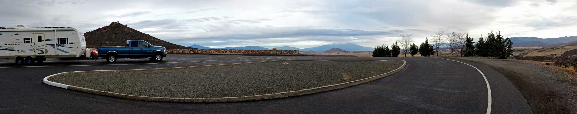
