 |
|
|
Wandering Northern Idaho and Western Montana
in an RV; 2009; page 6 |

|
|
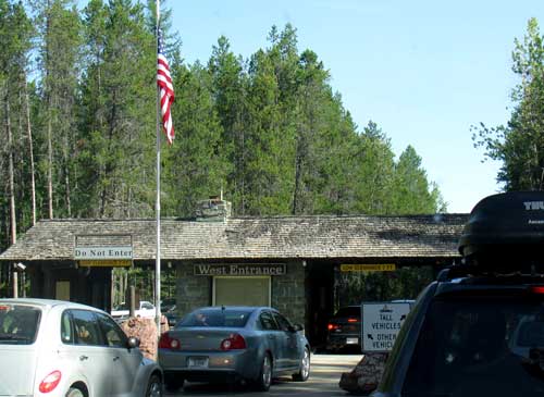
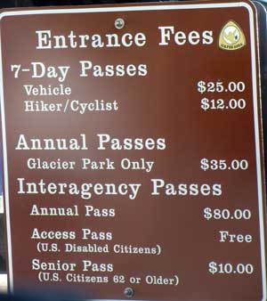
| Thursday, August 27, 2009: Glacier National Park is only about 50 miles from our camp at Swan Lake. We couldn't pass up the chance to visit one of the premier parks which is celebrating it's 100th anniversary next year. It was an easy drive to the entrance and I was a little surprised by the crowd since all the other campgrounds seem to be slowing down. You can see the entrance fee is substantial but we got in free with a Senior Pass. The $10 fee shown is to purchase the pass, I bought mine when I turned 62. The weather is perfect today. The high will be about 80. I was hoping for some killer sales on T-shirts but the best we found was 30% off. The attraction here at Glacier National Park is not the Glaciers. Apparently there were some at one time and a few are remaining near the tops of some of the peaks. I saw a photo of one of the glaciers taken in 1932 then again in 1988. It was substantial in 1932 but gone entirely in 1988. All of the panoramas below can be enlarged by clicking on them. The attraction seems to be the spectacular mountain scenery and the well maintained hiking trails to mountain peaks or lakes. |
 |
 |
|
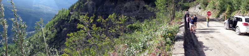 |
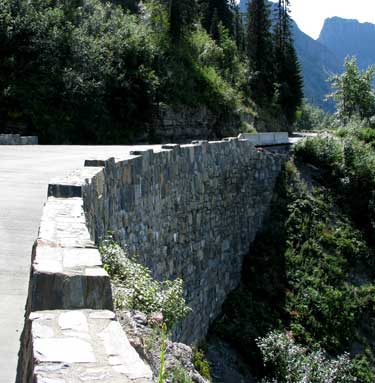
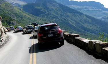
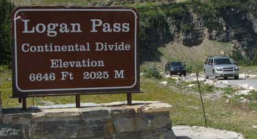
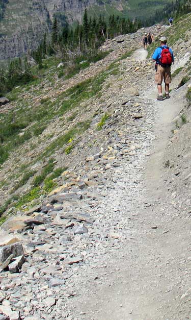
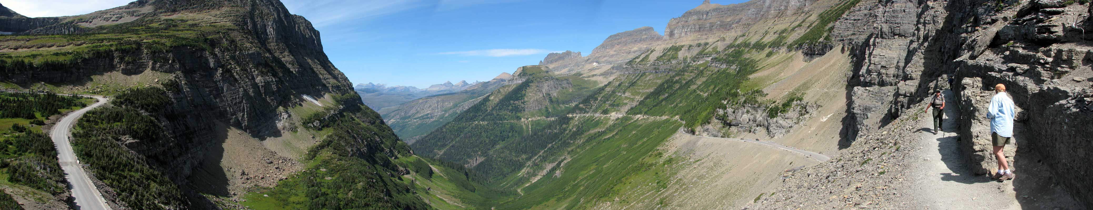
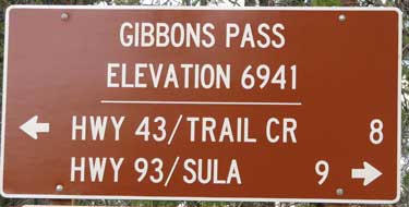
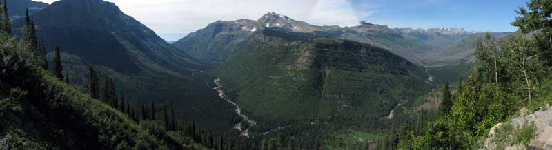
| Our goal for the day is the Logan Pass on the Going to the Sun Road. I had a post card for many years hanging in my office of a bicyclist riding the Going to the Sun Road and now I finally get to see the real road. If I was in decent shape, I'd have to ride this road like many other cyclists are doing today. There is road renovation happing on the Going to the Sun Road today and according to the literature, they expect the project to last ten years. There is only one hairpin turn but much of the road is carved out of the cliffs. The road is also very narrow, we folded our mirrors on the truck for fear of hitting mirrors on other trucks we might have to pass. Note that Logan Pass is the continental divide. All water on the east side of the mountain flows into the Mississippi while on the west side flows into the Pacific Ocean. |
|
 |
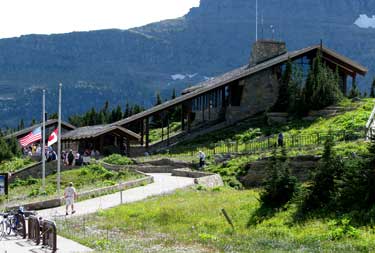 |
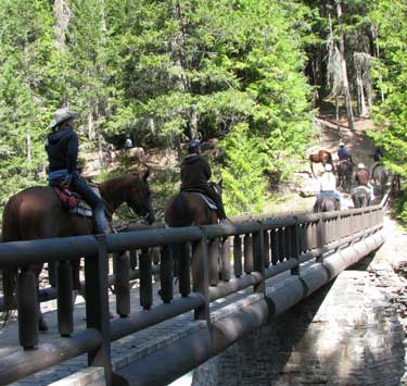
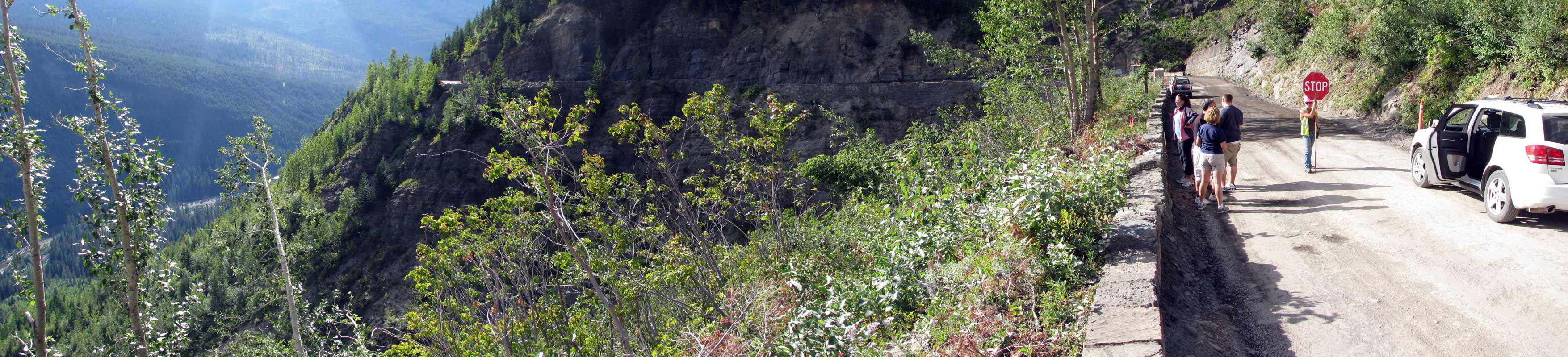
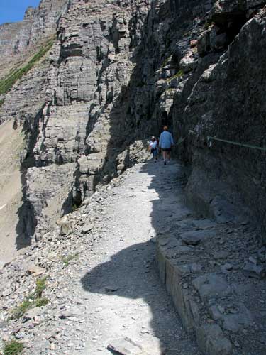
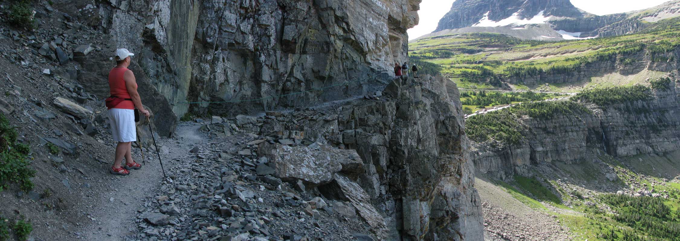
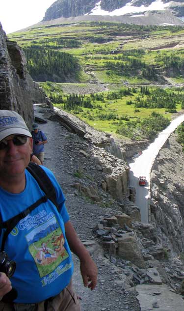
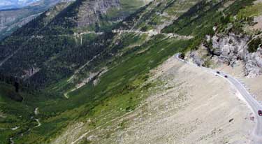
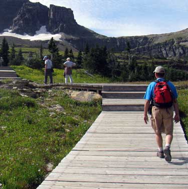
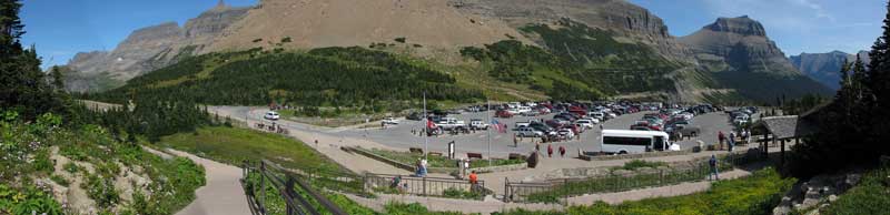
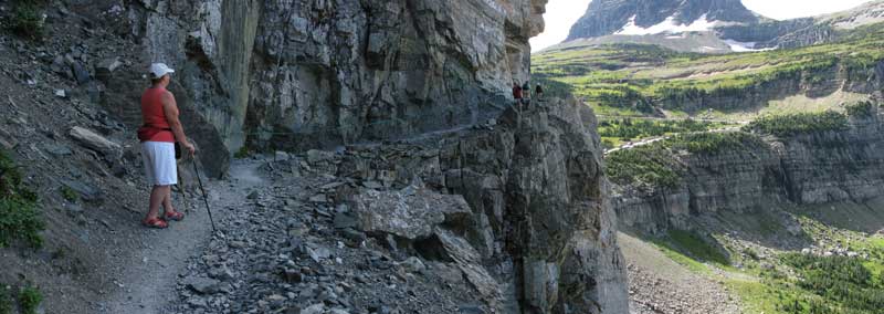
This is a very poplar location to visit while in Glacier. The Logan Pass parking lot is full and we had to fight for a parking spot. The visitor center is very nice with bathrooms, gift shop and back country information center. The flags are at half mast due to the death of Senator Kennedy. We did two hikes. The first is the Highline Trail. We noticed it on the way up the road because the trail is cut out of the side of a cliff over hanging the Going to the Sun Road. I thought we could get so good pictures of the road from this vantage point. |
|
|
|
 |
| This photo above gives you a good view of the Going to the Sun Road and of the Highline Trail. A young lady forest ranger is just now returning from the Highline Trail while Gwen waits for her turn. Note the familiar "U" shaped valley of a glacier carved valley. The road circle right below our trail. You can click any of the panoramas to enlarge. |
 |
|
 |
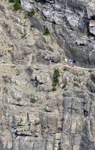 |
The photo to the left shows what the Highline Trail looks like from the ground.
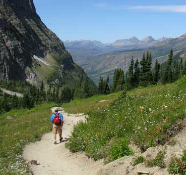
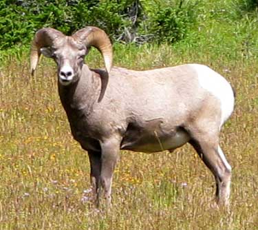
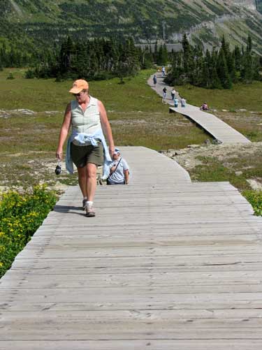
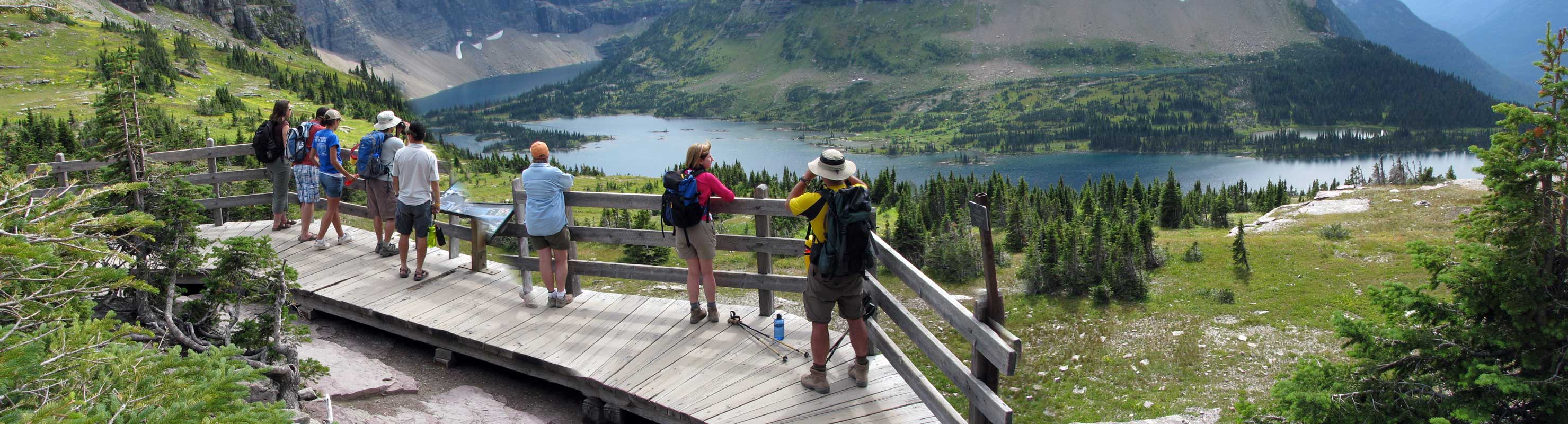
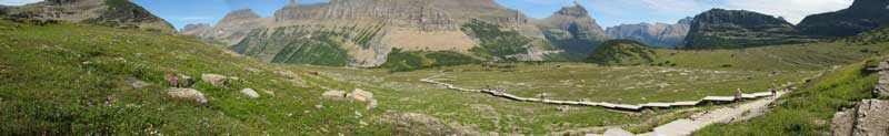
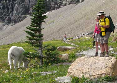
The second hike was to the Hidden Lake Overlook. It is a relatively short 1.5 miles one way with 500 feet of elevation increase. It is a very tame trail compared to the Highline Trail. Much of it is pavement or boardwalk. This trail was very popular so you will see many hikers along the route. We were also treated with Mountain Goats along the trail. They have apparently never been threatened by humans so saw us as just part of the herd. Our presents did not both them and they walked were ever they pleased even if humans were in their path.
In this first panorama of the Hidden Lake Overlook Trail, you will actually see Gwen twice since she was hiking at the time I took the multiple photos needed for the panorama. |
|
 |
|
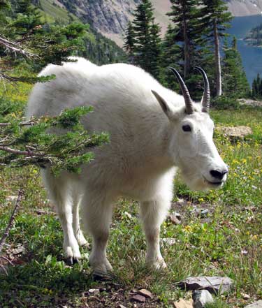 |
The goats are the stars on the mountains. Everyone had to take their photos including us. We just seemed to be part of the herd to them, they just ignored us. Pass your pointer through the photo to the left to see how everyone had to take their picture. |
|
We have reached our goal, the Hidden Lake Overlook. Gwen is standing in the center. The trail goes on to the lake but that's another 1.5 miles down a rocky steep trail and neither of us are up to that much hiking today. We did walk further up the trail and found another mountain goat to the right.
We finished our day with a dinner in the town of West Glacier. |
 |
|
 |
| Sunday, August 30, 2009: We are traveling south in Montana to visit the Big Hole National Battlefield. It was the scene of a battle between the US 7th Infantry and the Nez Perce Indians they were chasing. We have been able to camp at the May Creek Campground, only seven miles from the battlefield monument. This is also a location where Lewis and Clark traveled in 1806. We are camping on ground that they walked on 203 years ago. Ironically, the Nez Perce indians where guiding and helping Lewis and Clark all through this area. We are also camped on the site where Chief Joseph was trying to lead his people to Canada to avoid capture by the Seventh Cavalry. |
|
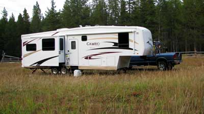 |
The May Creek Campground is a very nice campground only 7 miles from the battlefield. We chose to camp in the livestock field so we could have solar (assuming the weather clears) and satellite Internet. All of the campsites are surrounded by lodgepole pines. We drove through the worst hail storm I've ever driven in, but it cleaned the bugs off the trailer and did not damage our solar panels. We are at 6,300 feet so it's going to be colder here. The fee here is only $3.50 with a senior pass. |
|
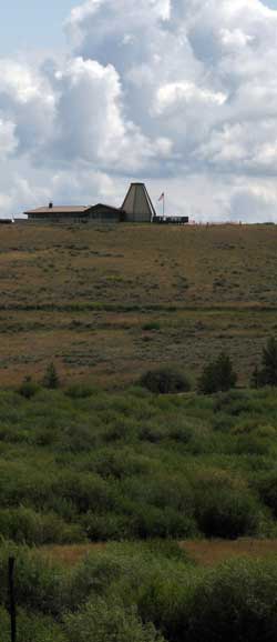
Monday, August 31, 2009: This is the day that all school age children in Montana and Idaho go back to school. While they begin their lessons we visited the Big Hole National Battlefield. The photo at right is of one of the visitor's centers for the Nez Perce National Historic Trail. As the Nez Perce were trying to avoid contact with the U.S. Army during their 1,170 mile walk, the 7th US Infantry under the command of Colonel John Gibbon caught them here in Big Hole and attacked in a surprise morning raid on the morning of August 9, 1877. The 1855 treaty between the Nez Perce and the US government was renegotiated in 1866 because miners trespassing on the Nez Perce reservation discovered gold. The new treaty gave the Nez Perce only 10% of the land they were promised in 1855. Five bands of Nez Perce refused to sign the new treaty and were referred to as "non-treaty Indians" from then on. In 1876 the government ordered the US Army to enforce the new treaty. The five bands tried to evade the army by traveling east to be with the Crow Indians, then headed north toward Canada. The plan by Colonel Gibbon was to surprise attack the camp of 750 Nez Perce (250 warriors, the rest women and children), surround them and get them to surrender. The army was to fire three volleys into the tipis at a low angle because the Indians were sleeping hoping to kill as many as possible then rush the village starting the tipis on fire and scattering the 2,000 horses belonging to the tribe. Gibbon had 135 soldiers plus 34 civilian volunteers. The surprise went wrong when one of the volunteers shot an Indian who was out checking on his horses.
Many of the photos below can be enlarged by clicking on them. If you see a fist with one finger, click the photo. Click the larger photo again to get the full view. |
 |
|
 |
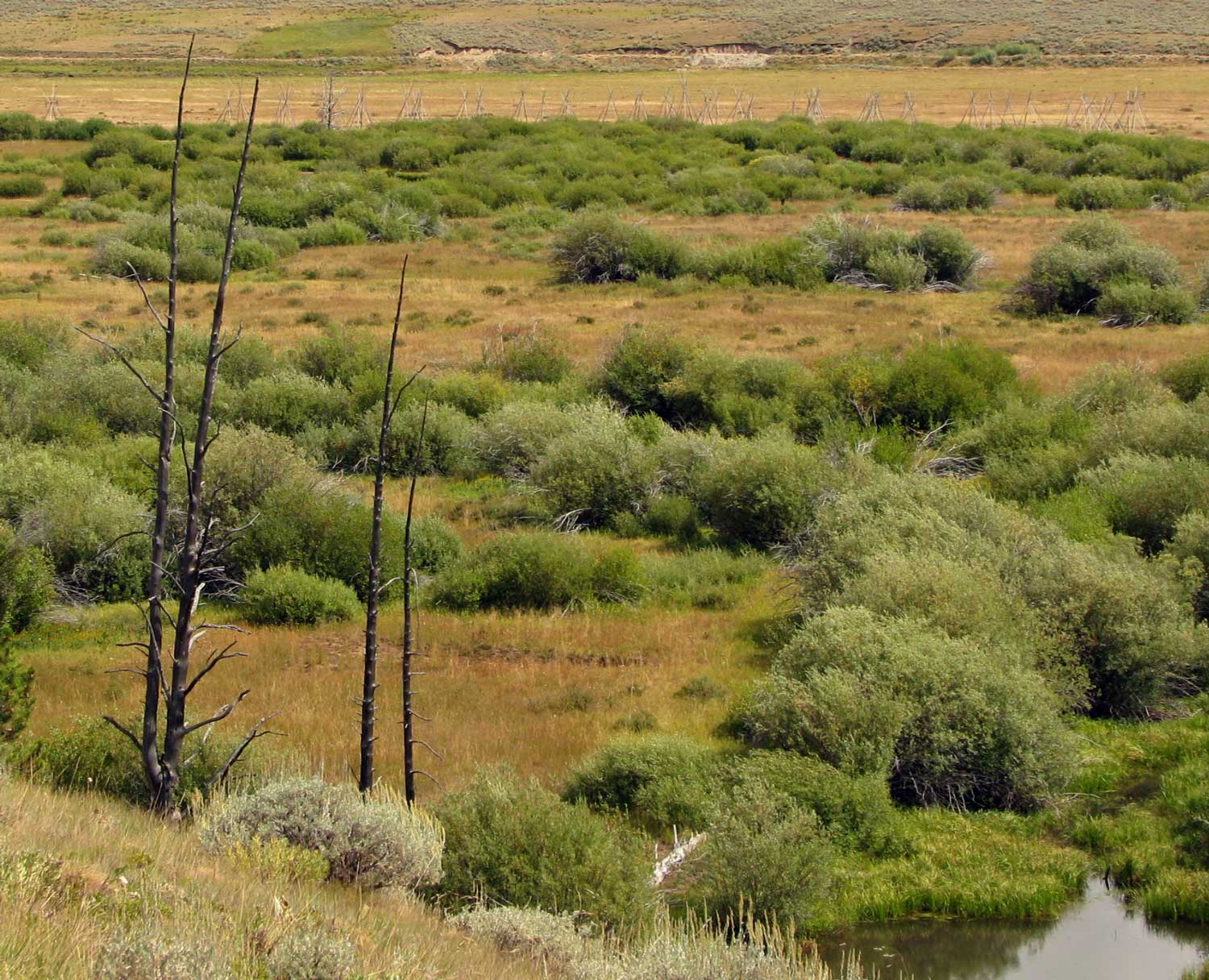
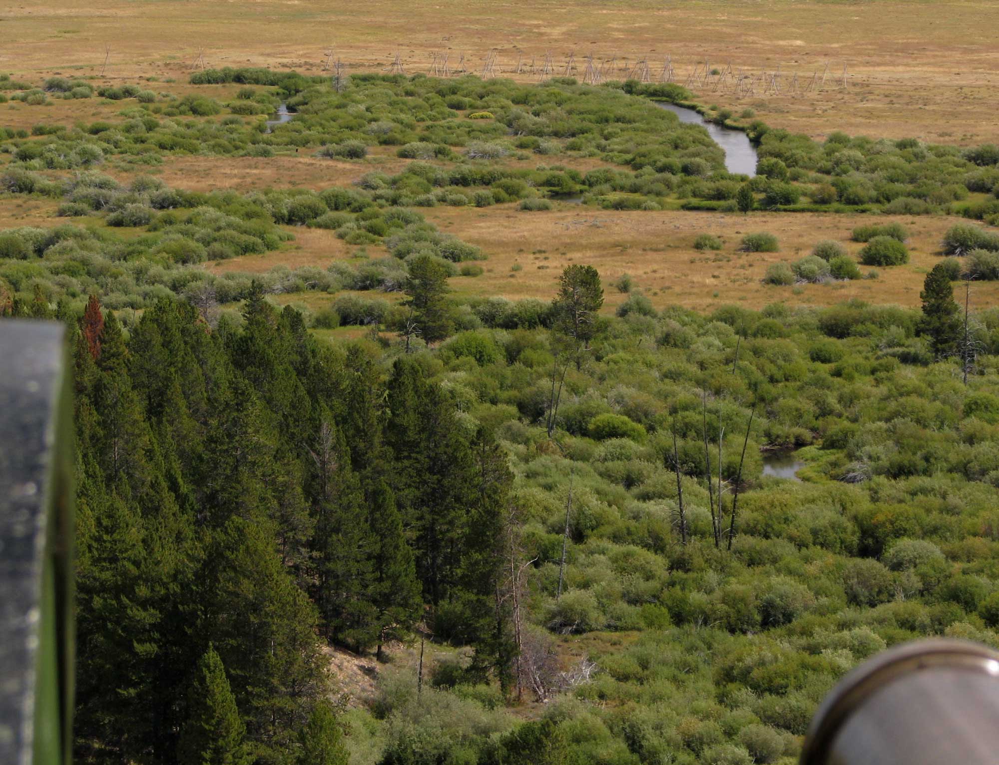
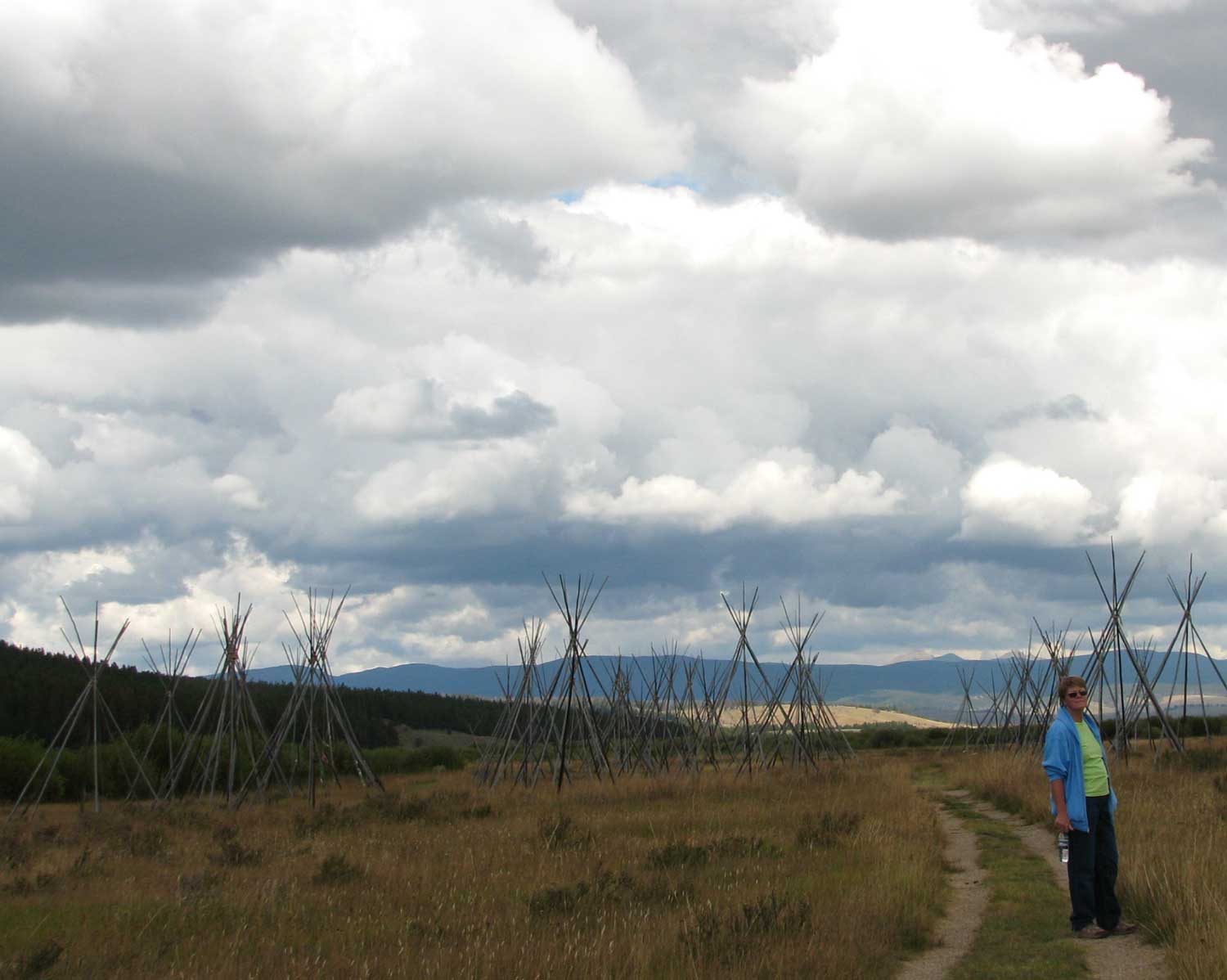
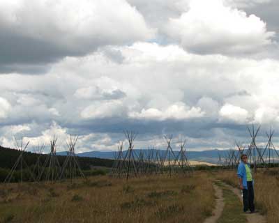
In the distance you can see the Lodge pole pine poles of the tipi location on the battlefield. Gibbon's men are hiding in the bushes on this side of the small Big Hole River with the intention of firing the three volleys then rushing across the river to charge the tipi camp. The first to fire were about 150 yards from the tipi camp. The camp was now aware of the surprise and began to panic. The army ran into the village setting many tipis on fire as they had been instructed to do. Chiefs White Bird and Looking Glass cried to the warriors to fight rather than run which they did. The army was soon in |
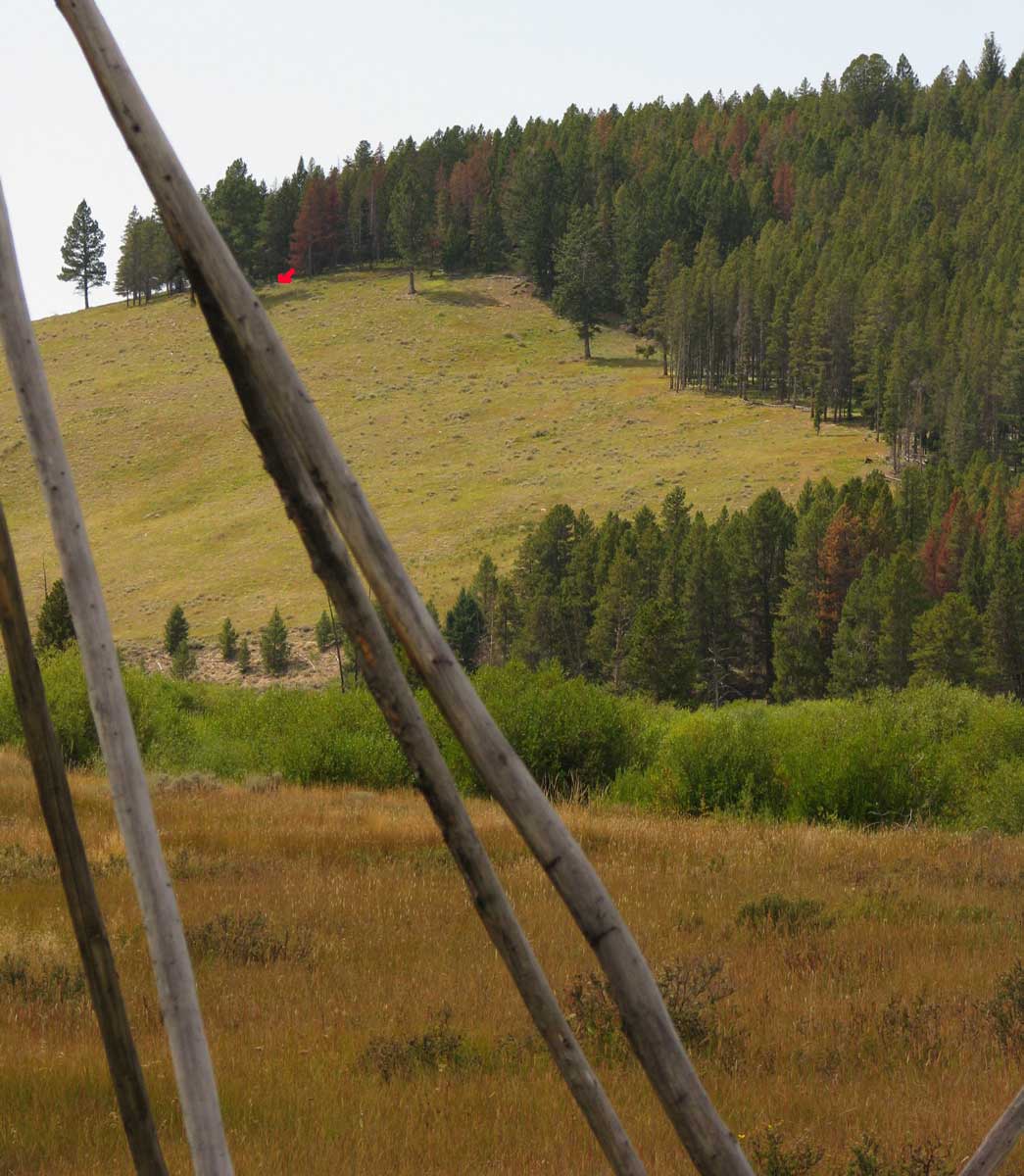
| retreat. The retreating army ran back to a low bench in the Lodge poles and began digging trenches to resist the counter attack. In the mean time, five soldiers with a 12 pound Mountain Howitzer arrived setting up on the western hill overlooking the camp. These five men got off two rounds when they were over run by the Nez Perce and lost the Howitzer. The photos below can be enlarged to show the view from the Howitzer location and the view toward the firing location from the tipis. |
|
|
|
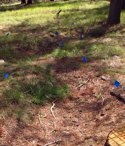
Blue flags mark the locations of trenches dug by the retreating army. They were pinned down for 24 hours which allowed the Nez Perce to regroup and flee to the south. 29 soldiers and volunteers were killed with 40 wounded. 90 Nez Perce were killed, 60 were unarmed women and children.
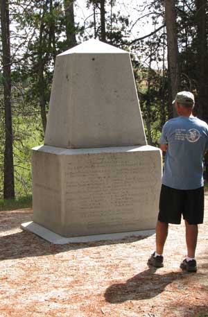
In 1883, the US Army placed the 6 ton monument to honor the soldiers who died here. Apparently in 1883 it was honorable to murder unarmed women and children.
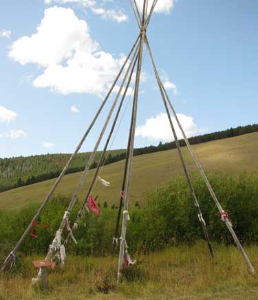
Chief Joseph tipi location is pictured below. Chief Joseph was NOT one of the war chiefs but a chief negotiator. |
 |
|
|
 |
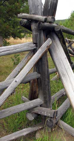 |
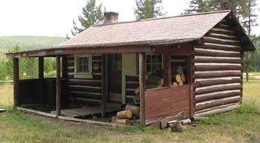
We continued our day of exploration and found the Hogan Cabin which was built in 1920 for forestry crews. It can be rented now for $25/night. I had to take a photo of the gate to the right because it was built without hinges. It pivots on a stone.
Click the map below to enlarge and see the whole area including May Creek Campground where we are parked. The Big Hole Battlefield in only a few miles east of our campground. |
|
|
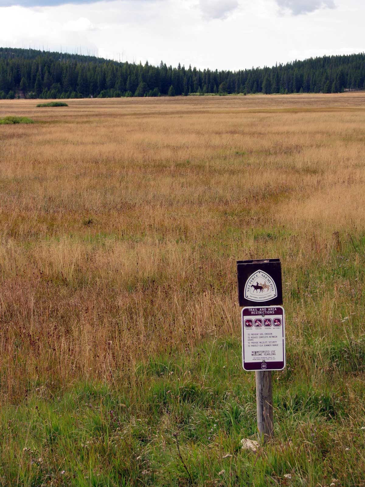
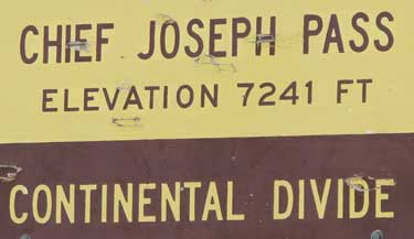
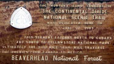
| We discovered a national trail we did not know about. The Continental Divide National Scenic Trail. Of course this is our first time to cross the continental divide and now we have done it several times as we have been exploring. I've hiked much of the Pacific Crest Trail so now will have to hike some of this trail. |
 |
|
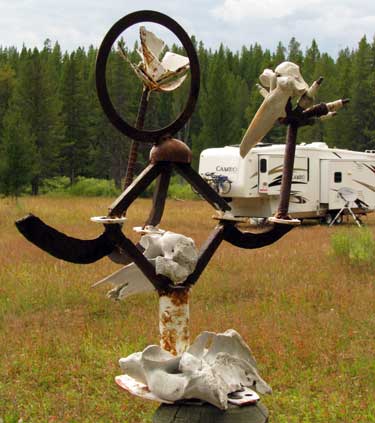 |
Near our campsite is a sculpture bolted to one of the fence posts separating our pack animal staging field where we are camped with the actual campground. It's mostly metal except for the animal bones someone has placed on it. |
|
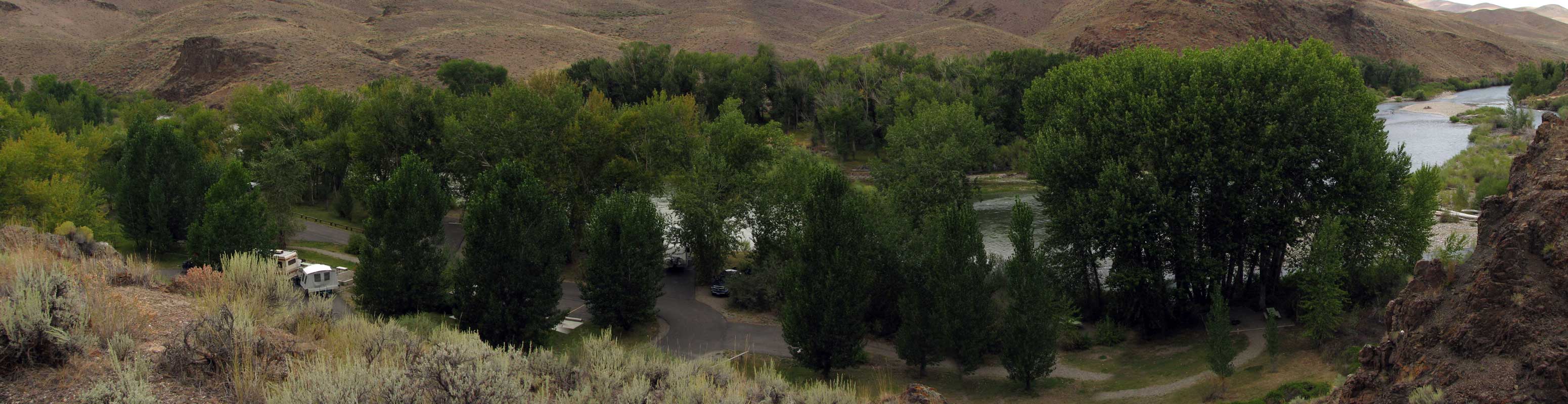
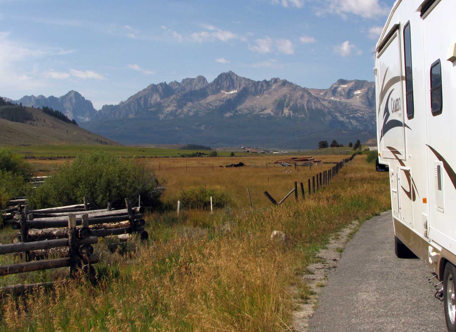
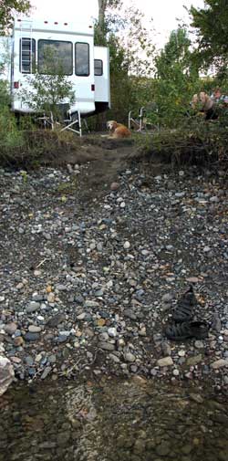
Tuesday, September 1, 2009: We left Montana and the May Creek Campground to continue south into Idaho. We passed through the city of Salmon, Idaho and made it to within 14.9 miles of Challis, Idaho when we spotted the Cottonwood Recreation Area on the Salmon River. I figured this would be a good stop for lunch and maybe they have an RV dump station. YES! They do have a dump station, let's drive through the park to see what else they have. Wow! Only a few other campers and many sites right on the Salmon River are available. They have water, vault toilets, paved roads and sites, fire rings, garbage pickup and the price is only $5 with a Senior Pass, let's stay a couple of days.
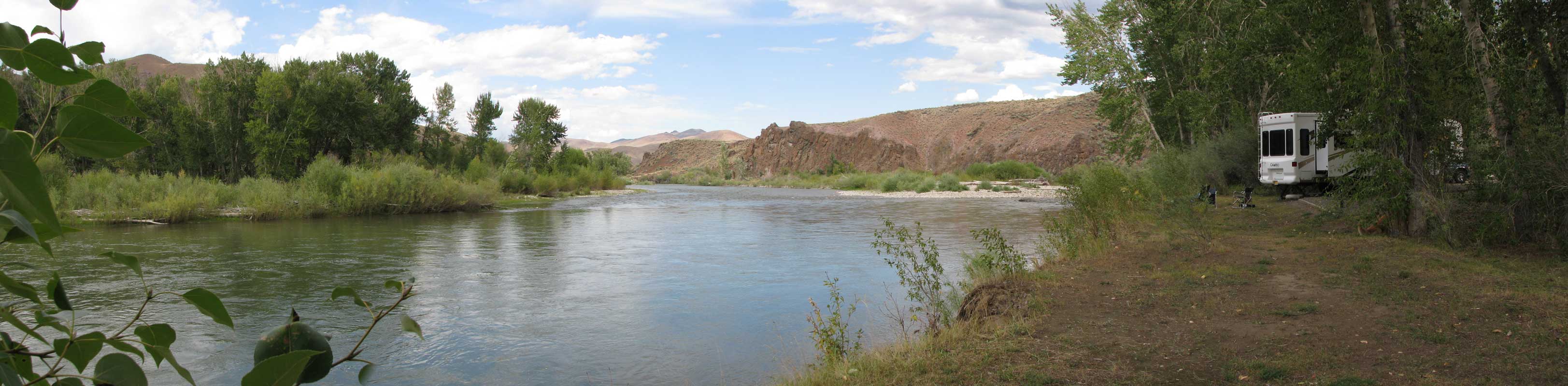
In the photo to the right, Gwen is in my chair reading her book on the right, I'm standing in the Salmon River to take the photo. Both the photos below can be enlarged, just click on them. We are hiding in the trees toward the right of the photo, look for the fifth wheel with the bikes on the front. Yes, trees are a problem ... we will only get about 2-3 hours of sunlight but we are fully charged and we're only staying two nights. Morgan is going to love this site. She's already been in the river several times. This is the nicest BLM campground we've come across so far, especially for the price. |
 |
|
 |
 |
|
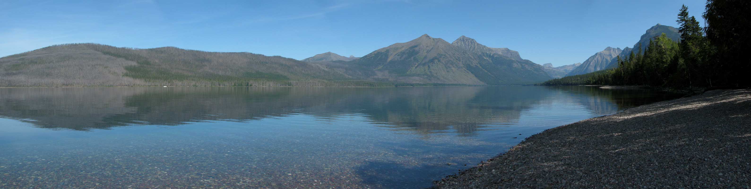
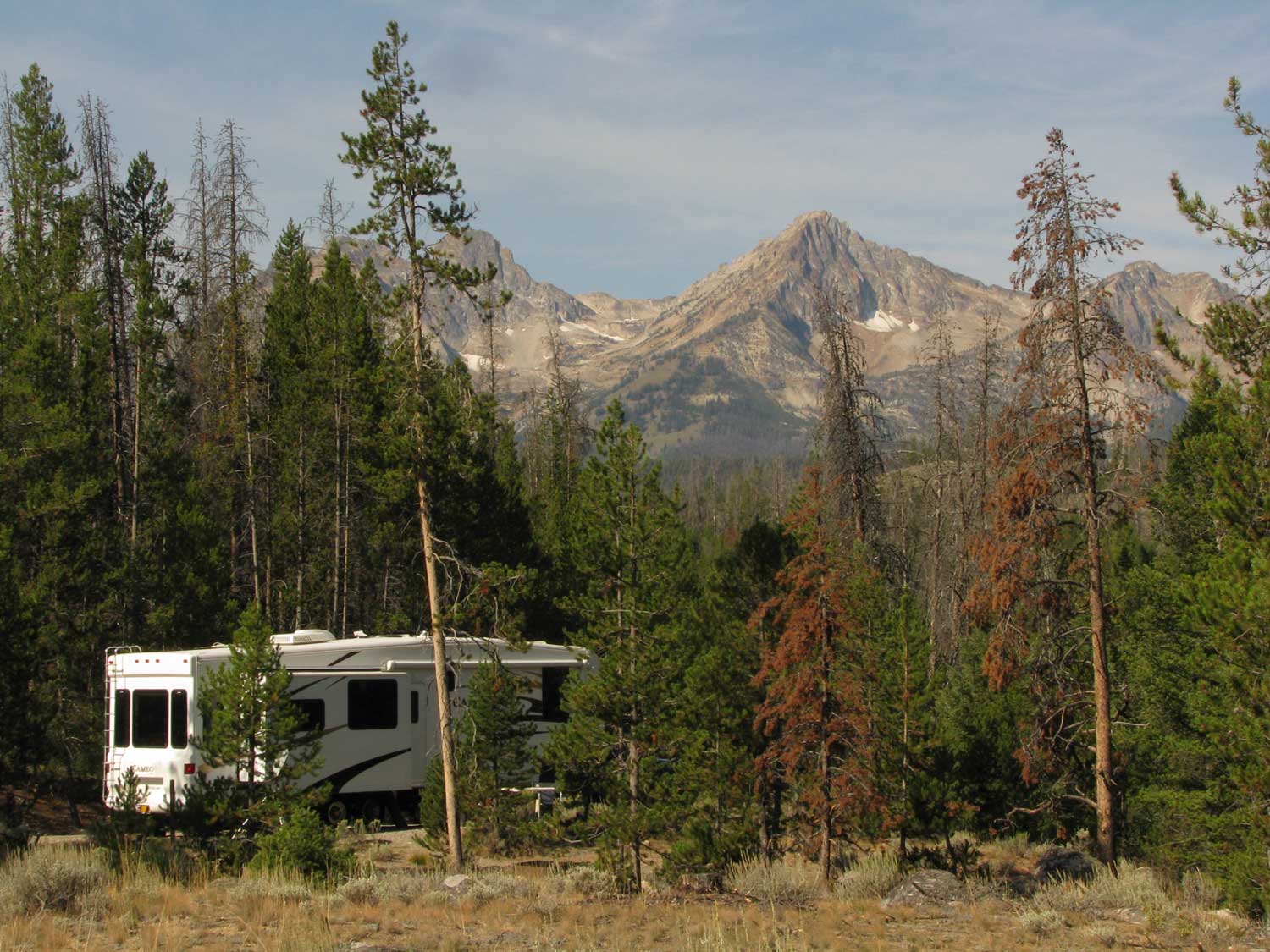
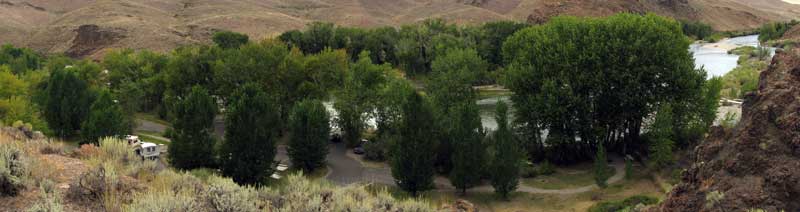
| Thursday, September 3, 2009: Today was a short travel day from the Cottonwood Campground north of Challis, Idaho to Stanley, Idaho. Above is our first view of the Sawtooth Mountain Range. This time we've found a free location to boondock next to the Salmon River. We are only about three miles from the Redfish Lake and Lodge. You can click any of these photos to enlarge. |
|
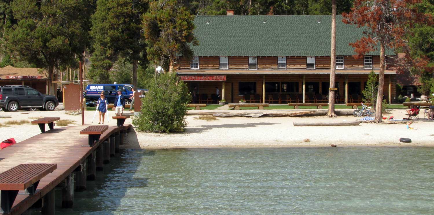
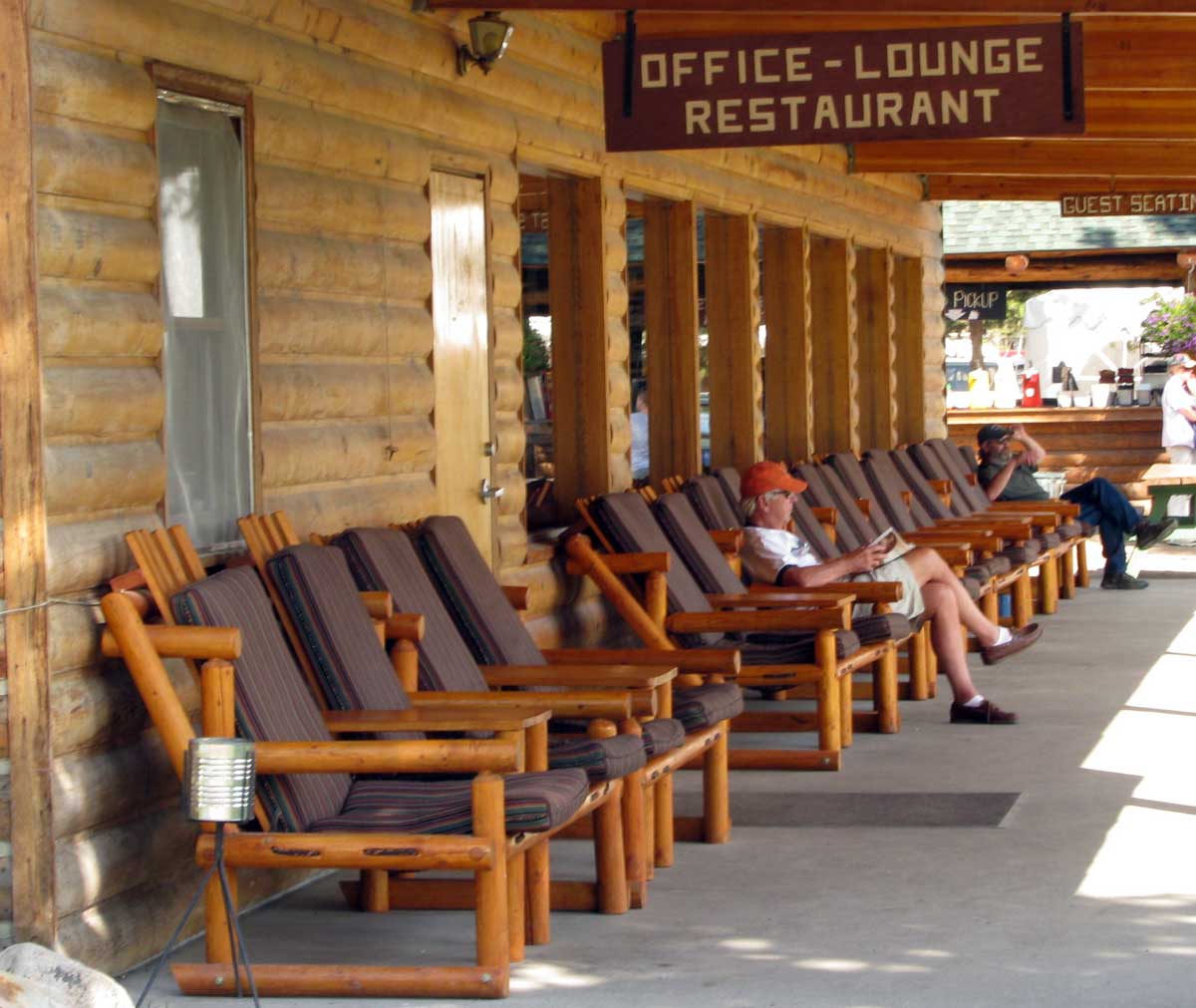
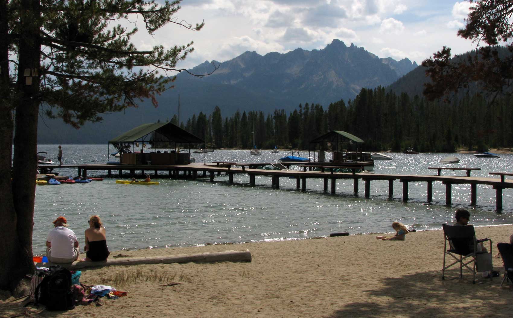
| The Redfish Lodge is only a few miles south of Stanley and on the west shore of Redfish Lake with the Sawtooths on the eastern shore. The Lodge is very welcoming and seems to be ready for the Labor Day weekend. The restaurant looks attractive with competitive prices. The patio looks like a great place to sit and read a book or watch the activities on the beach. The wind was blustery so not many paddlers in the lake. We are close enough to the lodge and lake to enjoy whatever is happening at the lodge. Our priority for tonight is to listen to the Boise State vs. Oregon Ducks football game on satellite radio. |
|
 |
Friday, September 4, 2009: Here we are boondocked along the Salmon River near the Sawtooth Mountains. Yes, many of the trees around us are dead or dying. In some cases it looks like as many as 3/4 of the forest is dead. I checked with the forest service and these Lodgepole pines are being attacked by the Mountain Pine Beetle which kills it's host. The healthier trees have been able to successfully defend against the attack but that is very few. In a hundred years or more, this will be a healthier forest because only the strongest trees will survive so it will be the strong trees reproducing the new forest, at least that's the theory. |
|
 |
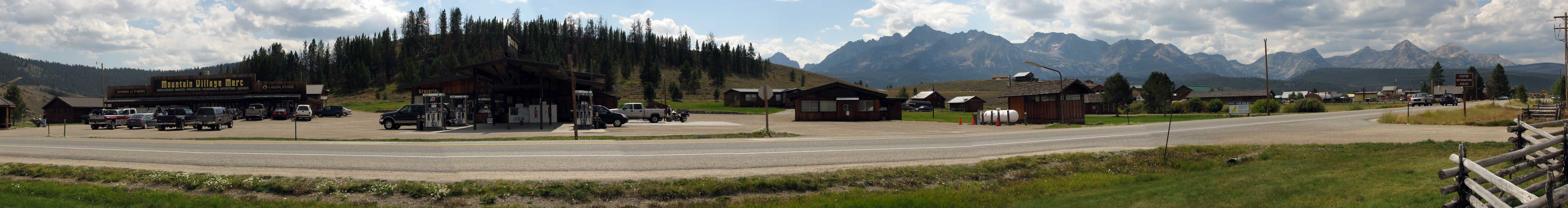
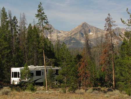
| Saturday, September 5, 2009: Stanley, Idaho is a tiny town with a population of 100 residents. It is known as the gateway to the Sawtooth Mountains which you can see in the distance. The town is totally centered around the sports minded person and traveler. There are several sports and outdoor supply stores, one grocery store and several restaurants. It appears to have winter sports activities with many snowmobile and cross country ski trails marked in the forest. This is Labor Day Weekend and every campground is full. The town seems busy. The sports stores have Labor Day sales happening but I couldn't find a T-shirt my size or in one case I wasn't going to buy the T-shirt I wanted with a discount of only 30%. Perhaps I'll be sorry when I'm wintering in Arizona and I don't have a Stanley, Idaho/Sawtooth Mountain T-shirt to wear. I've always got my Chicken T-shirt from Baker City, Oregon to wear. Click the photo to enlarge. |
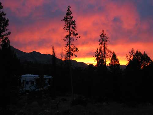
| Monday, September 7, 2009: This was a travel day from Stanley, Idaho returning to Meridian, Idaho to visit Gwen's grandchildren and watch them play sports. The photo at right is one last parting show at Stanley last night. We got a sunset just before the lights went out. Our trailer is hiding in the shadows, bottom left. The Sawtooths are in the distance. Almost this same daylight angle. |
 |
|
 |
Tuesday, September 8, 2009: We had a 7:30 am appointment to get our "axles flipped". Currently, the axles sit on top of the underside of the leaf springs. Flipping them would put the axle on the underside of the leaf spring raising the trailer about 5 inches taller, |
|
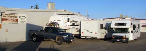
making the trailer tow level with the truck and giving much less chance that the tail end of the trailer will hit the ground. This is important since we seem to take this trailer into very tight conditions over rough ground. During the first tow after flipping the axles, it seems to handle better. We decided to "become invisible" at Wilson's RV Repair in Boise by parking among the other RVs. We spent the night camped here, and nobody noticed. We didn't have to go far to make our 7:30 am appointment.
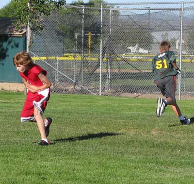
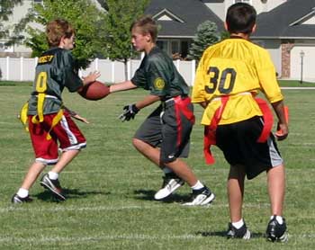
Gwen's 6th grade grandson, Jake (in red), is in flag football. We attended a practice this afternoon. In the play at right, someone is faking a handoff, can you tell who has the ball? Pass your pointer through the photo to see Jake catch a forward pass for a giant gain in yards. |
 |
|
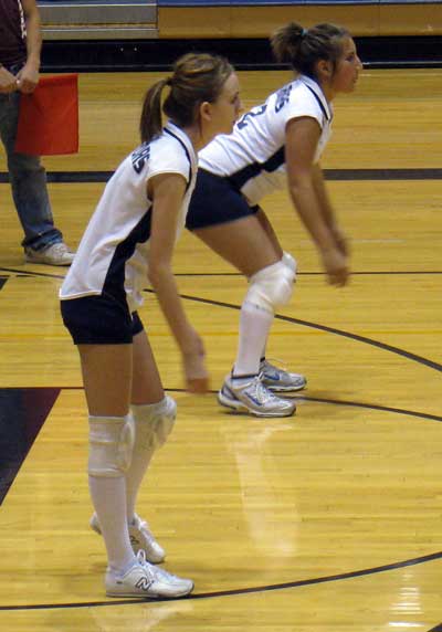 |
Wednesday, September 9, 2009: Today was Melanie's turn. Melanie plays volleyball for her high school freshman team. She is nearest the camera. Both Gwen and I have never seen a high school volleyball game before tonight so it was an education for both of us. It was interesting watching these young ladies play there best while representing their schools. The cheerleaders were there to help the players too. |
|
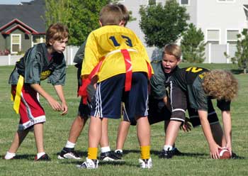
| Saturday, September 12, 2009: This was a football Saturday for us. We began the day watching Jake place flag football. Jake's in the red shorts. He plays for the Packers. He received the ball for a 2 point conversion score and made gains with several running plays like the one below. Click any of these photos to enlarge. |
 |
|
 |
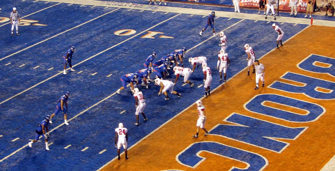
We continued with football Saturday by attending a Boise State Football game in their stadium, the only stadium with blue turf. If you aren't a Boise State fan, then you don't know they are consistently a winning team. This is the team who beat Oklahoma in a bowl game several years ago. The photo below is a perspective of the stadium. Click the photo to enlarge. There are more than 32,000 fans watching the game today. |
|
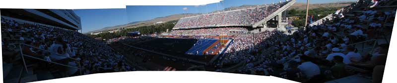 |
| Boise is playing the Miami University Redhawks from Miami, Ohio. Miami came a long way for nothing, since Boise took the game with a score of 48 - 0. The photo to the right is of one of the many Bronco touchdowns. Boise beat the Oregon Ducks last week holding them to ZERO first downs for the first half of the game. The most exciting part of the game was getting to sit in the stadium with 32,000 other fans. |
 |
|
|
|
|