 |
|
|
New Mexico, 2010
page 8 |
 |

|
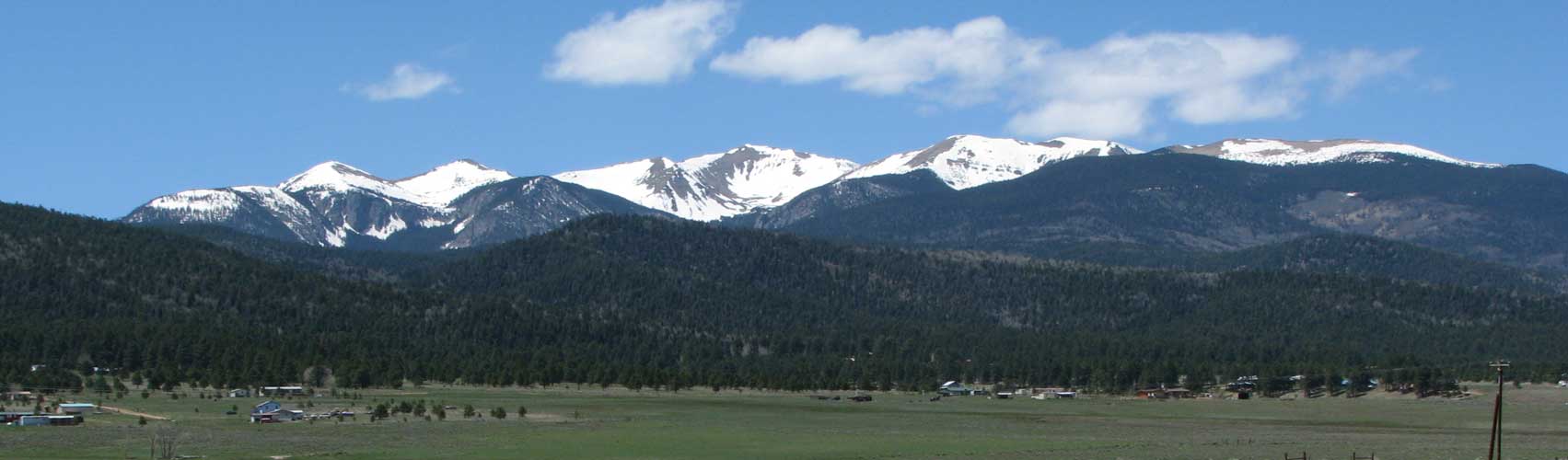
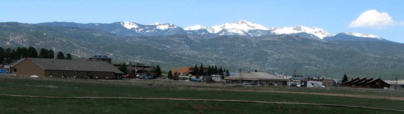
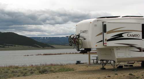
Tuesday, May 11, 2010: Today was moving day, we moved to Eagle Nest State Park near Eagle Nest, New Mexico. It was only a 1.5 hour drive from Raton and about 1,000 feet higher. We are now at 8,219 feet at the foot of the highest mountain in New Mexico, Wheeler Peak at 13,161 feet. Eagle Nest is a very small town with many RV Parks, a couple of restaurants and several real estate agents. It also has a good sized lake (Eagle Nest Lake) and (of course) today is very windy. We are parked on the north end of the lake with nothing to stop the wind so today's gust was 48.5. Only 9 miles down the road is a ski resort town of Angel Fire, New Mexico. The photo above is of Angel Fire with Wheeler Peak in the background. Click the photo for another view of Wheeler Peak. |
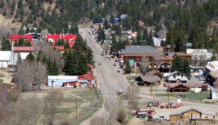 |
| Wednesday, May 12, 2010: We made our first trip around the Enchanted Circle today but spent most of our day in the ski resort town of Red River, only 17 miles north of our camping location. Since it's May, the town was very quiet with many stores closed until the week before Memorial Day. It was nice walking through the town during off season. We learned that the stores in town are actually busier during July and August than during the ski season. Folks from all over New Mexico come to Red River to stay cool. There are thousands of motel rooms in this town along with RV spaces. When walking through town, I could see it was possible to rent a motel room literally only feet from the nearest ski lift. |
 |
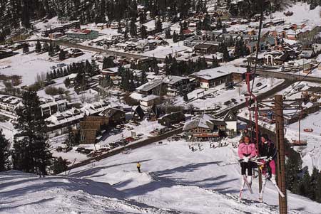 |
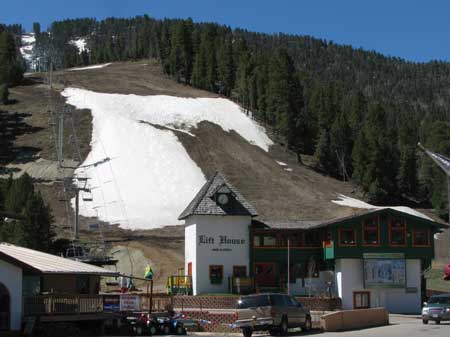
The Lift House Bar and Grill is located at the base of the Red Chair ski lift which goes to the top of the mountain. The view to the left is a postcard (photographed by Carl Brown) of a winter scene on the red chair looking back toward the Lift House Bar and Grill.
We'll need to take more time to visit the other towns on the enchanted circle, especially Taos. |
|
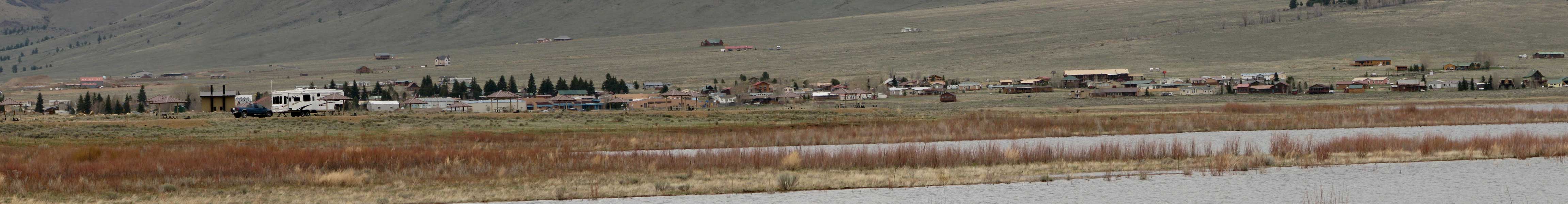
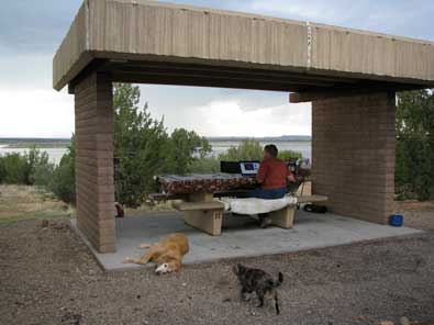
| Thursday, May 13, 2010: We are camped at Eagle Nest State Park on the shore of Eagle Nest Lake and only 2 miles from the tiny resort town of Eagle Nest. By the way, nearly the entire business district of Eagle Nest is for sale. There is a storm predicted for later today and tomorrow, you can see the storm clouds approaching. To the west is Wheeler Peak, New Mexico's highest peak. |
 |
|
| |
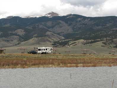 |
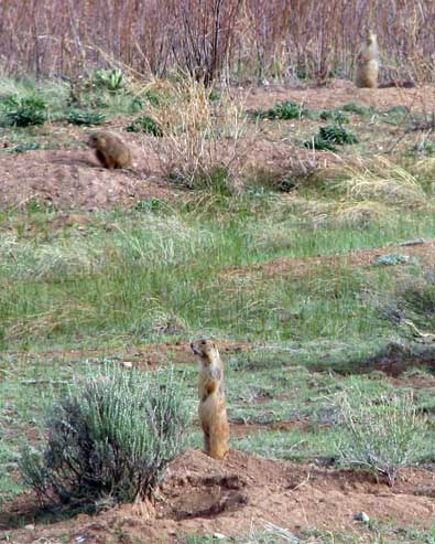
This area is essentially a huge mountain meadow about ten miles wide by 20 miles long. The lake is at 8,220 feet elevation. We are surrounded by prairie dogs. They seem to be all over the meadow and only 25 feet from our campsite. I've seen as many as a dozen at any one time.
Be sure to click the photo at left to see a larger view with the tiny town of Eagle Nest in the background. |
|
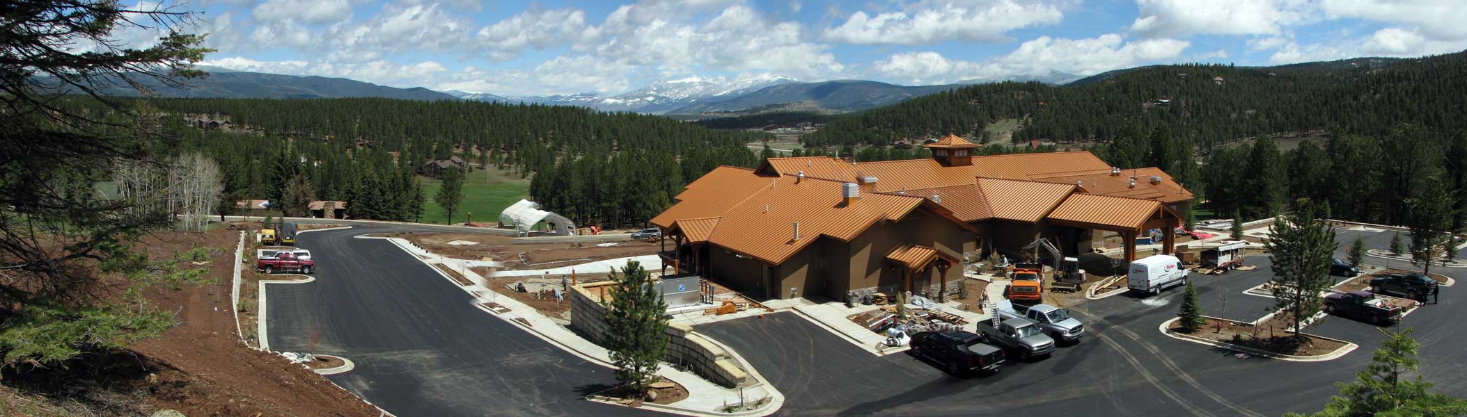
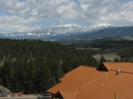
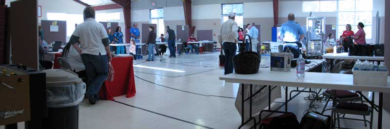
| Saturday, May 15, 2010: We drove to Angel Fire early today to attend the Health Fair held in the Community Center (photo below). As retired folks, we watch for such fairs to get inexpensive blood tests and other free or inexpensive checkups. We gave an address of General Delivery, Santa Rosa, NM which will be our next destination. It was a wonderful fair. We continue to be amazed at how friendly everyone in New Mexico is. The photo at right is an Angel Fire Resort development. The town of Angel Fire is about a mile just beyond the trees in the distance. We had snow last night, so you are also seeing fresh snow on the mountains. |
 |
|
 |
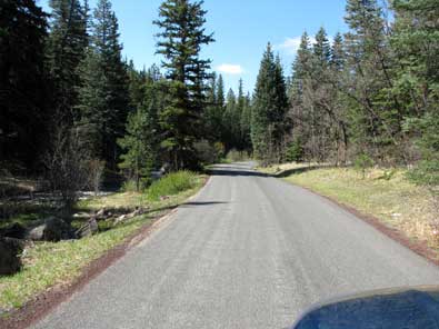 |
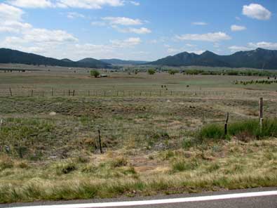
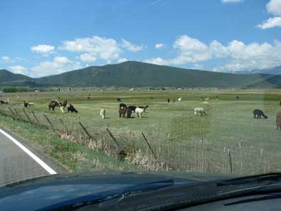
Monday, May 17, 2010: Moving day again from Eagle Nest State Park at 8,200 feet to Santa Rosa Lake State Park at 4,700 feet. While traveling south, the road became nearly single lane with no center line. Note Coyote Creek to the left of the road. We stopped at Coyote Creek State Park but Gwen was anxious to get to a lower altitude so did not stay. It certainly looked like our kind of park. We also passed many mountain meadows as we drove south. We wanted to stop at the Alpaca ranch but didn't see much parking space so will have to return. We arrived at Santa Rosa Lake State park in time for a thunderstorm but much warmer weather. |
|
|
|
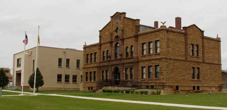
| Tuesday, May 18, 2010: We took a quick drive into Santa Rosa today. We did not get a chance to see the town before since we drove straight to the campground, 7 miles north of town yesterday. The historic Guadalupe County Courthouse is downtown. The photo below is just across the grass from the courthouse. |
 |
|
 |
 |
| If you recall, last summer I purchased new tires for the truck at Les Schwab. These were not cheap tires since they must be rated at 3,750 lbs per tire. I've been noticing that the rear tires have considerably less rubber than the front tires. They need to be rotated and I can't wait to return to a Les Schwab where rotation is done free. I stopped in Santa Rosa and paid a tire shop for the rotation. It was quick service. Apparently, the near 4,000 lbs of pin weight of the trailer takes a toll on the rear truck tires. |
|
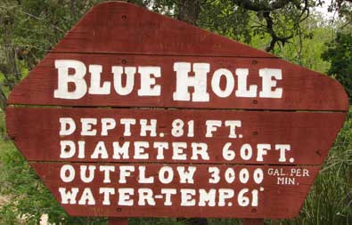 |
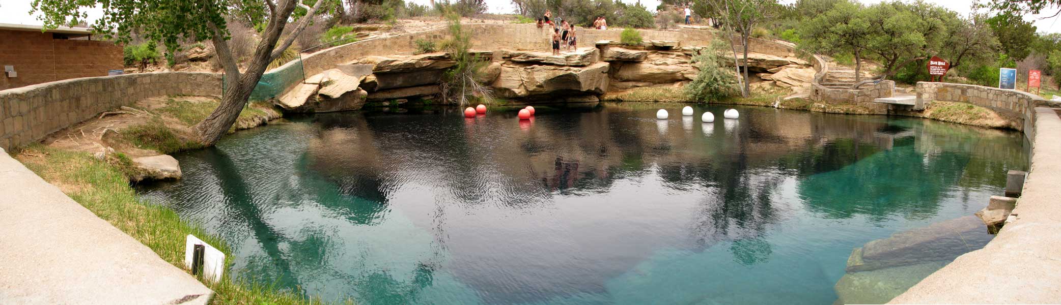
One of the attractions in Santa Rosa is what they call the "Blue Hole". This is a sink hole which fills with crystal clear spring water. It is a popular swimming and scuba diving location. We visited the hole today. There were teens also visiting and apparently swimming although they were all just standing around while we were there. The water temperature of 61° is very cold. I remember the temperature of Lake Tahoe in California (where I lived in a previous lifetime) is 65° in the summer and it feels very cold. Click the photo to see Blue Hole. |
|
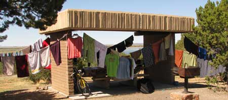
| Thursday, May 20, 2010: It's laundry day. Good thing we are the only campers in this campground. This was a warm day so it didn't take long to have dry clothes. We also visited the Route 66 Cafe and reviewed our experience on Yelp. You can access Yelp from the home page, scroll to the bottom and look on the left. |
 |
|
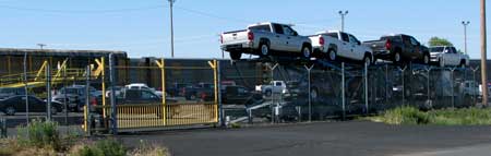 |
Friday, May 21, 2010: Santa Rosa's claim to fame is the Union Pacific Railroad auto transfer. The train transporting automobiles from the east, stop here, leave the transport cars where they are unloaded of their automobile cargo then parked |
|
| temporarily while waiting for truck transport to the final destination. The truck in the photo is nearly full. It left the yard about 15 minutes after I took this photo. Click the photo to get a better view of the railroad transport car. |
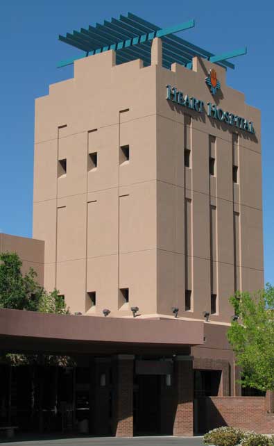
| Tuesday, May 25, 2010: You can read Gwen's full report here. On Saturday morning Gwen was feeling ill so we decided to try the health center in Santa Rosa. It was closed so we drove 120 miles to Albuquerque to visit and urgent care center. The tests they did showed everything normal but Gwen continued to feel ill so the doctor sent her to Heart Hospital for a blood test. We learned you never go to a hospital complaining of "chest pains" unless you want to stay the night. We ended up in the "medical labyrinth". After two days of tests with normal results, the doctors guessed it was "acid reflux". Heart Hospital of New Mexico is a very nice hospital with very friendly and thorough staff. If you find yourself feeling ill, you need to find a "primary physician" quickly during the weeks so you don't end up in an emergency room on a weekend. |
 |
|
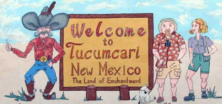 |
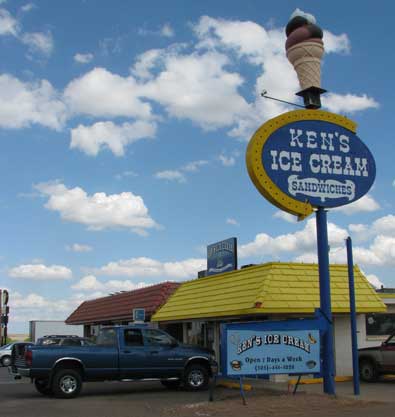
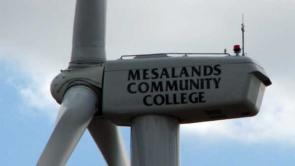
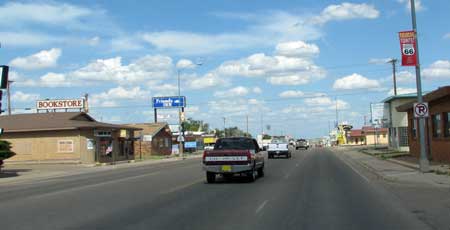
Wednesday, May 26, 2010: We drove to Tucumcari today only because we liked the name, "Tucumcari". Route 66 goes through town. There is a dinosaur museum, a community college and a downtown historic district which is mostly empty. |
|
We did enjoy a K-Bobs lunch then visited Ken's Ice Cream for desert.
The community college trains crews for wind generators so the center of the campus as this 300 foot tall generator. It can be seen from many miles away. Click the generator photo for the name of the community college. |
 |
|
|
 |
Thursday, May 27, 2010: We have discovered (new to us) grocery store, Whole Foods Market. We first discovered the market in Santa Fe but now have visited the two locations in Albuquerque. This is a market dedicated to healthy food and great presentation of food products. I think it took us 3 hours to leave the market the first visit because we were so impressed with the displays and quality of the product. I've learned my children know of the market but think it too expensive. They have a healthy food deli and really great coffee so we've had lunch/breakfast a couple of times too. |
|
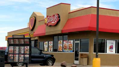
| Friday, May 28, 2010: OK ... we had to laugh about this ... where do retired folks go for cheap entertainment? Well, it doesn't HAVE to be a Carl's Jr, any fast food restaurant which lets you get your own drinks will do. For $3 we got two small drinks but could then refill them as we sat and watched CJ customers. Actually, because this CJ is next to a Loves Truck Stop, it had CNN news |
 |
|
 |
playing. Santa Rosa has no where else to go, not even a place to shop so CJ had to do. It took us about an our to sip our two drinks and refills. Oh, it was also air conditioned and pretty muggy out so we appreciated that too. We did visit Loves where I bought fuel injector cleaner and Gwen bought a new "trucker's shirt".
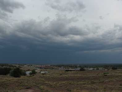
We are camped under those dark thunder clouds with Santa Rosa in the foreground. Tomorrow should be better, there is a softball tournament in town for the Memorial Day weekend. |
|
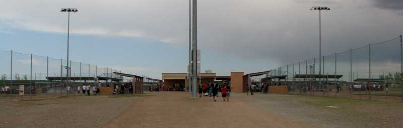 |
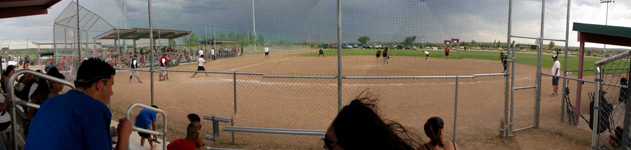
| Saturday, May 29, 2010: We spent the afternoon watching three softball games during the Santa Rosa Memorial Weekend Softball Tournament. We were glad for the cooling approach of the thunderstorm which really never arrived but high winds DID arrive and we were facing the winds for two of the three games. Santa Rosa has a nice softball complex with four fields. All of the teams we watcher were from Albuquerque. I believe they come to Santa Rosa because they can camp in the grassy areas near the fields. This really looks like a party weekend for the Albuquerque teams. Click the photo below to enlarge. |
 |
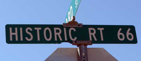
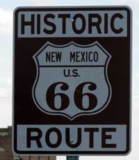
| Monday, May 31, 2010: New Mexico attracts tourists however they can. For example, every other town in southern New Mexico has a Billy-the-Kid grave site, home site, Mother's home, or bar with a stool where Billy sat. Here in northern New Mexico, Route 66 stretches across the state and every town it touches takes the "historic" advantage. Makes me want to see the old Route 66 TV show. |
|
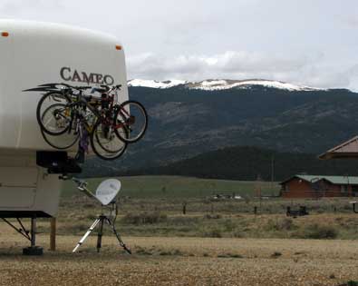
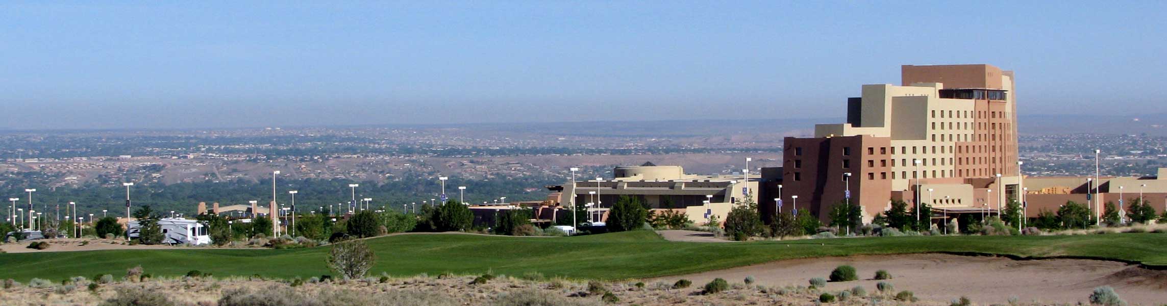
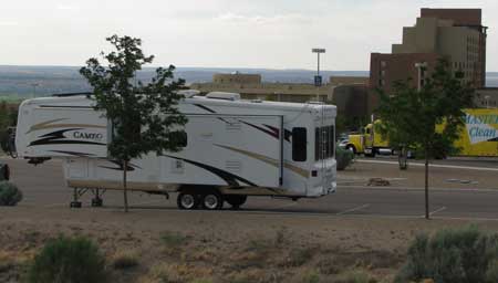
| Tuesday, June 1, 2010: This was moving day from Santa Rosa to Albuquerque, New Mexico. We had debated staying at the Elks Club but it is located near the Albuquerque airport and the Kirtland Air Force Base so it's a noisy place to be. Additionally, Morgan and I visited the Elks club when Gwen was in the hospital a couple of weeks ago and anytime Morgan stepped off the sidewalk she ended up with thorns (goat heads) in her paws. For those reasons, we've decided to camp free at the Sandia Resort and Casino parking lot. We are at the far end of the parking lot next to the golf course. So far, the only danger here are golf balls flying off the course. I had not planned to put our out satellite dish but the casino will not give out a wireless access code unless you have a room. I put up the dish on Wednesday afternoon. |
| Wednesday, June 2, 2010: I was back on my road bicycle for a nice morning ride although traffic was heavy on some of the city streets. Wednesday is half off at the Sandia buffet so two can eat for $10. The buffet is outstanding with great food and excellent service. Last evening we played bingo at the casino all evening. We did not win but there were many winners of $75 to $4000. We lost only $10 at bingo but decided not to play this evening. |
 |
|
 |
| Thursday, June 3, 2010: We are camped at the far left of the photo on the edge of the parking lot and about 50 yards from the fairway of the golf course. You can click to enlarge the photo. Today was shopping day to Whole Foods Market, Wal-Mart, Costco and Hobby Lobby for yarn to create a project by Gwen. This was a very warm day so we are both anxious to get to a cooler elevation, although we are parked at 5,400 feet. We are hoping another couple of thousand feet will make it cooler. Gwen is off playing bingo tonight, I hope she wins. |
 |
Friday, June 4, 2010: We've moved about 100 miles to the west of Albuquerque to Bluewater Lake State Park at 7,420 feet hoping for cooler weather. Actually, the daytime weather does not seem cooler but night time cools off much quicker. We expect to be here for a couple of weeks. We actually have a two week reservation for a space here but that won't begin until June 8. We'll check out the site to see if we really want to move to that spot. |
|
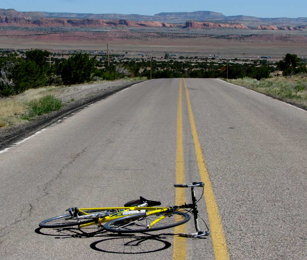
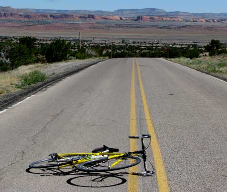
| Saturday, June 5, 2010: This is my new morning exercise route. I must climb to a point above the campground then descend to Prewitt, New Mexico, 1,000 feet below the state park. Click to enlarge. You can see I-40 in the valley with the red rock hills in the distance. I'm about half way back up the climb above the valley. Don't worry, I laid the bike in the road to give perspective to the view. I'm not putting on a lot of miles but the climb has extended my bike ride to more than an hour. |
 |
|
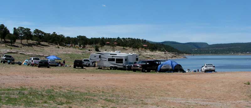 |
| Sunday, June 6, 2010: On the weekends, people seem to like to camp next to the water at Bluewater Lake. It seems pretty muddy to me and you must deal with the wind without anything to block the force. I'd rather be in the campground which is within walking distance of this view of the lake. There were lots of loud parties happening this weekend on the lake. The nice thing about today was the surprise thunderstorm this afternoon which cooled everything off and wet down the dust. |
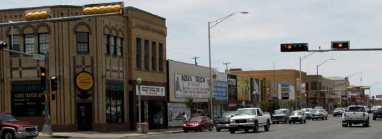 |
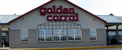
Monday, June 7, 2010: Our first visit to Gallup, New Mexico included a trip down main street on historic Route 66, Robin Hood at the movies, dinner at Golden Corral plus we shopped at Wal-Mart twice. Gallup is a city of more than 20,000. |
|
|
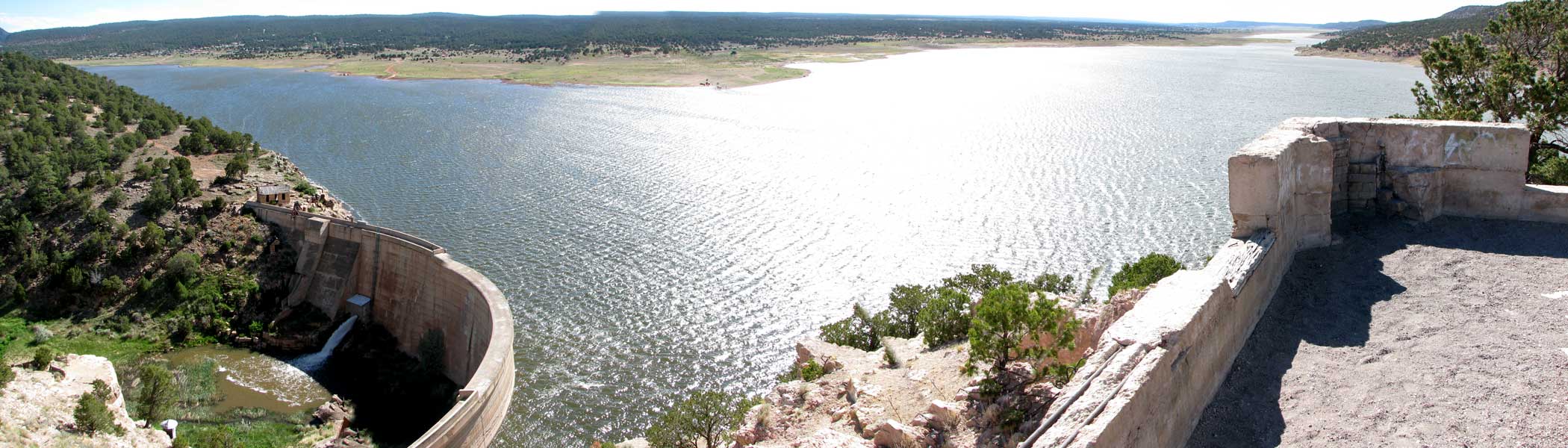
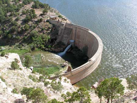
| Thursday, June 10, 2010: Today, Morgan and I took a hike from our campsite to the nearby Bluewater Lake Dam. We are camped at Bluewater Lake State Park and the dam is about a mile from our campsite. This seems to be a popular reservoir on the weekends. The park was only about 10% full during the week but has begun filling up today. Click the photo for a panorama of the dam and lake. |
 |
|
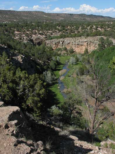 |
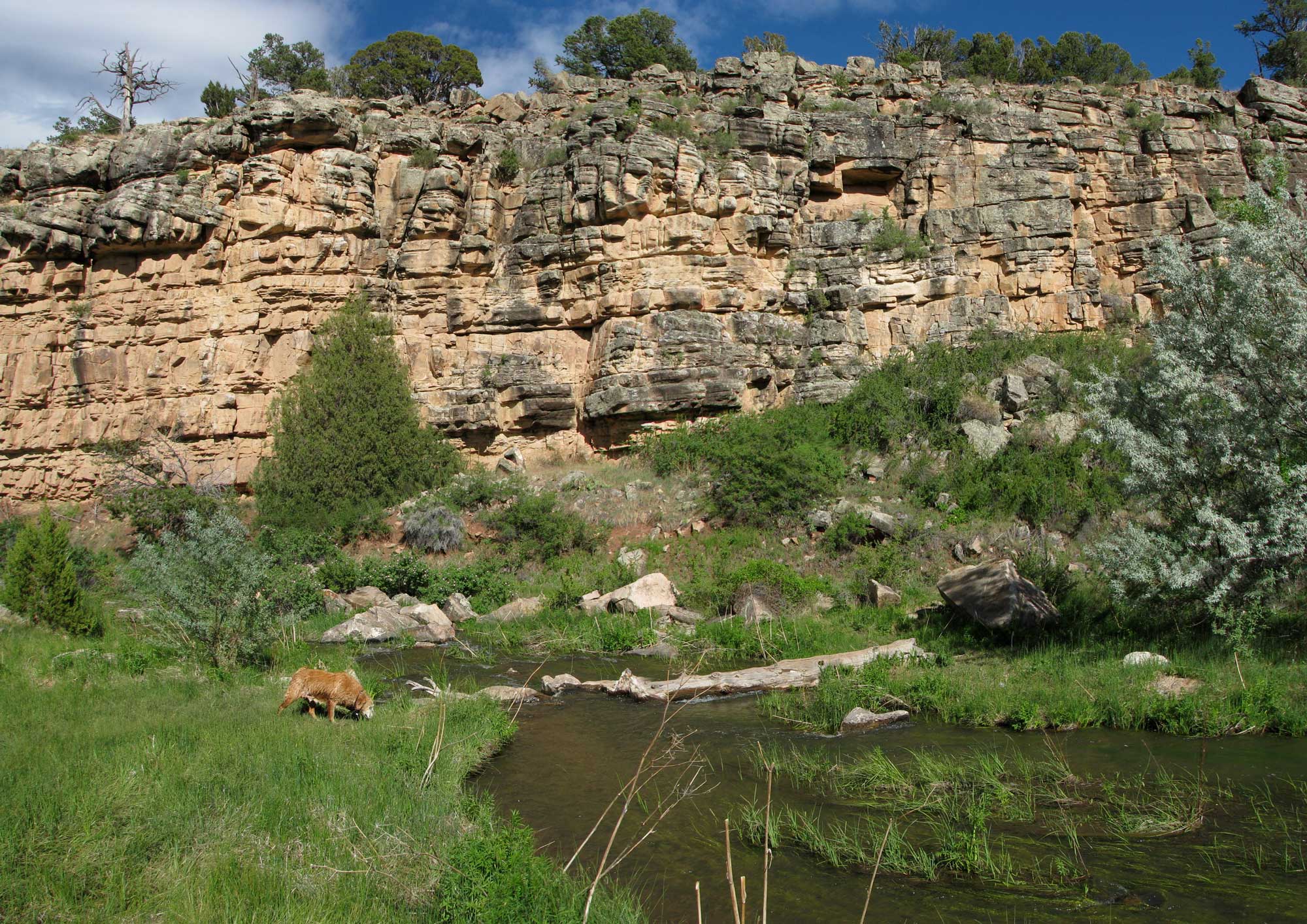
After the hike to the dam, we hiked to Bluewater Creek Canyon which was not too distant from the dam. This was very pleasant for Morgan since she got to swim in the creek. The rocks lining the canyon are very colorful and the trial was steep and uneven getting to the creek. There seems to be some wild horses located at the state park property. We see them each evening when the park is not full. Morgan and I found lots of evidence of horses in the canyon. Click the photo to see a photo from the canyon. |
|
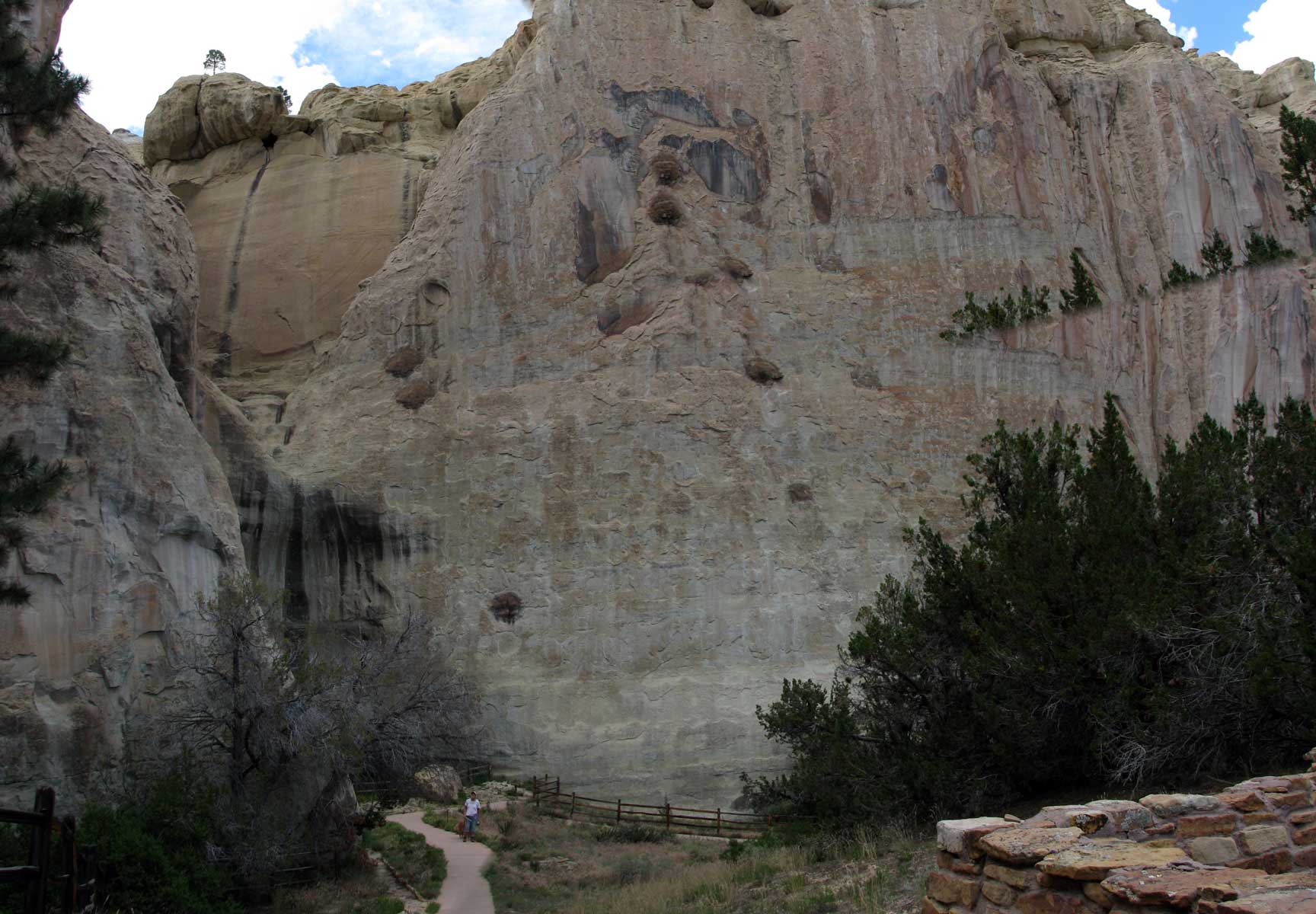
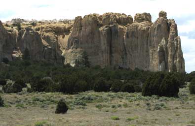
| Friday, June 11, 2010: We visit El Morro National Monument, probably one of the least known in the west but still very impressive. These are sandstone cliffs and a popular location in history because of water gathered in a pool at the base of the sandstone cliffs. The cliffs act as a funnel to guide the water to the natural reservoir from snow and summer monsoon rains. The Atsinna Pueblo Indians were some of the first to live here in the 1200's. |
 |
|
 |
 |
In the late 1500's the Spanish explored this area. The water hole made this a stop on the route to other New Mexico locations.
Each traveler from the Atsinna to the US soldiers in the 1800's left their marks in the sandstone cliffs. We saw animal petroglyphs and signatures, statements dated from the 1500's - 1700's when the Spanish traveled the area, plus names of US soldiers in the mid-1800's.
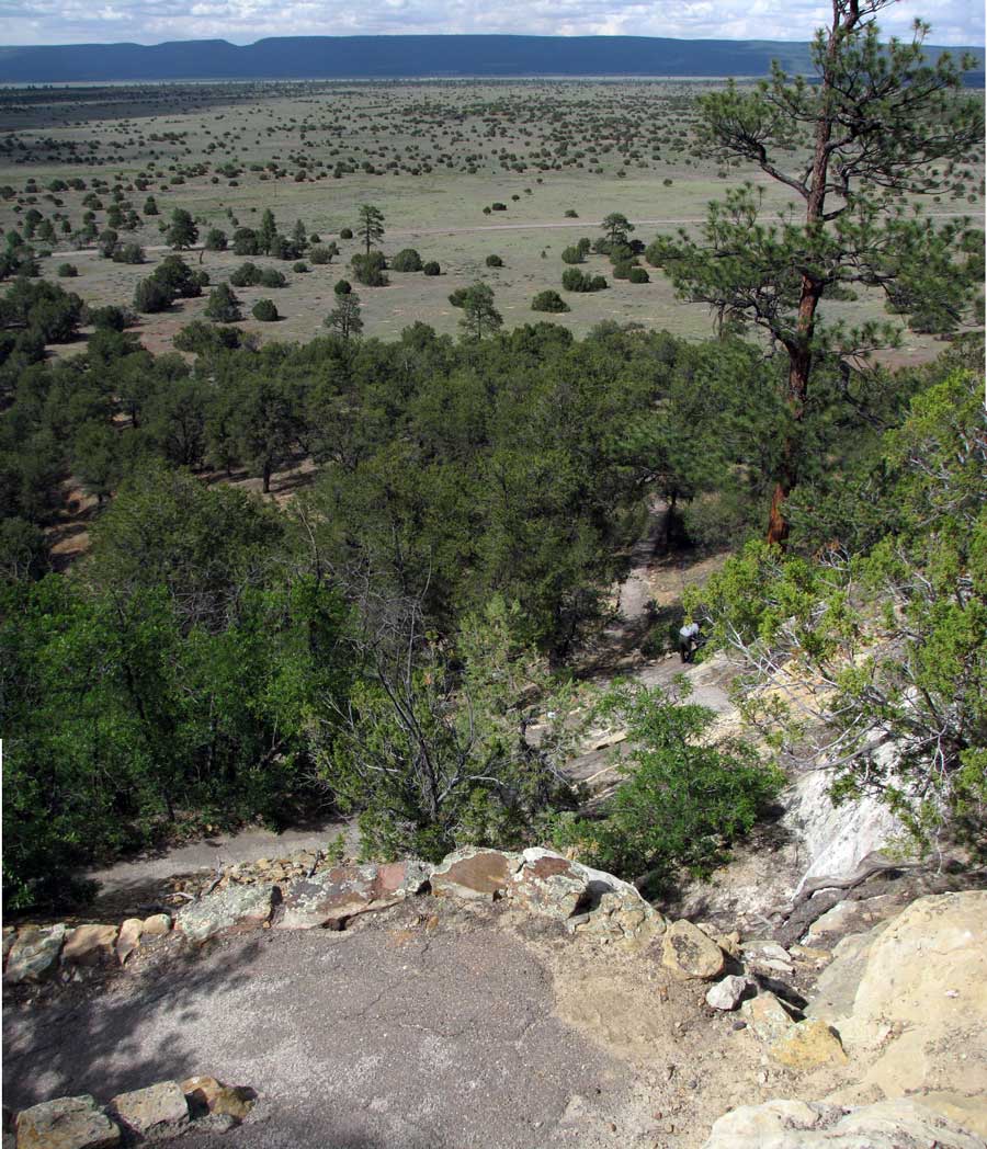
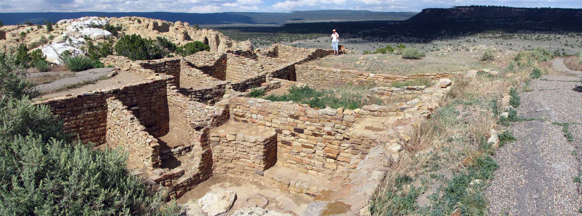
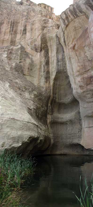
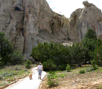
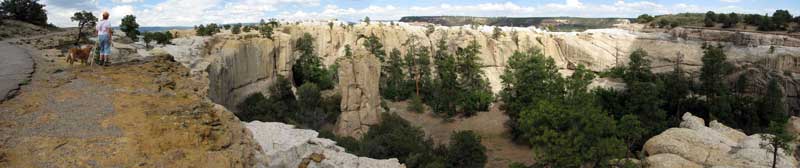
We followed the 2 mile trail leading around the base of El Morro, the pool (where Morgan took a cooling swim) then on to the top. The asphalt trail switch backed up the side of the cliffs 300 feet to the top. We circled the edge of the cliffs to the Atsinna Pueblo which was partially excavated. The Pueblo is estimated to have 800 rooms of which 12 have been excavated. You can imagine the activity in the 1200's when the Atsinna inhabited this Pueblo.
Every photo has a larger view behind it, just click the photo to see it. |
|
 |
|
 |
| |
| Return to page 7 |
Continue to page 9 |
|
|