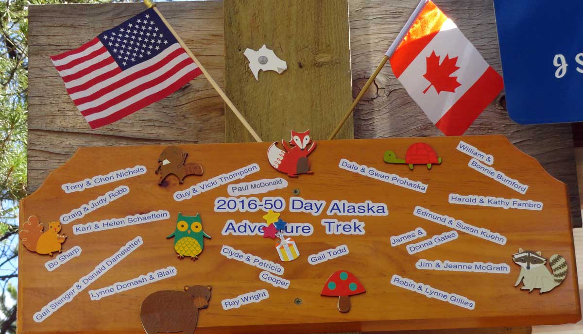
2016 - On Staff for
RV Adventure Treks
to Alaska
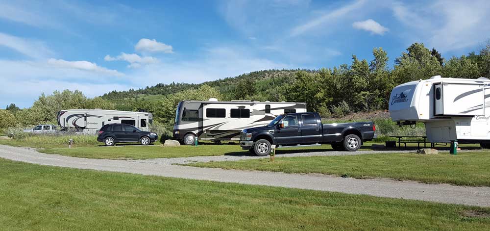
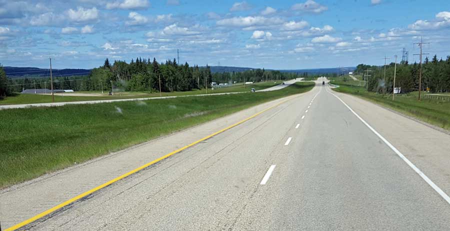
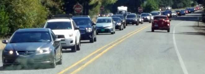 Sunday, August 21, 2016: On our way to Sutherlin, this is our last day of our Adventure to Alaska and return. Since it's a weekend and the weather is very hot in the valley, thousands of cars are on the road to the coast. As we pass 50 miles of these cars, I'm thinking they should all be told the coast highway (101) is nothing but a parking lot with so many people coming to the coast, no one can move. We are headed in the correct, uncrowded direction. It's hot in Sutherlin but this has been an incredible and enjoyable experience with unmatched natural beauty and many new friends already planning meetings this year and for next year.
 |
 |
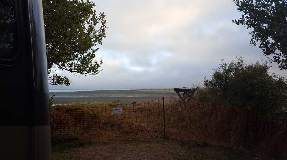
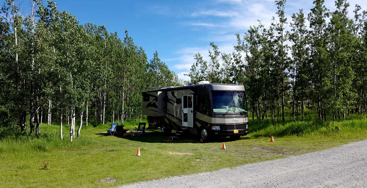
Thursday, August 18, 2016: Our first full day at Fort Stevens State Park. Don and Gail are busy with their volunteer job so Gwen and I went shopping and I completed some repairs.
I currently have three problems, one of the storage latches on the coach has broken (won't open), one of the driving lights doesn't work and the "Ready Brake" won't fit the coach two inch receiver, it bottoms out about 1/2" short of the holes lining up.
I plugged "welder" into the GPS and it took me to "Affordable Portable Welding". I didn't need welding but I figured a welder could cut two inch steel and I was right. Mr. Affordable whipped out his saw, cut 1/2" off the Ready Brake and the job was done in five minutes. I asked "How Much?" and he reported his minimum was $30, a little steep I thought but the job was done and the Ready Brake fits.
Napa supplied me with a new bulb to repair the driving light which I installed and the lights are working again. I'm waiting until I return to Sutherlin to repair the latch because these latches seem to break continually so I've got an idea of a more permanent fix. That idea will be easier to complete in Sutherlin (home base). Click the photos for additional views.
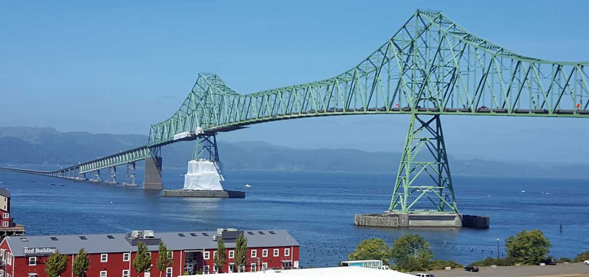 |
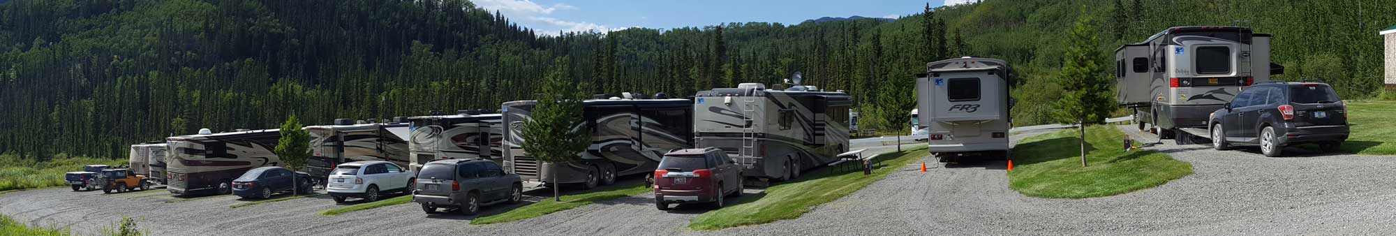
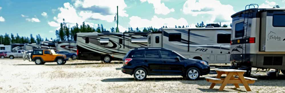
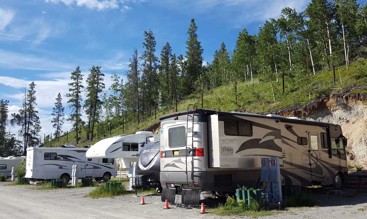
Wednesday, August 17, 2016: Our goal today is Fort Stephens State Park on the northwest tip of Oregon. Our friends, Don and Gail (from the Alaska tour) have volunteered as camp hosts at the park. We plan to stay three nights near them just to get to know each other better. The exciting part of THIS day is driving over the bridge between Washington and Astoria, Oregon at the mouth of the Columbia River. Some huge ocean going ships pass down the Columbia to Portland so the bridge is make very tall at the deepest part of the river. The deepest part is right off shore of Astoria so it must be very exciting seeing these huge ships pass nearby. We can see a half dozen in the distance but all are anchored and empty so must be waiting for cargo. We were lucky to get a camp spot at Fort Stephens, a very popular state park. We took the last site available but like the site because campers are only on one side of the coach. Click the photos for additional views. | 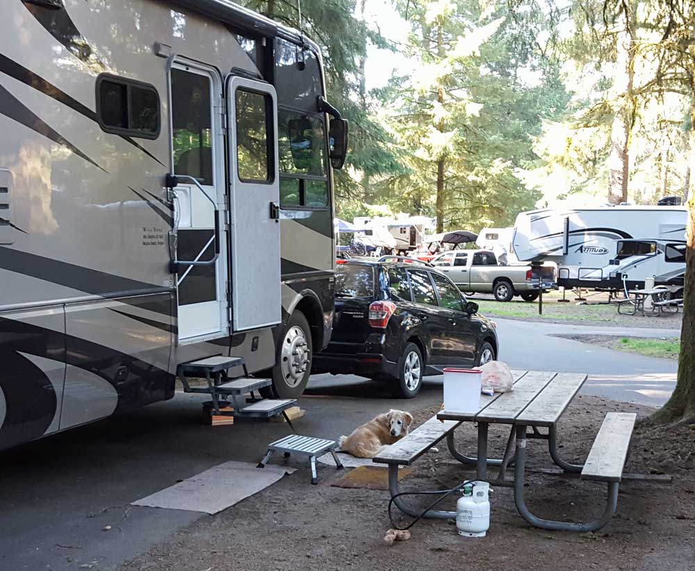 |
 |
 |
 |
 |
 |
 |
 |
 |
 |
 |
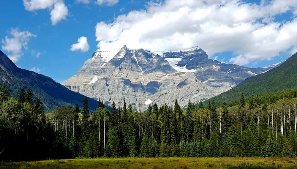 |
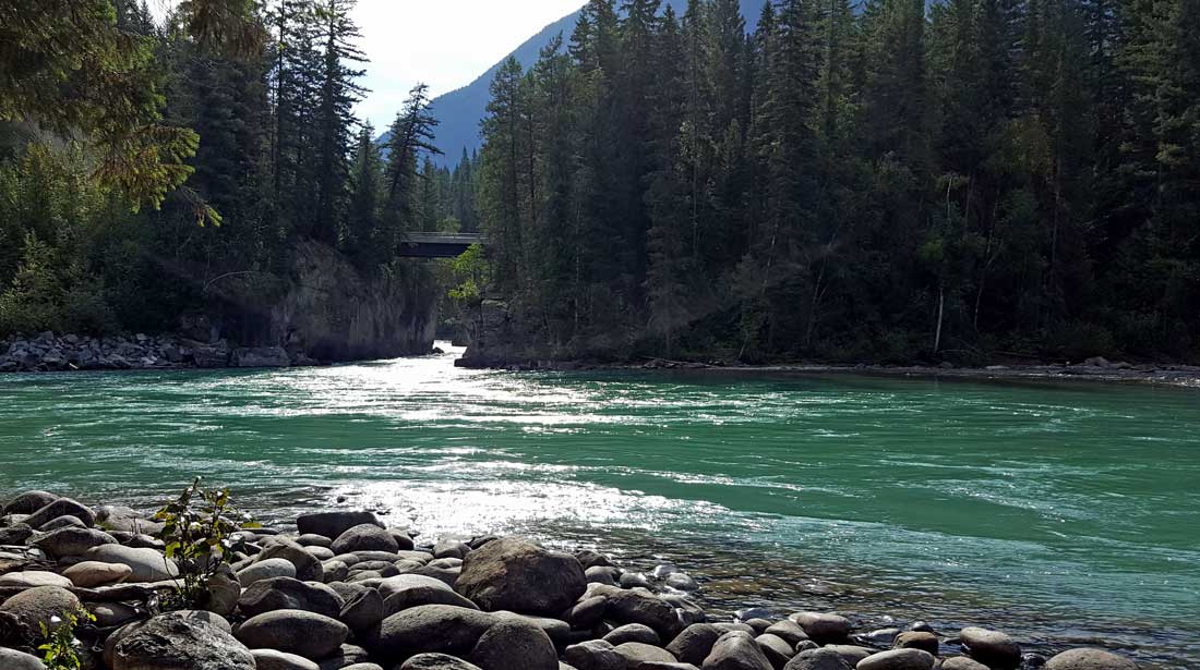
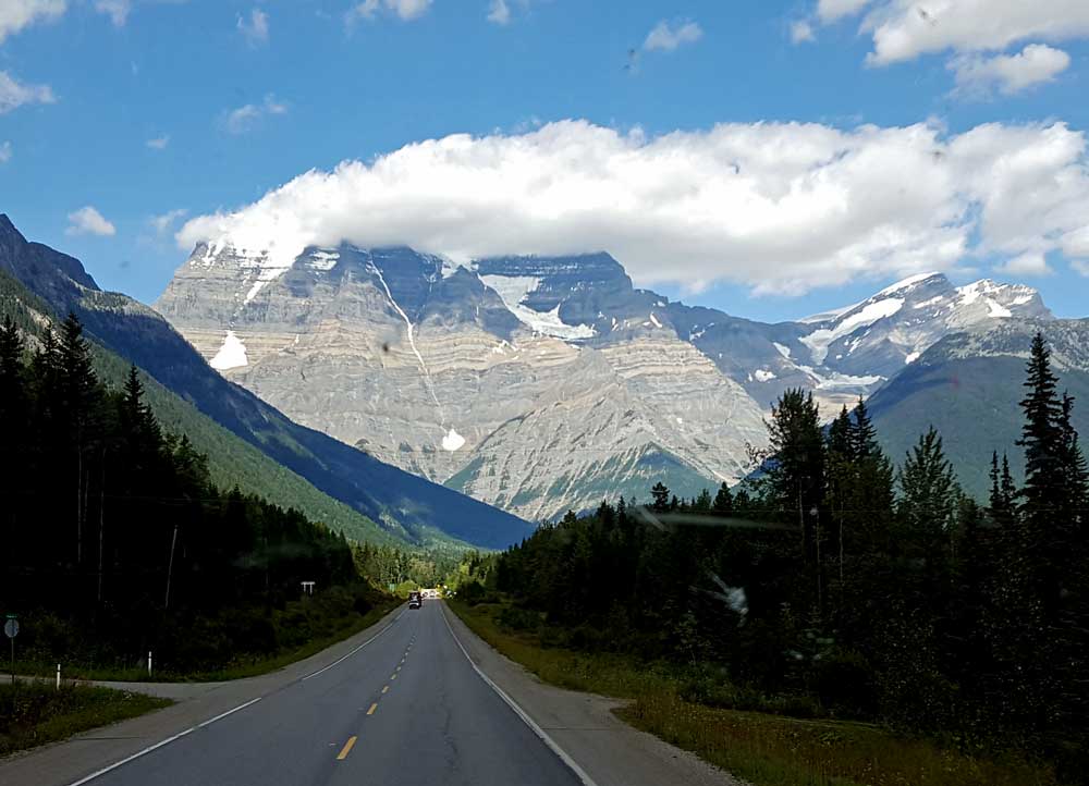
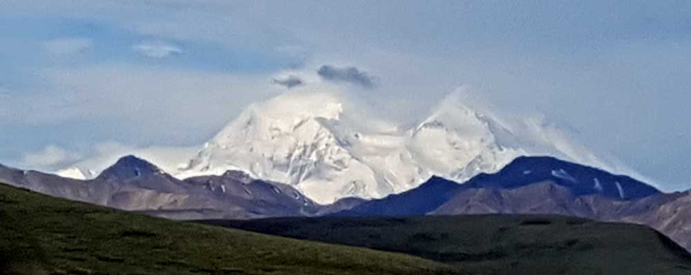
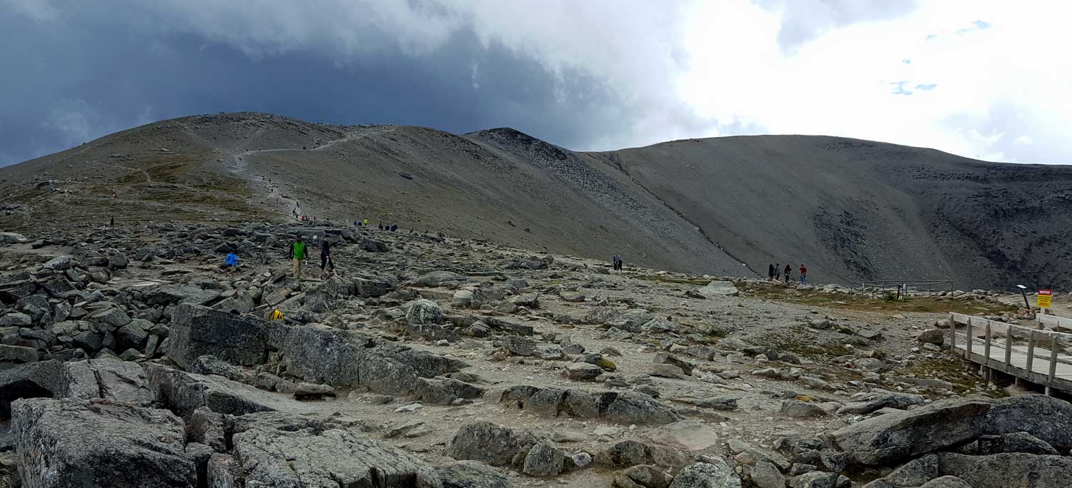
Saturday, August 13, 2016: Mt. Robson Provincial Park has a wonderful visitor center with a natural history display as well as information about this very large park. Mt. Robson is behind the visitor center, click the above photo for a better view. Again, no photo can do this mountain justice. Mt. Robson is the tallest mountain in the Canadian Rockies. Later, Gwen, Morgan and I visit the Fraser River, the fifth largest in Canada. Let's hope the water districts in southern California don't hear of the Fraser River! The color of the water comes from melting glaciers. Click the photo for another view of the Fraser River. This afternoon brought a thunder storm with lots of rain. Hopefully it's enough to kill any fires started by the electrical storm. Unfortunately, a disadvantage of camping "off grid" are the campers who buy cheap contractor generators. The problem with contractor generators is that they are very noisy, and always run at full RPM no matter the demand. People come to campgrounds to leave noise and enjoy the quiet surrounding, wildlife and scenery. A contractor generator can be heard 200 yards away. I've documented this many times in the states but it happens in Canada too! There ARE quiet generator options but they are more expensive. |
 |
 |
 |
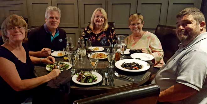 |
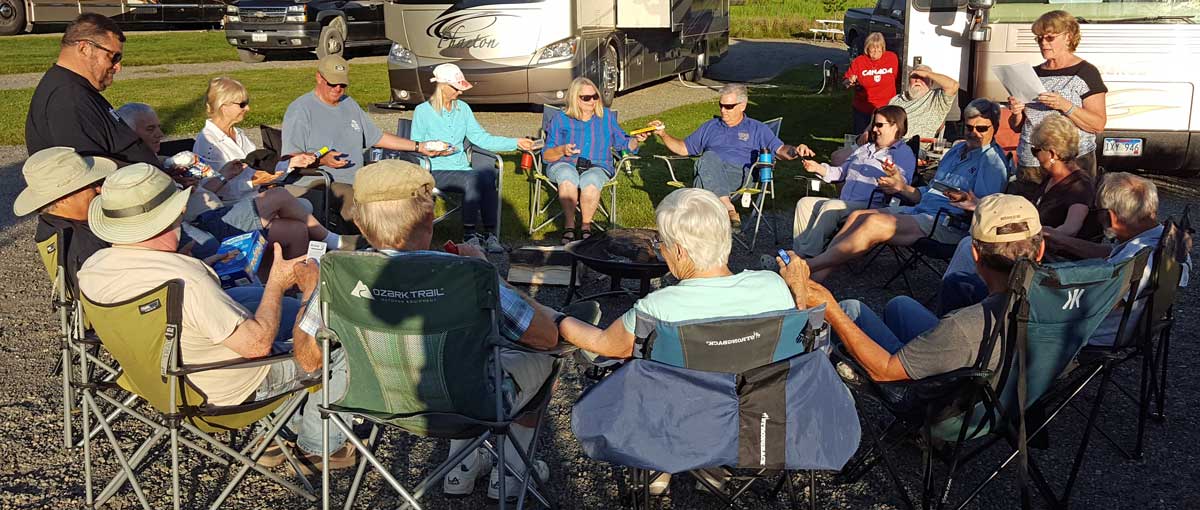
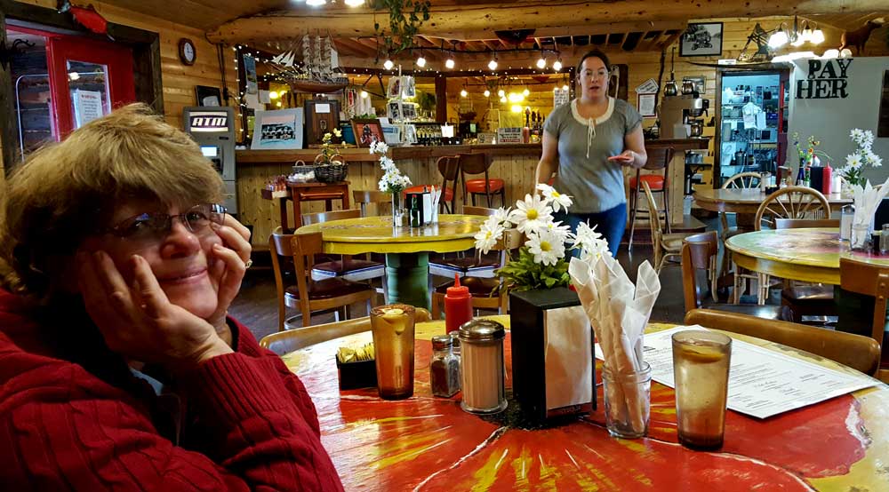
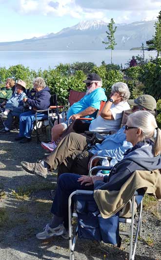
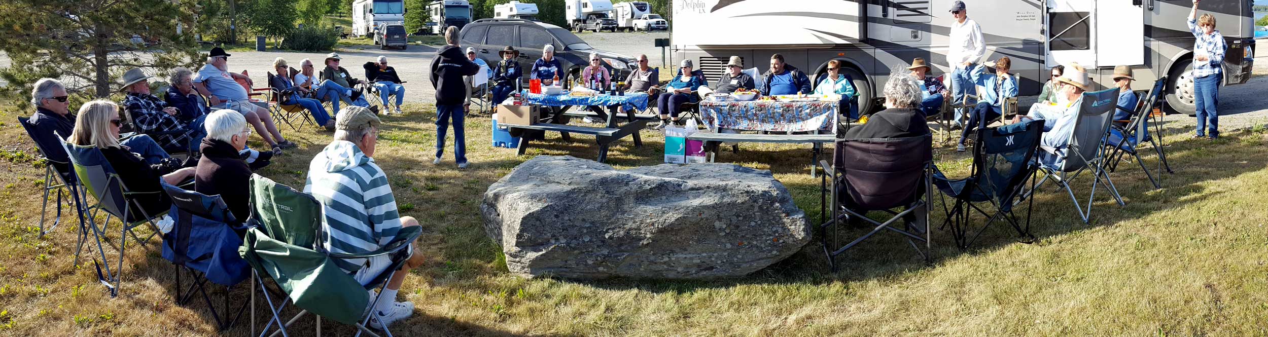
| Thursday, August 11. 2016: Most everyone left today for destinations south. We stayed one extra day to do laundry and grocery shopping. I had hoped to wash the vehicles but that became impossible. Two guests, now friends Craig, Judy, Suzi and Eddie invited us to dine with them. Eddie chose "North 54" which turned out to be the best restaurant we have dined in during the whole trip. Eddie, Suzi, Craig and Judy are great examples of people we hope to meet again and spend some travel time together. | |
 |
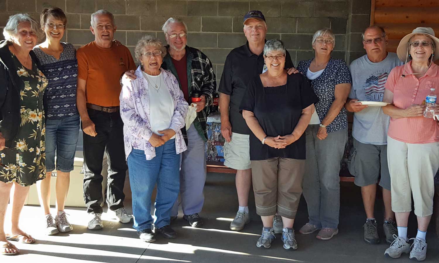
Wednesday, August 10, 2016, day 50 of the 50 day tour of Alaska with Adventure Trek and our position on staff as the "Tailgunner". We end up at South Park RV for our last night. At the end of the day, we all met at the Carmel Restaurant for a final meal together. This was a time of congratulations but sad because we are parting from the group tomorrow. Click the right photo for a view of our "guests" at the meal. Some surprises over the last 50 days. We were concerned about the attitudes of the tourists |
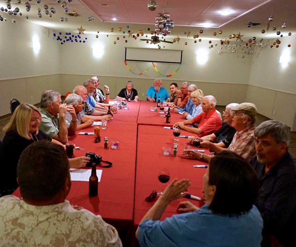 |
| paying for an Alaska tour. We couldn't believe what we were told... that we would make lifetime friends during the tour. As it turned out, we enjoyed everyone on the tour even though they (except for one rig) were all RV park to RV park travelers (not the way we travel). Indeed, we did make lifetime friends and would enjoy traveling with ANY of those on the tour. We hope to see everyone again. About the terrain, we enjoyed the Yukon as much as Alaska. The mountains in Canada and Alaska are incredible. The wilderness in both Canada and Alaska creates unique citizens in both countries. The roads in northern Yukon were rough due to construction and the roads in parts of Alaska were also rough due to frost heaves. Having said that, one guest had two flat tires while traveling a gravel road, no other guest had tire problems. One guest had a medical emergency which required a helicopter flight to Fairbanks but the emergency was not serious and that guest rejoined the group in two days. Not everyone was happy with the itinerary. Everyone agreed, too many museums (including me). We liked only two of the many RV parks but there were few choices in many cases. Many of the parks operate only four months of the year so little of the income can go to improving the parks. We were always crowded in the RV park and even though every park advertised "Internet access", that access was almost ALWAYS so poor it could not be used for any purpose. In all cases, the scenery outweighed any inconvenience. In every town except Hyder, Alaska, we always said to ourselves, "we would like to spend more time here". | ||
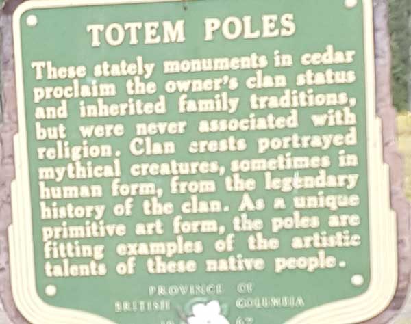 |
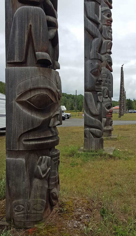
Tuesday, August 9, 2016: Nearing the end of the 50 day tour, we travel from Hyder, Alaska to Smithers, British Columbia. We pass a totem village in route. Smithers is our first large city in British Columbia and we have great hopes for good Internet access but no such luck. All the RV parks we stayed advertise Internet access but their systems are either overloaded or extremely slow to the point we can't use them. This campground is associated with a golf course but everyone is so tired they didn't bother to try it out. |
 |
 |
 |
 |
 |
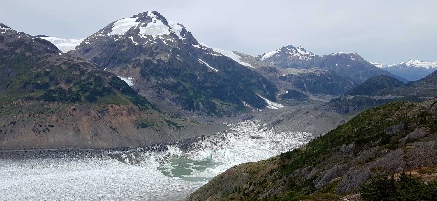 |
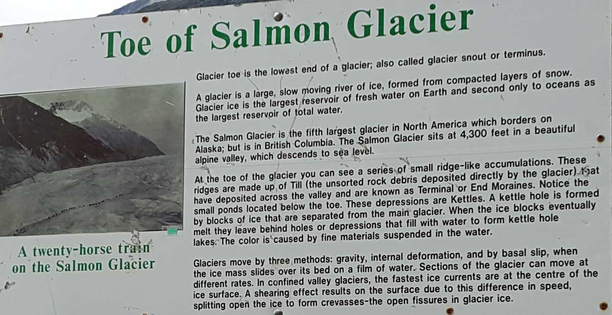
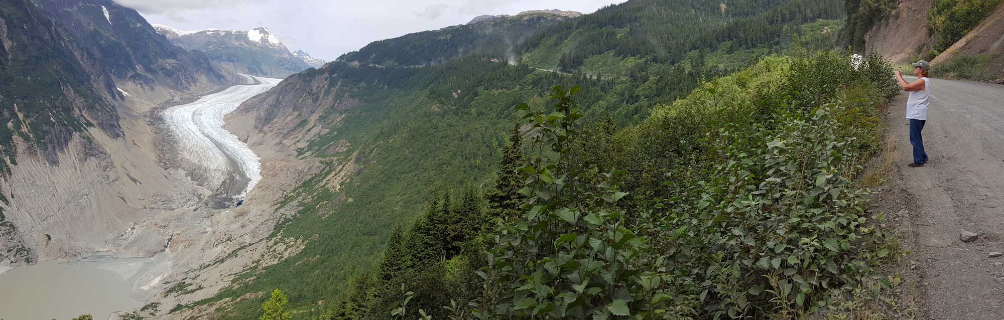
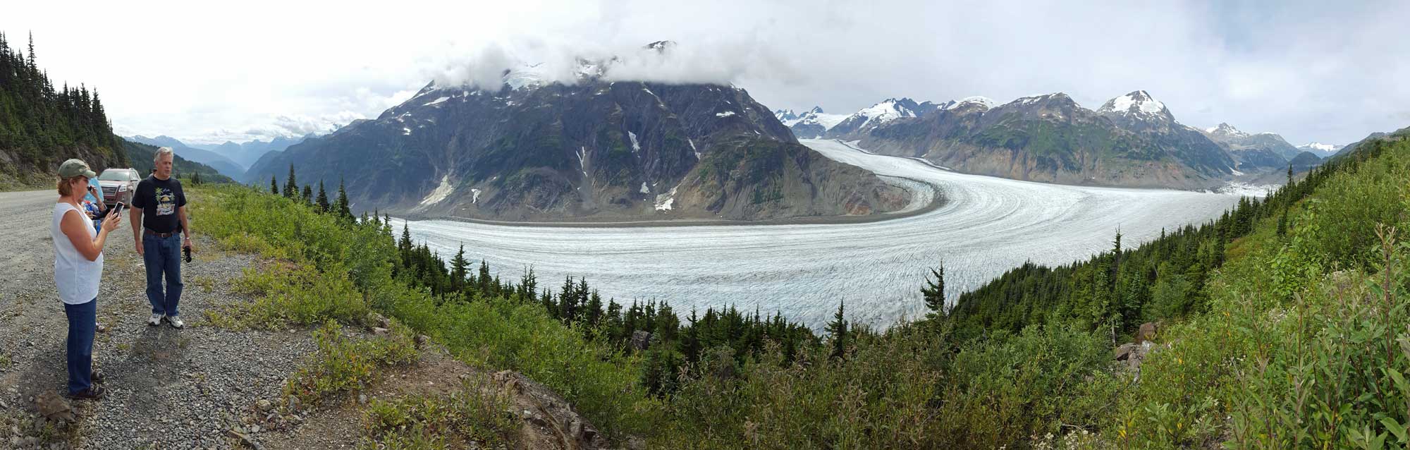
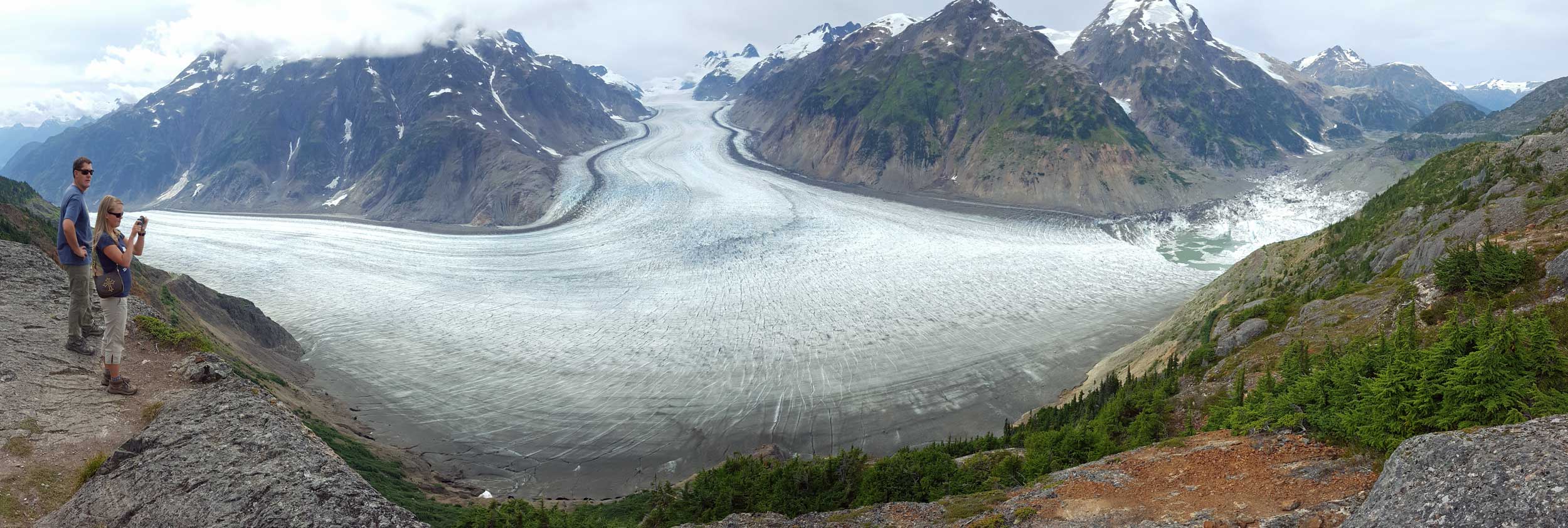
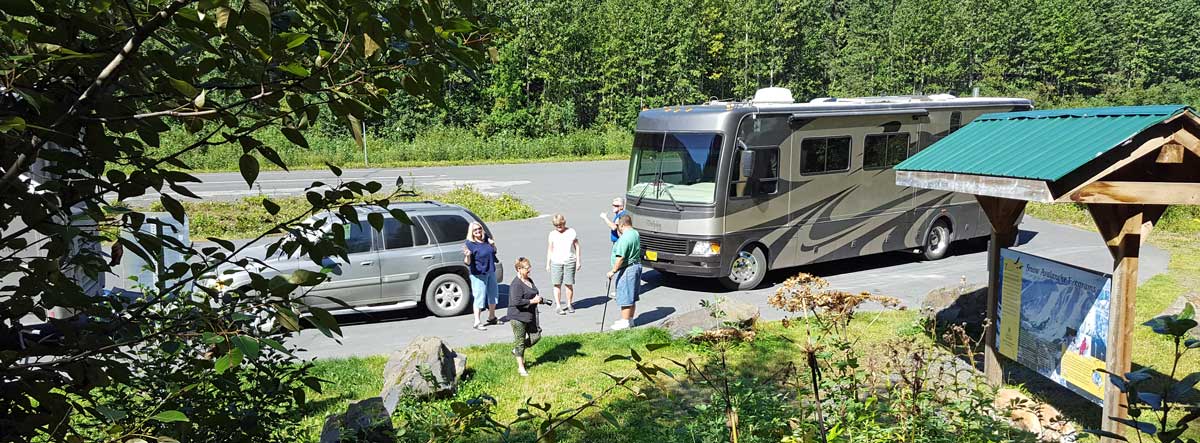
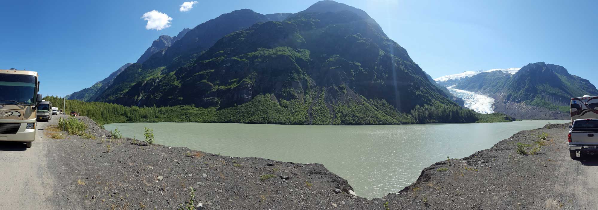
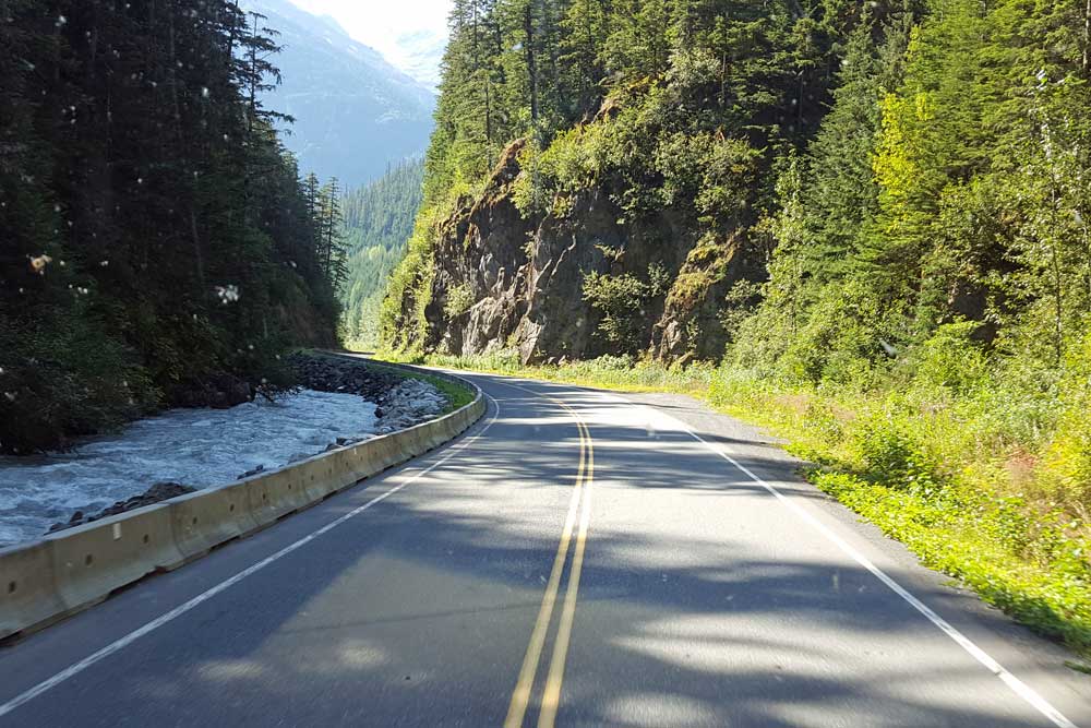
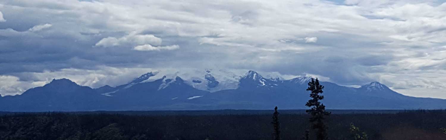
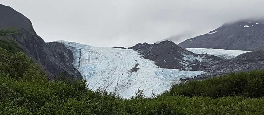
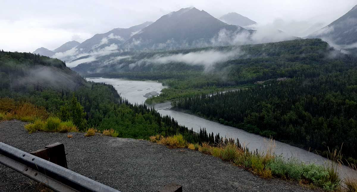
Monday, August 8, 2016: This is probably the highlight of the tour for scenery. We are able to drive to the Salmon Glacier overlook and see almost the entire glacier. This glacier is actually in British Columbia because we have crossed the border again when driving the gravel road to the glacier. No photo can do this scene justice.
The Seafood Express is a cooking bus where customers order at the bus door then wait, often a long time, for their order to arrive. This is a single cook and owner who cooks one meal at a time, hence the long wait. However, we are told by several guests (we didn't patronize the bus) that the food was outstanding. If we do this trip again, we'll give it a try. Click all photos for additional views.
 |
 |
 |
 |
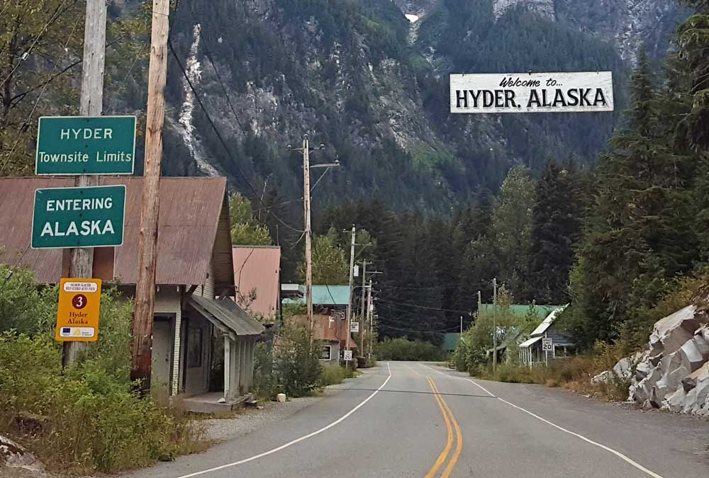
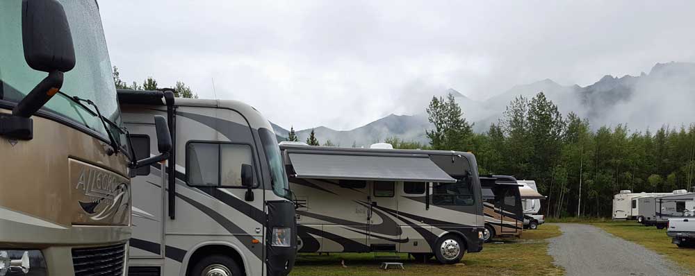
Sunday, August 7, 2016: We have a fun time together at the Mountain Shadow RV Park, probably the most scenic and comfortable park of the tour. Today is a travel day from Mountain Shadows to Hyder, Alaska. This turns into a scenic canyon drive where we find the bear glacier. We follow the route through Stuart, BC then cross the border again into Hyder, Alaska. This campground is probably the worst of the tour. The only reason, as it turns out, to come to Hyder is because the incredible Salmon Glacier is on up the road about 20 miles. We did have time, after parking, to drive to Fish Creek walkway where sightseers go to watch salmon and, hopefully, bears. We didn't see any bears. | 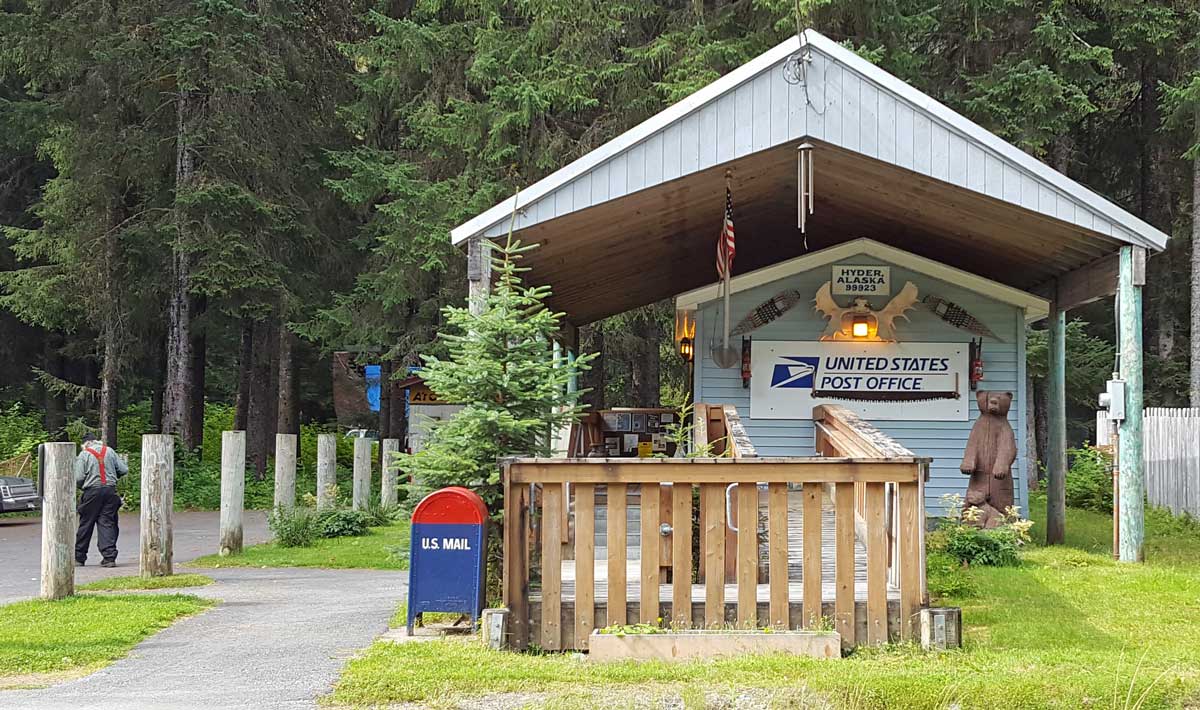 |
 |
 |
 |
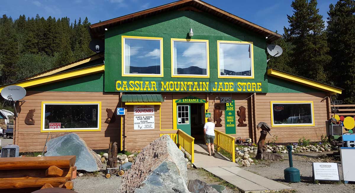
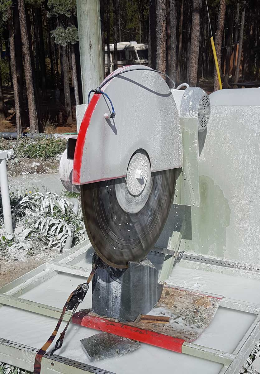
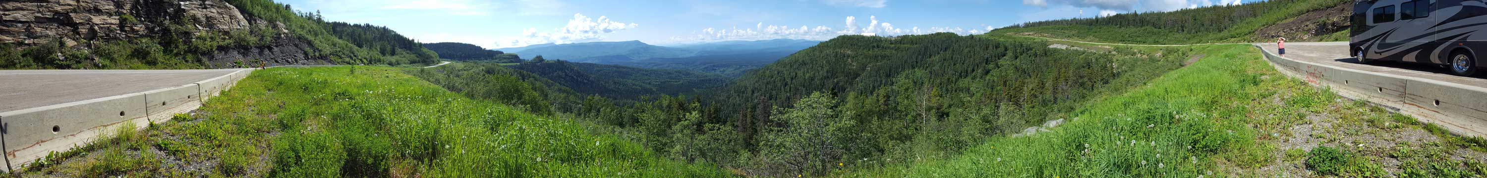
Saturday, August 6, 2016: Traveling from Watson Lake to Iskut, BC. This was a spectacular clear day on a narrow two lane road with no painted lines but a popular route for the "golden loop" which circles back to Dawson Creek. The scenery is more of the Pacific northwest mountains, rivers, many lakes all surrounded by Spruce and Pine. The ONE stop along the route for us was in Jade City where locally mined Jade is cut and polished into popular shapes.
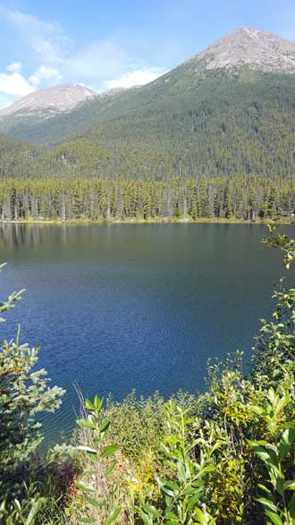
Our destination RV park is on a large lake but otherwise seems to be alone in the wilderness. No village of Iskut has been seen. This RV park takes the prize for the best yet on our tour.
The beetle would crawl onto my leg repeatedly after I set him on the ground. Click the beetle for a panorama of our grassy RV park.
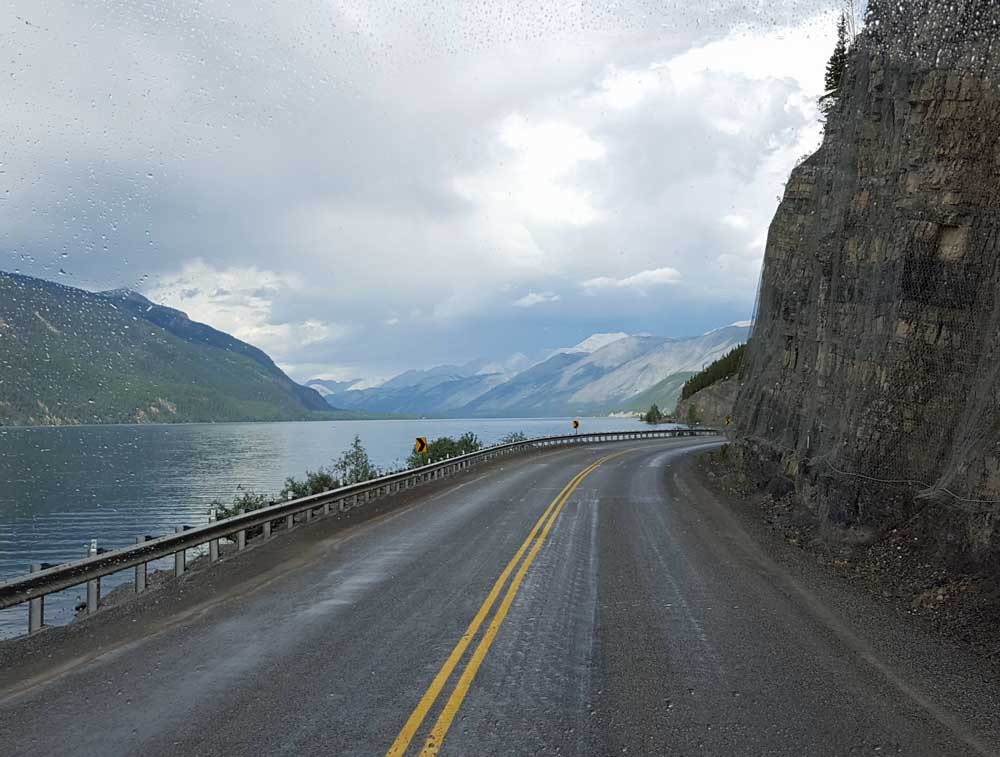
Friday, August 5, 2016: Another travel day from Teslin to Watson Lake where the sign forest is located. Yes, we were here in June but this time we are here to join the Cassiar Highway (37) which heads straight south.
When we were here the first time an Imax style movie theater was mentioned which I thought was showing a movie about the Yukon Territories. Gwen and I went with Jim and Jeanne to see the movie. The theater was impressive, a dome shape scream overhead with seats slanted back so you are looking into the dome. Instead of Yukon views there were two movies. The first illustrating the size of the universe and the second of the Aurora Borealis. This was a disappointment to me and probably to others since nothing was mentioned after the movie.
We stayed in the same park as last time but in a different location, a better location. Click the photo for a view.
Thursday, August 4, 2016: Today was a travel day back to Teslin, Yukon. It's a relatively short drive of 140 miles giving us much of the afternoon in Teslin.
Lynne is one of our guests and I noticed her T-shirt (Isn't Texas Cute"). I assume she purchased it to torment her Texas friends. I found it very amusing. The interesting part about this Texas/Alaska statement is that we have driving through Texas and have now driven through Alaska. Texas seems much larger. We decided the reason is Alaska has paved highways through a very small portion of the state so it seems you can drive Alaska much quicker. The reality is, you haven't even touched the entire state of Alaska via the road system.
Click Lynne's photo to see our Teslin camping location next to the huge Teslin Lake.
 |
 |
 |
 |
 |
 |
 |
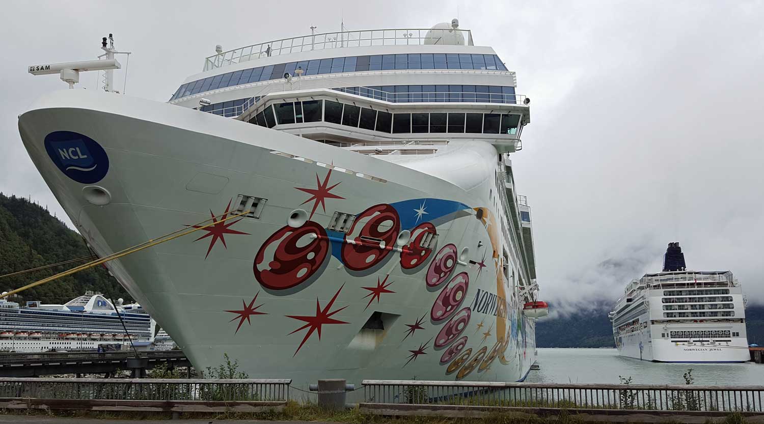 |
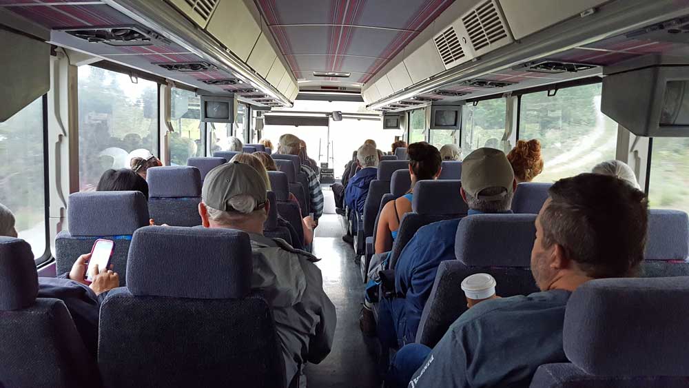
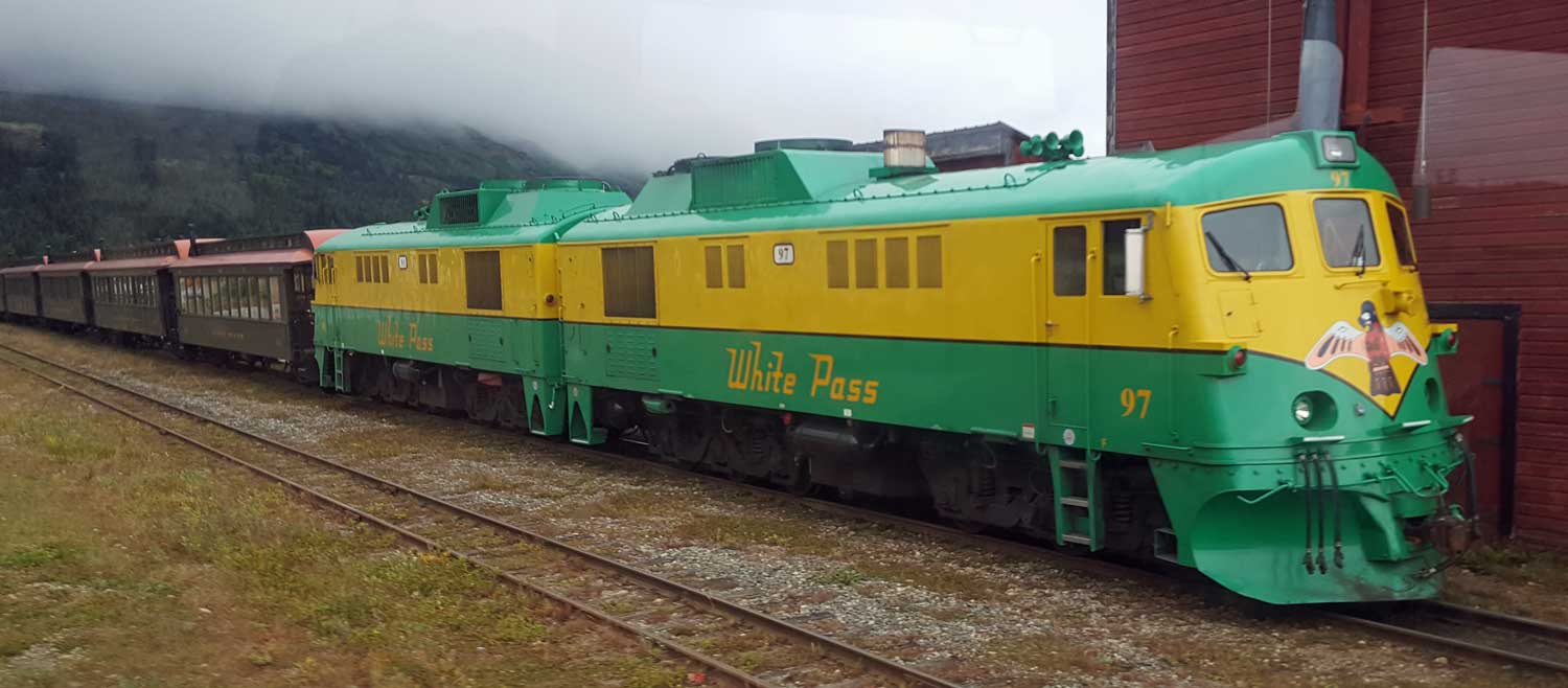
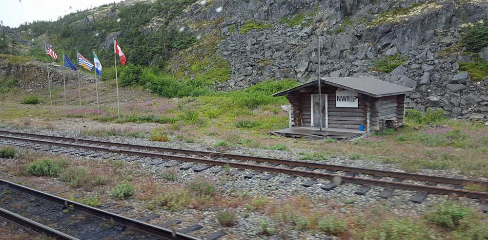
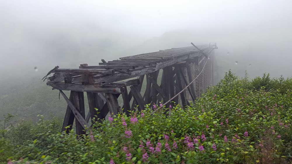
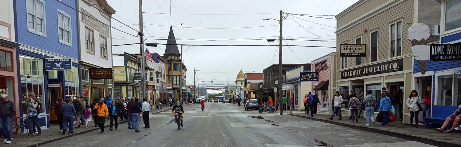
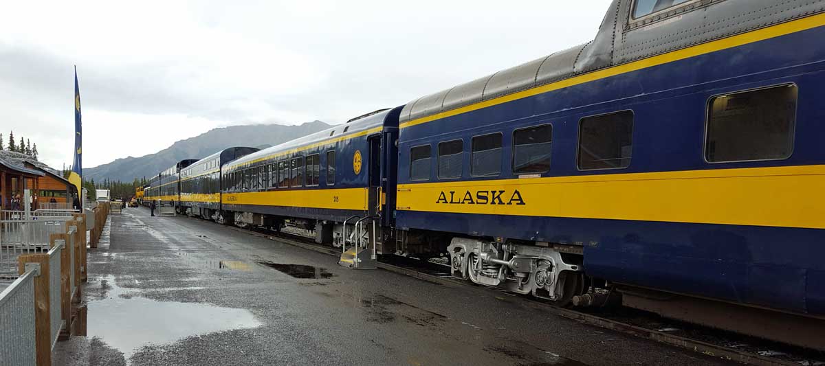
 Wednesday, August 3, 2016: Perhaps the highlight of the tour is the train ride to Skagway, Alaska. It is descending 3,000 feet from Fraser, British Columbia to sea level over 27 miles. I hope someone does a good job of maintenance because the train tracks are on the side of a very steep drop much of the way. This train was completed in 1900 to haul passengers and freight to and from the gold fields in northern Yukon. The train only went as far as the headwaters of the Yukon River where the rest of the trip was by boat. A bus picked us up at the RV park then transported us first to Carcross for a short stop then to Fraser, British Columbia where we transferred to the train for the ride to Skagway. When gold was discovered in the Klondike, prospectors would arrive in Skagway hoping to become rich overnight. They learned they must carry 1,000 lbs of survival gear with them. This is what motivated the building of the train route. For our trip, the weather was not perfect for photography but still enjoyable. Skagway is a cute tourist town with lots of ways to spend the tourist dollar. I noticed the four cruise ships in the harbor so was as interested in seeing them as the town. We had an enjoyable short stay before the return trip. Most guests were disappointed we didn't have more time. Click all photos for more views.
 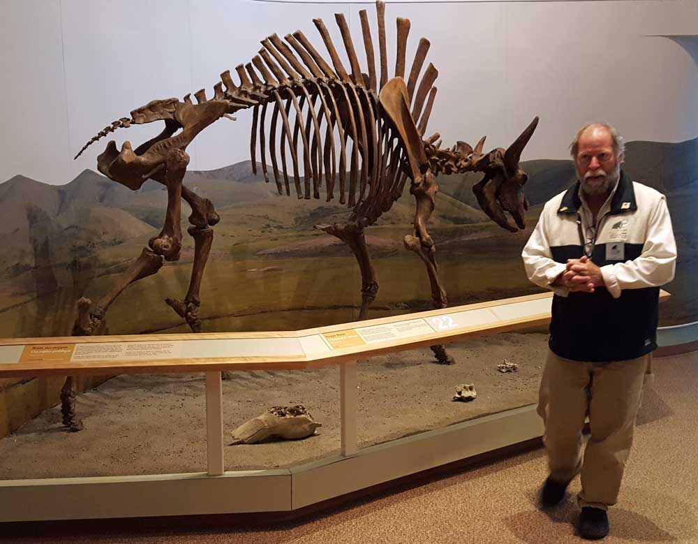 |
 |
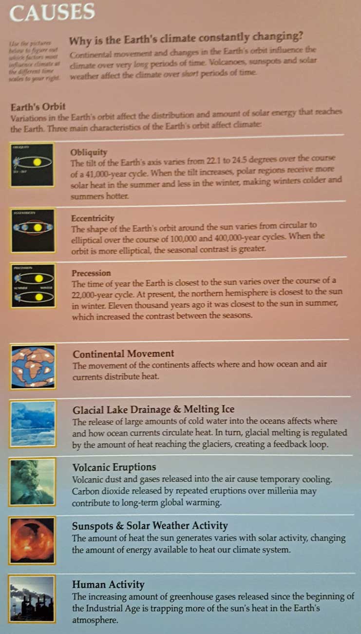
Tuesday, August 2, 2016: I take our guests to the Beringia Museum and education center near the Whitehorse airport. I was extremely interested in this topic since I had only been introduced to it in the last week. During the last ice age, ending about 23,000 years ago, there was an area which was cold but without ice called "Beringia" (pronounced bear-in-gee-a). This became the home for many herbivores and their predators. The herbivores included the Musk Ox, small horse, bison, and smaller creatures. The most impressive herbivore was the Woolly Mammoth. The predators. were the Sabre Tooth Tiger, Scimitar Cat, and Short Faced Bear. However, the chief predator was the human following these food sources across Beringia and later into north America. We had a guided tour from Beringia staff member, David. He discussed the geography, weather, animals and human activity of Beringia. He also discussed the causes of climate change (click the map photo). We also got a hands on activity with the use of an early weapon called the atlatl.
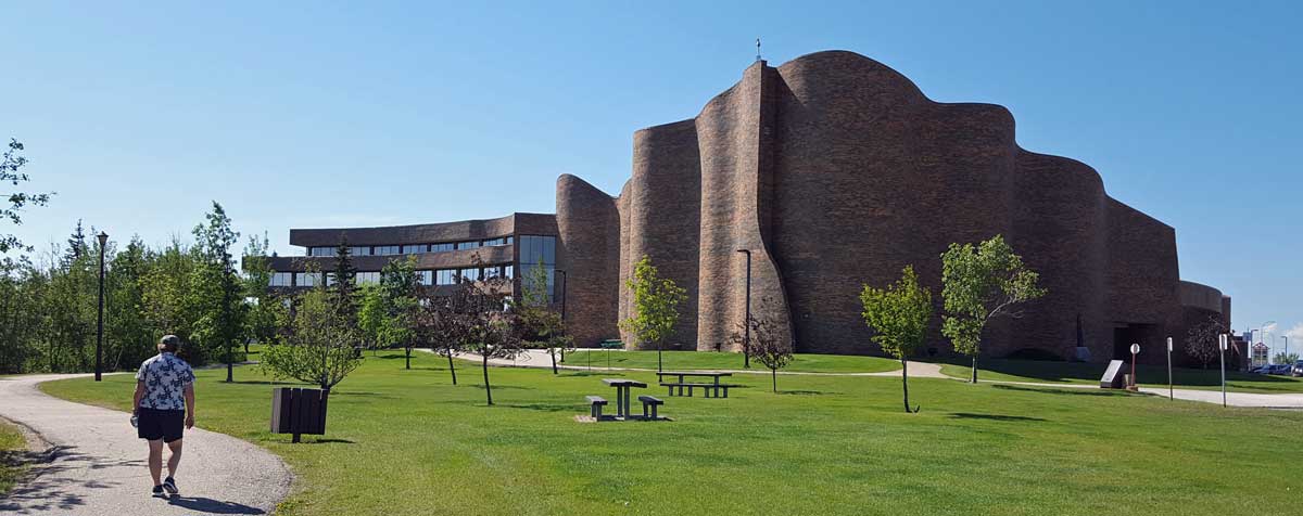
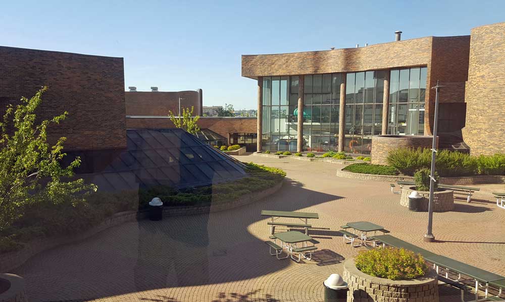
Later, Gwen and I toured the Yukon College (yes, I got another hat). It's a very nice campus with small numbers of students in each course. I learned that the college is working to become a university within five years. This is Yukon College, not UCONN found in the USA. Click all photos for additional views.
 |
 |
 |
 |
 |
 |
 |
 |
 |
 |
 |
 |
 |
 |
 |
 |
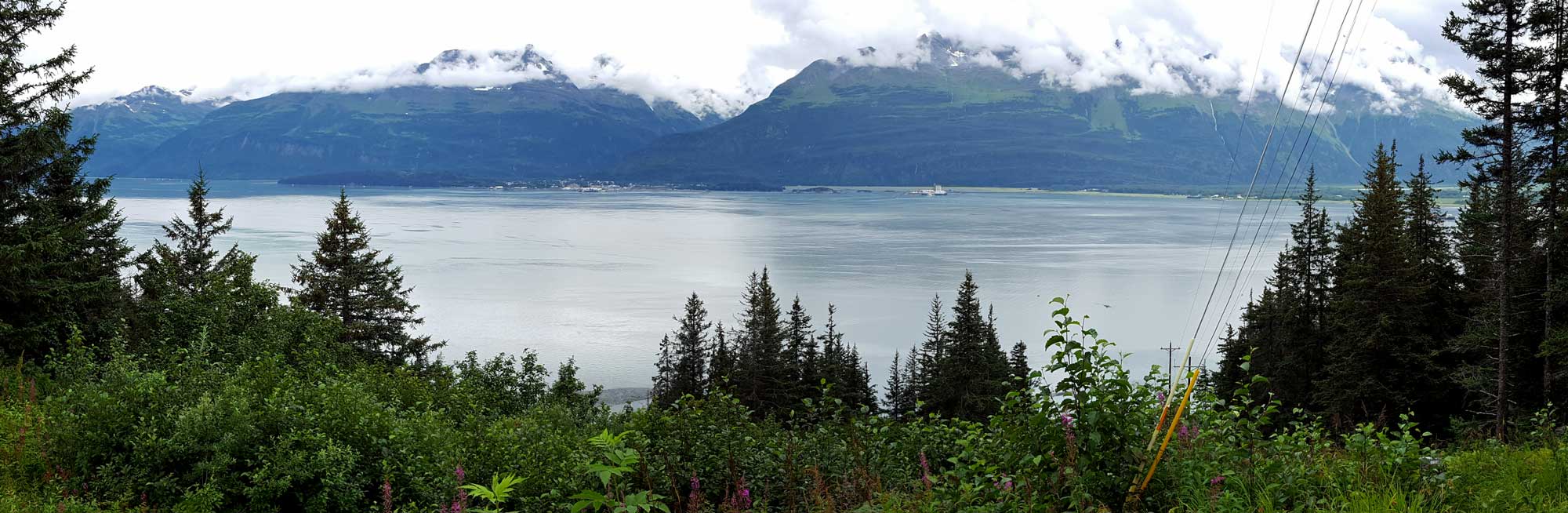
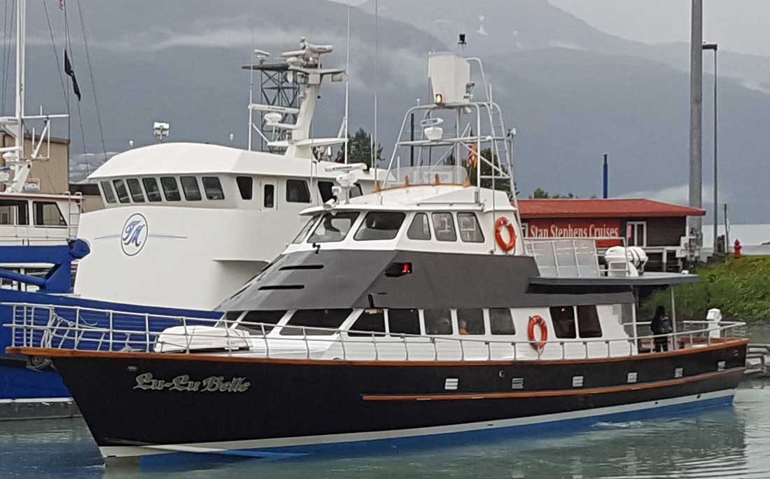
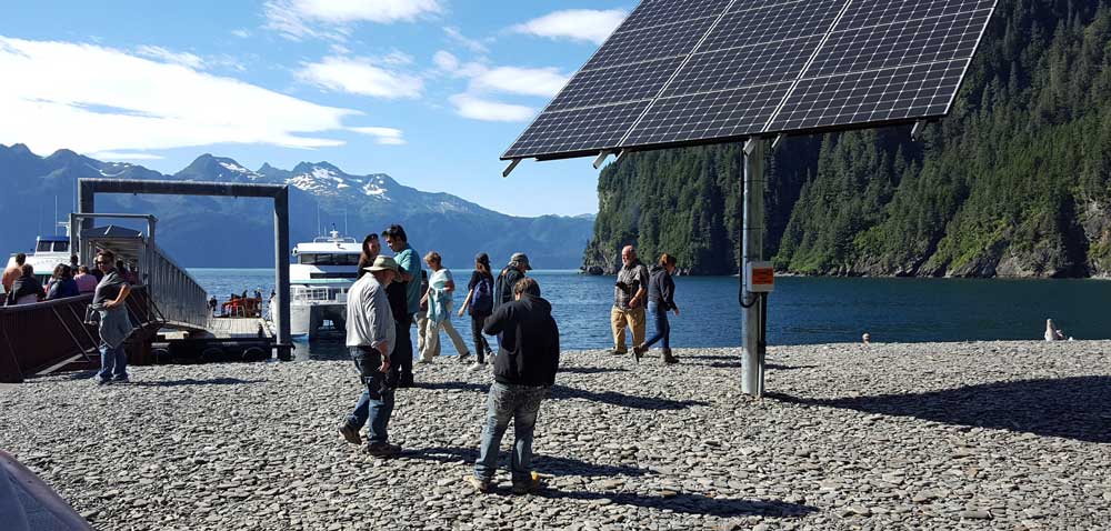
Wednesday, July 27, 2016: So today was a free day to explore the area, at least for us (the group went to another museum). Yesterday, Gwen took the group onto a nine hour boat ride with Captain Fred on the Lu Lu Belle. I had to take a photo of the boat as they returned. I'm sure Gwen will give a full report on her blog.
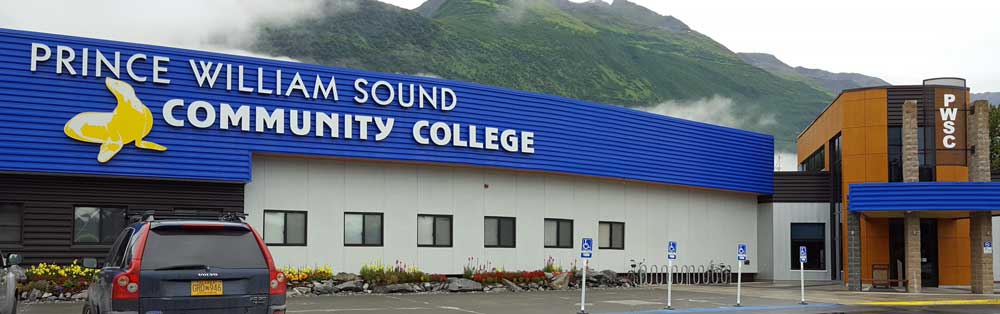
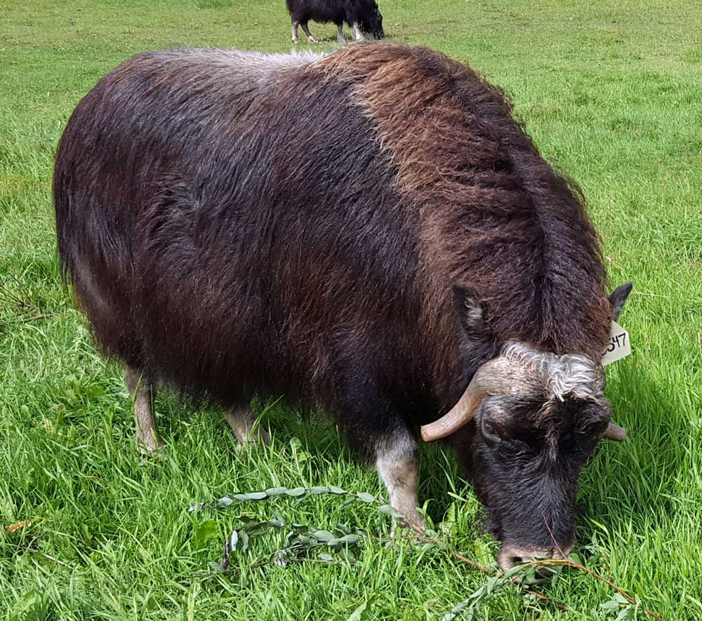
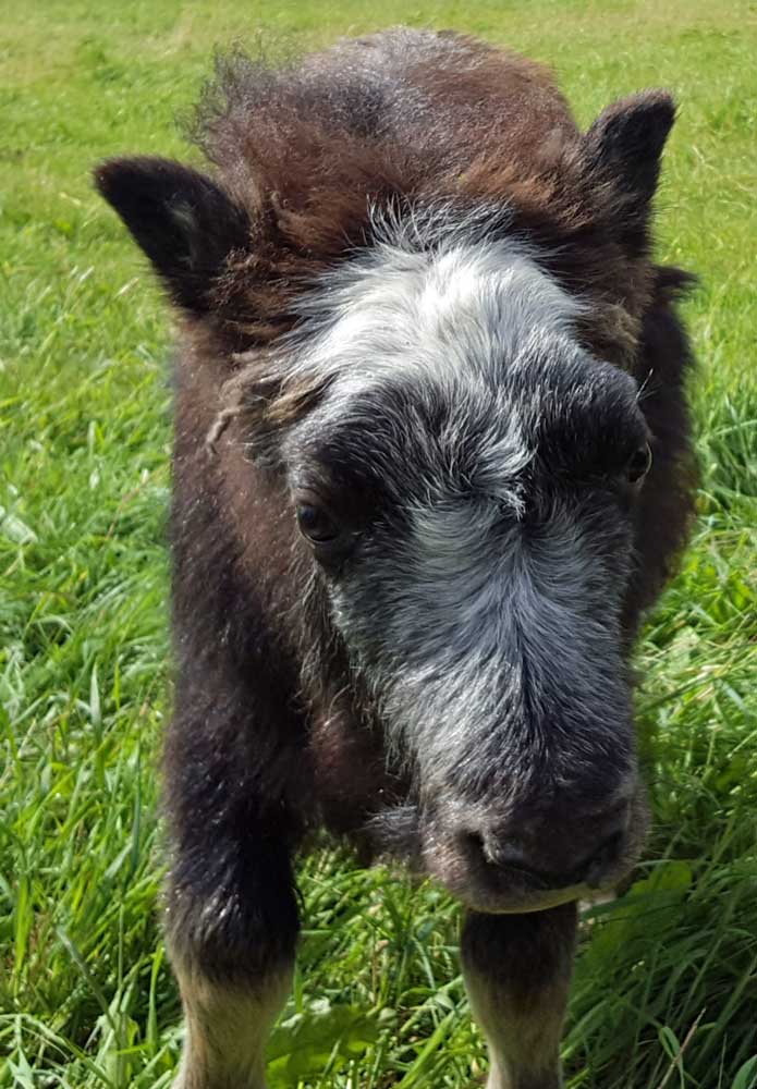
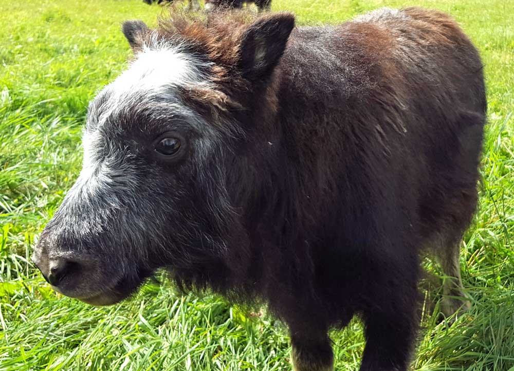
I'm always in search of college baseball caps so I visited the Prince William Sound Community College but learned they have no bookstore and the only logo-wear they had was sweat pants. Still, they did have a very nice museum with many Alaskan artifacts and a stuffed Musk Ox. Of course they had many stuffed Alaskan animals but I mention the Musk Ox because of our tour of the Musk Ox farm.
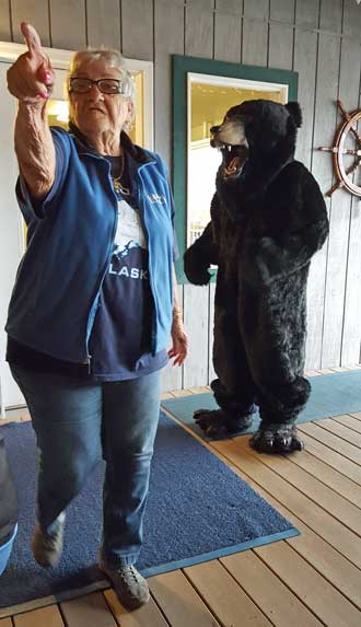
Tonight we enjoyed a potluck with our guests. While using the RV park deck, the owner of the park welcomed us and thanked us for choosing their park. Then she asked if we had seen any bears yet. The group answered in one voice, "No!". But we soon got our bear-wish ... what fun.
Click the top two photos for additional views.
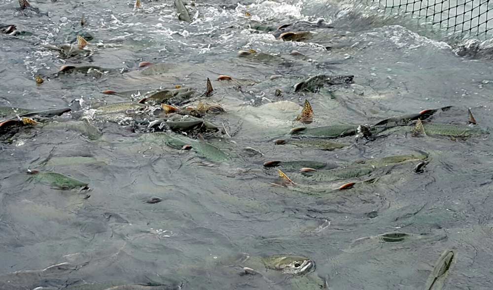 |
Tuesday, July 26, 2016: We visit a nearby Salmon hatchery and learn Pink Salmon are returning to spawn in the river. The river and bay where the river flows, are covered with thousands of Salmon. Further out in the bay, about a dozen Sea Lions are feeding on the Salmon so we often see spots of violent activity as the Salmon attempt to avoid being a meal for the Sea Lions. It seems that only a fraction of the thousands of Salmon actually reach the river to spawn. We are in Valdez for four nights. Again, we are crammed tightly (awning to awning) in a RV park. These Alaska RV parks have only the short summer season to make enough money to survive the year. So they cram as many RVs as they can onto their gravel parking locations. It is obvious, they put little back into their parks. Obvious because most of very rough, only 30 amp service, no sewer hook up with WiFi advertised as "free" but of little use it is so slow. |
 |
 |
 |
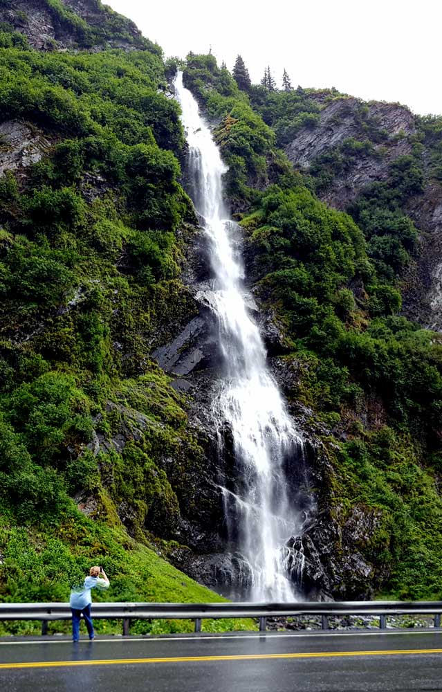 |
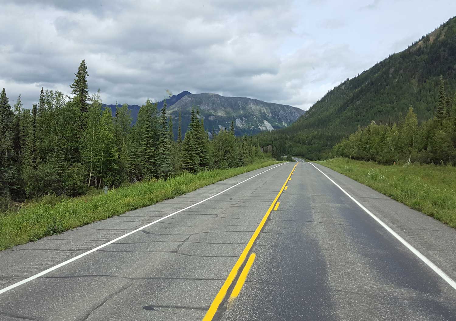
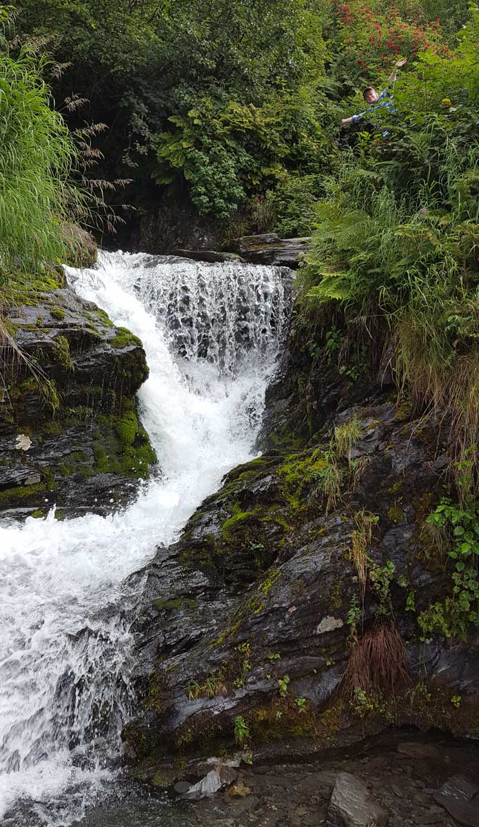
Monday, July 25, 2016: Another gloomy, wet, cloudy travel day to Valdez Alaska. It's a lonely port town with its major distinction as the terminus of the trans-Alaska oil pipeline. This is where the huge fuel tankers fill with Alaska oil from the northern part of the state. I don't see the tankers so they must be further into Prince William Sound for docking. It DOES seem that security of the terminus is significant although much of it is exposed in Alaska so I would think subject to a terrorist attack. The two lane road to Valdez has some fantastic scenery if not covered in clouds as it was today. We stopped at the Wrangell St. Elias National Park Visitor Center to look at photos of the park since we couldn't see it. This is the largest national park in the nation, eight times the size of Yellowstone. No doubt, some day there will be good access into this park but for now, it is far too rugged for roads. Bridal Veil Falls is just next to the road so everyone had to stop for photos. Click the photos for more views. | 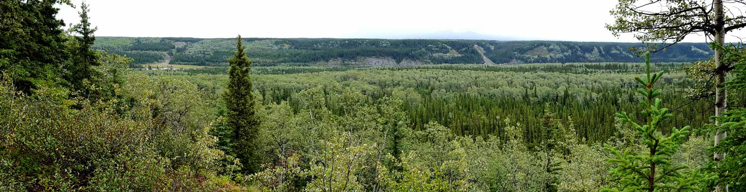 |
 |
 |
Friday, July 22, 2016: Today was a travel day from Seward to Palmer, Alaska. This had been our first real day of clouds and rain as we travel through Alaska. It is welcome to help put out some of the wildfires found around the state. Palmer, we learned, is the home of the Alaska State Fair and also one of the few areas of Alaska known as an agricultural area. The growing season is short but with the many summer hours of sunlight, the vegetable crops grow fast and large. It is also the home of the only Musk Ox Farm in North America which we will visit tomorrow. Gwen is making chili for a staff prepared meal. Click the photo for a view of our Palmer camp site. |
 |
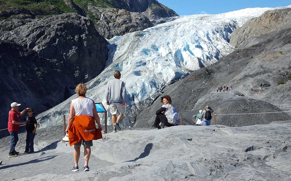 |
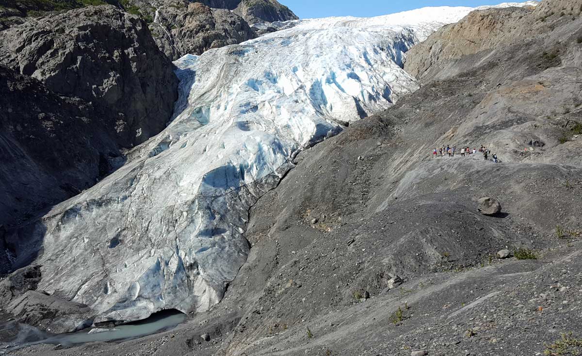
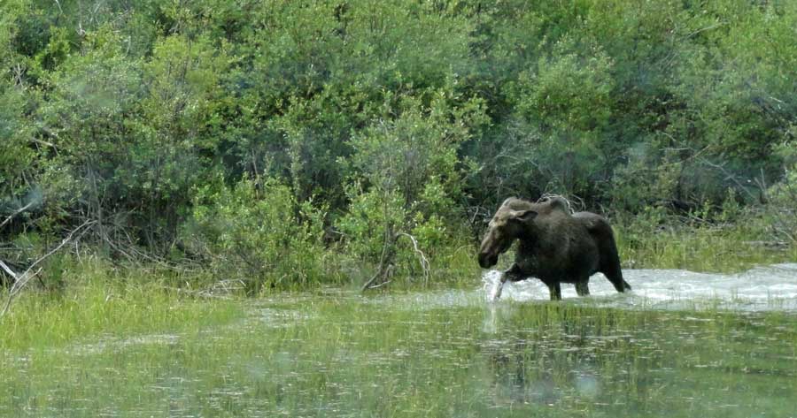
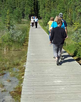
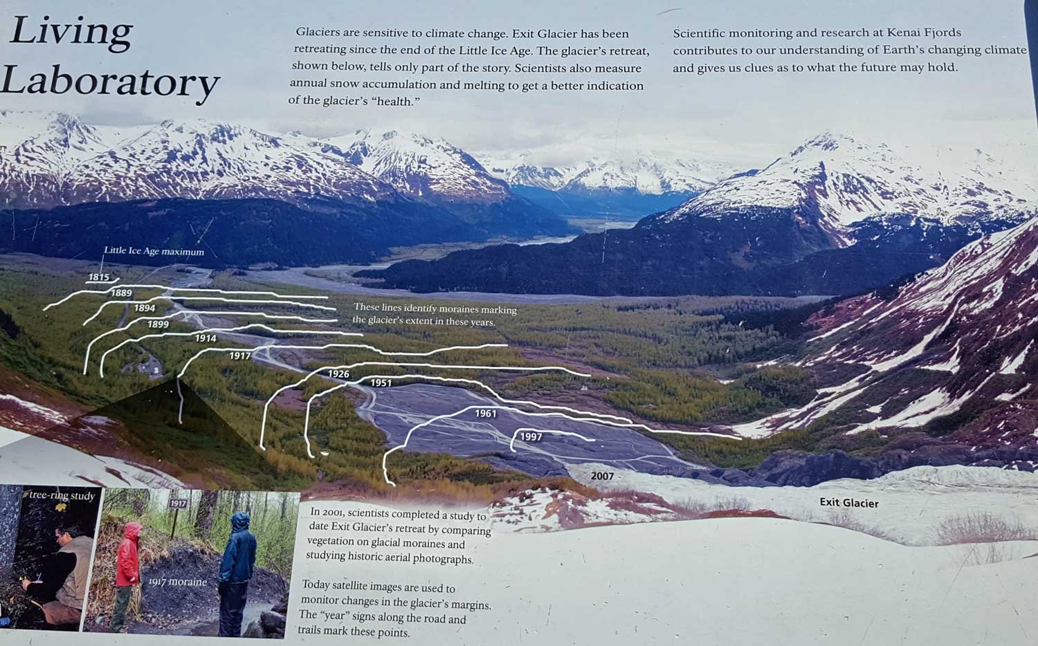
Wednesday, July 20, 2016: We all enjoy a hike to Exit Glacier today located about five miles from our camp. It is one of the few glaciers you can still drive to and also located within the Kenai Fjords National Park. It was a relatively easy, two mile hike round trip to the glacier view point. All these glaciers we have been seeing yesterday and today are coming from the Harding Icefield along the mountains separating Homer and Seward. The entire icefield is part of the Kenai Fjords National Park. The Exit Glacier has been receding since it's discovery and records are now kept of its position each year. Additionally, signs are posted marking the glacier's position on that year (1926). Click each photo for additional views.
 |
 |
 |
 |
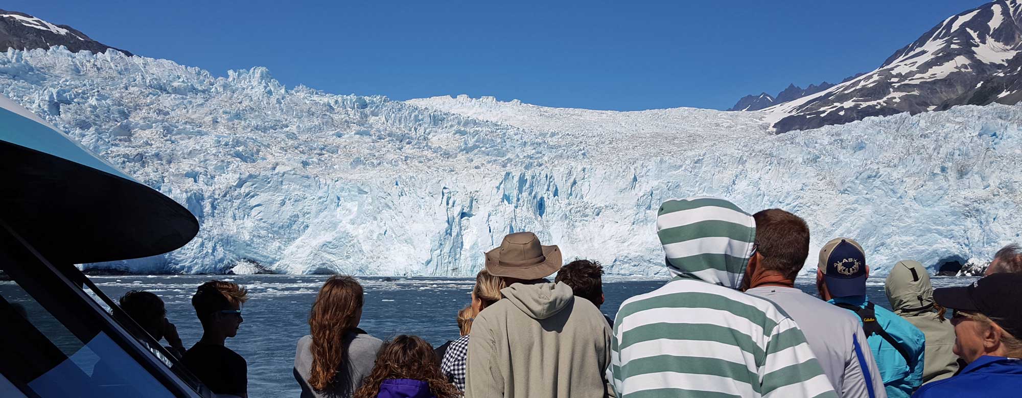
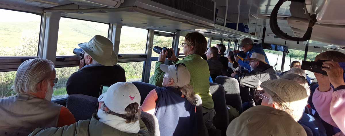
Tuesday, July 19, 2016: The day many of us have been looking forward to and the weather was perfect. We take the Kenai Fjords boat tour of the Kenai Fjords National Park wildlife and glaciers. This is an all day tour with lunch and dinner. We begin the tour with a close-up view of two otters floating near port then off to several islands where we see birds nettings along the cliffs. In another hour we reach the Aialik Glacier where we see and hear the calving of the glacier and see the seals enjoying the icebergs after the calving. Dinner is on Fox Island at the National Park lodge. Good salmon and prime rig. Click each photo for more views. | 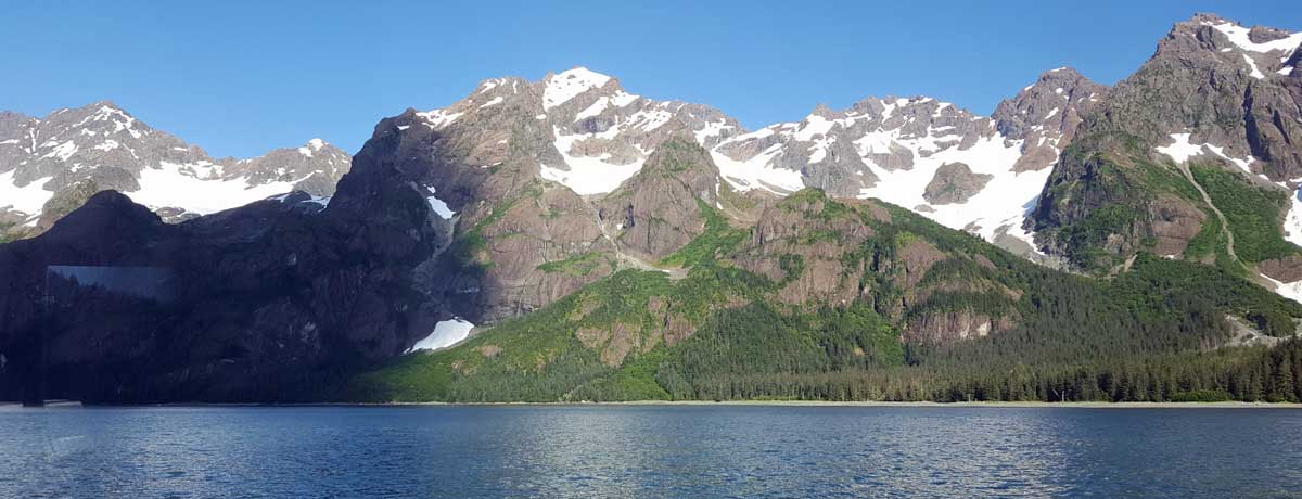 |
 |
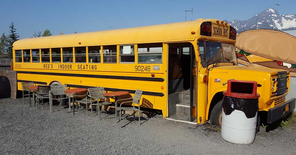 |
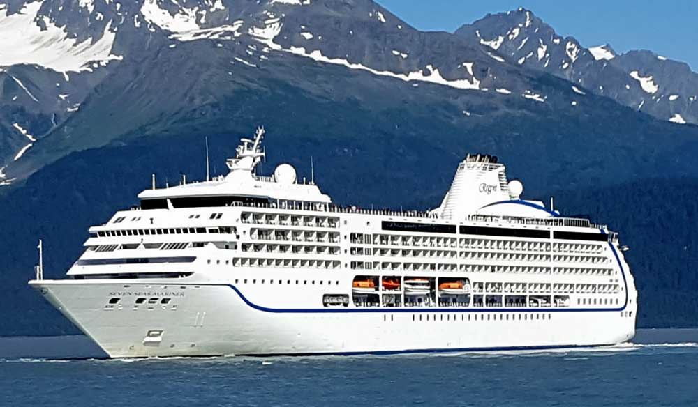
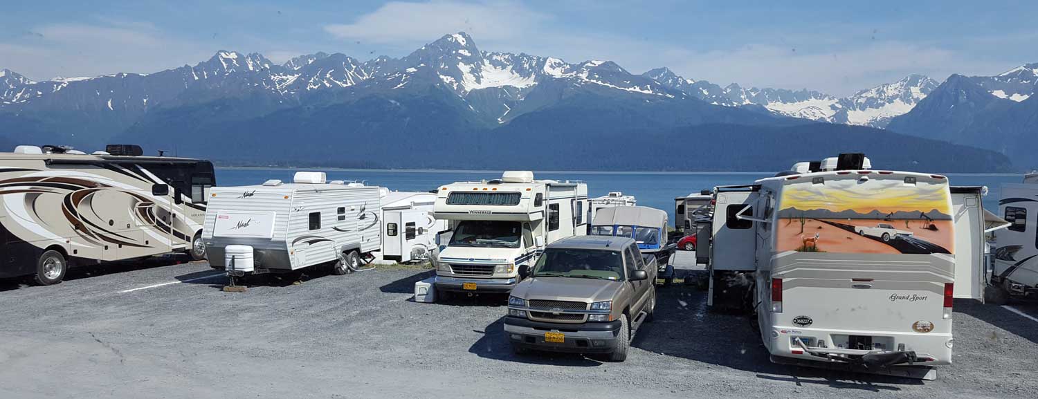
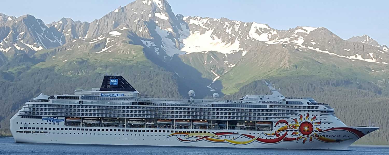 Monday, July 18, 2016: Another travel day, this time from Homer to Seward, Alaska. We camped in a "first come, first served" city park but the caravans have reserved spaces. "Adventure Treks" was reserved but WITHOUT front row bay views. Click the reservation sign to see our view. Several of our guests recommended "Red's Burgers" out of a "bus" so we tried it. We met our friends from Oregon, Ralph, Janet, Dick and Mary Ellen who are also visiting Seward. While visiting, we were able to see the Norwegian Sun embark on a week long cruise to several port cities in Alaska ending up in Vancouver, BC. Click all photos for more views.
 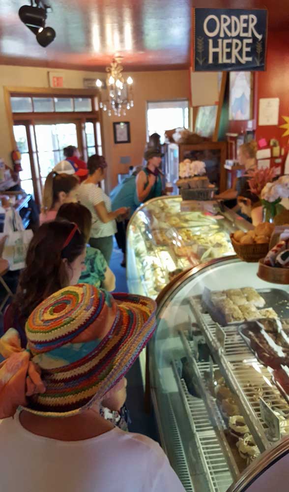 |
 |
 |
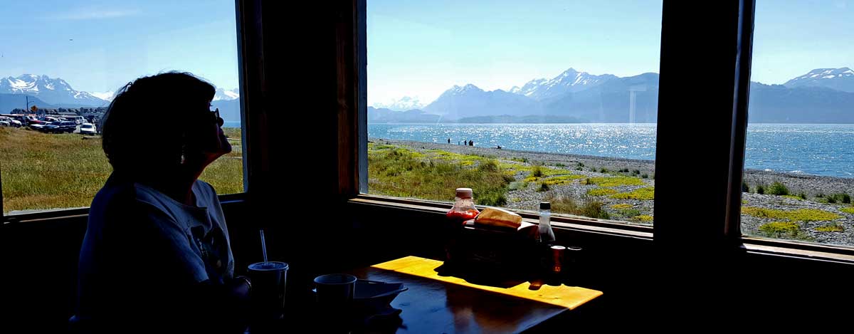 Sunday, July 17, 2016: This was suppose to be a rest day but, instead, we drove into town (after Gwen did a load of laundry) to get some file folders and another container of Halibut dip.
But first! We drove to "old town" to find the "Two Sister's Bakery" recommended to us by our tour guide yesterday. We learned it is a very popular bakery with a long waiting line. We bought bread, a lunch-time treat, and a few items for breakfast.
Next, we did find the combination hardware, housewares, quilt shop, garden shop and sport shop. This is where we found the file folders we were looking for to organize our brochures in the case we get to be trekmasters next year. This was another store recommended by our tour guide. The city of Homer does not allow large corporate stores so she called it, "Homer's Wal-Mart".
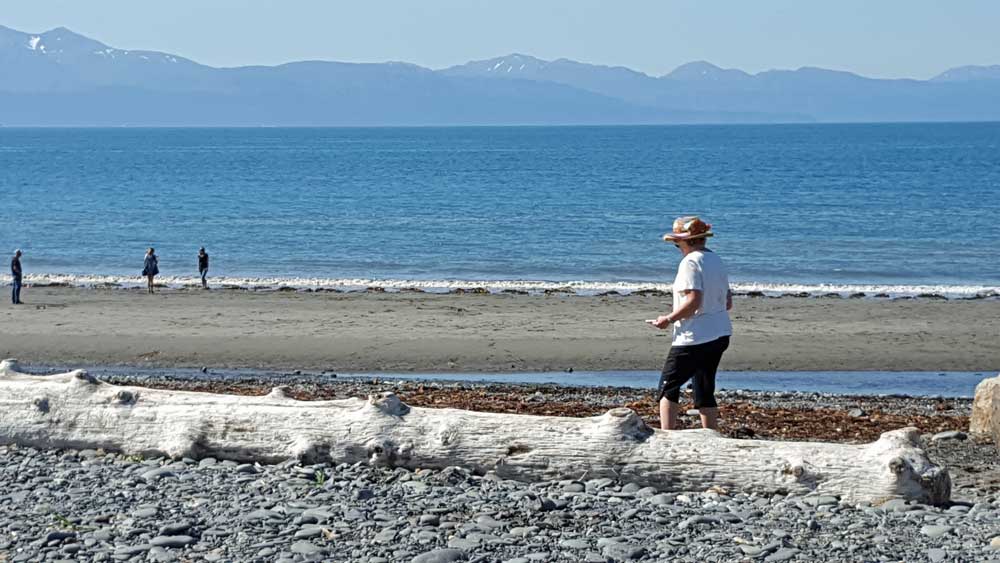
Our Homer beach walk found a bald eagle sitting on top of the tsunami early warning tower. I imagine these towers can make a lot of noise when activated. I believe we are sitting at least 30 feet above sea level so probably safe. As Gwen and I walked the beach looking for unique rocks, sea otters, seals, whales, we knew the tide was near its highest point.
Finally, we drove to "the spit" to get another container of Halibut dip. Something Gwen really likes. We decided to visit the Halibut and chips cafe recommended by our tour guide. We shared one basket, very enjoyable. Click all photos for another view.
 |
 |
 |
 |
 |
 |
 |
 |
Friday, July 15, 2016: We are traveling to the Halibut capital of the world, Homer, Alaska. This is a small town of 5,000 population but we are told, triple that during the summer months. This seemed like a long day with 222 miles to travel and many stops along the way to look at the scenery. Our job is to look for guests who might be "straggling" or in need of some sort of help. We saw no-one today but missing Robin and Lynne who we passed without seeing them. They explained, "we drove off the hi way looking at the scenery". Click all the photos for additional views. Be sure to scroll left/right on the top two, both are panoramas.
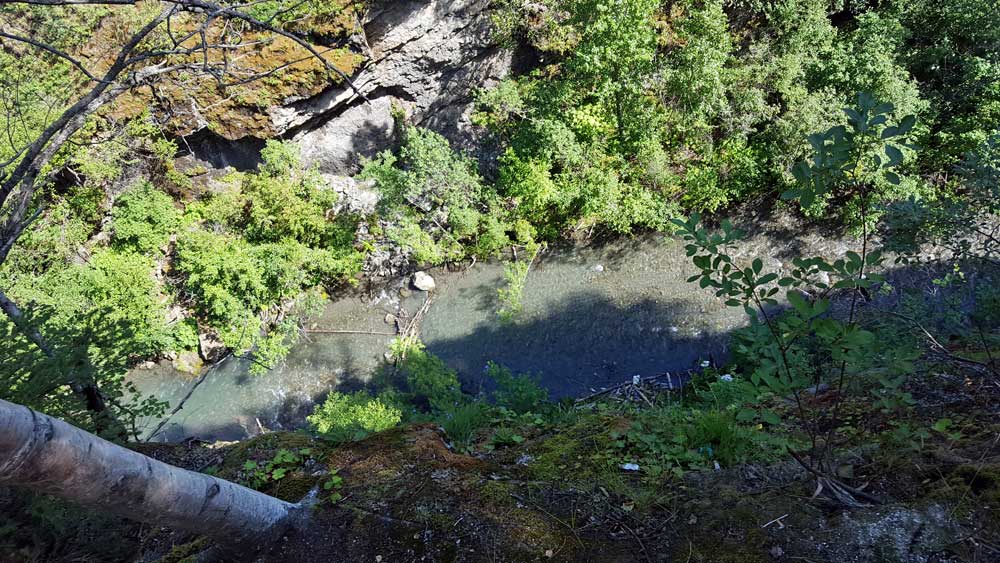
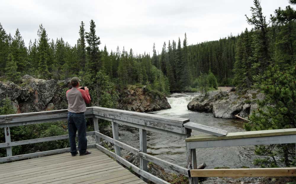
Thursday, July 14, 2016: Gwen and I sent the few guests who wanted to visit the planned event of another museum. Most are tired of museums as are we. We took ourselves and Morgan for a nice hike to Thunderbird Falls. This is a short hike next to a deep canyon where we get a view straight down to the river from an overlook (click the photo). Morgan's hiking limit is 2 miles so this was just right for her. There were lots of people and kids on this hike so a popular place to be on a Thursday morning.
Six of our RV rig guests signed for the 23 day tour and today is day 23. We had a pizza party to say good-bye. It is surprising to me how close friends you can become in 23 days of travel together. We have really enjoyed everyone and sorry to see them part from us. In the photo from the left are Bo, Cheri, Tony, Helen, Karl, Bill, Bonnie, Gail, Jim (I called him James), and Donna. I also surprised myself by learning ALL the names in about a day. We continue with nine rigs plus the Trekmaster and us.
 |
 |
 |
 Wednesday, July 13, 2016: This is our first full day in Anchorage. There is so much to do and see, we are hoping for more days but know we must see as much as we can in two days.
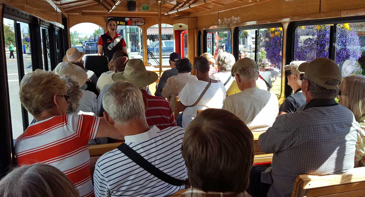
We begin the day with a trolley tour of the city. The tour was made most enjoyable by our driver, an ESL and Spanish teacher in Anchorage. Although she let us know that she has retired from that job to be a full time mom with a 14 month old baby at home. She talked non-stop during the bus ride and if we could have remembered everything we would know much about the city and the history of the area. What I remember is that Alaskan's eat more ice cream per capita than the other states and one in sixty residents is a pilot. The float plane base was very busy with planes lines up to take off.
The afternoon was at another museum. This time is was the Anchorage museum. Four floors of art and history. I found the discovery center which was made for kids to explore scientific and physical laws. I enjoyed it as much as the kids did.
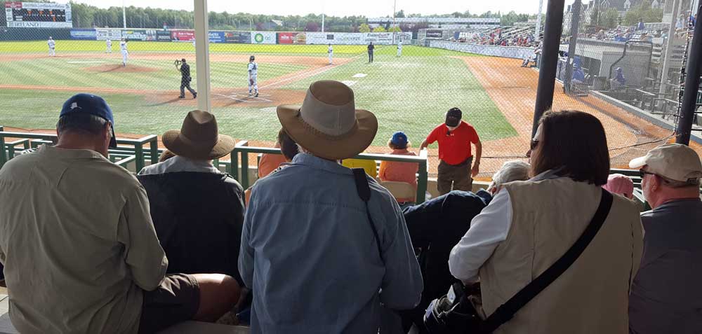
The final activity of the day was a "Mayor's Cup" baseball game with very talented college age young men. The "Pilots" won the game 3/0 and apparently very important to them with lots of calibrating. Click all photos for additional views.
 |
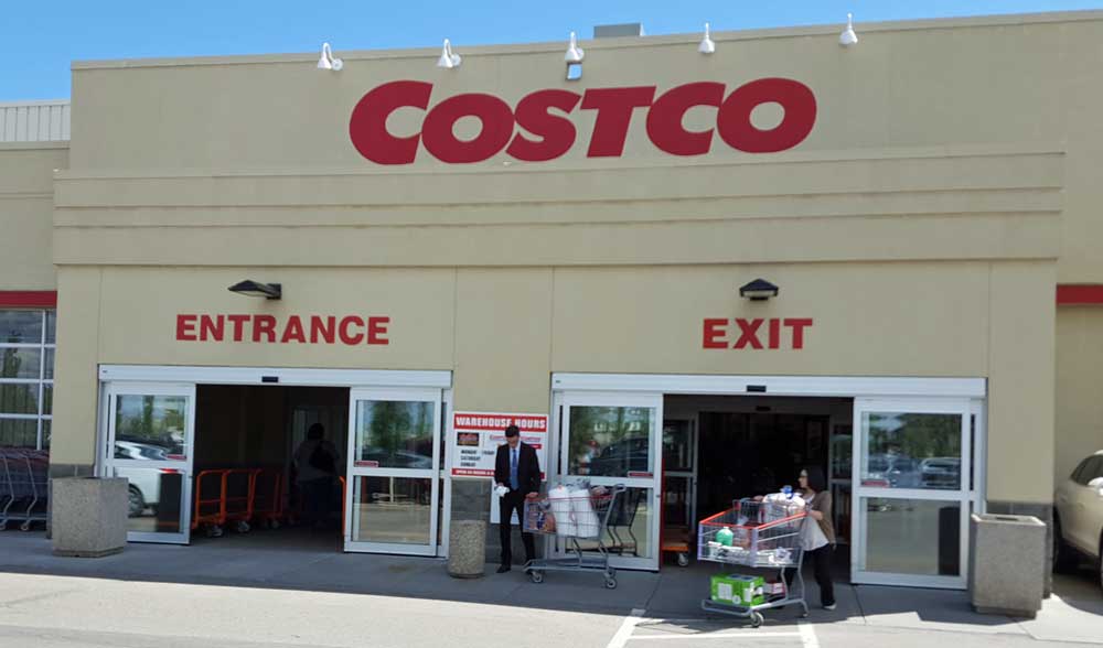
Tuesday, July 12, 2016: Be began our travel day by back tracking to view Mt. Denali since we had not seen it entirely. Then we made a U-turn for a short 90 mile trip to Anchorage. Click the Mt. Denali photo for a view of our crowded Anchorage RV Park. Once we arrived in Anchorage we drove to Costco before our RV park to get gas in the motorhome ($2.37/gallon). While in a new (to us) Costco I like to look for items which are unique to the local area. What I found in THIS Costco was a blackout panel (because the sun does not set until midnight) and a mosquito killing machine ($500). Additionally, I found a huge "dip-net" which seemed to be a hot seller. The photo shows the morning inventory and when I returned that same afternoon ( to make a return) the inventory was half gone. Click both these photos for additional views. | 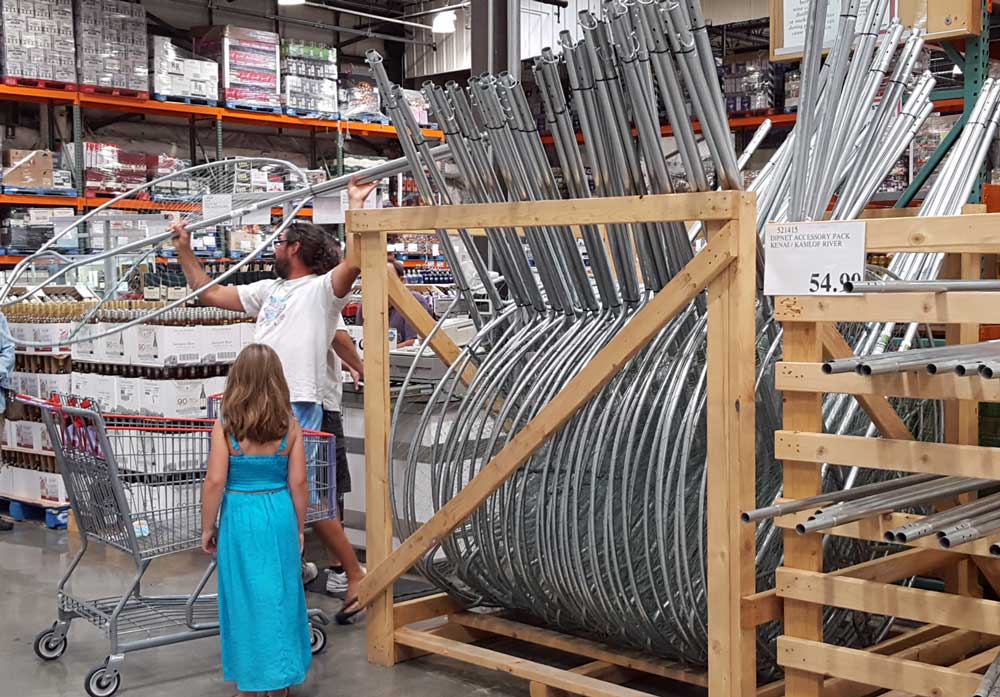 |
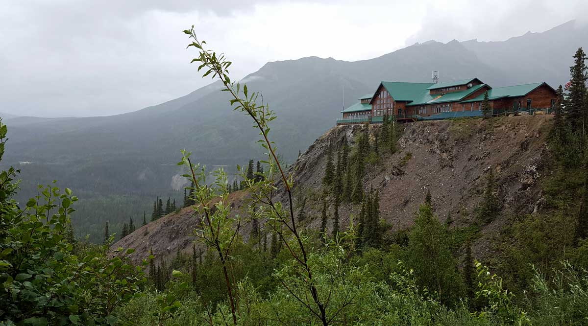 |
Monday, July 11, 2016: Gwen and I finally see a moose with her baby along side the road. Then we catch a view of the Alaska Railway train at the Denali Depot (click the moose photo to see the train). Just before leaving Denali we drive up to the Grand Denali located high on the mountain above our campground. The photo to the left is that view (on a rainy morning). Click the photo for a view of the resort sitting on the cliff. Then, off we go again to Talkeetna, a "hippy" town with interesting shops and restaurants. We start with the Talkeetna Historical Museum where we learn of the railroad and gold rush history of the town. This is also the town where climbers stay just before they ascend Mt. McKinley so we see a climbers exhibit in the museum. Click the museum receptionist |  |
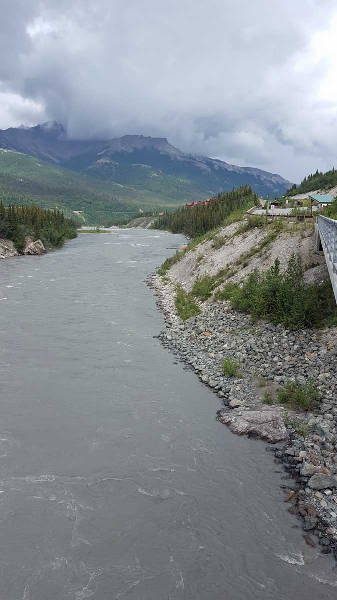 |
Sunday, July 10, 2016: Gwen, Morgan and I took a walk to the Nenana River pedestrian bridge. The bridge is about one mile from our RV park. This long of a walk was a "stretch" for Morgan. She begins "dragging" after a mile. The Nenana River is mostly fed by glacier melt during the summer months and carries a lot of glacier silt making it look muddy. During the winter months, the glaciers stop melting and the river is clear. Click these photos for additional views. | 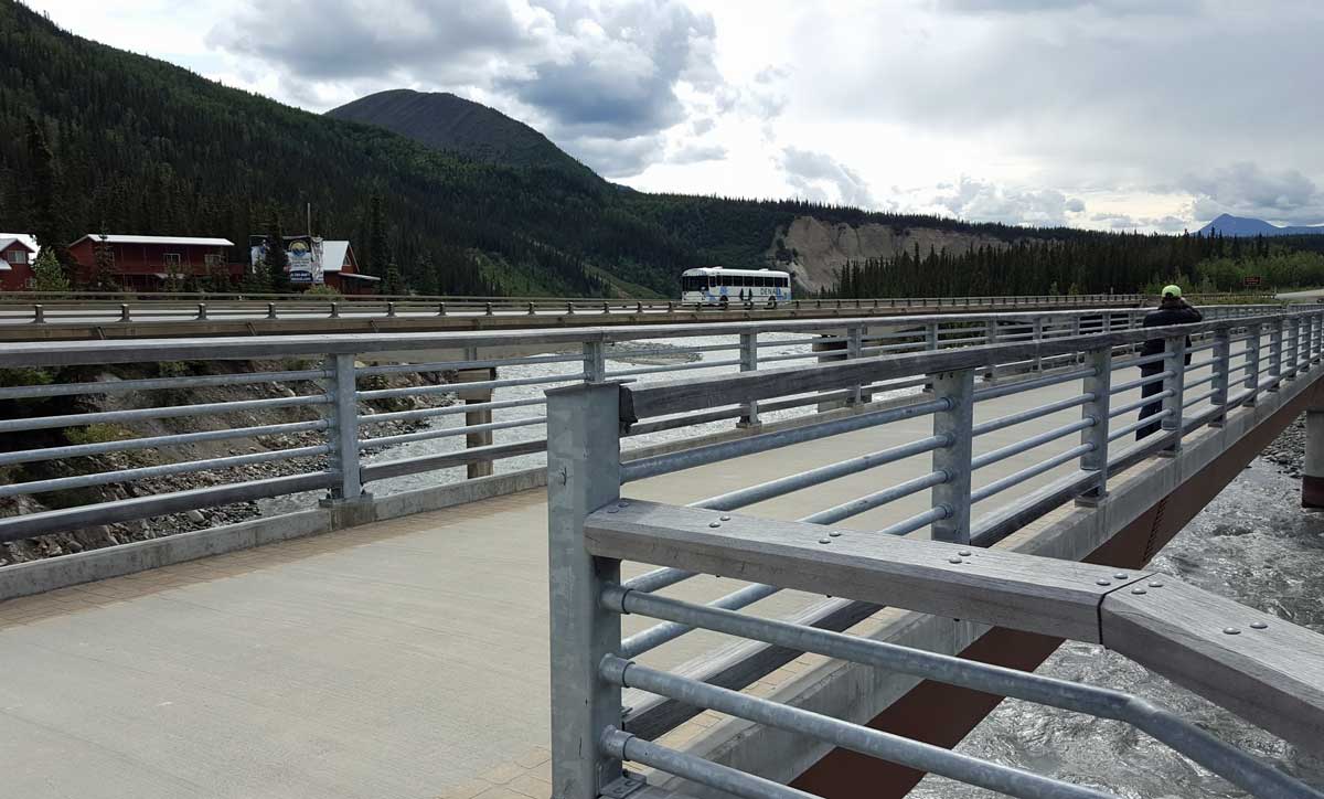 |
 |
 |
 |
 |
 |
 |
 |
 |
 |
 |
 |
 |
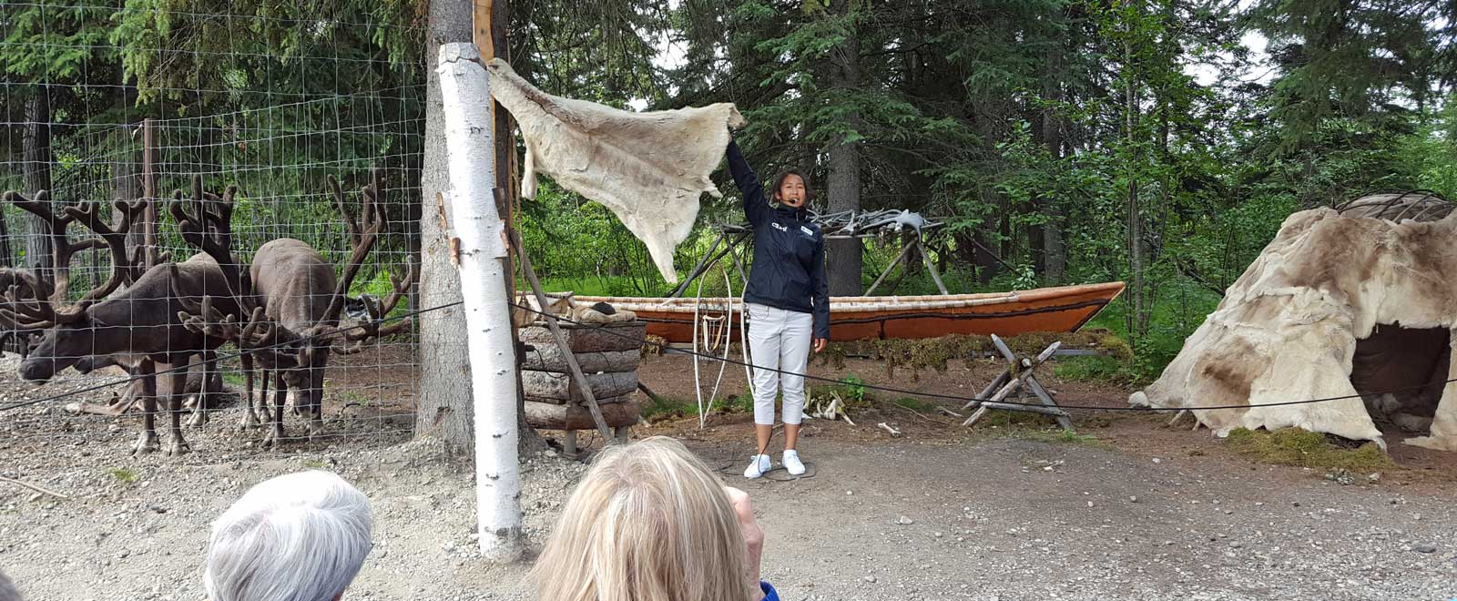 |
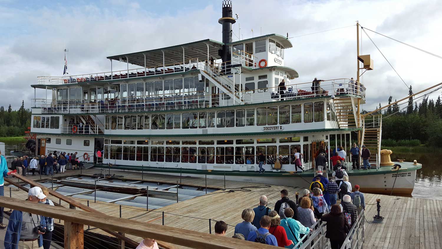
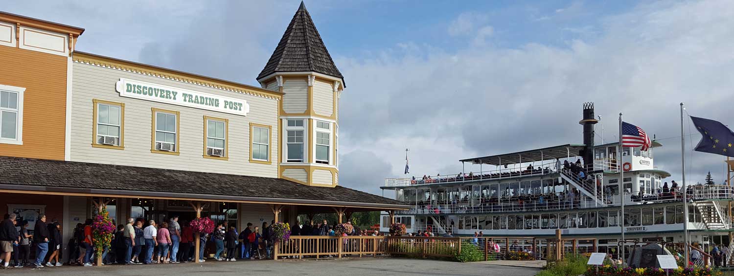
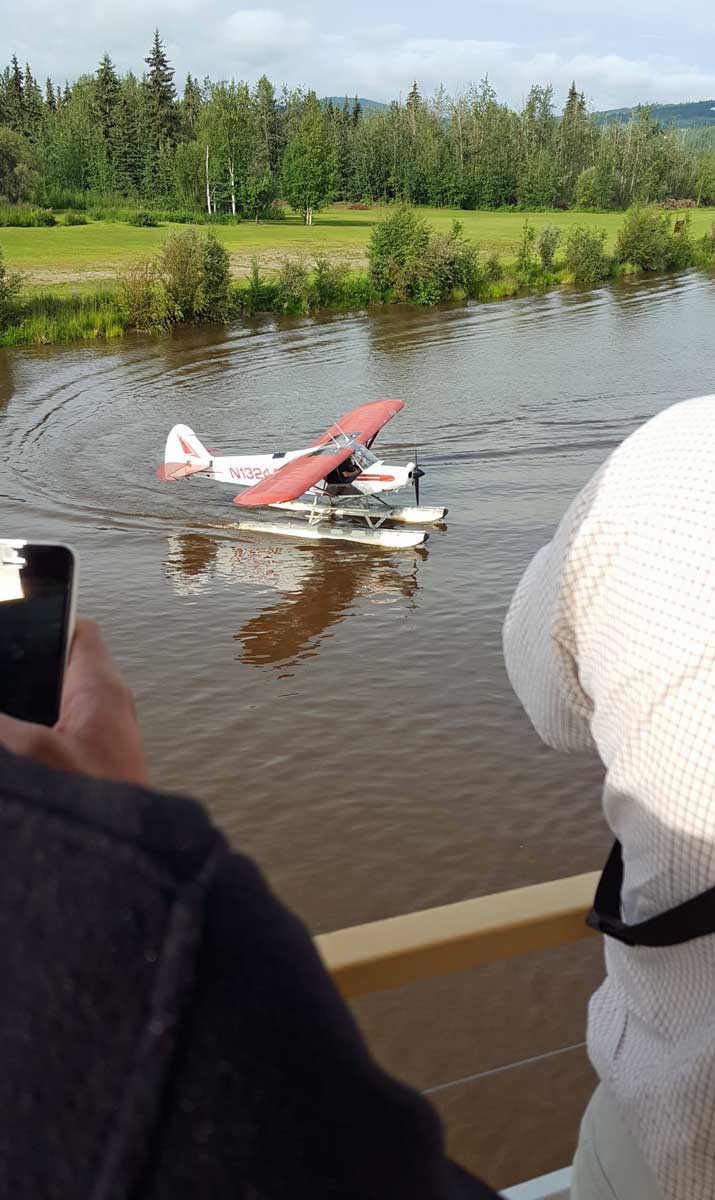
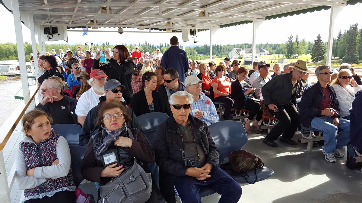
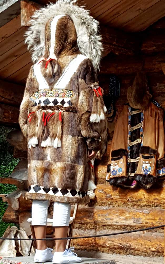
Wednesday, July 6, 2016: Today was a tour on an "authentic" paddlewheel, four story river boat. We arrived a bit early so at first we thought we might be the only tourists, however, soon buses full of cruise ship passengers began to arrive and filled the river boat. The announcer told us NOT to wait in line but to visit the gift shop before the cruise began. One of the popular attractions was the "40 below room" where your photo was taken in Alaskan winter weather. Today's temperature was 56 degrees below zero. The folks were lined up for the experience. Harold and Kathy struggled with hat choices. Gwen and I have matching coats too! Once we boarded and turned around, we were immediately entertained by a float plane pilot taking off and flying around the boat then landing again. The announcer interviewed the pilot for all to hear. Captain Ken maneuvered the boat on the river for about two miles which would not have been very exciting except for the skillful announcer who educated and entertained us along the short trip. We docked at a reproduction Athabascan Village. Teenage Athabascan students gave us a personal tour of the village and educated us with the Athabascan culture. Dog sledding is very popular in Alaska as a | 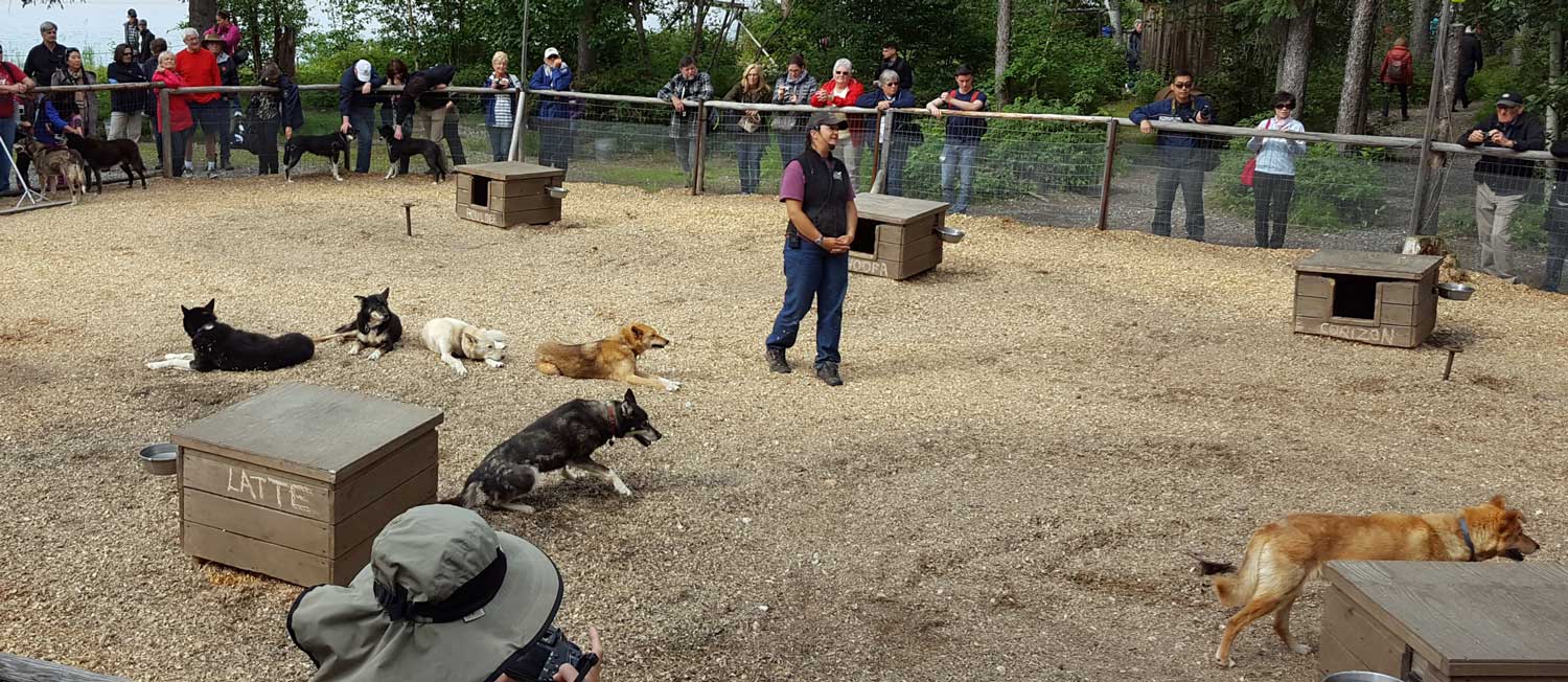 |
| sport. The boat stopped while the announcer interviewed the daughter of mushier Susan Butcher for all to hear. She was also present at the Athabascan village for a Q & A session with tourists. The boat is powered by diesel engines powering hydraulic pumps, no steam engine for this boat. This was not a cheap tourist attraction so I had doubts about it's value for a two mile trip. It was very professional, entertaining and educational so I enjoyed the ride and would recommend it. Be sure to click the photos for additional views. | ||
 |
 |
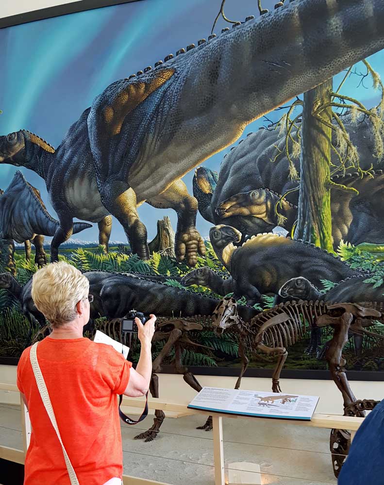
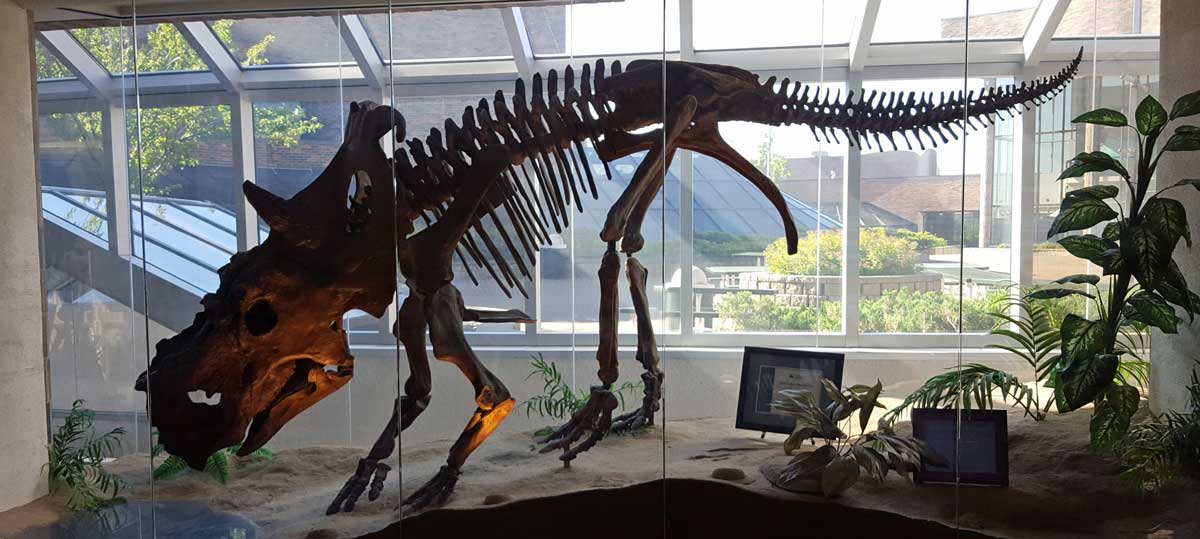
Tuesday: July 5, 2016: The University of Alaska has built an impressive museum of Alaskan history and natural history. We scheduled 3.25 hours at the museum but learned there is far too much to see and do at the museum in that short time.
When I parked I noticed a strange looking "meter" at each parking space. I quickly learned they were not meters but electrical outlets. During the winter months when the temperatures are -30° F or lower, most Alaskan cars are set up with an AC plug to keep the oil warm. Visitors to the museum have no need to worry about the cold weather with the University providing electrical outlets.
Alaskan river banks provide a source of dinosaur bones plus fossils and the museum has several displays.
In addition to the displays, there are historical and natural history videos shown every hour. The videos plus the amount of stores to read left us with time short.
Click the photos for additional views.
 Monday, July 4, 2016: Happy Independence Day. The photo shows the "Antler Arch" built of more than 100 moose and caribou antlers. It was built by Sandy Jamieson as an arch to walk through into the city of Fairbanks. Each antler has a story.
"A goal of the arch is to bring attention to the bike and walking paths along the Chena River in downtown Fairbanks, and to encourage people to make the short four-minute walk between the Morris Thompson Center and the Golden Heart Park. “It’s certainly going to be a tourist attraction. You can tell that already by the number of people who came by and took pictures as we were building it,” said Sandy Jamieson, local artist and cabin-builder who oversaw the installation of the antlers. “I always like seeing an antler or a skull out in nature. Some nice vines growing throughout the antlers in the summer would invoke the common experience of being out in the woods and connecting with nature.”
 |
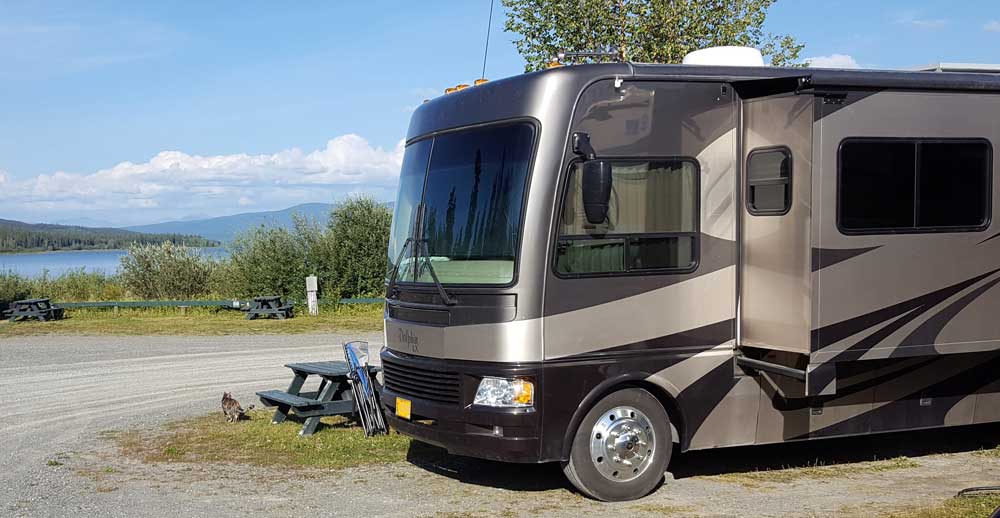
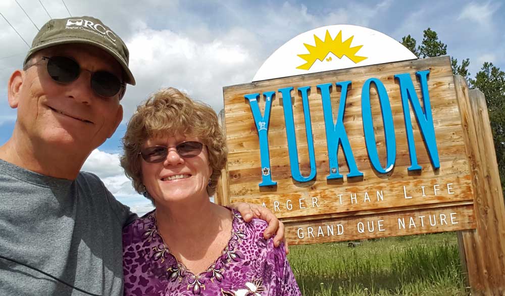
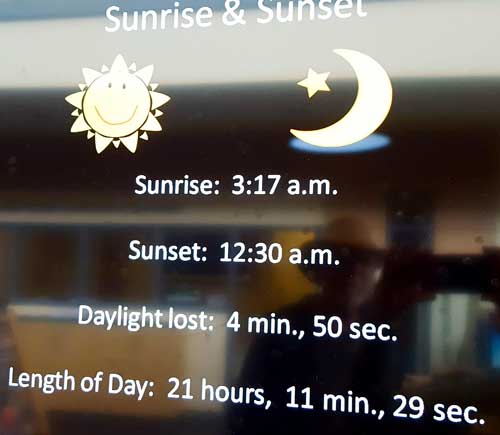
Sunday, July 3, 2016: I'm wearing my Grande Prairie Regional College (GPRC) hat when standing with Gwen in front of the "End of the Alaskan Highway" marker in Delta Junction, Alaska. It is about 250 miles inside the Canada/Alaska border. We continue toward Fairbanks to the River View RV Park in North Pole, Alaska, about 11 miles from Fairbanks. We arrived in time to join Ray and Bo at the Fairbanks visitor center. It's a beautiful building with videos, history and wildlife exhibits plus lots of gifts and books to buy. Click both photos for additional views. While at the visitor center, we got this report of today's sunrise/sunset data. | 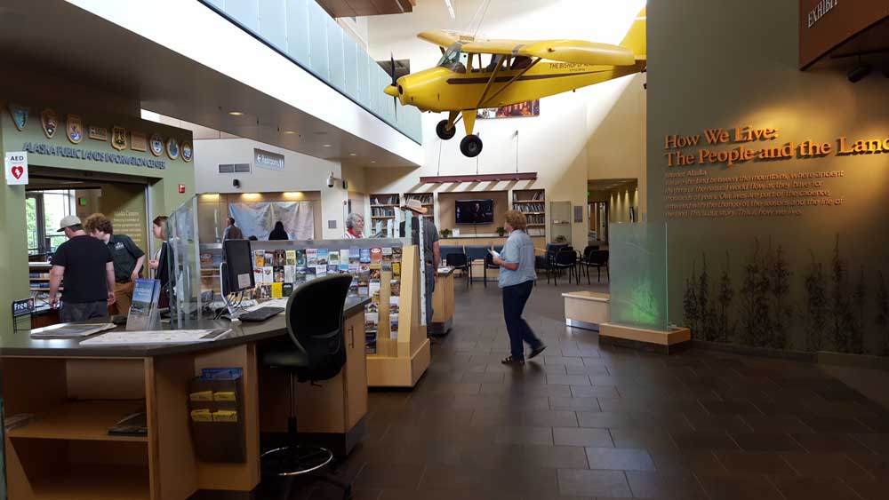 |
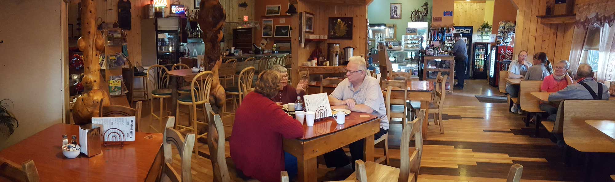
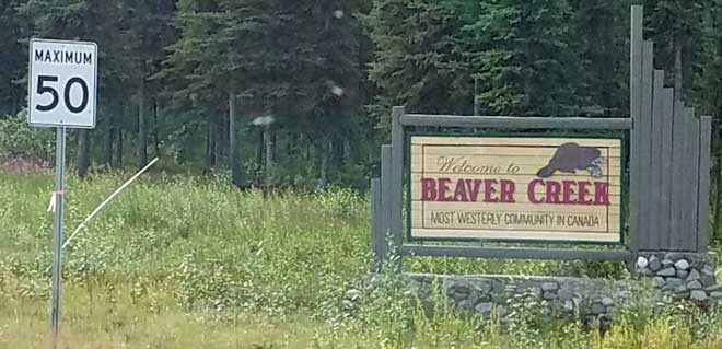
 |
Saturday, July 2, 2016: This was a travel day from the Cottonwood RV Park south of Destruction Bay, YT to Tok, AK in the USA. Our first stop was with friends, Bill and Bonnie for breakfast at Buckshot Betty's in Beaver Creek, YT, (click the photo above) the most westerly community in Canada. The US border is only 19 miles further west. Buckshot Betty was recommended to us. Food was good but slow, slow, slow. We were concerned about the condition of the road between Cottonwood and the US border. It was rough (lots of bouncing and slow going) but not as bad as we had anticipated. We were also concerned about the crossing back into the US but Ms. Wolf, the customs agent, was very friendly and when she learned we were the "tailgunners" for the 16 other rigs in our group complimented our group on how well prepared we were. The photo below is of the border crossing with Bill and Bonnie in the fifth wheel ahead of us. Just into Alaska is the Tetlin Wildlife Refuge. A huge 1094 square miles of wilderness along the |
 |
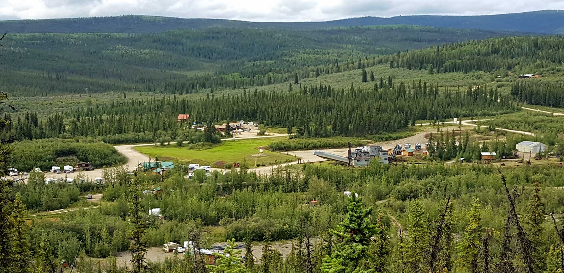
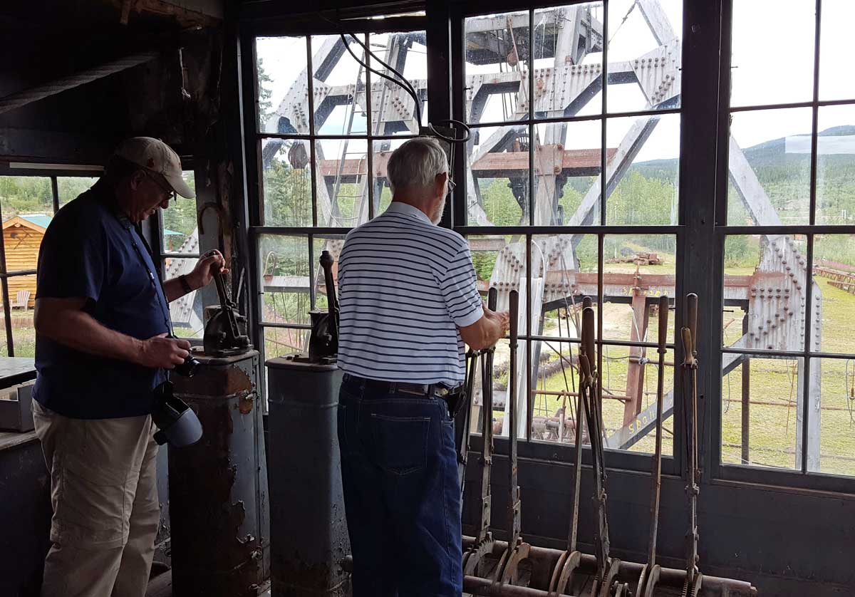
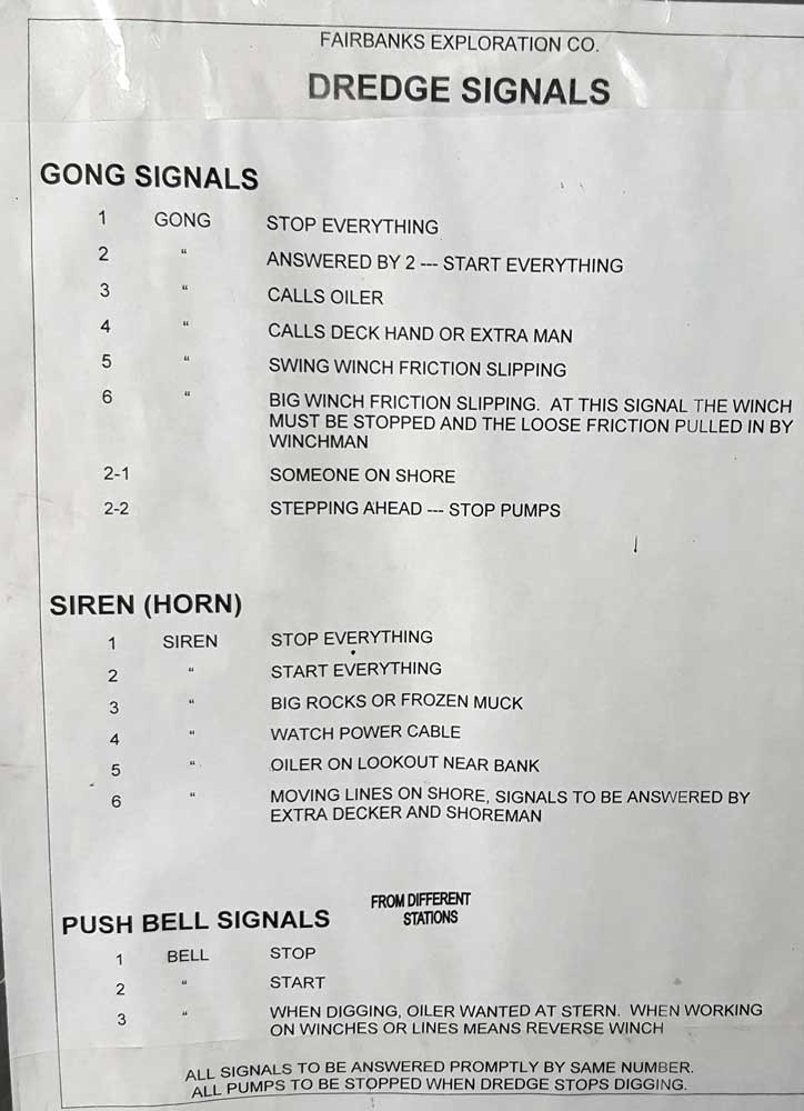
| flyway for the birds who travel south during the winter. We enjoy stopping at the visitor centers. Most have videos which quickly provide the traveler with all the information. When we arrived in Tok, set up camp (click the photo below), we all visited the Burnt Paw to learn about sled dogs. Sled dog racing is a very popular sport in Alaska. The dogs are specialized to a particular style race and also to their position on the team. The mushers are considered the "coach" for their athletic team (of dogs). Click the photo above/right to see Bill who told us about sled dogs. Finally, we visited the Jack Wade Gold Company where our guest got to hold a five pound gold nugget and shop for nugget jewelry. We also learned of mining for gold nuggets and the history of gold prospecting in Alaska. |
||
 |
 |
 |
 |
 |
 |
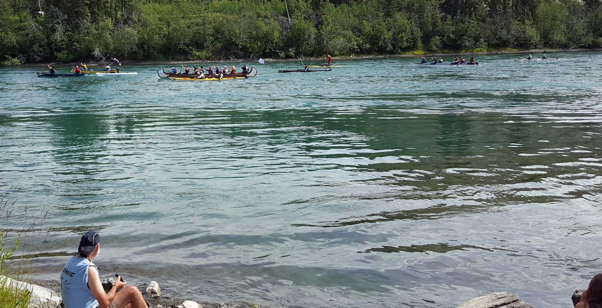
 Wednesday, June 29, 2016: We began this day with laundry in downtown Whitehorse. We finished the laundry just in time to see the start of the Yukon River Quest. The YRQ is a three day canoe, kayak and paddle board race to Dawson City. More than 200 participants are competing this year.
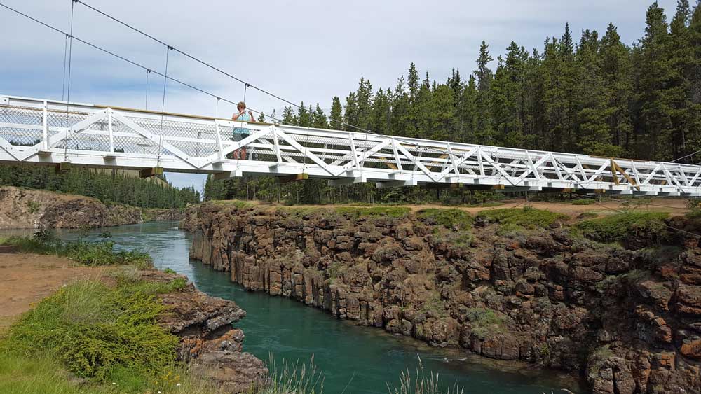
Next, we drove to, then hiked to the Miles Canyon trail. The canyon is a location on the Yukon River where the 1897-98 prospectors had to portage their goods around the narrow canyon. Today, the dam down river has raised the water level where boats can easily pass through the canyon. A suspension walking bridge was built in 1922 to allow hikers access to the other side of the Yukon River.
I have spent several hours in the visitor center because they have free WiFi which is hard to come by in the Yukon. Our RV park in Whitehorse has free WiFi however it would not allow me to upload the photos or pages for this Webpage hence my time in the visitor center.
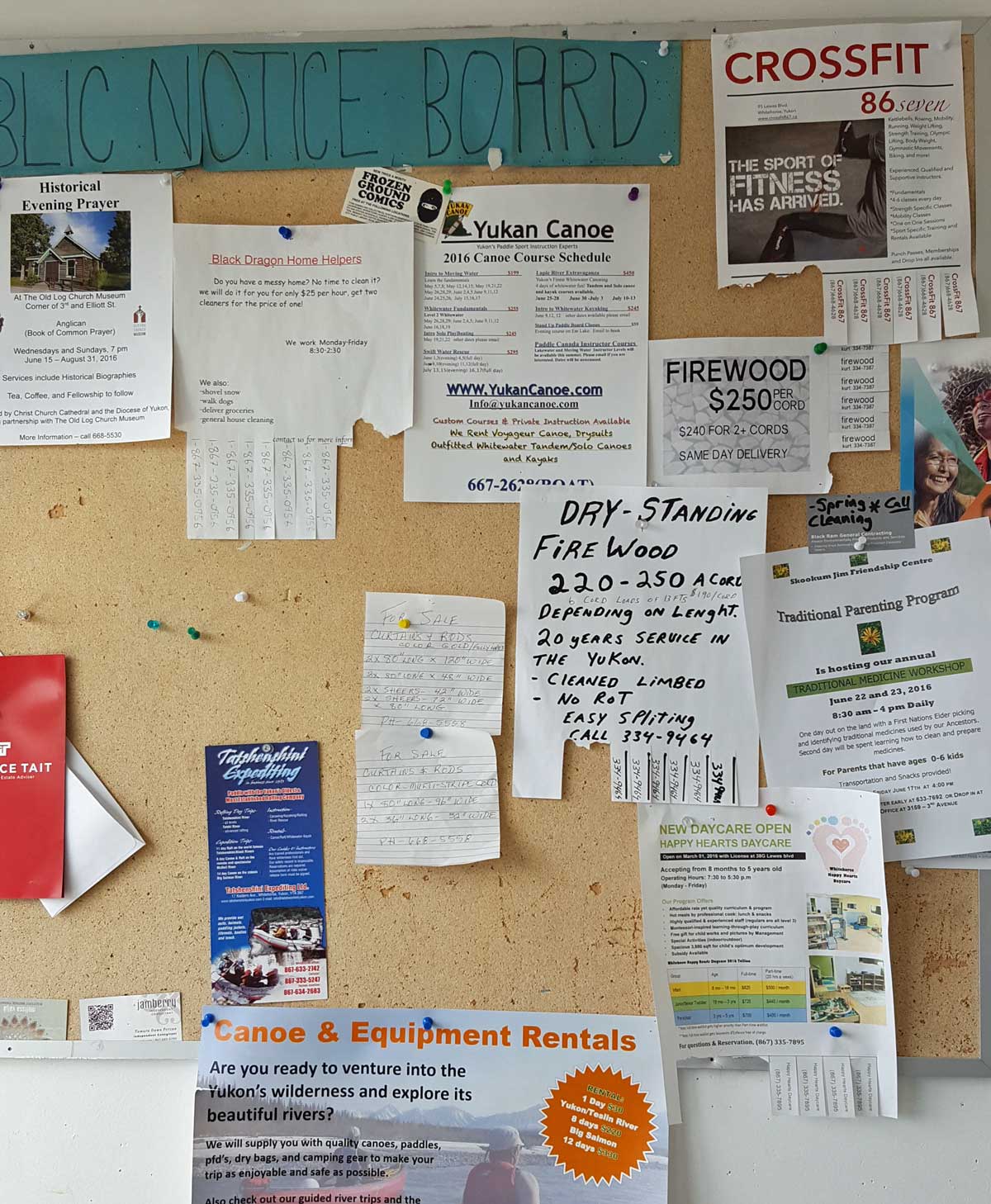
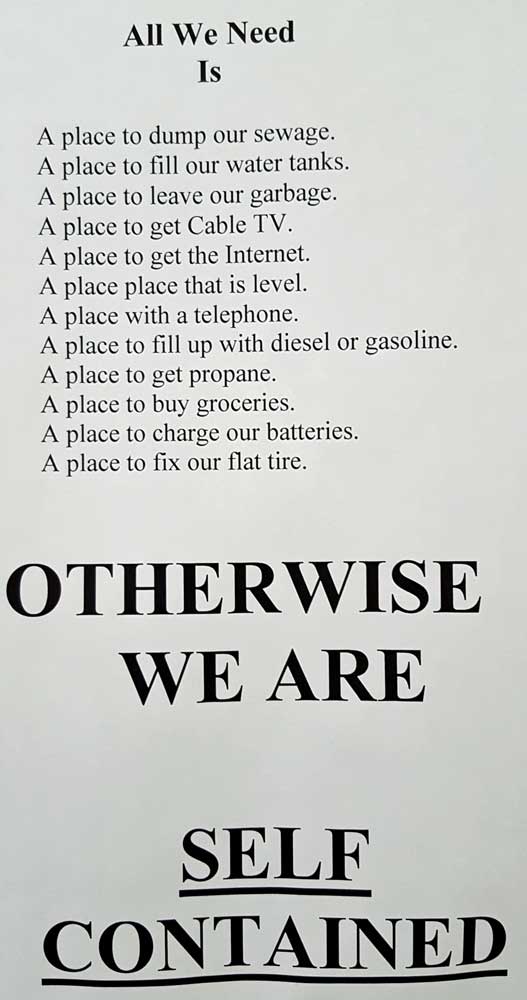
While at the laundry this morning I became interested in the public notice bulletin board. A photo of the notices is behind the visitor center photo. Click ALL the photos for additional views.
 |
 |
 |
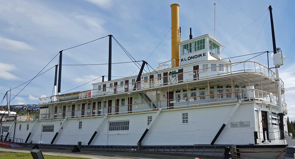
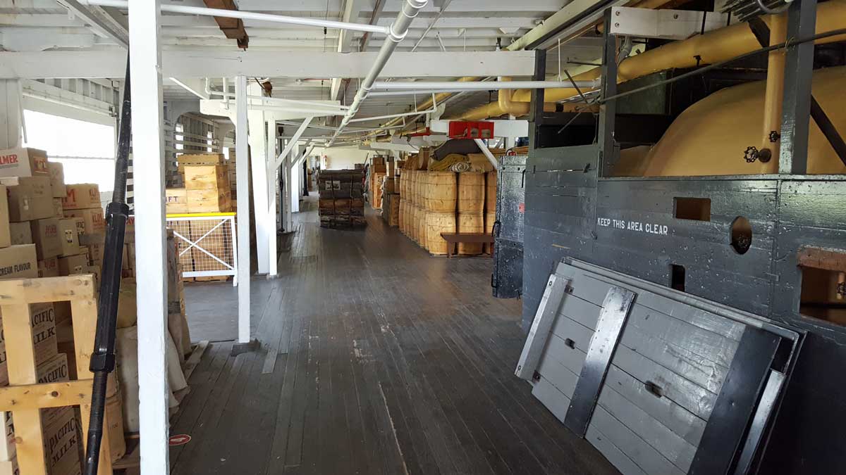
 Tuesday, June 28, 2016: The day began with a tour of the SS Klondike II built in 1937 and used until 1955 to haul ore from Dawson City to Whitehorse on the Yukon River. The trip downstream (from Whitehorse to Dawson City) took 1.5 days, the trip upstream took 5 - 6 days. Wood was used at a heat source to create steam. The boiler would burn 1 cord per hour. Since the boat carried 25 cords of firewood, it could steam for one day before reloading firewood. The ore carried was taken to a smelter in search of silver. The Yukon River is pictured next to the steamer. This is a popular tourist attraction in Whitehorse. Click the photos of the steamer for additional views.
I included the population of the Yukon and behind that photo, the hours of daylight for each month. If you desire lots of space, the Yukon is sparsely populated. Our next stop is Destruction Bay with only 46 residents and the power comes from a diesel generator. We find ourselves going to bed at 10 or 11 pm and it is still light.
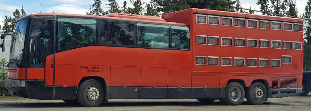
Tomorrow is the beginning of the Yukon River Quest, a paddle race using canoe, kayak or paddle board to travel with the current from Whitehorse to Dawson City. This is a three day event and seems well run with equipment examinations before the participant is registered. Behind the race advertisement is a photo of a German tour bus with 24 tourists and two staff. They eat, sleep and sight-see from padded seats in this bus. We had to walk down the street to see the German tourists and the bus.
 |
 |
 |
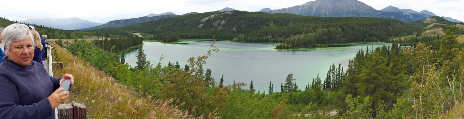
 Sunday, June 26, 2016: Another travel day from Watson Lake to Teslin, Yukon Territory. Along the way we stopped at a short hike to Rancheria Falls on the Rancheria River. We saw lots of L-O-N-G views of tree covered hills and mountains. We also saw evidence of huge forest fires and of forests recovering from fire. The distances here are so vast I can't imagine trying to control a forest fire. When Gwen and I accepted the job of "tailgunner" for this tour group I couldn't understand the need for a tailgunner. For the last three days we have been traveling without cell service and the distances between towns is long. I imagine we are often 100 miles or more from the nearest tow truck or ambulance so I'm beginning to understand the need for a tailgunner. Also, the group really needs more than a "leader" to function smoothly. Today was the "wine and cheese" social at the end of the day. We helped Vicki prepare for the social event. Tomorrow is a relatively short drive (115 miles) into Whitehorse, the capital of the Yukon where we will spend several days and give a chance for all of us to catch our breath since we have been moving each day. Click each photo for additional views. Behind the photo at left is the wine and cheese social. It is a panorama photo so scroll left and right to see the entire scene.
 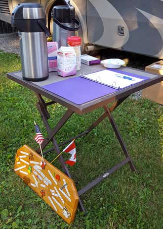 |
 |
 |
 |
 |
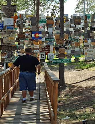 |

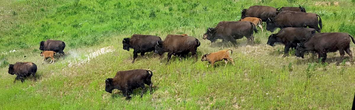
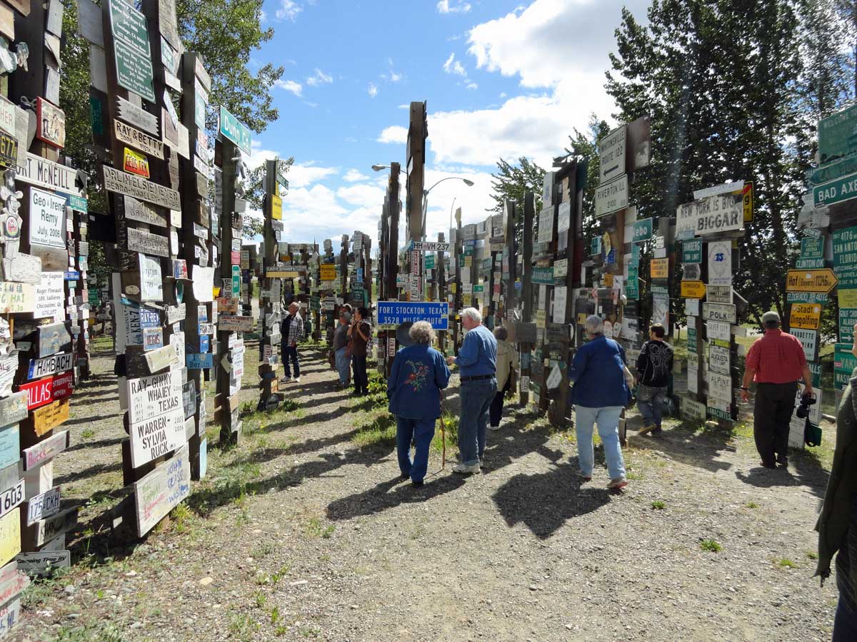
Saturday, June 25, 2016: Another travel day from Laird Hot Spring, BC to Watson Lake, YT (Yukon Territory). My day begins with preparing coffee for the guests and having it available by 6 am. The departure page is on the coffee table where guests sign out with the time of departure. We saw more wild life today, bears, rabbit and Wood Bison. The entire drive today followed the Liard River, one of the larger Canadian rivers. Our destination is Watson Lake, Yukon where the Sign Post Forest is located. On request, I had prepared a sign for our 50 Day Adventure Trek. Since I made the sign, I also got to install the sign which made me (and my sign) the "star" for about ten minutes. When these guests get home and show their photos of the Alaska adventure, I will be in all the photos. The photo directly above and to the right links (by clicking the photo) to a 360° panorama so you will need to scroll right and left to view the entire 360°. The photo to the right links to the story of how the Sign Post Forest began and grew. Click ALL photos for additional views of the day. Did you know the Yukon was NOT a Provence but a Territory? I didn't know that until this week.
 |
 |
 |
 |
 |
 |
 |
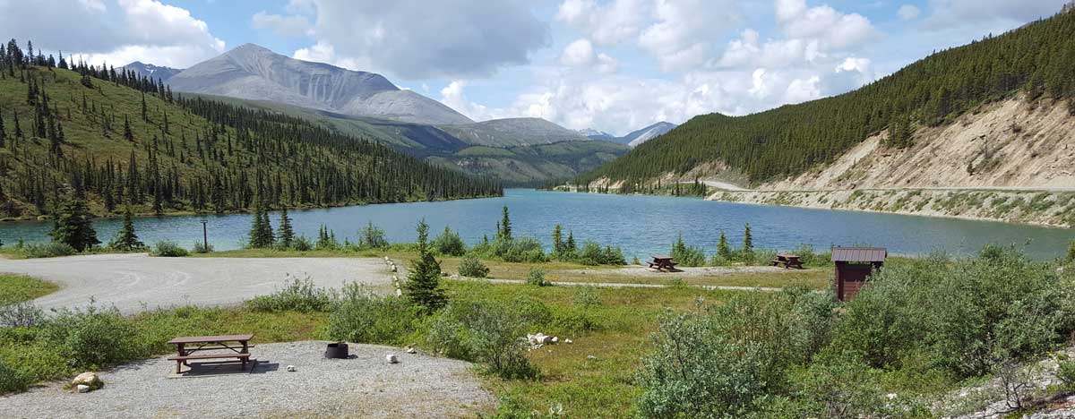
Friday, June 24, 2016: A travel day from Fort Nelson, BC to Liard Hot Springs, BC. There was a lot to see today. I likes the motorcycle pavement to gravel warning sign. Someone in the Canadian DOT must have a sense of humor. We saw moose, Stone Sheep, and bears. There were many sections of road construction. I washed the car and motorhome at the RV wash in Fort Nelson but neither survived the road construction (just don't touch them until they are washed). We saw trees to the horizon at view points. When we reached our hot springs destination we were ready. The water temperature varied depending upon the distance from the source. Click each photo for another view. |  |
 |
 |
 |
 |
 |
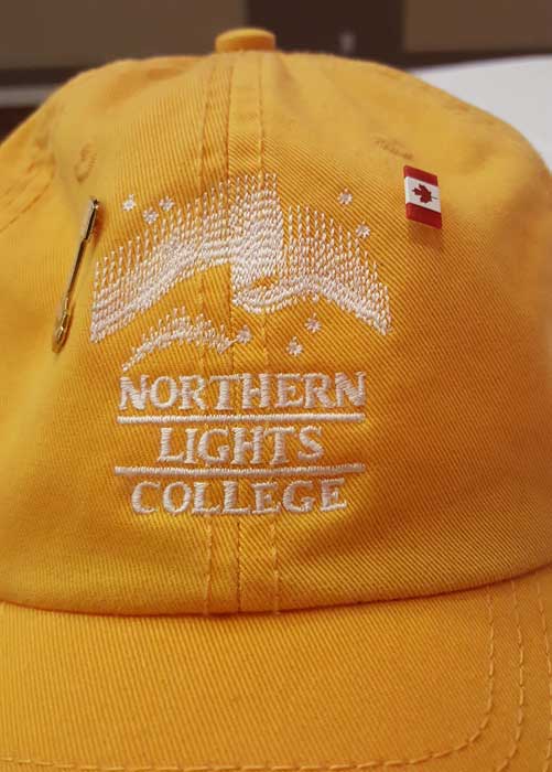
Wednesday, June 22, 2016: This is our first official day of the Adventure Trek (Day 1 of the 50 day Trek). All "guests" have shown up and all attended the presentation by the Dawson Creek Public Relations person. She gave a nice presentation of the history of DC and of the building of the Alaska Highway. After the presentation, we had another meeting to orient the guests and have self introductions. During the day, Gwen and I visited the Dawson Creek visitor center and gift shop. We took photos with the "Mile Zero" sign like ALL the tourists do. We also visited Northern Lights College which I like to do. Click the photos for additional views. |
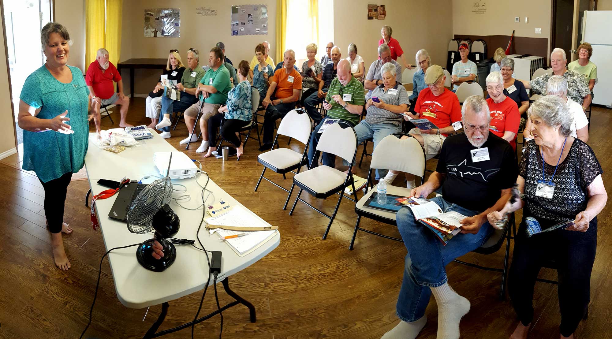 |

Tuesday, June 21, 2016: This was a travel day from Grande Prairie, Alberta to Dawson Creek, British Columbia. Dawson Creek is the start point of the Alaska Adventure Trek and the point where each of the travelers are to report by June 22. Today was our day to report for orientation and to begin our duties. We met the TrekMaster's Guy and Vicki for the first time today. After orientation, Gwen went with Vicki to visit some of the "guests" who have shown up a day early. One of my duties is to put an identification sticker on the top rear of each RV. I began that while Gwen was with Vicki We were also delivered the coffee pots I will use to make coffee each morning on travel days. This morning coffee must be ready by 6 am so that means an early day for me. It won't be easy making a good cup of coffee from the Folger's brand provided to us but I'll practice with the measure of grounds to water to get the best taste. We were also give a large notebook of "tailgunner" duties and another of those duties is to get "guests" to "sign-out" on travel days so we know the time they are departing. Currently we are working on matching names to faces and to rigs so we can identify our "guests" if we see them on the road. So far, that seems to be going well. Click the photo to see our space in the Northern Lights RV Park.
 |
 |
 |
 |
 Monday, June 20, 2016: Across Bear Lake from our parking location at the Grande Prairie Elks Lodge is the GPRC Campus (Grande Prairie Regional College). This would be equivalent to a Junior College or Community College in the states. I picked up a GPRC hat so if you see me wearing it, you'll know what GPRC means. It's a beautiful campus with many academic and technical courses. Unlike most 2 year colleges in the states, this college has considerable student housing since the distances are so vast in Alberta. We are leaving Alberta tomorrow morning for British Columbia. We entered Alberta ten days ago and except for the strong windy days have enjoyed every minute. What I've noticed about Alberta: there are no fat people in Alberta, there is no litter (garbage and recycle bins are located every 10 km on the major highways), it is very green in June, there are MANY heavy equipment sales and repair locations, the Albertans are friendly, many cars have 110 volt plugs at their grill (to keep engine blocks warm during the winter), there are lots of really dirty cars (from driving the surrounding gravel roads), education is marketed much like it is in the USA, there is a lot of construction projects (maybe because there is a short seasonal window for construction), there are lots of indoor "arenas" for sports (I assume for winter activities), Tim Horton's and A & W Rootbeer are the two most popular fast food restaurants - those two seem to be in every town, when someone from Alberta learns I'm from the states they assume I'm going to Alaska, there is 18 hours of daylight in June, it appears Albertans like both summer and winter outdoor activities, I like "kilometers" much better than "miles" - they roll by faster, finally, there are no $50 cars. There are lots of $50 cars in the states (at least in Oregon). A $50 car is an older model, barely running, body shot, tires shot, usually no muffler, full of adults/kids not using seat belts. It's the car you are afraid to have close-by because you know they don't have insurance. Click the photos for additional views of the college.
 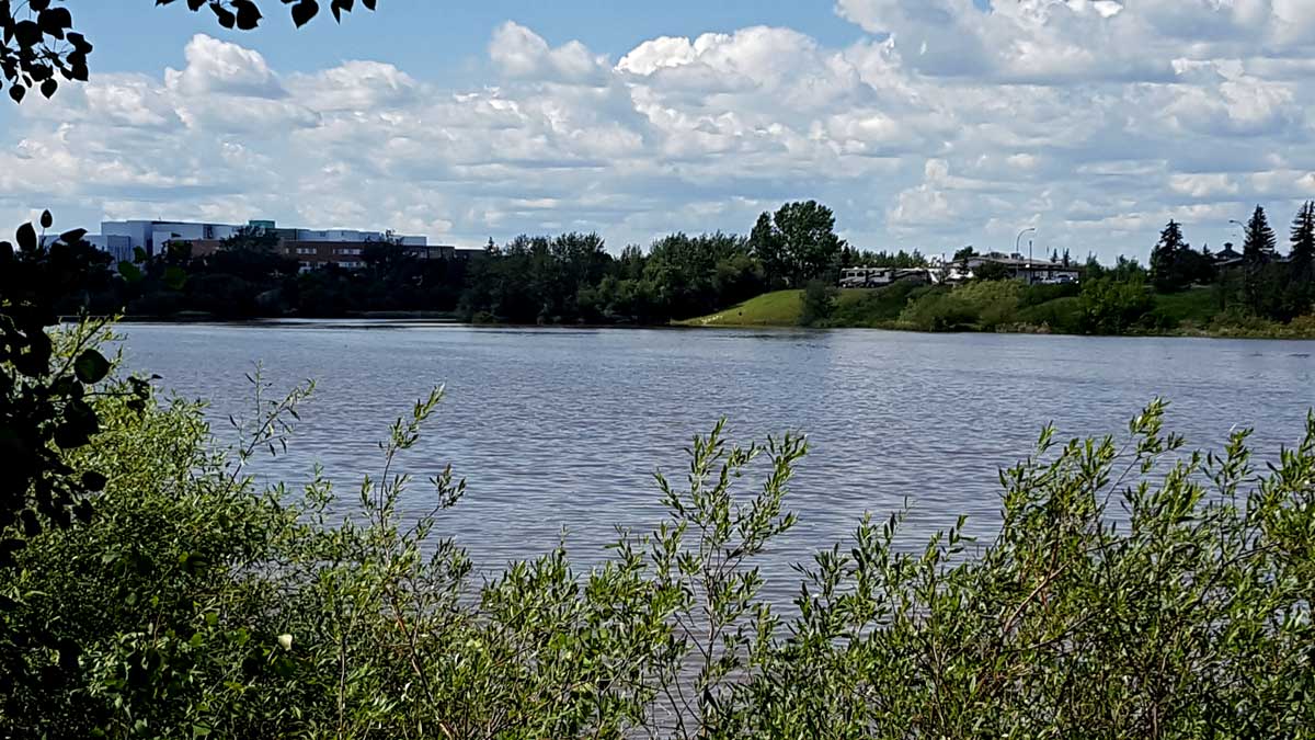 |
Saturday, June 18, 2016: We waited an extra day in Edmonton knowing the wind would be much less for driving to Grand Prairie today. It was much easier driving on a beautiful four lane road with little traffic the whole 443 km. After arriving we immediately took a walk with Morgan around the lake next to the Elks Club where we parked. Across the lake is the Rotary Campground where we met Ray, one of the 15 RVers to take the Alaska tour. He drove from Florida to take the tour so much more driving that we have had to do so far. Next, we wanted to see some of Grande Prairie so drove the two main streets in town. We passed Brown's Social House which we have seen in a few other Alberta cities so decided to visit. It turned out to be a sports bar with Canadian Rugby on most of the TV screens. Canada was playing Germany and was ahead until the last few seconds win Germany scored and won the match. No one in Brown's seemed to care, they were too busy socializing with the folks at their table. Click the photos for additional views. | 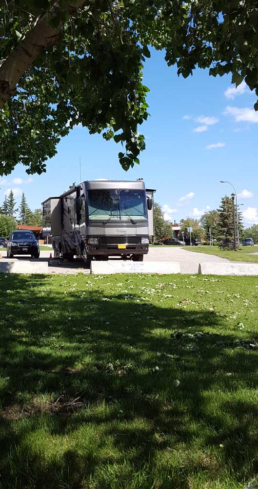 |
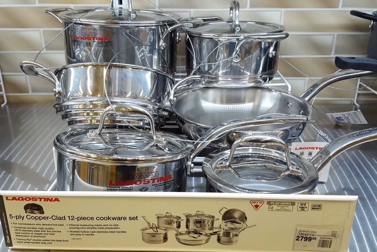 Friday, June 17, 2016: I brought my little air compressor so I could help the folks in our tour if needed. Today, I wanted to add air to a couple of my rear tires but I discovered the inner tire needed to accessed straight through one of the holes in the rim. My air nozzle would not seat against the valve because the valve fitting was at an angle. I decided to visit Canadian Tire, a store I discovered was cross between a Home Depot and a Fred Meyer store. They did not have a nozzle which was any different from what I already owned so I chose to get a valve extension which might allow my nozzle to work. While shopping for valve parts, Gwen walked the entire store and found some special pots and pans. I had to see this set of six pans because the price was $2799.00. That's a lot for a set of six pans. It DID make the $300 set look like a bargain price. Click the photo for a view of these special pans. After adding the valve extension, my nozzle fit the valve but I couldn't add air, probably because of the funky shape of the valve extension. I believe I'll just stop and add air at a tire shop.
 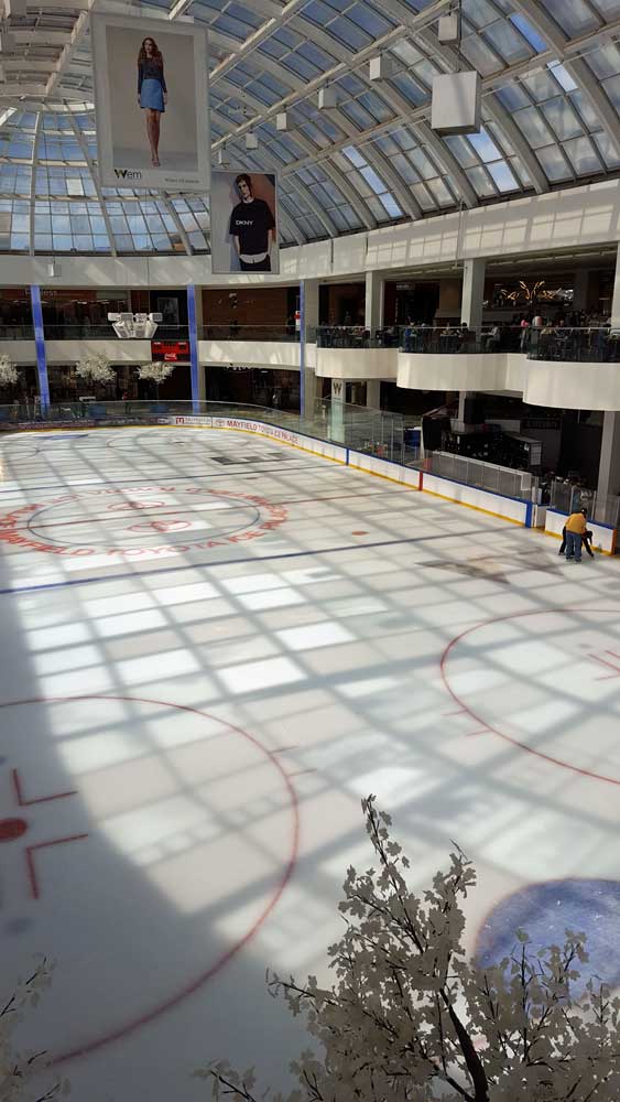 |
 |
 |
 |
 |
 |
 |
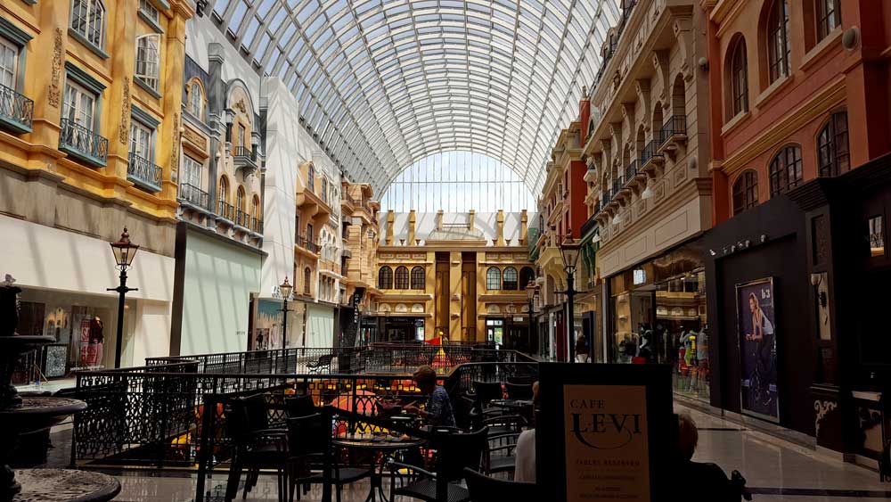
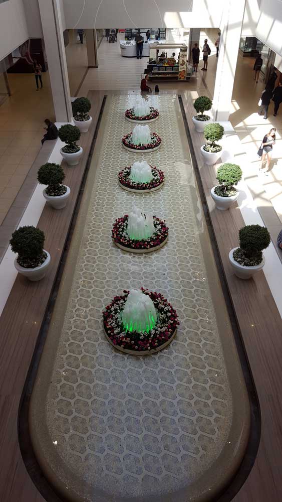
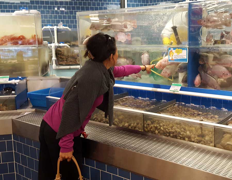
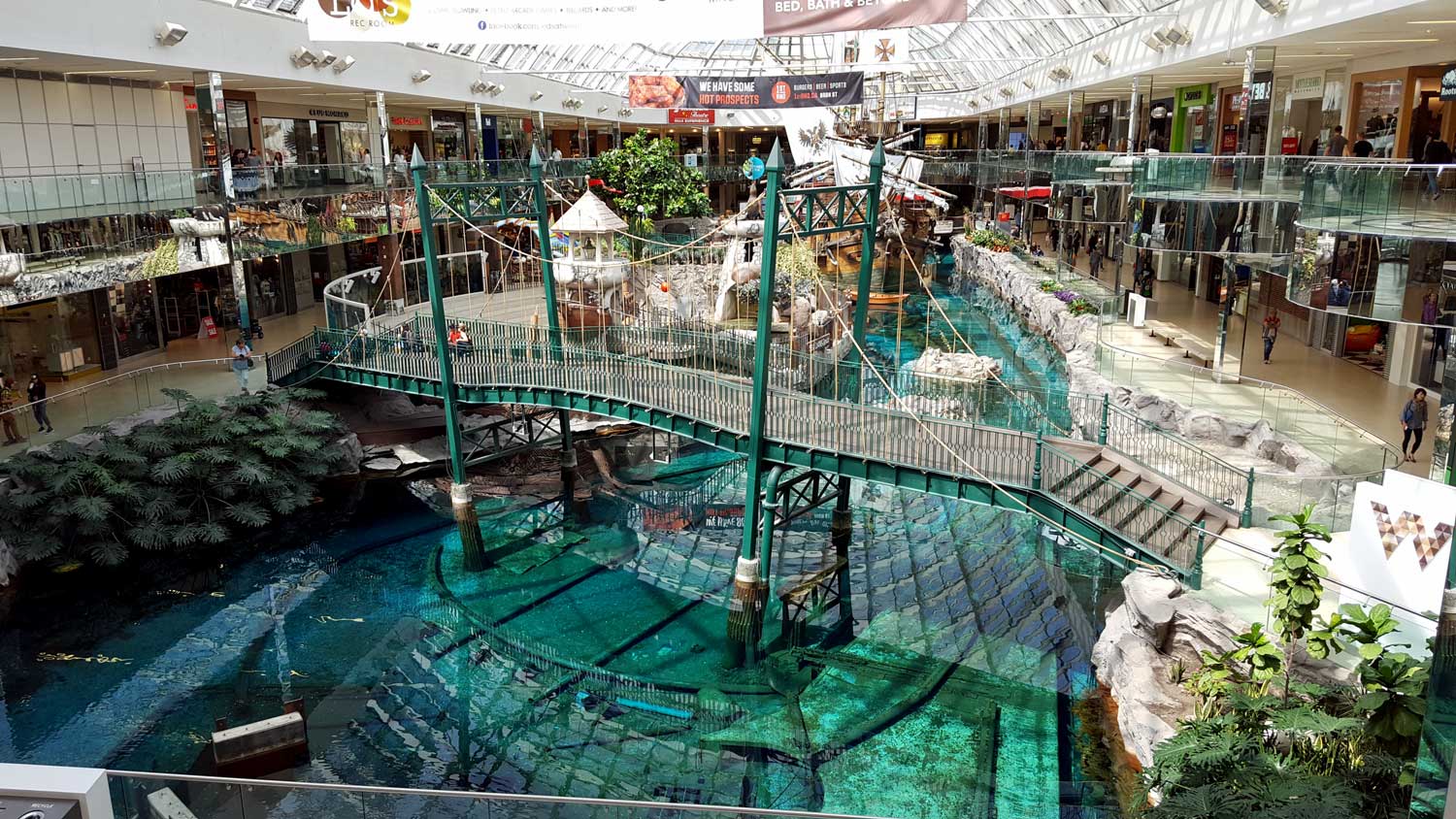
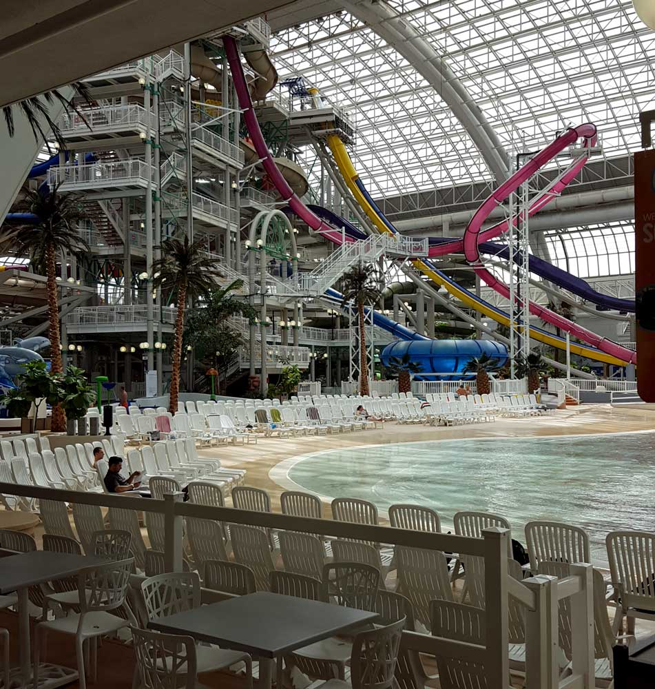
Thursday, June 16, 2016: Gwen and I spent most of the day in the West Edmonton Mall, the largest in North America. It is all indoors, no doubt the winter weather here makes this mall very popular in the winter months. It contains 800 stores (5% were empty) plus a miniature golf course, more than full size replica of the Santa Maria, a Sea Lion show, ice rink, IMAX theater, largest indoor amusement park with three roller coasters, huge water park with slides and wave pool, and European village. My |  |
| impressions: at least 80% of the stores were clothing related, there were NO fat people in this mall, I was disappointed when I didn't find anything unique (except the Hudson Bay Store and the Samsung S7 Store), I didn't see many people with bags (purchases) and we purchased nothing, the Hudson Bay store was a disappointment (felt like an expensive Macy store), I was tempted to buy a $20 raffle ticket for a $560,000 Lamborgini until I calculated I couldn't afford the insurance to drive it nor could I afford an oil change, Tim Horton fixed us a good lunch, at least 80% of the stores and their inventory is to appeal to teens and twenties. I met the Junior High teacher who brought her students to the Amusement Park for the day. Only the students who achieved 80% or higher scores could attend. I watched them ride the largest and fastest roller coaster and all were still smiling at the end of the ride. I also watched an oriental lady insist on the orange, live, Talapia at the T & T market. After a loud warning horn, I watched the wave machine create waves for the swimmers in the wave pool. Click each of the photos for additional views. | ||
 |
 |
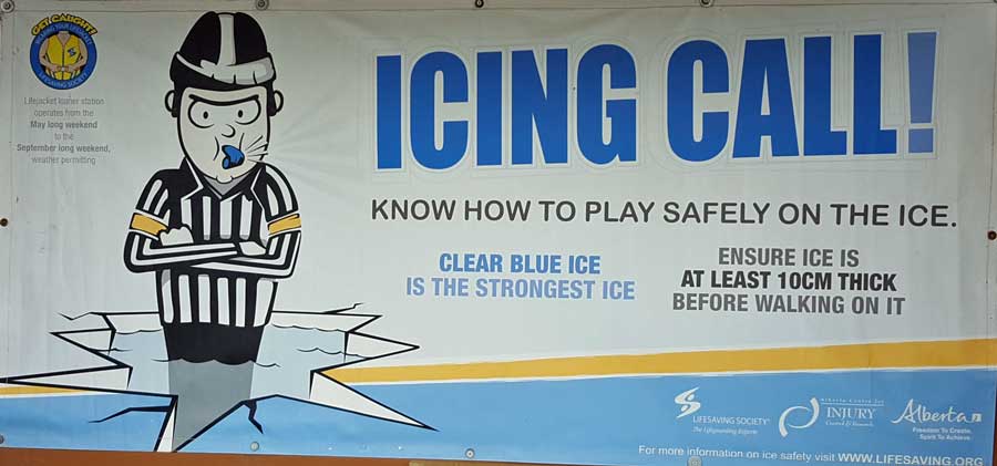
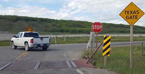 Tuesday, June 14, 2016: This was a rest day compared to the driving we did yesterday. I made adjustments to the CB antenna and took Morgan on several walks. Then I walked myself to the Ghost Reservoir Dam where I found a sign warning to be sure the ice was a minimum of 10 cm thick before walking on it. 10 cm is only four inches, I think I'd like to have even MORE than 10 cm of ice. Only a few sailboats are moored but many are parked on dry land with masts erected, ready to launch. The wind has not stopped blowing so I imagine a great reservoir for sailing. Finally, we came across several "Texas Gates" during our drive yesterday. A "Texas Gate" is what we call a "cattle guard". Gwen and I found the name strange, not sure why "Texas" gets the credit for the idea of keeping cattle in an area without the use of a gate. Click the above photo to see the ice warning sign.
  |
 |
 |
 |
 |
 |
 |
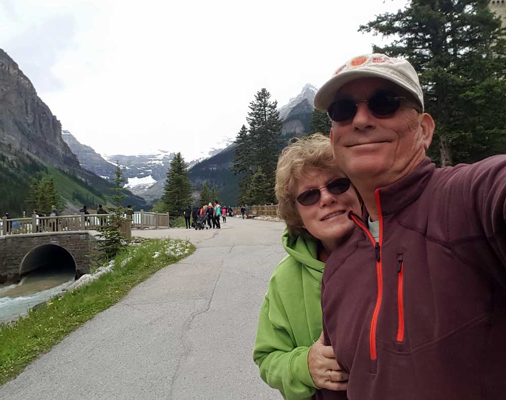 |
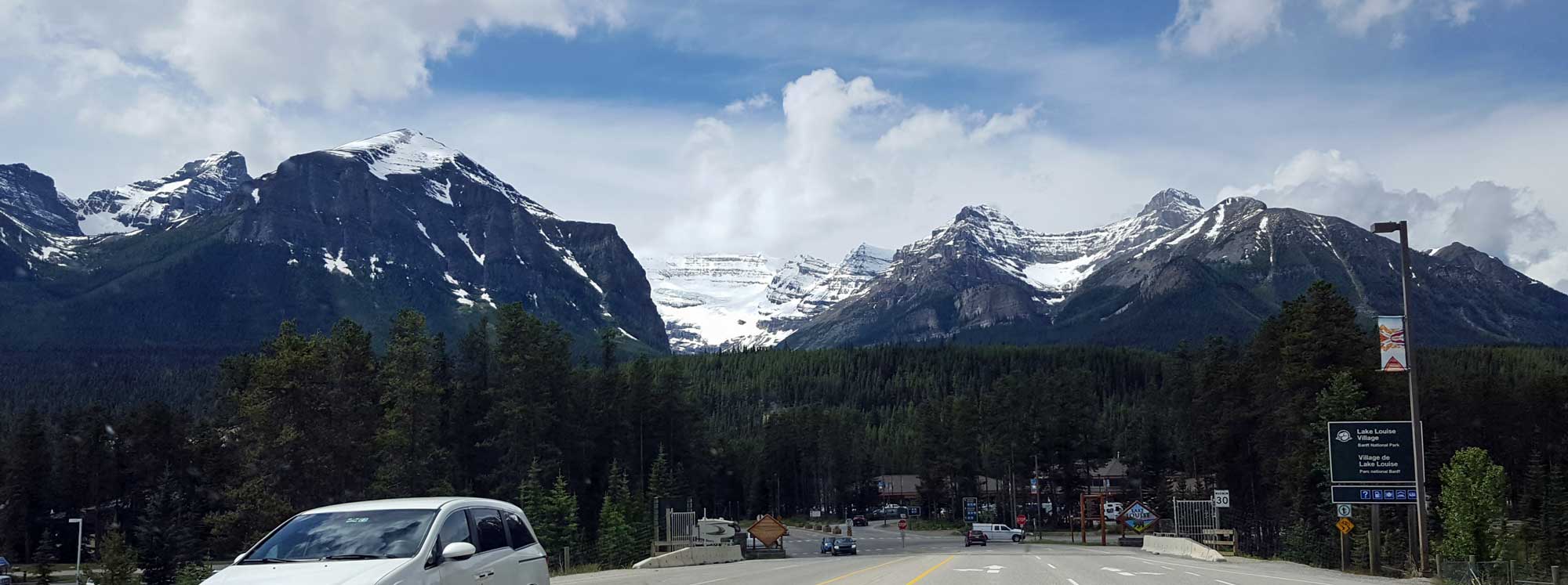
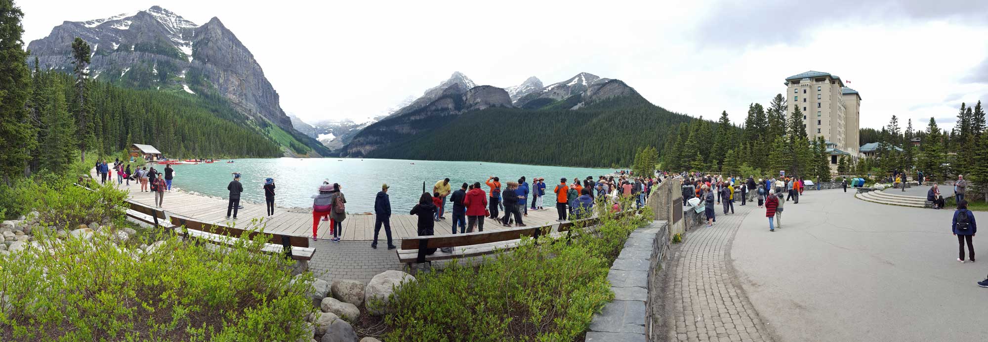
Monday, June 13, 2016: This was an adventure day into the Banff National Park (entrance fee $16 for two seniors, it would have been free in the USA with our Senior Access Passes). This is the heart of the Canadian Rockies. It was busy and crowded today but seemed obvious to me that their real season is the winter sports season. As we came closer to the Rockies we saw a large industrial plant across the river. We learned it was a cement plant because of all the lime stone in the mountain. The city of Banff is a tourist town like many we have | 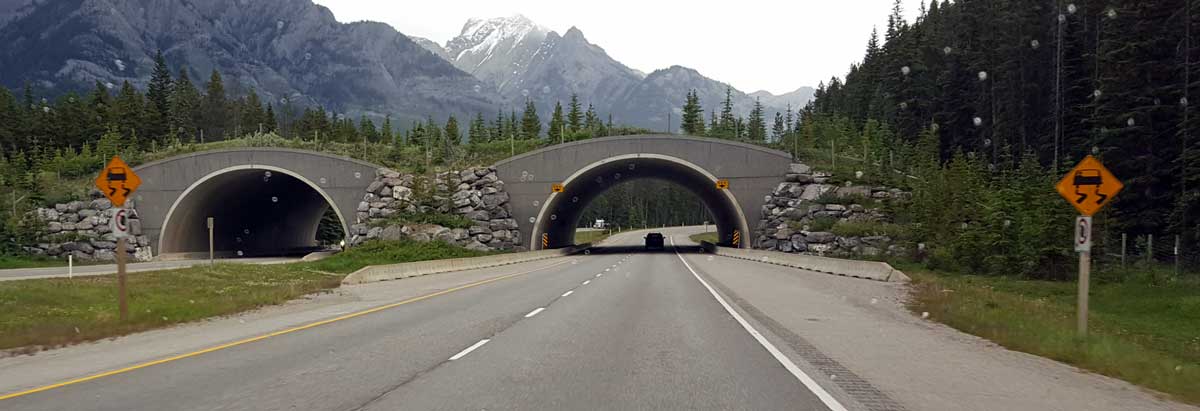 |
| seen. Gwen bought a Banff T-shirt, socks, post cards and sticker for the motorhome. I bought nothing, maybe next year. We then drove on west on the trans-Canada highway to Lake Louise. Very impressive scenery although we couldn't see the tops of the mountains due to the cloud cover. The water was turquoise from the melting glaciers. Hundreds of oriental tourists, perhaps from Japan but from Korea also. The Fairmont Hotel Resort was outstanding. The four lane Trans-Canada Highway had high fences on both sides to keep out wildlife. The allow the wildlife a method to cross the freeway, there were wildlife overpasses every 5 km. This was an area which really needs to be hiked to enjoy to it's fullest. We saw many day hikers and backpackers doing just that. Click all photos for additional views. After visiting Lake Louise, we drove a short distance on the Icefield Parkway to learn if it would be OK for the motorhome. We found it to be a wide two lane smoothly paved road so probably OK but it is nearly 300 km to the drive out of the mountains. It rained on the return to our campground but only cloudy weather as we left the mountains. | ||

 |
 |
 |
 |
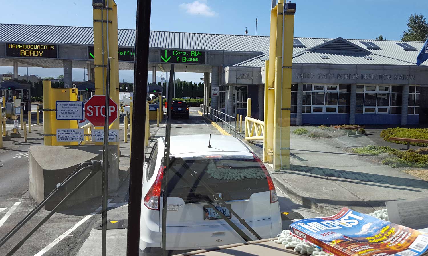
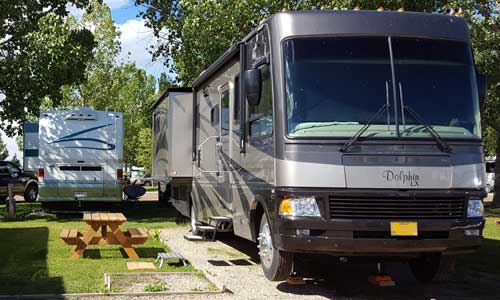
Saturday, June 11, 2016: A travel day from Hayden, Idaho to Lundbreck, Alberta Canada. This was our first time entering Canada with a motorhome. We had read all the information online but had few worries. We had some dog food in a dog food container but read online that all dog food had to be in original packaging. We had frozen chicken breasts in the freezer but online it says "no raw meat". We are also towing the Forester which is new enough the state of Oregon has not sent us the registration documents yet. I was hoping the paperwork I had from the dealer would be good enough. We it came |  |
 Friday, June 10, 2016: Gwen and I spent some time with her friends in Hayden, Idaho. When Gwen and her friend Penny took themselves to lunch, I drove around looking for a new chair. The two chairs we purchased from Costco a year ago (the Oregon and Oregon State chairs) were falling apart due to failing rivets. I took them back to Costco and got a full refund. Gwen found HER chair right away but I had to have one which would support my head in a "nap position". You'd think I was looking for something gold plated. After half a dozen stores including REI and Cabellas, I finally found what I was looking for at Wal-Mart.
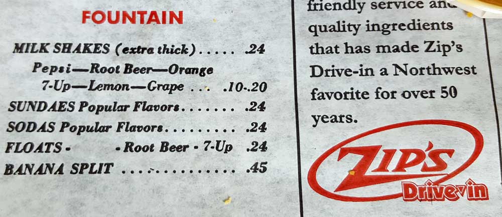
While shopping, I stopped at "Zip's" a fast food restaurant I had not heard of. They used a 1960 Zip's menu as a place mat. I occasionally tell the story that I got my first job (as a paperboy) when I was 12 years old because I didn't want to ask my parents for a quarter to buy a pineapple milkshake at the local Tasty Freeze. My children didn't believe I could buy a milkshake for a quarter. Now I have proof. The 1960 Zip's menu clearly shows the price of a milkshake to be 24¢. Click the photo to see the menu. I don't think my parents ever knew the REAL reason I got that job. It did TWO things for me. I didn't have to ask for the quarter and I didn't have to ask PERMISSION to get a milkshake. I just rode myself to the Tasty Freeze on my bike and bought their pineapple milkshake. Today's price for a pineapple milkshake at Zip's was $2.99.
Thursday, June 9, 2016: This was a travel day from Moscow, Idaho to Hayden, Idaho. Since leaving Boise, we have been traveling through wheat fields, a few barley, garbanzo beans and canola bean fields. The terrain is rolling hills compared to yesterday's mountains. The motorhome handles the rolling hills well but we spent a lot of time in second gear at 30 MPH while in the mountains. We arrived at the Hayden Elks club before noon. They have 30 RV spots on grass with 50 amps and water hookups. The fee is $20 per night. Just to be on grass and not gravel is a PLUS in my book. Again, this is a quiet, dark but not-so-cheap location. Click the photo to see the Elks parking.
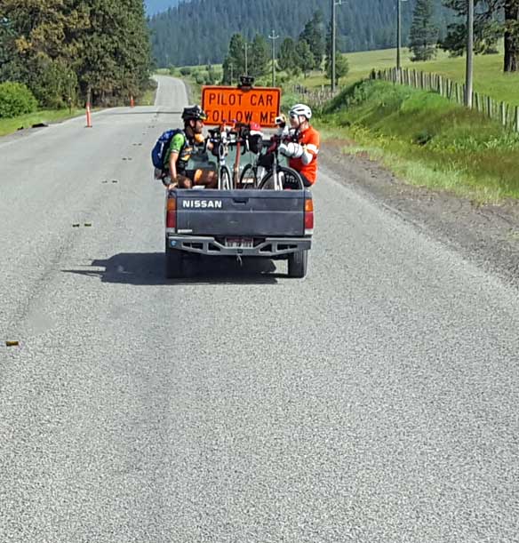 |
Wednesday, June 8, 2016: We continue north from "Last Chance" to Moscow, Idaho the home of the University of Idaho. Now we have left Highway 55 and are traveling 95 where there is a lot of road work. These two cyclists hop aboard the guide vehicle to avoid the chip-seal project and lots of loose gravel. I'm hoping we won't have this all the way to Alaska. We have been to Moscow previously and know of a (secret) parking location which is perfect for us, dark, quiet and cheap. It is Robinson Lake Park with only 6 RV spaces. The spaces have 50 amp power but no water | 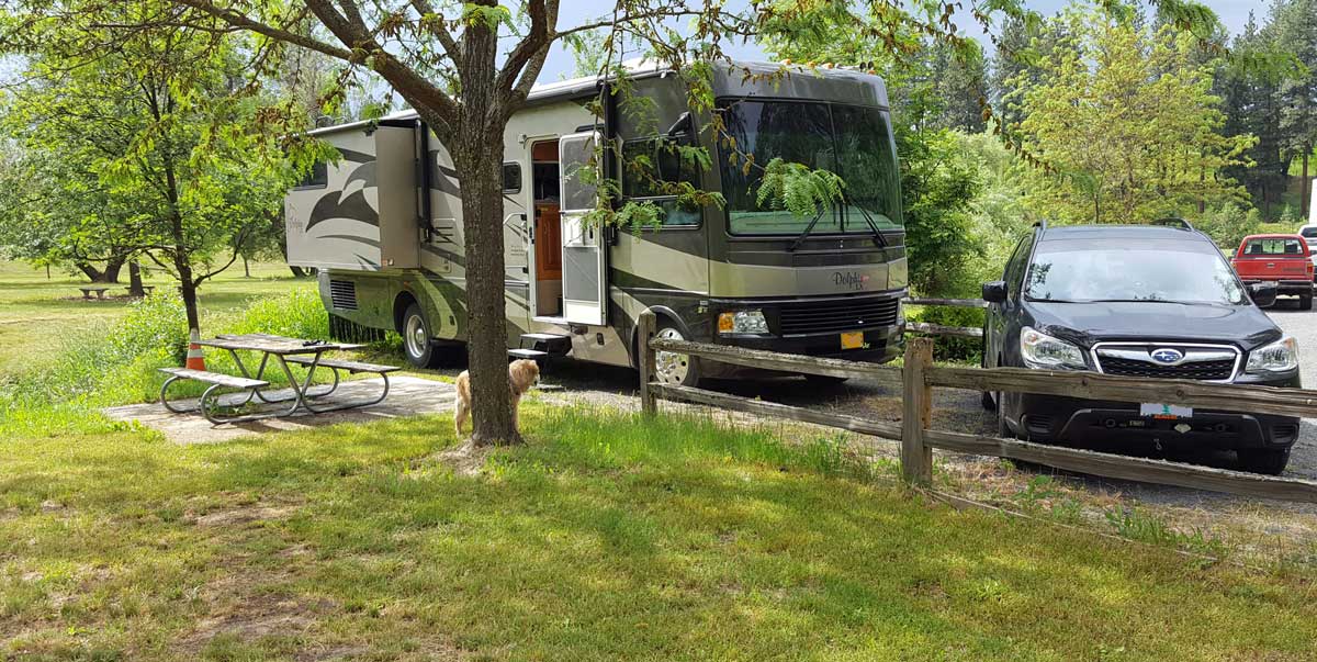 |
 |
Tuesday, June 7, 2016: We left Boise by 11 am traveling north on Highway 55 toward McCall, Idaho. This is two lane highway mostly following the Payette River. In some cases winding our way into deep canyons with steep ascents and descents. We tried looking in McCall for the night on the Payette Lake but I was discouraged with the $36 price tag. Instead, we drove on toward New Meadows and found a sign pointing to the "Last Chance" campground. Once I made the turn off Highway 55, THEN you could see the sign "Campground 2 |  |
| miles" on a gravel road. "Don't worry", I told Gwen, "I'll drive slowly and the motorhome will protect the car, it won't get dirty." After the 2 miles, we were rewarded with a wonderful camp spot for only $7.50. Click the left photo to see our quiet, dark, private camp location. Click the right photo to see Gwen rescuing the Forester. Even Gwen appreciated our location. | ||
