 |
|
RV Arizona
page 3
Note: Click any photo on this page to enlarge. |

|
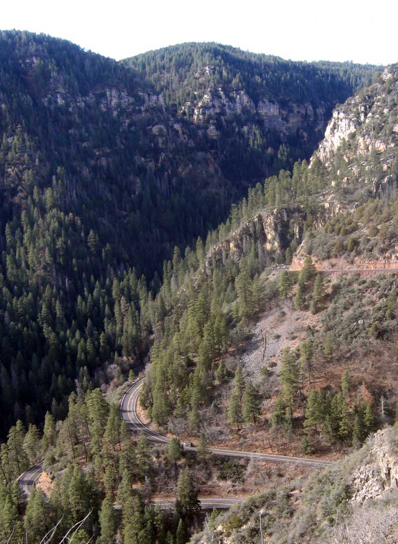
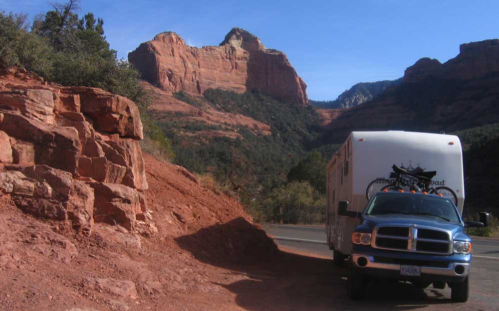
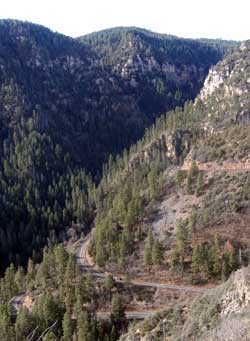
| December 16, 2006: From Williams, we took a short drive to Sedona, then on to our night camp at Cottonwood, Arizona. This part of Arizona is where a traveler is able to drive through the red rock country and see the scenery up close. We don't get to see anything like this in southern Oregon, at least the western part of southern Oregon, so we are fascinated by the |
 |
|
 |
colors and rocks coming straight up out of the ground. The photo above shows route 89a which we traveled south toward Sedona. I'm glad I was going down this grade and not the other way-round. The view to the left is of |
|
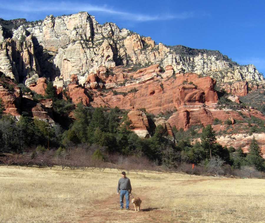
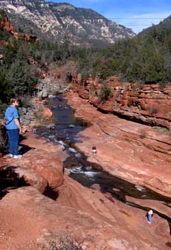
| Slide Rock State Park just north of Sedona. Apparently, during the summer, travelers will swim in the river and slide down the rocks in the canyon. It cost $8 to park here for this view so Gwen made lunch here to "get our money's worth". It is the Slide Rock area where an early pioneer planted hundreds of apple trees to market fresh apples to the local towns and travelers. |
 |
|
 |
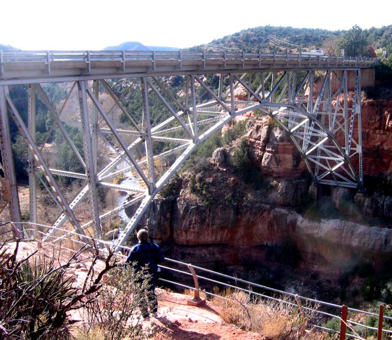
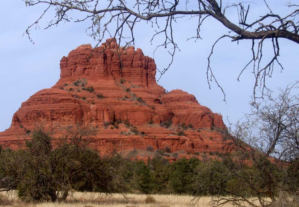
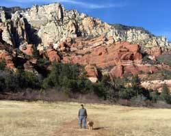
Just north of Sedona, we hiked under the bridge over Oak Creek. I tried to get Gwen to climb onto one of the support beams to add dimension to my photo but was not successful. This is still Hiway 89a leading into Sedona. The views below are of Bell Rock to the left and an easy |
|
|
 |
road pull-off for us when pulling the trailer. Remember, you can click any photo on this page to enlarge.
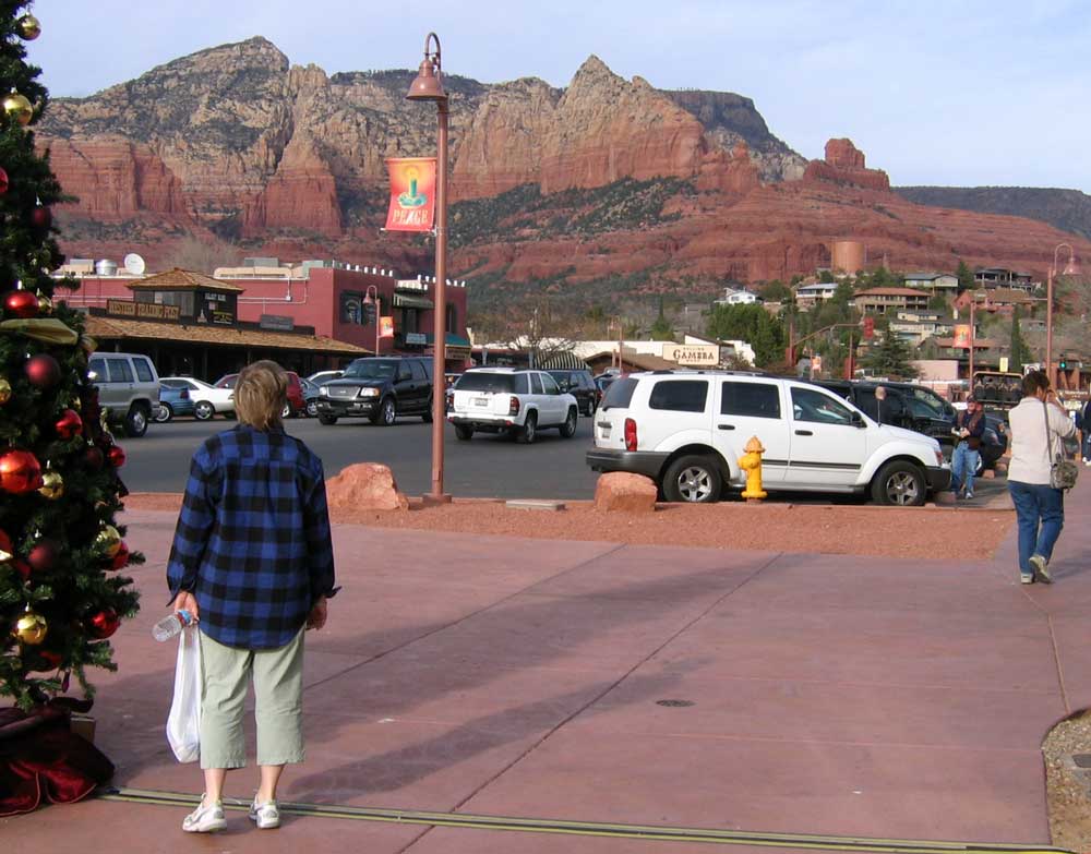
We have finally arrived in Sedona which turns out to be a very picturesque town with great mountain views and lots of great gift shops and galleries. We were able to purchase all our remaining Christmas gifts here |
|
as well as one for ourselves using the cash gift from my parents (I'll take a photo and show it later).
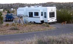
We drove on to Cottonwood and found Dead Horse Ranch State Park. It has a great camping area (at least for winter camping ... I'll bet people are "cooked" here in the summer months). |
 |
|
| We chose to camp here because it was not crowded, had plenty of open space with a clear view of the city and open sky. We also got electricity and water for $19 per night. We want to explore this area more and would not feel comfortable boondocking in this area, then unhitching. The first thing I did when arriving was to set up our satellite Internet and satellite TV dishes. It was the easiest setup I've experienced, perhaps because I did not have to fight trees for a clear view of the sky. |
|
|
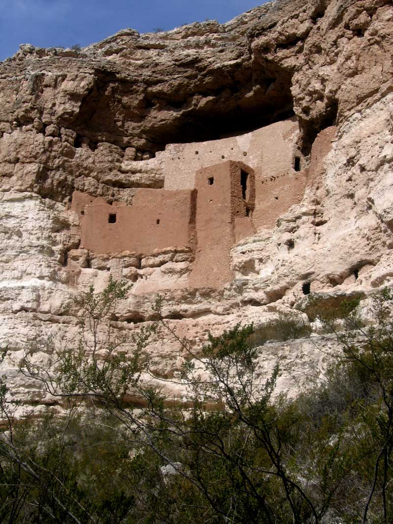
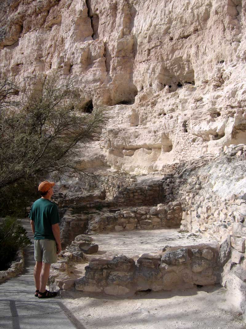
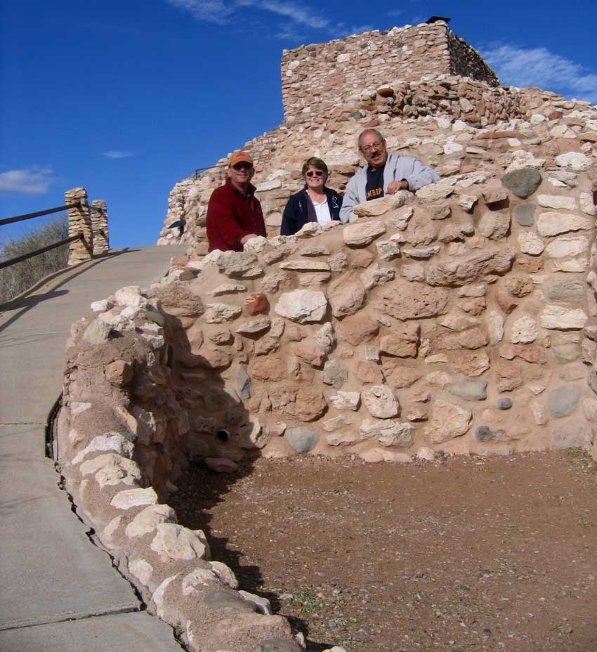
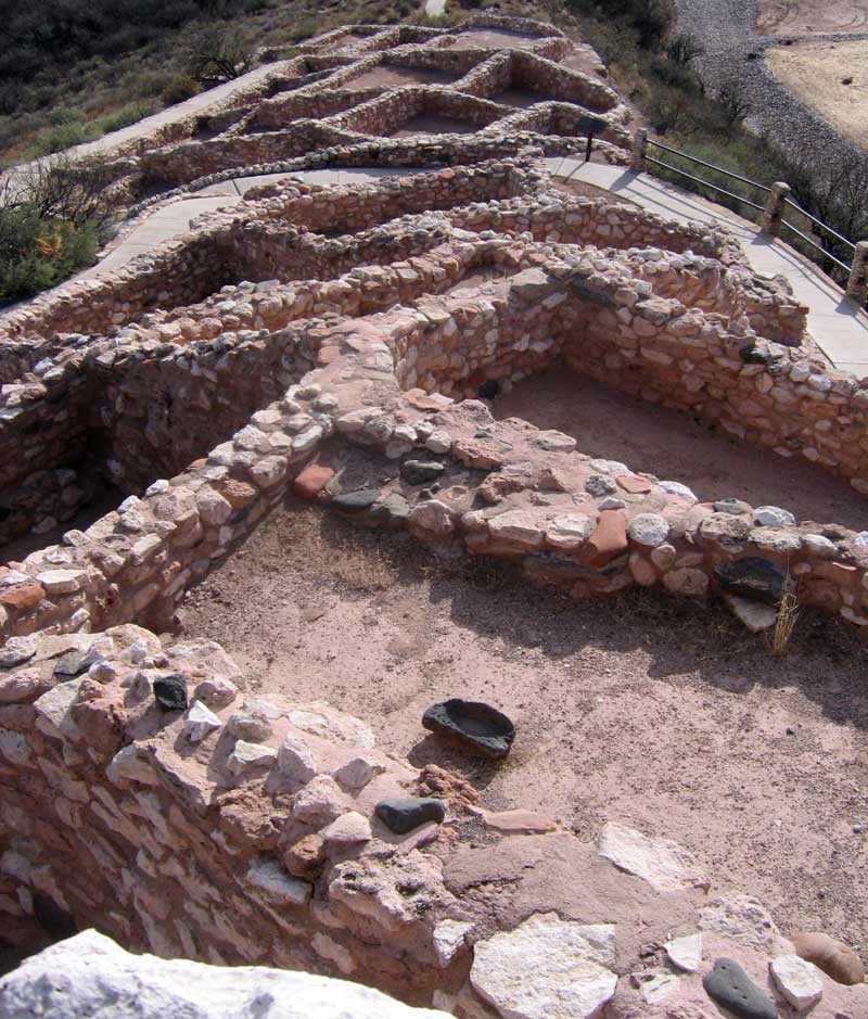
| December 17, 2006: Yesterday we visited Montezuma Castle National Monument, then today we visited Tuzigoot National Monument with Dick, a friend who moved from Oregon to Arizona a few years ago. These areas were inhabited by Sinagua farmers from 1125 to 1400, Montezuma had nothing to do with anything in this area. The name came from an earlier explorer who thought these were ruins from the Aztecs. The Sinagua grew and sold corn, beans, squash and cotton to travelers through the area. |
|
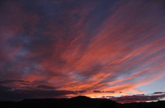
| Our friend Dick came to Cottonwood to meet us. We traveled to the Tuzigoot ruins together to explore. We spent the day together talking about old times and exploring Tuzigoot and Jerome, a copper mining town turned into a tourist town on the side of Mingus Mountains. This day ended with an Arizona sunset after a night of wind and rain. You can enlarge any of these photos by clicking on them with the exception of the sunset. |
 |
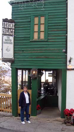
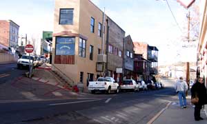
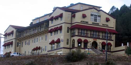
| December 18, 2006: Jerome is an historic copper mining town on the side of Mingus mountain. Note the "J" on the side of the mountain across the Verde Valley. The town is literally on the side of the mountain, every house has a clear view of the valley below. This town is now centered around tourism, not copper. The large building on the top-left of the town is the Jerome Grand Hotel. The town is on several levels, each street is probably 30 feet above the street below. Our friend, Dick, visited the town with us and showed us where to get a "Haunted Hamburger" ... apparently so named for all the condiments that are included with the sandwich. None of us were brave enough to order it, Dick and I had a quesadilla while Gwen had a regular (not haunted) hamburger. The Grand Hotel is on top of the town. Note: These photos do not enlarge. |
 |
|
|
 |
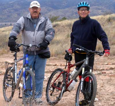
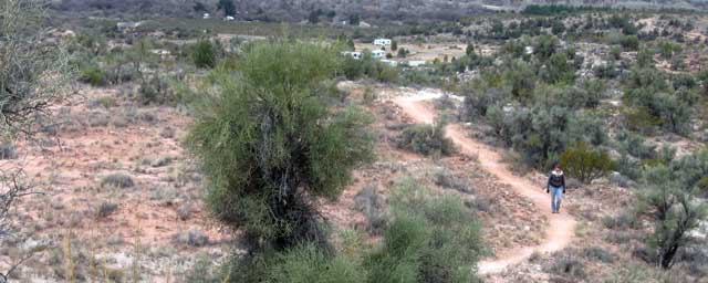
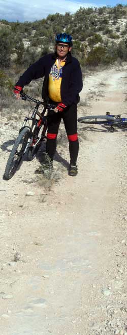
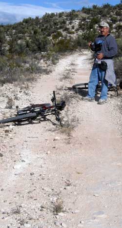
| December 19, 2006: My friend Dick and I decide to do a mountain bike ride on the Dead Horse Ranch State Park trails. They have some great trails and this is a great time to ride ... not too hot. Both Dick and I found ourselves gasping for air because we are so out of shape (we decided it had nothing to do with our age). We had to be careful to stay on the trails to avoid the thistle bushes. Below, the trail leads out of the RV park. |
 |
|
 |
 |
 |
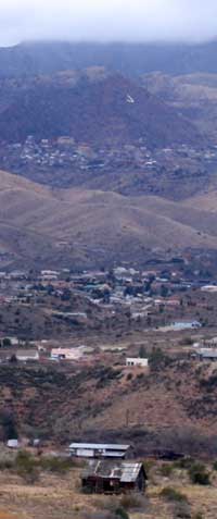
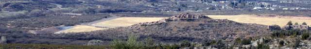
| One of the views we got from the trail was of the Tuzigoot National Monument. You can see how the Sinagua could watch over their farmland from their mountain homes. It was a chilly day but after struggling up the mountain, we were both sheading jackets. |
|
 |
| |
| Return to page 2 |
|
|
|
|