Click to Return to RVeCafe Homepage

RV the Oregon Coast,
December, 2005; Page 4

Oregon Coastal Atlas
December 30, 2005: The storm continues. We easily survived the night but our space 15 is looking pretty wet this morning. We are debating moving to a dryer spot. The wind is still heavy so if we must move, I'd prefer to hold out until tomorrow when it should be lighter.
Click to see What's New at RVeCafe
  I know our dish looks bad but I laid it down myself last night because I must point at 116 degrees and the 60+MPH wind is coming directly from 116 degrees. It is locked down tight and has not moved since last night. Another fortunate thing is that I bought some "barn boots" on sale yesterday at Fred Meyer for only $14, so my feet will stay dry in this lake. We are making this into a laundry day.

We vacated space 15

The wind and rain let up this afternoon so we took that opportunity to move out of the lake that was developing. Another three storms are expected in the next three days so I didn't want to take the chance that space 15 lake would increase. We were able to get the laundry completed and visit Ace Hardware in Gold Beach.
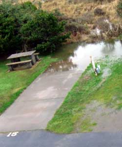
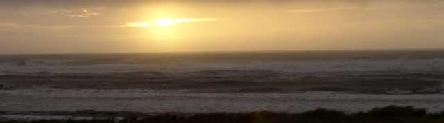
Our second space heater has failed so we purchased one of the oil filled radiator style. It had been recommended by a fellow traveler. Note our new, drier campsite #10 to the right. Today's final view of the sun setting in the Pacific. It now space 10 for us
The view out west from the light house tower
Safely parked in space 10

December 31, 2005: The last day of 2005 in Gold Beach began with continued rain, however the afternoon turned warm and sunny. A new storm is approaching but this afternoon sun was really welcome. We have learned that Highway 101 which we used to arrive in Gold Beach is now closed to the north before Port Orford due to a slide. This highway and Route 199 which we must use to return to Grants Pass are often closed due to slides during bad weather. Route 199 is still open but we are threatened with three more storms before we are returning on Thursday.

We went exploring today to find evidence of storm damage here in Gold Beach. I especially wanted to visit the Rogue River. The mouth of the Rogue is here in Gold Beach and we are hearing reports of flooding of the Rogue as it passes through

Grants Pass. Our home is only 1/4 mile from the banks of the Rogue in Grants Pass. As we look at our ocean view here at Irelands RV Park, we are seeing a muddy ocean and lots of debris from the flooding Rogue as it enters the ocean. We found a restaurant on the banks of the Rogue which will start to feel the Rogue in only a few more inches. In the photo to the right, you can see a ramp to what used to be the banks of the Rogue from the restaurant. The ramp is under water. If you move your mouse pointer over the photo you will see another photo of the height of the water on the ramp. In the photo below, I'm standing This restaurant is very close to the Rogue River
A restaurant river view 
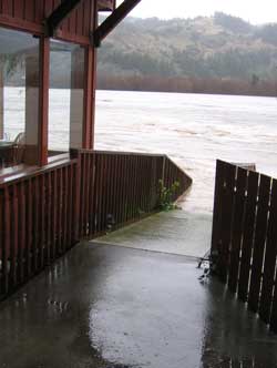
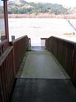
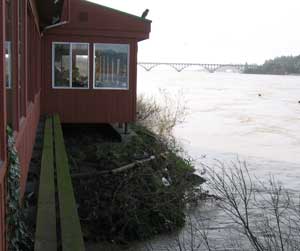
on the ramp and photographing the Rogue as it passes under the restaurant. Another few inches and this room might be in trouble.
The violent mouth of the Rogue River as it enters the Pacific Ocean, photo taken while standing on the south jetty

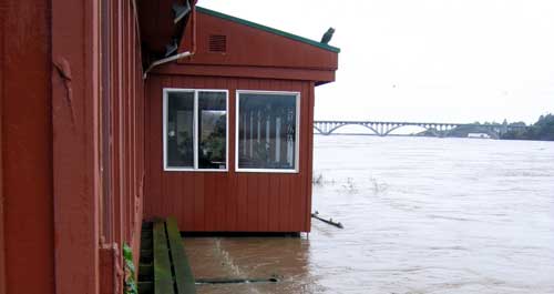
The photo above is of the mouth of the Rogue as it enters the Pacific Ocean. Today it is especially violent.

Gwen and I ended our day at a free concert at Gold Beach Books. Chris Vorster and Willow Owings, a Father-Daughter performing

Chris Vorster and Willow Owings
team are playing the concert tonight from 7pm - 10 pm. They are local artists with a great deal of talent and it was very pleasant being able to be in their audience. The Gold Beach Books - store is a very comfortable place to spend time anyway and they made it a great way to say good-bye to 2005.
First Day of 2006
January 1, 2006: The first day of 2006 in Gold Beach included a bit of everything for weather. (click the above photo to see a short video of Rogue River debris washing up on the beach.) Beginning with high wind, followed by rain, then sun. I checked out the level of the Rogue River again today, much lower than yesterday, probably 8 feet lower.
Debris washing up on the beach from the mouth of the Rogue River

Check the photo to the right and compare to the ramp photo above from yesterday. This photo along with the photo below will illustrate how much the Rogue River has dropped. Finally a correct prediction from the weatherman.

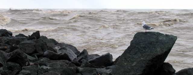
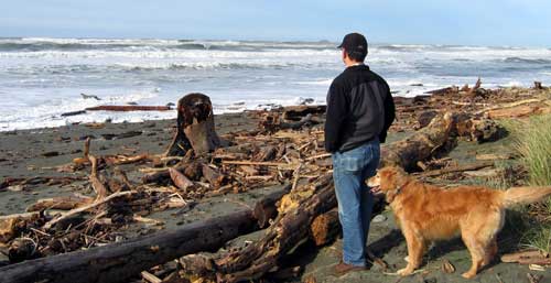
The photo at left shows 100 yards of debris that has gathered on the beach from the flooding Rogue River.

The weather improved

Lower River level on the ramp
No longer threatening the restaurant

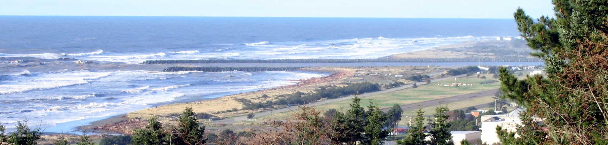
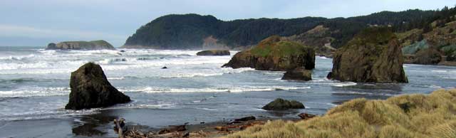
enough today so I felt flying a new years kite was the right thing to do. Click here to see a short video getting the kite off the ground.

Finally, the photo below is another panorama, click to see the larger view. The mouth of the Rogue is at the right, the south jetty runs through the center and a whole beach of debris on the left. The locals are picking up the debris for firewood.

Click to see the larger view of the mouth of the Rogue River as well as the debris gathering on the beach
January 2, 2006: Breakfast at our favorite Gold Beach breakfast restaurant, Indian Creek Cafe. The ICC is located on Jerrys Flat Road, along the south bank of the Rogue River about 1 mile from Highway 101. Indian Creek Cafe
Gold Beach and the Rogue River Jetties
Since the ICC is not located on 101 it is more of a locals restaurant and has excellent food and prices. Today was mostly sun with great views. Ireland's beach is at the bottom left corner of the photo above. Note the north and south jetties of the mouth of the Rogue River. Muddy water is still at heavy flow into the ocean. The town is located lower right with the airport viewable on this side of all the grass. Click the photo for a larger view. You will be able to see the logs and debris south of the south jetty in the larger view. When talking to the locals gathered to view the debris, they report it has been nine years since they last saw anything like this.
Water Stain Repair

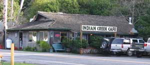
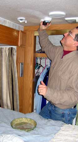
January 3, 2006: Since this day began with heavy rain, lightening, and wind gusts to 60 MPH, I began with inside projects.

Do you see the antenna control winder handle to the left of the photo. I had noticed a water stain growing on the ceiling during these tremendous rain storms. I couldn't get on the roof to check the problem due to the high winds. Once the wind finally slowed enough where I felt safe to take a look, I learned that the rubber boot around the coax had been blown out of place. It should have been covering the coax opening in the metal housing but wasn't. Not much water got through this hole but enough to cause some yellow-brown water stains on the ceiling. I remembered the advice given during the cleaning seminar I went to last summer. (Be sure to click on Mary's photo if you want to hear the seminar.)

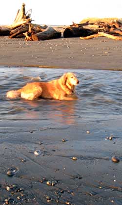
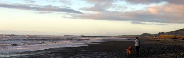
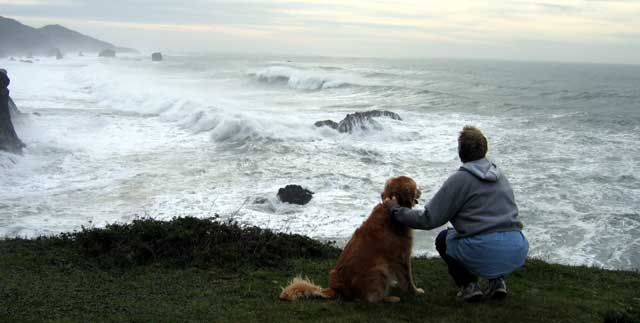
Mary suggested using only Woolite or baby shampoo for cleaning. I had Woolite on hand and used it with water. The result was a very clean ceiling where stains can't be seen. Perfect.

Toward the end of the day, Gwen, Morgan and I went on a beach, sunset hike. Morgan loves the ocean, but when she finds a fresh water creek, it's time to lay down and take a drink.

Gwen and Morgan find plenty of beach to walk for the first time. The storm surge has been above 20 feet which has left little beach for walking until this evening. It is time to look for treasures that have floated in from the Pacific after traveling the flooded Rogue River.

Finding fresh water
Sunset beach walk
  A morning walk on the beach
January 4, 2006: Today is a day to take a short hike on the Ireland's beach then off to Brookings just for fun. On the drive to Brookings we learned that a section of Highway 101 had nearly washed away and was under repair. It appeared that the roadway dropped at least 15 feet.
More photos of the Oregon Coast Highway 101 washout Road Dropped 15 feet
The Thompson Creek Bridge is the highest bridge in Oregon, 345 feet high. It's located on Highway 101 between Gold Beach and Brookings.
Highest Bridge in Oregon
A view north on the Oregon coast
A great Ace Hardware in Brookings 
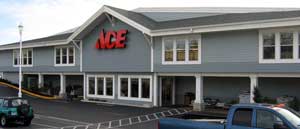
Gwen and I spent some time in Brookings at several different shops and lunch at our favorite fish shop. But we discovered a beautiful Ace hardware, my favorite kind of store.
One of the items we purchased was silicone sealant. I used this to fill the passage where the coax passes through the housing into the trailer. Then I put sealant around the housing and replaced the boot. This will stop the water leak even if the boot blows off as it did earlier. Silcone to fill the coax entry
A last view of the ocean
A picnic 20 feet from an ocean cliff 
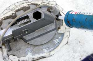
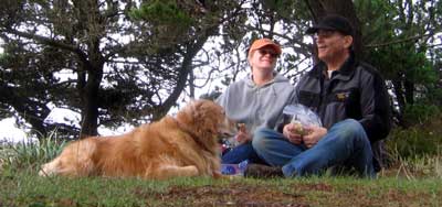
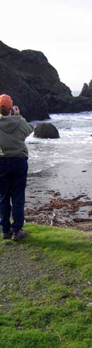
January 5, 2006: This last day of vacation took us to Thunder Rock Cove to view the ocean for the last time. We had to hold on to Morgan since we were surrounded by cliffs to the water. Our picnic was only a few feet from the edge.
Thunder Rock Cove

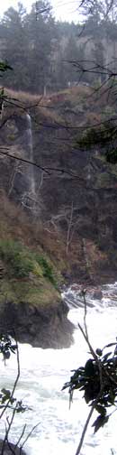
In the photo to the left, if you look carefully, you can just make out the trailer at the top of the cliff just to the right of the waterfall. We are hiking back to the trailer at this point.

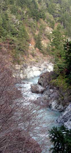
The photo at right is the Smith River in northern California. This is a very scenic, wild river. Highway 199 connecting the coast to Grants Pass runs along the Smith River. It is mostly 2 lanes with some very narrow sections where the trailer is only inches from a drop to the river or from a rock wall. It is a road which will cause the driver to hold his/her breath.

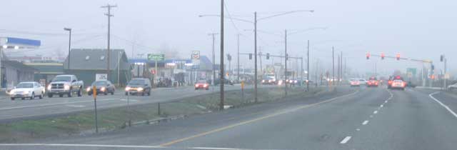
Finally, Grants Pass and guess what? It's foggy and cold. I'll bet it didn't reach 62 degrees here as it was on the coast.

Smith River in Northern California
Fog in Grants Pass
Return to Page Three Return to Page One
Return to RV trips Copyright, 2005 by RVeCafe.com