 |
|
Learning to Backpack Again
|
| Return to Traveling |
|
| |
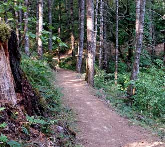
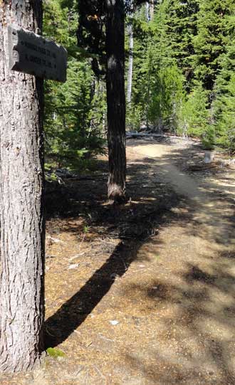
Rogue River Trail
April 25 - 30, 2017 |
|
|
|
|
|
|
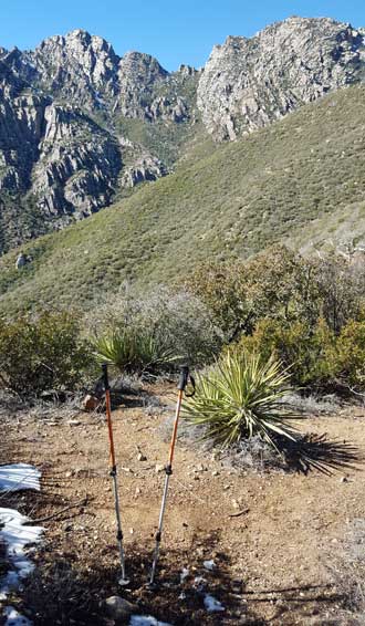
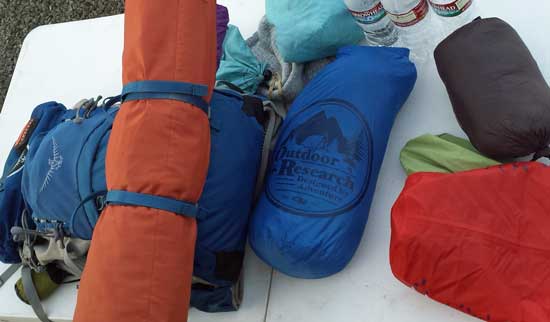
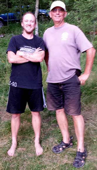
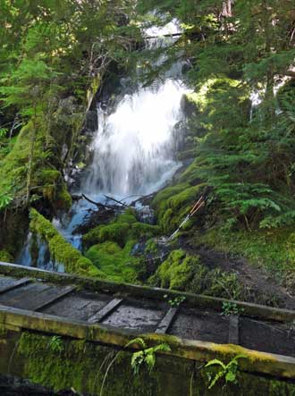
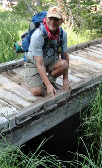
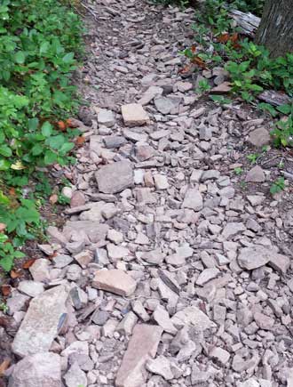
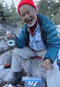
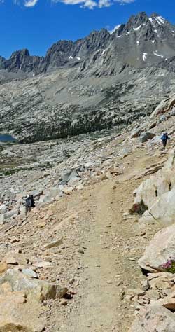
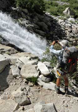
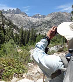
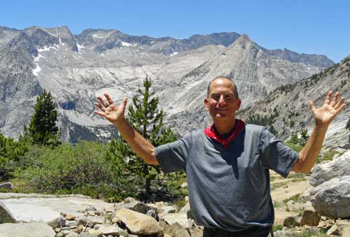
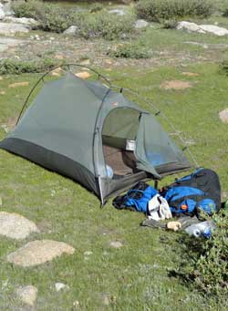
| Tuesday, April 25 - 30, 2017: My friend Richard planned another nice backpack trip on the Rogue River Trail in southern Oregon. The trail is 41 miles long through forested areas as well as trail carved along solid rock cliff next to the Rogue. John, Lane, Richard and I hiked the entire trail with Kevin and Golden "Wish" joining us on the first and last days. We began the route on Tuesday in the rain with heavier rain on Tuesday night and Wednesday morning. I'm glad the rain ended on Wednesday afternoon because as much as we all prepared, most everything was wet by Wednesday afternoon. I depended on my phone for photographs but it was damp on Wednesday so dared NOT turn it on until Thursday which turned out to be too soon. It would not take a charge on Wednesday night so put it into my bag of freeze dried scrambled eggs and potatoes hoping the freeze dried food would suck the moisture from the phone. It worked but I missed photos from Wednesday and Thursday hiking. Every time I go backpacking I wonder WHY am I doing this? The only answer is the scenery I would not see otherwise plus the adventure with "the guys". It was not a disappointment. The views of the river and the forest were spectacular. And the "manly entertainment" from my hiking buddies couldn't be beat. I prefer hammock camping. They do not require level ground, or rock clearing, far more comfortable, can be used as a chair, easy to set up quickly for a trail nap (if needed), usually lighter and more compact than a tent and above the ground critters. When set up correctly with a rainfly, they are just as dry as a tent. Richard was difficult to convince but I think I've made a believer of him. Watch this video of our best campsite. Click all the photos above for more views and here is a link to Lane's photos. Be sure to scroll down a bit for each photo because Lane has taken the time to caption each photo. Here is a link to Richard's story. RIchard is a far better writer than I am so expect to be entertained with his story. The trail was relatively well maintained and easy to follow. There were few steep sections but some of the cliff hiking took my breath away. The wildflowers were in their glory and I believe Richard and Lane took a photo of EVERY stinking flower which made them the last to finish the hike. In fact Lane bragged at taking 722 photos while Richard passed him with 900 photos. Lane was fortunate to see a Ringtail Cat but I was sound asleep at that time. Poison Oak lined the entire 41 miles of the trail but I believe we all avoided exposure. Ticks were also plentiful and only Richard was fast enough to avoid a tick bite. They are more painful than a mosquito bite. I wore my gaiters the whole 41 miles to help keep them off but one found a path to my knee. Richard had the only injury near-miss when he slipped off a rock during a creek crossing. It reminded us of John's mishap three years ago. Believe me, there were a thousand places along this trail to have a serious accident. Both Richard and Lane have active SPOTs while I have let my subscription lapse. I did not get photos of the many wilderness lodges along the route due to the wet phone but I did get photos of the Rogue River Ranch. Here is more about the ranch. Kevin and Wish rejoined us at the end of the trail and saved us with fresh chocolate chip and peanut butter cookies. |
Arizona Trail, Four Peaks Wilderness Section #130
February 9, 2016
|
|
|
|
 |
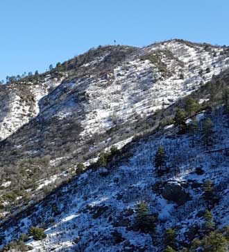
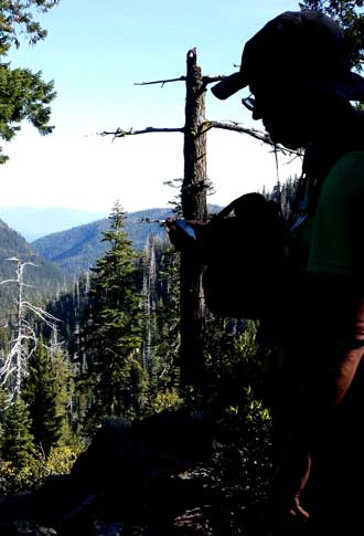
Tuesday, February 9, 2016: The Arizona Trail is an 800 mile trail from the Mexican border to the Utah border with extensive desert hiking, mountain hiking and through the Grand Canyon. I wanted to hike as much of the trail as I could while camped at Roosevelt Lake so I chose the Four Peaks Wilderness Trail #130. The Four Peaks can easily be seen from our campsite and even though the trail reaches 5,800 feet, very little snow can be seen from below. However, I learned the hard-way, 80% of the first ten miles of the trail was snow covered. That meant I sunk or slipped with every step. I already knew this would be a difficult 14 mile hike for me since I'm out-of-shape but was brave enough to try this trail after contacting the "Trail Steward" for this trail section and being told I would not see snow after the first four miles. Since I couldn't see snow from my campsite and anxious to do this section of the |
 |
|
| Arizona Trail and since Gary and Jeanne would deliver me to the Pigeon Trailhead and pick me up from the Mills Ridge Trailhead, I chose to do the hike! We got an early morning start (8 am) but the Pigeon Trailhead was 11 miles off the main highway on a Jeep trail (fortunately, Gary and Jeanne have a Jeep) so I didn't start the hike until 9 am. I also didn't remember to begin the map tracking for the first 3/4 mile of the hike so the map records behind the last photo and in the above link only shows 13.35 miles. It took about six miles of hiking to reach the best view of the Four Peaks. It was also at this point I realized I was not going to make my 2 miles per hour average (due to the snow) and would NOT make the Mills Ridge Trailhead at my scheduled arrival time. Fortunately, I had activated by SPOT so Gary and Jeanne were monitoring my progress and I was able to communicate via text message with them. What a gorgeous hike, with wonderful views and lots of water for this first six miles. The rest of the hike had little water sources except for the snow. I didn't need water, however, since I carried a full Camelback in my pack. Robert Bruce of the Tempe REI store is the Steward for this section of the trail and was very helpful with his trail advise. I mentioned to him my desire to carry "micro-spikes" which I did not own and Robert assured me I would NOT need them. He was WRONG! There were several long stretches of snow where I would have worn them and one very dangerous section where a slip on the ice would have sent me far down the mountain with a tough climb back to the trail. I firmly planted my trekking poles and boots on each step of this section. I'm definitely putting micro-spikes on my REI shopping list. The snow DID highlight the animals in this wilderness area. I didn't see any but animal tracks were everywhere in the snow. I was especially surprised to see that they seemed to follow the Arizona Trail. I saw deer and lots of paw prints which may have been coyote and/or some sort of cat prints. Of course, rabbit and mouse prints were also seen. I did NOT see human tracks although it seemed, ten miles into the hike, I thought I saw evidence of faint snowshoe tracks (perhaps I was just delirious ... smiley face). The weather was perfect. I appreciated the occasional wind gust to cool me off on this especially warm day. The snow was wearing me out and if I had an escape route, I would have taken it. I even considered stopping at a convenient location for the night and using my survival gear for the first time in my life. I chose, however, to endure the pain (knowing I would endure ridicule from my backpacking friends, Richard and Lane), stop whining and continue to my planned destination. As my hike continued I realized I didn't have one of my many headlamps in my pack so I sent a text message to Gary requesting he hike toward me with a flashlight. I was fortunate he found me just before twilight ended and we spent the last hour on the trail together in the dark. I could have exhausted my cell phone battery as a flashlight but saved that to the last. I'm writing this story two days after the hike so my sore calf muscles have begun to recover and I'm looking forward to the next hiking adventure. Click all the photos for exceptional views. The photos don't do this hike justice however, the views were better than a photo could capture! |
| Oregon Coast Trail, Bandon to Port Orford, August 22 - 25, 2015 |
|
|
|
|
|
 |
Richard, Lane and I had planned a hike into the mountains but since much of Oregon wilderness is on fire, we changed our plan to hike a portion of the Oregon Coast Trail from Bandon to Port Orford, thirty miles. Our first day was clear, windy and relatively easy hiking on firm sand with no major river crossings. After a few miles we were hiking alone, outside of the populated area. This portion of the Oregon coast is mostly undeveloped so after leaving the Bandon area, we saw no more houses. Much of this hike is in the Snowy Plover protected area where the dunes portion of the beach is off limits and all hiking must be on "wet sand". You'll see the protected area border in many of the photographs. Our first night was restricted to a |
 |
|
| BLM "primitive campground" near the New River. Someone had set up boards for sitting, other than that, the area was truly "primitive". The second day was overcast and misty but no wind. Now the sand has turned soft, even the wet sand was soft which made for exhausting hiking without relief. Our second night of camping was a Blacklock Point in the trees about 200 feet above the beach. We felt safer here from the always predicted great Oregon tsunami. Since we had trees, I was able to try out my new "lounging" hammock. This is a lightweight, cheap hammock I purchased to use for day hikes and comfort in the campground. It worked fairly well but because of the method used in manufacture the back side of the hammock did not reach up behind my head when sitting on the edge. Something to think about when buying a cheap hammock. Still, it was good for a comfortable nap, sitting to take-off/put-on shoes and for storing backpack contents when loading/unloading. The third day was hazy but clear and windy. We passed the Cape Blanco lighthouse and State Park. The state park made it easy to get water and wash-up. The wind was blowing hard enough to pelt us with sand but fortunately was from our backside which helped our forward progress. We had two rivers to cross this third day, the Sixes River and the Elk River. The Sixes was low, so barely to our boot tops. The Elk, on the other hand, was deeper so I was glad to get back to Richard's car waiting for us at the Paradise Point Wayside in Port Orford. We used his car to shuttle us back to my car waiting in the Best Western parking lot in Bandon. Click ALL photos for additional views. |
Tuesday, August 18, 2015: Only three miles from Timber Valley is the Cooper Creek Reservoir and the Cooper Creek Trail. I've hiked here before but this is the first time this year. After my experience with cross country hiking, I appreciate this trail. Today is forecast to be 102 degrees so I'm out early and appreciate all the tree shade on this trail. Fortunately, this trail is 90% in the shade, really appreciated today. I'm not sure my "crash course" in preparing for a backpack trip this weekend is working. But one relief, my group has decided to hike the Oregon coast because of all the Oregon wildfires. There is too much smoke in the area where we originally planned. Click the photo for a nice view of the lake. |
 Sunday, August 16, 2015: I chose to begin the same hike today that I did yesterday. Standing on the ridge at 1,000 feet above Timber Valley and searching with my binoculars, I decided there was a way to make a loop out of this hike rather than an out and back on the same road. The old logging roads below me would probably lead through the tree stands and then back to my park. I was expecting this hike to be one or two hours long, after all, it's only four miles. Click the photo to see the trail through the trees to the left of this photo. I disturbed a doe and fawn staying cool in the tree. Beyond the trees, I expected to walk as easily through the next forested patch but found it was tangled with blackberries so decided to try to rejoin my original access road only one ridge away from where I was stranded. It was a bad Sunday, August 16, 2015: I chose to begin the same hike today that I did yesterday. Standing on the ridge at 1,000 feet above Timber Valley and searching with my binoculars, I decided there was a way to make a loop out of this hike rather than an out and back on the same road. The old logging roads below me would probably lead through the tree stands and then back to my park. I was expecting this hike to be one or two hours long, after all, it's only four miles. Click the photo to see the trail through the trees to the left of this photo. I disturbed a doe and fawn staying cool in the tree. Beyond the trees, I expected to walk as easily through the next forested patch but found it was tangled with blackberries so decided to try to rejoin my original access road only one ridge away from where I was stranded. It was a bad |
| decision. I ended up in thistles, blackberries, wasps, poison oak and walking on downed branches most of the time. My hiking clothes were also picking up anything that would stick to them. My legs and arms were scratched by thistles and blackberry bushes. I had plenty of water but the heat was making me nauseated. This quickly turned into the hike from HELL. I was measuring forward progress in inches so my easy four mile hike turned out to be five hours long. The lesson ... no more cross country hiking, I'm sticking to the trails. |
|
 Saturday, August 15, 2015: I'm backpacking into Eagle Cap Wilderness in a week and I haven't prepared so I decided on a crash course in hiking fitness. Timber Valley is surrounded by mountains, the mountain to the south has been calling me since we moved here. Today, I climbed 1,000 feet to the top of the ridge, my first time since moving here in 2012. I hope the trails in Eagle Cap are not as steep as the climb up this mountain. What a great way to get use to climbing and descending in a week. Sutherlin is in the valley below. Click the photos for wider views. Saturday, August 15, 2015: I'm backpacking into Eagle Cap Wilderness in a week and I haven't prepared so I decided on a crash course in hiking fitness. Timber Valley is surrounded by mountains, the mountain to the south has been calling me since we moved here. Today, I climbed 1,000 feet to the top of the ridge, my first time since moving here in 2012. I hope the trails in Eagle Cap are not as steep as the climb up this mountain. What a great way to get use to climbing and descending in a week. Sutherlin is in the valley below. Click the photos for wider views. |
| Diamond Peak Wilderness, June 19 - 24, 2015 |
|
|
|
| This is a five day backpack into the Diamond Peak Wilderness area near Willamette Pass in the Cascade Mountains of Oregon. I've never hiked near Diamond Peak so a new experience for me. I'm packing with two friends, Richard and Kevin. I have a three part measure for mosquitoes, "tens, hundreds, thousands". Richard wanted to add "trillions" but I can't count that high. The mosquito count was mostly in the tens but enough for me to stay behind my mosquito net all five days rather than soak in Deet. I'm using my hammock this trip knowing there are plenty of trees for hanging. We started the route crossing the Amtrak train tracks and were lucky enough to catch the Amtrak on the return as it headed west toward Eugene. Upon arriving at our first lake, Divide Lake, I learned I'd left my spoon at home so used my "Deuce of Spades", my cat-hole spade. My rule is "never touch anything but dirt with the spade" so I wasn't afraid to use it. Still, that made me the JOKE of the backpack. Diamond Peak is impressive with lots of surrounding lakes. We camped at Divide Lake the first night, then on to Rockpile Lake the second night. The most scenic lake was Diamond View Lake for night number 3 and 4. The morning photo of the lake shows the reflection of Diamond Peak on the glassy smooth water. We spent about half the trip on the Pacific Crest Trail looping off the trail for day 3 and 4. Click each photo to see the spectacular views we saw during our five days. |
 |
|
| |
| |
| Siskiyou Wilderness Backpack, May 23 - 27, 2015 |
|
|
|
 Thursday, May 28, 2015: The Siskiyou Wilderness is 2.5 hours to the south. The four of us, Richard, Rick, Lane and myself began the trip on Saturday morning with beautiful, perfect weather. This was my first time with my new pack, slightly larger than the Osprey pack I won last year. This new pack only cost $27 because I used my REI rebate coupon and got a special discount on the price too. I also used my new air mattress purchased from Costco. It turned out to be a failure because it lacked any insulation properties. I will return it. I've decided to put extra effort into repairing the leak in my old mattress. Finally, I also used my solar charger for the first time. I take my phone because it is my GPS loaded with topo maps and also my camera. There is NO cell service in the Siskiyou Wilderness. My phone battery needs to be charged each day. I have an external battery to charge my phone battery. I use the solar charger to power the external battery. The phone can easily be charged overnight by the external battery. This way, I have the use of the phone during the day. The solar charger worked perfectly. Thursday, May 28, 2015: The Siskiyou Wilderness is 2.5 hours to the south. The four of us, Richard, Rick, Lane and myself began the trip on Saturday morning with beautiful, perfect weather. This was my first time with my new pack, slightly larger than the Osprey pack I won last year. This new pack only cost $27 because I used my REI rebate coupon and got a special discount on the price too. I also used my new air mattress purchased from Costco. It turned out to be a failure because it lacked any insulation properties. I will return it. I've decided to put extra effort into repairing the leak in my old mattress. Finally, I also used my solar charger for the first time. I take my phone because it is my GPS loaded with topo maps and also my camera. There is NO cell service in the Siskiyou Wilderness. My phone battery needs to be charged each day. I have an external battery to charge my phone battery. I use the solar charger to power the external battery. The phone can easily be charged overnight by the external battery. This way, I have the use of the phone during the day. The solar charger worked perfectly.
The Siskiyou Wilderness is particularly rugged hiking with steep, rocky trails also covered with limbs shed from all the trees over the trails. After camping in Youngs Valley, we did several day hikes, one to Raspberry Lake where Lane tried to fish with his trekking pole. The first night was noisy with celebrations from other backpackers but everyone packed out the second day so the rest of the trip was quiet. Rick is one of Richards racquetball friends so there were lots of racquetball stories. Click all photos for additional views. |
|
|
| |
|
| Sunday, May 3, 2015: Went hiking on the Tioga section of the North Umpqua Trail with Gary, Christy and Gwen. This is one of the longest hikes (8 miles) I can remember Gwen doing and I know she would not have done it had she known it was to be 8 miles. This trail is always beautiful in the spring and usually lots of water coming off the canyon walls into the river but little water this year due to the drought. Our friends Gary and Christy chose the trail so I'm not in trouble for tricking Gwen into a longer hike. Click the photos for additional views. |
|
|
| Friday, March 27, 2015: Today I hiked the circumference of the Smith Rock State Park near Redmond, Oregon. This is a 7.6 mile hike over the "Summit Loop" trail and several other trails which circle the park. The park is primarily used for climbing and hiking. I waited until a weekday thinking the crowd would be smaller but since this is "spring break" the parking was still difficult and crowded. Most of the folks seemed to be on the mountain climbing or watching the climbers. I was still never more than 100 yards from the nearest hiker, so the trails were crowded to. The weather was perfect with 360 degree views of Mt. Bachelor, The Three Sisters, Mt. Washington and Mt. Jefferson and occasionally, even Mt. Hood, far to the north. The photos don't do the views justice. Click each of the photos for additional views. |
|
| Saturday, March 21, 2015: I drove to Smith Rock State Park only 5 miles from Redmond hoping to do some hiking. It reminded me of the parks in Arizona when I arrived. Every parking location was taken so I had to park well outside the park. I walked to the "welcome center" and purchased an annual state park pass which will work for Smith Rock and many other parks in Oregon. I chose NOT to hike today because the trails were so crowded. I'll return on another day. Click the photos for other views. |
|
| Tuesday, March 3, 2015: I coordinated a one-way hike into Reno today with my daughter and her husband Scott. It turns out to be a 9+ mile hike from my RV in Verdi to their house in Reno. I was hiking strongly today with a good pace and kept my heart rate at a 124 beat average. It's always hard to keep a higher heart rate when walking. I used the new Black Diamond trekking poles today, all the benefits of using the poles without the disadvantage of the pole weight. I could really feel the difference. After arriving, I was able to read and sing several books to Lucy. She didn't participate in the singing but DID sit without squirming through three books. Scott must drive to work past Verdi in the afternoon so I was able to catch a ride back to the RV park. Click either photo to enlarge. |
|
| Friday, February 20, 2015: My new friend John invited me on a hike with three other of his friends. We went back to the MCCT (Mokelumne Coast to Crest Trail) again but a different section of the trail from last week. This time we climbed to some high view points of the Pardee Reservoir. This was a warm, clear day, unlike my first hike on the MCCT. Click the photos for additional views. |
|
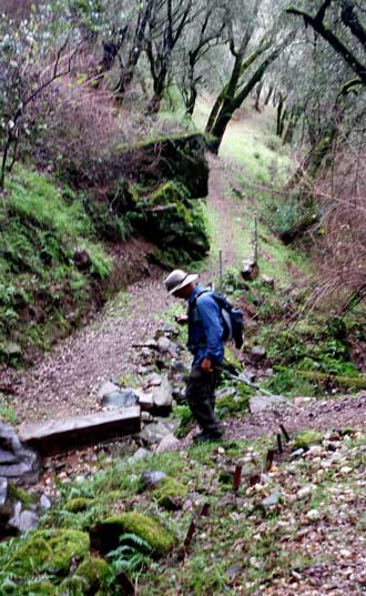 |
Saturday, February 7, 2015: After arriving in Lodi, I searched for "Meetup" groups with a hiking interest. I found the San Joaquin Hikers and a hike happening today. There were about a half dozen hikers signed to hike the Mokelumne Coast to Crest Trail (MCCT), or a portion of the trail (8 miles). So I signed also. The weather turned wet for this Saturday and I learned, Californian's don't hike in the rain. It was just John (the hike leader) and myself on this hike. We had mostly scattered showers with an occasional downpour. This was a well groomed trail, much different from Arizona hiking. We hiked from Rich Gulch to the East Terminus then looped back along the Mokelumne River. It is the Mokelumne which is only a few blocks from Mom's house in Lodi but this trailhead is in the foothills about 45 minutes from Lodi. There are two reservoirs between this trailhead location and Lodi. Of course the locals are hoping the rain will help fill the empty reservoirs. This was a good hike with some steep climbs and some pleasant level hiking. Click the photos for more views. |
 |
|
| Picacho Peak, January 23, 2015 |
|
|
|
| Friday, January 23, 2015: This was a special hike with my friends, Jack and Steve to the top of Picacho Peak. Jack had warned me about the hike and advised me to bring gloves to better grip the cables. I was thinking of cables more like fences than for climbing assistance. To get to the top, you will see that we had to climb straight up in some places with only small hand-holds and the cables to help. We had a nice two mile walk through the Sonoran Desert before the climbing began. This is not the usual hike and I haven't done any climbing like this in a long time so I was nervous. Jack has done the hike before so I believe he was much more comfortable than Steve and myself. Fortunately, there were no loose rocks on the climbing portion of the hike but I always made sure I had a tight grip on the cables. There was plenty of room at the top for photographs and lunch. This trail is 6.2 miles round trip but because the the difficulty it took us 4.5 hours to complete the trip. Click the photos above for additional views. |
|
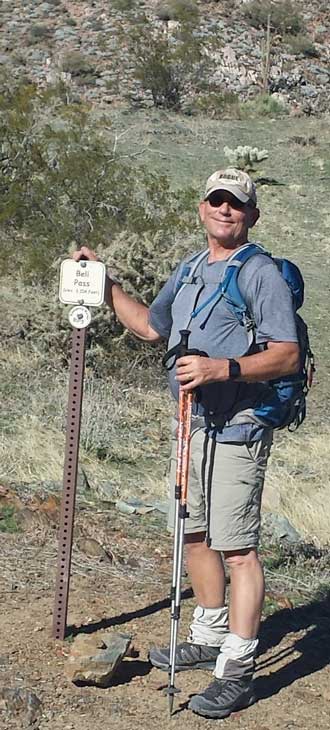 |
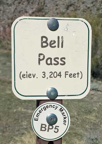
Friday, January 16, 2015: Today was an early morning start with my friend Steve to the top of Bell Pass, a seven mile hike with 1,514 feet of climbing. This is another popular area for hiking with many cars in the parking lot. Most are here to do the "Gateway Loop" and we passed many going and coming but met few on the Bell Pass trail. We found this hike by searching the Internet and found Hike Arizona. This was typical Sonoran Desert hiking with lots of loose rocks, and every bush has thorns. Still, the views at the top are hard to beat. Click the photos for additional views. |
 |
|
|
| |
Wednesday, January 14, 2015: I took Morgan for a short hike today (2.25 miles) to the top of Casa Grande Mountain, a very popular hike. There were a dozen cars at the trailhead when I arrived and two dozen when I finished the hike. This trail is a little over one mile to the top while climbing 683 feet. Morgan is more than 14 years old so her hiking endurance is now around 3 miles so I felt she could make this ascent. We met many hikers on the trail and everyone had to say hello to her and give her encouragement. I carried a gallon of water with me but she wanted only a couple of swallows. Some nice views of the surrounding desert at the top. Click the photos for additional views.
|
|
Friday, January 9, 2015: My friend Steve and I hiked the Usery Mountain Regional Park. We hiked the 7.5 miles around Pass Mountain with 800 feet of elevation increase. A nice day hike with enough rough terrain to keep my heart rate high. Click the photos for views of the mountain park.
|
| Superstition Mountains, January 3 & 4, 2015, Arizona |
|
|
|
 Monday, January 5, 2015: For my first backpack in Arizona, using "Meetup", I found a group of hikers packing into the Superstition Mountains. This is an impressive group of mountains to the southeast of Phoenix. It only took an hour and forty minutes to get to the Peralta Trailhead. I got there early, good thing because this is a very popular area to hike and I would not have found a parking space had I been later. Our plan on the first day was to hike by Weaver's Needle, a popular day hiking destination. Then on day two, hike by Miner's Needle, another popular day hiking destination. In our pre-planning, we learned that the water available at LeBarge Spring was good so we need not pack in two days of water. The spring was our overnight camping location. I've mentioned before, every bush, plant, tree and, of course, cactus has a set of thorns or spikes ready to grab the hiker. As I'm hiking along, branches are reaching out, grabbing me like Velcro attaching to my pants, shirt, hat and even bare skin. I'm often needing to stop, reverse direction to "un-clip" from the arm of a tree which has grabbed me. Since the other hiker's knew I was from Oregon, I joked with them about the many Saguaro Cactus, saying, "Saguaro is the Spanish word for Douglas Fir". Those who have been to Oregon understood the joke. The hiking in the Superstition Mountains was incredible, views incredible and my hiking partners are good people. It was tough hiking with rough, uneven and rocky trails. The Arizona hiking makes me appreciate the softer Oregon trails and the many good sources of Oregon water for hikers. Click each photo for another view. Yes, there was snow from a recent storm on the north side of all the mountains. My Arizona hiking partners mentioned they had never seen snow on Weaver's Needle so were taking photographs of the new experience. They also mention how this was the only time of year to hike the Superstitions in comfortable temperatures, 60 daytime and mid-20s night time. My new, warmer sleeping bag kept me warm even with ice forming on my tent. |
|
|
|
Thursday, January 1, 2014: What a marvelous mountain park in the center of Phoenix. It's call Phoenix Mountain Park. It is very popular. We had to search for a parking spot with the park so crowded. Most hikers were on the trail to the top of the mountain. We chose to hike the circumference of the mountain instead. A couple of surprises for me, that the park is so popular and that the park has not be "sanitized" to make the trails more like Disneyland. Instead, the park is typical desert mountain hiking, loose sand and rocks and steep climbs rather than switchbacks. Lots of great views of the city of Phoenix since the city surrounds the mountain. There is NO water on this mountain so all water must be carried, that's typical of these desert mountains too. We enjoyed hiking with Dave, Brook and Bell, they are strong hikers. Click these photos for additional views. |
Wednesday, December 24, 2014: After a week with "Arizona Crud", I'm feeling well enough for a 5 mile hike today. This time it was close, no hour and half drive, about 20 minutes to the trailhead of the Casa Grande Mountain Park. This park is about 1,200 acres with lots of trails, the longest is 5 miles one way. I hiked the "Ridge" trail hoping it would take me to the ridge of the mountains, about 800 feet above the trailhead. Instead, the trail followed the contour of the mountain on the east side. I got the length of hike I wanted but didn't get to the top of the mountain. Click the photo to see the view to the east. |
|
|
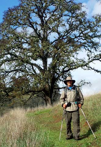
Tuesday, December 16, 2014: This was my first hike in Arizona. When I arrived in Casa Grande I searched for "hiking clubs" in the area and found several "Meetup" groups organized around different hiking areas and abilities. I joined several to get their hiking calendar and found this hike organized by Lawrence with two other hikers, Ruth and Janice confirming their participation. The Pass Mountain Trail sounded perfect to begin learning the area. This trail is in the Usery Mountain Regional Park. We started from the end of Meridian Road, on the for right of the map. I was surprised with the number of plants and how green they were. No Douglas Fir trees (like Oregon) but more than the dry area of Spirit Mountain. This was a fun group to hike with, they showed me just what I was looking for. Click the photos for additional views.
|
| Spirit Mountain Wilderness Area near Laughlin, Nevada |
|
|
|
|
 Thursday, December 11, 2014: On Tuesday, Gwen dropped me off at the trailhead of the Grapevine Canyon into the Spirit Mountain Wilderness Area. There are no maintained trails in this wilderness, but there is a good, short, trail to the petroglyphs. This is a sacred area for the first Americans and the petroglyphs mark the entrance to the canyon. A short hike beyond the petroglyphs and the canyon is blocked to easy access by a tall dry fall under a bolder. Access is gained by hiking the left side of the canyon over the blocked area. A faint trail continues up the canyon but soon disappears and the rest of the hike is bolder hoping, circumventing bushes, sinking into sand, slipping on decomposed granite but then finding a great slot canyon which got narrower as I continued deeper into the slot. At the end of the slot is a small ledge I used to climb out of the slot. The weather is nearly perfect with a slight breeze and 70 degrees and I have a great view of Laughlin and Riverside Casino from my campsite. This evening, I'm welcomed by an owl landing on a nearby rock and wooting at me for about an hour. About that time I notice the ISS (International Space Station) flying directly overhead. After it passed, I saw three other satellites flying by. I checked all against an airliner to be sure I was seeing satellites. I've seen the ISS many times before so knew it when I saw it. I forgot my earplugs so the breeze kept me awake for a while by rattling my tent, otherwise, the night went well. Wednesday morning was another perfect day with only a slight breeze. The best part of returning to the trailhead was getting to hike through the slot canyon again. The return off the mountain went faster than the ascent so I was at the trailhead before Gwen. I continued down the gravel access road but Gwen found me 1/2 mile from the highway. This is a hike I would never have done without the SPOT. Anyone following my SPOT page would know my location so I felt "found" even though there was no trail and no other hikers in the area. Click the photos for additional views. Thursday, December 11, 2014: On Tuesday, Gwen dropped me off at the trailhead of the Grapevine Canyon into the Spirit Mountain Wilderness Area. There are no maintained trails in this wilderness, but there is a good, short, trail to the petroglyphs. This is a sacred area for the first Americans and the petroglyphs mark the entrance to the canyon. A short hike beyond the petroglyphs and the canyon is blocked to easy access by a tall dry fall under a bolder. Access is gained by hiking the left side of the canyon over the blocked area. A faint trail continues up the canyon but soon disappears and the rest of the hike is bolder hoping, circumventing bushes, sinking into sand, slipping on decomposed granite but then finding a great slot canyon which got narrower as I continued deeper into the slot. At the end of the slot is a small ledge I used to climb out of the slot. The weather is nearly perfect with a slight breeze and 70 degrees and I have a great view of Laughlin and Riverside Casino from my campsite. This evening, I'm welcomed by an owl landing on a nearby rock and wooting at me for about an hour. About that time I notice the ISS (International Space Station) flying directly overhead. After it passed, I saw three other satellites flying by. I checked all against an airliner to be sure I was seeing satellites. I've seen the ISS many times before so knew it when I saw it. I forgot my earplugs so the breeze kept me awake for a while by rattling my tent, otherwise, the night went well. Wednesday morning was another perfect day with only a slight breeze. The best part of returning to the trailhead was getting to hike through the slot canyon again. The return off the mountain went faster than the ascent so I was at the trailhead before Gwen. I continued down the gravel access road but Gwen found me 1/2 mile from the highway. This is a hike I would never have done without the SPOT. Anyone following my SPOT page would know my location so I felt "found" even though there was no trail and no other hikers in the area. Click the photos for additional views. |
|
|
Friday, December 5, 2014: I'm hiking today to try to find an easier way through the mountains between our campground and Davis Dam. There is NO trail but lots of washes which are easier hiking than the loose granite mountain sides. This time, a friend drops me off about a mile from the campground and I walk the wash to Davis Dam then turn around and walk back a slightly different route looking for a better route through the mountains. I was rewarded with a 3 second, clear view of a coyote. He looked healthy so he must be good at catching the few rabbits I've seen around. A survey crew was out yesterday in one of the washes I hiked, not sure why. The photo on the right would be of a "dry fall" if I was hiking in Death Valley. Click that photo for a view over the last mountain with the campground through the pass on the right. Click all photos for another view. With an average of 5 inches of rain each year and temperatures of 120 degrees in the summer, there are NO trees here.
|
| Hiking the Mt. Whitney Portal Trail |
|
|
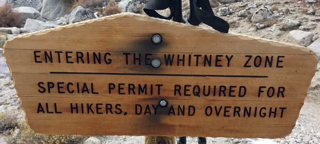 Thursday, November 13, 2014: Today was a serious hike on the Mt. Whitney Portal trail. This trail is 11 miles to the summit of Mt. Whitney, so 22 miles round trip and many hikers do it in a day. That would be 6,100 feet of climbing from the trailhead. I am not even close to that fitness. I climbed until lunch at Mirror Lake, 10,686 feet, so 2,300 feet of elevation increase. I was ready to turn around at that point. When I picked up my permit, I was told NO pooping in the wilderness, the hiker must carry out any poop. I was also told, bear spray is not allowed, certainly different from Yellowstone where bear spray is recommended for every trail. As I climbed from the trailhead at 8,300 feet, I was climbing into increasingly bad weather. It became colder, overcast and snowing. I met about 15 backpackers either coming down the trail or climbing. I also met 8 day hikers like myself. I would certainly be tempted to backpack and spend the night but I would need a warmer sleeping bag. You can see in the photos I had to add layers as I climbed higher. I still had two more layers I could have added but didn't have the need. The backpackers descending the mountain were dressed considerably warmer than I was so it must have been much colder at the higher elevations. This was my first hike where I was considering the need for micro spikes. Six of the backpackers were still wearing theirs as they descended past me. My assumption is, they would be mandatory for a climb to the summit. Before this hike, I had no desire to summit Mt. Whitney but now that's changed. I can't see hiking it in one day however. Click the photos for additional views. Thursday, November 13, 2014: Today was a serious hike on the Mt. Whitney Portal trail. This trail is 11 miles to the summit of Mt. Whitney, so 22 miles round trip and many hikers do it in a day. That would be 6,100 feet of climbing from the trailhead. I am not even close to that fitness. I climbed until lunch at Mirror Lake, 10,686 feet, so 2,300 feet of elevation increase. I was ready to turn around at that point. When I picked up my permit, I was told NO pooping in the wilderness, the hiker must carry out any poop. I was also told, bear spray is not allowed, certainly different from Yellowstone where bear spray is recommended for every trail. As I climbed from the trailhead at 8,300 feet, I was climbing into increasingly bad weather. It became colder, overcast and snowing. I met about 15 backpackers either coming down the trail or climbing. I also met 8 day hikers like myself. I would certainly be tempted to backpack and spend the night but I would need a warmer sleeping bag. You can see in the photos I had to add layers as I climbed higher. I still had two more layers I could have added but didn't have the need. The backpackers descending the mountain were dressed considerably warmer than I was so it must have been much colder at the higher elevations. This was my first hike where I was considering the need for micro spikes. Six of the backpackers were still wearing theirs as they descended past me. My assumption is, they would be mandatory for a climb to the summit. Before this hike, I had no desire to summit Mt. Whitney but now that's changed. I can't see hiking it in one day however. Click the photos for additional views. |
Hiking into Death Canyon, the Teton Range |
|
|
| Wednesday, October 22, 2014: Before leaving the Teton area, Wyoming, I got the chance to hike 8 miles roundtrip into the Teton Range. It was a cold day but I still over dressed and saw other hikers in much lighter hiking gear. Still, when in the shade, I was glad to have the extra warmth. Much of this hike reminded me of my experience on the John Muir Trail. The trail was steep, rocky (granite just like the Sierras), lots of water around, occasional wind, many other hikers, and great views. Click the photos for additional views. |
|
| Hiking the North and South Rims of the Grand Canyon of the Yellowstone |
|
|
|
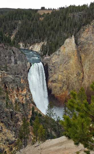 |
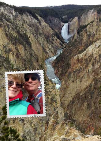
Thursday, October 16, 2014: We have only a few days at Yellowstone before they close our campground for the season. There is a nice trail along the north and south rims of the Grand Canyon of the Yellowstone. Gwen drove around the rims while I hiked the trail hoping for better photographs. As it turned out, most of the view points can be easily accessed from the road but I enjoyed the hike. The best view of the Lower Falls is from the "Red Rock Trail" with a steep hike to the "rock" and back. Few other hikers on the trail. Click each of the photos for additional views. I did carry bear spray because of all the warning signs and printed information about bear encounters. |
 |
|
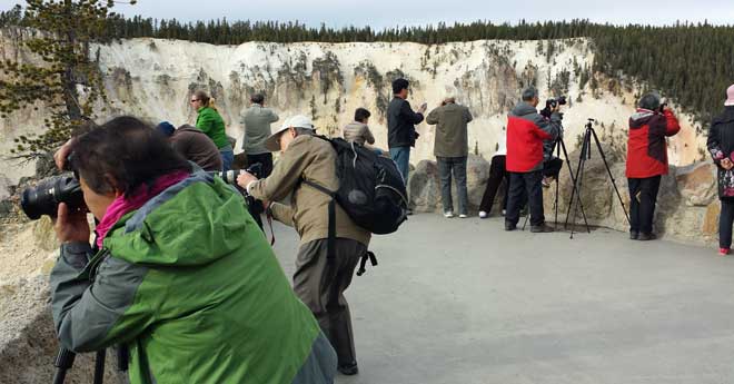
The Artist Point on the south rim was a favorite spot for all the tourist photographers. The canyon colors and volume of water passing through the canyon helped to make for good photographs. We are enjoying exploring Yellowstone this time of year, far fewer crowds but all buildings are closed except for a few at the Old Faithful tourist area. Gwen and I kept in touch using FRS walky-talkies. It worked well and we were able to meet for lunch.
|
|
| Jefferson Park with the PCTA Trail Maintenance Crew, August 29 - September 5, 2014 |
|
|
|
|
|
| Monday, September 8, 2014: This was a seven day trail work crew sponsored by the PCTA (Pacific Crest Trail Association). We began with nine including our crew leader, Andrew, and two Forest Service employees, Andrea and Andy. One of the nine is Scott, the Art Director for "Country" magazine and along with the crew to gather information for the magazine and donate a day of work. That leaves Tim, Leif, Vanessa, Robecca and myself. The climb to our camp is about 6.5 miles into Jefferson Park at the foot of Mt. Jefferson in the Mt. Jefferson Wilderness Area. Since it's a wilderness area, no power tools are allowed. This first day included a German film crew making a documentary of the PCT for German television. After they finished with filming the mule train which brought in our common camp gear and food, they filmed us in a "normal" work day then hiked down the mountain. That's when the weather began to pour into the valley. It was not forecast on the weather reports I looked at so I brought only a poncho thinking it would keep any rain from happening (not bringing rain gear will surely bring rain). Unfortunately, we got nearly 24 hours of rain which soaked my work pants and soaked even those who brought better rain gear. Vanessa left her rainfly open so all her gear was soaked and she was shivering. Andrew walked Vanessa out of the wilderness but had to leave anyway since both our Forest Service radios shorted out due to the rain. The next day, Scott (the Country magazine art director) had seen enough and also left a day early. So now we had four volunteers and three supervisors. My work clothes are now soaked but my hammock and bedding plus hiking and bedtime clothes are dry. This is my first test of the hammock in rain so I'm very pleased it kept everything dry. Be sure to click all photos above, each has another view which can be seen by clicking on the photo. The sun comes out by mid-day on day three so all our gear including my work clothes are dry again by day four. Our job is to open trails to the approved campsites and close "social trails" deemed "not approved" and confusing. We are using handtools and wildland firefighting tools to work on the trails. My hammock is only a few feet from a glacier stream coming directly from the "Park Glacier" on our side of Mt. Jefferson. Each morning the stream is dry because the glacier has stopped melting overnight. By late afternoon, it is running strongly again. I wish I had brought (but didn't) my rain pants, tall gaiters (I brought my short gaiters), rain jacket, gloves, and waterproof hiking boots. Usually the first question asked by the German film crew and by Scott was, "Why are you volunteering to do this?" Everyone answers, "to give something back to the trail", "to preserve the trail for the future", "because I love the wilderness" .... I agree and would add: "to help make the wilderness experience easier for the novice", "to learn skills from more experienced backpackers", "I believe in a 'use tax' and this is a method of paying a use tax". |
|
Thursday, August 28, 2014: I'm ready for the Pacific Crest Trail Association maintenance crew (I think). I've gone through the packing list twice and believe I have everything I need. The pack feels like less than 30 lbs. No need to pack food or any cooking gear, that will be provided. Toilet paper is also provided so I don't have that either. We've been told to bring rain gear but the forecast is for clear skies. I did bring my cheap, plastic poncho because I know if I don't bring something, it will rain for sure. I'm also bringing my rain fly for the hammock for the same reason. Gloves and a helmet will be provided. My double front work pants are brand new and have never been worn. My long sleeve work shirt is cotton, so not a good choice but I have nothing else. I sewed by PCT "Certified Sawer" patch onto that shirt to look "official" and look like I know what I'm doing, after all, I spent three days earning that patch. The pack on my back is the pack I won as a door prize during that three day training event. Now all I have to do is start traveling by 5 a.m. No more posting until I return in a week. You CAN click the SPOT Gen3 above to see my posting from the wilderness. |
Wednesday, August 27, 2014: This was a day to get some shopping done then move the Alumascape to storage. Finally, I had time to begin packing for the next big adventure. I have volunteered for a Pacific Crest Trail Association trail maintenance crew. I must report early Friday morning but the drive will be about four hours to the trailhead so that means a very early start on Friday. I've begun to gather everything I'll need for the one week worth of work. Of course I won't have Internet access so RVeCafe will be silent for a bit more than a week. I'll take photos and share the experience when I return. |
|
| Tuesday, August 19, 2014: This last weekend I did a "Richard" hike. Richard has become a good friend since our hike on the Lost Coast. He does at least one hike each week but this hike is the first I've been able to coordinate with him. He planned a ten mile hike to Oldenburg Lake. The trailhead begins at Crescent Lake beyond Willamette Pass, about a 2 hour drive for us. I was surprised to see many Pacific Crest Trail thru hikers on our trail since this is NOT the PCT. But I learned it is used as an alternate to the PCT since there are lots of water sources on this trail. Richard is like Katchan and Lane, he stops to take photos of flowers, trees and bugs. I do my best to take photos of him taking photos. I couldn't believe we were only 4 miles from Windigo Pass after driving 2 hours to the trailhead. Gwen and I were only a few miles from Windigo Pass when we camped at Diamond Lake. This was an easy hike, we took our time and investigated lakes and meadows along our trail. Richard learned a lesson from our rescue at Lost Coast and carries a SPOT with every hike too. Click these photos for additional views. |
Sunday, August 17, 2014: While camping at Diamond Lake, we had campers move in next door to us. After entering a conversation with them I learned they had just picked up their son off the Pacific Crest Trail, only five miles away and brought him to Diamond Lake to spend the night with them. I've actually met quite a few thru hikers on the trail but Trevor is the first I've been able to get a photograph. A "thru hiker" is a hiker starting in Mexico, hiking to Canada on the Pacific Crest Trail, all 2660 miles of the trail. We talked about much of the PCT and I learn Trevor was in the same area of the John Muir Trail when I was hiking earlier in the summer. No doubt Trevor got a shower and clean clothes too. Trevor left the next morning before we were outside. The weather he hiked into was rain and electrical storms. |
| Last 35 miles of the North Umpqua Trail, August 7 - August 10 |
|
 First hiking day: I did not get an early start, probably on the trail by 10:30 am and dreading the warm hiking. As it turned out, 95% of the trail in this first section is cool and in the shade both because of the river and the canopy. My first lesson came from a missing bridge on the trail. There were bridge ramps on both sides of the river but no bridge and no alternative in sight to getting wet in the crossing. I hiked up-river looking for a dry alternative. After thirty minutes, I was STILL looking for the dry alternative and finally just walked through the water, something I could have done at the missing bridge crossing. Now I had to fight my way back through heavy brush on the opposite side to the trail. I would have saved time just crossing at the missing bridge and saved my mattress. Somehow, the mattress got punctured in the fight through the brush back to the trail (see photo below). I was surprised by the amount of water coming from the side creeks and springs since we are in a drought. Four miles into the hike was the hot springs area. This was very busy with car campers, day hikers, backpackers and bike riders. I had no intention of trying the hot springs advertised at 108° because we never kept our hot tub higher than 104°. I also did not want to wait in line for a time in a "public" hot spring. The "Dread and Terror" section of the trail begins at the hot springs. Again, the first five miles of this section was very wet. I chose a private area where previous hikers had camped for my night camp. My hammock was a little close to the river so I had to use ear plugs. I was surprised in the middle of the night when I got up to urinate. Something bit my toe while I'm standing on the edge of the ground cloth. I shined my headlamp toward the ground and saw thousands of black ants off my cloth. None on the cloth (except the ONE which took a bite on my toe), but thousands on the ground. The next morning, no ants, just like it was when I set up my camp. On the way out the next morning I took an old T-shirt, tin can and candy wrappers (left by previous hikers) with me. Click all photos in this report for additional views. First hiking day: I did not get an early start, probably on the trail by 10:30 am and dreading the warm hiking. As it turned out, 95% of the trail in this first section is cool and in the shade both because of the river and the canopy. My first lesson came from a missing bridge on the trail. There were bridge ramps on both sides of the river but no bridge and no alternative in sight to getting wet in the crossing. I hiked up-river looking for a dry alternative. After thirty minutes, I was STILL looking for the dry alternative and finally just walked through the water, something I could have done at the missing bridge crossing. Now I had to fight my way back through heavy brush on the opposite side to the trail. I would have saved time just crossing at the missing bridge and saved my mattress. Somehow, the mattress got punctured in the fight through the brush back to the trail (see photo below). I was surprised by the amount of water coming from the side creeks and springs since we are in a drought. Four miles into the hike was the hot springs area. This was very busy with car campers, day hikers, backpackers and bike riders. I had no intention of trying the hot springs advertised at 108° because we never kept our hot tub higher than 104°. I also did not want to wait in line for a time in a "public" hot spring. The "Dread and Terror" section of the trail begins at the hot springs. Again, the first five miles of this section was very wet. I chose a private area where previous hikers had camped for my night camp. My hammock was a little close to the river so I had to use ear plugs. I was surprised in the middle of the night when I got up to urinate. Something bit my toe while I'm standing on the edge of the ground cloth. I shined my headlamp toward the ground and saw thousands of black ants off my cloth. None on the cloth (except the ONE which took a bite on my toe), but thousands on the ground. The next morning, no ants, just like it was when I set up my camp. On the way out the next morning I took an old T-shirt, tin can and candy wrappers (left by previous hikers) with me. Click all photos in this report for additional views. |
|
|
|
| Second day of hiking: This day finishes the Dread and Terror section of the trail. The Dread and Terror section of the trail is 13 miles long. The second half of the trail was not as wet as the first but still shady and cool. The first photo above shows the trail falling way into the river, about a 50 foot drop. I was wishing for a hand-hold at this point and admired the cyclists who road through this section without getting off their bikes. It was busy today with mountain bikes, most road both directions on the trail. There were tough, technical parts of the trail for cyclists such as the log carved out to the left. I also passed Lemolo Falls today, a large, impressive fall on the river. Yesterday a hiker passed me saying, "Great trail, doesn't get any better than this." I immediately thought of my John Muir Trail experience then decided the trails are "different" not better. So today, when a hiker stopped me and asked, "Is this trail boring to you?" (the question took me by surprise). I was ready with my story of the previous day hiker and my decision to call it different. He finished his question with explaining he had just come from fifty miles on the trail in the Rocky Mountains and "nothing" could beat that experience. My goal for this evening was the far end of Lemolo Lake. The map showed a campground and I expected to get water and dump the garbage I brought from the first camp site. As it turned out, I was able to dump the garbage but no water in the campground. I knocked on the door of the campground host but no-one home. He had an ice chest full of bottled water so I took what I needed then returned three days later with replacement bottles. Lemolo Lake also had good Internet access so I sent Gwen and text message (she already knew where I was because I was using my SPOT). She immediately hopped into the truck and drove to meet me so we had dinner together with me showing her how I fix my hot meal. I also chose this location for camping because Lane will join me tomorrow morning for the last two days of hiking. |
|
 |
Third and fourth hiking day: Lane joined me this morning (weekend ... he still must work ... he hates it when a ask ... "what's a weekend?") From the point on, the trail changes. Now it's hot and dusty with few water sources and the trail is away from the river even though we are hiking to the North Umpqua headwaters. We are also increasing a couple thousand feet in elevation so this third day was a tough one. We also hiked further than we planned (looking for water) so I was plenty tired. But what a good night sleep I had even with a poorly patched hole in my mattress.
The fourth day of hiking began early with a short hike to Lake Maidu, where the North Umpqua River begins (headwaters). It's only a slow moving creek under the bridge (on the left). Lane and I must continue our hike over the last mountain, crossing the Pacific Crest Trail and on to Miller Lake where Gwen will pick us up. We drove straight to lunch, much better than backpack food! |
 |
|
______________________________________________________________________________________ |
|
 |
Monday, August 4, 2014: Yesterday was a nice hike I found in the book, 100 Classic Hikes in Oregon,  by Douglas Lorain. The trailhead is about an hour and 20 minutes to the southeast. Lorain says the hike is 11.5 miles long but it was 13.5 miles according to my measurement. The hike climbs 2000 feet up Hemlock Creek with several waterfalls then makes a wide loop around Hemlock Lake. It was hazy due to the many wildfires in southern Oregon and northern California. The forest service provided a nice log table in a "remote campsite" at Hemlock Lake which I used during lunch. The photo at left needs explanation.
 |
 |
| I have nothing against horses or their riders. I enjoyed talking to two riders on the trail. My comment is, if Morgan had gone with me and she pooped in the trail as this horse did, I would be expected to bury it or pick it up and I always do and abhor dog owners who don't cleanup after their pets. Shouldn't stock owners at least move the poop off the trail? Just saying! The photo at right shows a portion of the trail which is unusual for Oregon ... and more like the John Muir Trial in California. Behind that photo is one of my dirty socks. The stickers and crud on my socks (and in my shoes) would not have happened had I worn my gaiters. I'll remember to do that next time. |
|
Tuesday, July 29, 2014: Hiking Cooper Creek Reservoir because it's only three miles away and a trail on dirt for 3.5 miles. This time of year, lots of ski boats on this tiny lake. They must watch out for each other. Click the photo for another view. |
|
Monday: July 28, 2014: About 60 mile east of Roseburg is a short 3 mile round trip trail to Twin Lakes. Gwen and Morgan went along and we all enjoyed the trail. This was typical Oregon, green everywhere, soft trail (compared to the granite of the John Muir Trail). The water was warm. I carried a pack because I need to get in shape for another pack trip. This pack is the one I won at the PCTA training camp. It's a light weight, small volume pack but large enough for 3 - 5 days as long as I don't have to carry a bear canister. Each of the lakes had a shelter available to campers on a first come, first served basis. Click the photos for additional views. Gwen is at the second Twin Lake shelter. The large fire pit had lots of tin cans which campers apparently thought would "dissolve" is burned. Well they don't. I picked them up and packed them out since I had room in my pack after we ate lunch. |
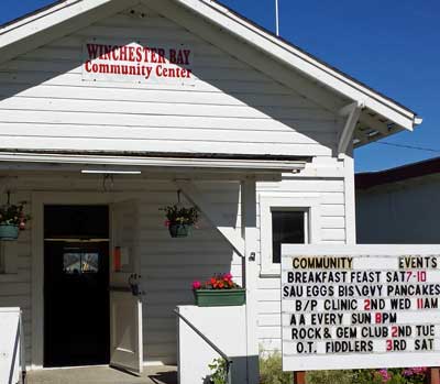 Saturday, July 19, 2014: I returned to Winchester in time to make the breakfast event at the Winchester Community Center. I must have arrived just after the rush because the room was full (click the photo) and the breakfast orders were backed up .... and they were out of coffee. I was patient and got my fill of blueberry pancakes. I took Morgan back to the trailer and then took myself on a ten mile hike to make up for the short hike on the north Umpqua Spit. This time I hiked to the south from the south Umpqua jetty. It was the same endless beach with huge sand dunes away from the water where the dune buggies were playing all day today. I hiked far enough to hike into the fog. My hat is reversed because I was hiking into a 25 mph wind on the return north back to the parking lot. I was thinking that all hikes would be easy compared to the hiking I did on the John Muir Trail and felt ten miles on level beach sand would be a "piece of cake". However, I was humbled by the quickness of the hike (about 3 hours for the ten miles ... we took 8 hours to do our days on the JMT), and by the ferocity of the wind on the return. I was exhausted. I did carry a pack, even though I did not plan an overnight. Saturday, July 19, 2014: I returned to Winchester in time to make the breakfast event at the Winchester Community Center. I must have arrived just after the rush because the room was full (click the photo) and the breakfast orders were backed up .... and they were out of coffee. I was patient and got my fill of blueberry pancakes. I took Morgan back to the trailer and then took myself on a ten mile hike to make up for the short hike on the north Umpqua Spit. This time I hiked to the south from the south Umpqua jetty. It was the same endless beach with huge sand dunes away from the water where the dune buggies were playing all day today. I hiked far enough to hike into the fog. My hat is reversed because I was hiking into a 25 mph wind on the return north back to the parking lot. I was thinking that all hikes would be easy compared to the hiking I did on the John Muir Trail and felt ten miles on level beach sand would be a "piece of cake". However, I was humbled by the quickness of the hike (about 3 hours for the ten miles ... we took 8 hours to do our days on the JMT), and by the ferocity of the wind on the return. I was exhausted. I did carry a pack, even though I did not plan an overnight. |
| |
|
| Friday, July 18, 2014: My friend Richard told of a nice hike along the north Spit of the Umpqua River. It was a dirty, rough drive to get to the north Spit but worth the adventure. Because it is so difficult to get here, there are few people visiting this part of the Oregon beach. All you see is sand in both directions so the reward is solitude. Morgan came along with me, click the photo to see Morgan and the view to the north. |
| June 25 ... returning to Sutherlin July 9, 2014: Sixty-two miles on the John Muir Trail. |
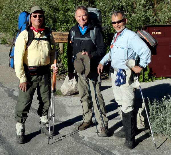 The trail for us began at the Onion Valley Campground, west of Independence, California. This campground is at 9,700 feet on the east side of the Sierra Nevada mountains. Kearsarge Pass separates us from the Pacific Crest Trail which is also the John Muir Trail in this part of California. This photo is the "before" photo... before we took our first step onto the Kearsarge Pass trail. Our plan was to do five passes, each at or above 12,000 feet in nine days exiting the trail at Bishop Pass then on to South Lake then Bishop, California. My car is parked at South Lake, Katchan's car is parked here at Onion Valley. I'm on the left in this photo, Merle is in the center and Katchan (our backpack leader) is on the right. We all have identical hiking boots, Katchan is wearing knee high gaiters, not knee high boots. He thought we might have to wade deep water at the King River crossing (as it turned out, we did not). I have many photographs to process so I'll fill in the details of our backpack over the next few days. This was the toughest backpacking I've ever done. Also, at 67, I am the youngest, Katchan is 70 and Merle is 72. I was also the weakest of the three hikers but tried NOT to whine since I was the youngest. Click the photo for a wider view. The trail for us began at the Onion Valley Campground, west of Independence, California. This campground is at 9,700 feet on the east side of the Sierra Nevada mountains. Kearsarge Pass separates us from the Pacific Crest Trail which is also the John Muir Trail in this part of California. This photo is the "before" photo... before we took our first step onto the Kearsarge Pass trail. Our plan was to do five passes, each at or above 12,000 feet in nine days exiting the trail at Bishop Pass then on to South Lake then Bishop, California. My car is parked at South Lake, Katchan's car is parked here at Onion Valley. I'm on the left in this photo, Merle is in the center and Katchan (our backpack leader) is on the right. We all have identical hiking boots, Katchan is wearing knee high gaiters, not knee high boots. He thought we might have to wade deep water at the King River crossing (as it turned out, we did not). I have many photographs to process so I'll fill in the details of our backpack over the next few days. This was the toughest backpacking I've ever done. Also, at 67, I am the youngest, Katchan is 70 and Merle is 72. I was also the weakest of the three hikers but tried NOT to whine since I was the youngest. Click the photo for a wider view. |
|
|
 Wednesday: Day One: This was the first hiking day and the day where we tested our legs and bodies. None of us really knew what might happen at this altitude. Onion Valley campground is at 9,700 feet and the trail climbs from that point. Kearsarge Pass is 11,760 feet, so only 2,000 feet of climbing but how will our bodies react to the altitude? As it turned out, none of us seemed to have any altitude sickness symptoms and we felt strong so we continued past our first choice camping location to the second night camping location, Charlotte Lake. Katchan stopped to photograph every flower so that made our pace leasurely which Merle and I appreciated. Later in the week, we learned that Kearsarge Pass was a relatively easy ascent compared to the next four passes we were to climb before exiting the John Muir Trail. Be sure to click each photo for an additional view. Topping Kearsarge Pass was a incredible experience because it was our first view of the Kings Canyon National Park and the overwhelming mountain and canyon scenes seen from the top of the pass. Charlotte Lake was about nine miles from the Onion Valley Trailhead which is about half what the thru hikers (those walking the entire Pacific Crest Trail) will do in a day. Nine miles with the climbing we had to do was plenty for us and we were all ready for camp when Charlotte came into view. I was surprised to learn there was a ranger station a Charlotte Lake with a full time Ranger stationed there. The photo is of Ranger Jim, we disturbed him for photos when he was "off duty". Wednesday: Day One: This was the first hiking day and the day where we tested our legs and bodies. None of us really knew what might happen at this altitude. Onion Valley campground is at 9,700 feet and the trail climbs from that point. Kearsarge Pass is 11,760 feet, so only 2,000 feet of climbing but how will our bodies react to the altitude? As it turned out, none of us seemed to have any altitude sickness symptoms and we felt strong so we continued past our first choice camping location to the second night camping location, Charlotte Lake. Katchan stopped to photograph every flower so that made our pace leasurely which Merle and I appreciated. Later in the week, we learned that Kearsarge Pass was a relatively easy ascent compared to the next four passes we were to climb before exiting the John Muir Trail. Be sure to click each photo for an additional view. Topping Kearsarge Pass was a incredible experience because it was our first view of the Kings Canyon National Park and the overwhelming mountain and canyon scenes seen from the top of the pass. Charlotte Lake was about nine miles from the Onion Valley Trailhead which is about half what the thru hikers (those walking the entire Pacific Crest Trail) will do in a day. Nine miles with the climbing we had to do was plenty for us and we were all ready for camp when Charlotte came into view. I was surprised to learn there was a ranger station a Charlotte Lake with a full time Ranger stationed there. The photo is of Ranger Jim, we disturbed him for photos when he was "off duty". |
|
|
|
| Thursday: Day Two: Hiking from Charlotte Lake to Rae Lakes over Glen Pass was our only day of stormy weather. As we climbed 11,960 foot Glen Pass the weather became worse and threatened rain with heavy wind. This was our only day to use our rain gear and gloves (later Katchan used gloves to keep off mosquitoes) which included pack covers. As we descended the north side of Glen Pass, we encountered our first snow field which had to be crossed carefully to find the rest of the trail. It also warmed so we began taking off layers. I had five layers with me (not including the layers I could have added from my sleeping clothes) and today I used four of those layers, the most of the trip. Katchan found his "secret" camping location at Rae Lakes. This was he second time to visit these lakes. He promised to find a location away from the mosquitoes which worked to keep them away along with the wind. I was surprised with the large number of southbound hikers on the trail. At the end of the trip I decided the north side of all the passes we did on the PCT were worse than the south side so I would recommend hiking to the north. My rain fly was soaking wet inside from condensation so this is my last night to use the rain fly, there was no need the rest of the trip. |
|
 |
Friday, Day Three: No passes today, instead, descending from Rae Lakes to Woods Creek crossing for the evening. Woods Creek was the lowest point of our trip at 8,500 feet. Still, it's tough hiking for us using muscles we haven't used much to descend 3,000 feet. Every step was hard because we knew we would have to climb tomorrow every step we were descending today. We crossed the 10,000 foot level, fires are not allowed above 10,000 feet. This is also the day Katchan taught me to stuff my convertible pant legs into my gaiters, no need to remove them and they can be quickly reattached if attacked by mosquitoes. Today, I was the only one of the three of us to spot two brown bears. Sorry, I didn't have my camera with me. They didn't notice me so I quietly back tracked. I couldn't believe both Katchan and Merle packed in pill organizers for their vitamins. Maybe that's what made them the stronger hikers. The suspension bridge at Woods Creek was pretty rustic with several broken 2 x 4s, I watched every step on that bridge and held the cables in case a board broke under my foot. |
 |
|
|
 |
 |
Saturday, Day Four: Our toughest hiking day to-date. We must climb Pinchot Pass, an elevation increase of 3,700 feet in 7.7 miles then a descent to Lake Margorie. Imagine 3,700 steps, each 1 foot high spread over 7.7 miles with 35 lbs on your back. Oh! and you are beginning at 8,500 feet climbing to 12,130 feet without shade in bright sunshine. This is also a day of revelation: I hate instant oatmeal with dried fruit for breakfast, it's nauseating. I also hate Clif bars for lunch, they turn my stomach as much as the oatmeal. That leaves the Mountain House freeze dried dinners. They save me each evening, pretty good for backpack food. Lots of NOBO (northbound) hikers today. There are about as many female as male hikers on the trail. |
 |
|
|
 |
Sunday, Day Five: Our plan for the day was to hike to the base of Mather Pass, then do the pass tomorrow. However, we had enough energy we climbed the pass and camped on the northside near Lake Margorie. Glad to get Mather Pass behind us. The mosquitoes were back enough today, Katchan put on his headnet but in doing so, lost his sunglasses. This was very disturbing to him so we began asking each NOBO hiker if they had found sun glasses. Finally, two hikers with trail names, Gizmo and dirt-nap caught us. When asked about sunglasses, they hadn't found any but dirt-nap had an extra pair which he gave to Katchan. This made all the difference to Katchan and his mood changed from "discouraged" to normal. Again, the north side of the Mather Pass seemed tougher than the southside. I'm glad we are walking north rather than south. The SOBO hikers don't seem to mind however. |
 |
|
|
 |
Monday, Day Six: Another no-pass day but our longest hiking day, about ten miles. A long descent to the King River. Again, every step down was a reminder that we would need to climb back tomorrow. We are at the headwaters of the King River. Lots of switchbacks off Mather Pass to the north. I feel sorry for each SOBO hiker passing us, little do they know of what is ahead of them, steep climbing on many switchbacks to the summit. I finally get to use the mosquitoes head net I purchased for this trip. I've not used my deet yet and hope to avoid using it. I also pointed out the glacier polish on the rocks around us. I decided, besides hating the oatmeal and Clif bars, I hate the freeze dried Yuban coffee "crystals" mixed with power creamer I created for breakfast. I may switch to tea like Katchan drinks. Today is a warm day and I'm hoping for relief with a nice rainstorm but the afternoon clouds did not produce any precipitation. Katchan shared some jerky for lunch, far better than Clif bars! Tonight was our only campfire since we are below 10,000 feet. |
 |
|
|
 |
 |
Tuesday: Day Seven: The plan is to climb out of the King River Canyon toward Bishop Pass. This was a brutal climb to a small lake near the summit. None of us could understand the short fence with wood gate across the trail. Our camp is highest of the trip, 11,400 feet. My favorite words from Katchan, "Let's take a break!". Once we set up camp, a lady ranger came by to visit with Katchan. She nicely told him we couldn't camp in the nice comfortable grass, instead we must find gravel or rock for a camp. Ugh!!! Our camp was insight of Bishop Pass. |
|
|
|
| Wednesday, Day Eight: Our original plan was to hike all of Bishop Pass then camp at Long Lake on day eight, but we have been 1/2 day ahead since day one so our camp is only a bit more than a mile from Bishop Pass summit. We are all ready to hike by 7:00 am and hit the summit at 8:00 am, before the sun is on the summit. Bishop Pass, for many reasons, has been the toughest of the five passes we have summited this hike. We must each take a drink of Scotch from Katchan's flask at the summit. We still have six tough downhill miles to reach my car parked at South Lake. Katchan has taken several thousand photos (he passed no flower without a photo of it) so he must switch to a new battery, one of the seven he brought with him. This time, unlike the PCT and JMT, we pass many family day hikers ascending the trail to Long Lake for the day. I hope they brought mosquitoe protection because long lake has plenty of them. What a welcome sight as South Lake comes into view and we are less than a mile from my car. The final photo is the "after" photo to match the "before" photo at top. One final comment: since we were camped between 8,500 and 11,500 feet, the stars were brilliant and the milky way was visible every night. |
| ......................... End of John Muir Trail Backpack story ....................................... |
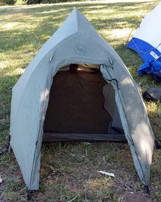
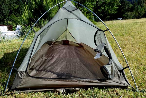 Thursday, June 19, 2014: After reading PCT through hiker journals, I've learned that the mosquitoes on the John Muir Trail could be thick. I've also learned that many of the hikers spray their clothing and tents with Permethrin, a chemical which repels and kills mosquito's and ticks. Tomorrow I'm getting Red Cross First Aid and CPR training then leaving early Saturday morning for Reno, so, this afternoon, I sprayed my clothing then set up my new tent and sprayed the entrance. I'm still learning how to setup this tent, so a good thing I did this for a third time, I'd hate for the "guys" to see me have to take the tent down only to set it up correctly a second time. Click the photo to see the rain-fly installed. The spray bottle of Permethrin is on the ground in front of the rain-fly. Thursday, June 19, 2014: After reading PCT through hiker journals, I've learned that the mosquitoes on the John Muir Trail could be thick. I've also learned that many of the hikers spray their clothing and tents with Permethrin, a chemical which repels and kills mosquito's and ticks. Tomorrow I'm getting Red Cross First Aid and CPR training then leaving early Saturday morning for Reno, so, this afternoon, I sprayed my clothing then set up my new tent and sprayed the entrance. I'm still learning how to setup this tent, so a good thing I did this for a third time, I'd hate for the "guys" to see me have to take the tent down only to set it up correctly a second time. Click the photo to see the rain-fly installed. The spray bottle of Permethrin is on the ground in front of the rain-fly.
|
|
| Tuesday, June 17, 2014: Saturday and Sunday were the two days of instruction for chainsaw certification. In a different lifetime, I owned a tree farm for seven years and owned a beautiful Stihl chainsaw for four years (it was stolen on Thanksgiving, 1994). I put many miles on that chainsaw so I have a lot of chainsaw experience. However, after taking this two day course, I wish I had taken this course before purchasing my Stihl. I learned a lot and ended up with a "B" certification meaning I can help clear the PCT without supervision. Lief (pronounced Lafe ... long "a") was our volunteer instructor. There were five in our class, Todd, Eric, Jeanette, Ben and me. In this photo, Lief gives instruction to Jeanette. The PCTA provided three meals each day during our training. Breakfast was a make it yourself with bacon, bagels, packages of instant oatmeal, and fruit. Lunch was also make it yourself, sandwiches, chips, apples and cookies to take with us because we would not return from the woods until late. Dinner was hot. It was a vegetarian alfredo but seasoned chicken was on the side and I added it to the alfredo. It was easy to form new friendships because we all had care for the trail in common. Click each photo for another view. |
|
|
| Monday, June 16, 2014: I returned late last night from three days of training with the Pacific Crest Trail Association (PCTA). My goal was to become chainsaw certified so I can help clear the trail using a chainsaw during a PCTA work party. I'll publish photos of the training over several days, too many to share in one sitting. The first day was crosscut saw training. Chainsaws are not allowed in a wilderness area nor are they allowed during fire season so a crosscut saw must be used. We must use antique saws because they are no longer made. David and Kim are the volunteer trainers. All the trainers and students are people who care about the trail and want to make it a pleasant experience for all who use it. They also care about the environment and the preservation of the wilderness for future generations. Today, we are learning how logs were cut before the chainsaw so we are learning history as we clear the PCT as it passes near our camp at Hyatt Lake, Oregon. This lake is about 8 miles from Howard Prairie Lake where Gwen worked for five years and where I commuted to Medford. Behind one of the photos above you'll see the Howard Prairie Marina sitting on dirt because southern Oregon is in a drought and the water level in the lake is so low, the marina and most slips are sitting in the dirt. Here is what it should look like. Click any of the above photos for another view. For dinner this first evening I took myself to Greensprings Inn, about 3 miles from Hyatt Lake. The PCTA will feed us during the training but the food does not start until Saturday. Click here to see a short video of crosscut sawing. |
 |
Wednesday, June 11, 2014: After scoring the final exams and recording course grades for the college class I'm teaching (for the last time), I set up the two tents I own. The Sierra Designs Night Watch CD (on the right) is the tent I've owned for 19 years. I originally purchased it for bicycle touring and got great use of it for that purpose. It was advertised as a "two person" tent. It is very well made and has been through some record making storms. The photo shows the tent without the rain fly which completely covers the tent. It weighs 7.5 lbs. I would consider it a three person tent now because the trend is for lighter and smaller tents. The tent on the left is the Big Agnes Seedhouse |
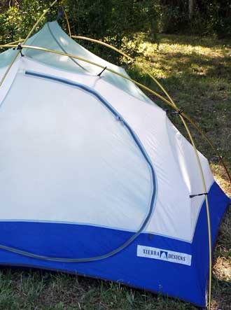 |
| SL-1 (but an older model) advertised as a 1 person tent. I just purchased it used from my friend Ray who went on the California Lost Coast Backpack trip. He doesn't like it because the door is at the end rather than the side of the tent. It weighs 3 lbs. I wanted to be sure I remembered how to set up both tents. I'm taking the Night Watch tomorrow to a PCTA training (Pacific Crest Trail Association) and I'm taking the Seedhouse on the John Muir Trail in 12 days. Both have their advantages. The Night Watch is roomy and self supporting and tough. The Seedhouse is lightweight and compact. Both will do what a camper needs, keep out the bugs and the rain. Both have "footprints" which are protective bottoms separate from the tent itself. I made a few adjustments to the Seedhouse but the Night Watch only needed cleaning. Tomorrow is a trip to Hyatt Lake for the PCTA training. Click both photos to enlarge. |
|
|
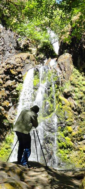 |
Tuesday, June 10, 2014: Today was the second hike of the Timber Valley Hikers. We chose to drive to the North Umpqua River and hike to three of the many falls along the river. The first is Deadline Falls on the river itself. We were hoping to see Salmon jumping the falls, but none were seen. The second was the Susan Creek Falls, about a 1/2 mile to the north of the North Umpqua River. This as an easy hike on a trail groomed for wheel chair access. The final falls was Fall Creek Falls which was also our lunch break. It was also about 1/2 mile to the north of the North Umpqua River. The trail was narrow and steep in places so more to my liking. It was also a multi-level falls. On the return hike from the Fall Creek Falls, we visited Job's Garden, an area of volcanic rocks. Morgan did all the hikes with us which was a surprise. She normally becomes exhausted in a mile of walking. This time she walked 3 times that much probably because there was water for her to drink and lay in. On the return drive, we stopped in Glide, Oregon for an ice cream treat. Click all photos for additional views. |
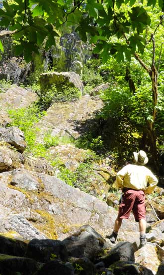 |
|
|
|
|
| Monday, June 9, 2014: This last weekend my friend Lindsay and I backpacked to Windy Gap. Our plan was to go on the hike with the Friends of the Umpqua trail hike but carry our packs. After the lunch stop, we would continue deeper into the wilderness and camp for the night a Windy Gap. The plan worked perfectly. Neither of us had been to this area so it was nice being led to a nice trail hike with the group. The first part of the forest had experienced a devastating wildfire only a few years ago but was already showing lots of new growth. We saw new, volunteer evergreens sprouting everywhere in the burned forest. The destination of the club hike was Whitehorse Meadows but first hike to a small lake, Wolf Lake, only about 1 mile from the trailhead. Each of these photos has another photo behind so click each photo to see another view. I was using a US TOPO Map APP on my phone and had made a way-point for a spring off the trail but near our destination at Windy Gap. After lunch, then, our first destination was this spring to get water for dinner and breakfast plus enough to carry us to the top of Rattlesnake Mountain before returning to the truck. I was very pleased that my APP took us right to the spring. The water was coming straight out of the mountain, clear, cold and clean. Only another mile and a half and we were at Windy Gap hoping the area would live up to its name to keep the hundreds of mosquitoes off of us. Today, no such luck but since there were only "hundreds" of mosquitoes rather than "thousands", we applied repellant and spent the night. I had my hammock with bug netting and Lindsay had his new REI Quarter Dome tent, also with bug netting. The next morning Lindsay encouraged me to hike to the top of Rattlesnake Mountain, about a 1,000 foot climb with the trailhead right at our campsite. We were hoping for some good views of the area. We got what we wanted, views, plus some snow for photographs. Unfortunately, the morning was a bit hazy. We could just make out Mt. Bailey, Mt. Thielsen and the Crater Lake calderas but could not get photographs of what we were seeing due to the haze. We were back at camp and hiking toward Whitehorse Meadows by 12:30. We stopped at our spring again to be sure we had enough water in our hydration packs for the hot hike back. Whitehorse Meadows was again our lunch location before finishing our backpack returning to the trailhead. We were both exhausted and wondered how we would do this day after day on a longer backpack. I'll learn that lesson in a couple of weeks. |
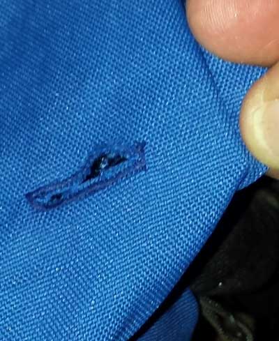
Monday, June 2, 2014: Today began the work on my pack to figure ways to reduce the weight. This old pack has no way to hold a hydration reservoir so I have been strapping a Camelback to the back of the pack. I can save 9 ounces if the hydration reservoir is stored inside the pack as are the new packs. I practiced making button holes with Gwen's sewing machine before sewing one in the top of the pack. The bite valve and tube fit through the hole so now the hydration reservoir can be carried inside the pack IF a protective and supportive pouch is made for the reservoir. Click the button hole photo to see the ripstop nylon and cord I used to make the pouch weighing much less than an ounce. After making the pouch, I sewed it into the pack to support the weight of the reservoir. Now the pack is a half pound lighter and has an internal hydration reservoir, cool. The negative is that I have no hydration pack to carry with me after setting up camp. |
| Friday, May 23 through Wednesday May 28, 2014 |
|
| Day 1: The schedule was for all of backpackers to meet at Richard's house by 8 am. Richard is the organizer and leader of this trip. The California Lost Coast has an awesome reputation for rugged, remote, wilderness and it is a new hike for all of us. Including Richard, six backpacking friends will travel from Winston, Oregon to the Mattole Beach Campground near Petrolia, California on this day. Two more California friends will meet us at Mattole Beach. I say "friends", but on this day, I knew only Richard (and his reputation for tough hikes) but by the end of the adventure, I consider all to be friends. We began with a delay because Ray forgot his hiking boots. This was a big joke to the rest of the hikers only for a short while until John realized he had also forgotten his boots. This put John and Lane into the vehicle with Lindsay as a driver to retrieve John's boots. They are to meet the second vehicle, driven by Richard with me and Ray as passengers, on down Interstate 5. I'm beginning to wonder about these "seasoned" campers and it becomes even worse when we finally arrive at Mattole Beach after a long day of tough driving. That's when we learn Lane has forgotten his boot laces and had to find a substitute for them. Next, we learn Richard has forgotten his hiking pants so must use his pajama bottoms (more like sweat pants) for the next three days. All photographs in this backpack story have another, larger view behind them, just click each photo then the "back" button to see all photos. The above photos were taken at the Mattole Beach Campground after arrival the first night and the next morning just before beginning the hike. My pack weighs 35 lbs, heavier than I wanted but I could not bring myself to throw anything else out. It is an old Lowa design (30 years old) and the pack alone weighs 6.5 lbs, much heavier than the new packs. I do not have a lightweight tent but thought I could use my new hammock even though I knew there were few trees. This first night I tried hanging between two metal poles installed for horses. That meant hanging over the area horses are kept (a straw floor over sand), I just refused to think about what the horses had done there. The poles were too far apart so the hammock would NOT stay off the ground even when tightened three times, still, I slept well this night. My final comment on day 1: Lindsay is a retired English instructor and I dread what he will find when he reads my report! |
|
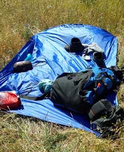 |
Day Two: Since this is Memorial Day weekend there are probably 300 - 400 hikers using the trail. Most are in their twenties. We now have eight in our group, Al and Katchan have joined us from the Monterey Bay area. Lane is the youngest at 51 while Al is the oldest at 74. All the rest of us are between those ages but closer to Al's age. John and I are 67. We expect to hike 8 miles today which will put us at the shuttle pickup when we reach the Black Sand Beach Trailhead on Tuesday morning. We have seen the photographs on the Internet so expected the deep sand hiking but had not thought of the coast winds. Today, the wind is strong and tosses us around and off the trail at times. We hike like drunken sailors, unable to walk a straight line. Our first point of |
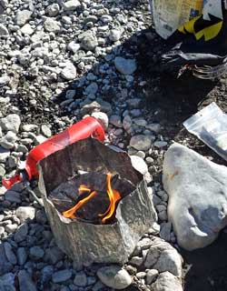 |
|
| interest is the abandoned lighthouse. The Punta Gorda lighthouse is about 1/2 mile in the distance of this photo. I had to dress warmly due to the high wind for the day. It looks like all 400 hikers have visited it and some are still exploring when we arrive. While resting at the lighthouse, Richard spots sea lions warming on the beach. We continue south finding relief from the sand hiking when we reach a beach of boulders. As it turns out, the boulders are as difficult and because the footing is so uneven we all begin to feel points of friction on our feet inside our boots. Now we are looking for relief from the boulder hiking. Watch a short video of our hiking action. We must camp next to creeks for the fresh water. We all have methods to make the water safe since there are likely livestock upstream. My method is to boil the water because I've left my water filter at home to reduce my pack weight. Richard has also given me some of his purification tablets in the case I don't have time to boil the water. We choose a creek seven miles from the trailhead. We still look pretty fresh at the end of the first day of hiking. I'm watching most of the seven other hikers drop into their tents or next to the creek for a quick nap (me included). Meanwhile, the young campers around us are playing in the creek, laughing, hiking to the top of the coast hills around us or showing their youthful energy in some way. I choose to "cowboy camp", a term I learned by reading the Pacific Crest Trail journals. It means camping with no tent. A backpacker needs a tent for only two reasons (and maybe a third which I learn later in this trip). The two reasons are rain and bugs. I expected neither tonight and I was right. I spread my 5 x 7 foot ground cloth then slept and organized my gear on it. My cooking was done on the rocks next to the creek because I was afraid my Whisperlite stove might catch the grass on fire. I only needed to boil two cups of water to mix with my Mountain House freeze dried dinner of Chicken and Rice. Richard and Lane join me next to the creek and begin their humorous male banter. I can remember when this joking was funny but I don't have enough testosterone left to care. Pretty soon I was laughing everytime I heard the two words, "she said", even though I hardly understood the meaning (:-)). This was my best night's sleep of the three nights on the beach. The next morning on the hike back to the beach, keep your eyes straight ahead, Richard! |
|
 |
Day Two: Where yesterday was a "wind dance", today is a "wave dance". Much of our hiking is between the surf and steep rocks facing the ocean. We intentionally pay attention to the tide tables to get down the beach during the lowest tide possible but still must dash around rocky points between waves. I believe John was the only one who got caught on that first rocky point. Fortunately, about half our hiking day is on a flat plain called Spanish Flat, a sea of tall grass. I think we all felt more comfortable hiking today even with sore muscles and potential blisters. We had more energy and less apprehension about this difficult terrain. Much of the day was hiking next to surf polished rocks. We would hear what sounded like hundreds of bowling pins falling as a receding wave would crash the rocks together. What were once sharp pointed and jagged rocks fallen from the nearby cliffs are now rounded marbles of many sizes. At one point, the trail seemed to |
 |
|
| disappear over the side of a cliff. Some of the others descended the crack in the cliff so the rest of us had to follow. This day also seemed to pass more quickly so we arrived at our chosen camping creek about 3:15 p.m. Richard and I are hiking together upstream next to the creek when we see John, about 200 yards upstream from us, take a bad fall while attempting to cross the creek. Al is right there with him pulling him out of the creek and helping to remove his pack. By the time we reach John it is obvious he is injured badly. Soon, all of our party is surrounding John examining and giving advice. By 3:30 the group has decided we must summon help, John will NOT be walking another step. We are as far from cell phone contact as you can get in the King Range. Both Ray and I have a SPOT device. I learned of a SPOT only a few months earlier when reading the Pacific Crest Trail journals. It is used to communicate the users position using satellites rather than cell towers so can be used in any location. It can also be used to summon search and rescue in the case of an emergency. Of course, none of us have ever used the SOS function and only knew what the device instructions told us would happen if we pressed the SOS button. So I pressed the SOS at 3:30 at which time all eight of us began to watch the skies thinking it would soon fill with helicopters looking for our signal. What I learned later was that International Search and Rescue called my cell phone to verify the signal and got my voice mail where they left two messages. They next called my wife, Gwen to verify my activity and learn if I might REALLY be in this remote area of the California coast. I am unable to explain the reason I pushed the SOS button, when activated, it sends out a distress message and my exact GPS coordinates to 5 places past the decimal point (so plus or minus 3 feet of where the SPOT is located). So Gwen is "freaking out" (her words) by the call from International search and rescue. I also later learned that International Search and Rescue called the California Office of Emergency Services who contacted the Coast Guard in Arcata, California (about 80 miles north of our location) at 4:49 p.m. We first sighted the helicopter just before 6 p.m. and did our best to attract it's attention. Of course they knew exactly where we were but my hiking partners still used orange jackets and a neon orange space blanket to wave them down. This very impressive looking helicopter with a four person crew was soon on the beach and talking with Richard and Lane who were already on the beach. Swimmer John Rice was the first on the scene giving comforting information that they would make sure John was taken care-of. I made sure Swimmer Rice knew John was a Viet Nam veteran. I had learned John served in the Navy as a member of a four man crew on a 32 foot river patrol boat in Viet Nam. In my mind, special care should be taken of someone with that veteran history! Our first thought was to help John hop to the helicopter on the beach. It soon became apparent this was too difficult for both John and the crew assisting. The basket was retrieved from the helicopter and six of us, Swimmer Rice and five of John's friends including me, carried John to the helicopter. Lindsay brought John's pack along so both pack and John are loaded into the helicopter. Swimmer Rice had already warned us to leave our hats under a rock at the edge of the beach or the copter would blow them off. We still got sprayed with sand from the copter blades. In a few minutes, after delivering John, the Coast Guard had him on the way to the hospital in Arcata. For a short video of the MH-65 Dolphin taking off from the beach click here. Here is a press release from the Coast Guard of the incident. We all breathed a sigh of relief and began to make preparations for our evening by setting up camp and cooking dinner. I cowboy camped again and sent Gwen the only message I could send ... that I was "happily camped in this location", hoping she would get the REAL message that the SOS was over and I was still safely hiking. To explain the delay in this message, once an SOS button is pressed on the SPOT, all other buttons are disabled. All my new hiking friends often hike alone as I do and after seeing the power of the SPOT, most said they will make the purchase. |
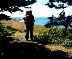 |
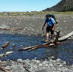 |
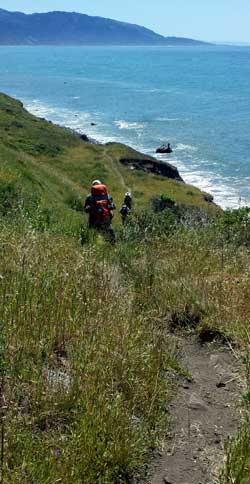 |
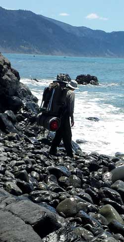 |
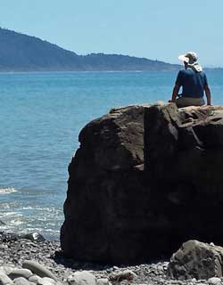 |
Day Three: The last planned backpacking day and the day we finally see our destination, the Black Sand Beach Trailhead. Of course it is about 12 miles away when we first caught sight of it. Where day 1 was the wind dance and day 2 was the wave dance, today is the "poison oak dance". We were all familiar with the plant but wondered how many of the other 400 hikers would go |
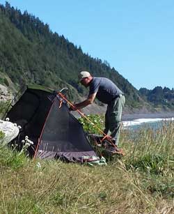 |
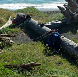 |
|
| home scratching. This day had the most variety of pebble walking, boulder hopping, grasslands, wind, deep sand, surf avoidance and climbing off of steep rocky cliffs. It was also our longest hiking day, ten miles, but seemed to go by easily because we could see our destination. Al is the only hiker smart enough and strong enough to bring his own chair for ocean viewing. There were also several locations along the ocean we could see the migrating whales with their calves within 100 yards of the shoreline. Watch another short video of our hike on day three. We missed our intended creek camp somehow, but caught the next creek only about 1.5 miles from our destination. Katchan decided upon a massage from hot rocks before the final push to the last campsite. The rest of us soon joined him to try the warm muscle relaxant from these black pebbles. We continued the hike to a comfortable camping location but the night turned out to be cold and windy. This is where I finally added two cups of boiling water to my Mountain House Apple Strudel and shared with the other six hikers, yummy. Al and Lindsay admire Al's bedroom view. Even though I cowboy camped next to a log to block the wind, the air would still find its way into my bag causing a chill. I snapped down every snap and curled up enough to stay warm. Occasionally, though, the wind would make such noise, I awoke. This is the case where I believe a tent would have helped to keep the breeze away from my bag but would not have helped with noise. |
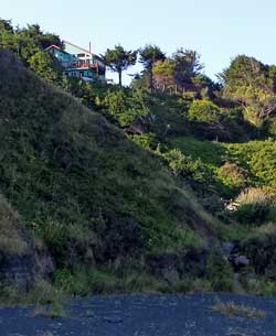 |
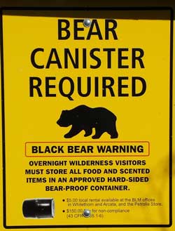 |
Day Four: We all planned to get up early this morning knowing we needed to meet the shuttle at the Black Sand Beach Trailhead. Some fixed a breakfast last night and others, like me, only ate a breakfast bar. I was the second out of camp following Al. It was a quick 1.5 miles so I arrived at 8:30 a.m. I helped to make sure the other hikers did not climb the "short cut" I took, instead, walked |
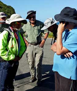 |
|
| around the point to the horse trail. As soon as we learned there was cell reception Richard made a call to John to learn of his condition. We all learned he had no broken bones or torn ligaments as we had suspected. His injury was a severe strain where he still could not walk and was on crutches waiting for us at his motel in Arcata. We all rejoiced at the news and all decided to meet together again in Arcata for a group photo below. As it turned out, the shuttle company mistakenly thought we would arrive on the next day but the situation was quickly resolved for our return trip to Mattole Beach Campground where our cars are parked. The shuttle drive was two hours over mostly single lane, paved roads at 20 MPH. Our drive back to US101 was about 1.5 hours of single lane, paved roads so we didn't arrive in Arcata until 5 p.m. That's when the eight of us are back together. From the left, Lane, Dale (me), Lindsay, Richard, Katchan, John, Al and Ray. John is the happiest in the group because he has had at least two showers and good restaurant food. One final word, I believe Al and Ray are our oldest hikers but they are also our STRONGEST hikers. |
|
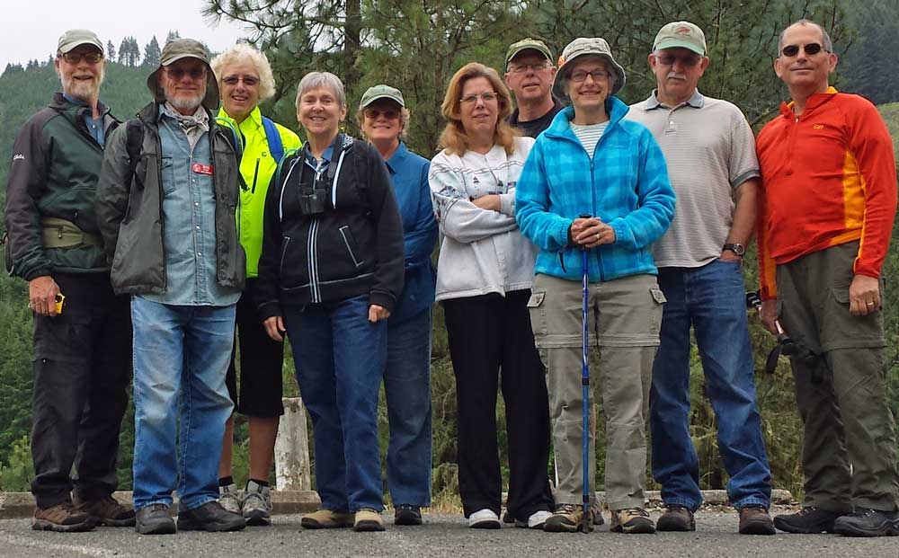 |
| Wednesday, May 21, 2014: Gwen and I are trying to bring more activities to Timber Valley after spending the winter months with some of the other Escapee parks. Sponsoring a group hike is one activity we are trying and today was the first hike for the park. Ten hikers showed up for the easy 3.5 mile shuttle hike along the west shore of Cooper Creek reservoir. The weather was perfect, in the mid-60s. This photo was the "before" the hike photo. Click here to see the "after" hike photo. The folks in the above photo from the left are: Denise, Bob, Barb, Pat, Gwen, Christy, Tom, Dar, Gary and Dale (me). I carried a 29 lb pack to help get ready for the big hike this weekend. Everyone enjoyed the hike and for some, it was their first time on this trail. After the hike, we met at the White Horse Coffee shop for lunch. |
|
| Saturday: April 26, 2014: Gwen and I, with two park friends, went on another of the "Friends of the Umpqua" hikes. This hike, Gwen went with the group doing the five mile hike while I went with the group doing the eight mile hike. Gwen stayed on the North Umpqua Trail while I hiked part of the Bradley Trail, then the Boulder Creek Trail into the Boulder Creek Wilderness Area for a lunch stop then returned to the North Umpqua Trail to meet Gwen at the end of the hike. There were a total of 21 hikers and perfect weather for the day. I didn't take my 25lb pack and glad I didn't because our trail climbed steeply for the first 1.5 miles. Our lunch destination was a spring coming straight from the mountain. The dogs and a few humans enjoyed this spring water. Click all the photos to see additional views. The last photo is of the "Green Tunnel". I've learned that Pacific Crest Trail thru hikers (those hiking from Mexico to Canada on the PCT) complain that once they reach Oregon, it is a "Green Tunnel" because there are so many trees they can't see the view. This is my third hike with the "Friends" and another enjoyable day. I would repeat any of the three I've been on, they have all be so good. The hike today, for me, featured the view of the Boulder Creek Wilderness canyon, a steep walled, rocky and forested canyon with Boulder Creek at the bottom. Here is what the trail looked like on MapMyWalk. |
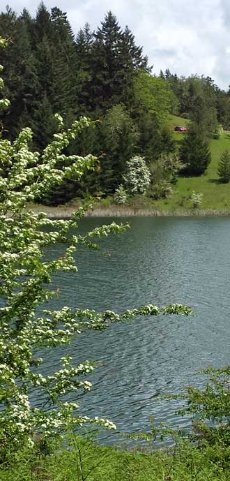
Friday, April 25, 2014: That car in the distant parking lot is our Prius. Yes, I'm hiking Cooper Creek Reservoir Trail again, it's just too close and too easy to get to. Perfect weather for a seven mile hike, cloudy and occasional rain and only mid-fifties. I still sweat pretty good, I don't know how to keep from getting wet (especially down my back) when backpacking. Unfortunately, I was more tired at the end of the hike today BUT ... that makes 14 miles on my new hiking boots. Click the photo for a better view of the lake and of some new geese to add more goose poop around the shore. Also you can see my SPOT report of the hike if you click here (available for about a week). This report shows the location of my SPOT Gen3 every ten minutes during my hike. |
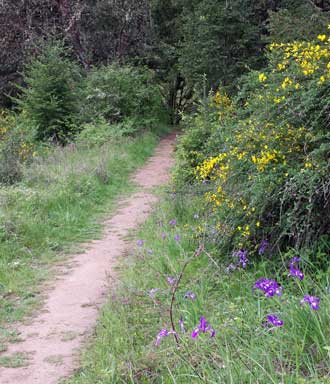 |
Thursday, April 24, 2014: After a fun birthday party for a friend, with friends, I did a workout hike with a 25 lb pack on the Cooper Creek Reservoir Trail. This was my first hike with my new hiking boots. The REI expert measured my feet and fit me with a size boot that I would never have dreamed would be right for me. But they felt comfortable in the store so I trusted the expert judgment and bought them. So now those new boots have 7 miles on them. No blisters, a good thing, but not as comfortable yet as my old, worn, hiking boots. Click the map on the right for the details of my hike today. |
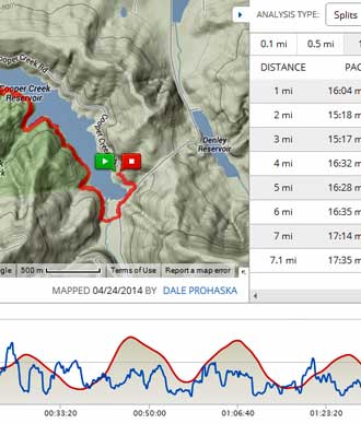 |
|
|
| Sunday: April 20, 2014: After a busy morning, Gwen and I packed a lunch and went for a hike again to the North Bank Habitat Management Area (NBHMA) only about 30 minutes from our home. This time Gwen chose to go to the end of my hiking trail with Morgan and meet me there for lunch. Meantime, I hiked five miles up 1,000 feet to the ridge of the mountains following new trails (new to me) and exploring the idea of bring a group of hikers onto this trail. I decided the trail was too steep for the Timber Valley hiking group but would probably be OK for the Friends of the Umpqua group. All trails seem to be a steep (rather than gradual) climb the the 1,700 foot summit of the ridges in the area. Anyway it was a good hike, click the photos for more views and a good lunch Gwen had prepared for us. Gwen and Morgan enjoyed a hike of there own while I was climbing the mountain. We ended our day with a trip to Dairy Queen to try a "Blizzard" in a waffle cone we had seen advertised. |
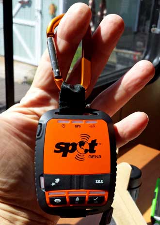
Thursday: April 17, 2014: About a month ago I visited REI in Medford, Oregon and while there picked up an REI VISA application which promised a $100 REI gift card if I only applied for and received the card. So I applied and got the card. About a week ago, I got the $100 gift card. I used it to purchase the SPOT Gen 3 to use when I hike and backpack alone. I expect to hike and backpack in areas which don't have cell phone coverage. In that case, the SPOT Gen3 will use satellites to let family and friends know I'm OK and exactly where I'm located (by sending my coordinates). It's a good thing Gwen and I have learned to Geocache (finding a treasure using only coordinates). I can also summon a pickup at my locations and/or send an emergency message to search and rescue (only for a life-threatening emergency). So, I may be in the wilderness but everyone will know how to find me. Click the photo to see the most current track. Today's track (which will change as I do more hikes with the SPOT) is my first test hike using the SPOT. It's not as good as MapMyWalk but SPOT works without a cell tower. Of course when satellite phones are the price of cell phones, SPOT Gen3 will go the way of typewriters. I will be adding a link at the top of this page directly to my SPOT Gen3 page to track future hikes. Here is a link to the instruction manual if you wish to know more. I learned of the SPOT when reading Pacific Crest Trail Thru Hiker journals, it's what they use. |
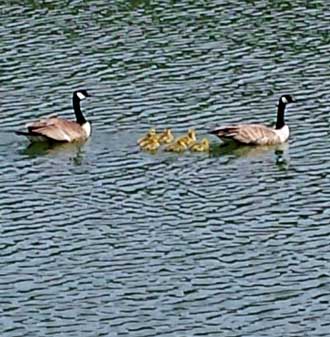 |
Wednesday: April 16, 2014: After some more experimenting with the hammock (click the geese photo) using my trekking poles to support the tarp, I packed up and left my campsite. I planned to show the scratches on my arm to the right and mention how prepared I was with my first aid kit. I used my Neosporin and a Band-Aid to keep it clean. Unfortunately, on my walk home I did a face plant on the asphalt road as I was nearing home. Both my feet got stopped by a six inch rise in the asphalt and since my trekking poles weren't in use (I don't normally use them on asphalt) I smashed my face into the asphalt with a 30 lb pack pushing the way. If you want to see what it looked like, click the photo of my arm. I've decided |
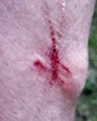 |
| that my glasses cut my eyebrow since that lens is scratched and the cut is in the shape of that lens. A fellow in a truck was right behind me and saw the whole thing. He stopped and asked, "are you alright?" I was getting up and trying to take off the pack and keep the blood from getting on any of my clothes or shoes (it was streaming through my left eye and off my face at this point). So here I am, awkwardly trying to get the pack off, blood spewing out of my eye, but leaning forward to keep the blood on the street and not my clothes. Pack is now off, I reach for my handkerchief and stop the bleeding so turned and said, "I think I'm OK", which was probably a relief for him so he drove off. I knew right were my first aid kit was, got a band aid (by this time the bleeding had slowed considerably) and placed it over the eye gash. I hiked the rest of the way home, took a shower and cleaned up all wounds. Gwen bought some butterfly bandages which are working nicely so it looks like the worst damage was to my new glasses, I will likely have to replace the damaged lens.
When I was still on the ground, I was actually thinking, "would this have happened had I been "37" rather than "67"? I think the answer is "no", it would not have happened to me when I was 37. I was stronger when I was 37 but I continue to work at getting stronger with training as a 67. I have noticed that my stability is not what it was when I was younger but I'm continually preparing for that. I use the trekking poles most of the time and buy good hiking boots (although my current boots are worn out). I also have a pretty good first aid kit but now will add back the "signaling mirror" I left at home thinking "no one uses those any more". Without a mirror, I'd have a tough time putting a bandage on that gash. I'm also adding butterfly bandages to my first aid kit. A regular bandage worked even when I couldn't see what I was doing, (I took a picture of myself while still in the road after I made the repair just to show Gwen I could take care of myself). So, should I quit, stay home and read books, play on the computer, watch TV, never venture into activities again because this was a "warning shot". Nope! I'd rather die on an adventure. So I'll do my best to anticipate what I need in my first aid kit, learn hiking methods to add stability and I've purchased a nice little electronic device to summon help which I learned by reading Pacific Crest Trail thru hiker journals. I'll review that device sometime in the future. |
|
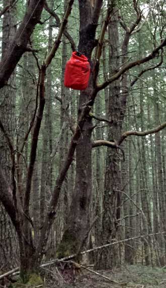 |
Tuesday: April 15, 2014: I'm still testing my backpack equipment, especially setting up the hammock. I'm still learning and experimenting but slept in the correct direction this time. I was comfortable and warm but did not sleep well, mostly due to the noise of traffic nearby. I'm on the side of a mountain off Cooper Creek Reservoir where I do my training hikes and the noise took me by surprise since I'm in the "wilderness". The tarp had slipped to touching the hammock which I don't want so I'll do some more experimenting later. I hung my food in a tree like every good backpacker should do. In the morning, I fixed a Mountain House breakfast by pouring in 12 oz of boiling water into the bag then letting it sit for 10 minutes. It actually tasted good. A serving suggestion is to wrap the contents in a tortilla. In that case, I think the bag would serve two hikers. Click the photos for additional views. I also tested my washing methods using leftover hot water from breakfast. |
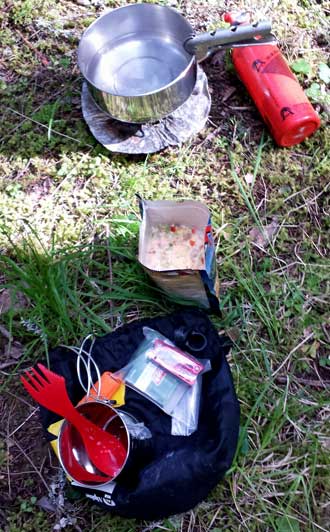 |
|
|
| Monday: April 14, 2014: Gwen and I take a hike into North Bank Habitat Management Area (NBHMA) which is a large area set aside to outdoor recreation. The recreation includes, horses, bicycles, hiking, and dogs. The area is also open to hunters. This was our first time to hike this area and we are both excited about it. We also realize that this is the very best time to hike the area. Later in the season would be too hot and dry and the winter would likely be too wet. Fall is a time for hunters. The views from the top of the ridge are fantastic. The mountain is covered with Poison Oak, huge bushes of Poison Oak, but the trails are clear. For hikers not paying attention, their pants, dog, or trekking poles could touch the Poison Oak and then transfer the allergen later to the hiker. Click the photos for additional views. Gwen hiked the first part of the West Trailhead where we entered while I hiked over the mountain to meet her on the other side at the Main Trailhead. I reached the sign on the right which confused me and I didn't think to look at the photo I had taken of the area trail map for clarification. So I took a wrong turn and had to call Gwen to a different rendezvous point to pick me up. It was a good lesson, I'll remember to look at my photo of maps after this. Gwen and I started at point "E" on the map, then she drove to point "A" to wait for me. But I took a wrong turn and ended up on the road at the Talburt Trail. She found me and we drove back to point "A" for a nice picnic lunch. |
|
|
| Saturday, April 12, 2014: Gwen joined me today on another Friends of the Umpqua hike. This time on one of the segments of the North Umpqua Trail. The trail is 79 miles long beginning near Glide, Oregon and ending high in the Cascade Mountains. The trail is divided into segments, this is the Panther Segment and is 5 miles long. The trail follows the North Umpqua River but this segment has only one short section where there is river access. We crossed many small creeks on this well maintained trail. The sky was clear today but temperature was barely into the low 60's. Still, we warmed up and shed layers of clothes as we hiked. This was our first time on the North Umpqua Trail. Before hiking it today, there was a mystery and mystic to the trail just as there is for the Pacific Crest Trail but now we feel "familiar" and know better what to expect and we are looking forward to the next hike which will be on another segment of the trail. Click the photos for additional views. Thirty hikers joined the club on the hike today, I assume because of the good weather and the trail is relatively close to Roseburg. |
|
| Thursday, April 10, 2014: I am trying out the Hennessy Hammock for the first time. This hammock comes with an attached bug screen and a tarp and I got the whole thing on sale for a price less than what a bug net and tarp would have cost for my homemade hammock. But this hammock is different than my homemade version and I need to figure out how it works. I setup the hammock at the end of our bocce ball court in the park. I stuck my "Chapter 9 Rally" sign in front of the hammock just to keep the park residents confused long enough for me to spend one night in the hammock. The instructions on the hammock claim, "setup in 3 minutes". I worked at it for 3 HOURS. I couldn't figure out which side of the tarp goes toward the sky. I also forgot to install the "snake skins" before attaching the hammock to the trees so had to remove and re-install. I also struggled with finding the right height for the hammock so moved it several times. After 3 hours, I was ready to sleep but it wasn't dark so I returned after dark to set up the Thermarest mattress and down blanket. I slept well but struggled to get onto the diagonal. After packing up quickly using the snake skins I walked home and did two things. I re-read the instructions learning that I slept on the diagonal in the direction opposite of how I should have. The two sides of this hammock are not equal. Second, I emailed Hennessy to learn which side of the tarp to put toward the sky and why the shock cord was slack. The answer is the "shinny side" toward the sky and the shock cord is attached to a ground peg rather than to the tarp. Click the photos for additional views. |
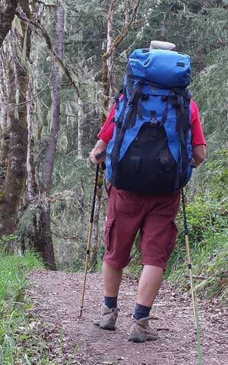
Tuesday, April 8, 2014: I improved my exercise routine today by adding a 25 lb backpack to my hike on the west side of Cooper Creek Reservoir. The trailhead is only a 3 mile drive from our trailer. This has two purposes. One, to get my body use to the load so I can start doing some serious backpacking. Two, to work the bugs out of this old pack. I believe this pack may be 25 years old and backpacking was much different 25 years ago. This pack is huge and I use to fill it to 50 lbs. The pack alone weighs 6 lbs. Today's packs are half that weight. So I'm finding ways to cut down the size and weight of this pack. You see the pouch on the very top of the pack? I've removed that and figured a method of rolling and locking the top. I learned how to do that by watching a video demonstration on the topic of backpack methods. I've also had to replace some of the old foam padding which as literally turned to dust. The newer packs don't have all the straps like this one but I can't bring myself to cut them off yet. This hike was for 7 miles with the hiking time of 2 hours and a rest time of about 30 minutes while eating a snack and working with a tracking APP on my phone. Click the photo to see break time. My body is holding up well. I believe I could easily do another 3 miles for a ten mile hike. The Pacific Crest Trail thru hikers do about 23 miles each day and hike for 12 hours. I'm not looking for that kind of endurance yet but a ten mile hike would give me time to fool around in camp and site-see. |
Sunday, April 6, 2014: I'm getting ready to try hanging a hammock again and have decided to try a sleeping bag liner. I made my own bag liner from an old flannel sheet using Gwen's sewing machine. After sewing it up, I'm unsure how comfortable it will be, it felt tight but mummy bags ARE tight. I was expecting this liner to be compact and light weight and it is neither. But, this will give me an inexpensive way to test the idea of a bag liner to learn if it is needed and/or helpful.
Behind this photo (click to see) is what I hope, a solution to a sleeping problem when attaching the Thermarest down blanket to the Thermarest mattress. It's difficult to enter the sleep system because the top of the blanket is not flexible and too tight to wriggle into the bag. I've put shock cord through loops on the back of the mattress and will attach the blanket loops to the shock cord. This will give enough flexibility to enter the bag then pull the corners tight around the mattress once I've settled in. I'll be trying both the liner and shock cord idea very soon. |
|
| Saturday, April 5, 2014: I've not hiked the trail around Cooper Creek Reservoir, Gwen has. So Gwen takes me for a nice five mile hike on one side of the reservoir. It was a wet day so we dressed warmly and had to dodge rain showers at the beginning of the hike. This reservoir is only 1 mile from our park but 3 miles by road to get to the parking lot. I'm really impressed with the work done to create this trail. I know there is a route around the lake but I'm afraid the eastern side may be road walking. I'll circumnavigate the lake soon to learn if there is a trail around the lake. If not, I'll hike the western trail out and back just to stay on a trail rather than asphalt. Click these photos for additional views. |
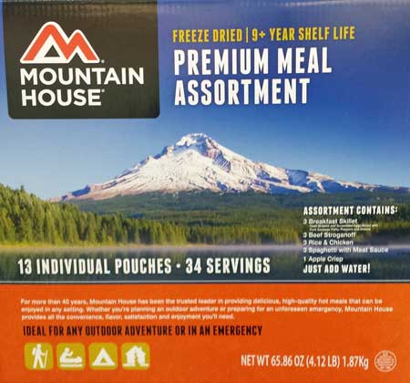
Tuesday, April 1, 2014: This was a busy day in Roseburg taking care of errands. One errand was a birthday bagel for Joe, the shoe repair shop owner. He turned 67 yesterday, that's my age and he was pretty proud of it. Next was the National Forest Service for maps, brochures and directions to the hiking trails in Douglas County. Then off to BiMart for suspenders (to hold up my hiking pants) and to check our number for prizes, no prizes this week. Next to Costco to check for a few items and a surprise. The surprise was this box of Mountain House freeze dried meals at a pretty good price, less than $5 per meal. These work great for backpacking so now I have few excuses to get going except for the college class I teach, I can't leave that class for many days. Also while in Costco, we ate the Costco salad from the food court thinking we were eating low calories. But while we ate, Gwen checked the Costco food court calorie report and learned we were eating more than 700 calories. So after one more store stop, I got out in Wilbur on the way home. I walked 6.37 miles which I hope burn off those calories and will help in my conditioning. |
 Monday, March 31, 2014: I've already mentioned it has been a long time since I've done any backpacking. Here are some of the things that have gotten me interested again. It started last summer when Gwen and I spent two weeks north of Sisters, Oregon parked in the woods. We had some good hikes into the Mt. Jefferson Wilderness Area. I realized I could hike further than I thought I could. Then came our winter trip. First we met Eric (the hitchhiker) and we became friends. Eric and I did some hiking in southern Nevada into some mountains where would never have ventured (because it looked so tough). That gave me the confidence to try bigger hikes so I took myself into the desert near Yuma, Arizona. Then on to Joshua Tree National Park where I broke my hiking record for a day hike. But my record did not hold long because I got involved with the Jojoba Hills Hiking Group and they guided me to my longest hike yet. I would not have attempted any of these long hike had Eric not challenged me. Now I look at mountains and trails differently. Rather than look at them with a defeated attitude, I'm looking at them with a "Can-Do" attitude and a fun challenge. I'm working to get stronger so I can enjoy a longer backpack without the strain. My next challenge is backpack food ... I don't remember it fondly. Today I received a free online copy of TrailGroove Magazine. It is 146 pages of some really great stories and photos showing some great reasons to hike and backpack. Click the magazine to get a copy for yourself. Monday, March 31, 2014: I've already mentioned it has been a long time since I've done any backpacking. Here are some of the things that have gotten me interested again. It started last summer when Gwen and I spent two weeks north of Sisters, Oregon parked in the woods. We had some good hikes into the Mt. Jefferson Wilderness Area. I realized I could hike further than I thought I could. Then came our winter trip. First we met Eric (the hitchhiker) and we became friends. Eric and I did some hiking in southern Nevada into some mountains where would never have ventured (because it looked so tough). That gave me the confidence to try bigger hikes so I took myself into the desert near Yuma, Arizona. Then on to Joshua Tree National Park where I broke my hiking record for a day hike. But my record did not hold long because I got involved with the Jojoba Hills Hiking Group and they guided me to my longest hike yet. I would not have attempted any of these long hike had Eric not challenged me. Now I look at mountains and trails differently. Rather than look at them with a defeated attitude, I'm looking at them with a "Can-Do" attitude and a fun challenge. I'm working to get stronger so I can enjoy a longer backpack without the strain. My next challenge is backpack food ... I don't remember it fondly. Today I received a free online copy of TrailGroove Magazine. It is 146 pages of some really great stories and photos showing some great reasons to hike and backpack. Click the magazine to get a copy for yourself. |
|
|
| Saturday, March 29, 2014: Today was my first hike with the Friends of the Umpqua Hiking Club. This hike was much different from previous hiking in southern Arizona and California. First it was a wet, rainy day and that's the reason Oregon is Green. Look at the trees, brush, ferns and moss ... something not seen on any of my hikes this winter. This turned out to be a little more than 9 miles with two fabulous water falls flowing heavy due to the recent rains. We got to walk UNDER one of the falls. I took 90 photos but have posted only 16 here. Click each photo above for another view. I enjoyed this group because of the age variety. There were those in their 20's and then older hikers like myself. They were all strong hikers and I had to work to keep up... something I like. We all came ready for rain and we weren't disappointed. After most of these photos were taken, we had to quickly put on rain gear to keep dry. Because of the wet weather, this hike reminded me of a hike I did many years ago with my sister Dorana in the HOH Rainforest where it poured rain during our second hiking day. I'm looking forward to the next hike with this group. Under the last photo (the sign) is a photo of me crossing one of the streams feeding Brice Creek. I had to cinch my rain hat strap because of the air currents while hiking under Trestle Falls. My glasses were hanging around my neck because I couldn't see out of them, they were fogging. Cinching my hat cord brought the glasses under my chin, that's why they look peculiar. Just saying ... |
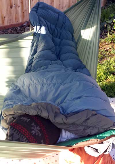 Saturday, March 15, 2014: Gwen sneaks a photo early in the morning when I'm still asleep for my first experiment with hammock camping in my Mother's backyard. I wish I could say it was a wild success and everything I expected hammock camping to be (comfortable). Let me first describe what you are seeing. Hammock campers wear something over their head since the head is not tucked into a mummy bag so I'm wearing a stocking cap. You are also seeing my Thermarest mattress hanging off the hammock to the right. The mattress is attached to a Thermarest Alpine down blanket and I'm tucked in between the mattress and blanket. I'm trying hammock camping because I don't like sleeping on the ground and hammock camping has many benefits to ground sleeping. What I've learned from the first night in a hammock. Now, I want to end on a positive note so I will begin with the negative. I'll try to put my points in order starting with the worst negative. My mother's house is on a well traveled four lane road so the noise of the traffic was by-far the worst. Even with ear plugs, the traffic kept me from sleeping. Besides vehicle traffic, the train tracks are 3/4 mile away and there must have been a dozen trains last night. For some reason the traffic and trains sounded like they were going through the backyard. I wasn't expecting bugs because it's early spring but the mosquito's pestered me and found their way to my skin. If you click the photo you'll get a wider view and you can see that my Thermarest mattress is about half out of the hammock and toward the lowest point. It seemed that it would slide on the rip-stop hammock toward the lowest point. A hammock sleeper should sleep on a diagonal and at-least I have accomplished that (from the photo). One of the loops which attaches the Alpine Blanket to the mattress pulled loose and I had to deal with that in the middle of the night. As it turns out, our neighbor has a motion activated light pointed into my mother's backyard and would occasionally turn on due to my moving (shining into my eyes). I wasn't able to sleep on my back for long periods of time like I thought I would. Something is not quite right. I would pull myself toward the head end of the hammock because my feet were too high and I needed to be more equidistant from both ends but always seemed to end up in the position you see. I tightened the structural ridgeline thinking that would help but now I'm wondering if I should have eliminated it entirely. I'm not testing tonight because I don't want to listen to the traffic again. Now for the positive (again, in order of the best first): My "sleep system", Thermarest mattress and Alpine Down Blanket kept me warm. It dropped to 47° which is mild but felt cold outside of my "system". My new stocking cap kept my head warm. I learned I must stay on the mattress or I'm cold underneath. I was able to sleep on my side. I was able to reposition the mattress by tugging on the head-end of the hammock. I didn't fall out of the hammock even though I struggled with keeping my sleep system in the right position. The tarp kept the dew off. I believe I was more comfortable than if I had been in my tent but I question if that would be true in a strong wind or storm (I know for a fact that my tent works in terrible weather). Finally, all my knots held. Now for wishes: I wish my 5 x 10 foot hammock was bigger (to hold my sleep system better in place). If I were to spend some serious time in this hammock, I would sew a 4" lip on both sides to keep the mattress from sliding off the edge (this could be a novice problem or structural ridgeline problem as I mentioned above). It was a nuisance (again, maybe a novice problem) to stay on the mattress so maybe an underquilt is the better idea over a mattress for insulation. I didn't get much sleep but mostly because of the noise and mosquitoes, not because I was uncomfortable. I need to watch some more videos, perhaps ask a few questions of the hammock forums. I'll try again where it is much quieter in Oregon. Saturday, March 15, 2014: Gwen sneaks a photo early in the morning when I'm still asleep for my first experiment with hammock camping in my Mother's backyard. I wish I could say it was a wild success and everything I expected hammock camping to be (comfortable). Let me first describe what you are seeing. Hammock campers wear something over their head since the head is not tucked into a mummy bag so I'm wearing a stocking cap. You are also seeing my Thermarest mattress hanging off the hammock to the right. The mattress is attached to a Thermarest Alpine down blanket and I'm tucked in between the mattress and blanket. I'm trying hammock camping because I don't like sleeping on the ground and hammock camping has many benefits to ground sleeping. What I've learned from the first night in a hammock. Now, I want to end on a positive note so I will begin with the negative. I'll try to put my points in order starting with the worst negative. My mother's house is on a well traveled four lane road so the noise of the traffic was by-far the worst. Even with ear plugs, the traffic kept me from sleeping. Besides vehicle traffic, the train tracks are 3/4 mile away and there must have been a dozen trains last night. For some reason the traffic and trains sounded like they were going through the backyard. I wasn't expecting bugs because it's early spring but the mosquito's pestered me and found their way to my skin. If you click the photo you'll get a wider view and you can see that my Thermarest mattress is about half out of the hammock and toward the lowest point. It seemed that it would slide on the rip-stop hammock toward the lowest point. A hammock sleeper should sleep on a diagonal and at-least I have accomplished that (from the photo). One of the loops which attaches the Alpine Blanket to the mattress pulled loose and I had to deal with that in the middle of the night. As it turns out, our neighbor has a motion activated light pointed into my mother's backyard and would occasionally turn on due to my moving (shining into my eyes). I wasn't able to sleep on my back for long periods of time like I thought I would. Something is not quite right. I would pull myself toward the head end of the hammock because my feet were too high and I needed to be more equidistant from both ends but always seemed to end up in the position you see. I tightened the structural ridgeline thinking that would help but now I'm wondering if I should have eliminated it entirely. I'm not testing tonight because I don't want to listen to the traffic again. Now for the positive (again, in order of the best first): My "sleep system", Thermarest mattress and Alpine Down Blanket kept me warm. It dropped to 47° which is mild but felt cold outside of my "system". My new stocking cap kept my head warm. I learned I must stay on the mattress or I'm cold underneath. I was able to sleep on my side. I was able to reposition the mattress by tugging on the head-end of the hammock. I didn't fall out of the hammock even though I struggled with keeping my sleep system in the right position. The tarp kept the dew off. I believe I was more comfortable than if I had been in my tent but I question if that would be true in a strong wind or storm (I know for a fact that my tent works in terrible weather). Finally, all my knots held. Now for wishes: I wish my 5 x 10 foot hammock was bigger (to hold my sleep system better in place). If I were to spend some serious time in this hammock, I would sew a 4" lip on both sides to keep the mattress from sliding off the edge (this could be a novice problem or structural ridgeline problem as I mentioned above). It was a nuisance (again, maybe a novice problem) to stay on the mattress so maybe an underquilt is the better idea over a mattress for insulation. I didn't get much sleep but mostly because of the noise and mosquitoes, not because I was uncomfortable. I need to watch some more videos, perhaps ask a few questions of the hammock forums. I'll try again where it is much quieter in Oregon. |
|
|
| Friday: March 14, 2014: OK, since I'm getting serious about doing some hiking and backpacking (again, after 18 years) stimulated by the hiking I've been doing lately and the reading of the Pacific Crest Trail thru hiker journals I've been reading too. So I built my own hammock to try out the new (to me) method of backpacking lighter (using a hammock rather than a tent). I'm wanting to give it a try before investing any more money into this new obsession so I bought a cheap tarp to keep off the morning dew in my Mother's backyard. The tarp is hung first if it's raining but I wanted to practice so I set up the tarp first. It was time consuming making the guylines and ridgeline to fit the tarp for the first time (click the top photo). When hanging the tarp I used a Prusik knot to stretch the tarp on the ridgeline. The knot I used on the guylines and the structural ridgeline I don't know the name. It's the knot I was taught to use when tying down the wings of my plane when I was a new pilot (many years ago). So far, it's working fine. Then I hung the hammock under the tarp, click the Prusik knot photo. The photo of the hammock under the tarp is behind the Prusik knot. Next, I set up my Thermarest sleep system by connecting the down blanket to the Thermarest mattress. I'm also using a structural ridgeline believing the hammock is more comfortable with it. The hammock is ready, click the tab and loop photo for the view under the tarp. |
| |
| |
|
|
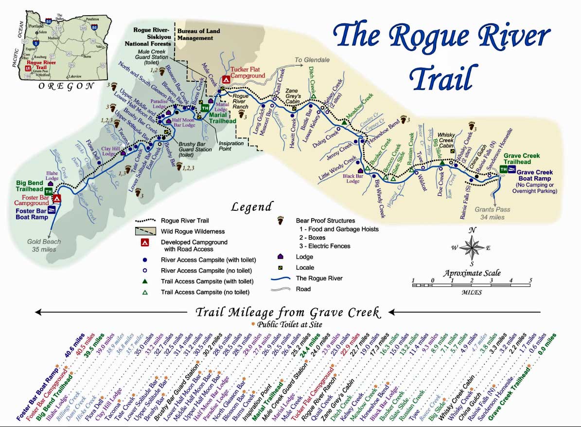
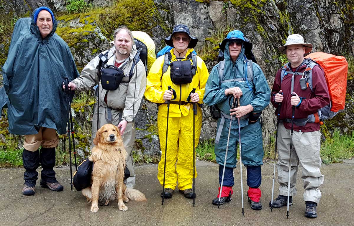
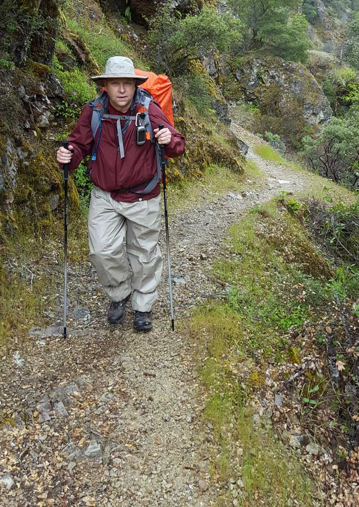
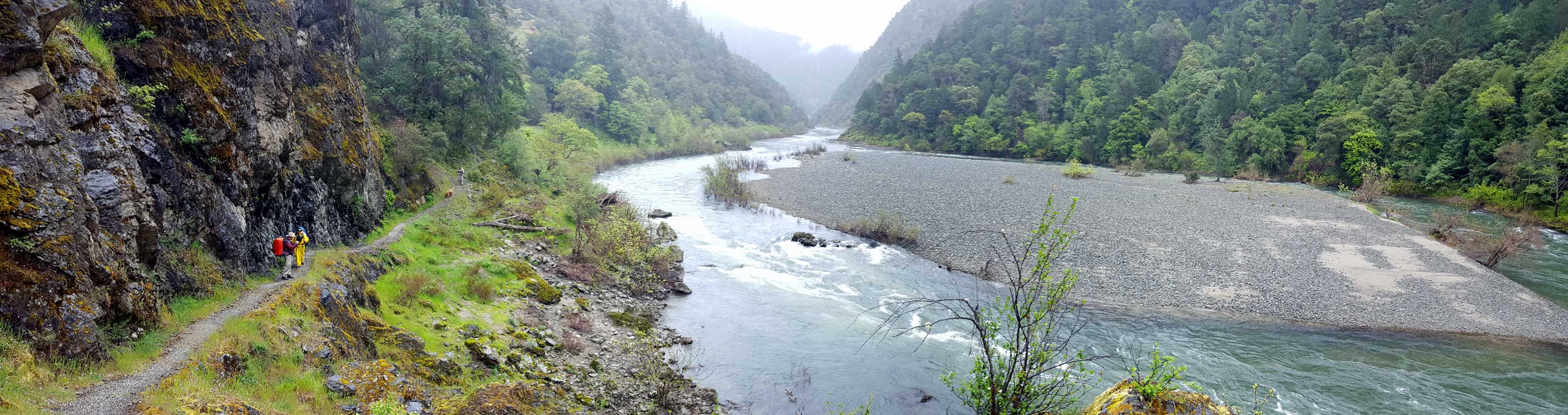
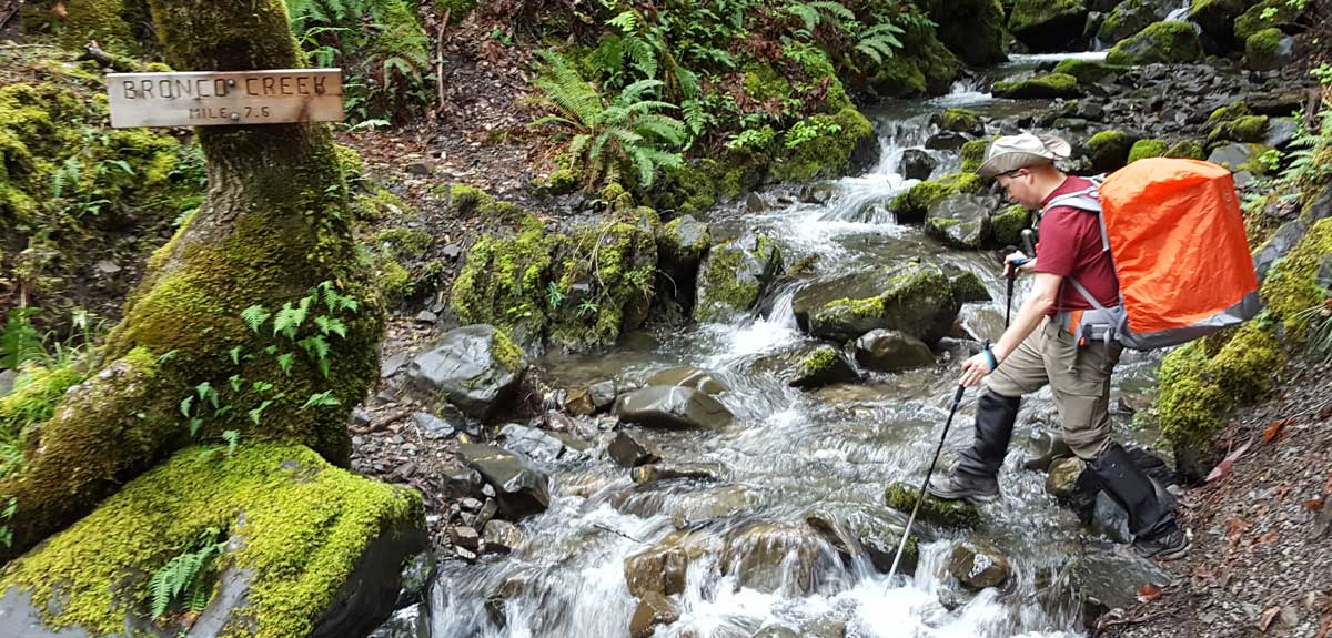
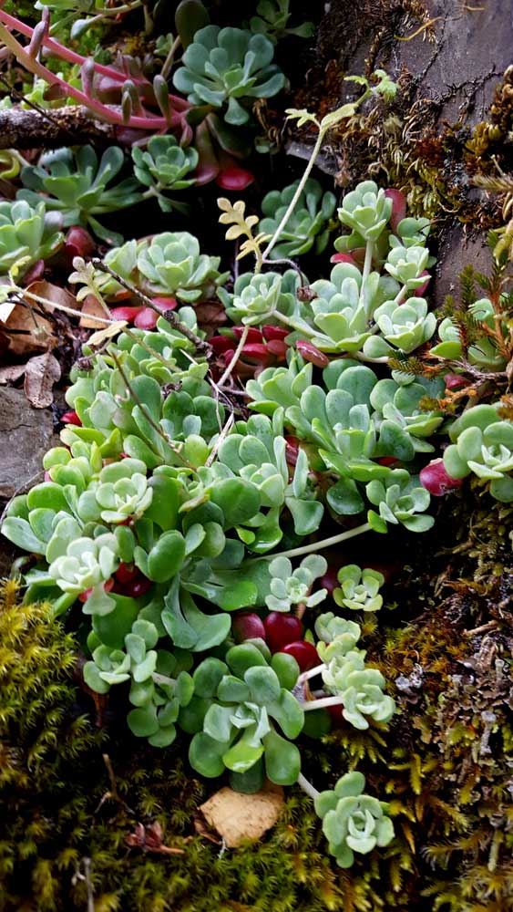
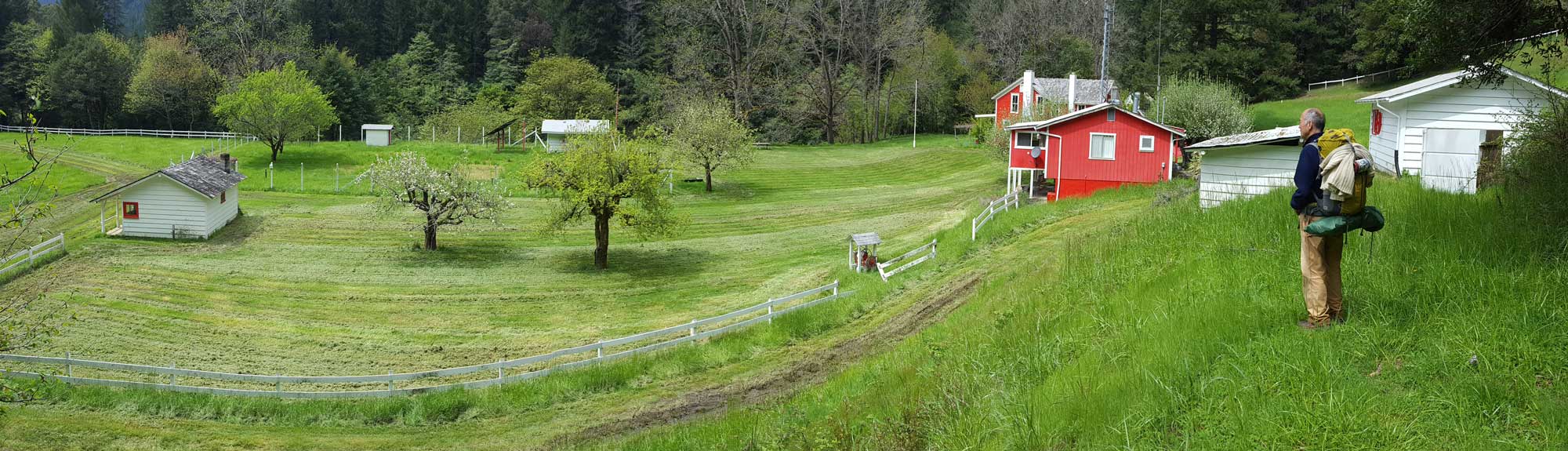
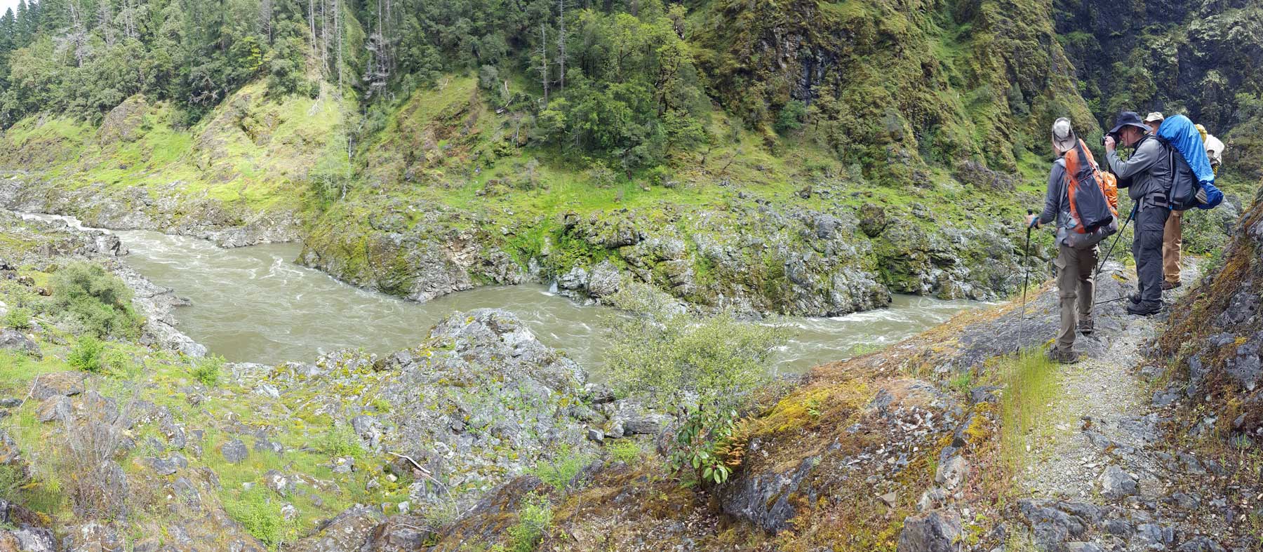
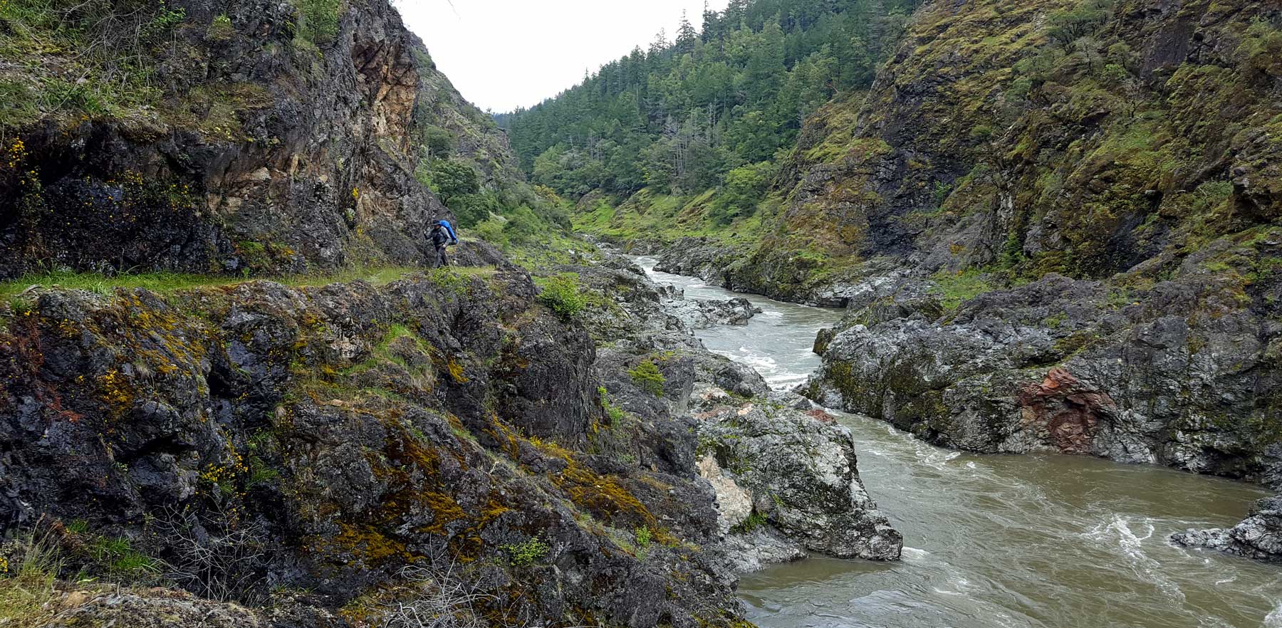
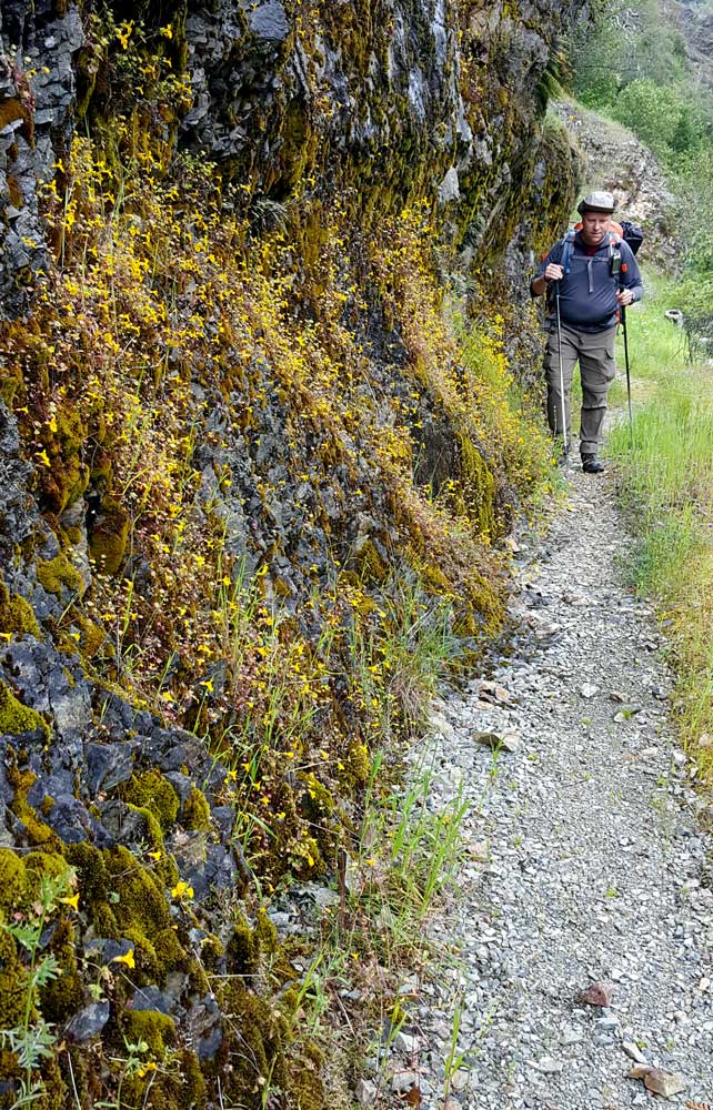
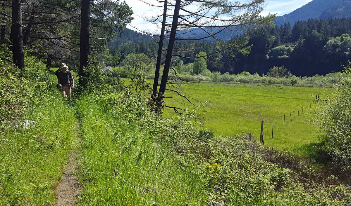
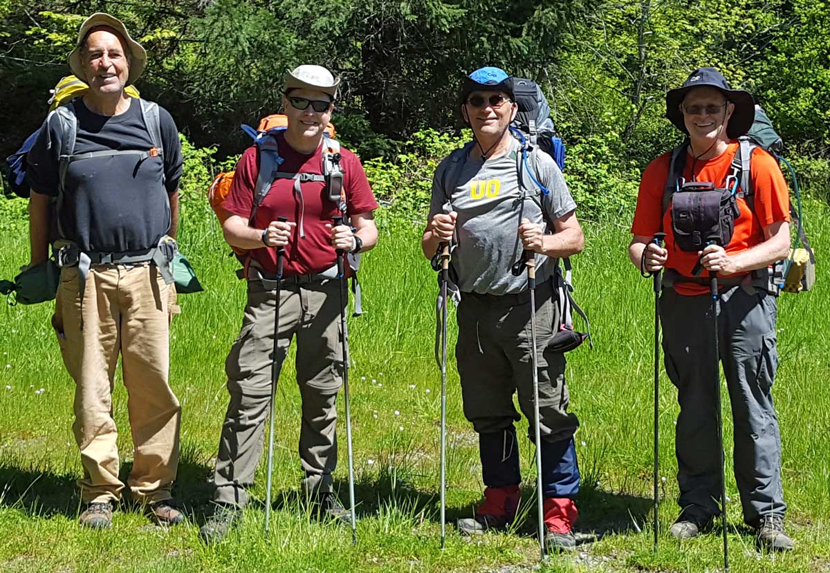
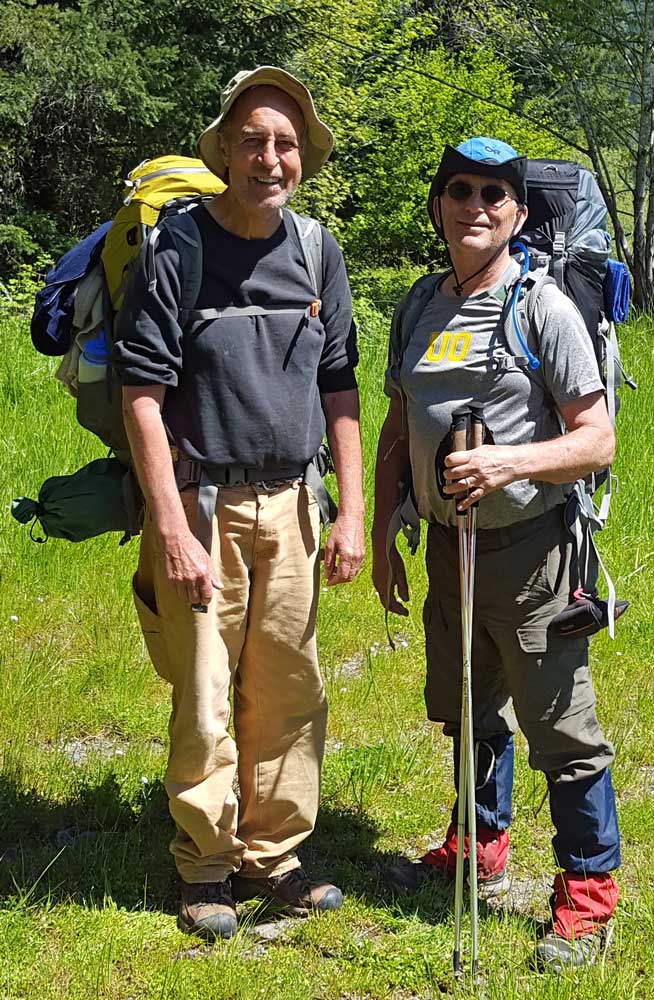
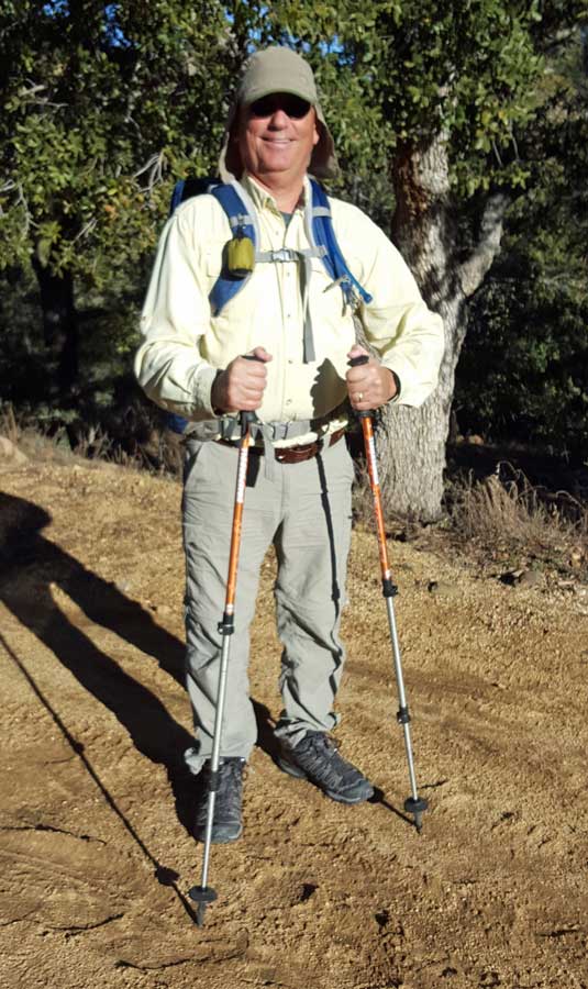
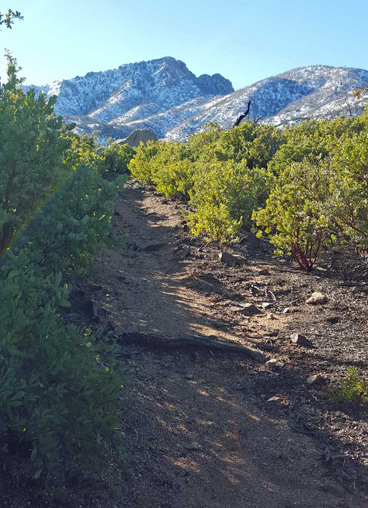
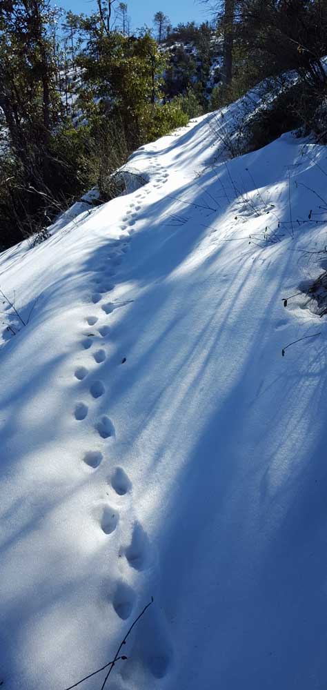

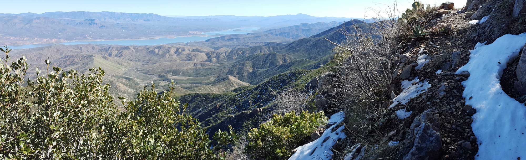

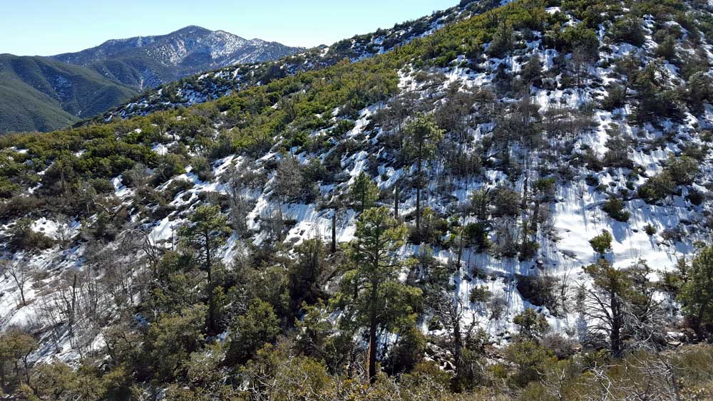
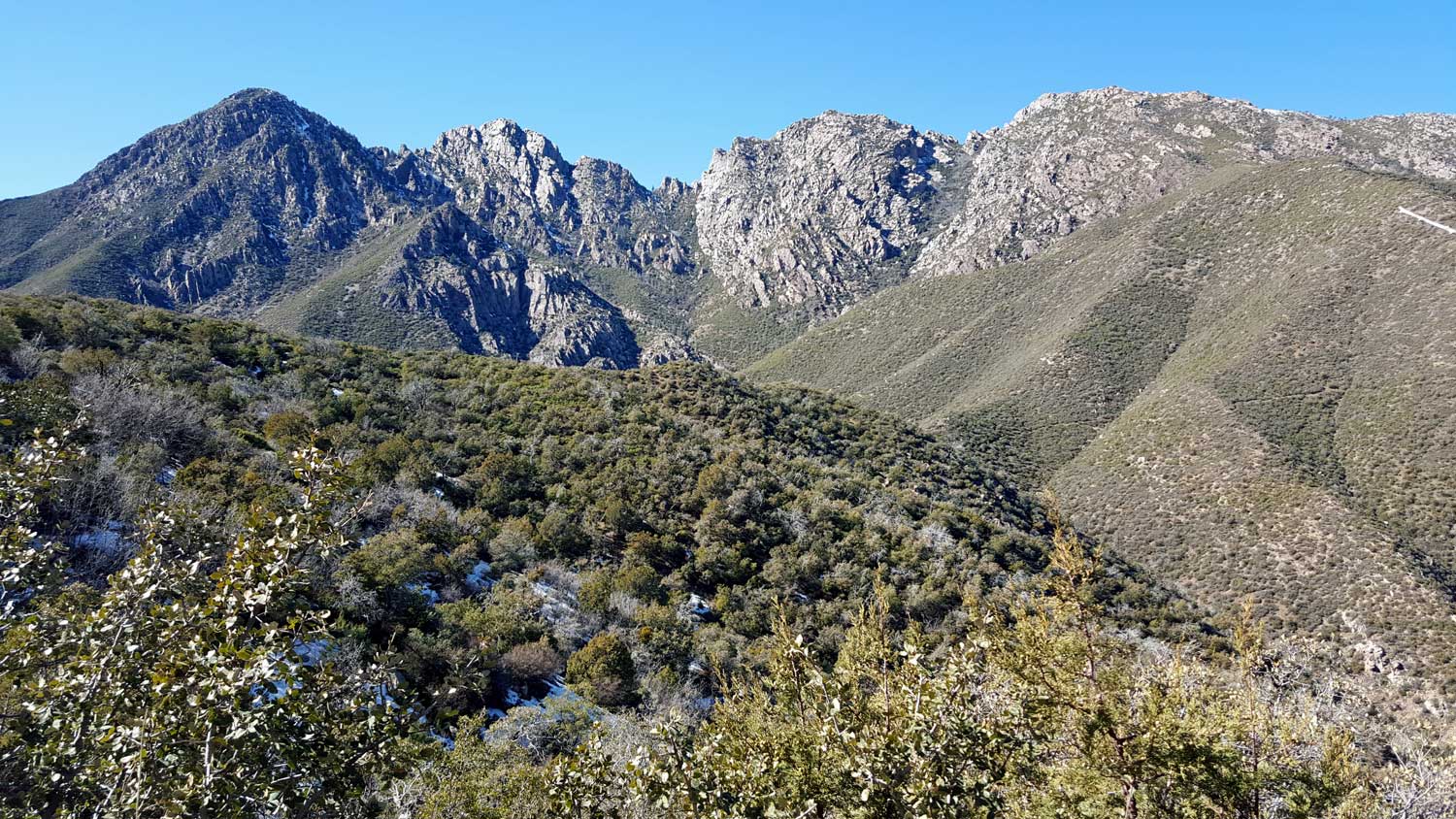
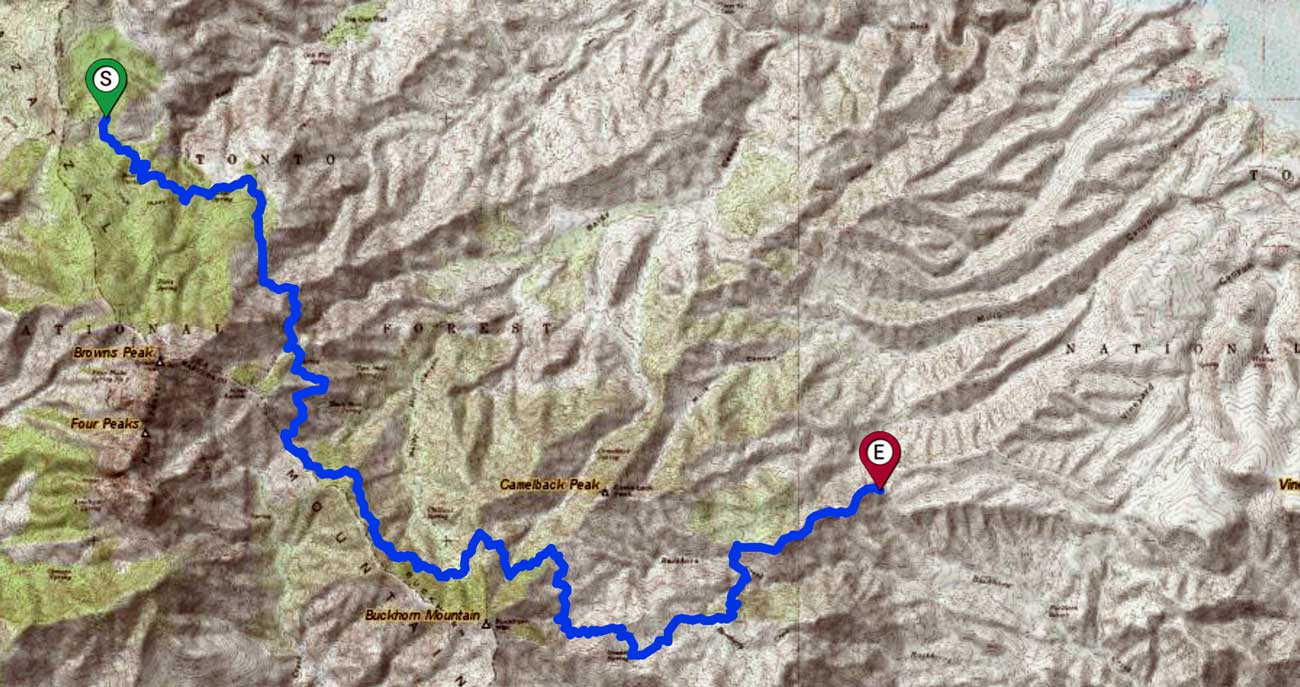
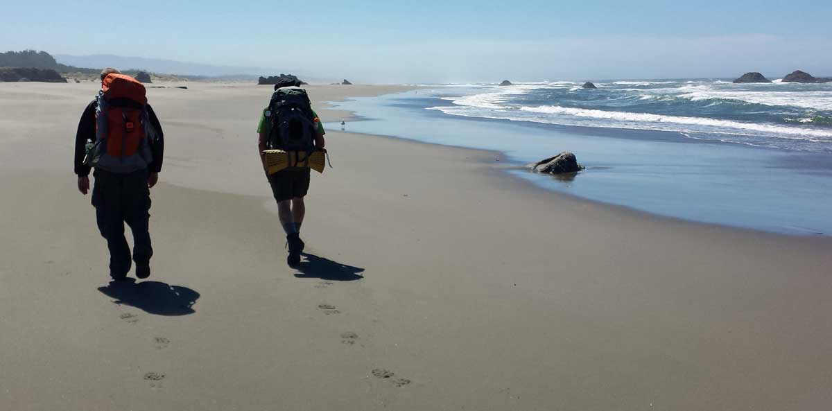
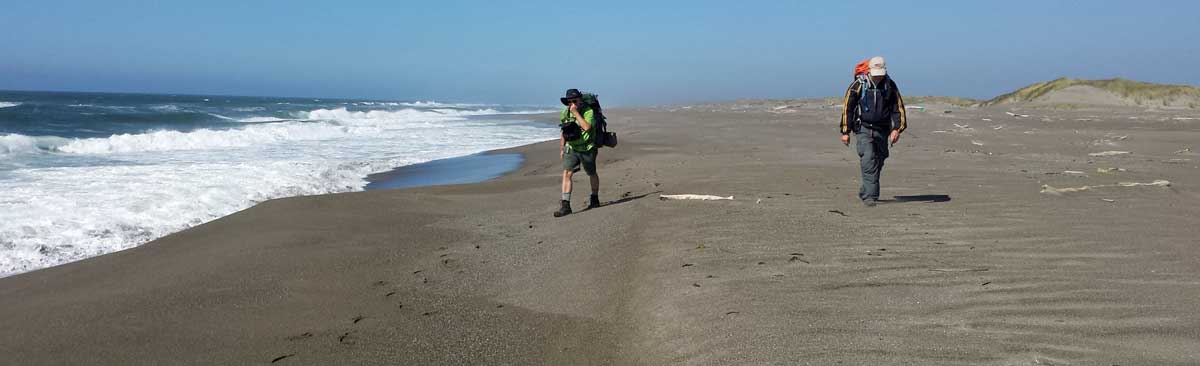
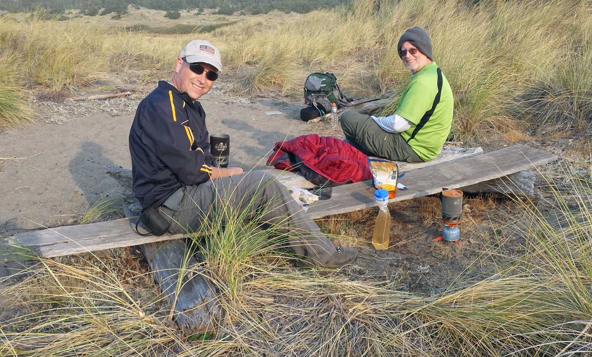

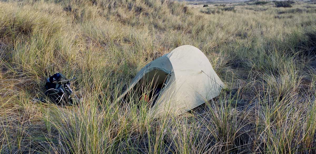

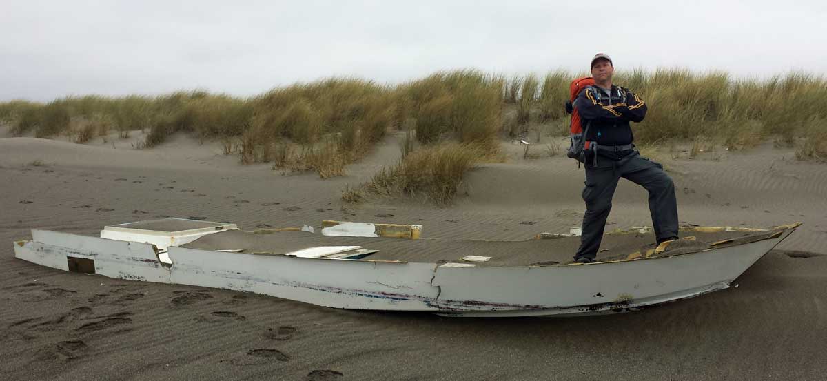


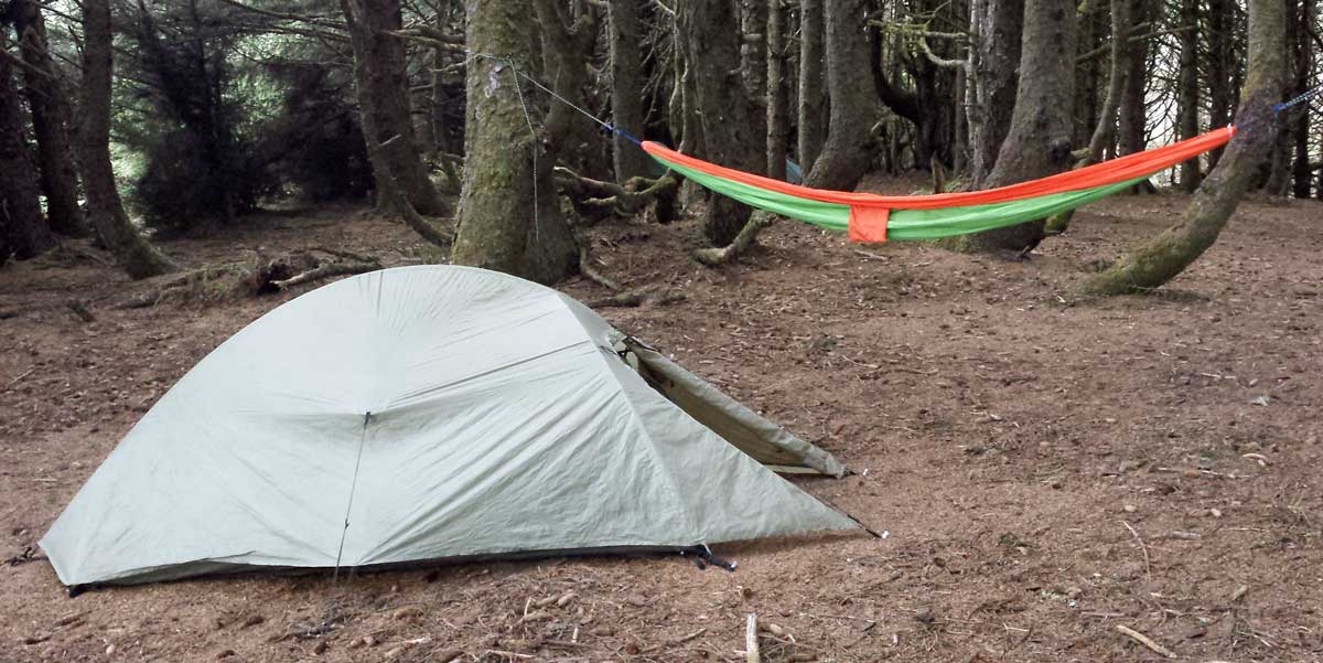
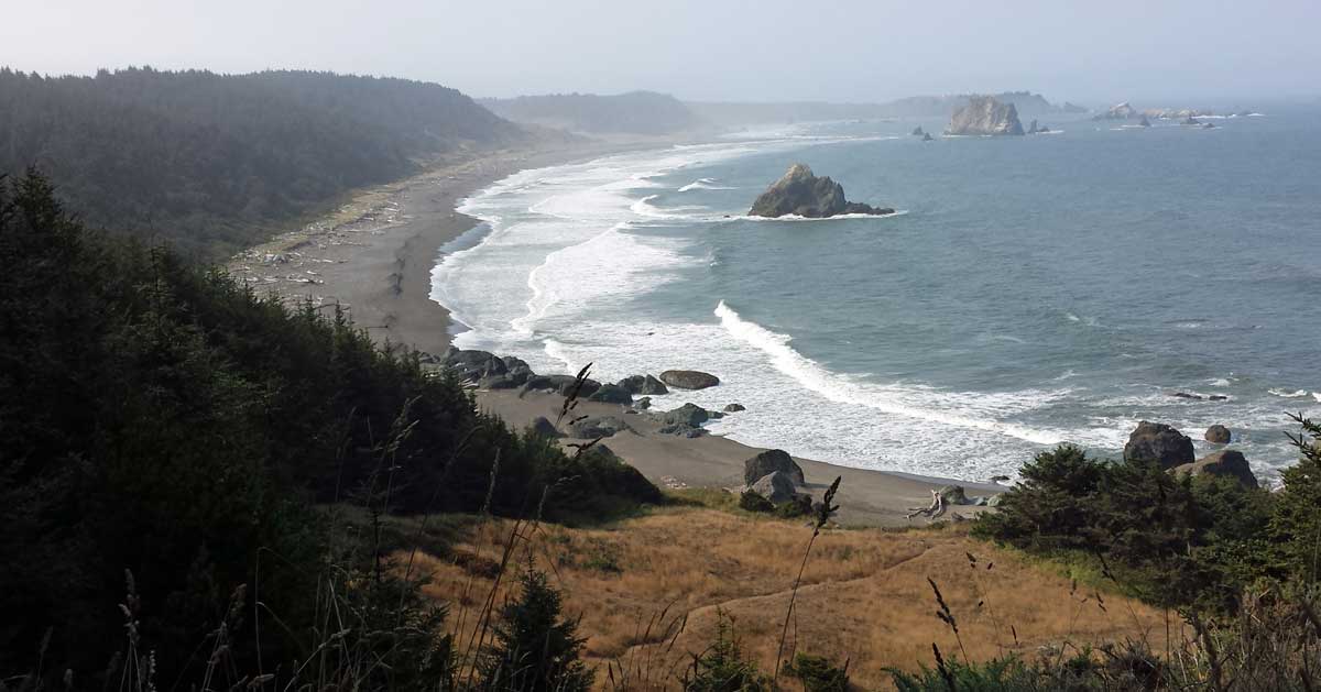

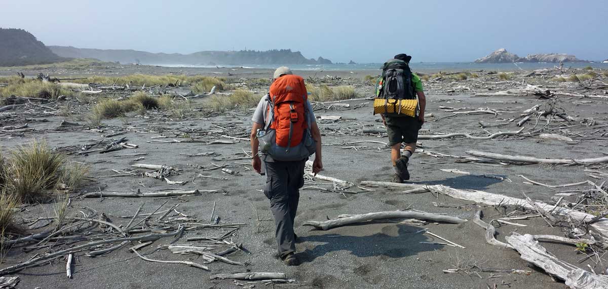
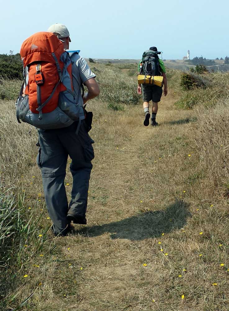
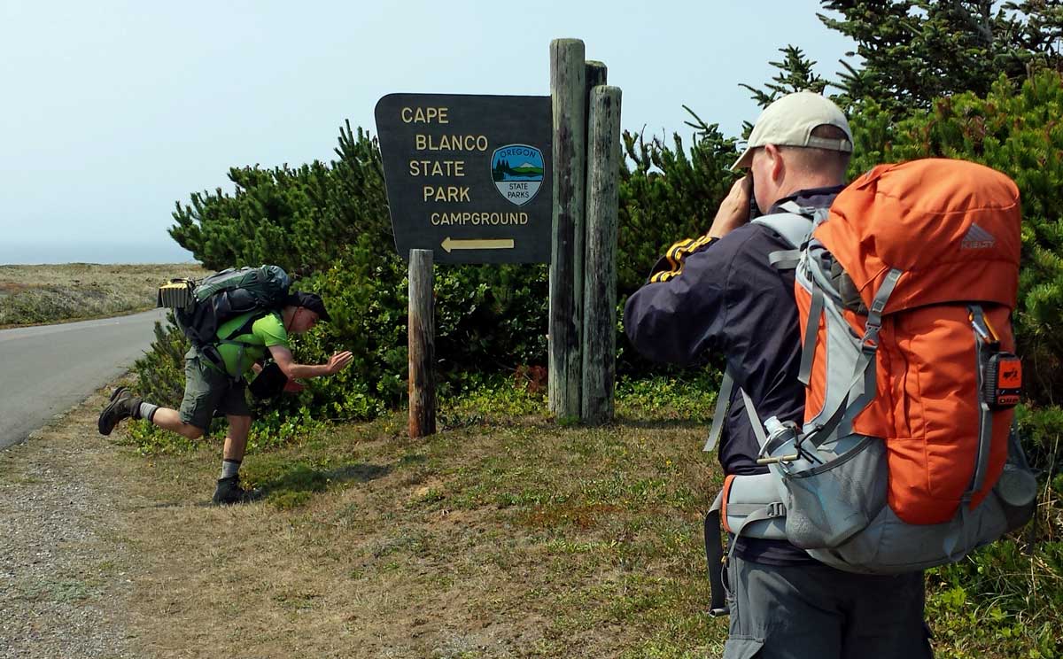
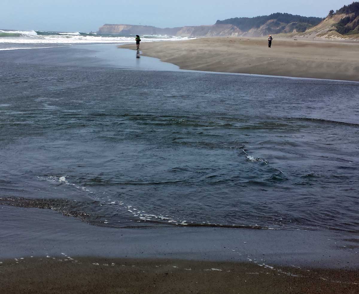
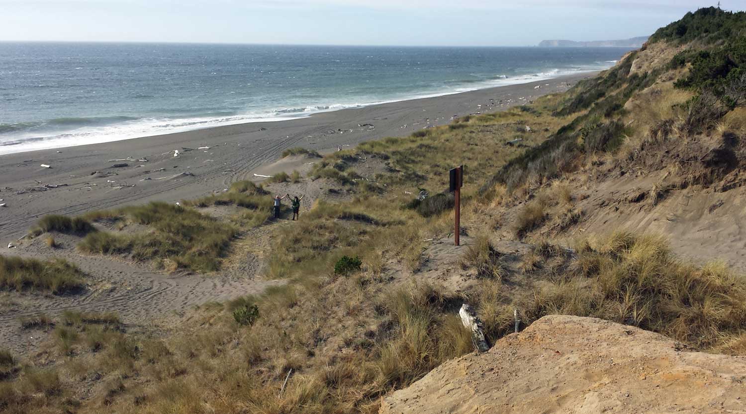
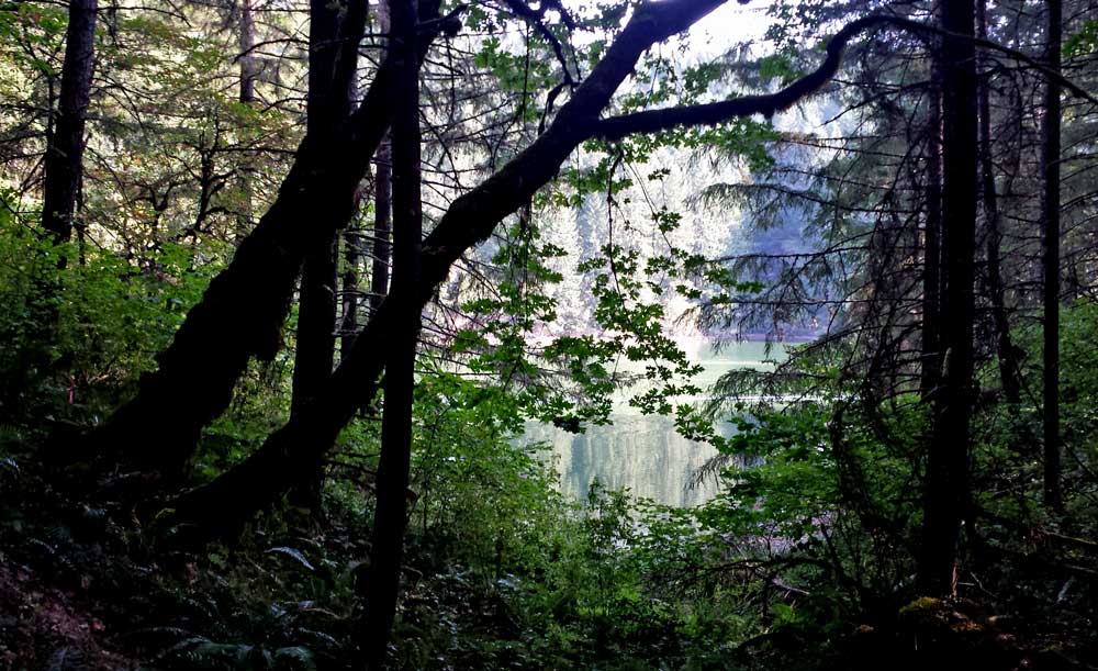
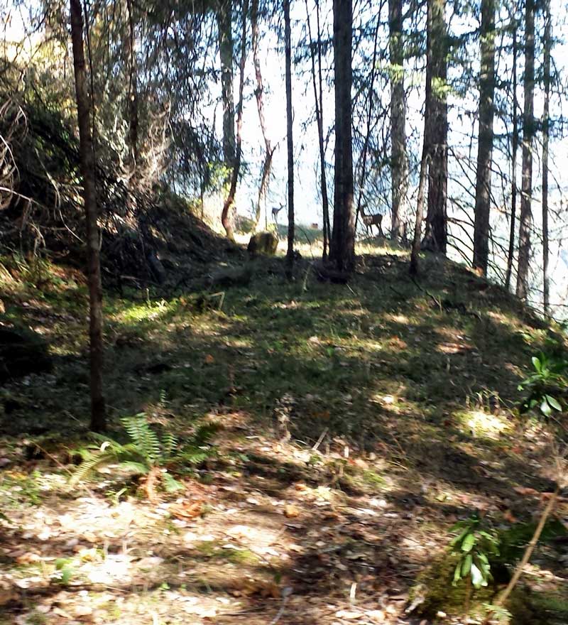 Sunday, August 16, 2015: I chose to begin the same hike today that I did yesterday. Standing on the ridge at 1,000 feet above Timber Valley and searching with my binoculars, I decided there was a way to make a loop out of this hike rather than an out and back on the same road. The old logging roads below me would probably lead through the tree stands and then back to my park. I was expecting this hike to be one or two hours long, after all, it's only four miles. Click the photo to see the trail through the trees to the left of this photo. I disturbed a doe and fawn staying cool in the tree. Beyond the trees, I expected to walk as easily through the next forested patch but found it was tangled with blackberries so decided to try to rejoin my original access road only one ridge away from where I was stranded. It was a bad
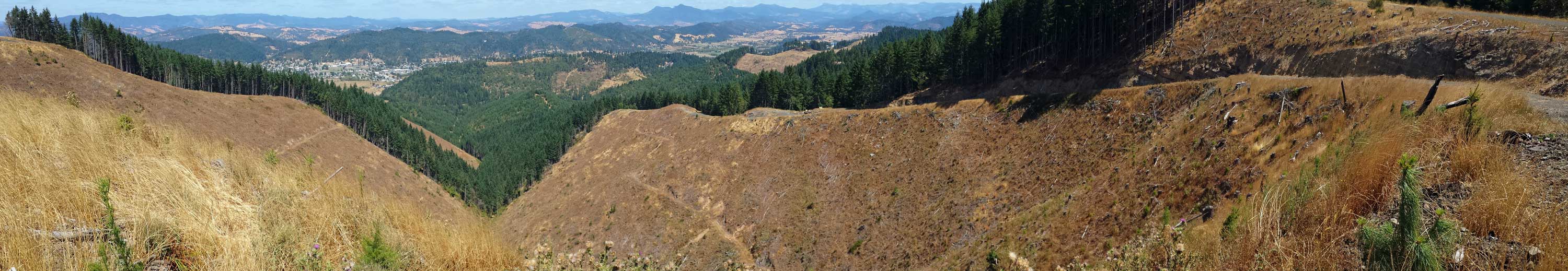 Saturday, August 15, 2015: I'm backpacking into Eagle Cap Wilderness in a week and I haven't prepared so I decided on a crash course in hiking fitness. Timber Valley is surrounded by mountains, the mountain to the south has been calling me since we moved here. Today, I climbed 1,000 feet to the top of the ridge, my first time since moving here in 2012. I hope the trails in Eagle Cap are not as steep as the climb up this mountain. What a great way to get use to climbing and descending in a week. Sutherlin is in the valley below. Click the photos for wider views.
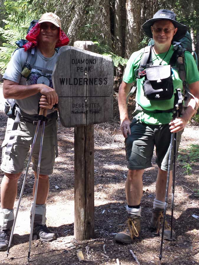
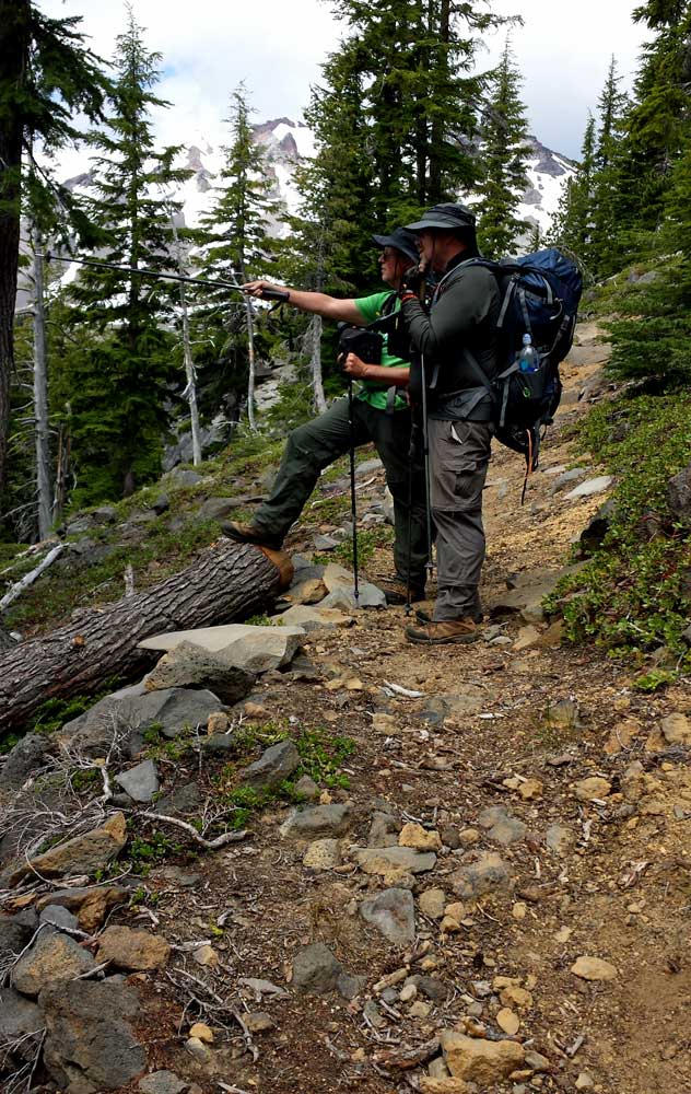
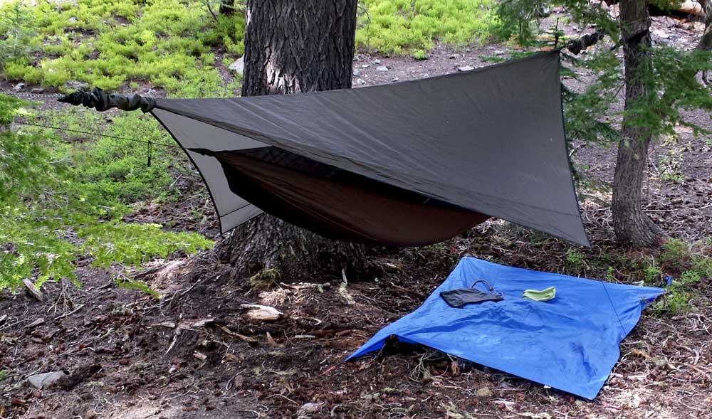
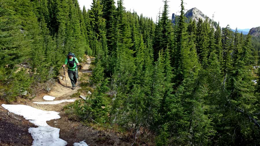

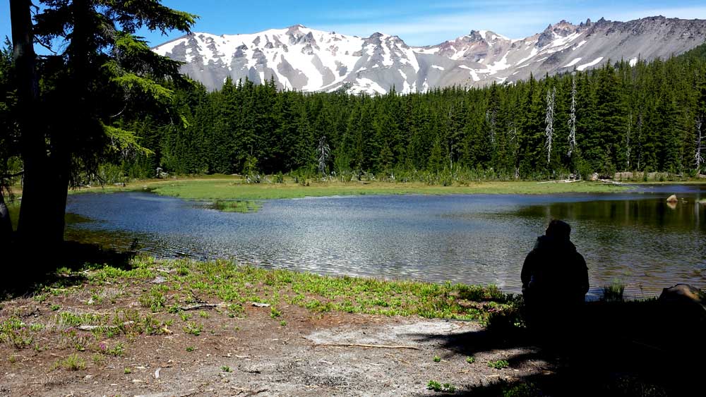

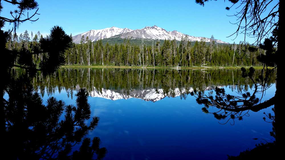

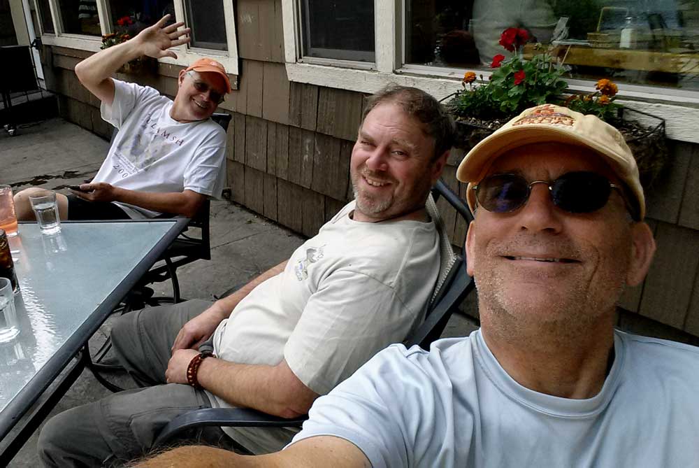
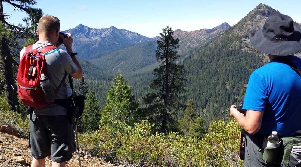
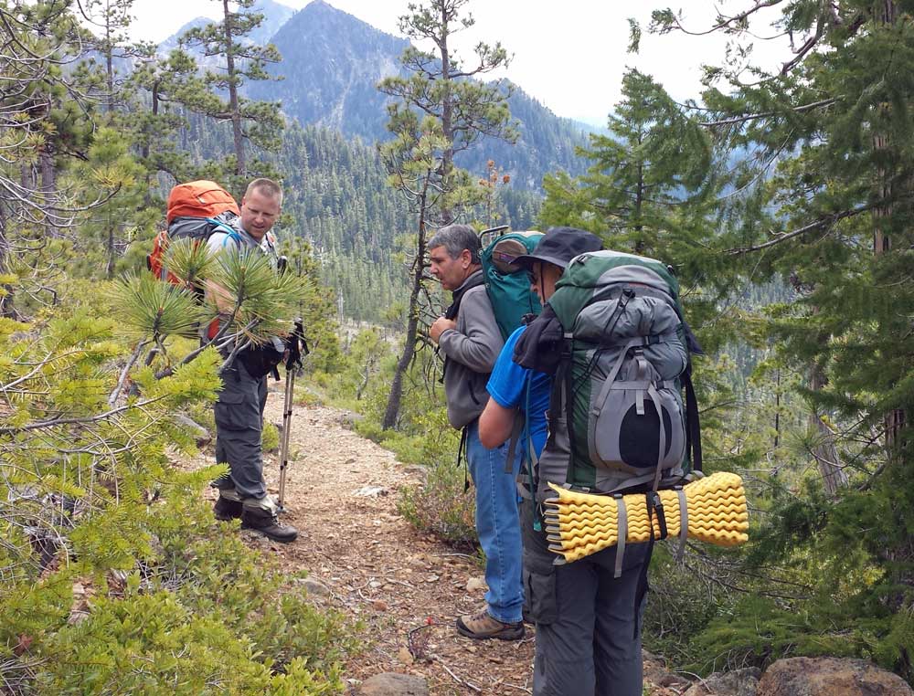
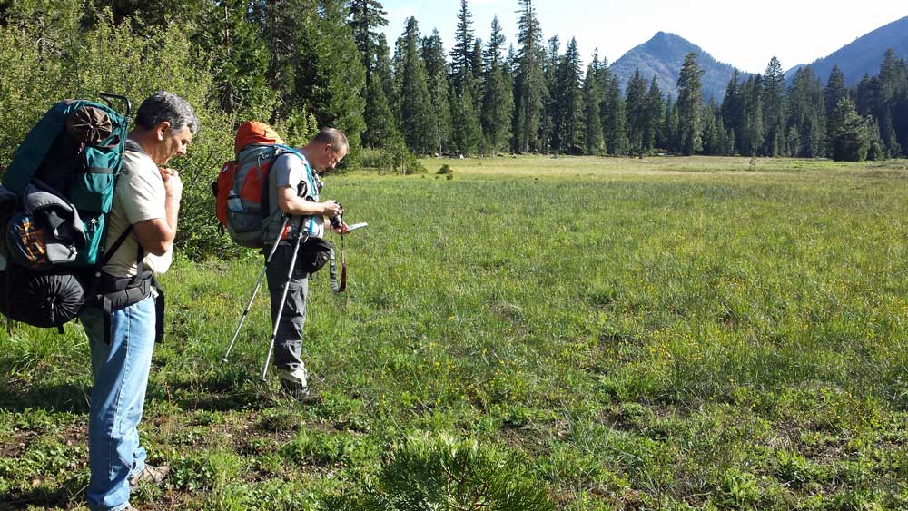

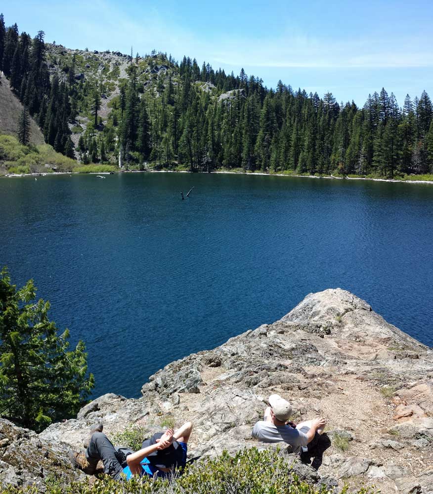
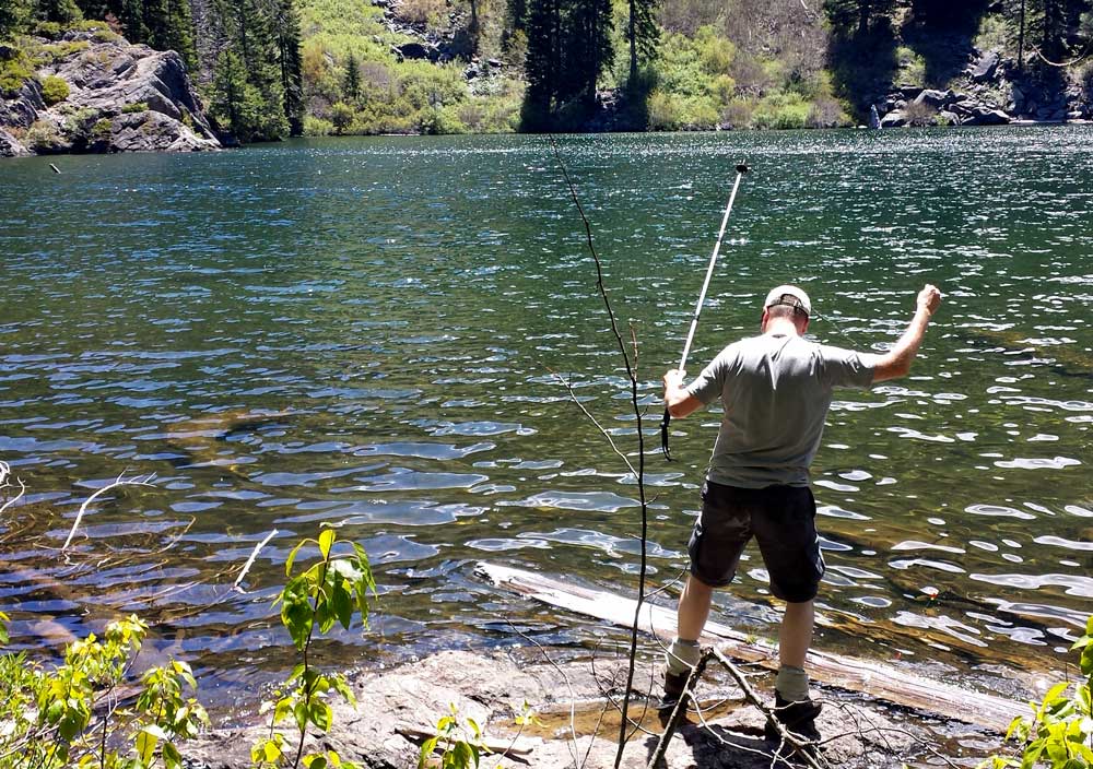


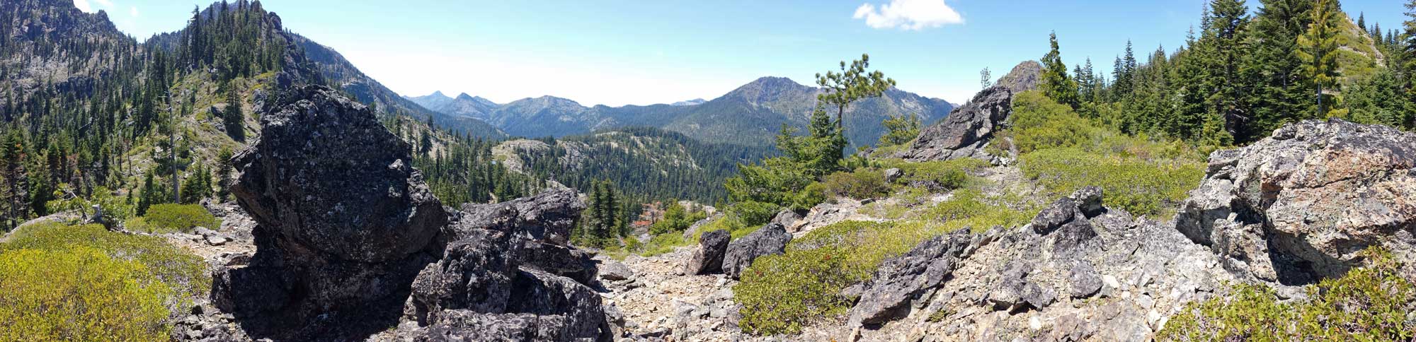
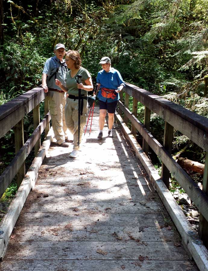
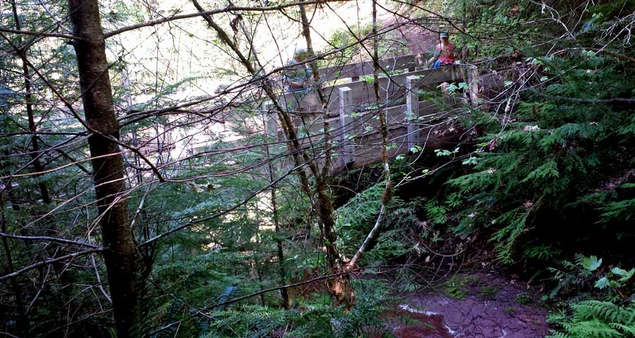
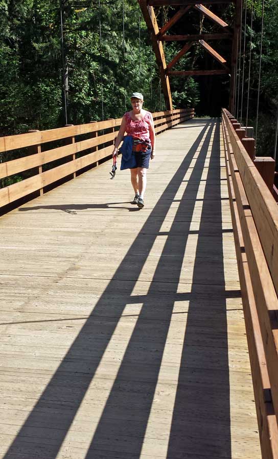
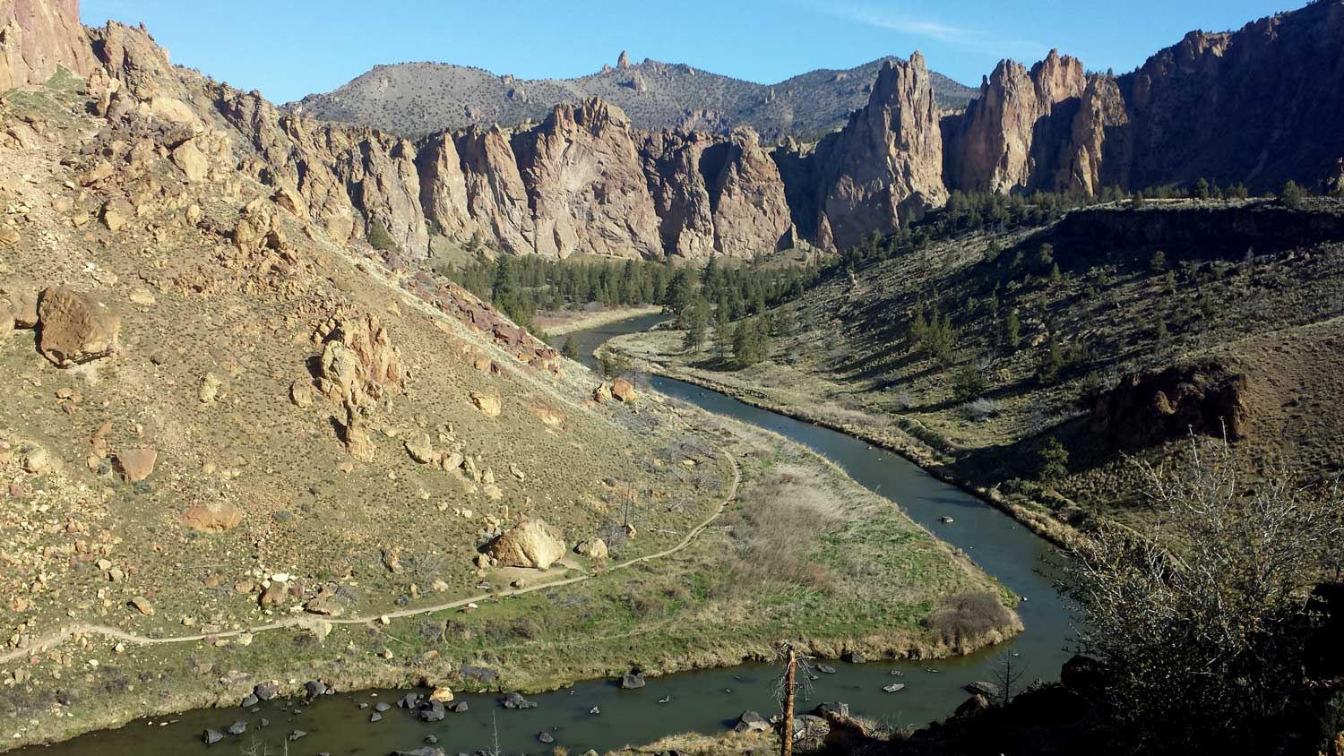
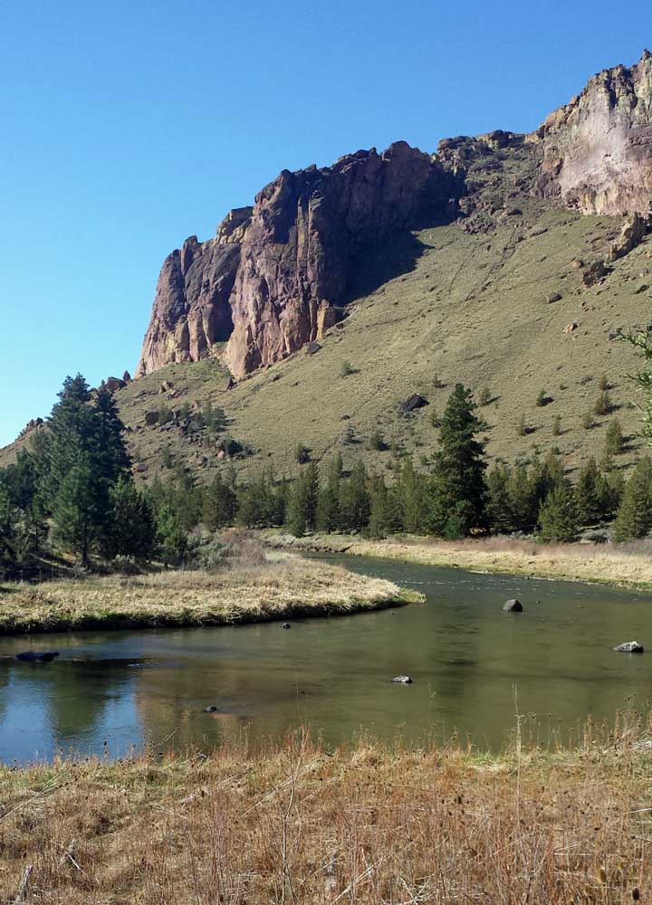
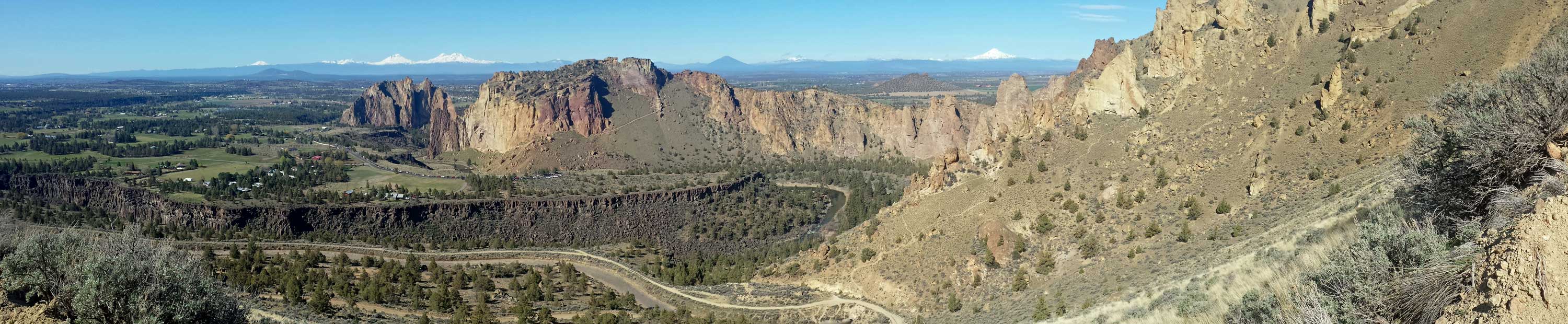
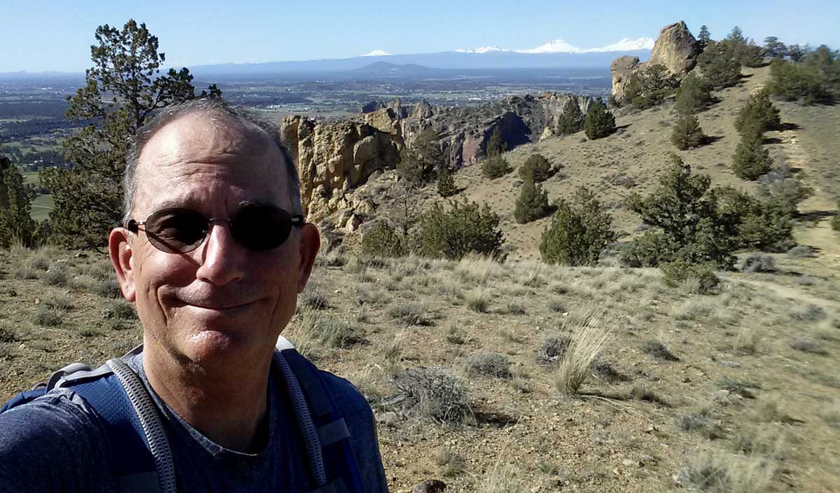
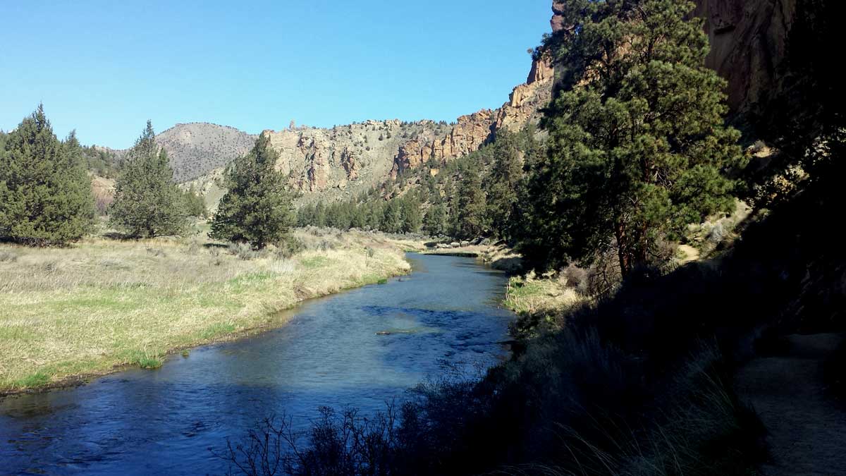
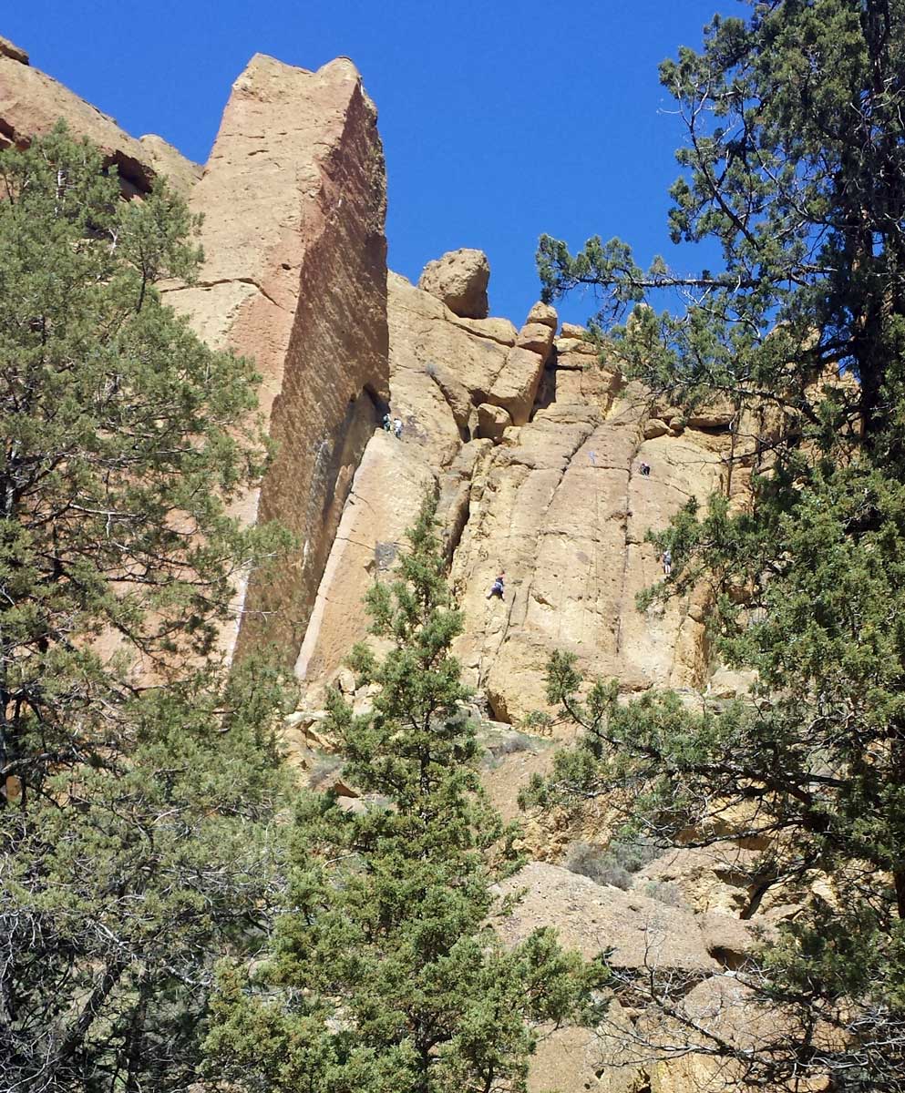

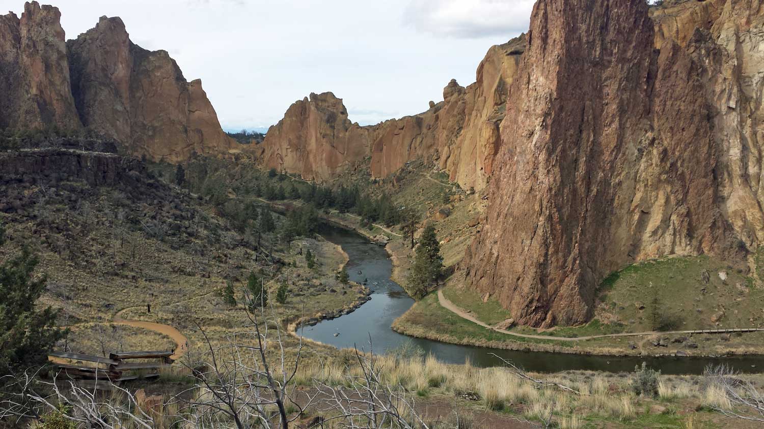

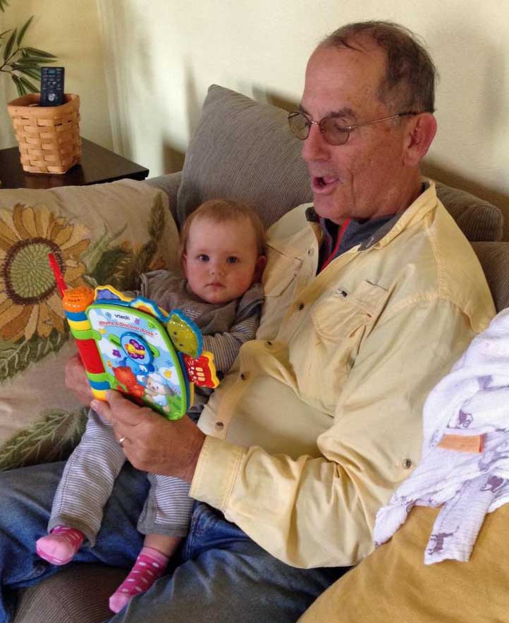
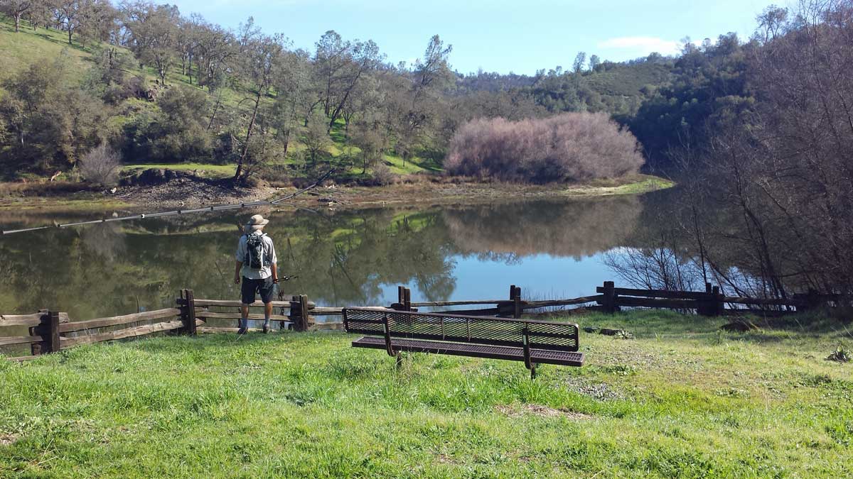
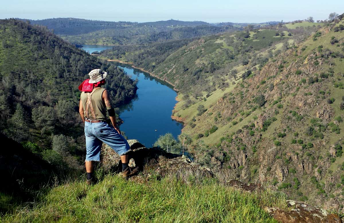
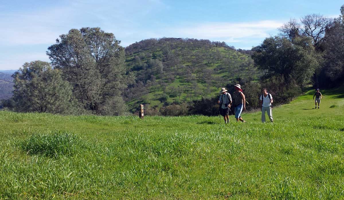
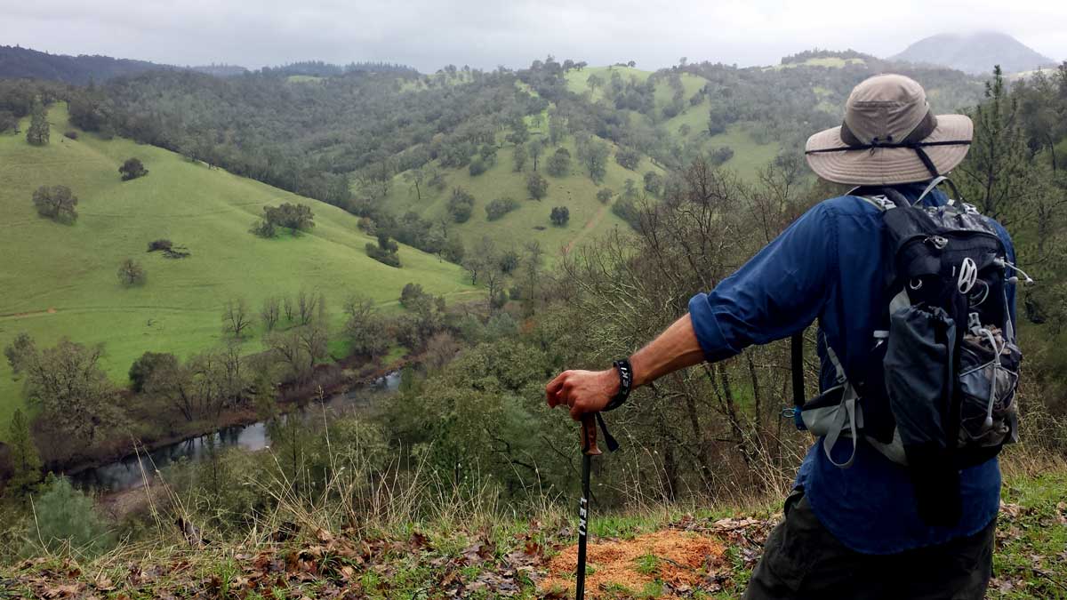
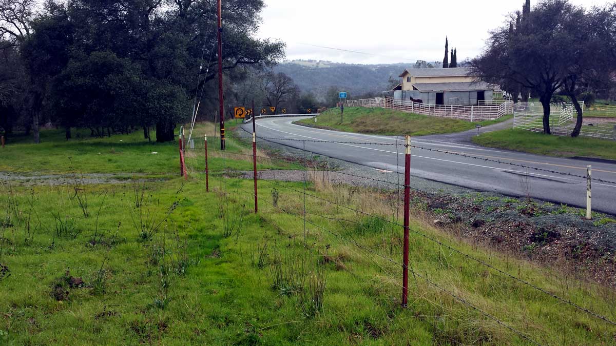
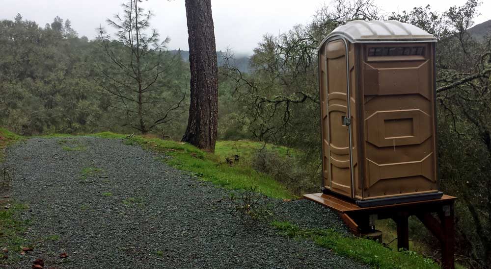
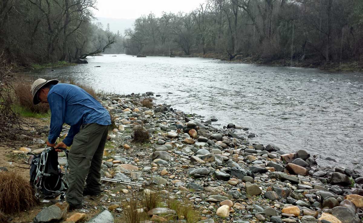
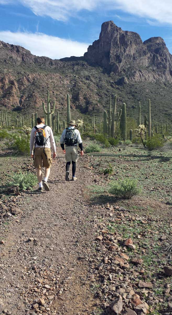
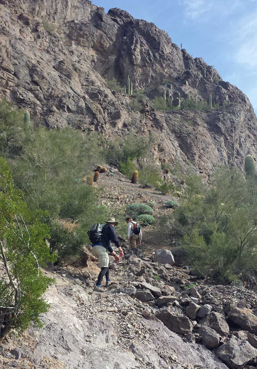
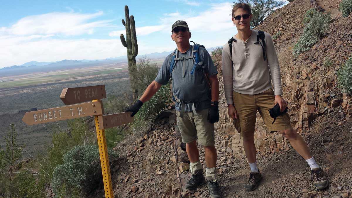

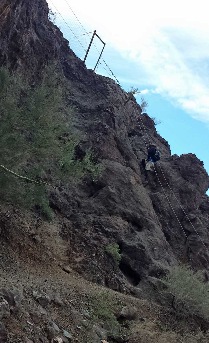
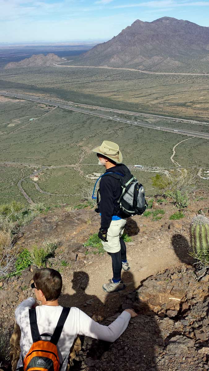
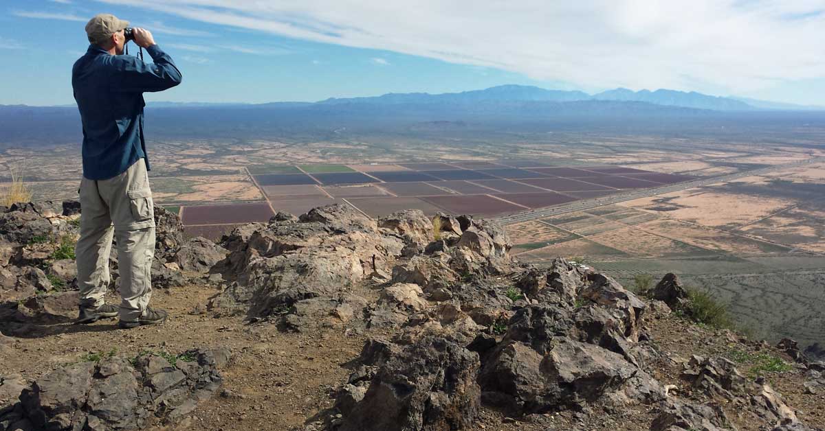
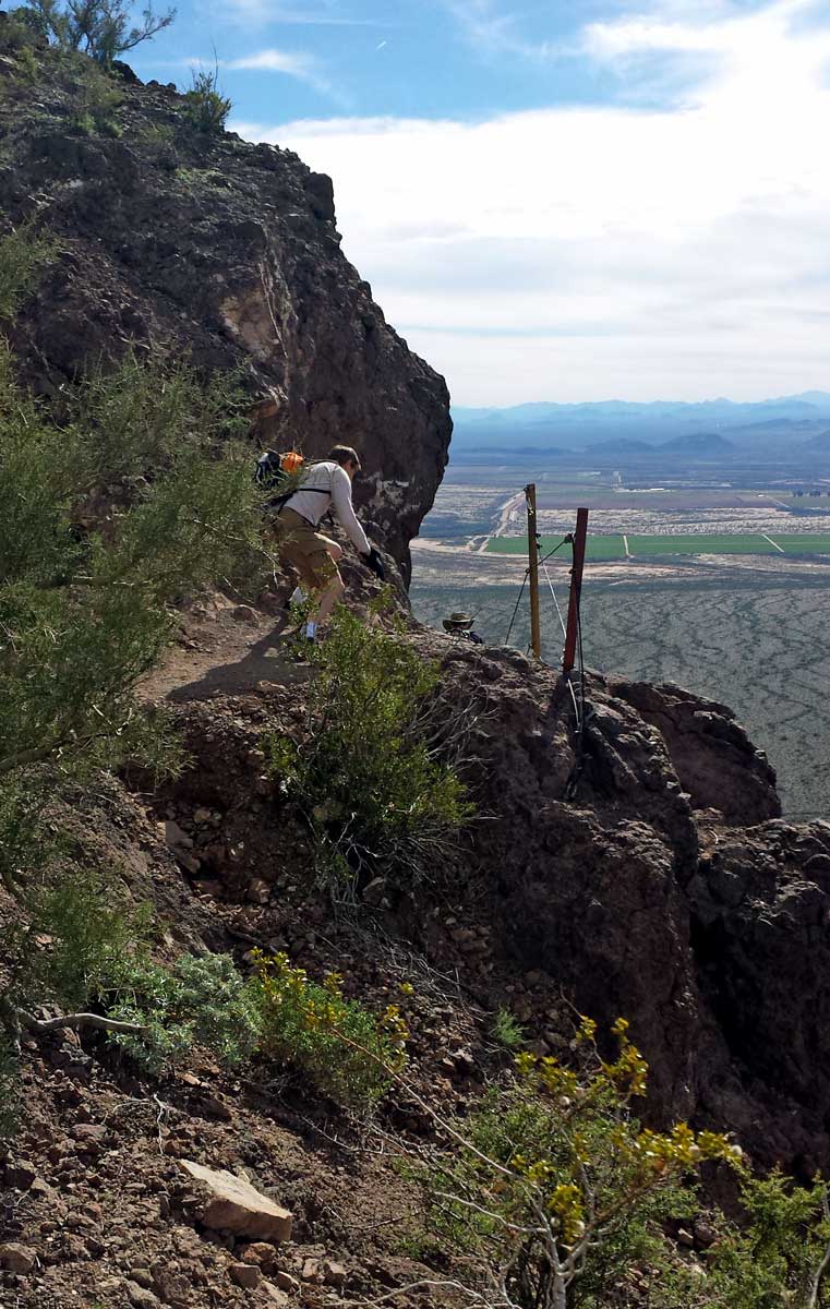
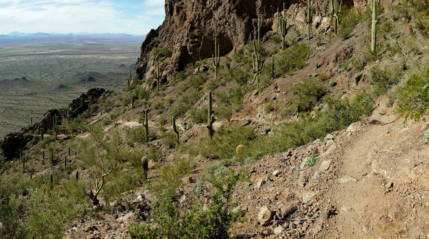
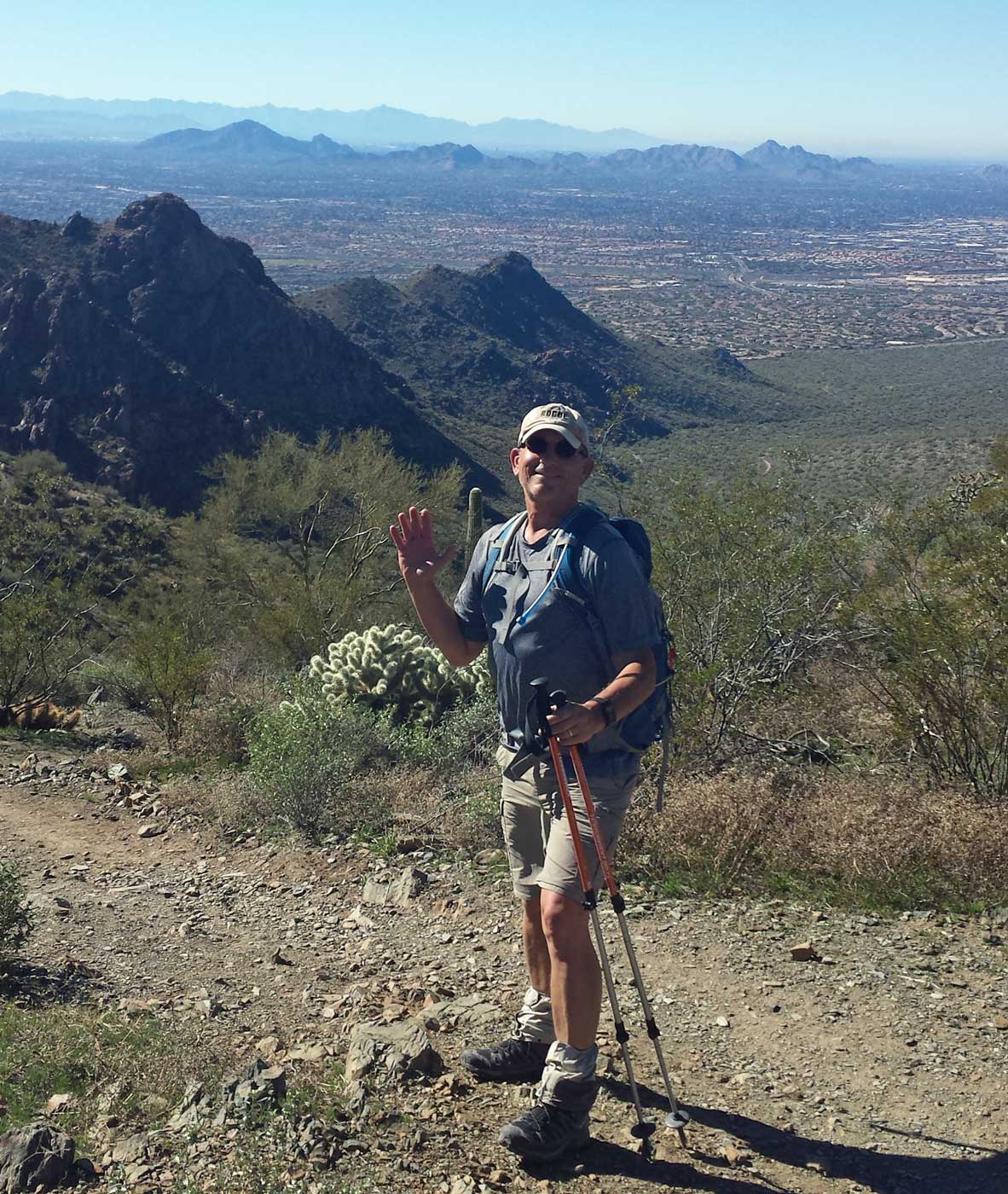


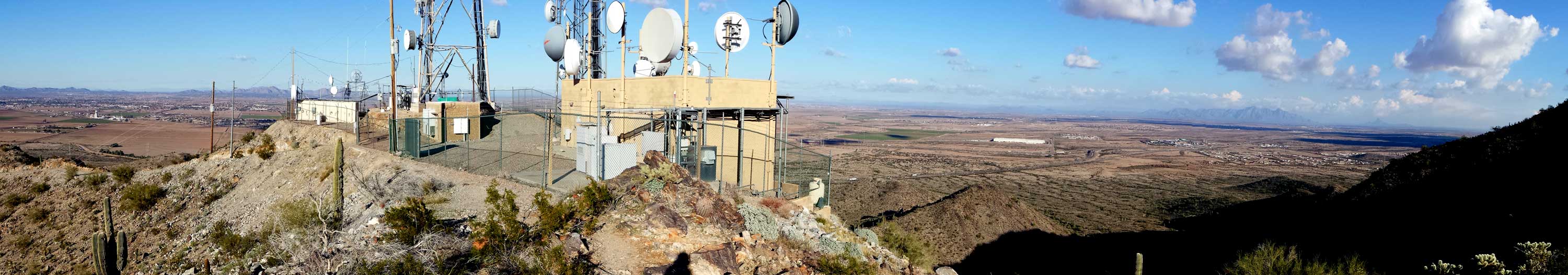

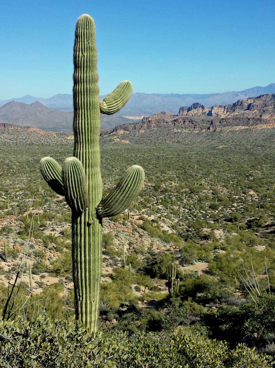
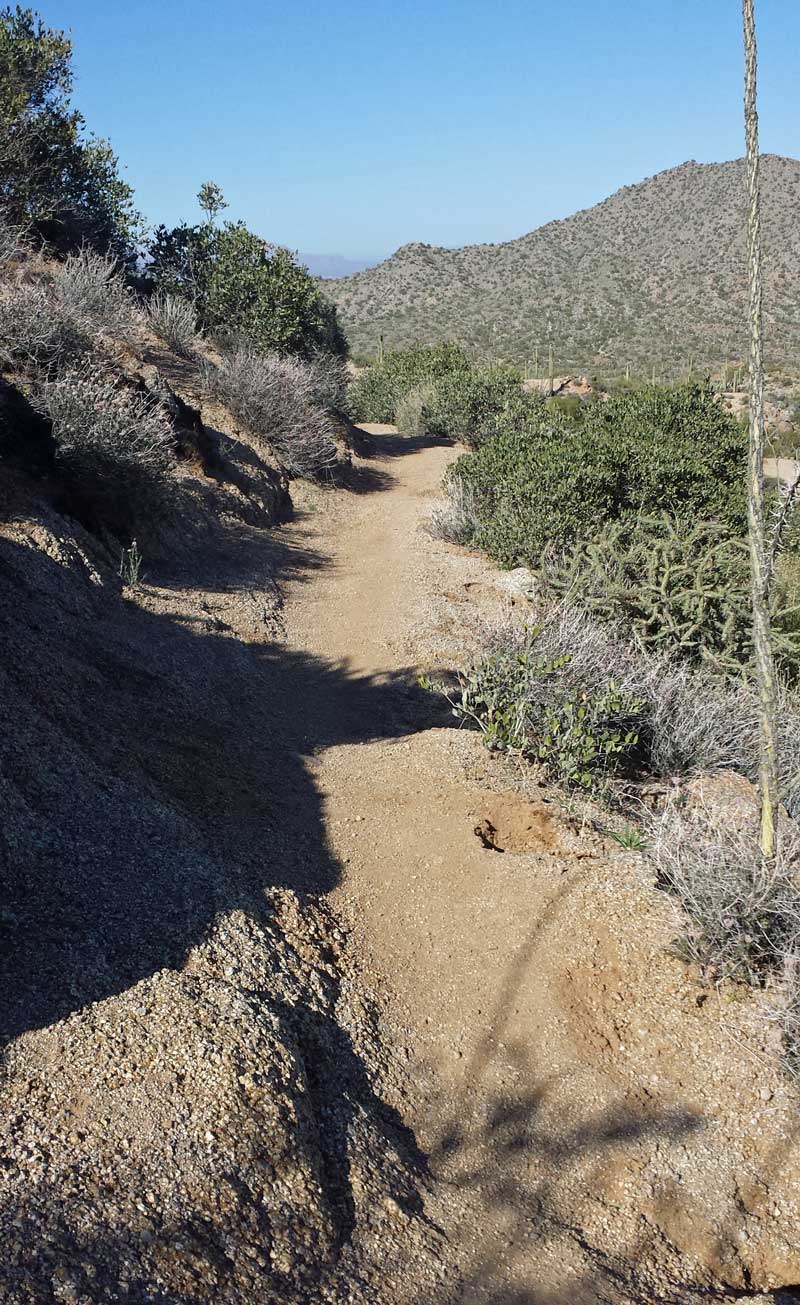
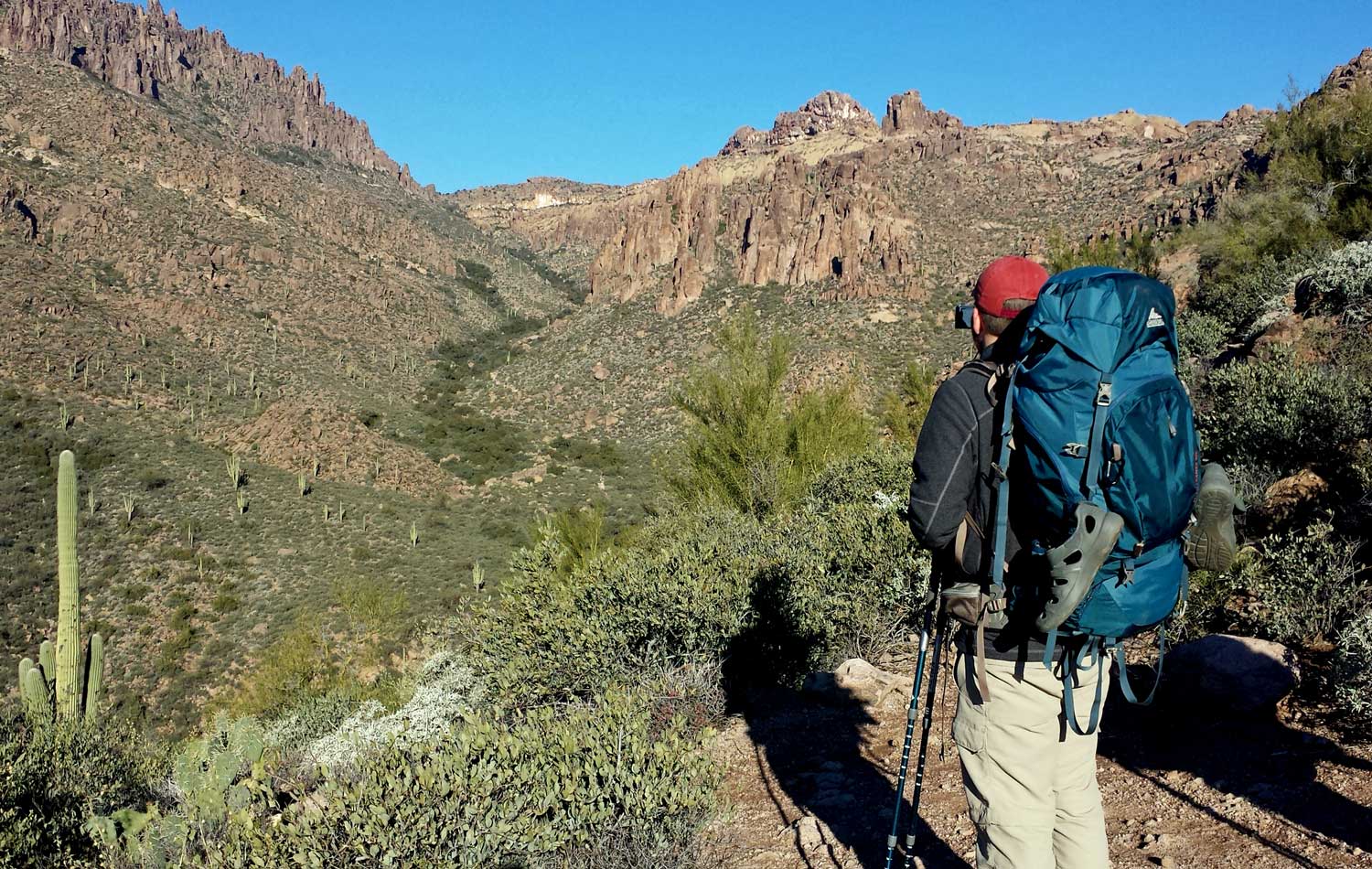
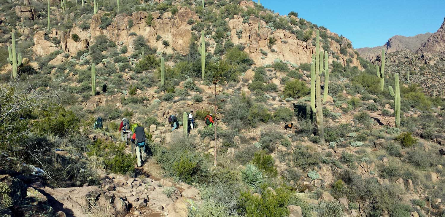

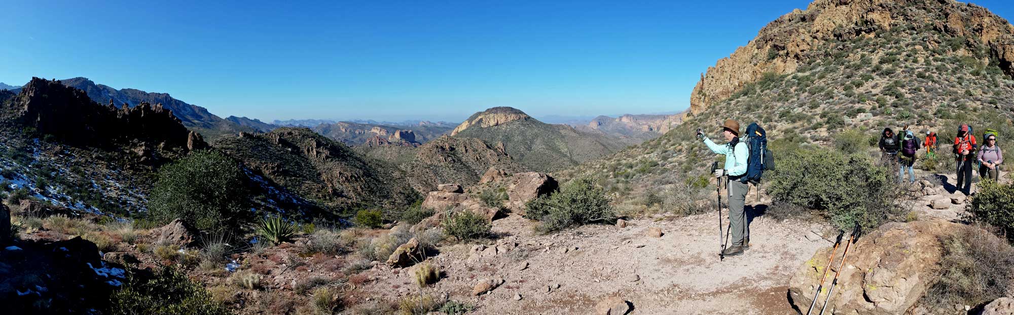
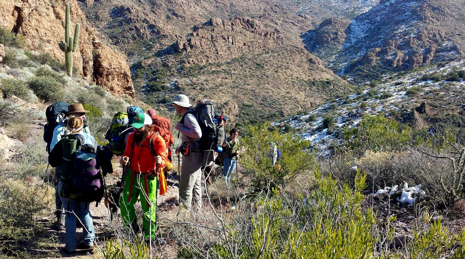
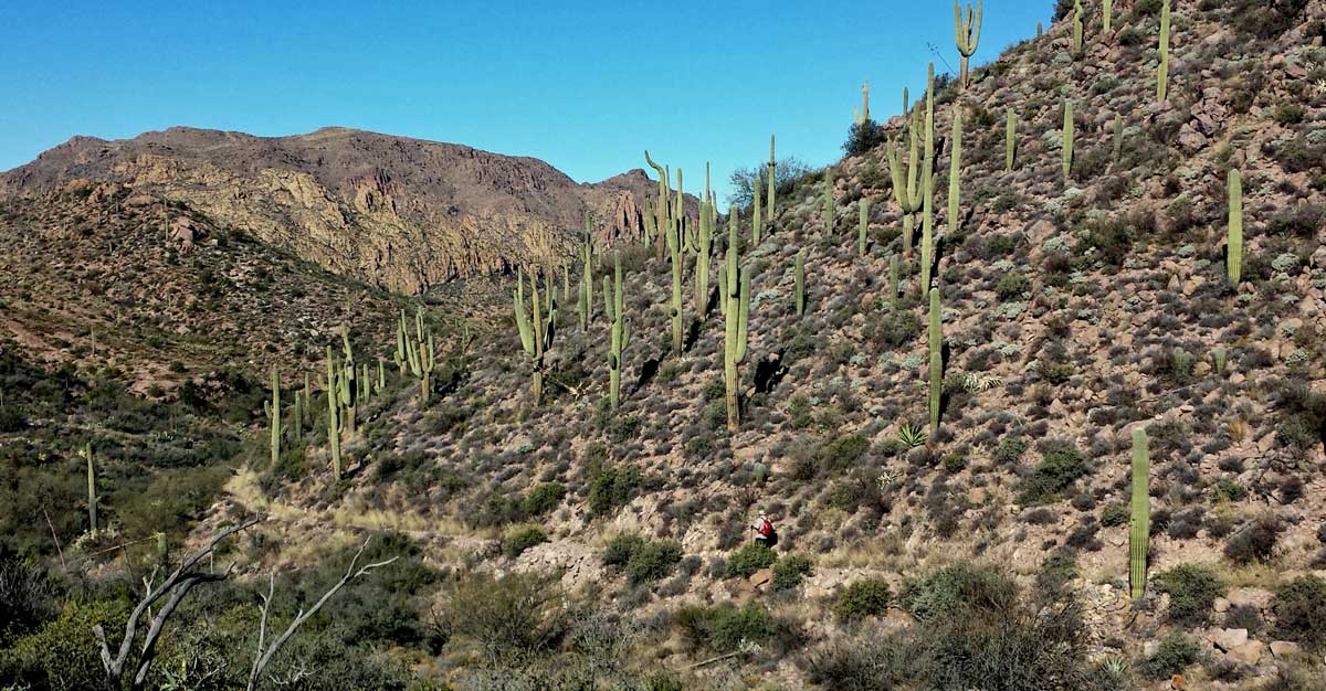
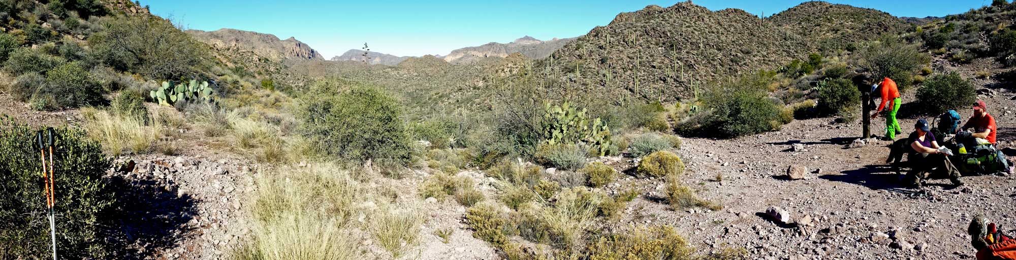
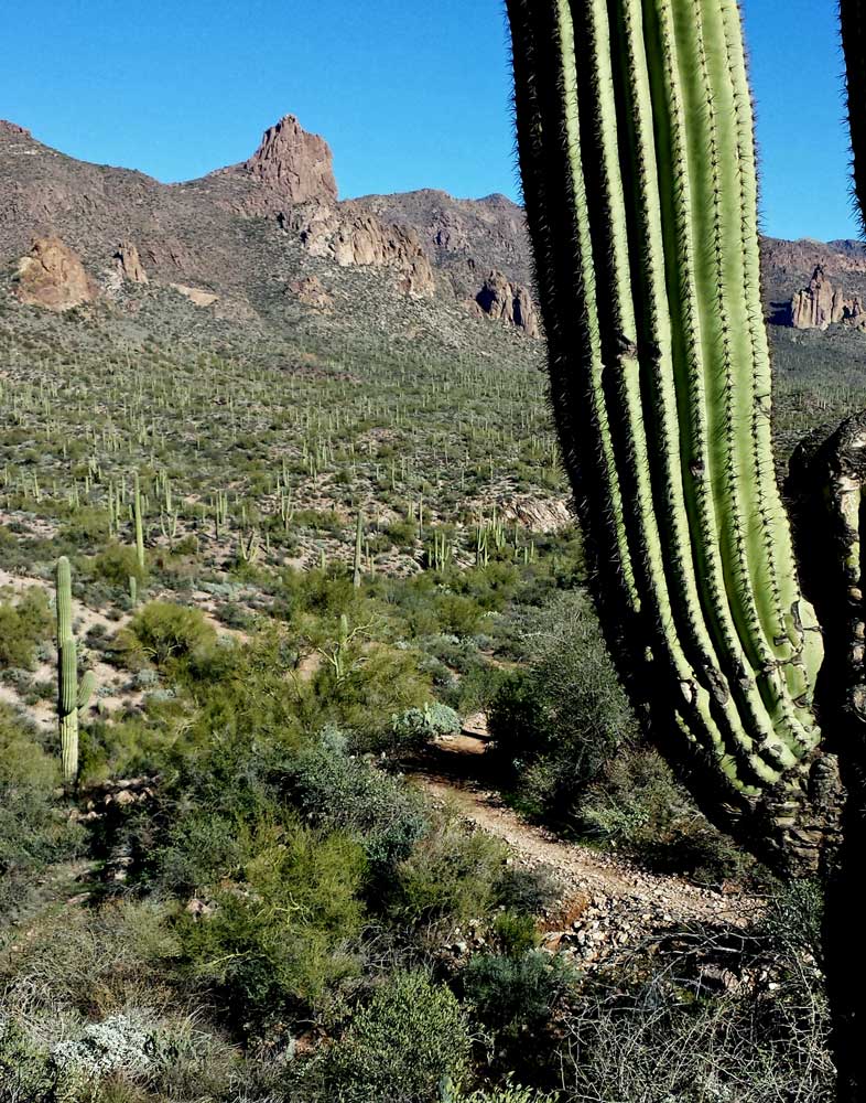 Monday, January 5, 2015: For my first backpack in Arizona, using "Meetup", I found a group of hikers packing into the Superstition Mountains. This is an impressive group of mountains to the southeast of Phoenix. It only took an hour and forty minutes to get to the Peralta Trailhead. I got there early, good thing because this is a very popular area to hike and I would not have found a parking space had I been later. Our plan on the first day was to hike by Weaver's Needle, a popular day hiking destination. Then on day two, hike by Miner's Needle, another popular day hiking destination. In our pre-planning, we learned that the water available at LeBarge Spring was good so we need not pack in two days of water. The spring was our overnight camping location. I've mentioned before, every bush, plant, tree and, of course, cactus has a set of thorns or spikes ready to grab the hiker. As I'm hiking along, branches are reaching out, grabbing me like Velcro attaching to my pants, shirt, hat and even bare skin. I'm often needing to stop, reverse direction to "un-clip" from the arm of a tree which has grabbed me. Since the other hiker's knew I was from Oregon, I joked with them about the many Saguaro Cactus, saying, "Saguaro is the Spanish word for Douglas Fir". Those who have been to Oregon understood the joke. The hiking in the Superstition Mountains was incredible, views incredible and my hiking partners are good people. It was tough hiking with rough, uneven and rocky trails. The Arizona hiking makes me appreciate the softer Oregon trails and the many good sources of Oregon water for hikers. Click each photo for another view. Yes, there was snow from a recent storm on the north side of all the mountains. My Arizona hiking partners mentioned they had never seen snow on Weaver's Needle so were taking photographs of the new experience. They also mention how this was the only time of year to hike the Superstitions in comfortable temperatures, 60 daytime and mid-20s night time. My new, warmer sleeping bag kept me warm even with ice forming on my tent.
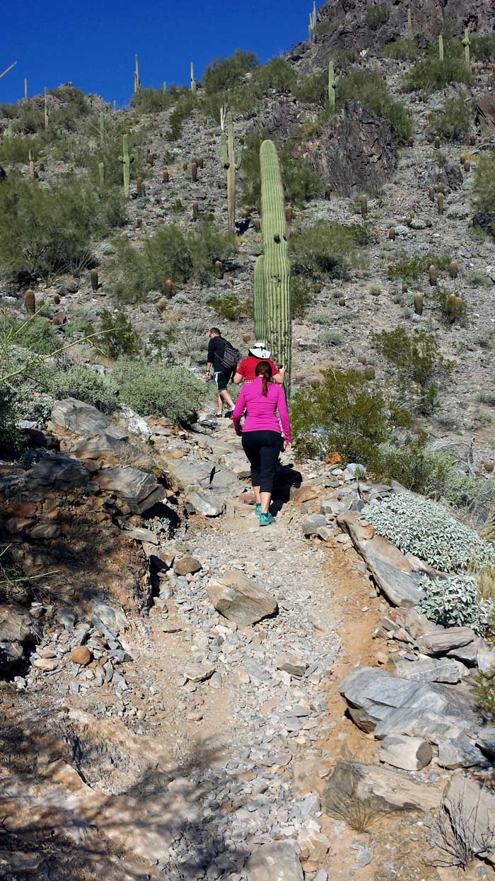
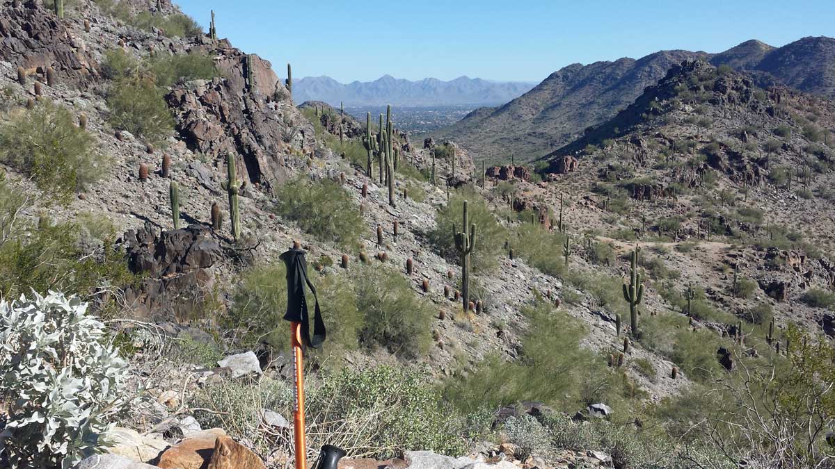

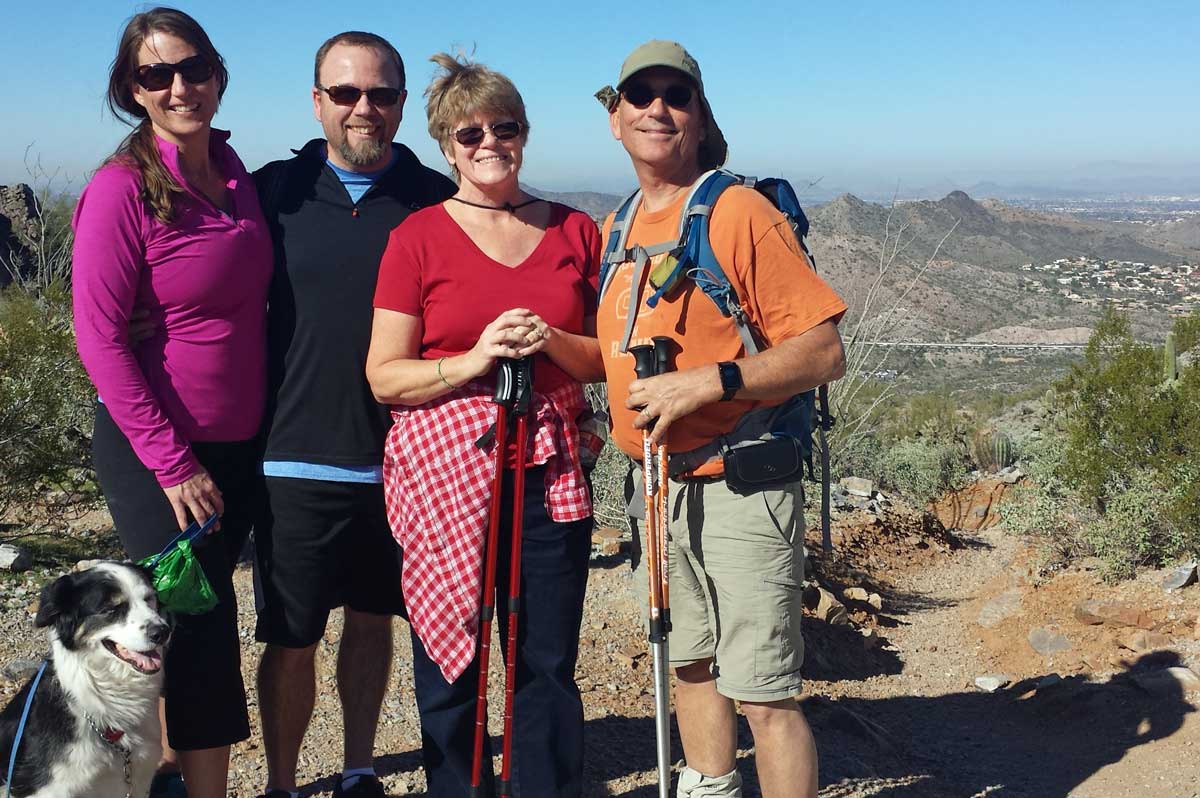
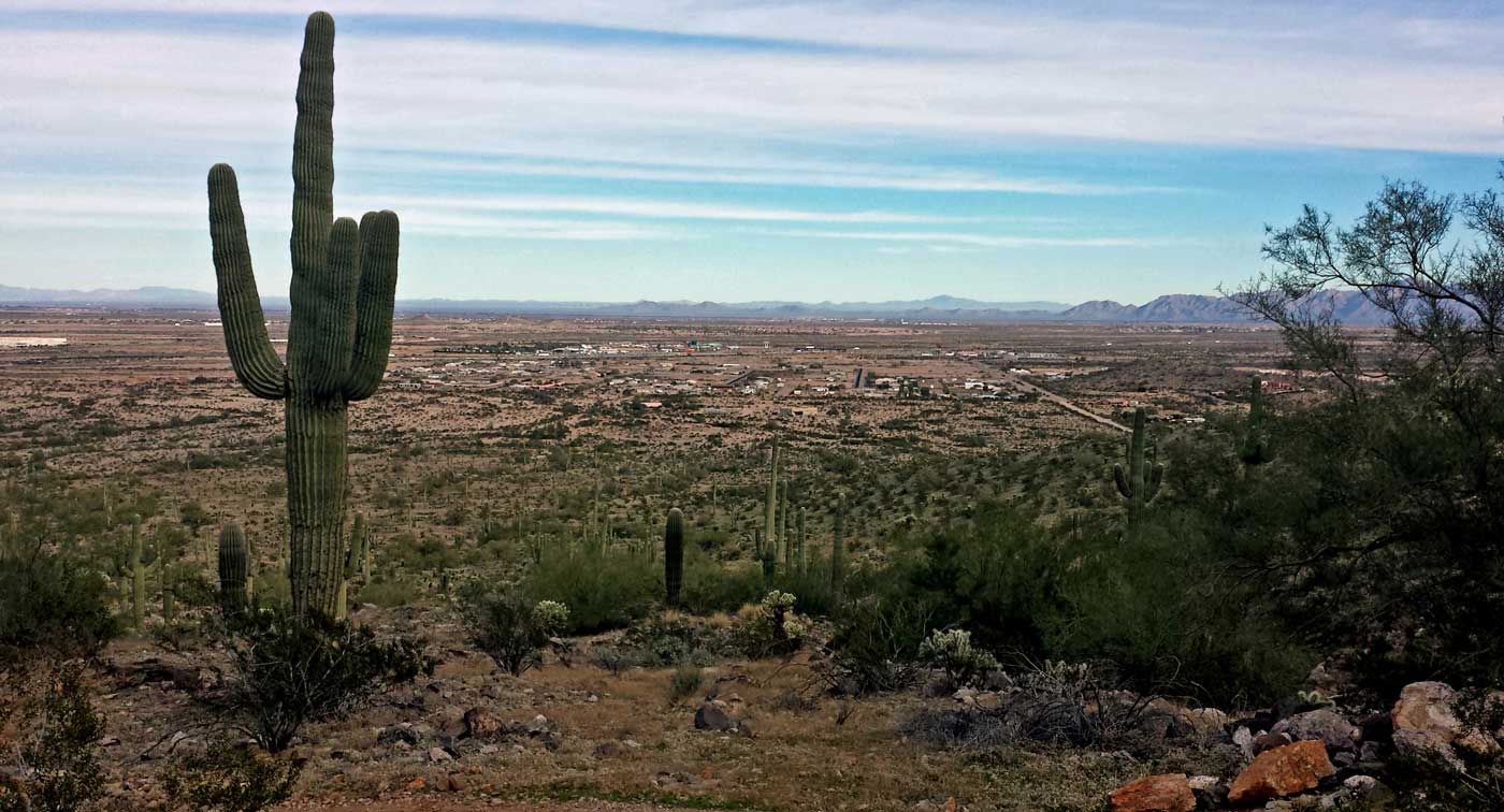

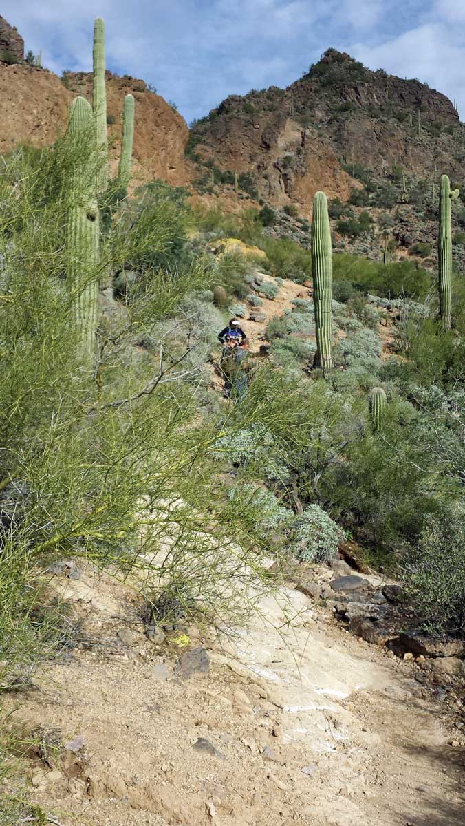
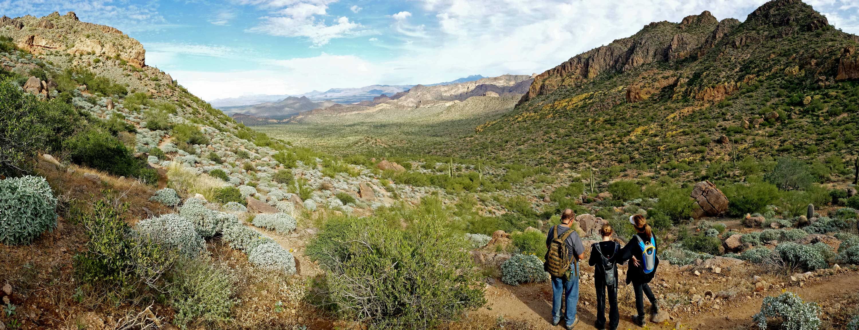


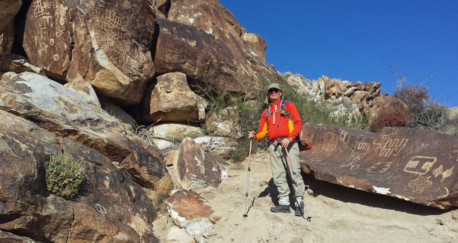
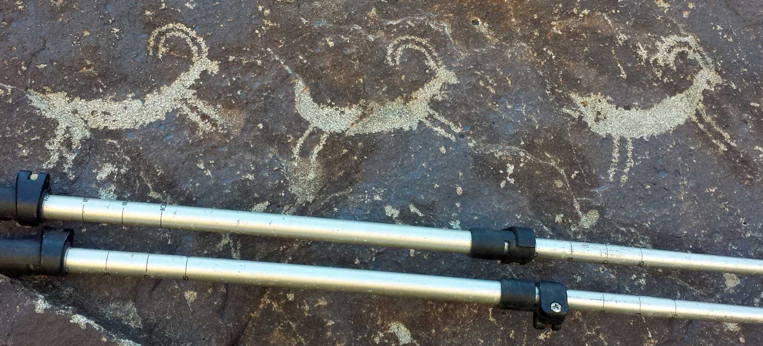
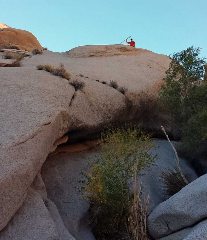
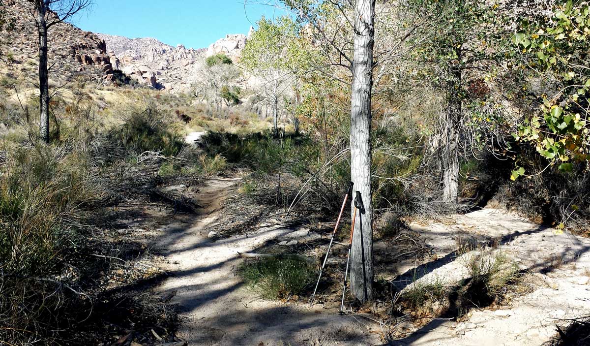
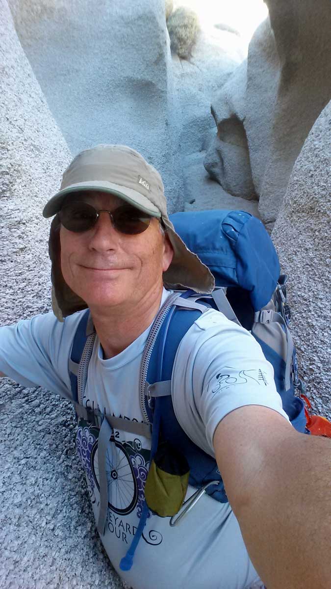

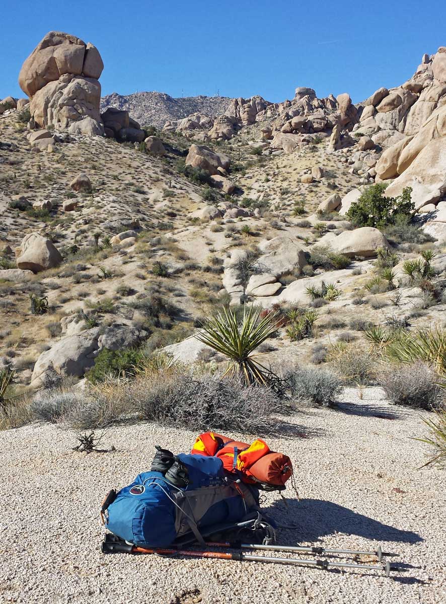
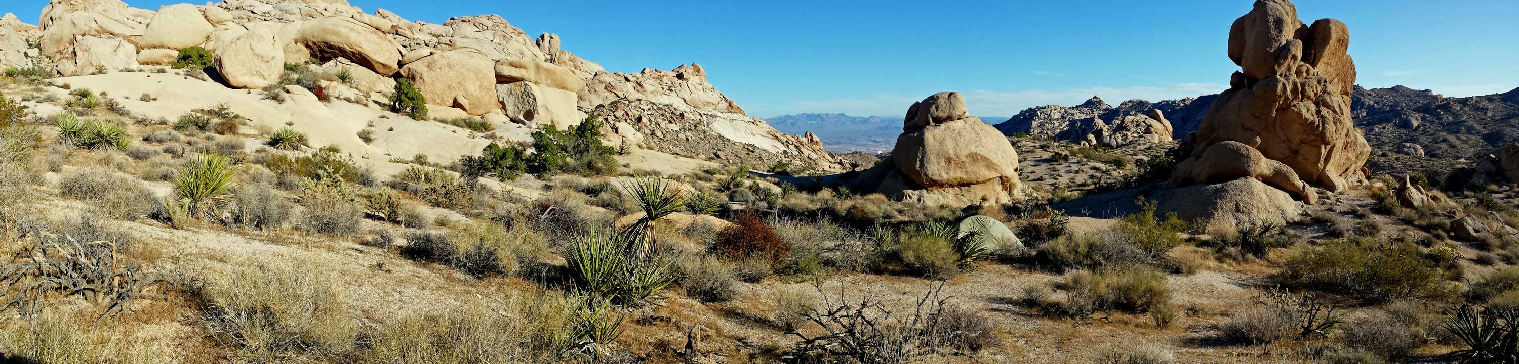
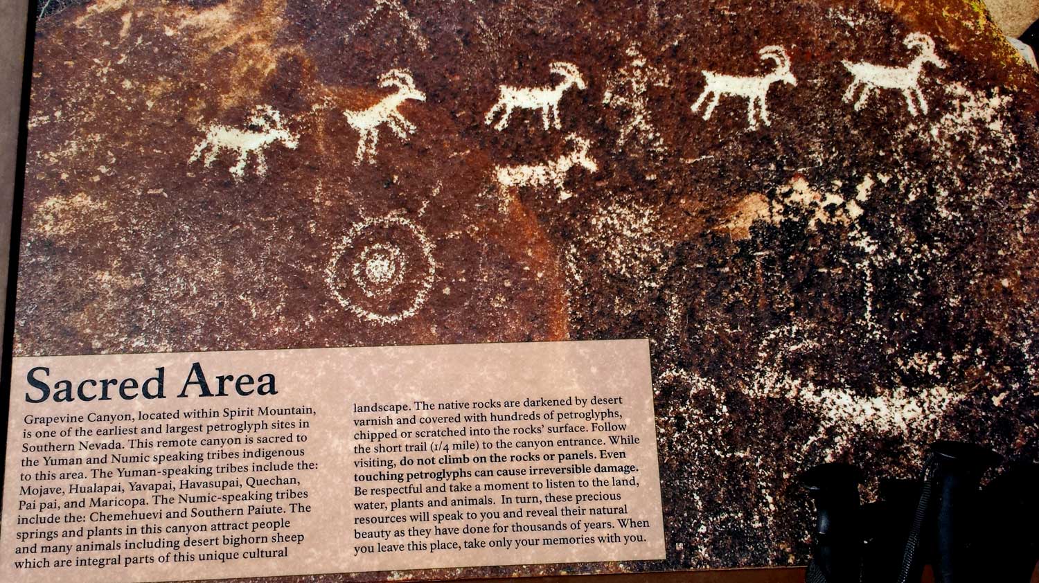 Thursday, December 11, 2014: On Tuesday, Gwen dropped me off at the trailhead of the Grapevine Canyon into the Spirit Mountain Wilderness Area. There are no maintained trails in this wilderness, but there is a good, short, trail to the petroglyphs. This is a sacred area for the first Americans and the petroglyphs mark the entrance to the canyon. A short hike beyond the petroglyphs and the canyon is blocked to easy access by a tall dry fall under a bolder. Access is gained by hiking the left side of the canyon over the blocked area. A faint trail continues up the canyon but soon disappears and the rest of the hike is bolder hoping, circumventing bushes, sinking into sand, slipping on decomposed granite but then finding a great slot canyon which got narrower as I continued deeper into the slot. At the end of the slot is a small ledge I used to climb out of the slot. The weather is nearly perfect with a slight breeze and 70 degrees and I have a great view of Laughlin and Riverside Casino from my campsite. This evening, I'm welcomed by an owl landing on a nearby rock and wooting at me for about an hour. About that time I notice the ISS (International Space Station) flying directly overhead. After it passed, I saw three other satellites flying by. I checked all against an airliner to be sure I was seeing satellites. I've seen the ISS many times before so knew it when I saw it. I forgot my earplugs so the breeze kept me awake for a while by rattling my tent, otherwise, the night went well. Wednesday morning was another perfect day with only a slight breeze. The best part of returning to the trailhead was getting to hike through the slot canyon again. The return off the mountain went faster than the ascent so I was at the trailhead before Gwen. I continued down the gravel access road but Gwen found me 1/2 mile from the highway. This is a hike I would never have done without the SPOT. Anyone following my SPOT page would know my location so I felt "found" even though there was no trail and no other hikers in the area. Click the photos for additional views.
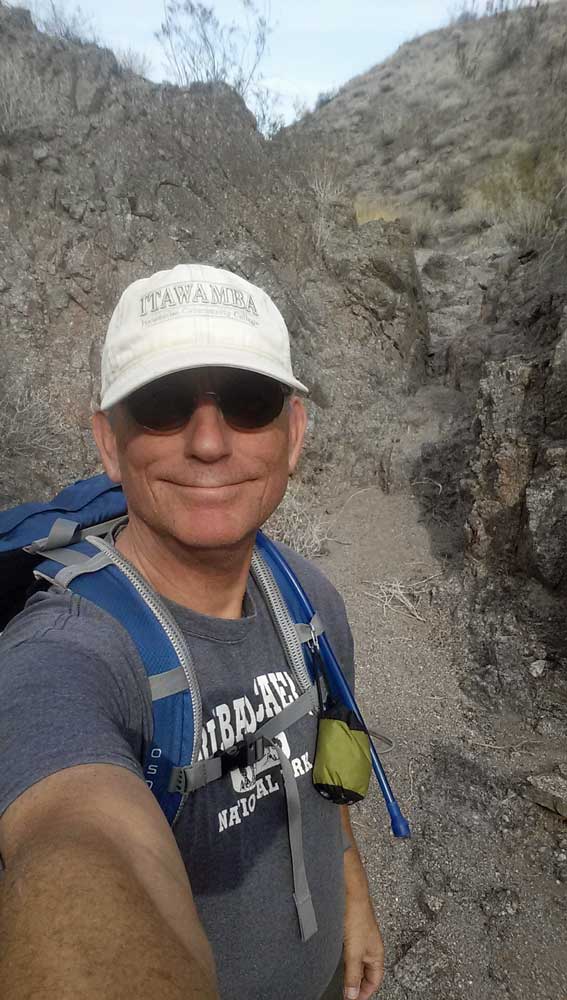

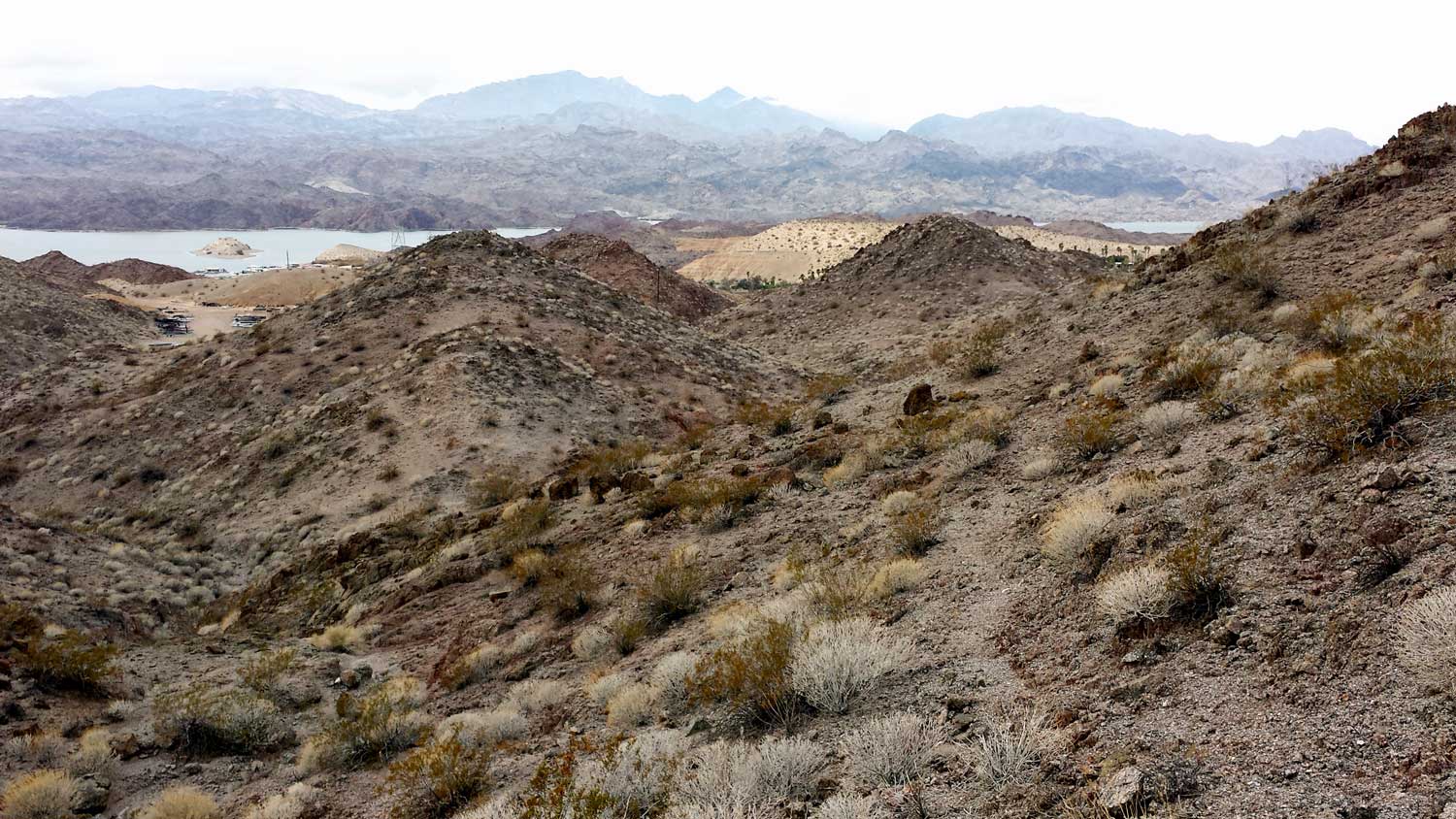

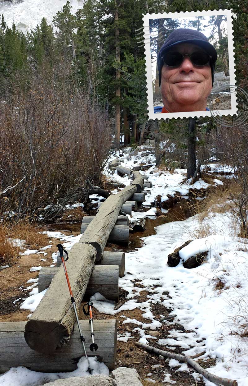
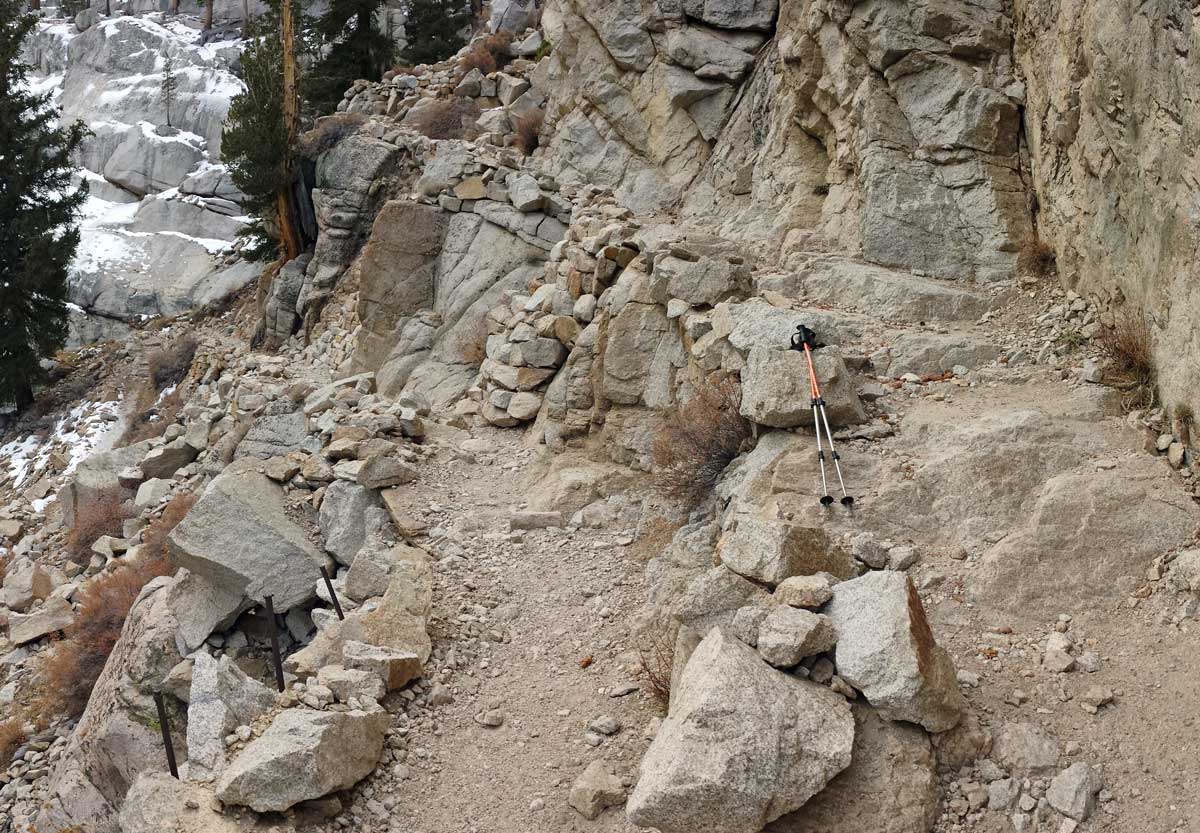
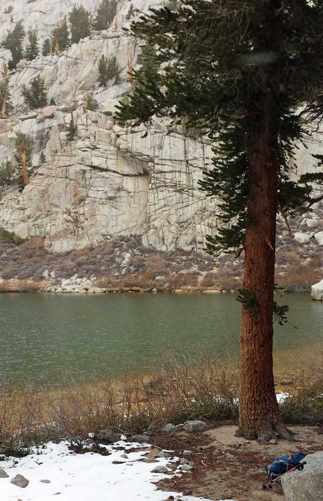
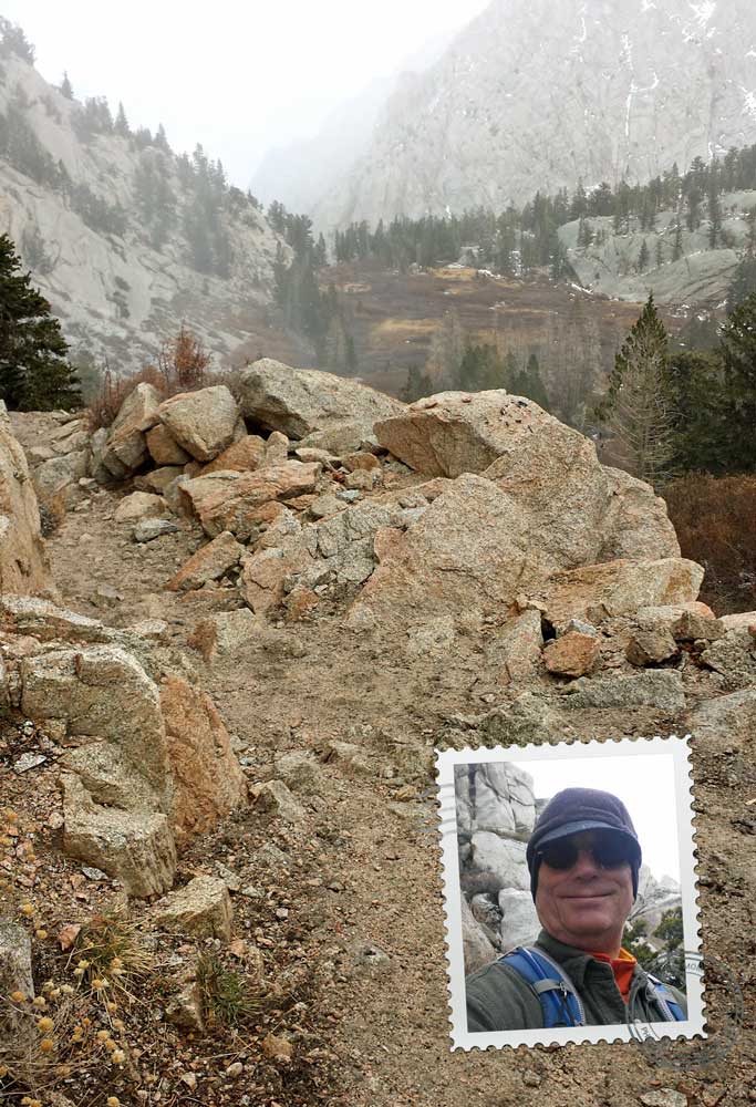
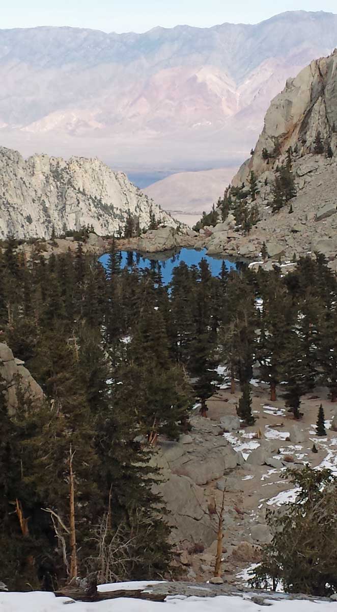
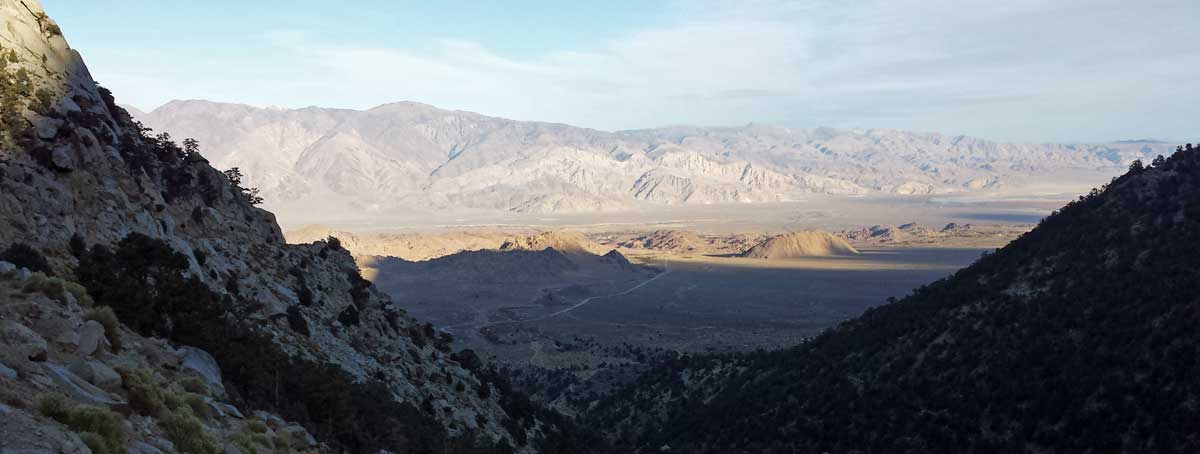 Thursday, November 13, 2014: Today was a serious hike on the Mt. Whitney Portal trail. This trail is 11 miles to the summit of Mt. Whitney, so 22 miles round trip and many hikers do it in a day. That would be 6,100 feet of climbing from the trailhead. I am not even close to that fitness. I climbed until lunch at Mirror Lake, 10,686 feet, so 2,300 feet of elevation increase. I was ready to turn around at that point. When I picked up my permit, I was told NO pooping in the wilderness, the hiker must carry out any poop. I was also told, bear spray is not allowed, certainly different from Yellowstone where bear spray is recommended for every trail. As I climbed from the trailhead at 8,300 feet, I was climbing into increasingly bad weather. It became colder, overcast and snowing. I met about 15 backpackers either coming down the trail or climbing. I also met 8 day hikers like myself. I would certainly be tempted to backpack and spend the night but I would need a warmer sleeping bag. You can see in the photos I had to add layers as I climbed higher. I still had two more layers I could have added but didn't have the need. The backpackers descending the mountain were dressed considerably warmer than I was so it must have been much colder at the higher elevations. This was my first hike where I was considering the need for micro spikes. Six of the backpackers were still wearing theirs as they descended past me. My assumption is, they would be mandatory for a climb to the summit. Before this hike, I had no desire to summit Mt. Whitney but now that's changed. I can't see hiking it in one day however. Click the photos for additional views.
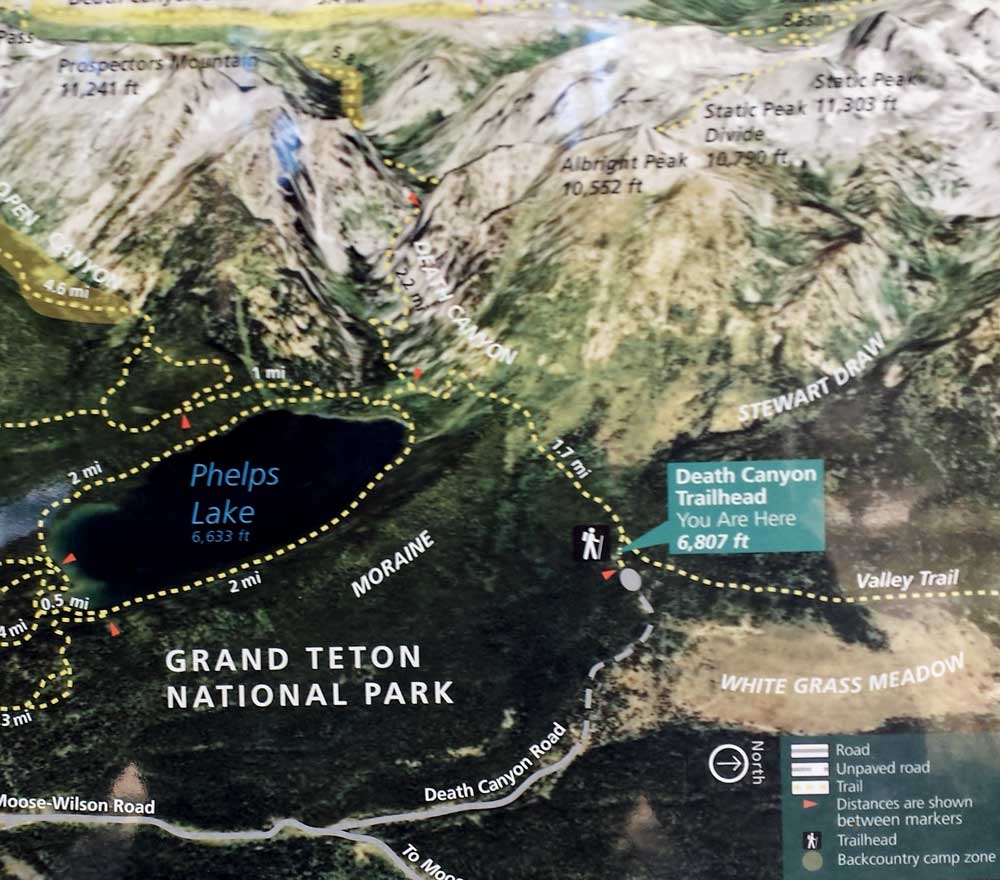
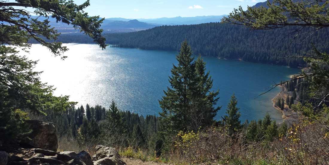
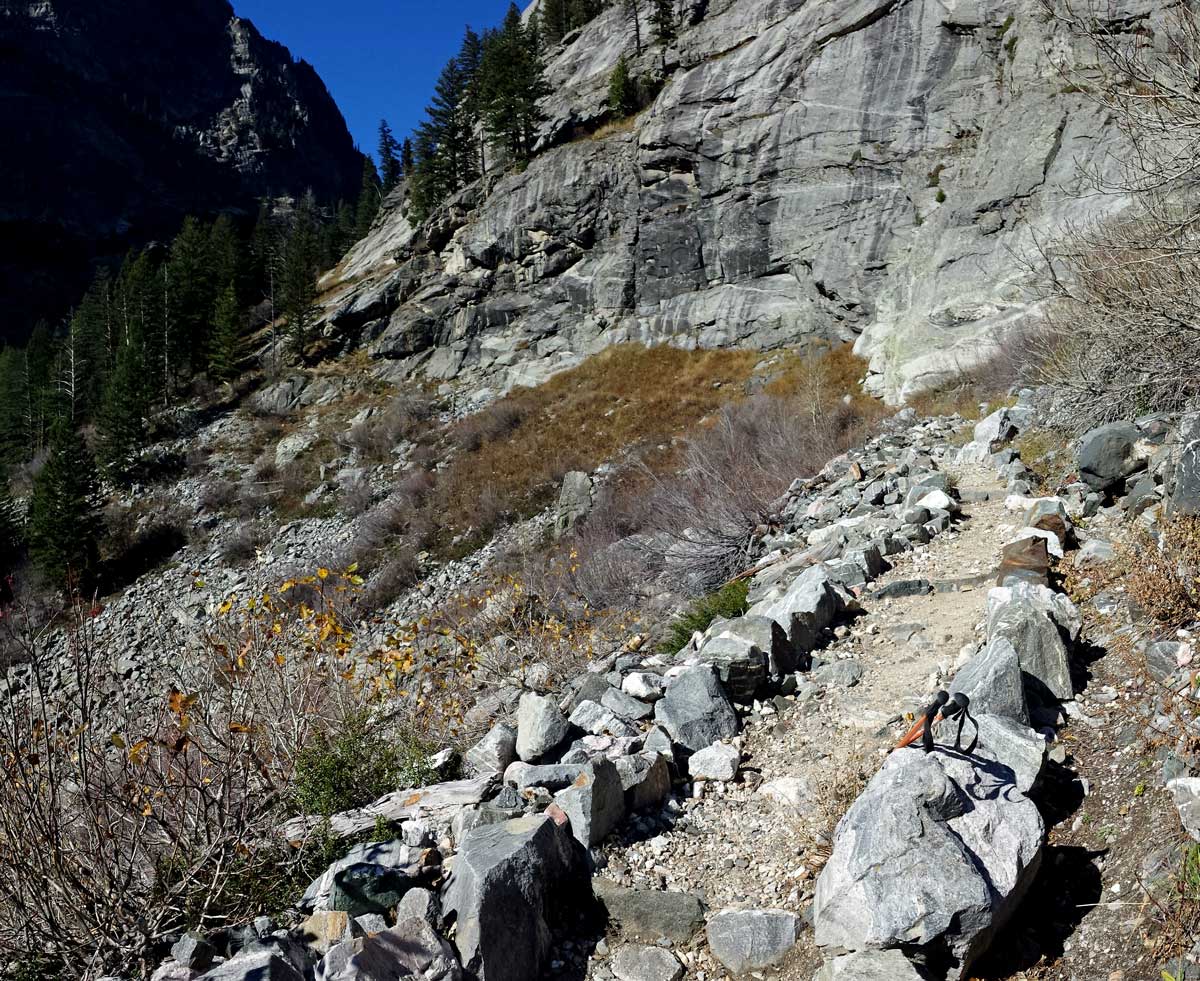

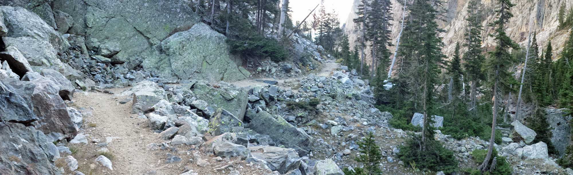
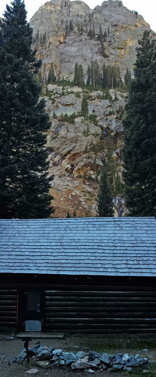
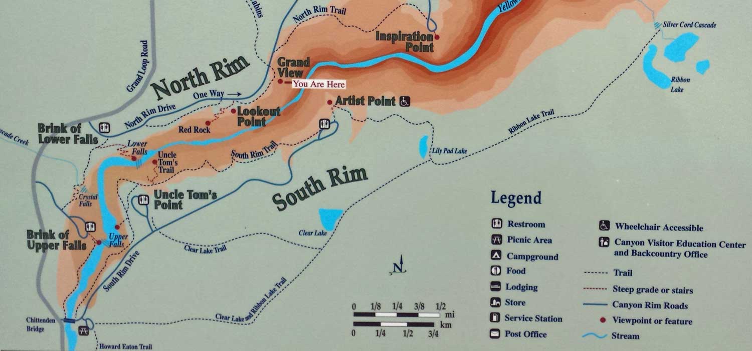
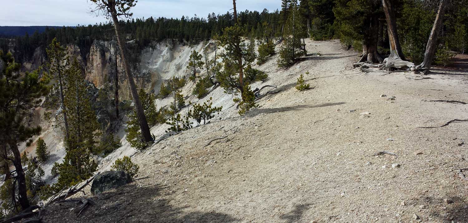
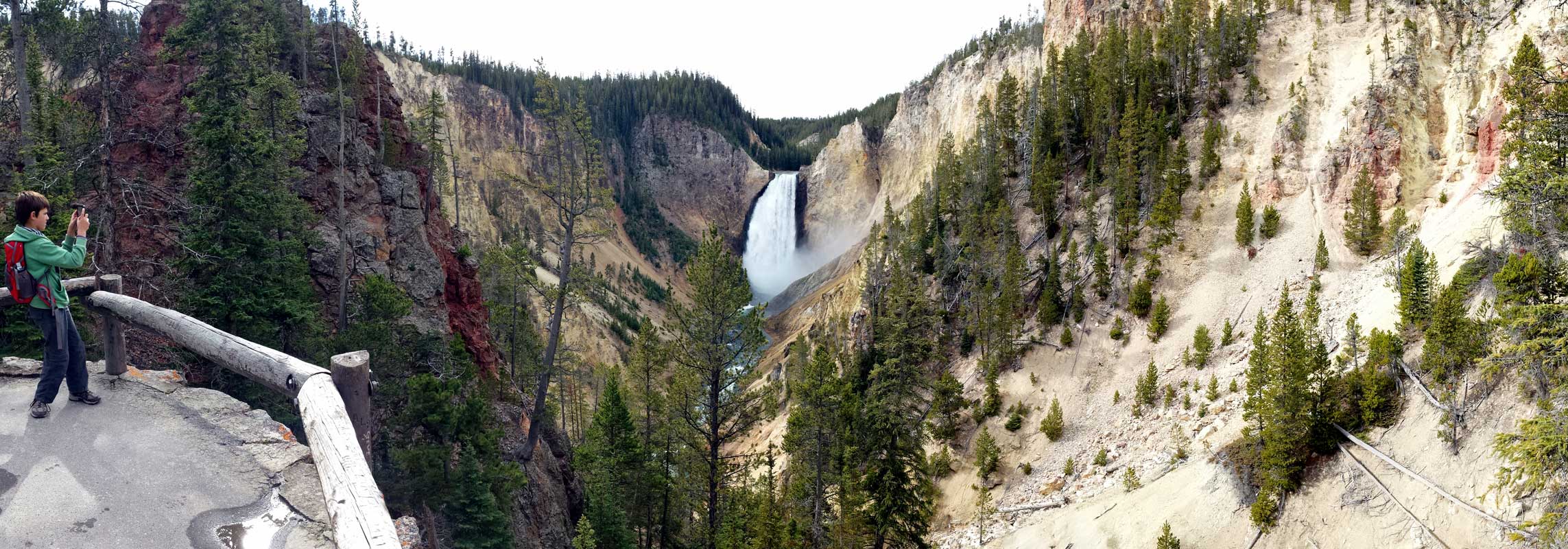
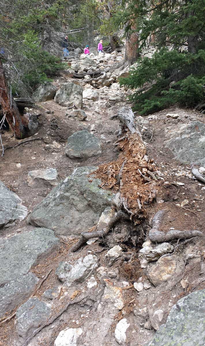
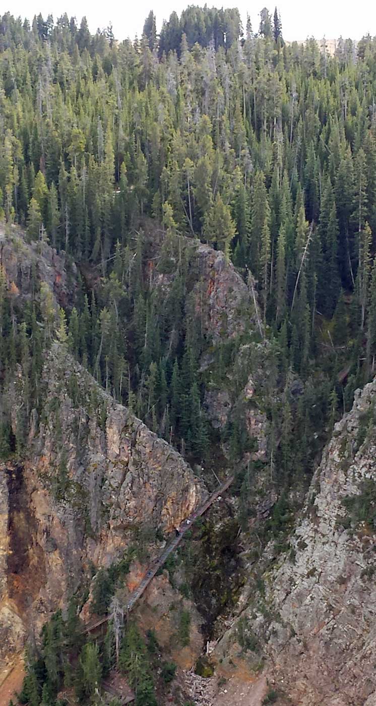
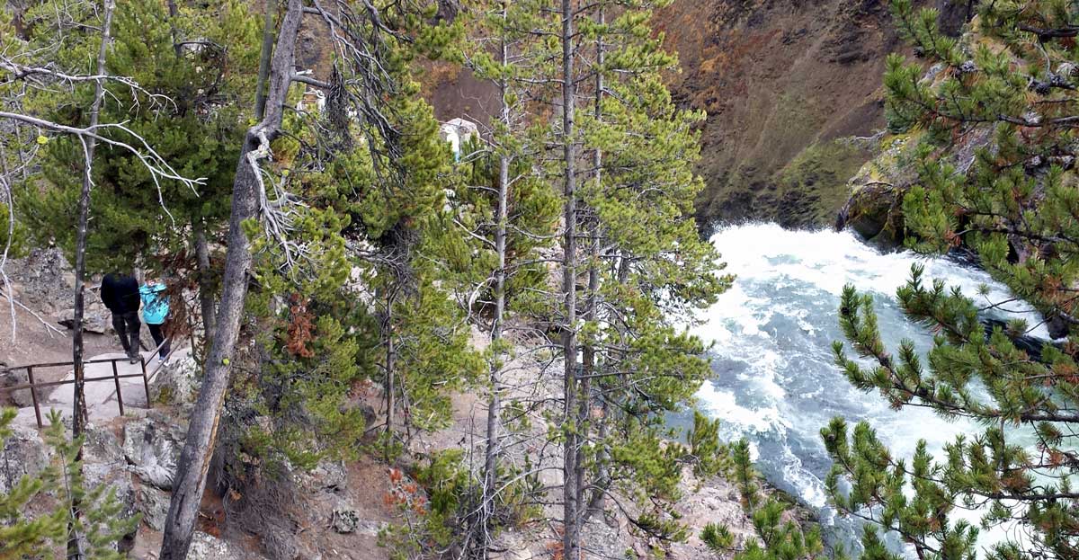
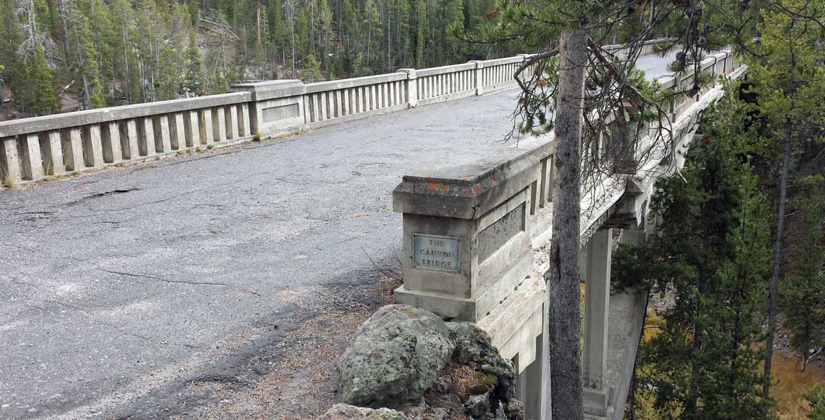

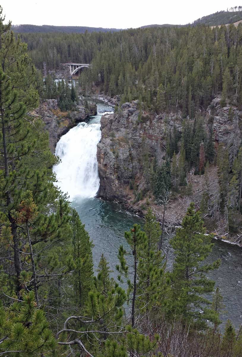
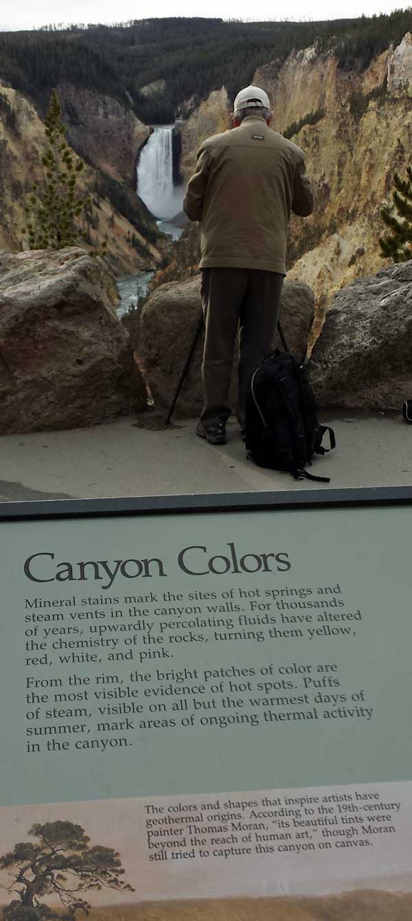
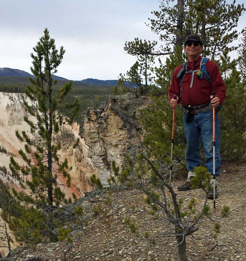
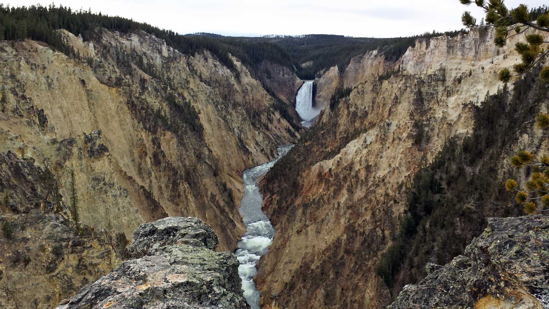
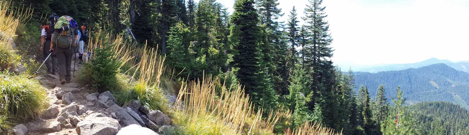
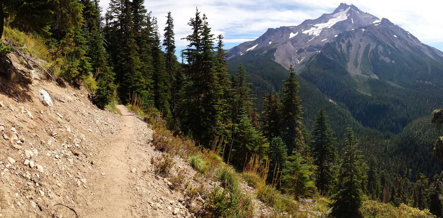

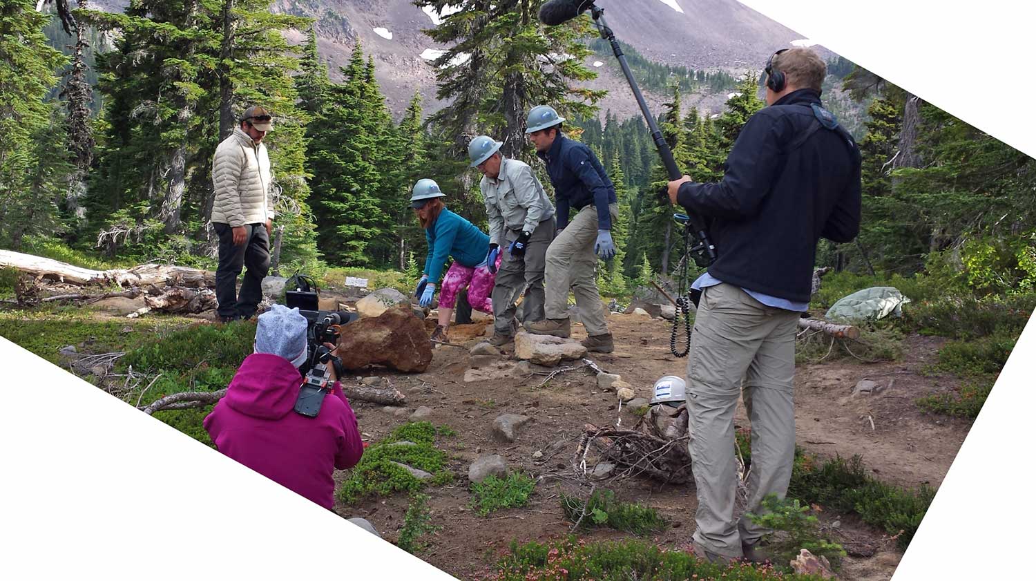
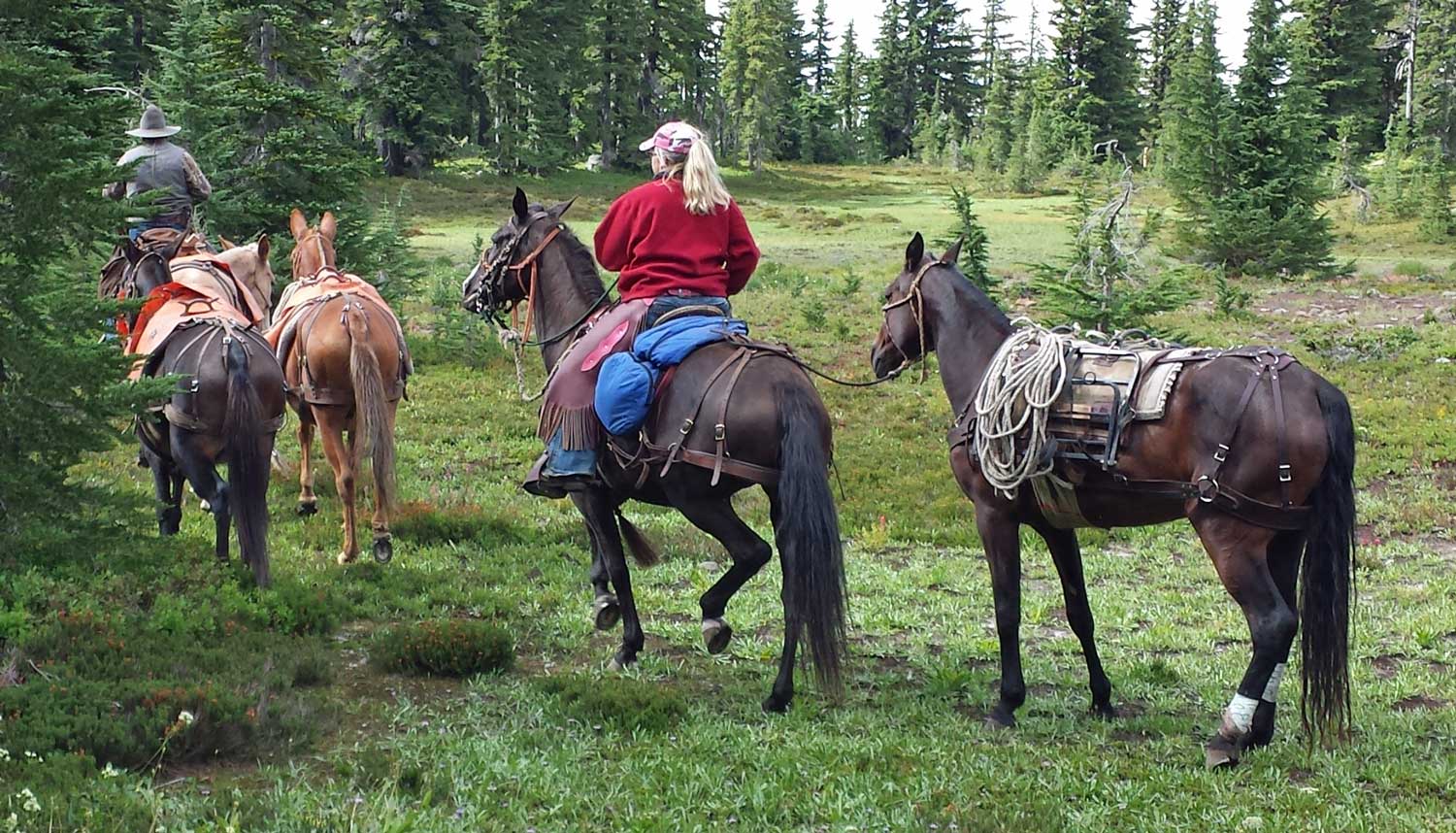
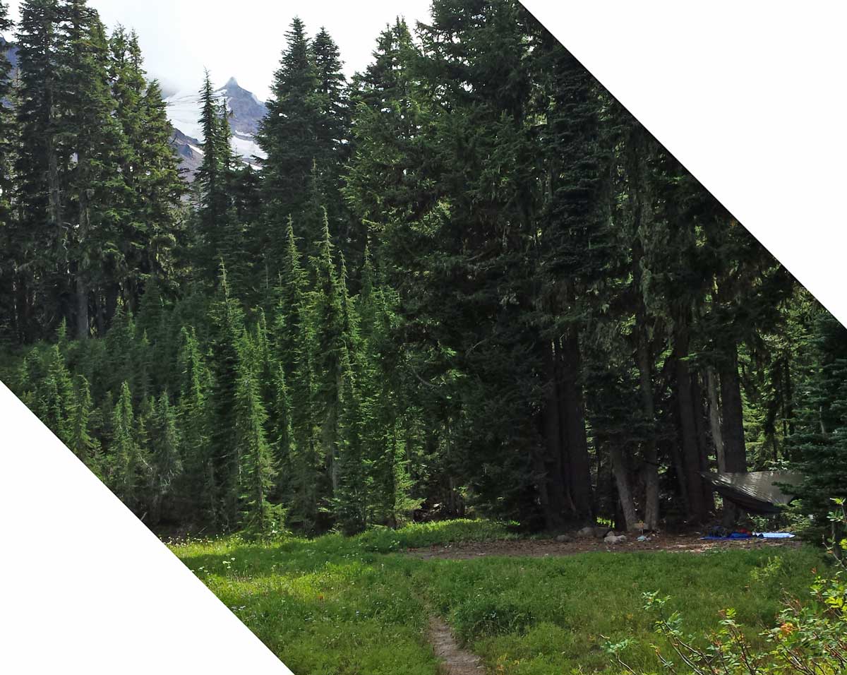

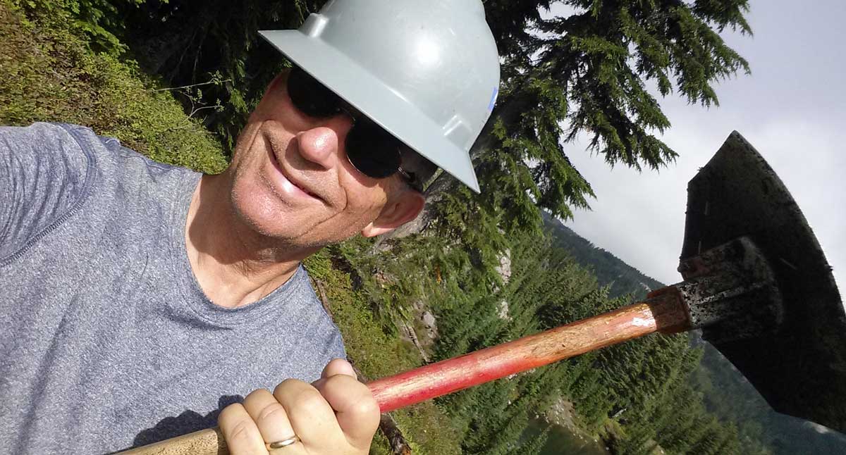
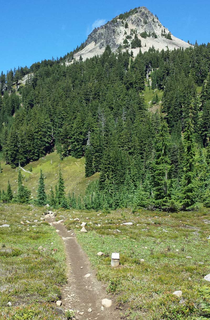
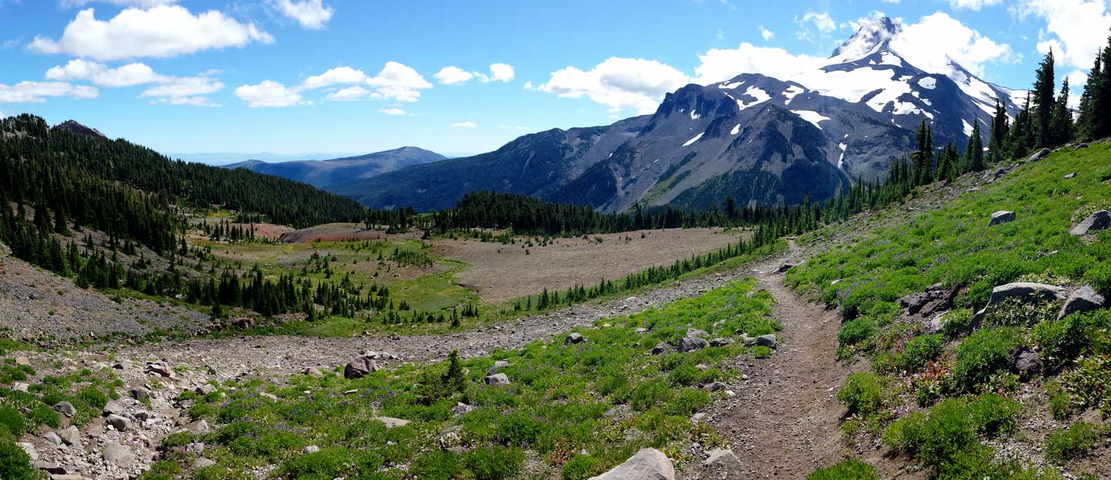
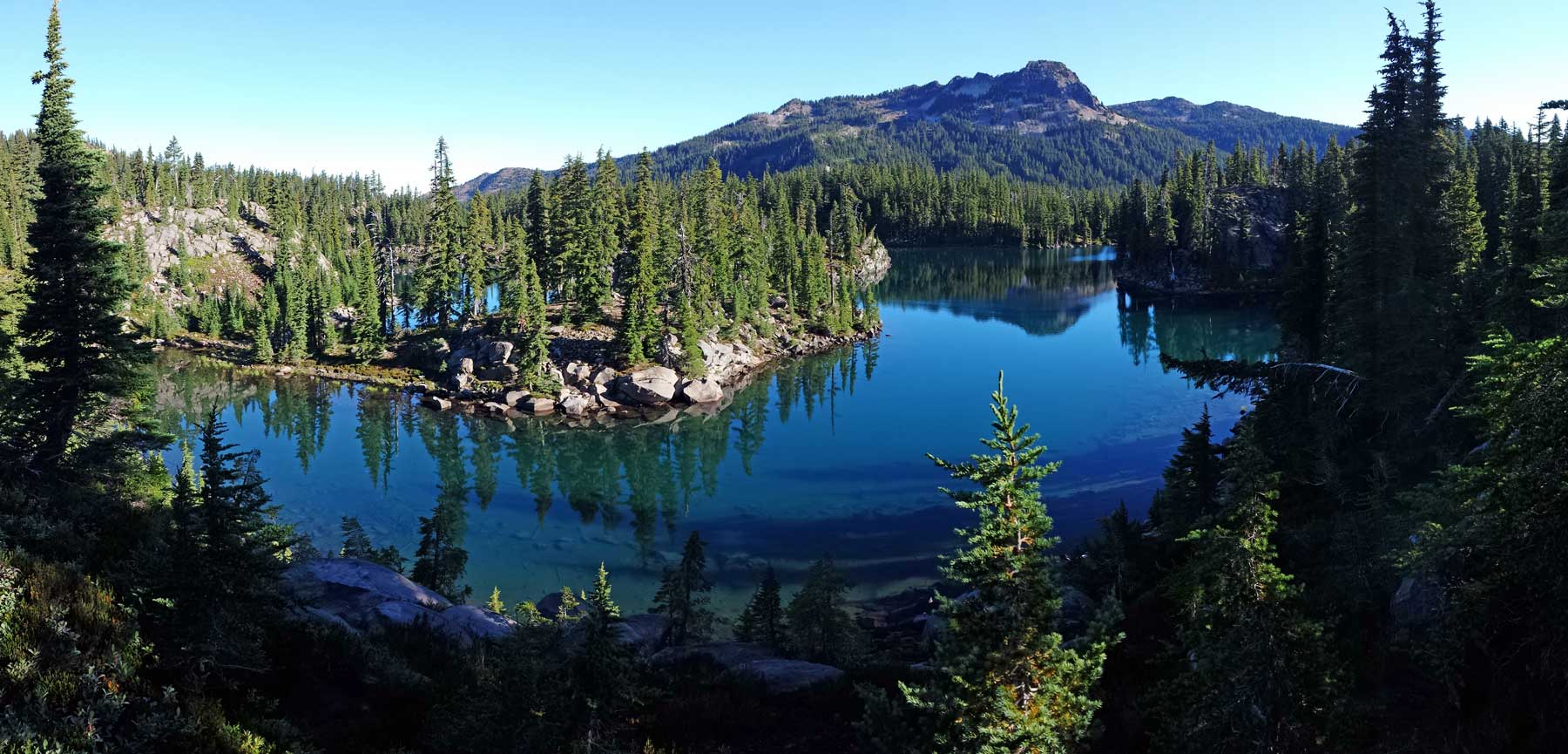

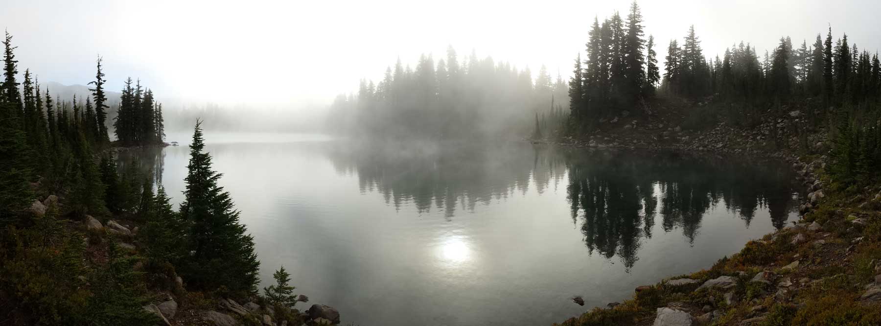
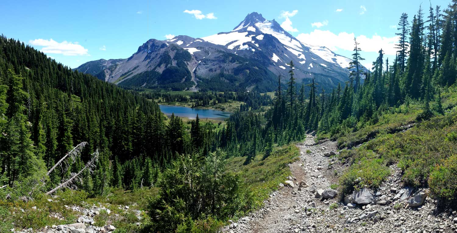

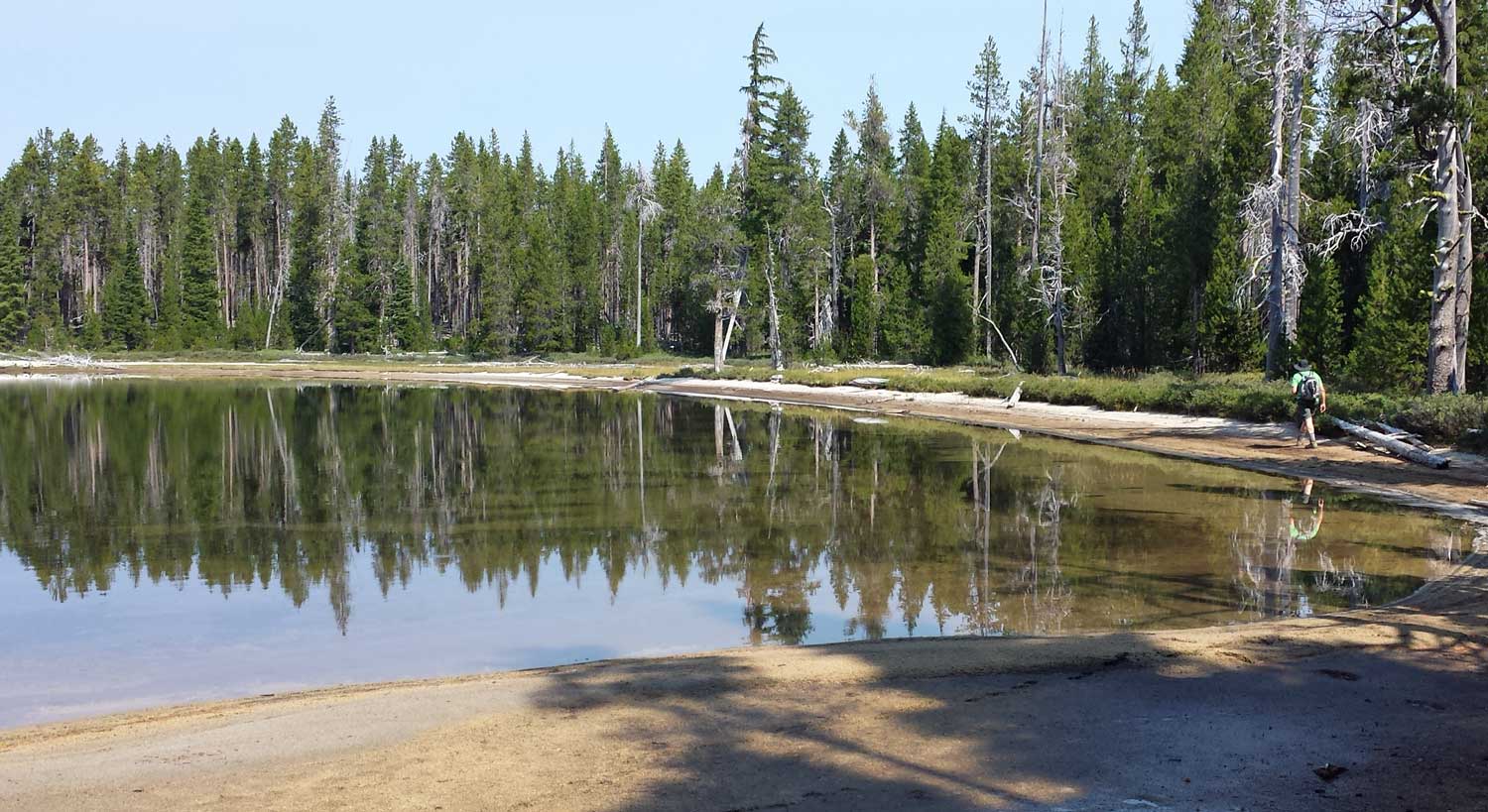
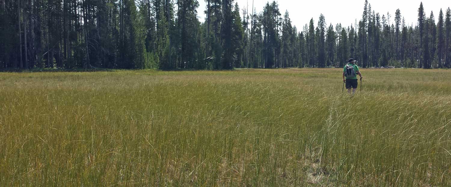
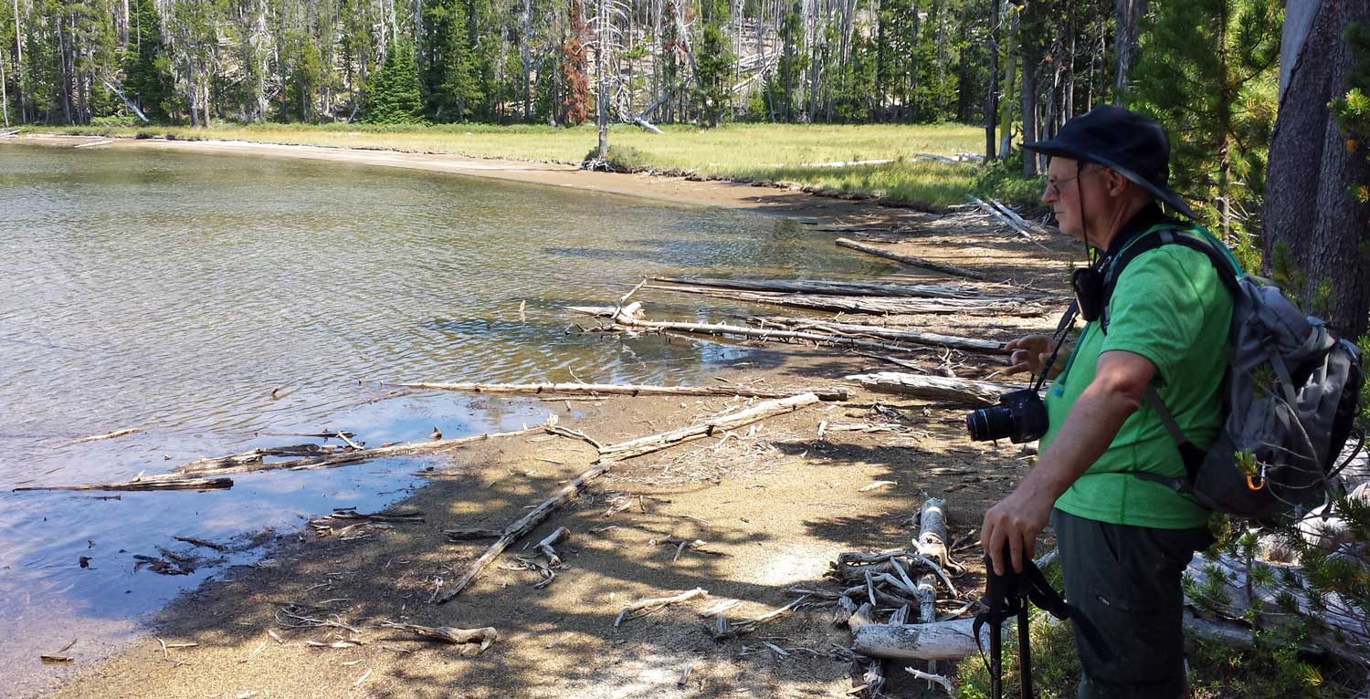
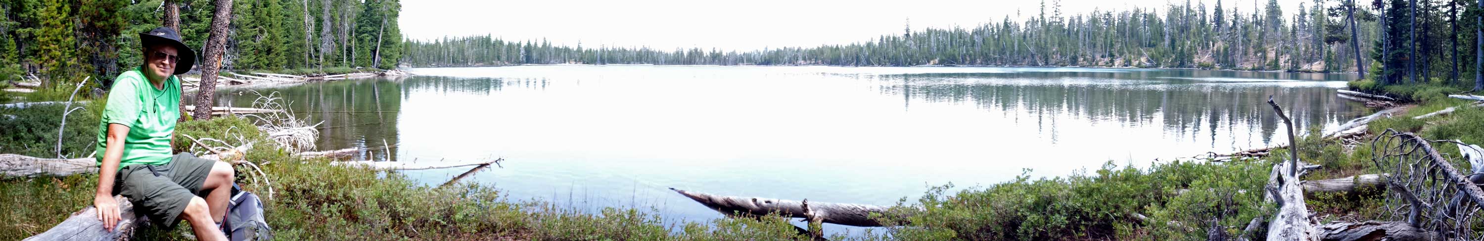
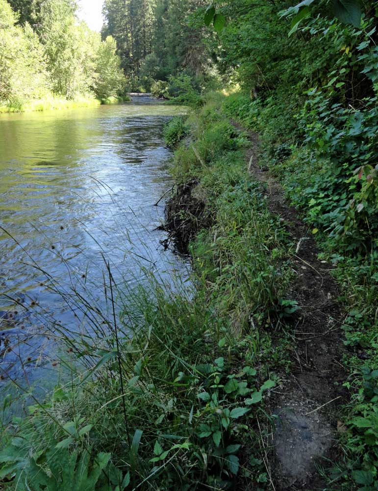
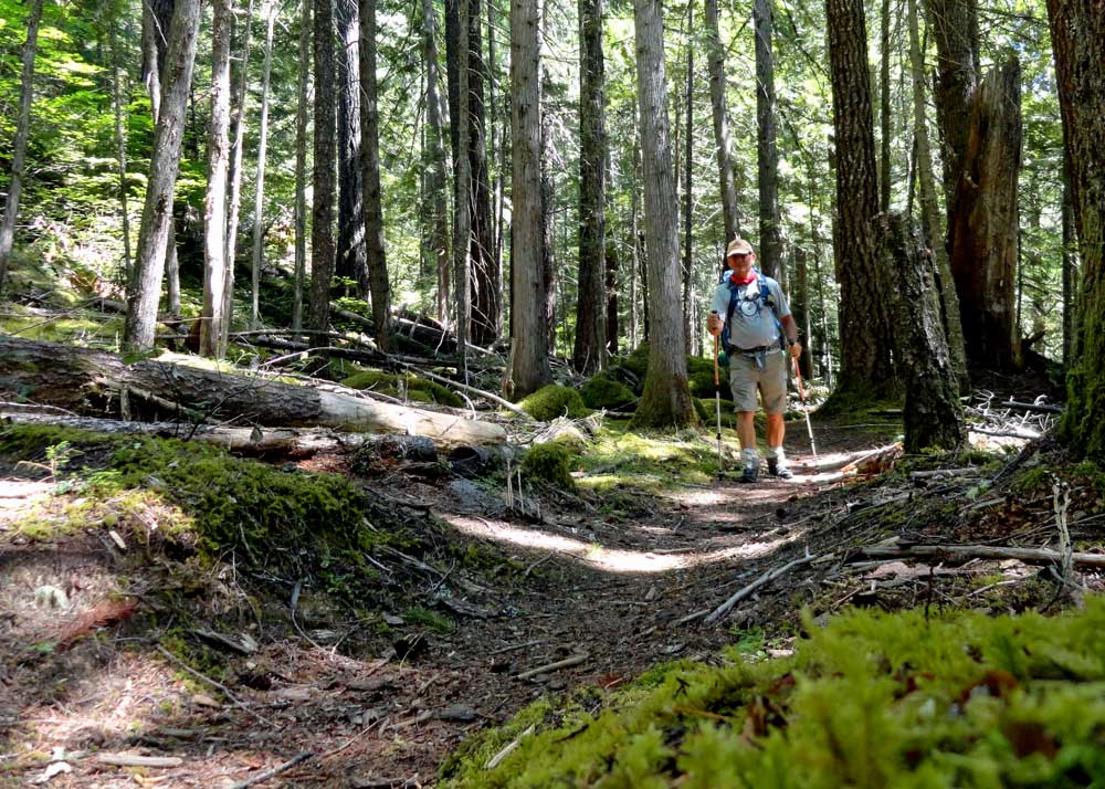
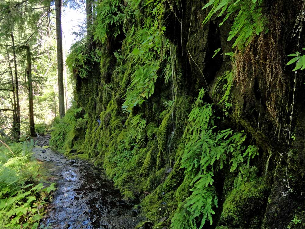
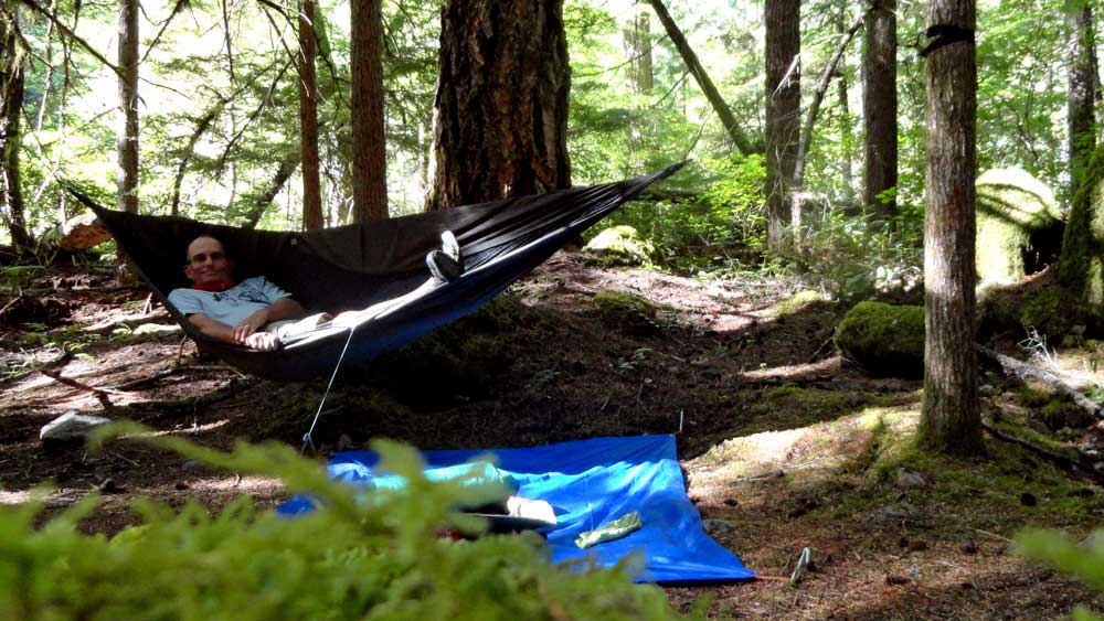 First hiking day: I did not get an early start, probably on the trail by 10:30 am and dreading the warm hiking. As it turned out, 95% of the trail in this first section is cool and in the shade both because of the river and the canopy. My first lesson came from a missing bridge on the trail. There were bridge ramps on both sides of the river but no bridge and no alternative in sight to getting wet in the crossing. I hiked up-river looking for a dry alternative. After thirty minutes, I was STILL looking for the dry alternative and finally just walked through the water, something I could have done at the missing bridge crossing. Now I had to fight my way back through heavy brush on the opposite side to the trail. I would have saved time just crossing at the missing bridge and saved my mattress. Somehow, the mattress got punctured in the fight through the brush back to the trail (see photo below). I was surprised by the amount of water coming from the side creeks and springs since we are in a drought. Four miles into the hike was the hot springs area. This was very busy with car campers, day hikers, backpackers and bike riders. I had no intention of trying the hot springs advertised at 108° because we never kept our hot tub higher than 104°. I also did not want to wait in line for a time in a "public" hot spring. The "Dread and Terror" section of the trail begins at the hot springs. Again, the first five miles of this section was very wet. I chose a private area where previous hikers had camped for my night camp. My hammock was a little close to the river so I had to use ear plugs. I was surprised in the middle of the night when I got up to urinate. Something bit my toe while I'm standing on the edge of the ground cloth. I shined my headlamp toward the ground and saw thousands of black ants off my cloth. None on the cloth (except the ONE which took a bite on my toe), but thousands on the ground. The next morning, no ants, just like it was when I set up my camp. On the way out the next morning I took an old T-shirt, tin can and candy wrappers (left by previous hikers) with me. Click all photos in this report for additional views.
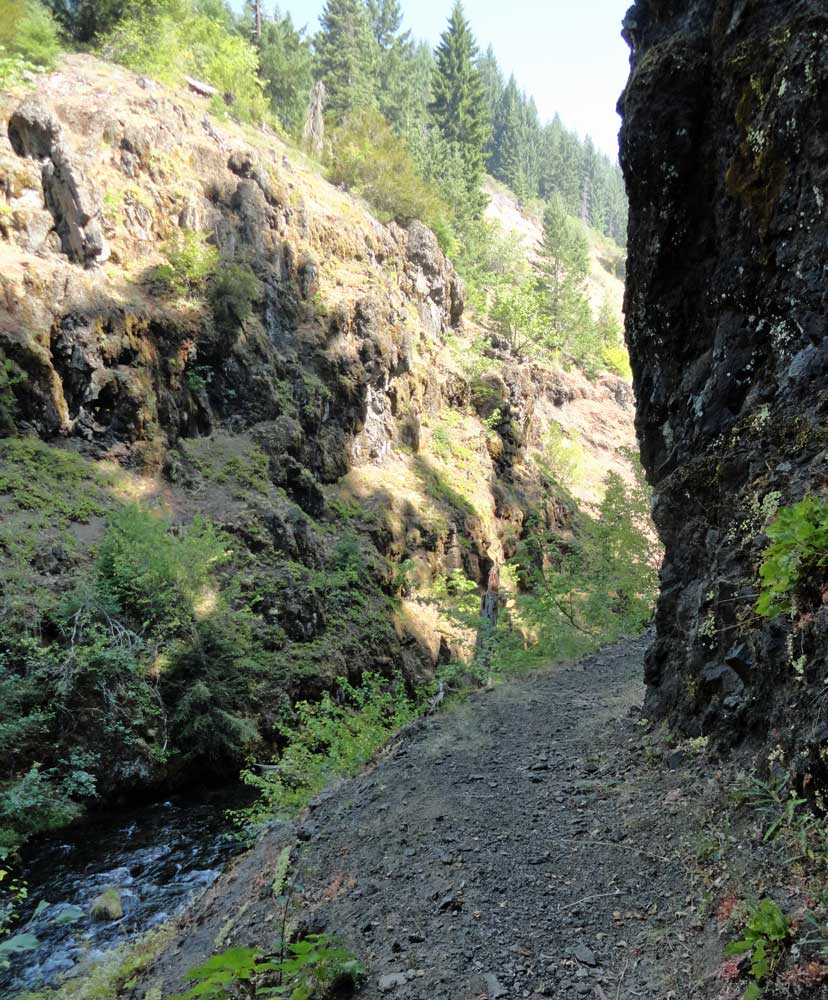
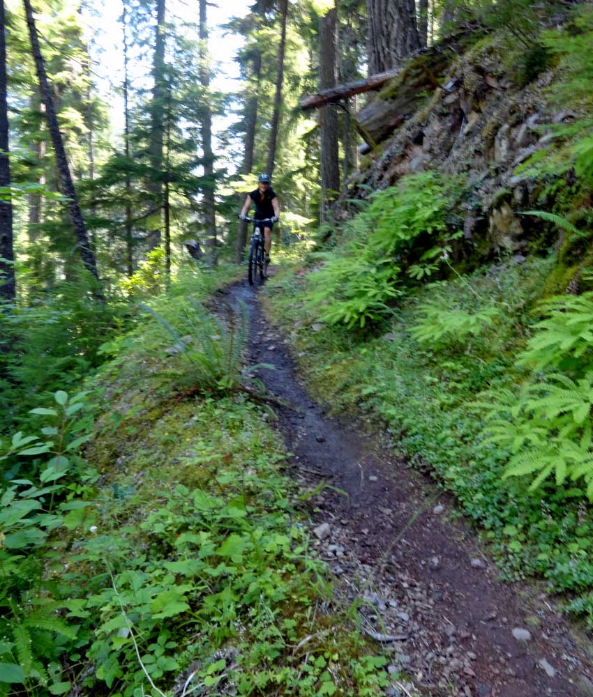

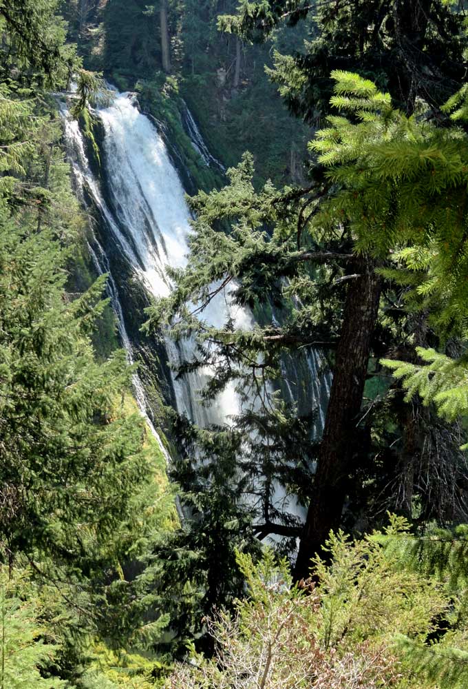
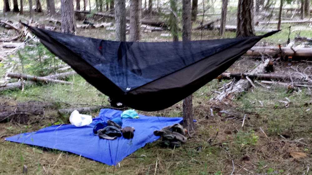
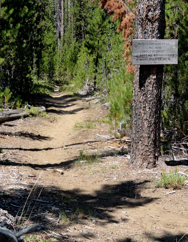
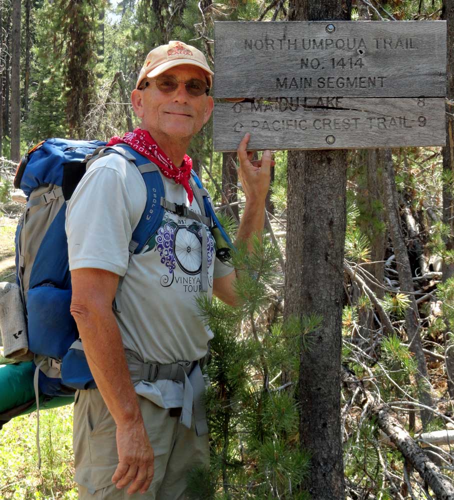
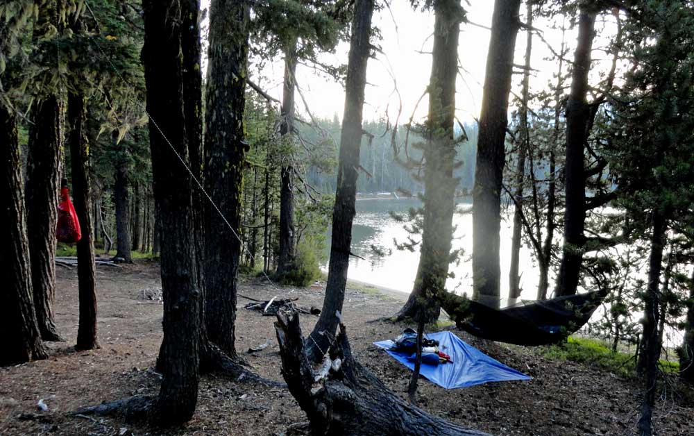

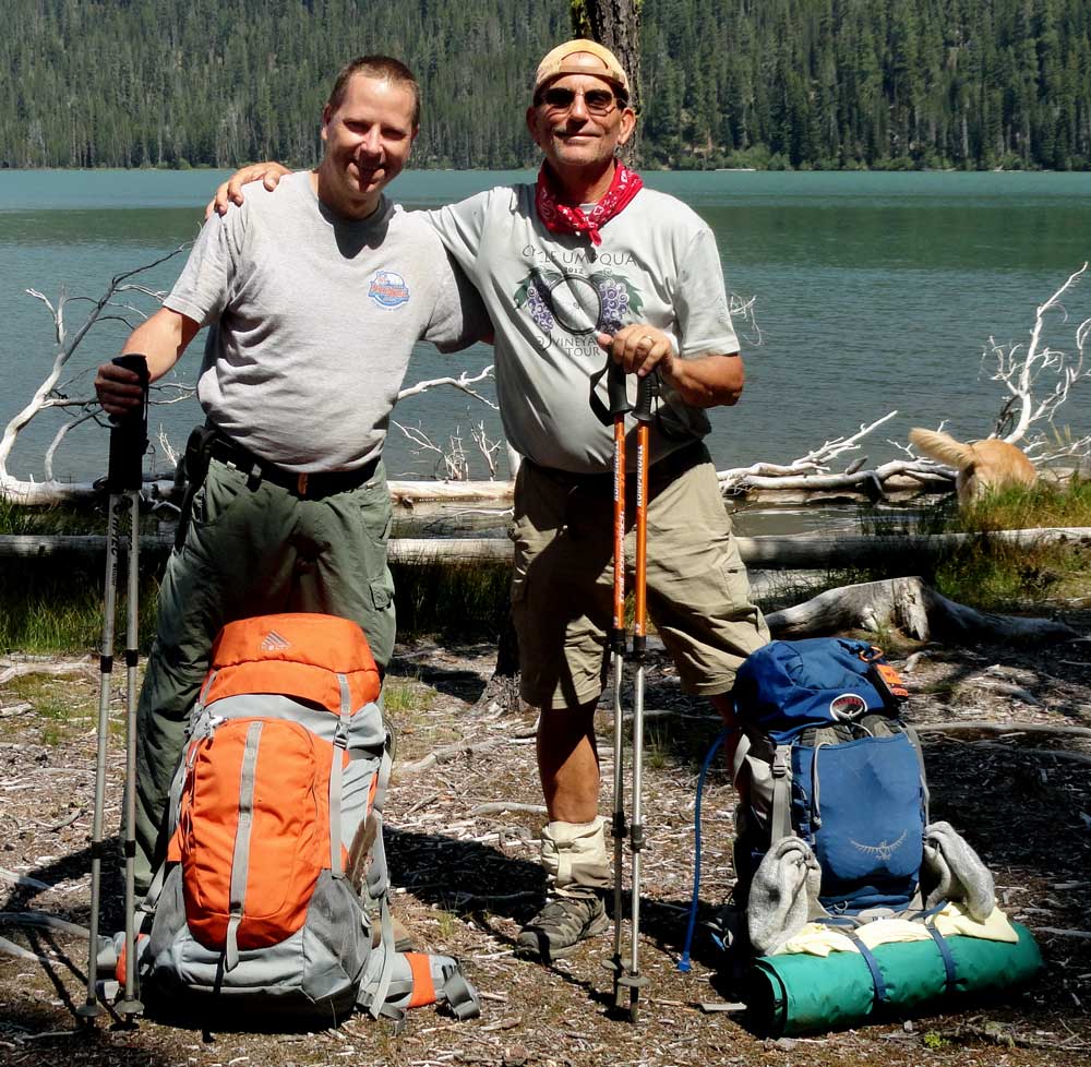

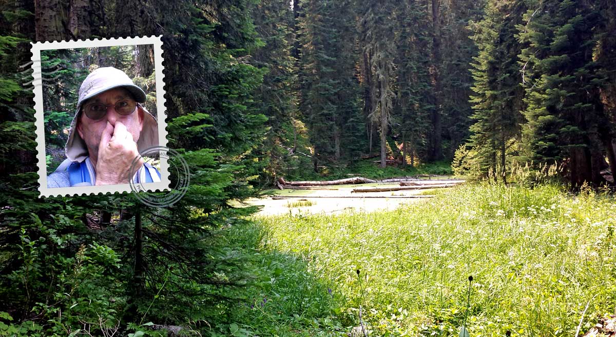
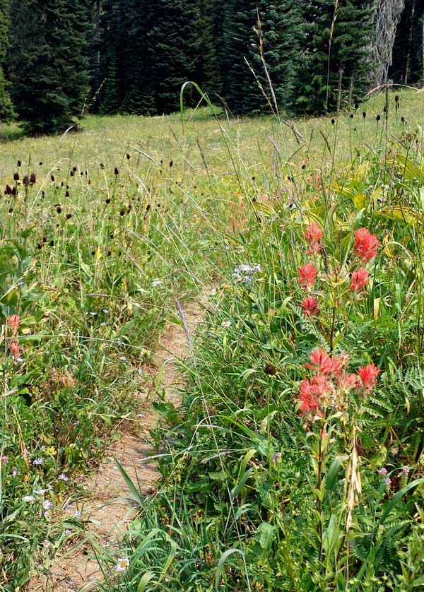
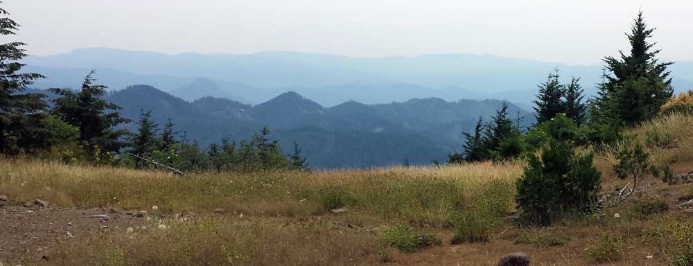
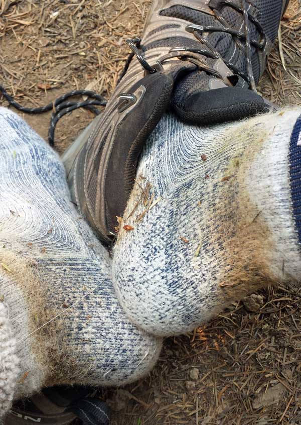


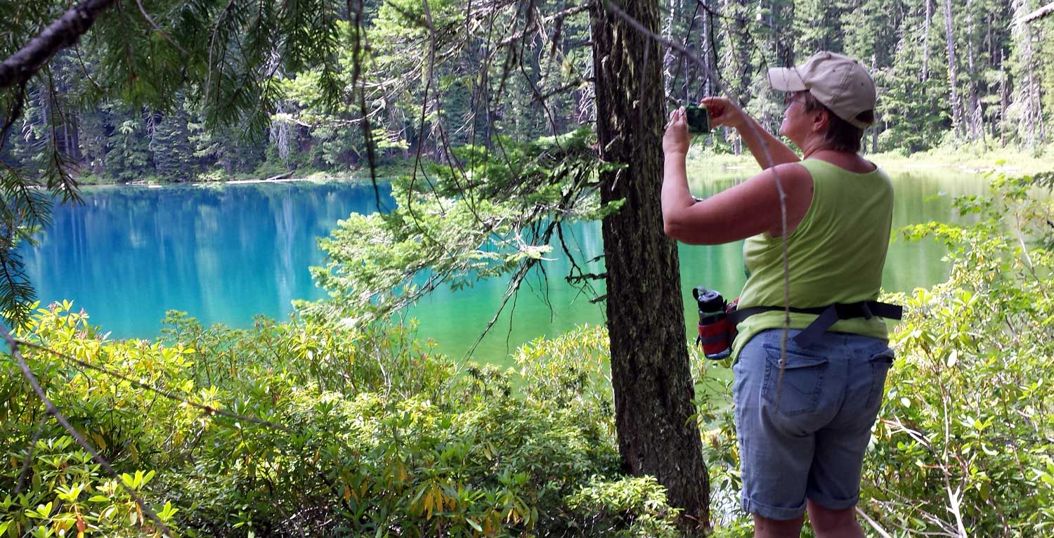
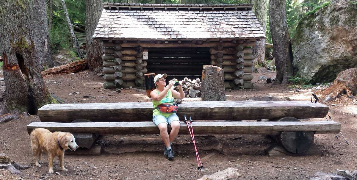

 Saturday, July 19, 2014: I returned to Winchester in time to make the breakfast event at the Winchester Community Center. I must have arrived just after the rush because the room was full (click the photo) and the breakfast orders were backed up .... and they were out of coffee. I was patient and got my fill of blueberry pancakes. I took Morgan back to the trailer and then took myself on a ten mile hike to make up for the short hike on the north Umpqua Spit. This time I hiked to the south from the south Umpqua jetty. It was the same endless beach with huge sand dunes away from the water where the dune buggies were playing all day today. I hiked far enough to hike into the fog. My hat is reversed because I was hiking into a 25 mph wind on the return north back to the parking lot. I was thinking that all hikes would be easy compared to the hiking I did on the John Muir Trail and felt ten miles on level beach sand would be a "piece of cake". However, I was humbled by the quickness of the hike (about 3 hours for the ten miles ... we took 8 hours to do our days on the JMT), and by the ferocity of the wind on the return. I was exhausted. I did carry a pack, even though I did not plan an overnight.
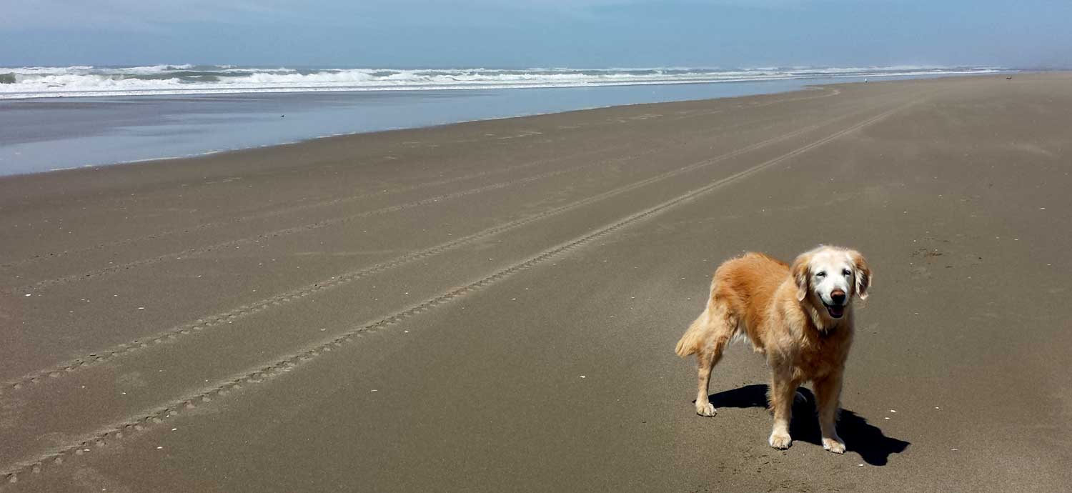
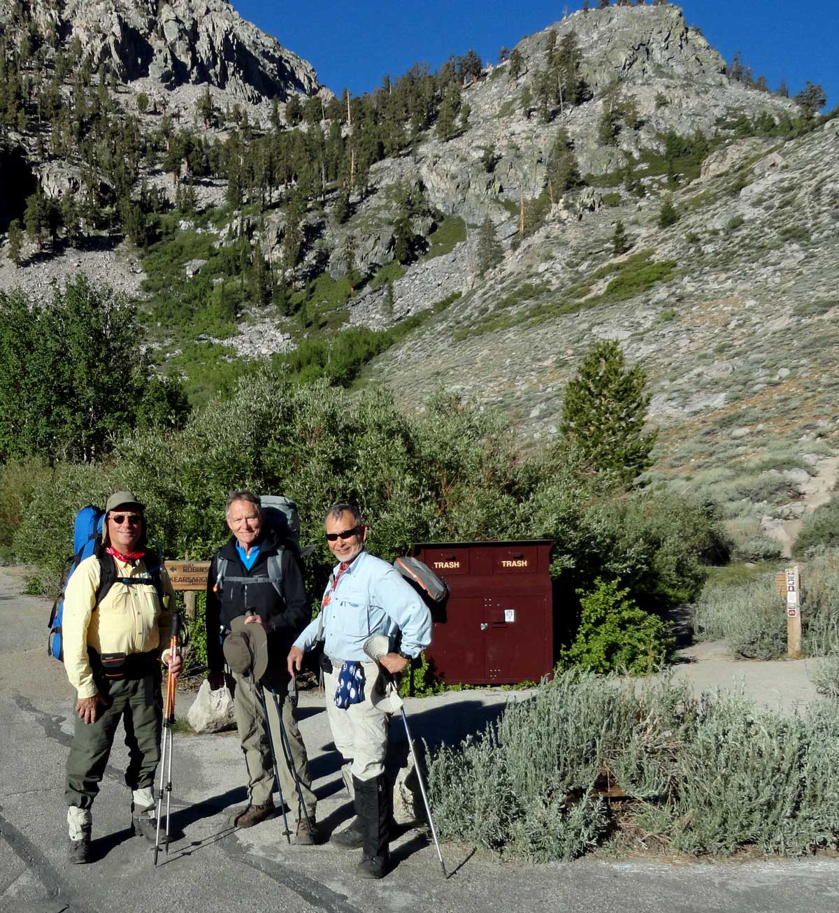 The trail for us began at the Onion Valley Campground, west of Independence, California. This campground is at 9,700 feet on the east side of the Sierra Nevada mountains. Kearsarge Pass separates us from the Pacific Crest Trail which is also the John Muir Trail in this part of California. This photo is the "before" photo... before we took our first step onto the Kearsarge Pass trail. Our plan was to do five passes, each at or above 12,000 feet in nine days exiting the trail at Bishop Pass then on to South Lake then Bishop, California. My car is parked at South Lake, Katchan's car is parked here at Onion Valley. I'm on the left in this photo, Merle is in the center and Katchan (our backpack leader) is on the right. We all have identical hiking boots, Katchan is wearing knee high gaiters, not knee high boots. He thought we might have to wade deep water at the King River crossing (as it turned out, we did not). I have many photographs to process so I'll fill in the details of our backpack over the next few days. This was the toughest backpacking I've ever done. Also, at 67, I am the youngest, Katchan is 70 and Merle is 72. I was also the weakest of the three hikers but tried NOT to whine since I was the youngest. Click the photo for a wider view.
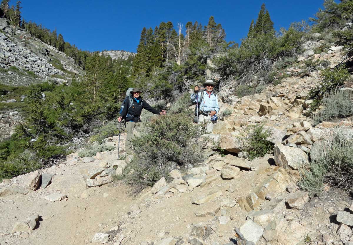
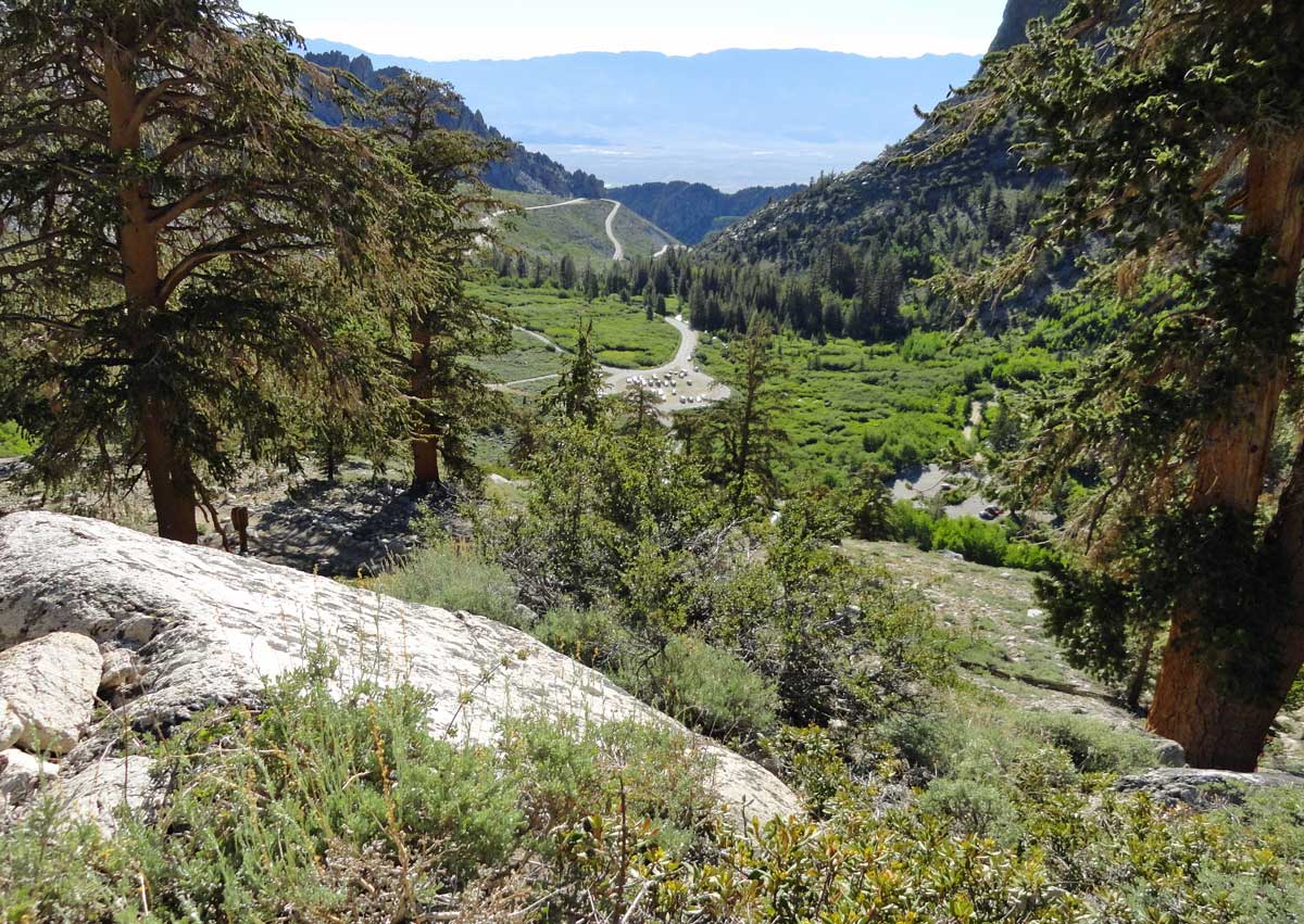
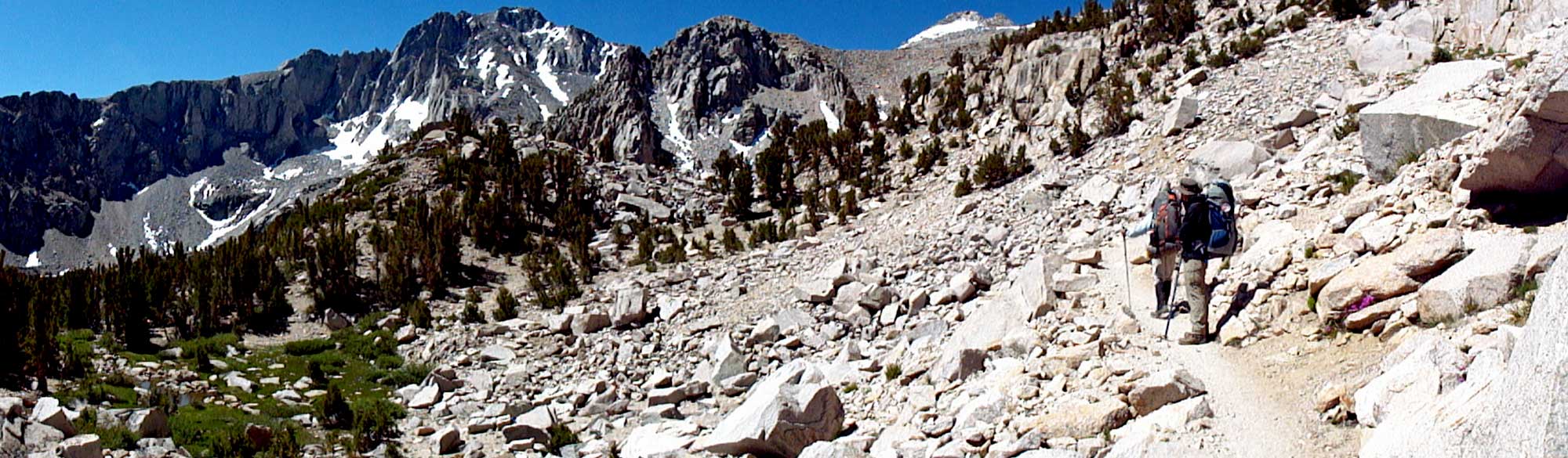
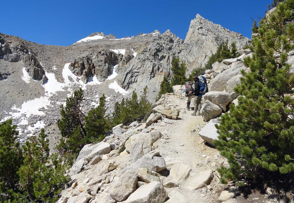
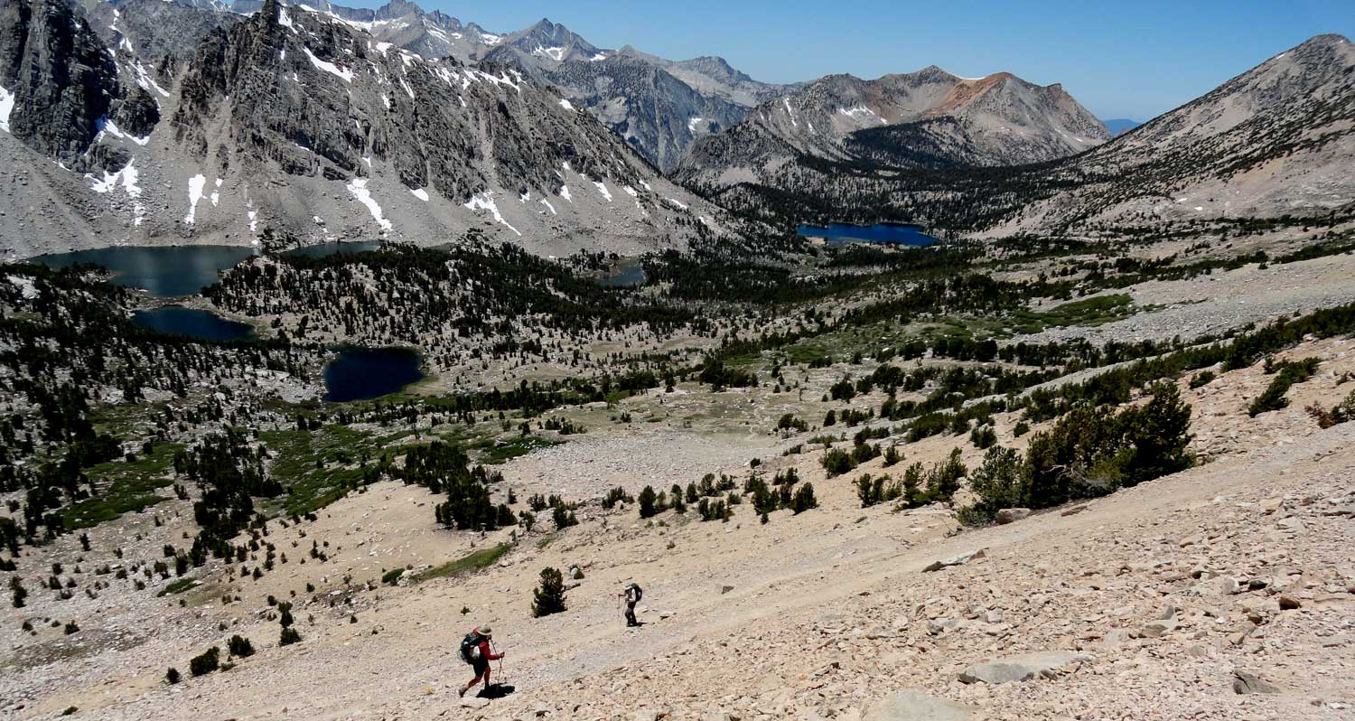

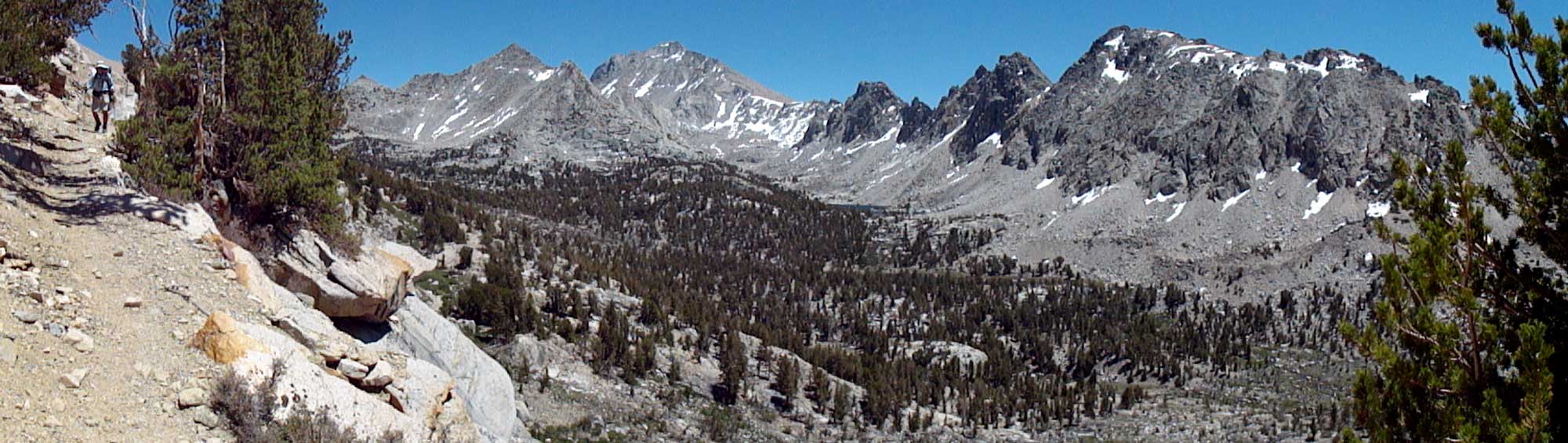

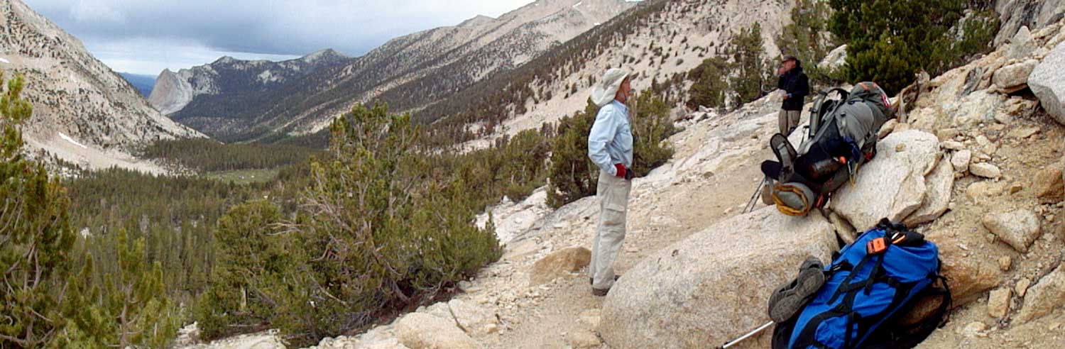 Wednesday: Day One: This was the first hiking day and the day where we tested our legs and bodies. None of us really knew what might happen at this altitude. Onion Valley campground is at 9,700 feet and the trail climbs from that point. Kearsarge Pass is 11,760 feet, so only 2,000 feet of climbing but how will our bodies react to the altitude? As it turned out, none of us seemed to have any altitude sickness symptoms and we felt strong so we continued past our first choice camping location to the second night camping location, Charlotte Lake. Katchan stopped to photograph every flower so that made our pace leasurely which Merle and I appreciated. Later in the week, we learned that Kearsarge Pass was a relatively easy ascent compared to the next four passes we were to climb before exiting the John Muir Trail. Be sure to click each photo for an additional view. Topping Kearsarge Pass was a incredible experience because it was our first view of the Kings Canyon National Park and the overwhelming mountain and canyon scenes seen from the top of the pass. Charlotte Lake was about nine miles from the Onion Valley Trailhead which is about half what the thru hikers (those walking the entire Pacific Crest Trail) will do in a day. Nine miles with the climbing we had to do was plenty for us and we were all ready for camp when Charlotte came into view. I was surprised to learn there was a ranger station a Charlotte Lake with a full time Ranger stationed there. The photo is of Ranger Jim, we disturbed him for photos when he was "off duty".
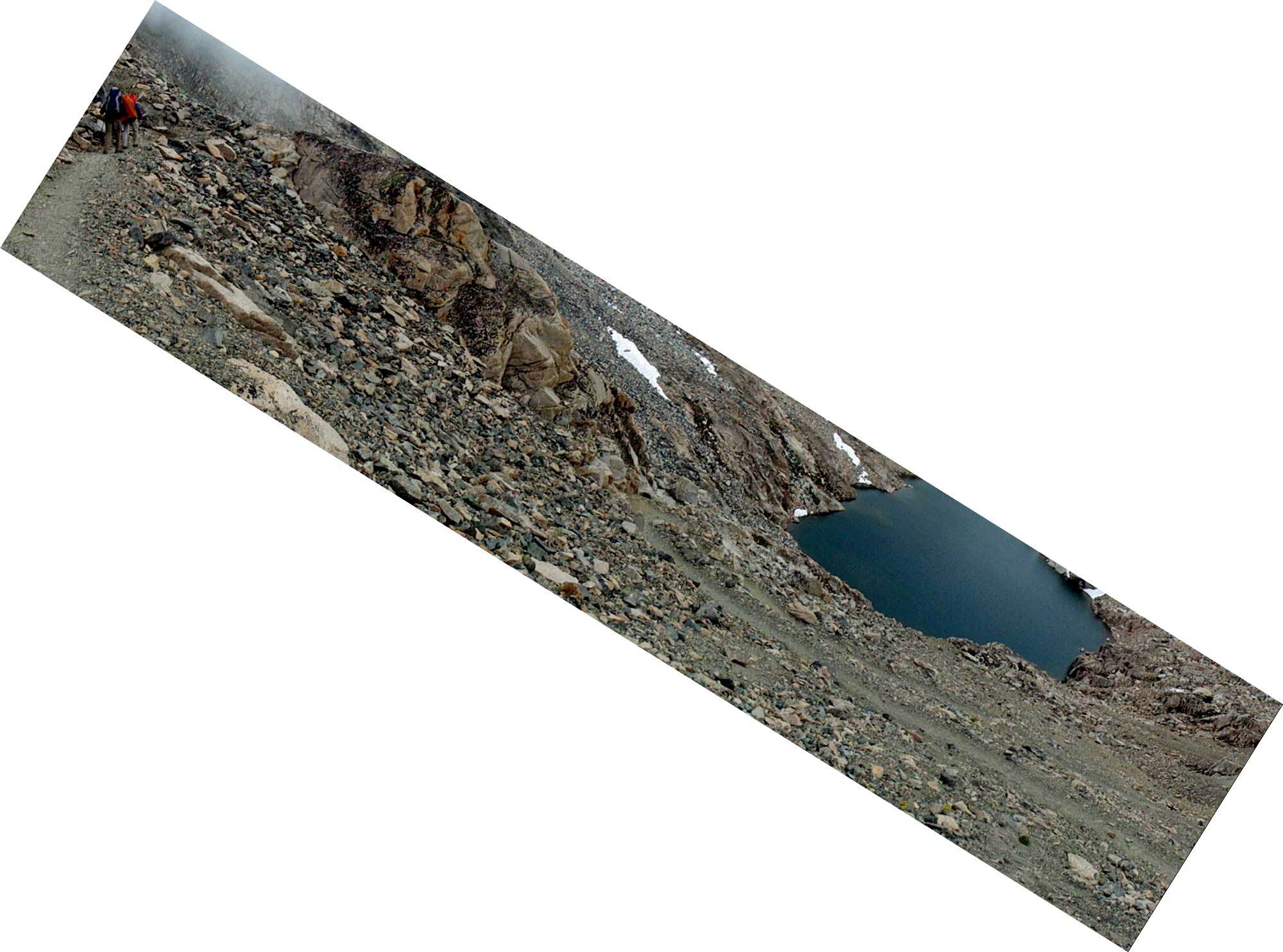
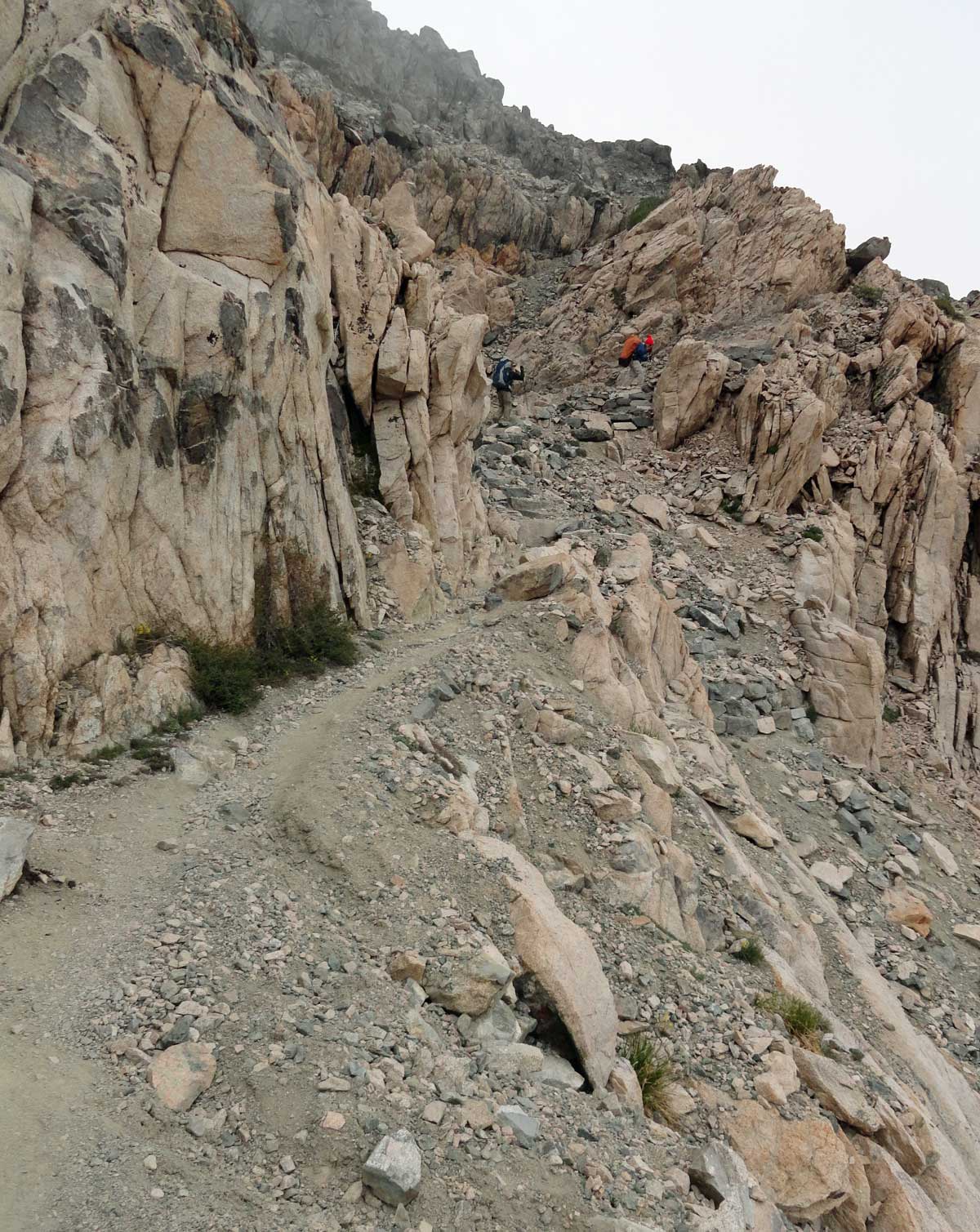
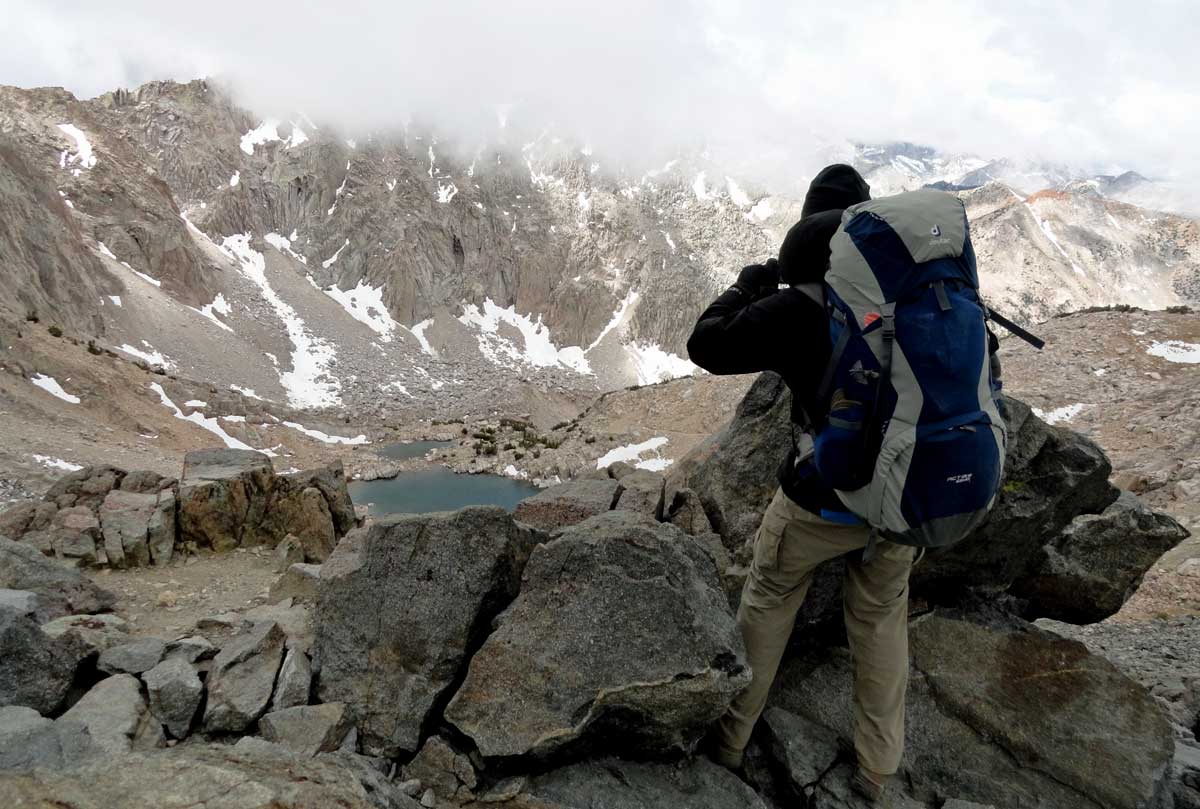

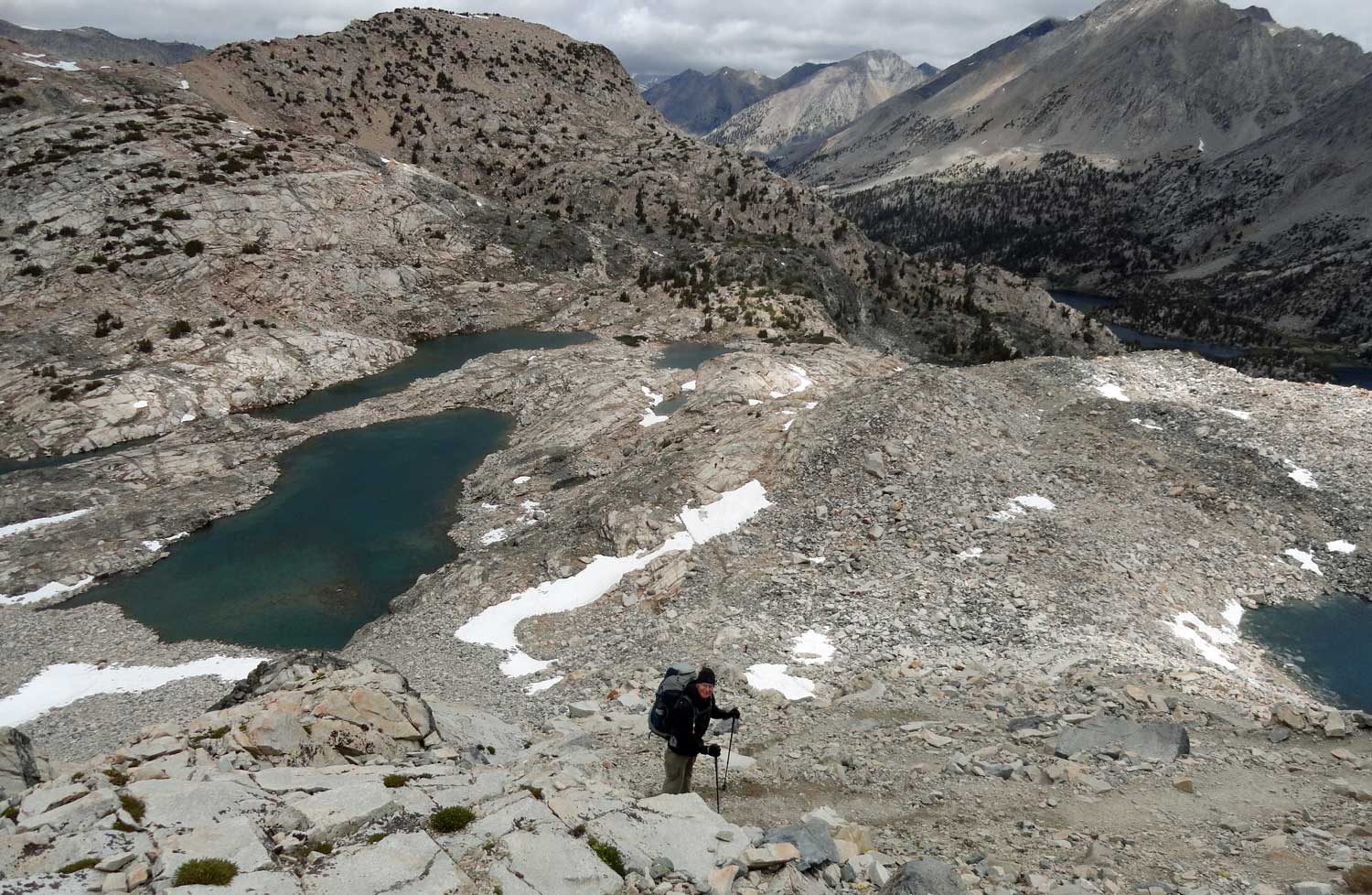
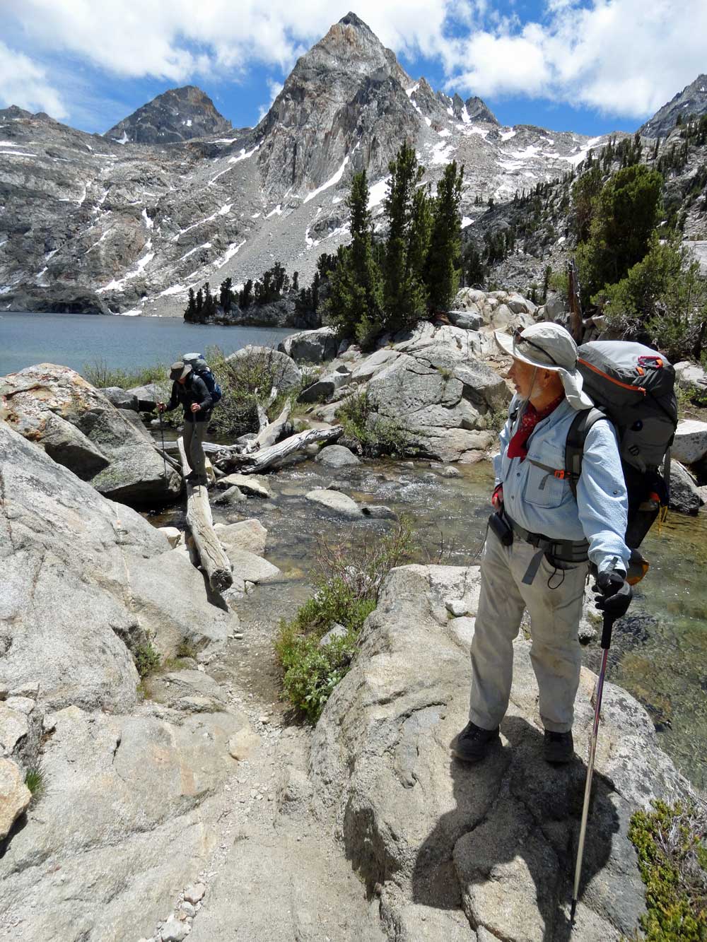
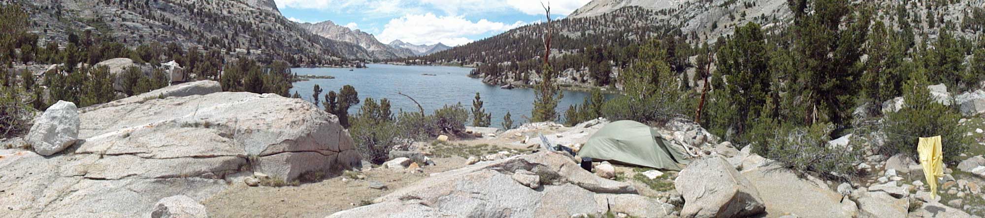
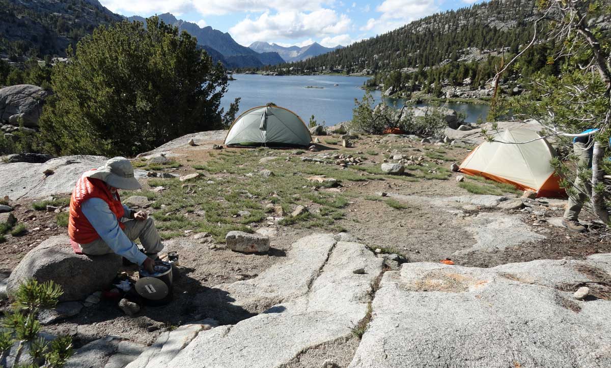
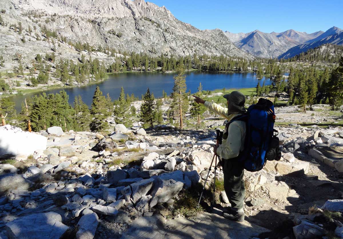
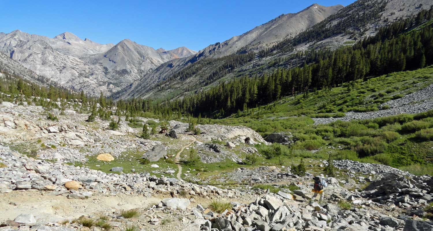
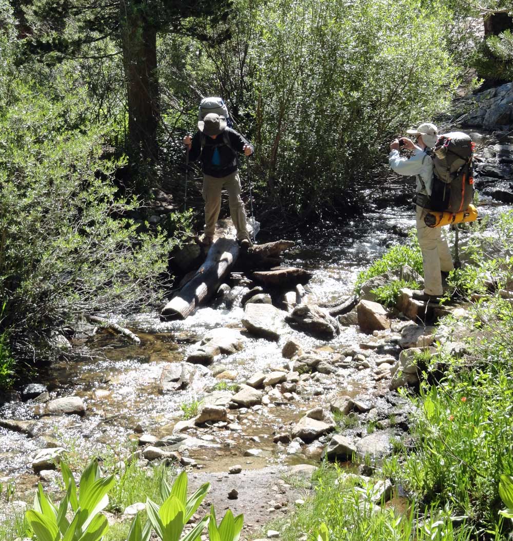

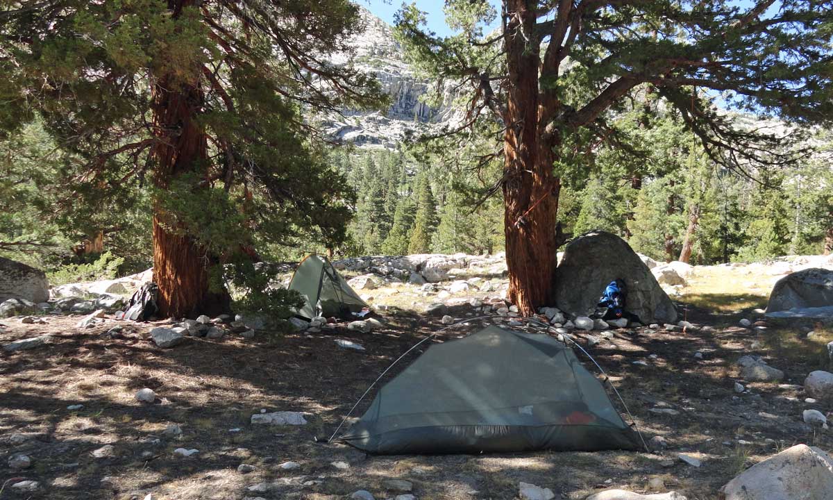

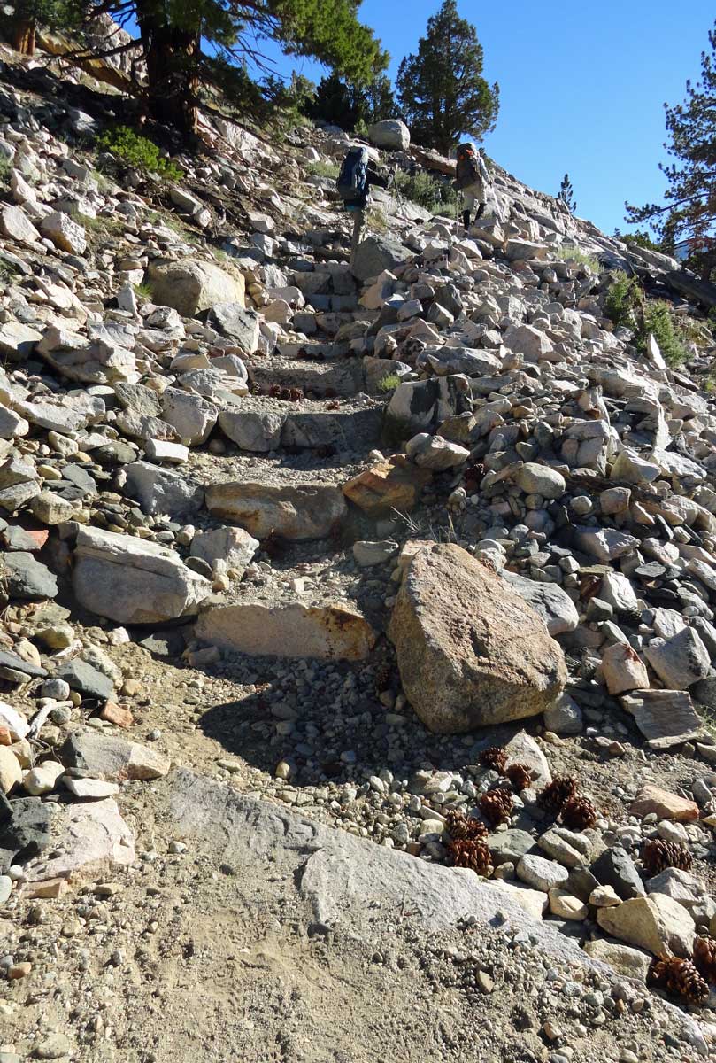
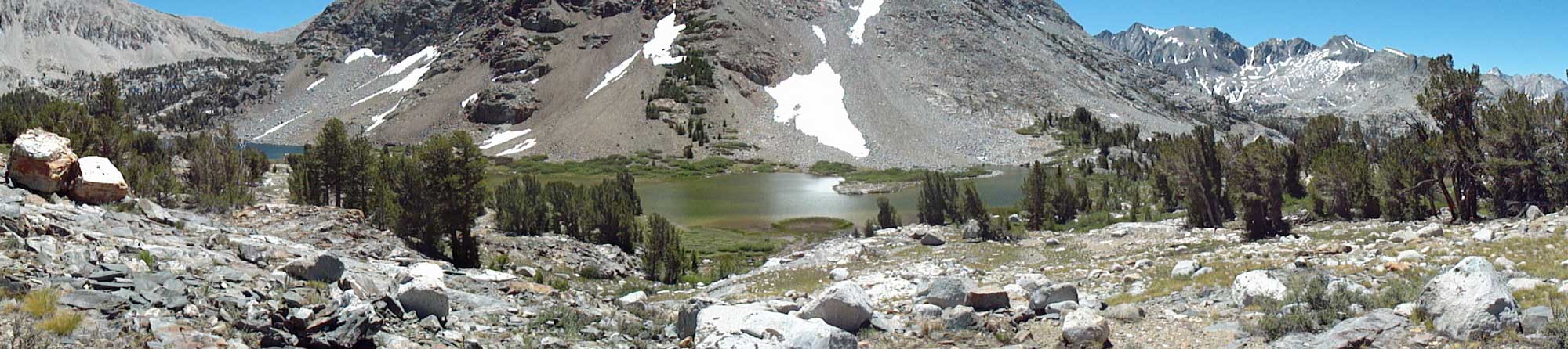

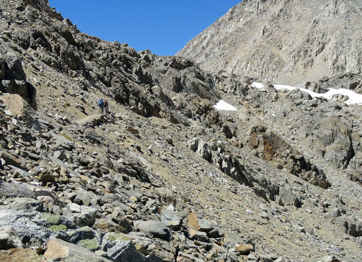
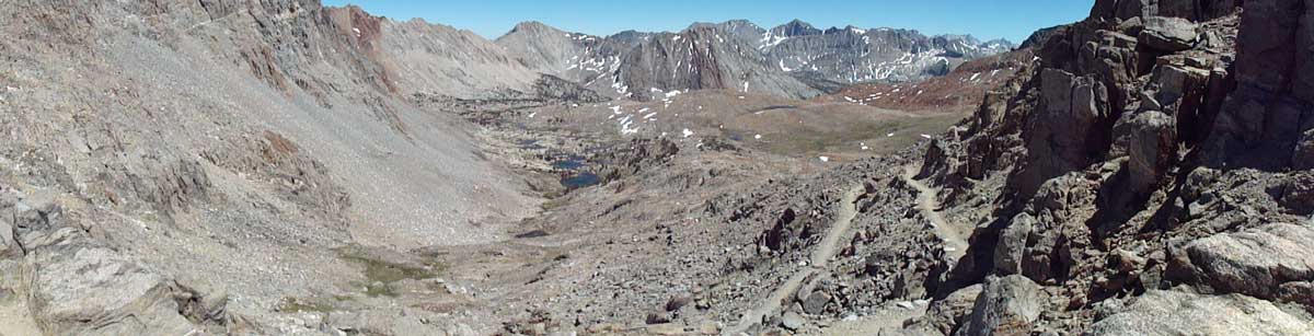
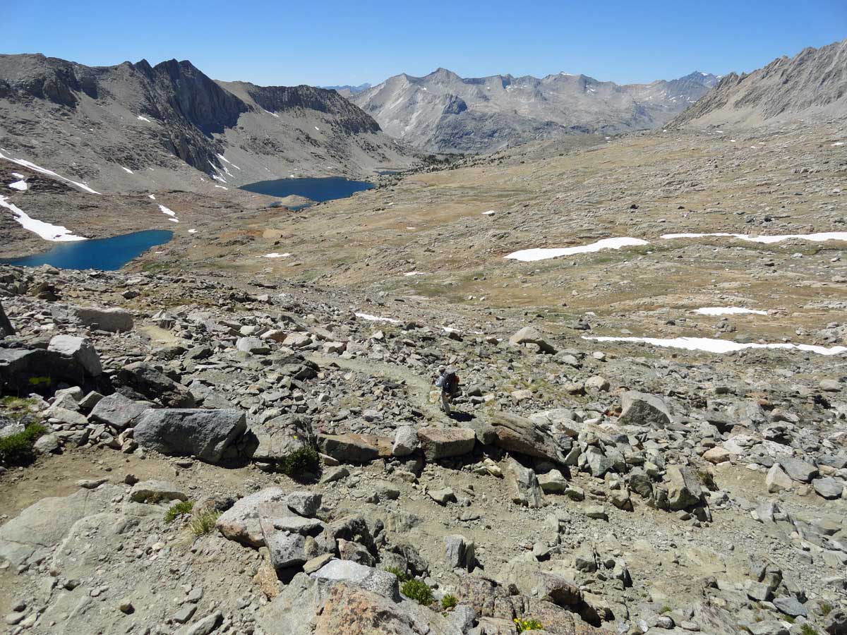
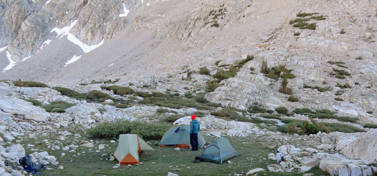

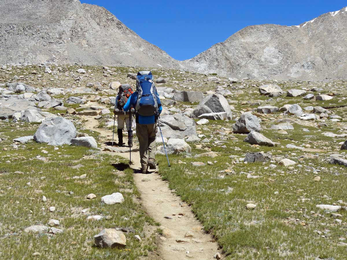
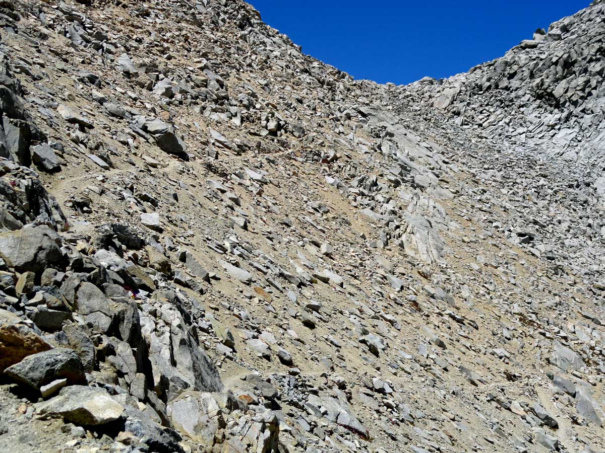
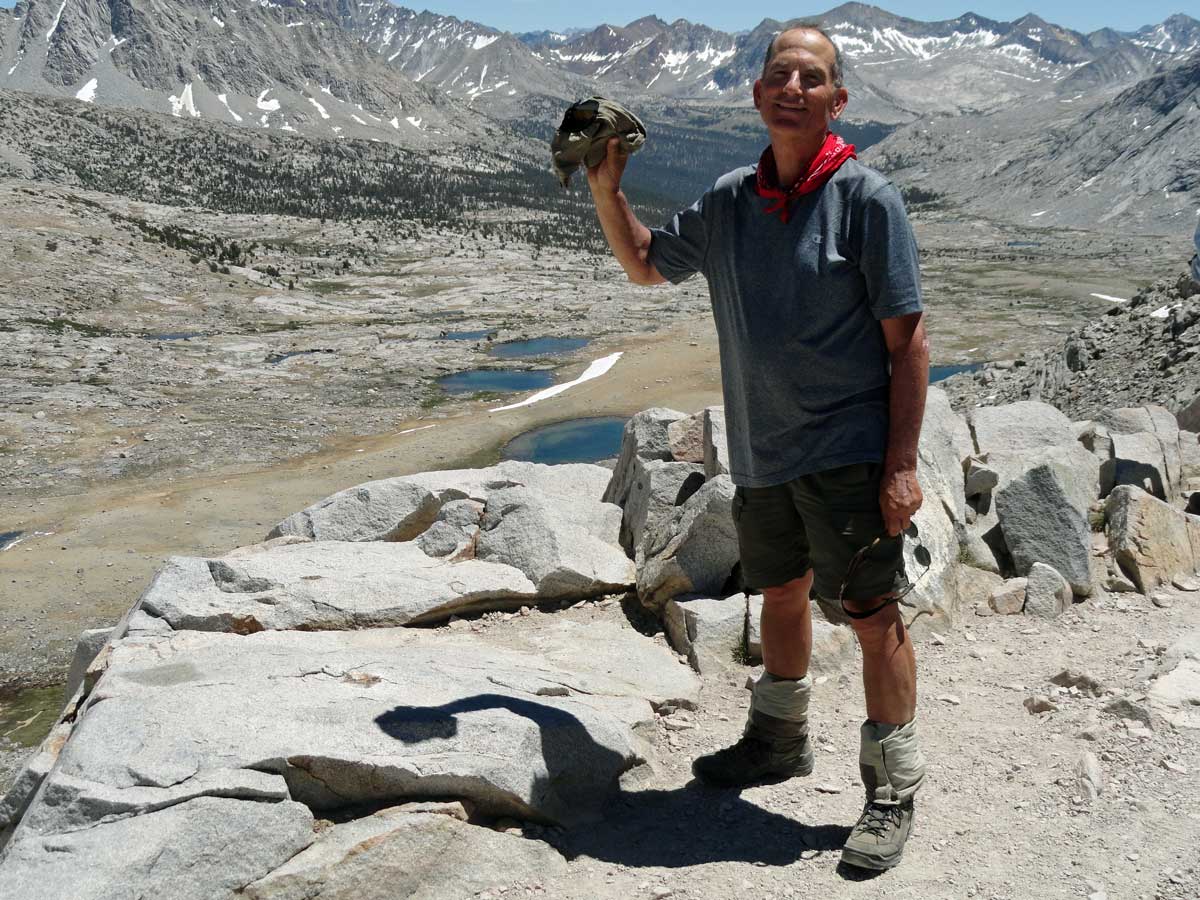

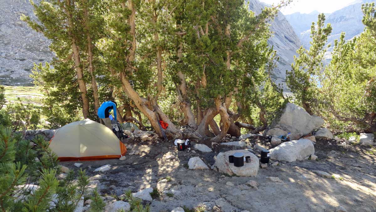
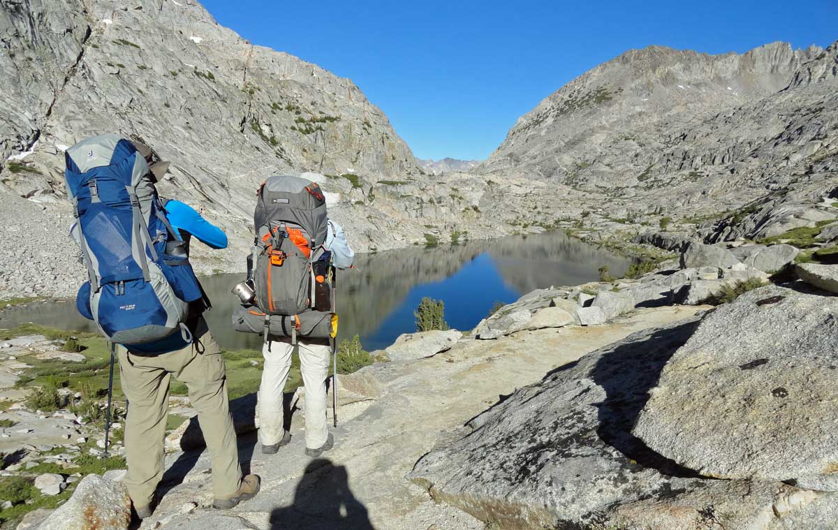

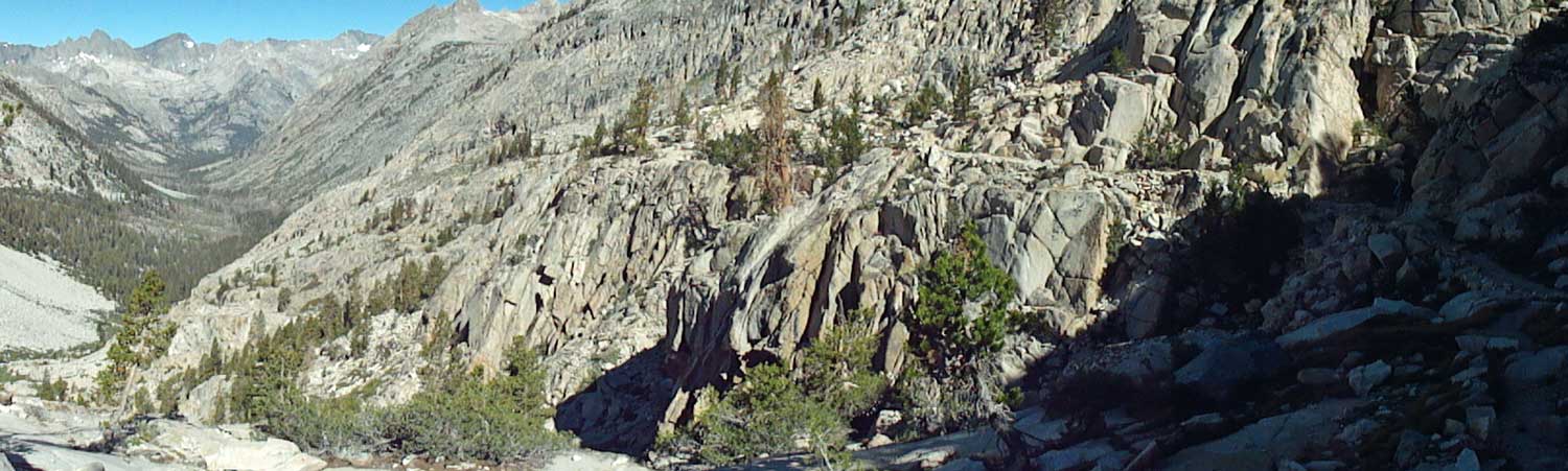
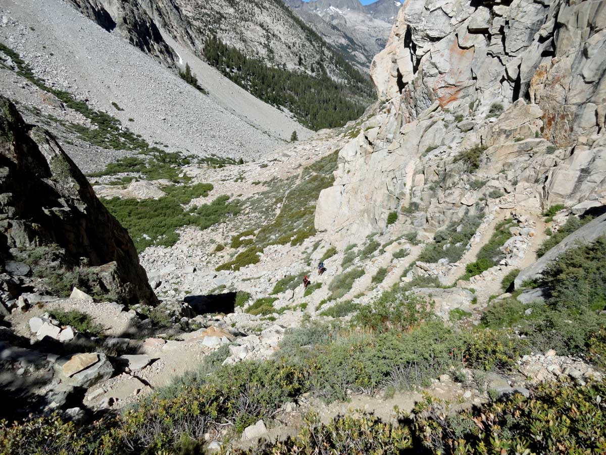
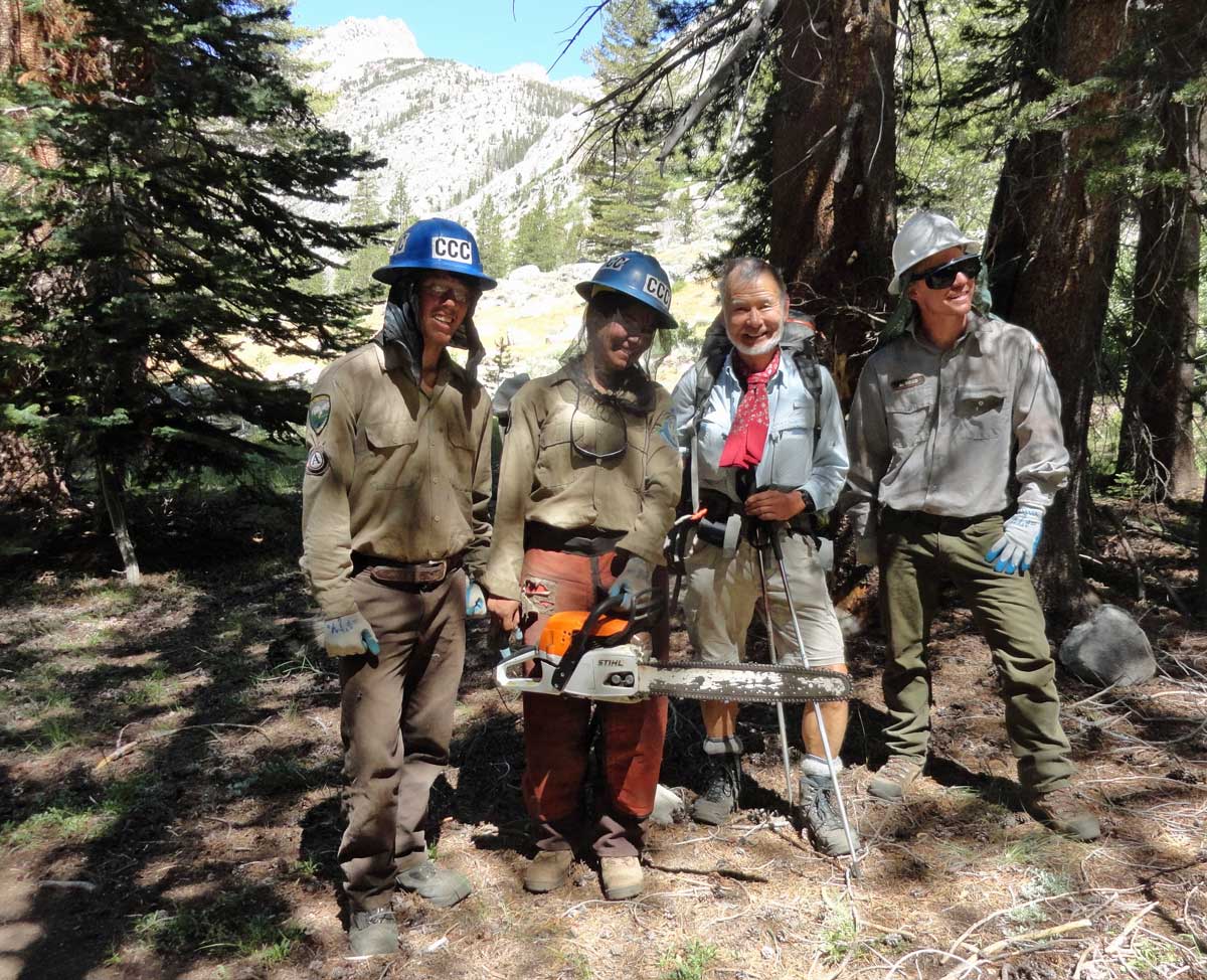
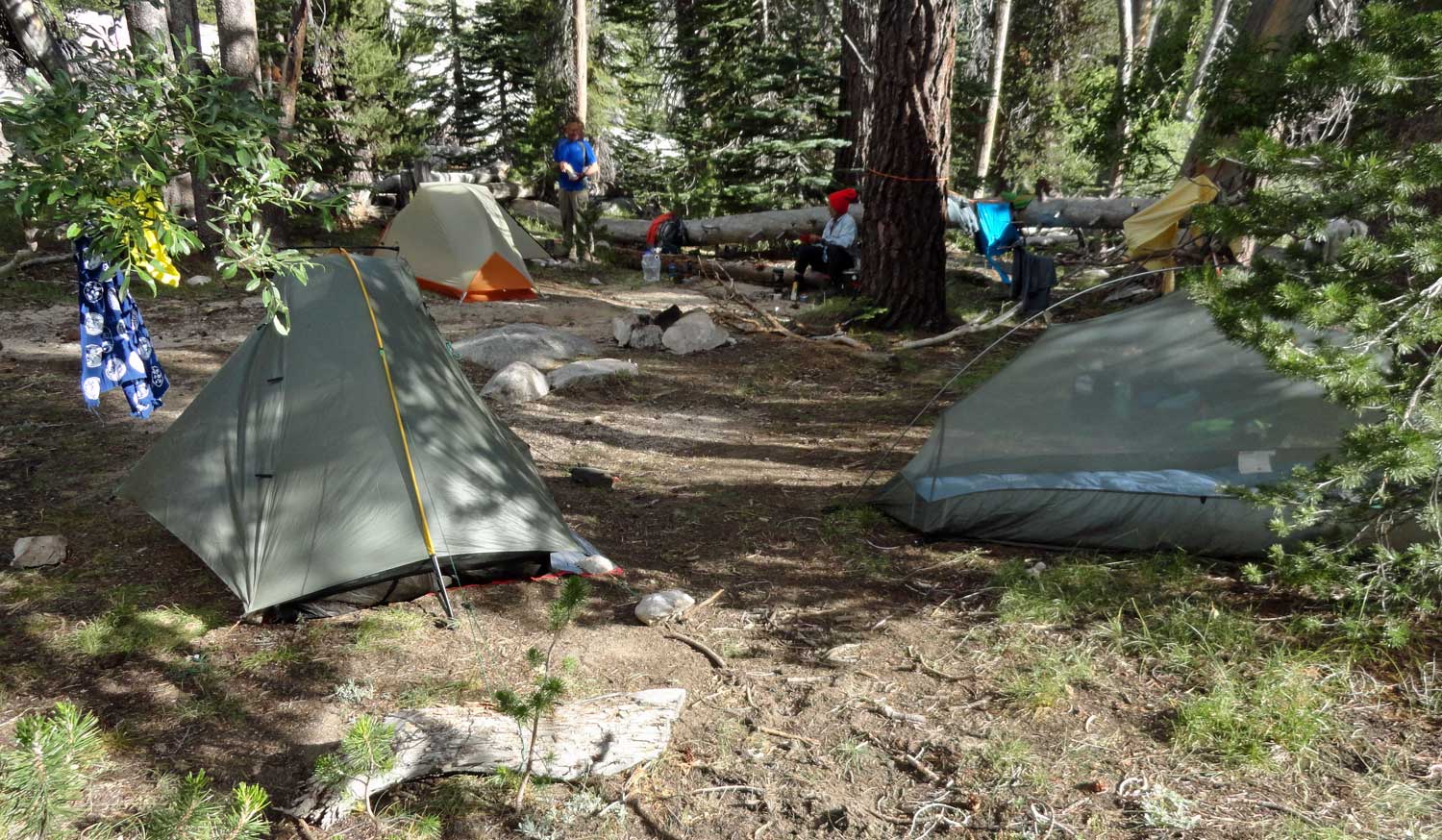
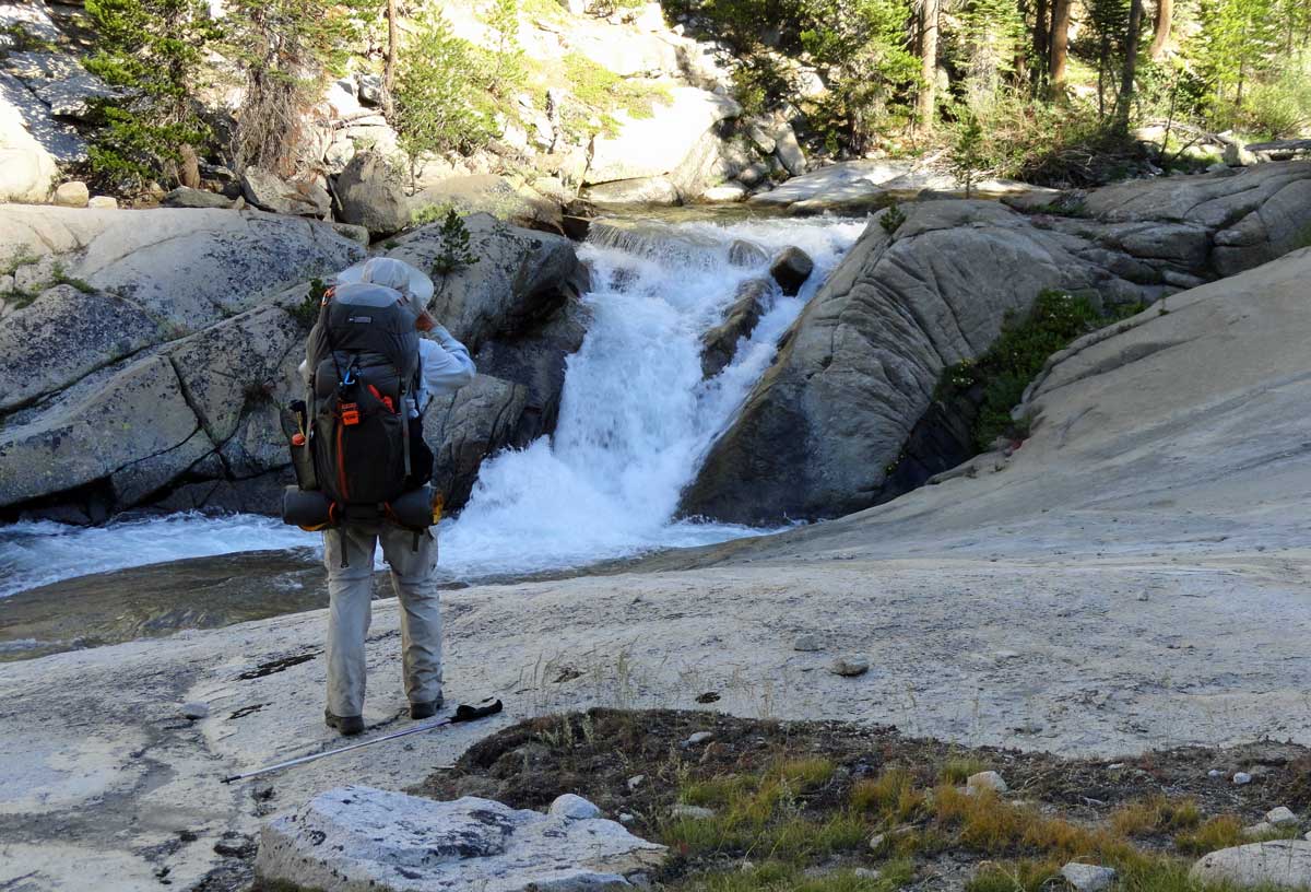
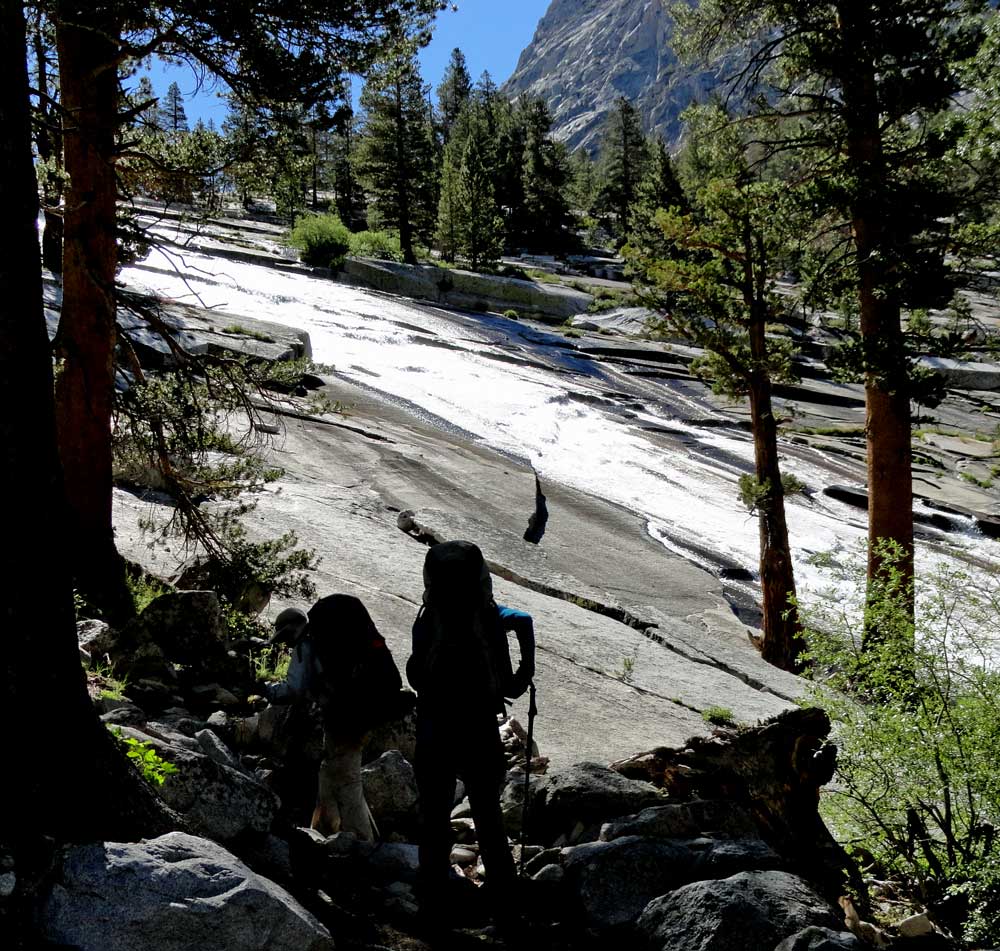

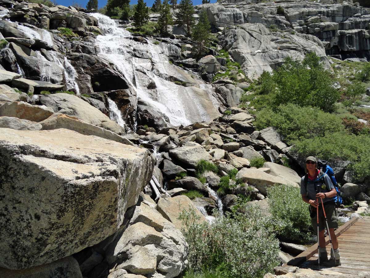
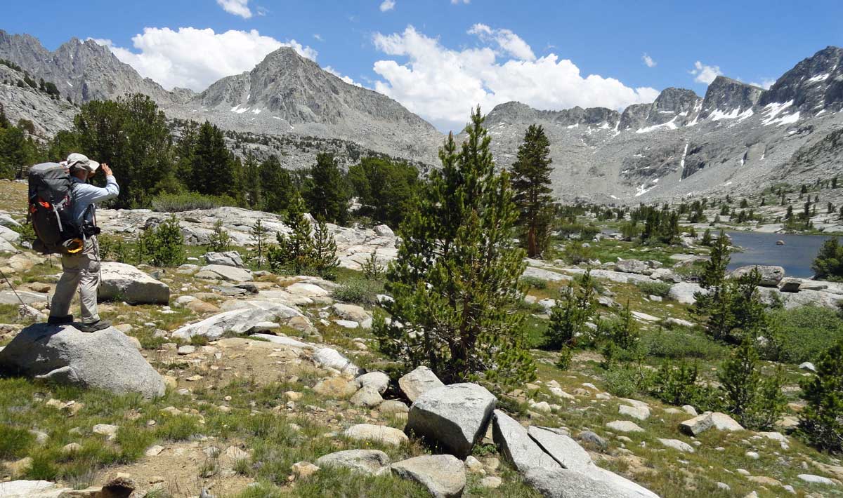
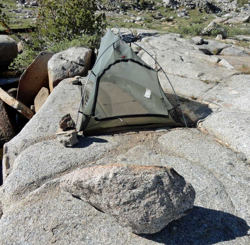
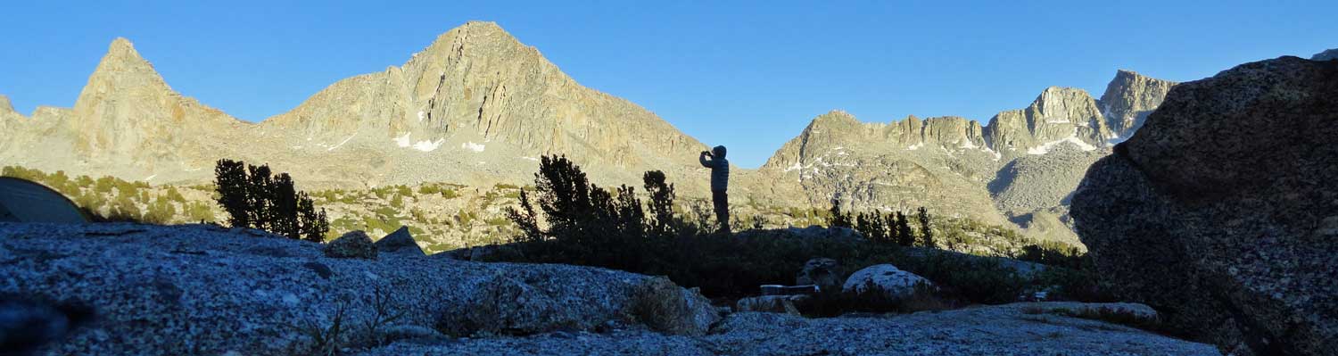
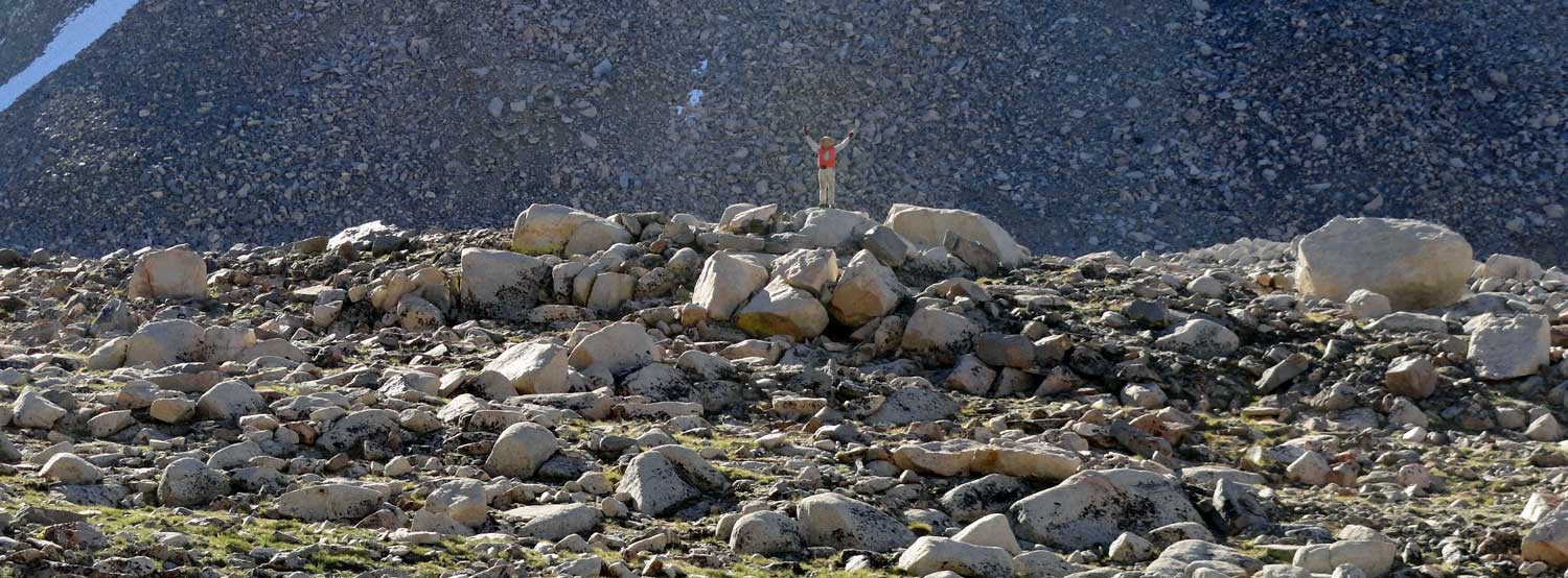
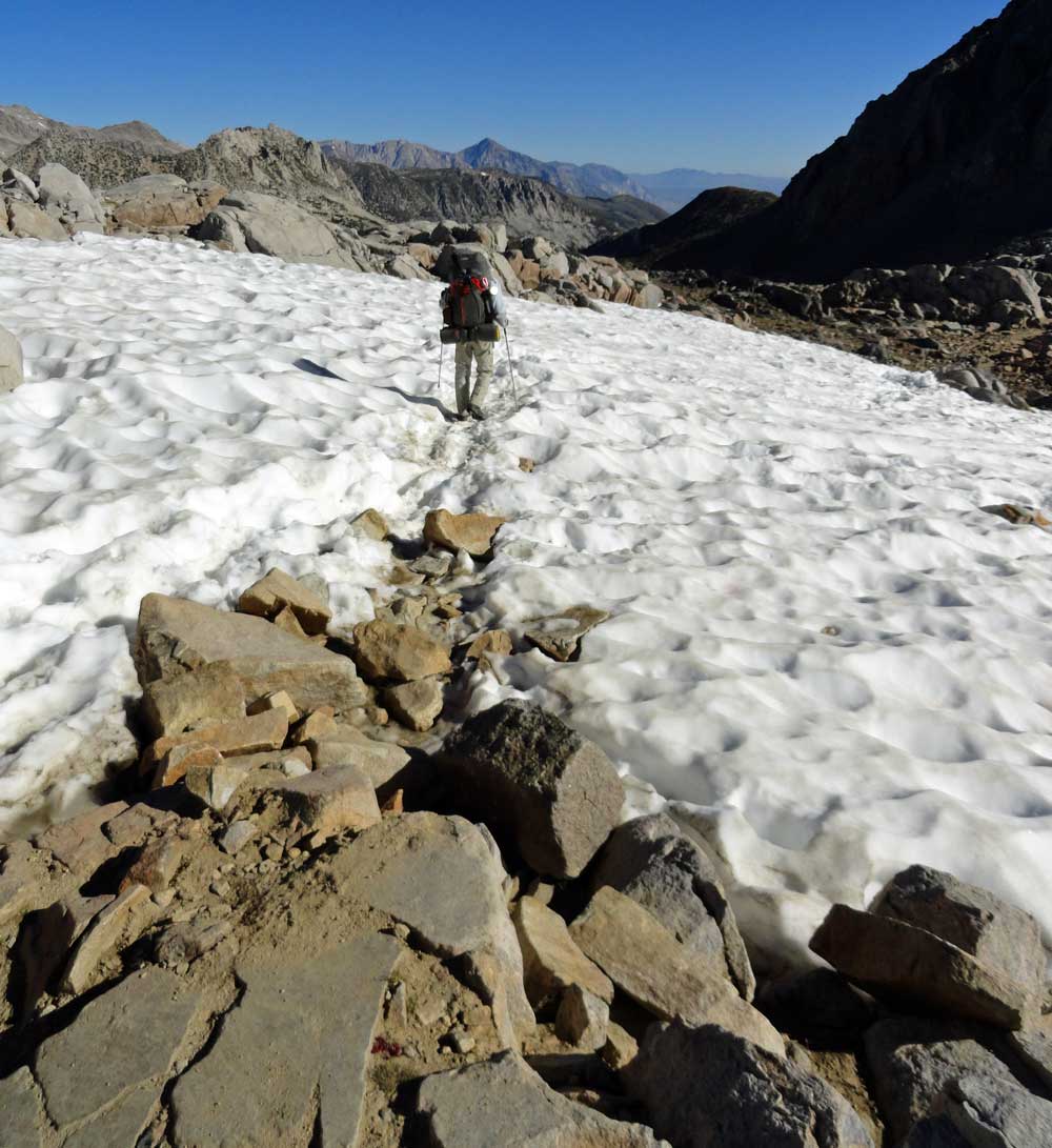
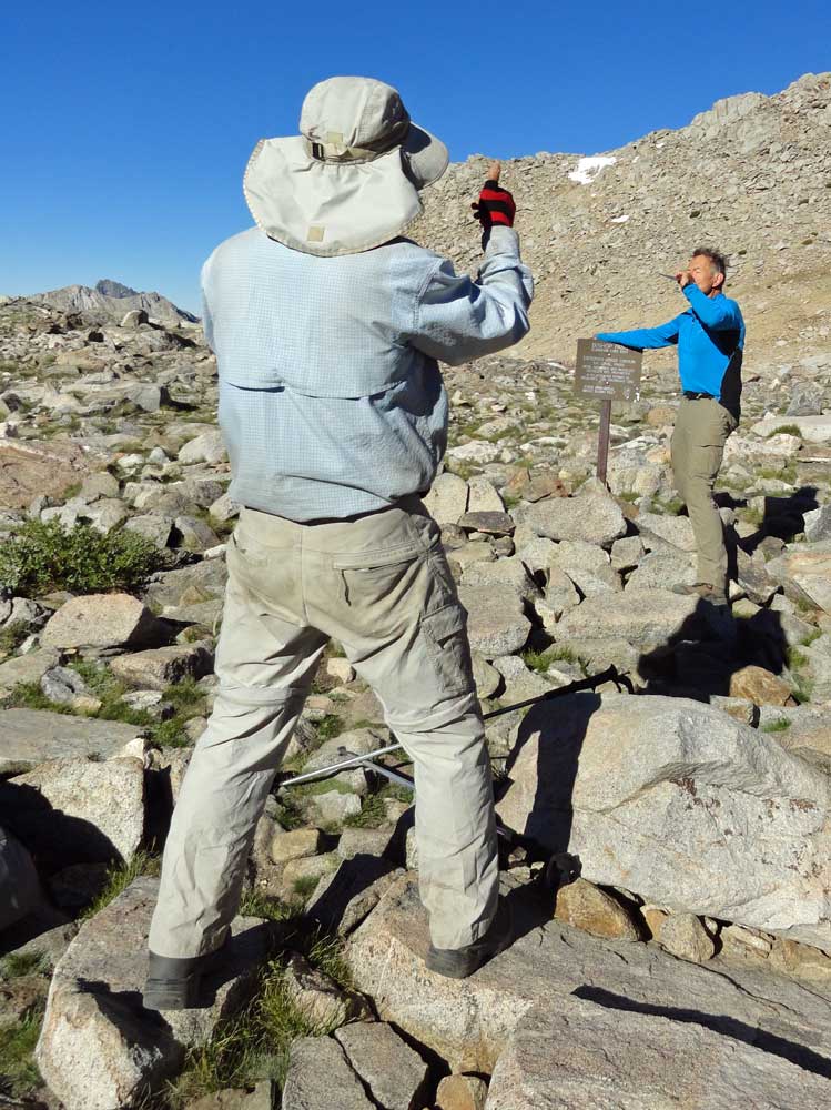
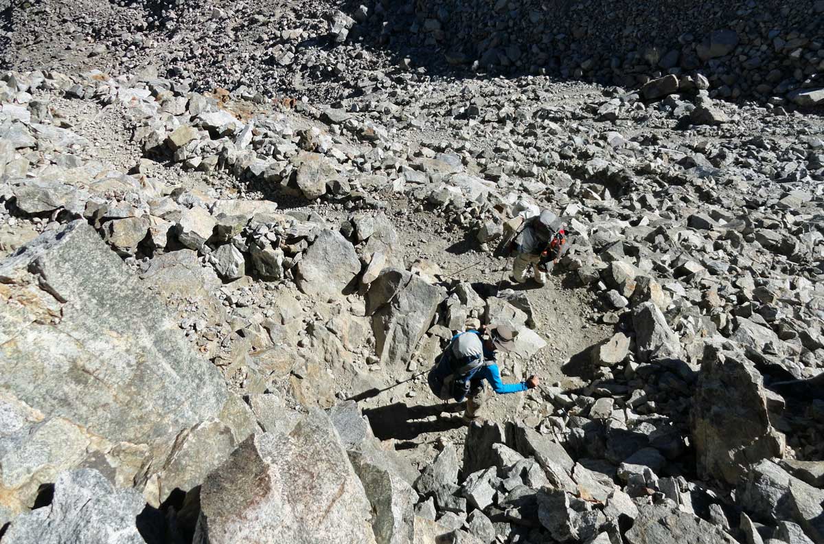
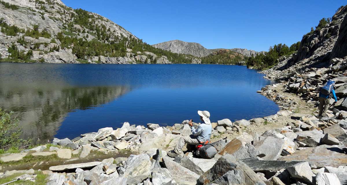


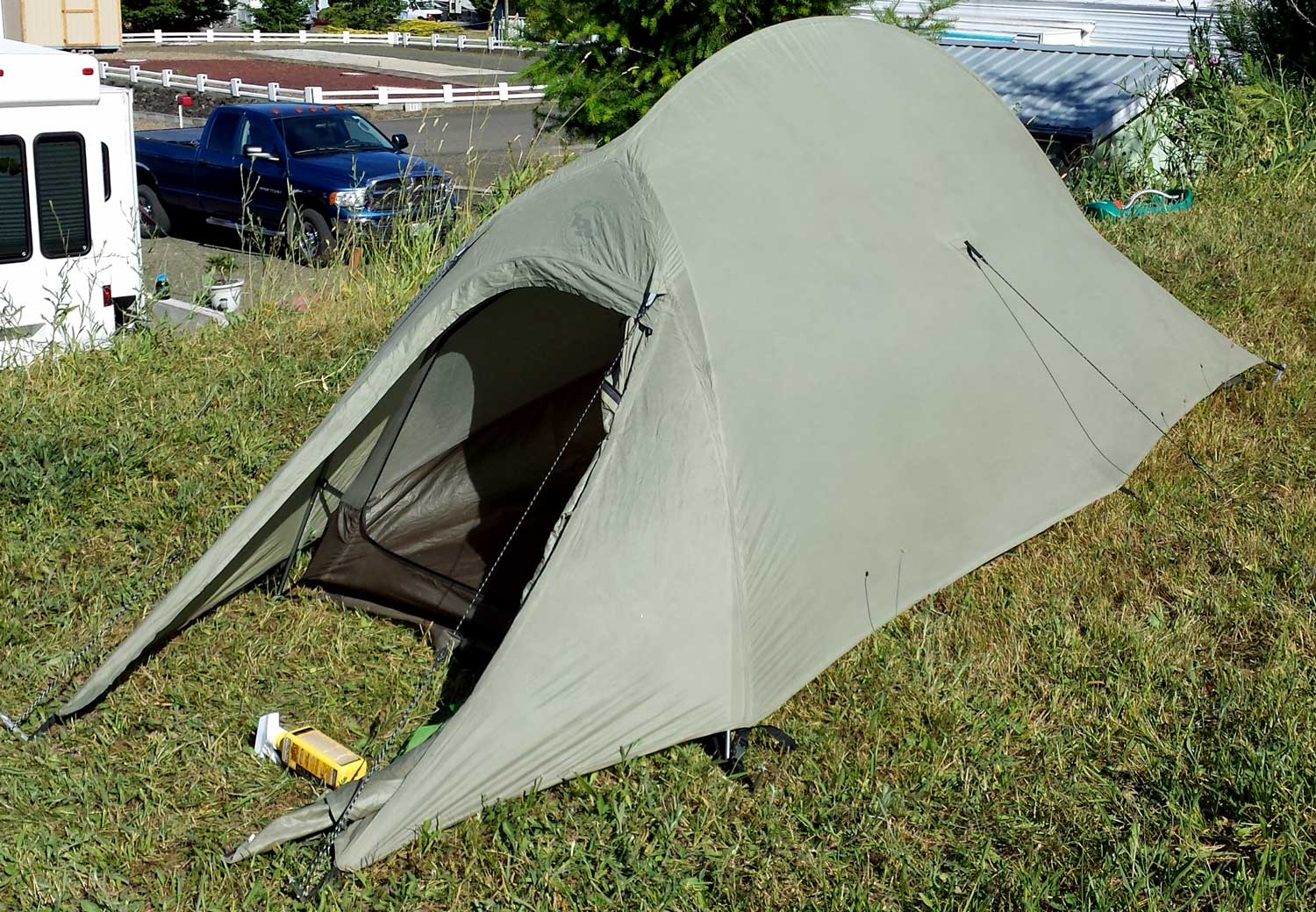 Thursday, June 19, 2014: After reading PCT through hiker journals, I've learned that the mosquitoes on the John Muir Trail could be thick. I've also learned that many of the hikers spray their clothing and tents with Permethrin, a chemical which repels and kills mosquito's and ticks. Tomorrow I'm getting Red Cross First Aid and CPR training then leaving early Saturday morning for Reno, so, this afternoon, I sprayed my clothing then set up my new tent and sprayed the entrance. I'm still learning how to setup this tent, so a good thing I did this for a third time, I'd hate for the "guys" to see me have to take the tent down only to set it up correctly a second time. Click the photo to see the rain-fly installed. The spray bottle of Permethrin is on the ground in front of the rain-fly.
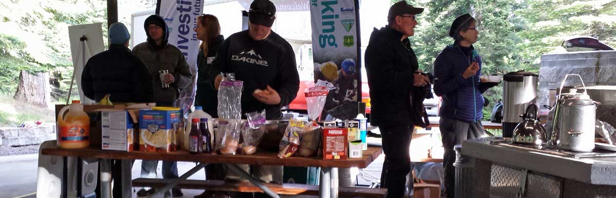
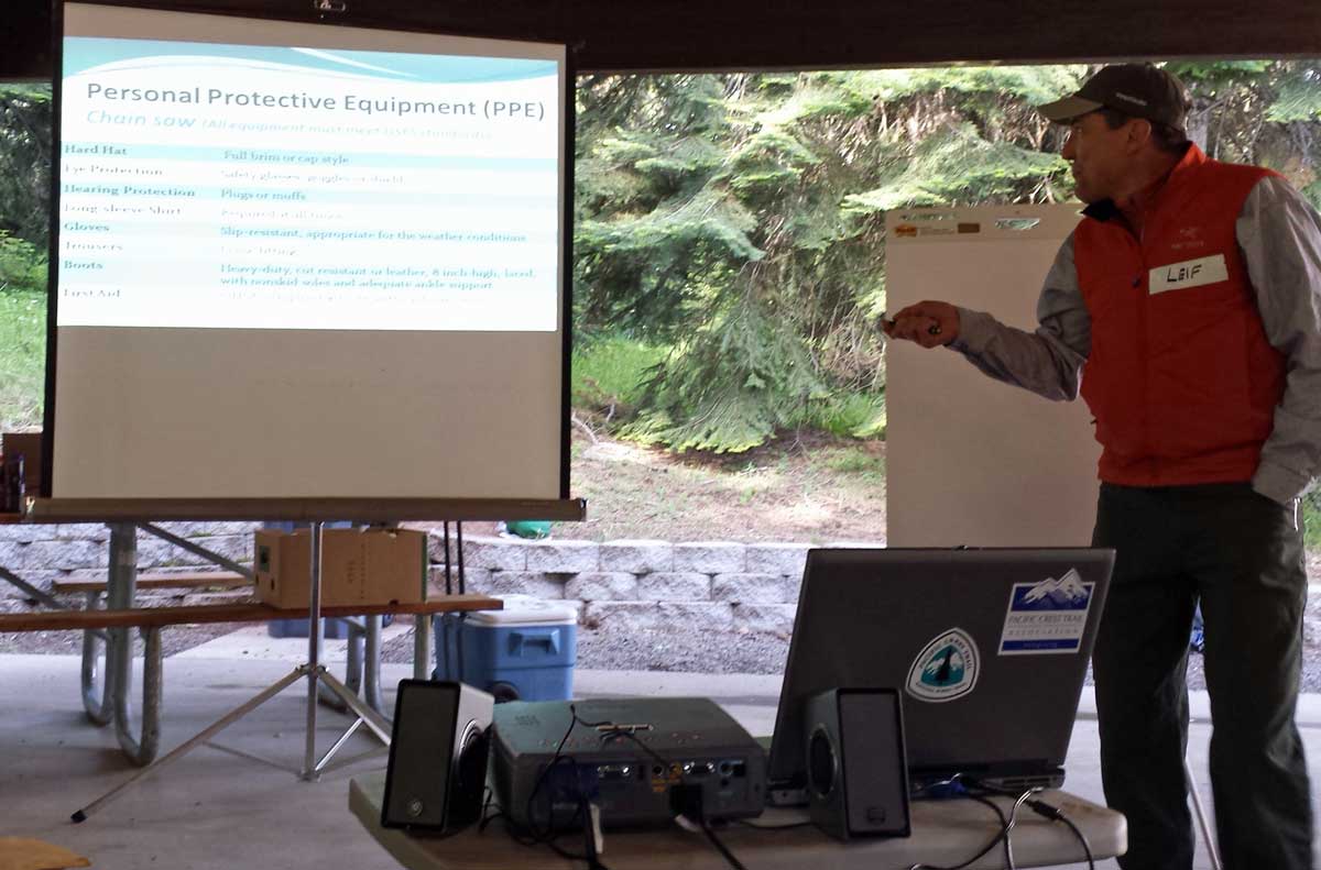

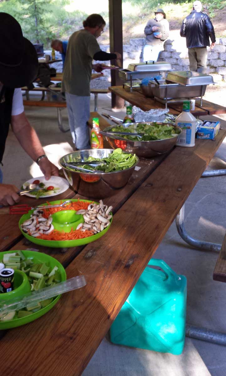

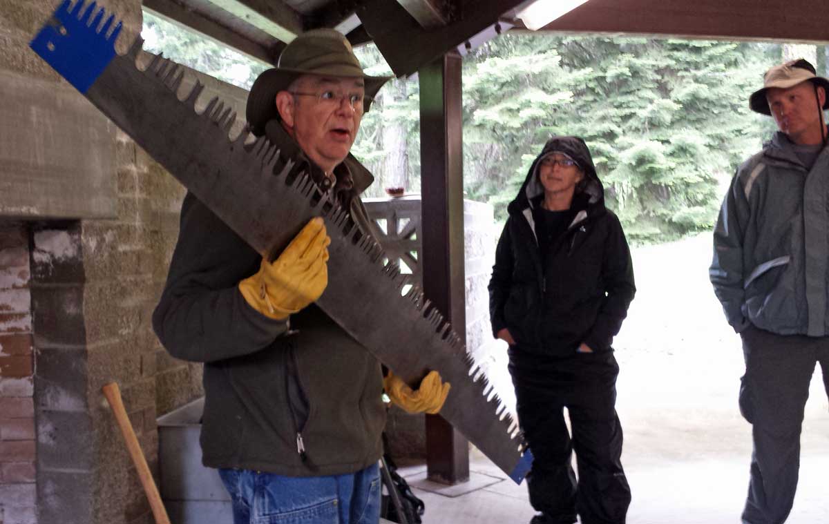
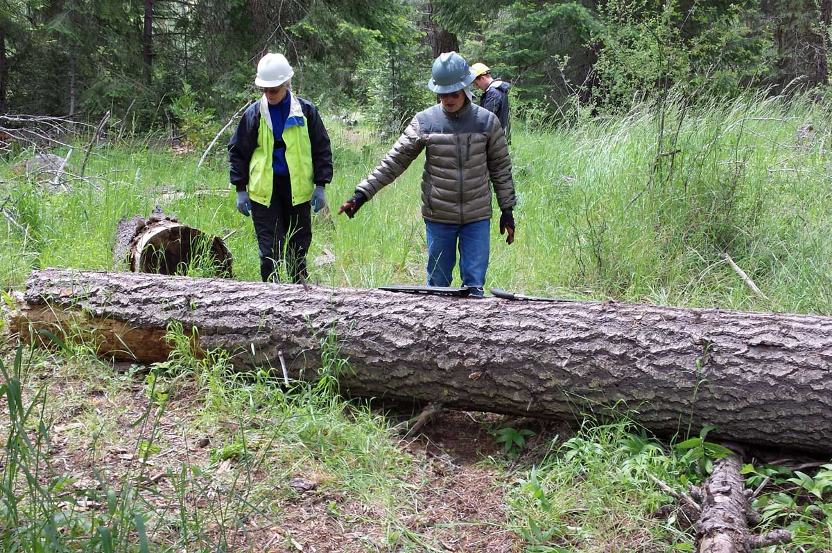
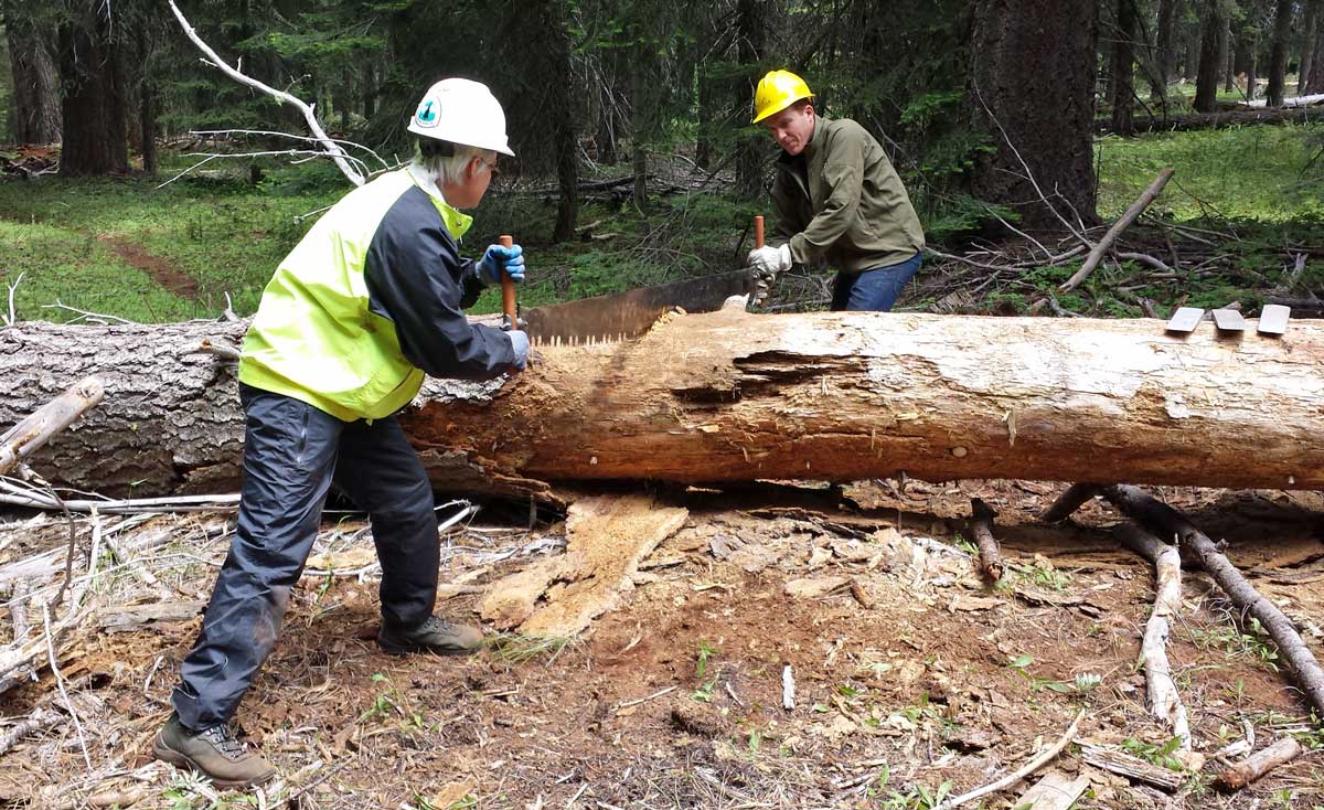
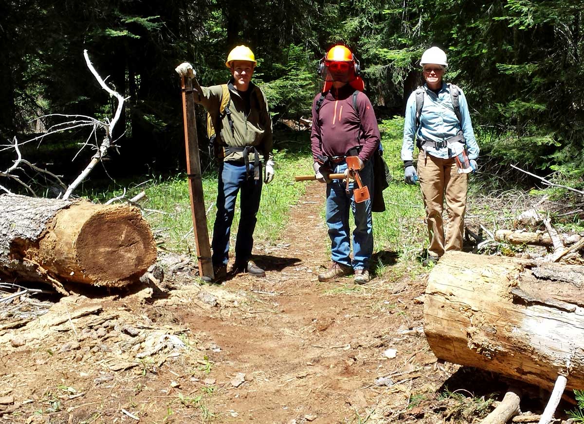
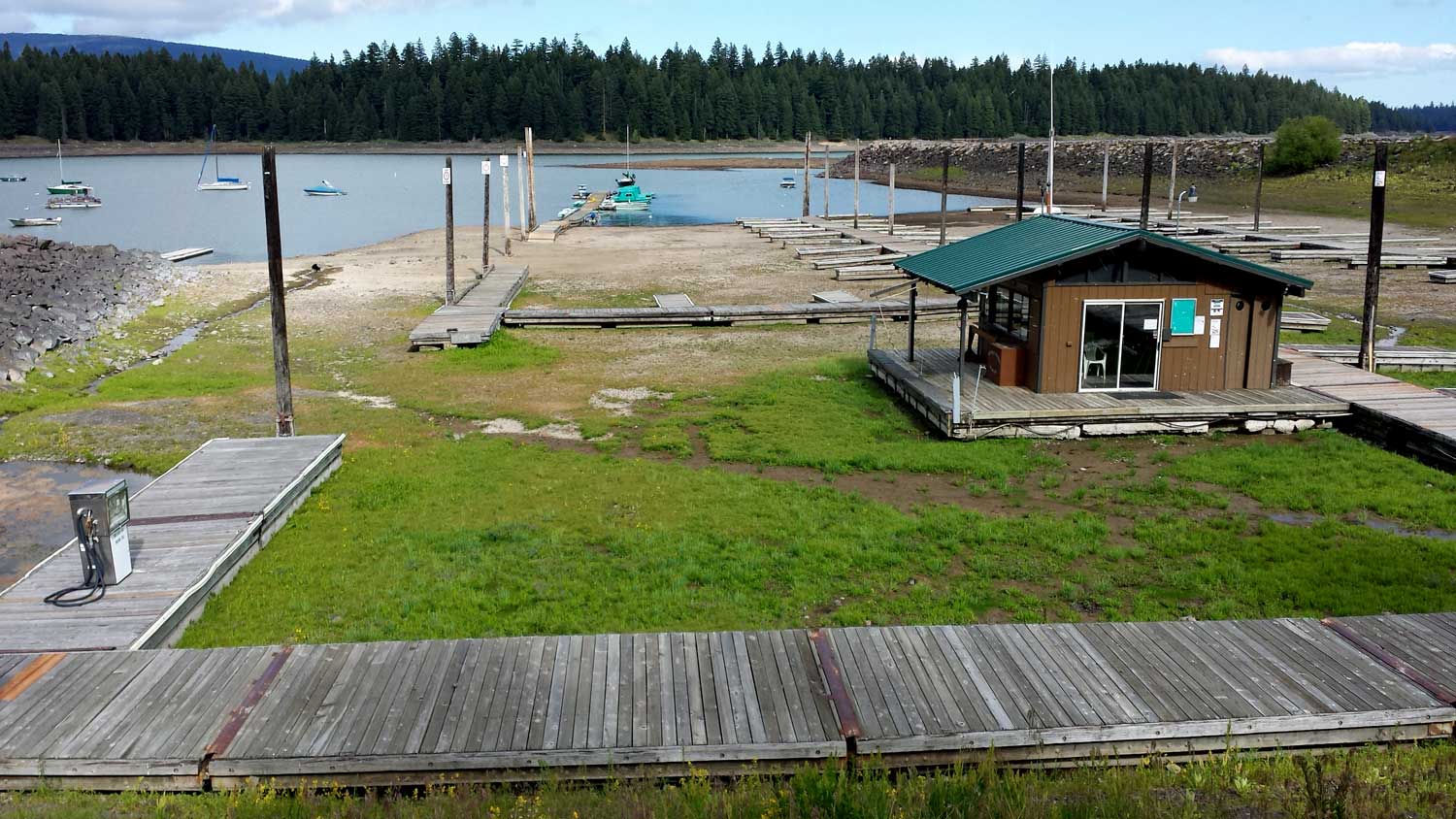


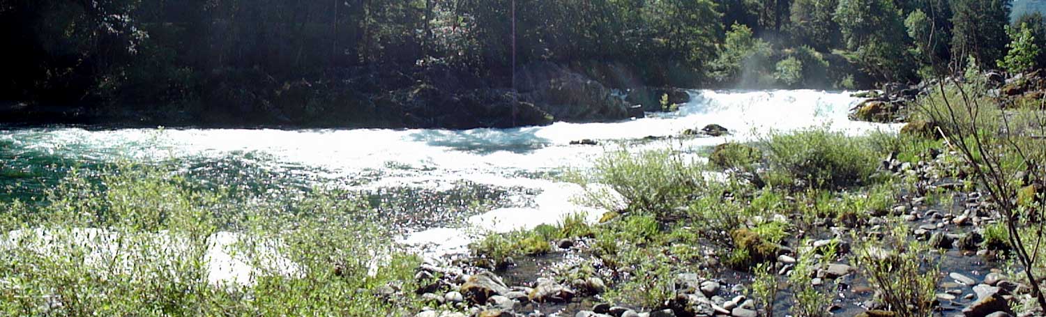
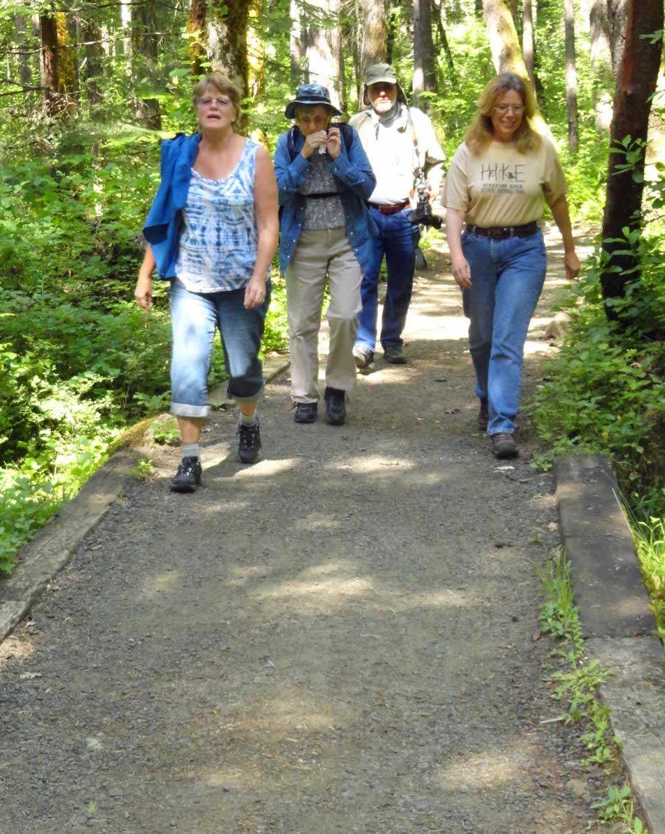

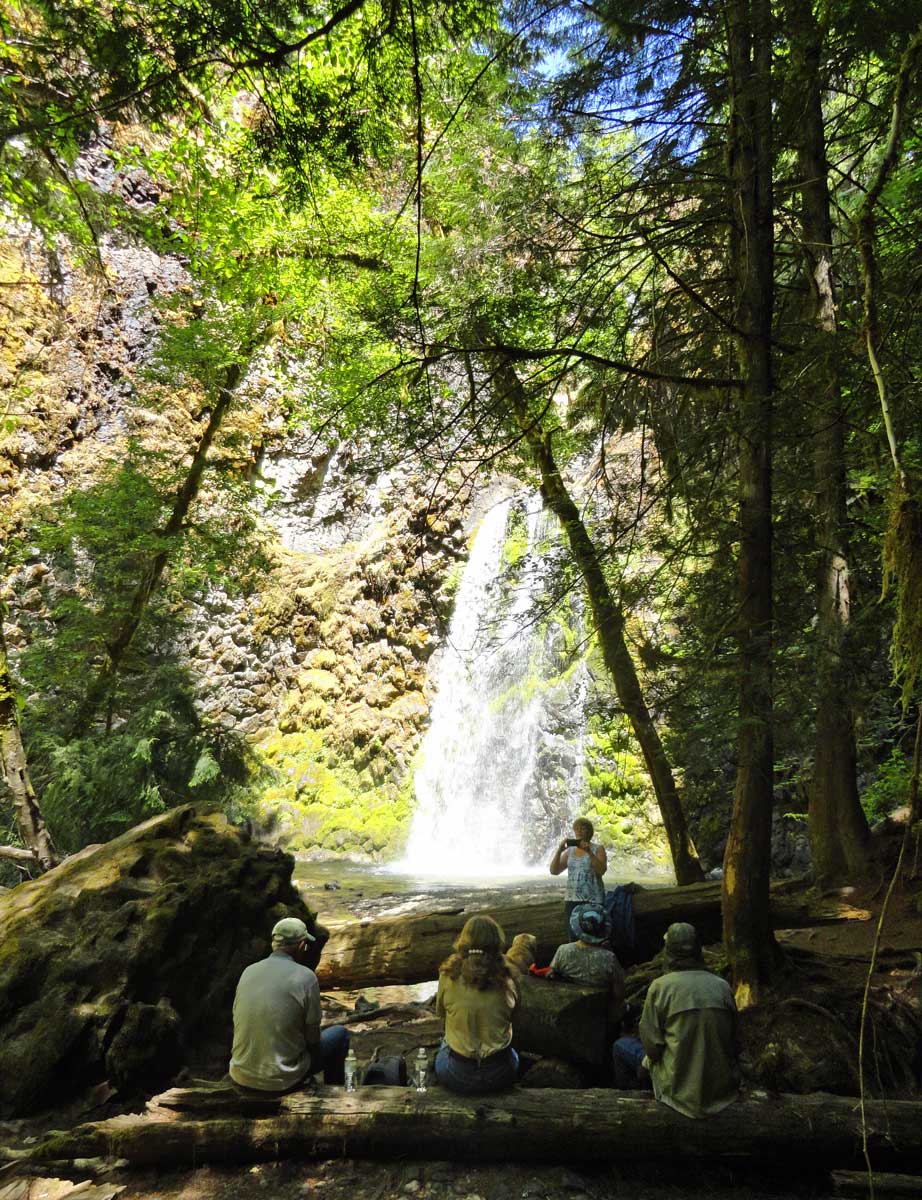
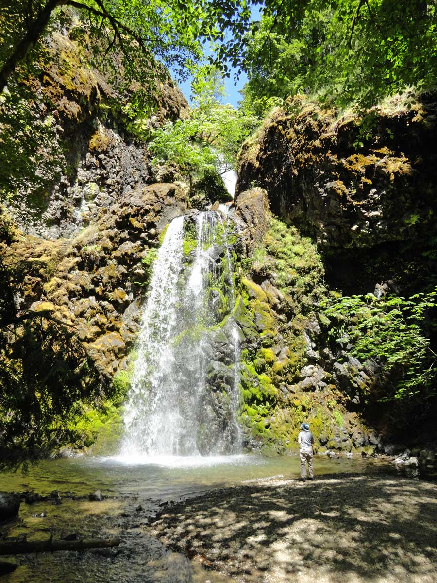
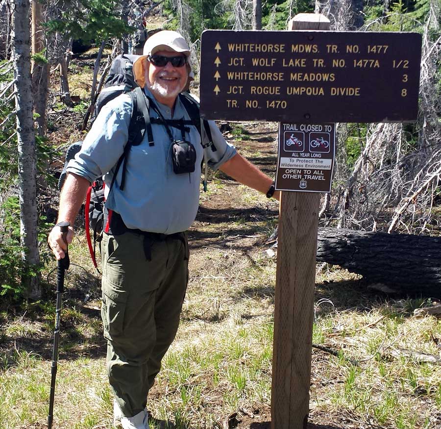

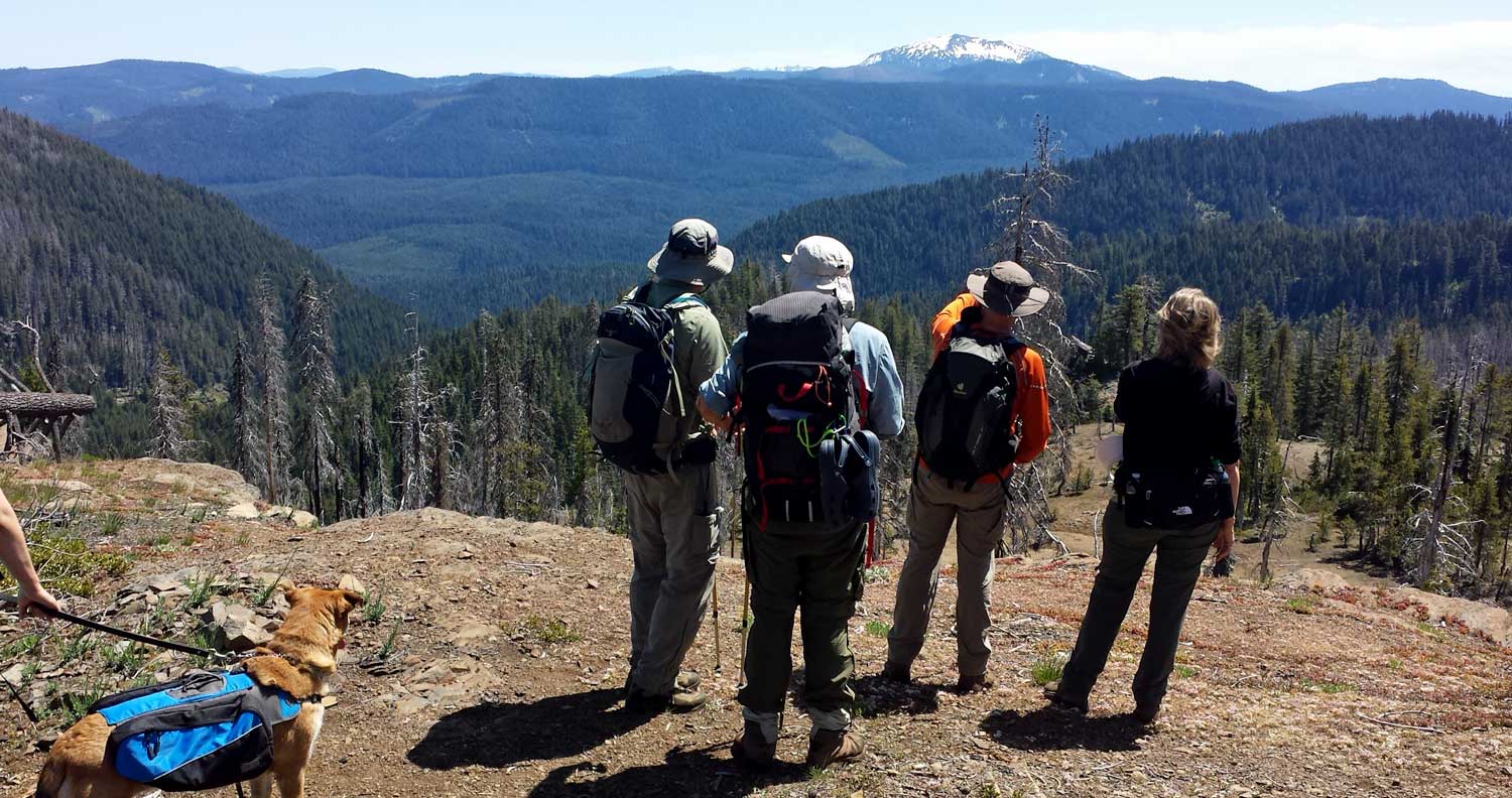
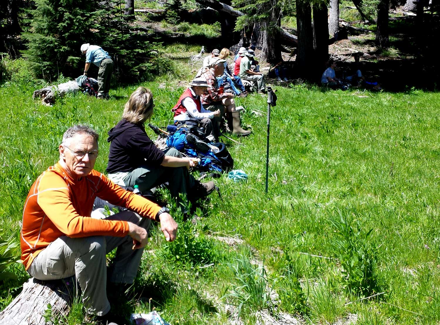

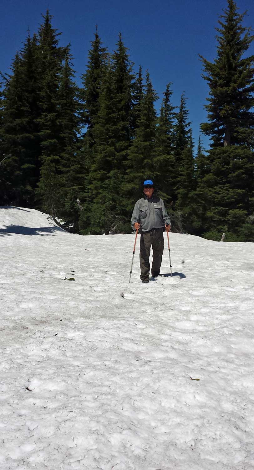
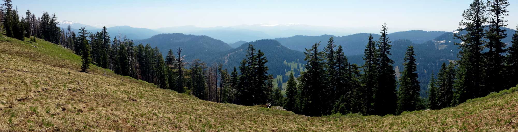

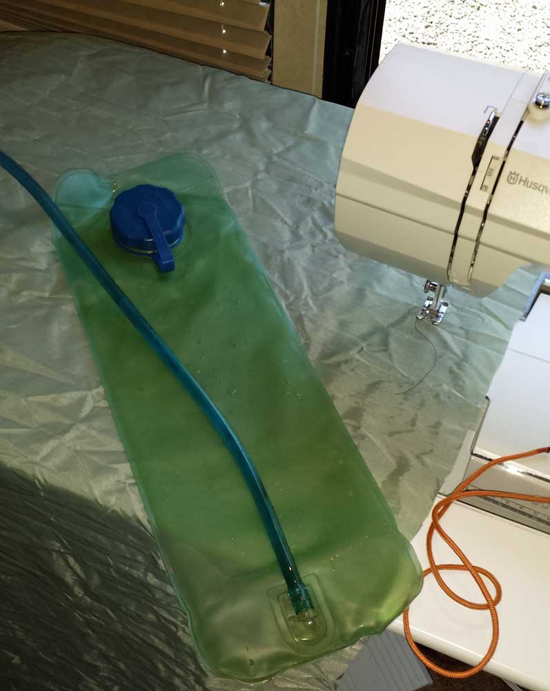
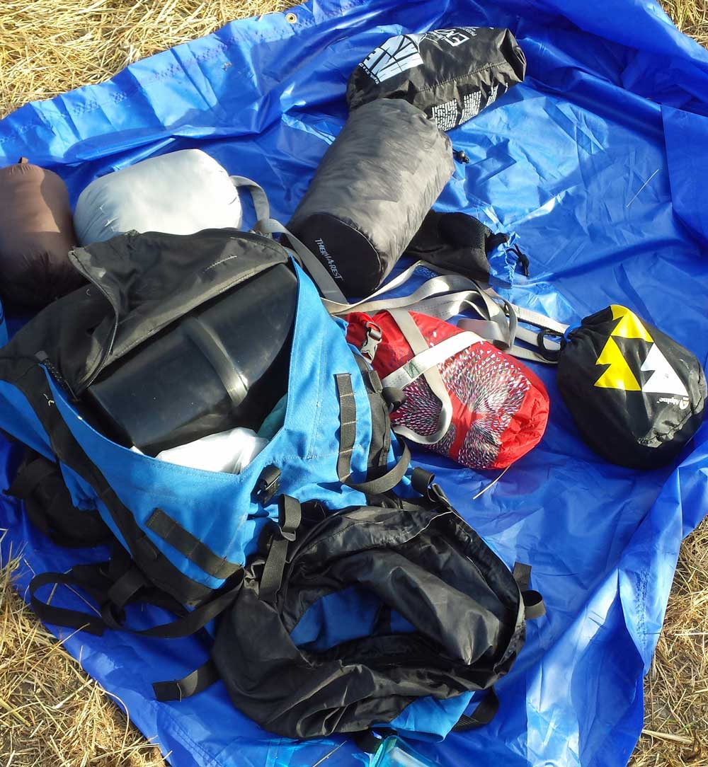
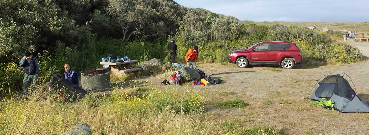
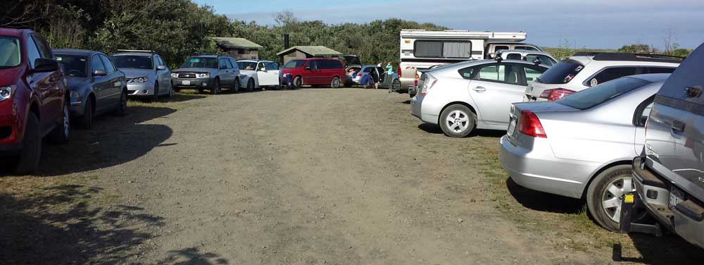
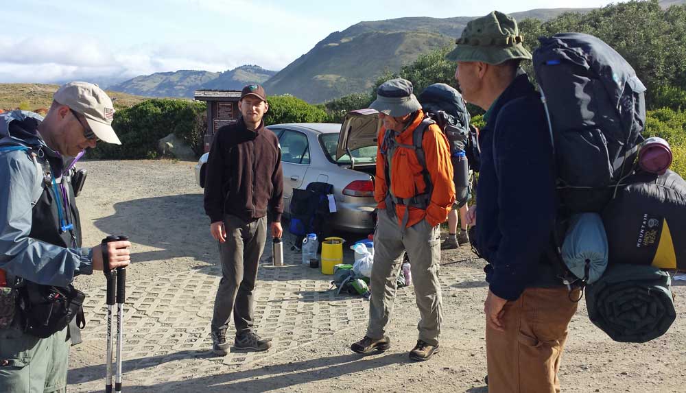

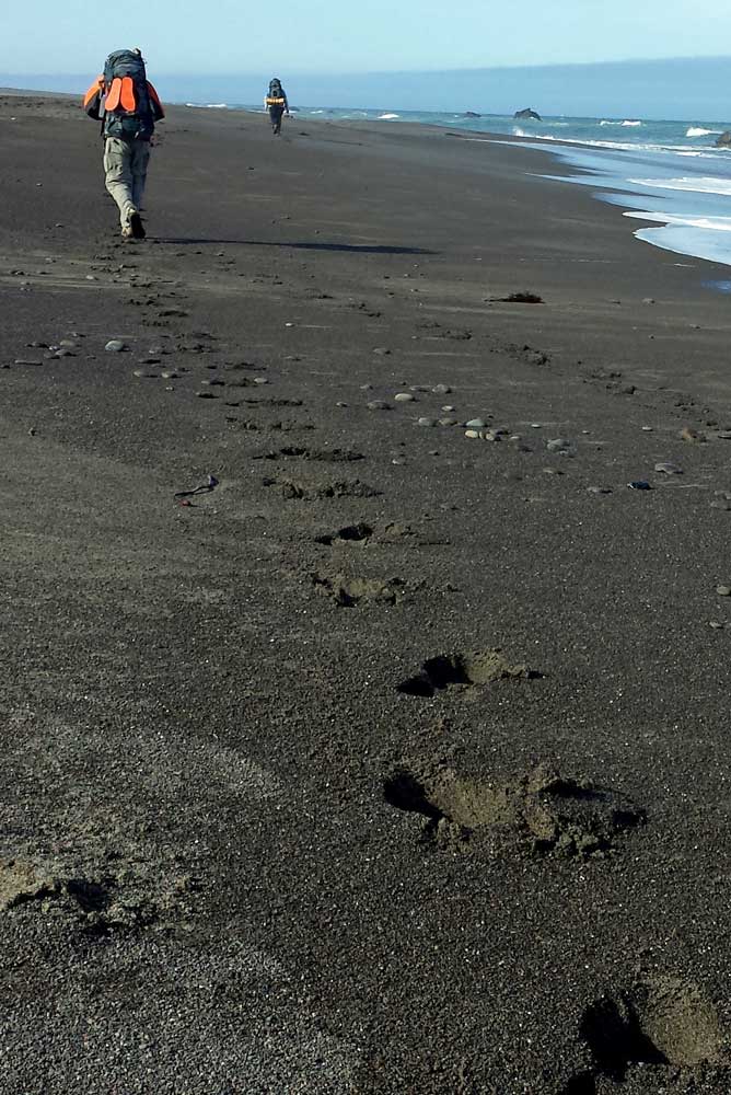

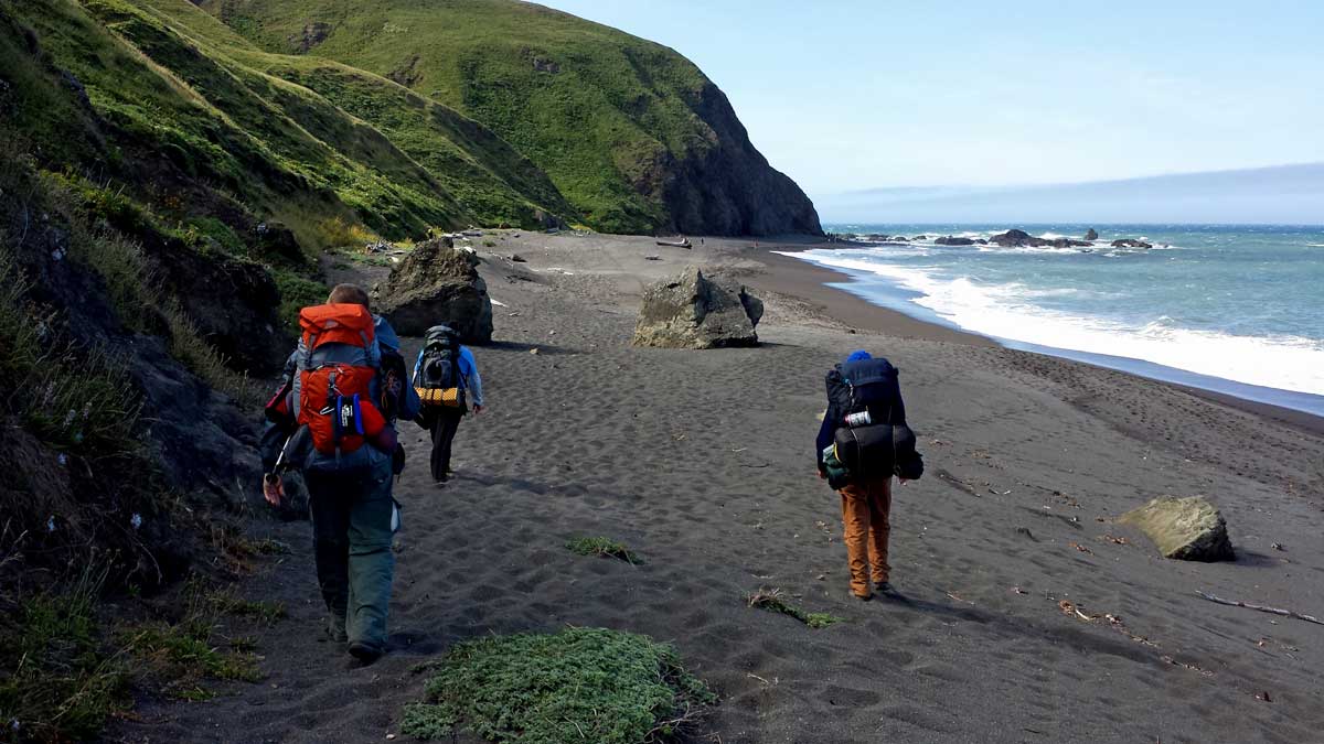

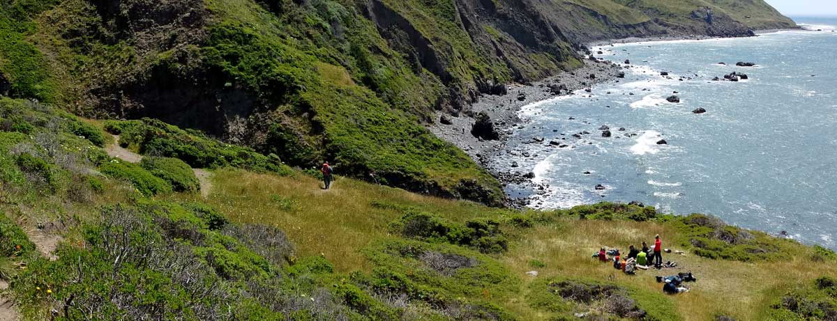
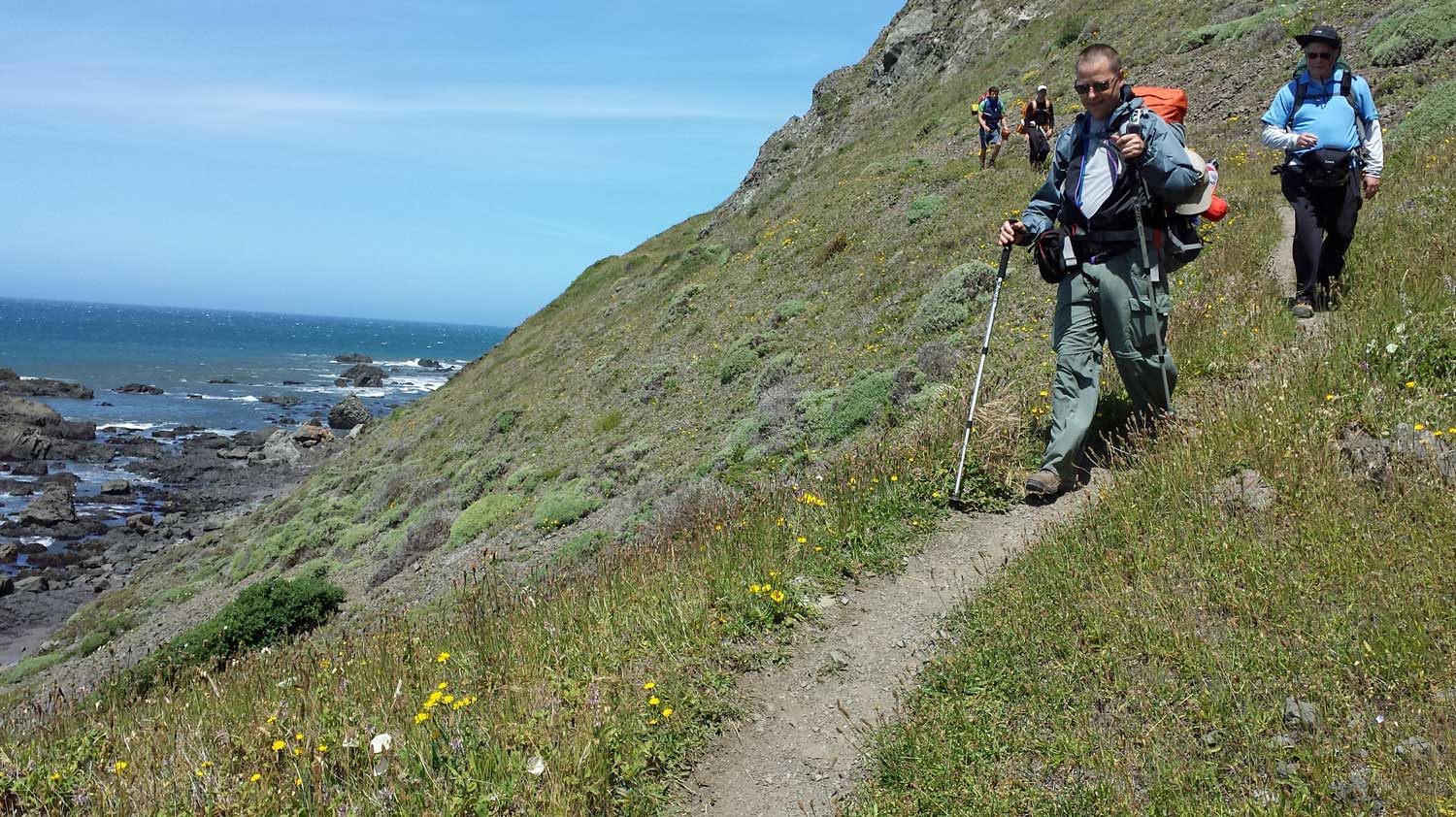

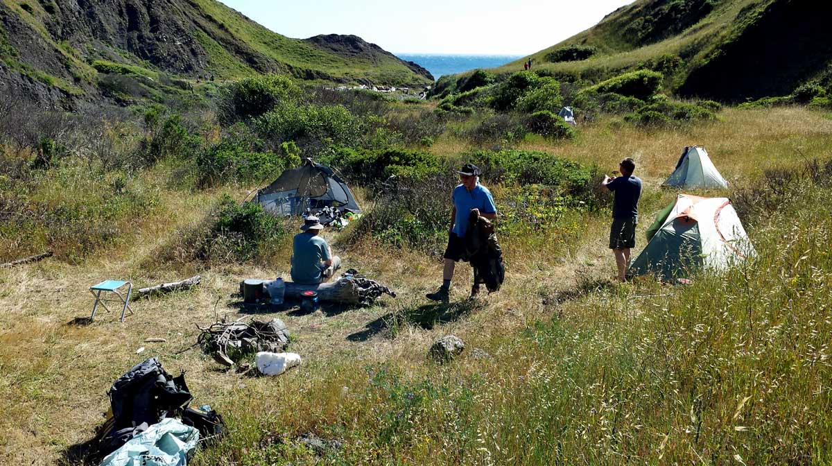
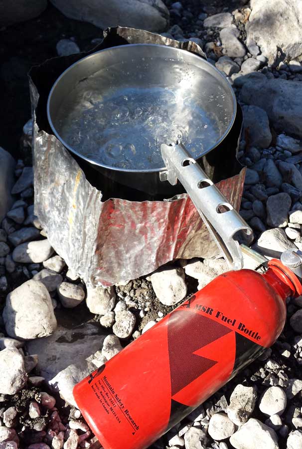

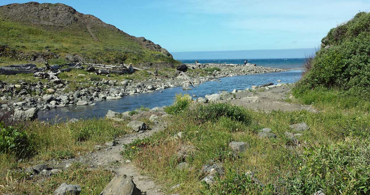
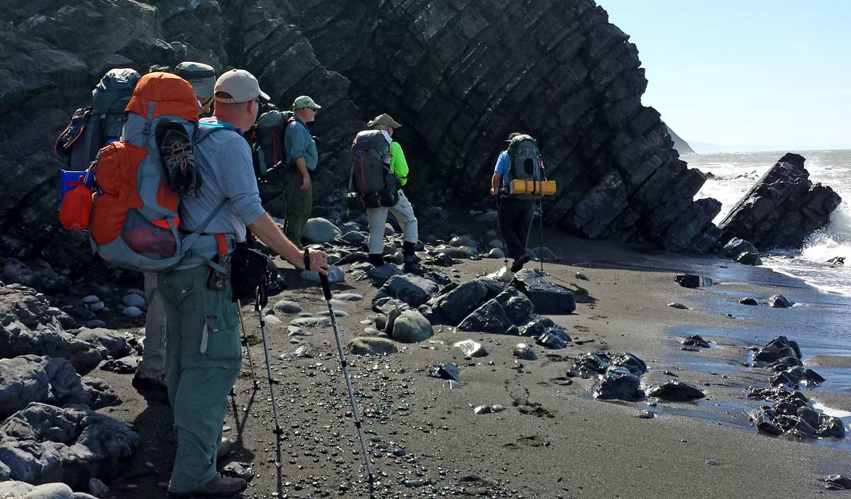
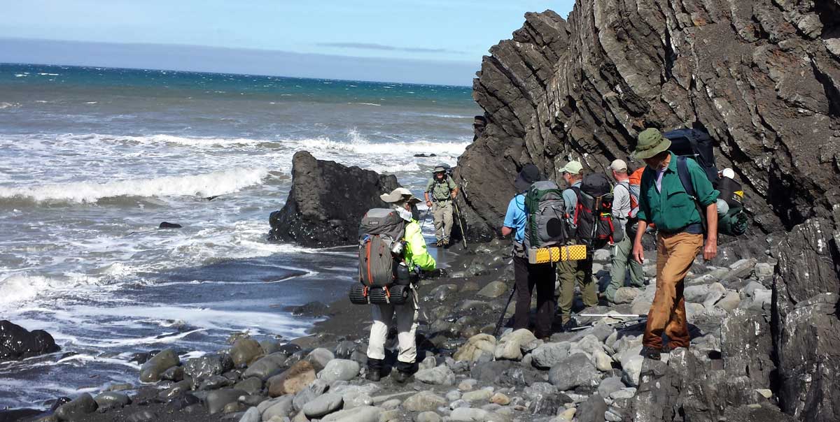


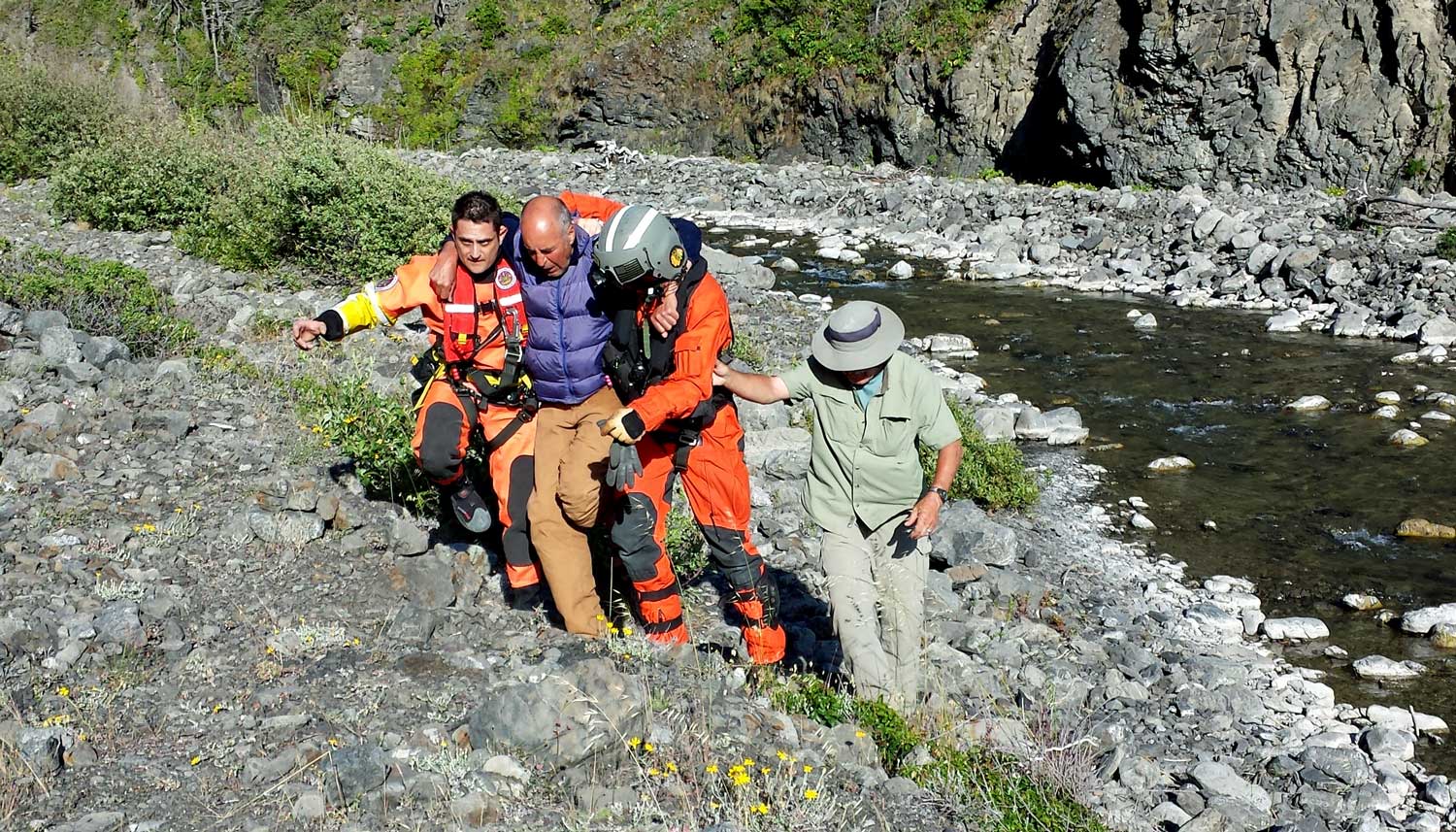

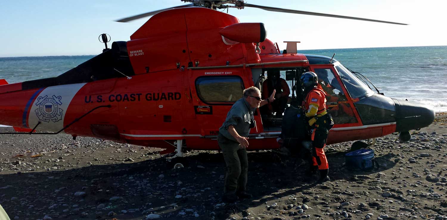
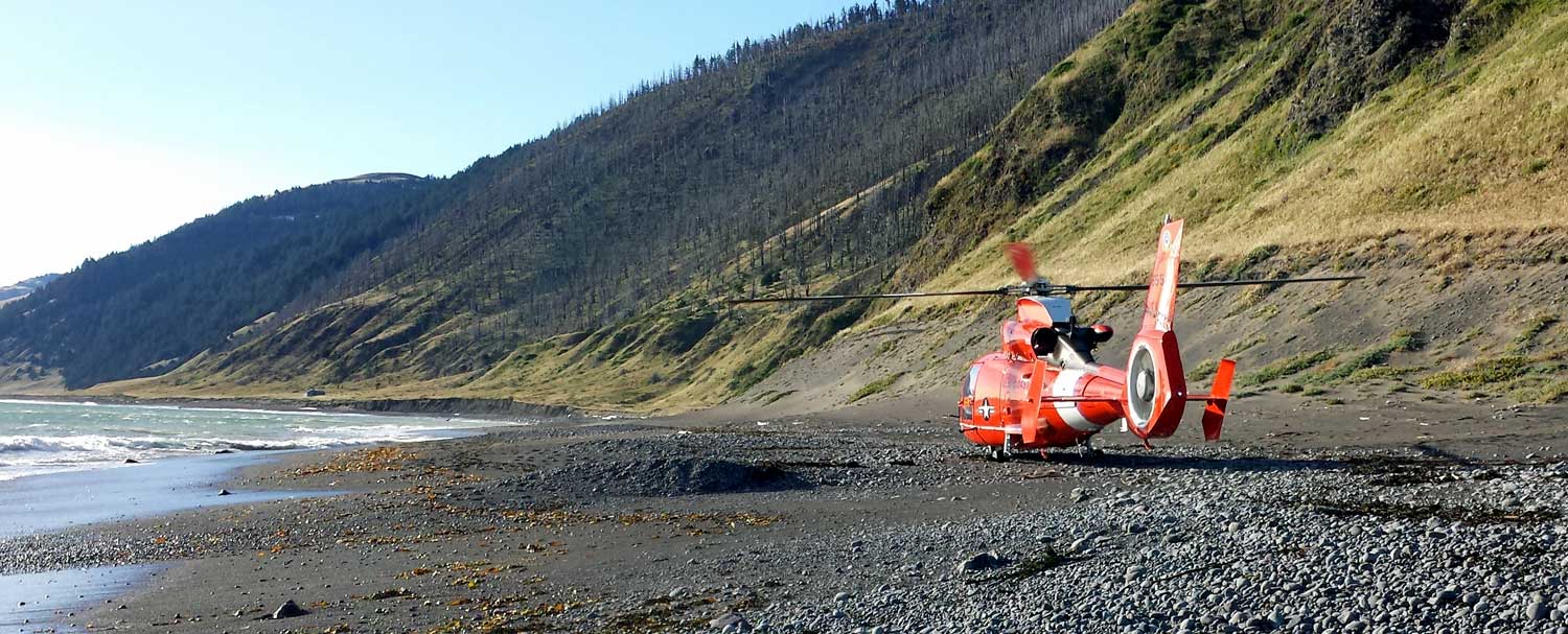
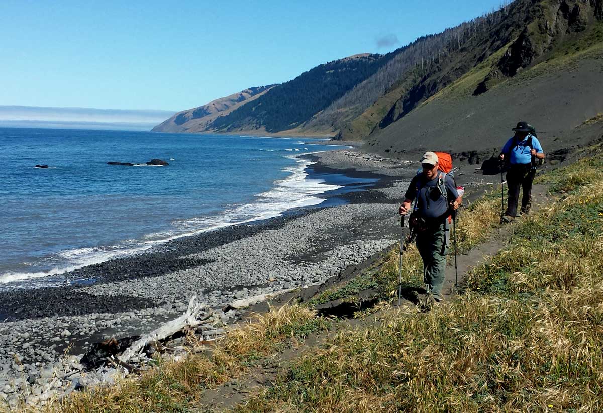
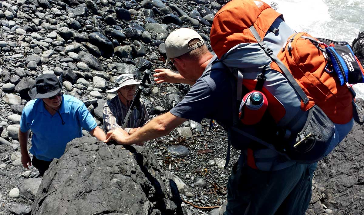
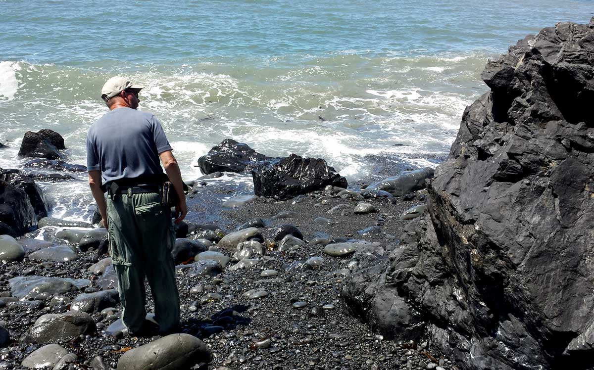
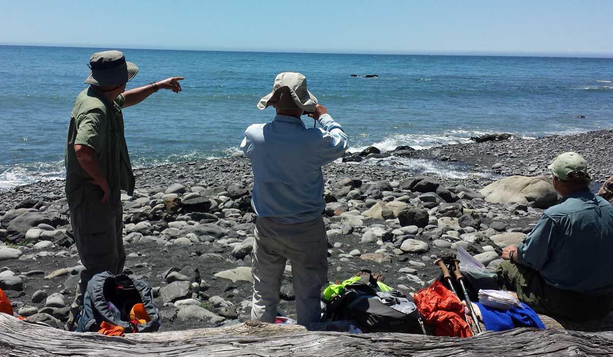
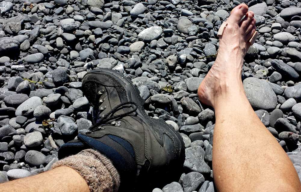

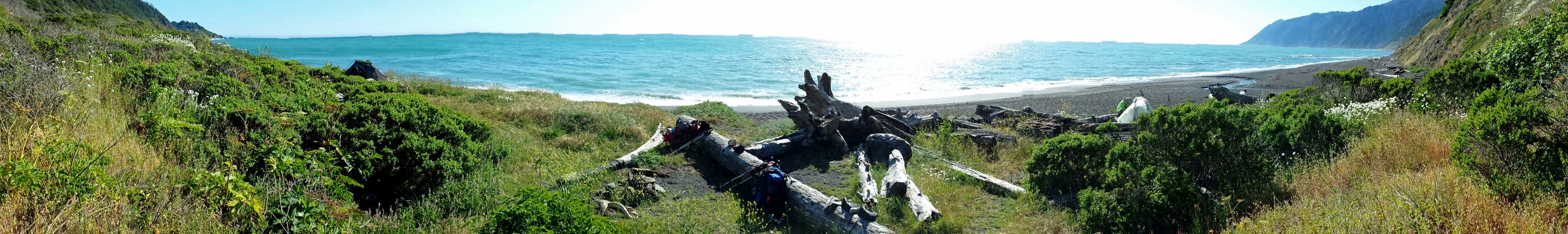
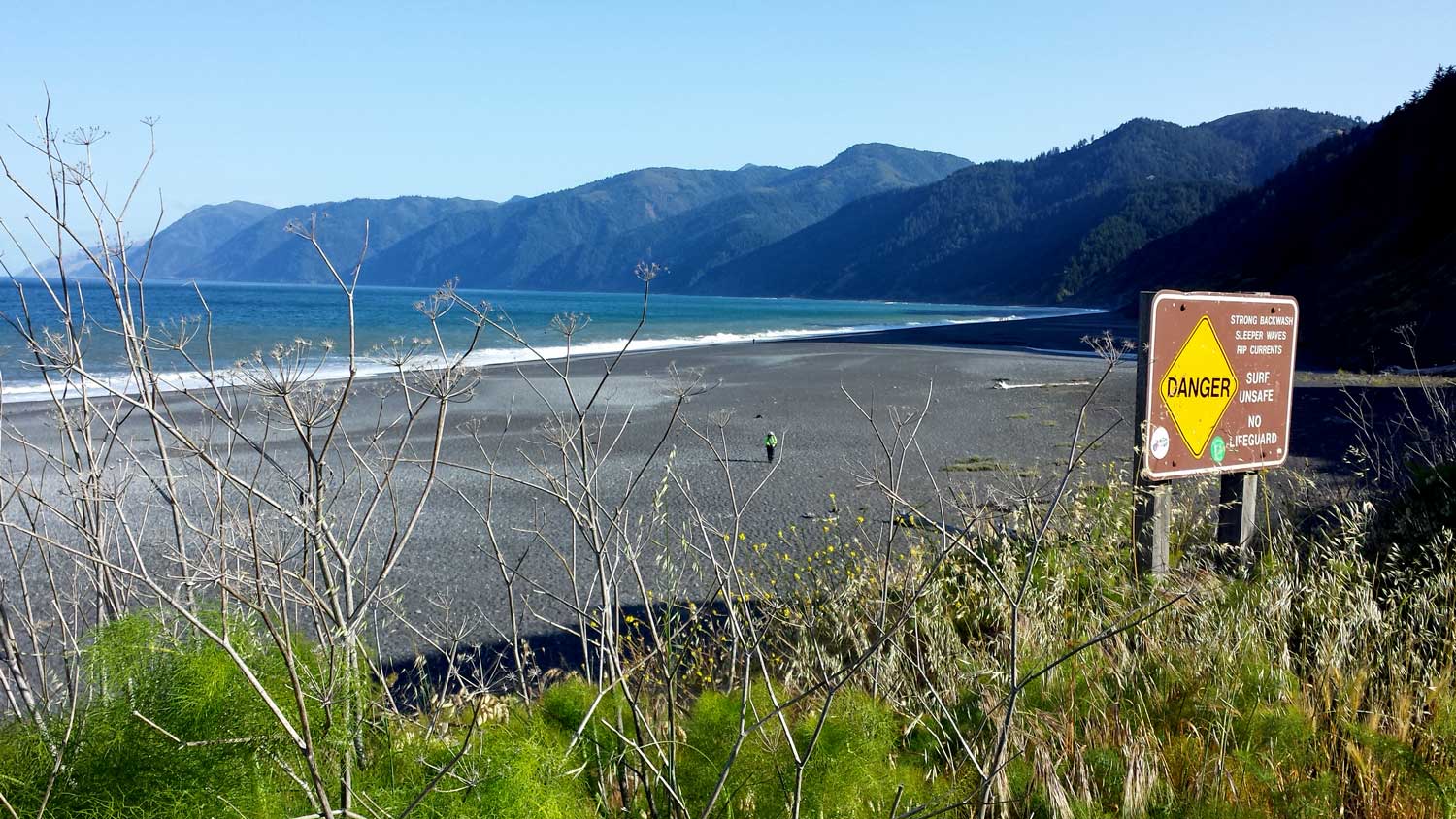
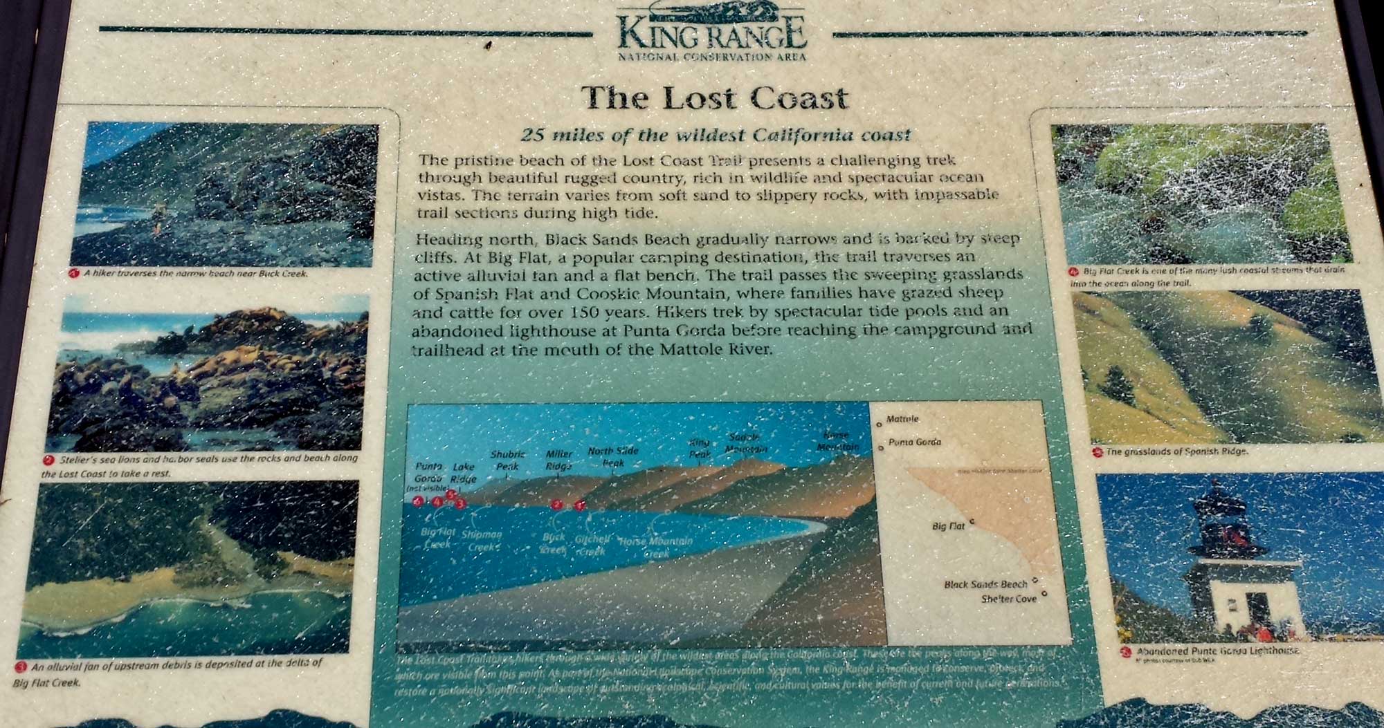

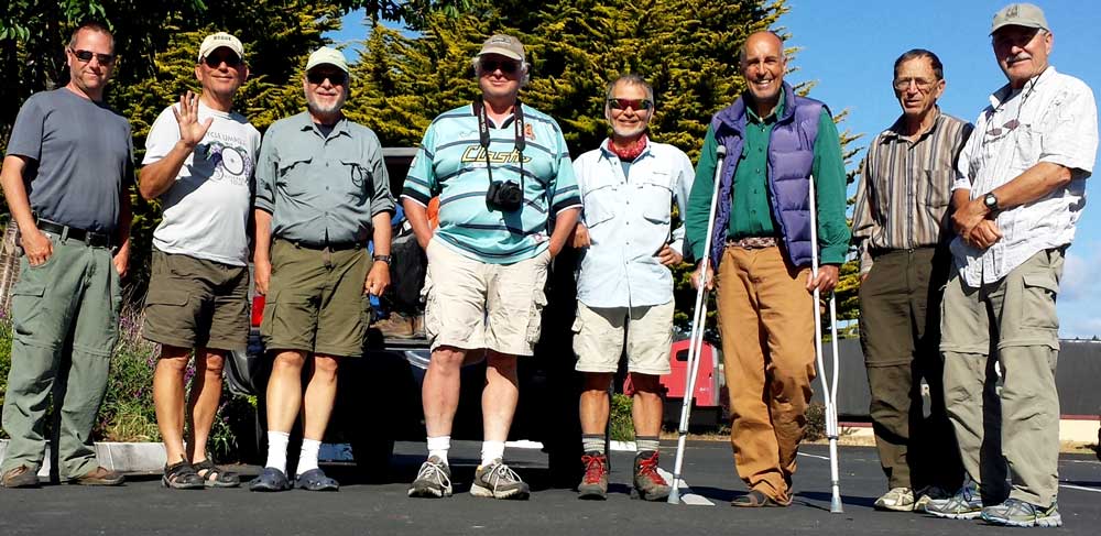
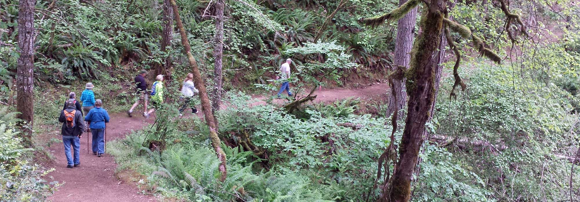
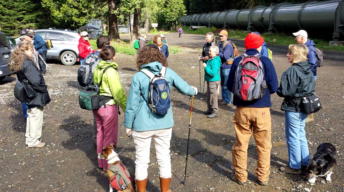

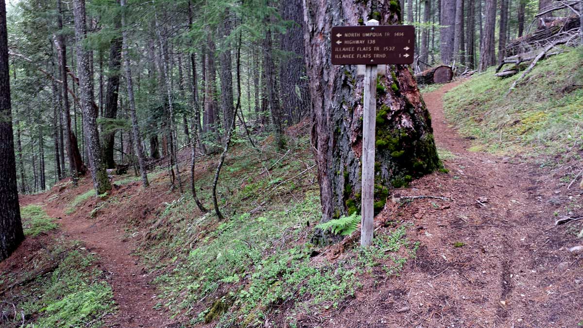
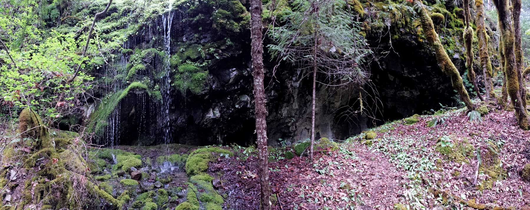
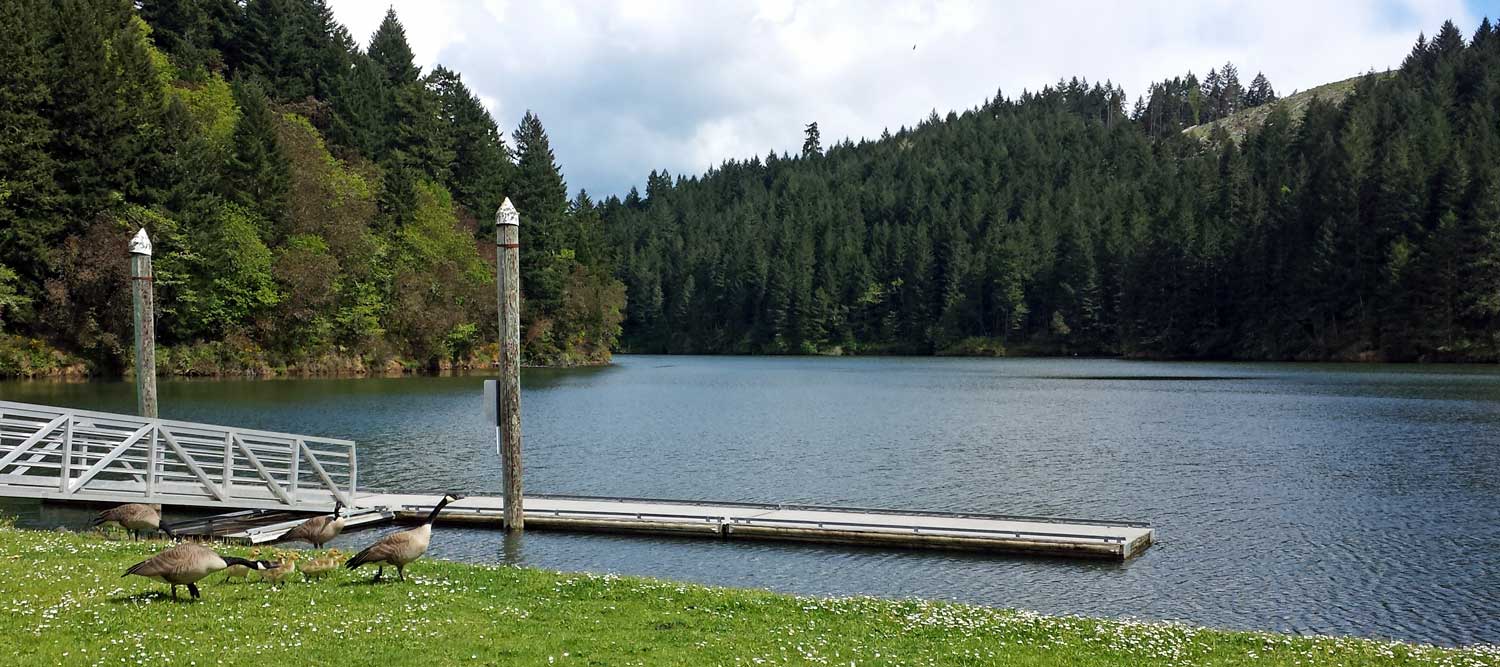
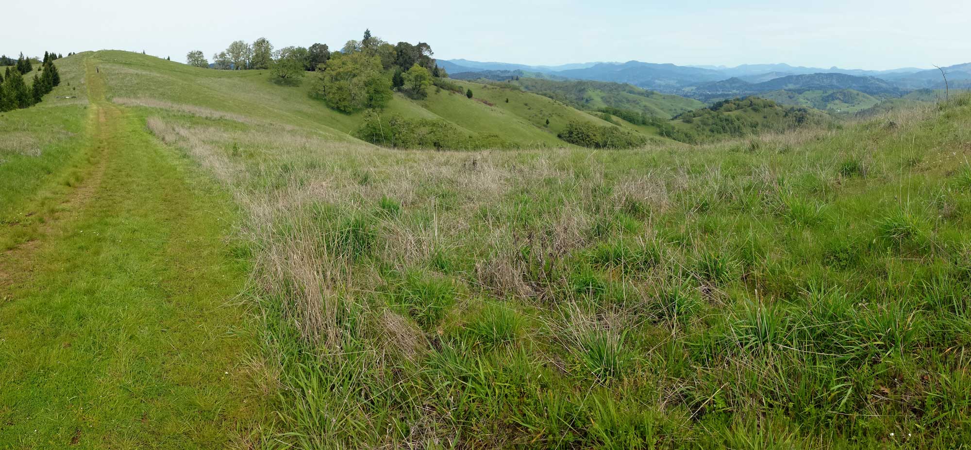
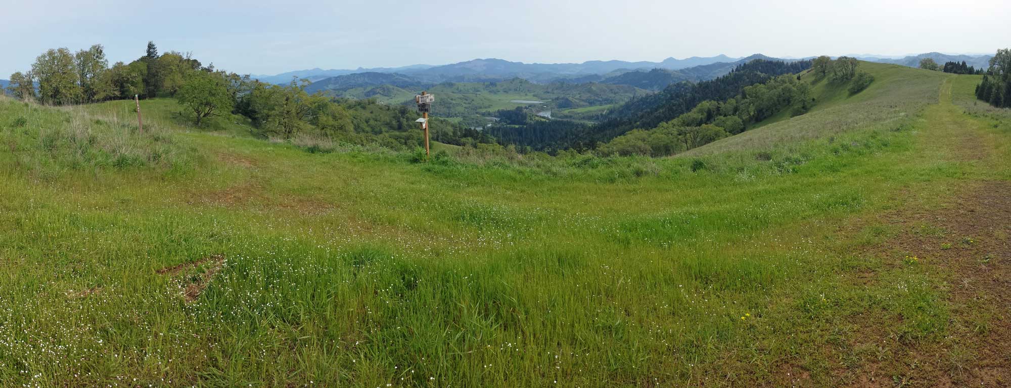
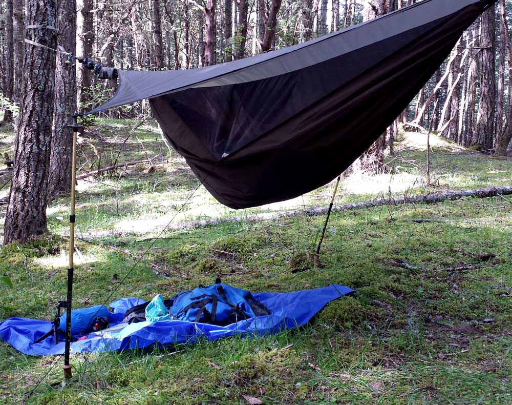
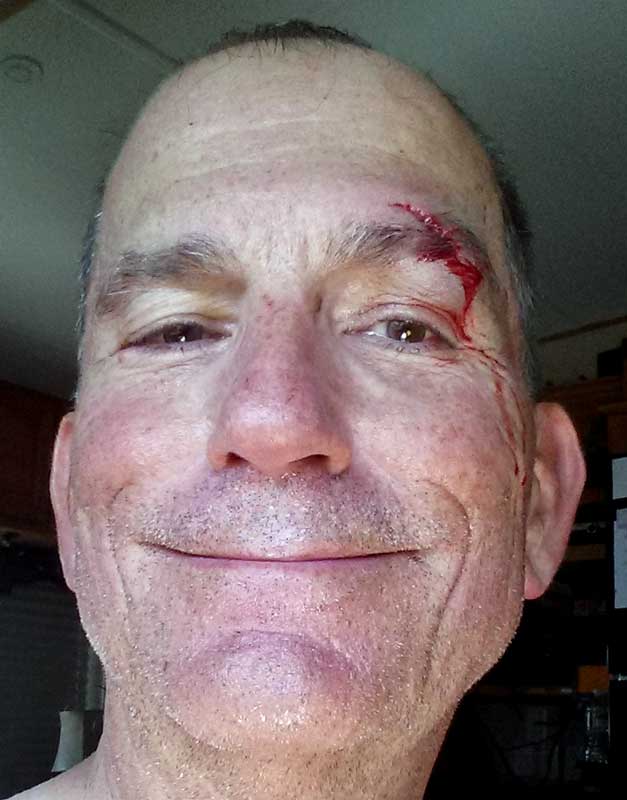
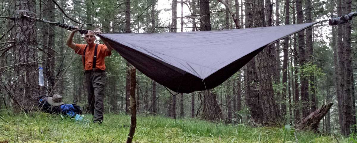
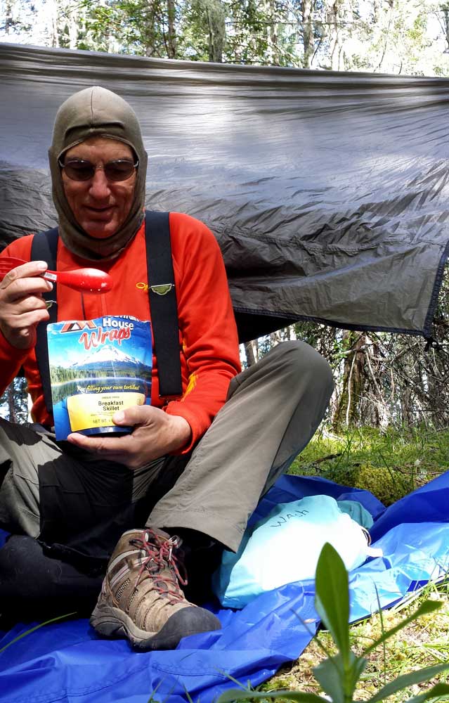

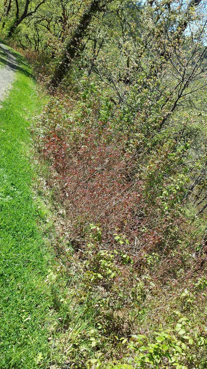
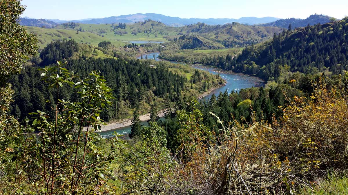
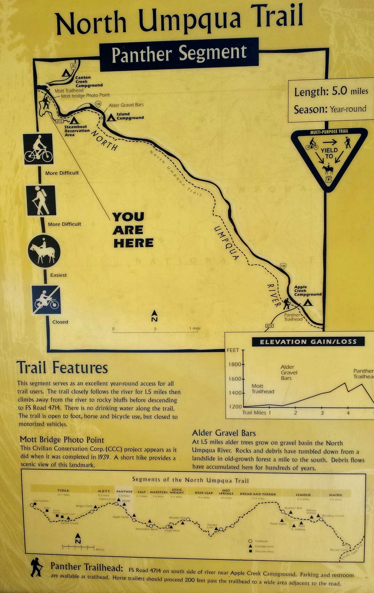
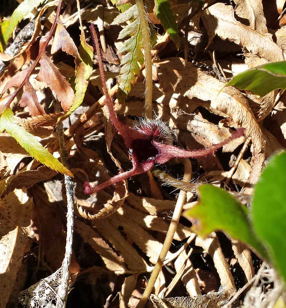

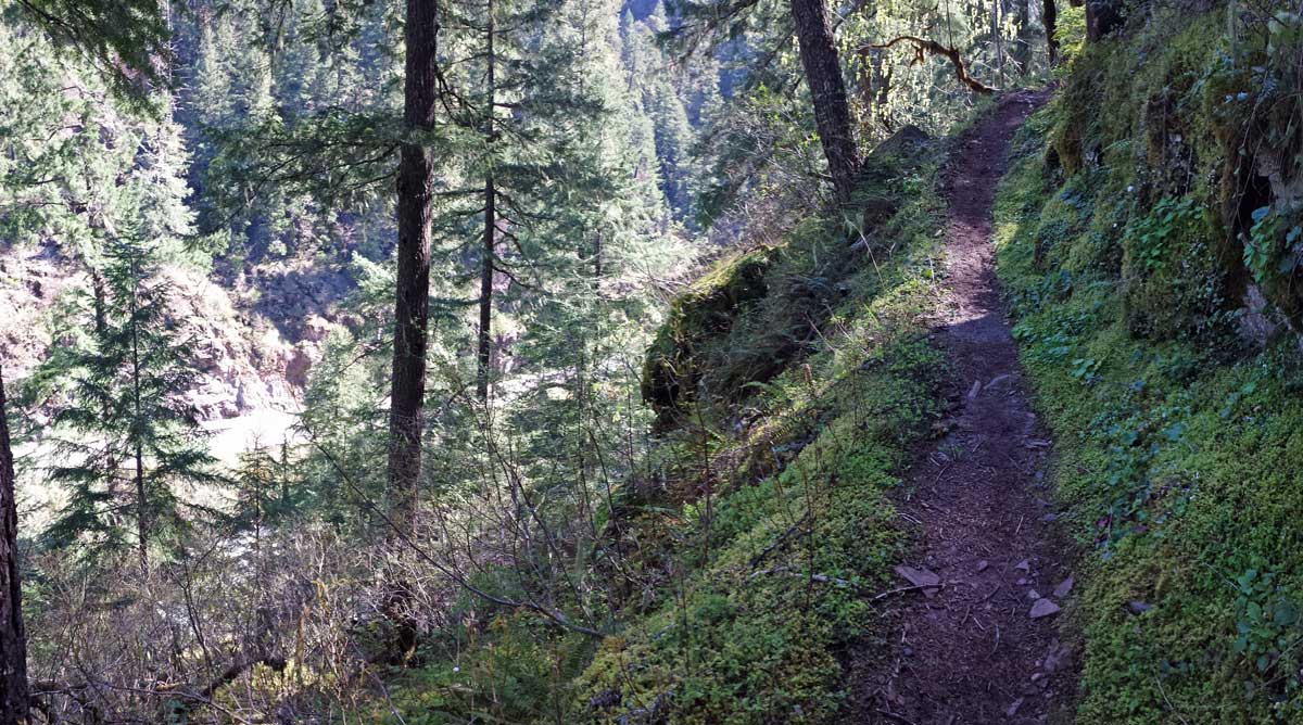
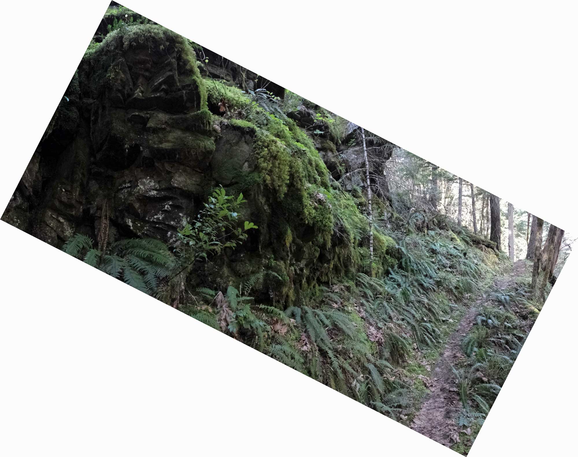

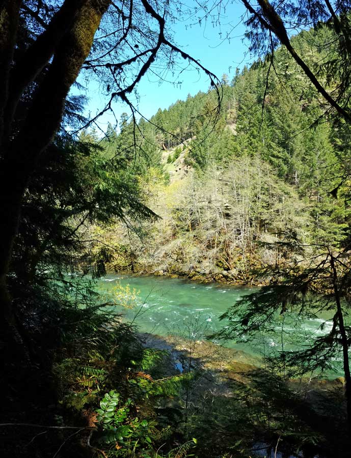
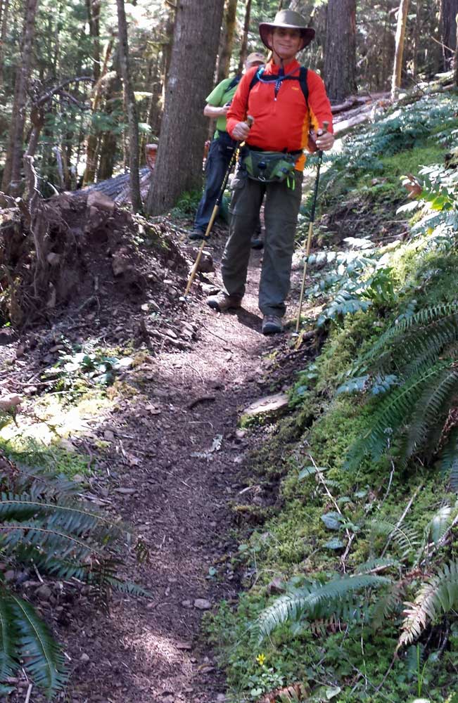
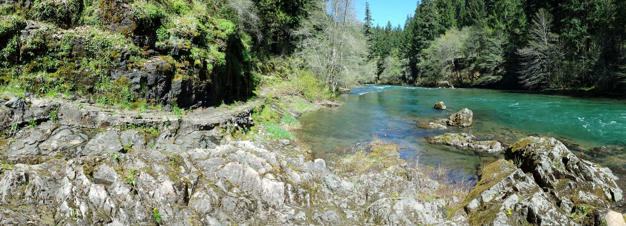

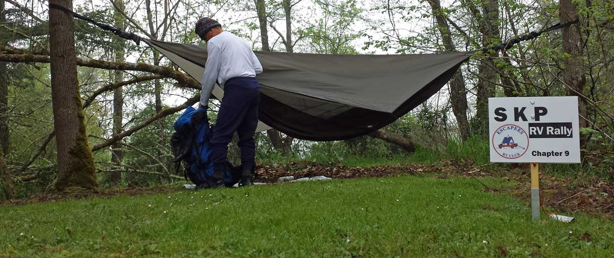
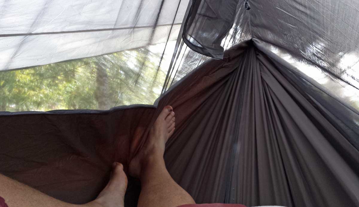
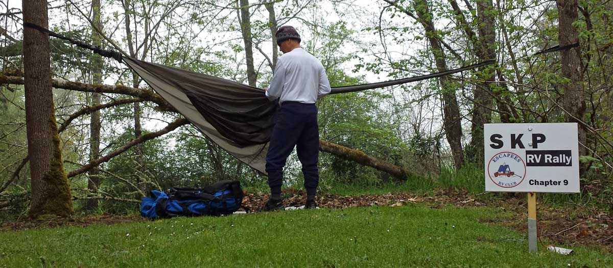

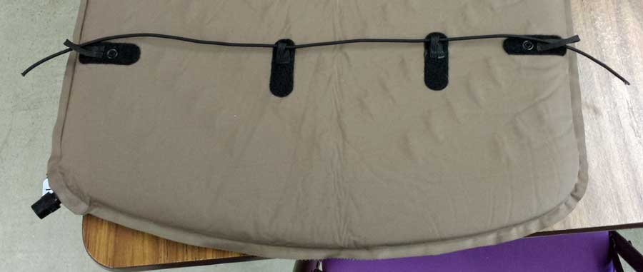
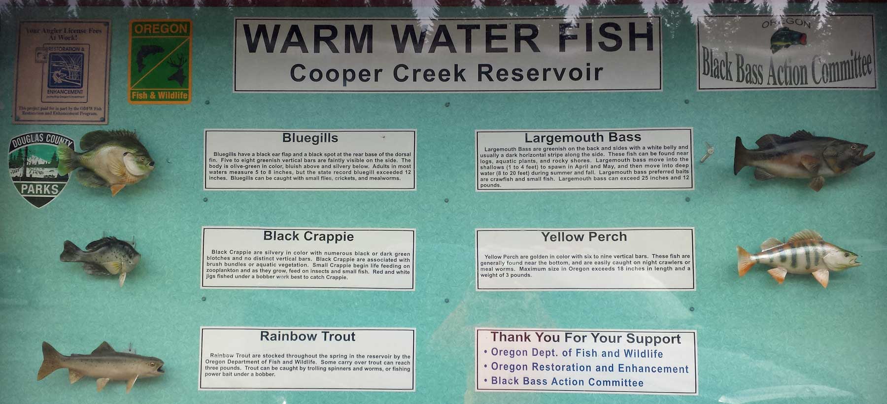
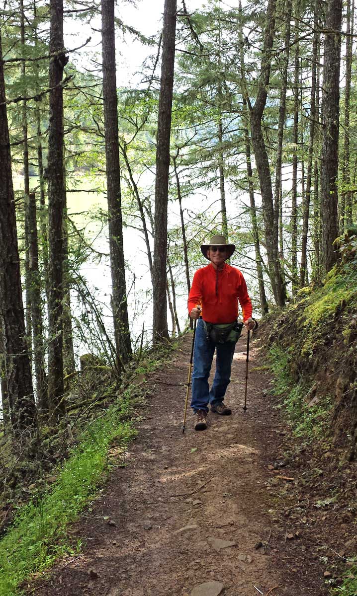
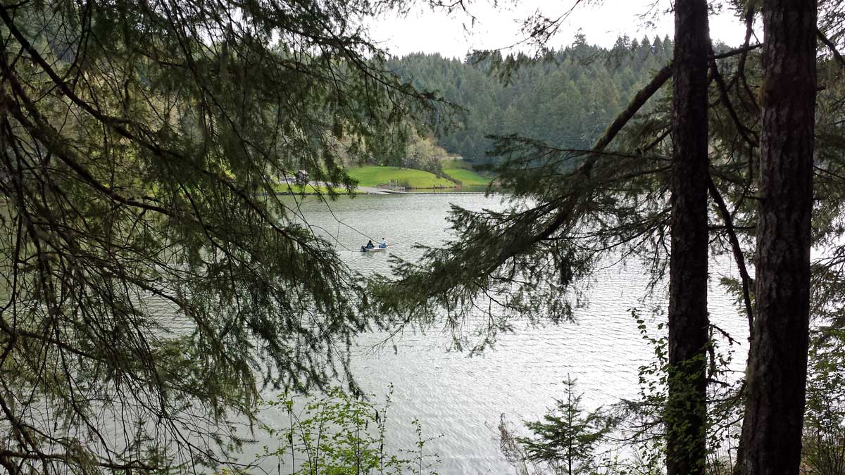
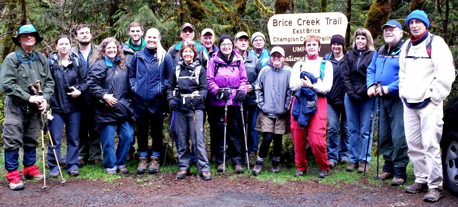
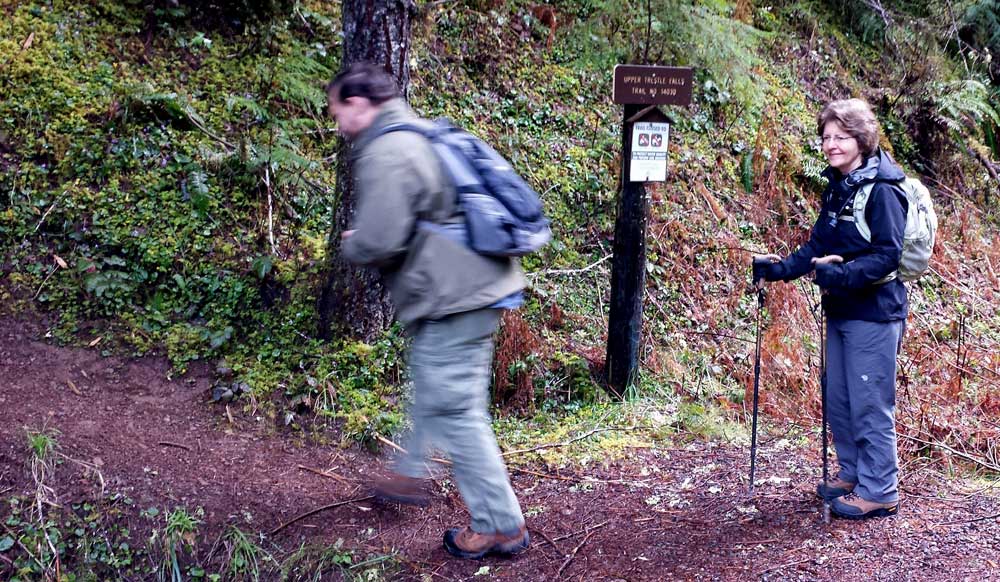

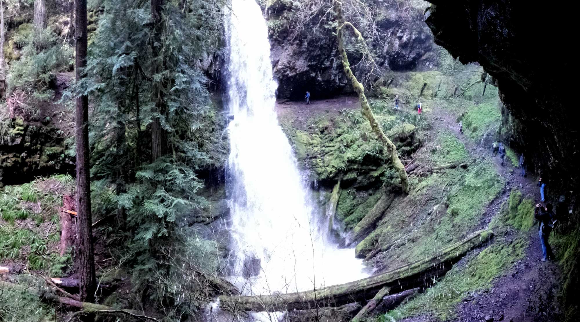

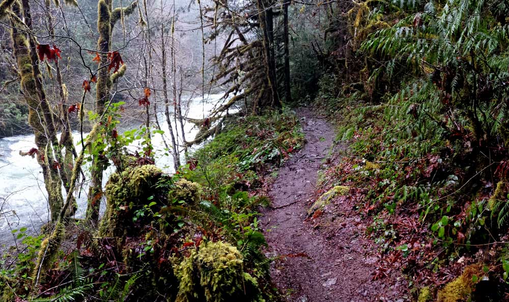
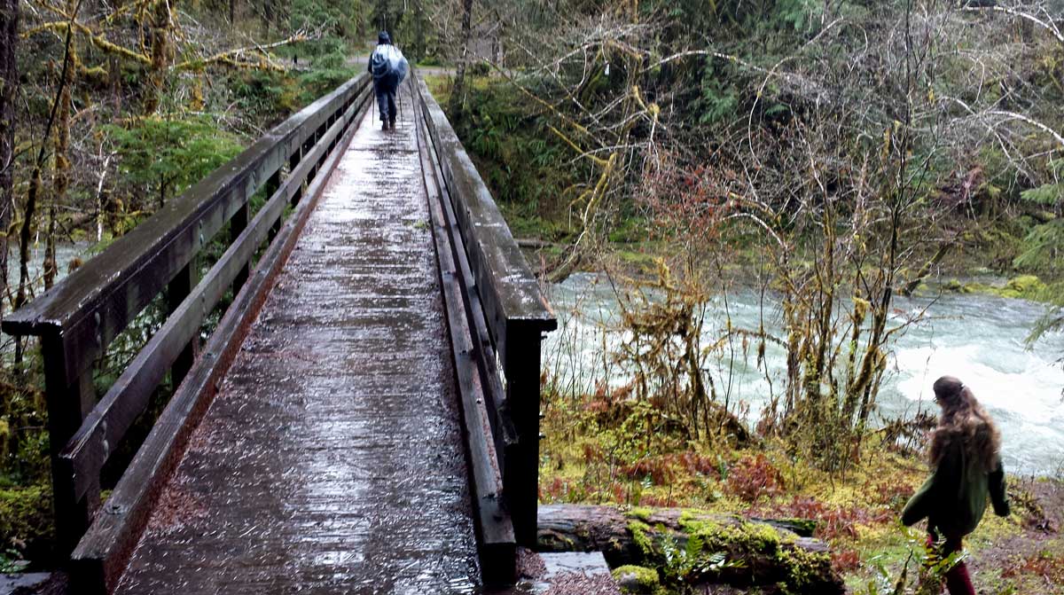
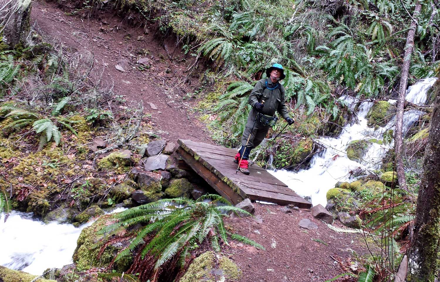
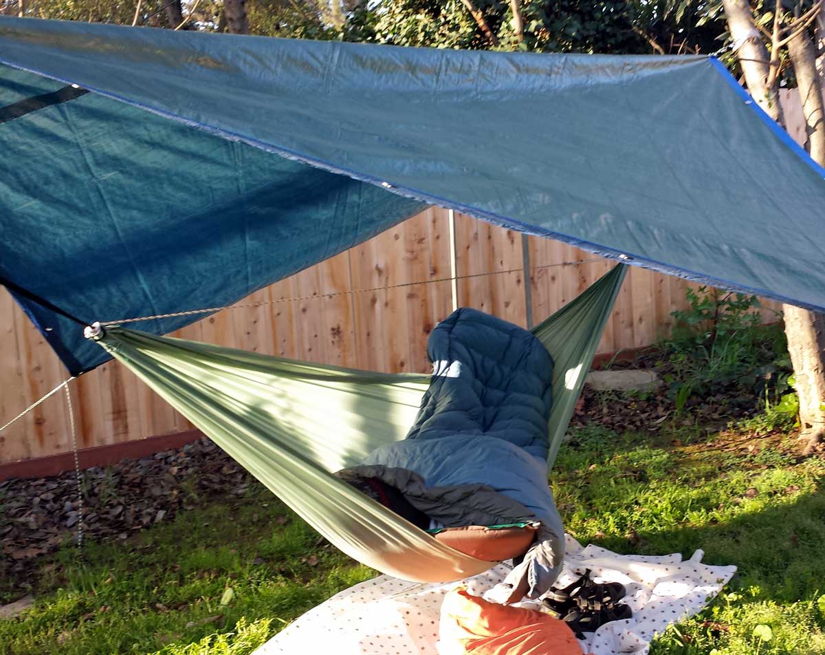 Saturday, March 15, 2014: Gwen sneaks a photo early in the morning when I'm still asleep for my first experiment with hammock camping in my Mother's backyard. I wish I could say it was a wild success and everything I expected hammock camping to be (comfortable). Let me first describe what you are seeing. Hammock campers wear something over their head since the head is not tucked into a mummy bag so I'm wearing a stocking cap. You are also seeing my Thermarest mattress hanging off the hammock to the right. The mattress is attached to a Thermarest Alpine down blanket and I'm tucked in between the mattress and blanket. I'm trying hammock camping because I don't like sleeping on the ground and hammock camping has many benefits to ground sleeping. What I've learned from the first night in a hammock. Now, I want to end on a positive note so I will begin with the negative. I'll try to put my points in order starting with the worst negative. My mother's house is on a well traveled four lane road so the noise of the traffic was by-far the worst. Even with ear plugs, the traffic kept me from sleeping. Besides vehicle traffic, the train tracks are 3/4 mile away and there must have been a dozen trains last night. For some reason the traffic and trains sounded like they were going through the backyard. I wasn't expecting bugs because it's early spring but the mosquito's pestered me and found their way to my skin. If you click the photo you'll get a wider view and you can see that my Thermarest mattress is about half out of the hammock and toward the lowest point. It seemed that it would slide on the rip-stop hammock toward the lowest point. A hammock sleeper should sleep on a diagonal and at-least I have accomplished that (from the photo). One of the loops which attaches the Alpine Blanket to the mattress pulled loose and I had to deal with that in the middle of the night. As it turns out, our neighbor has a motion activated light pointed into my mother's backyard and would occasionally turn on due to my moving (shining into my eyes). I wasn't able to sleep on my back for long periods of time like I thought I would. Something is not quite right. I would pull myself toward the head end of the hammock because my feet were too high and I needed to be more equidistant from both ends but always seemed to end up in the position you see. I tightened the structural ridgeline thinking that would help but now I'm wondering if I should have eliminated it entirely. I'm not testing tonight because I don't want to listen to the traffic again. Now for the positive (again, in order of the best first): My "sleep system", Thermarest mattress and Alpine Down Blanket kept me warm. It dropped to 47° which is mild but felt cold outside of my "system". My new stocking cap kept my head warm. I learned I must stay on the mattress or I'm cold underneath. I was able to sleep on my side. I was able to reposition the mattress by tugging on the head-end of the hammock. I didn't fall out of the hammock even though I struggled with keeping my sleep system in the right position. The tarp kept the dew off. I believe I was more comfortable than if I had been in my tent but I question if that would be true in a strong wind or storm (I know for a fact that my tent works in terrible weather). Finally, all my knots held. Now for wishes: I wish my 5 x 10 foot hammock was bigger (to hold my sleep system better in place). If I were to spend some serious time in this hammock, I would sew a 4" lip on both sides to keep the mattress from sliding off the edge (this could be a novice problem or structural ridgeline problem as I mentioned above). It was a nuisance (again, maybe a novice problem) to stay on the mattress so maybe an underquilt is the better idea over a mattress for insulation. I didn't get much sleep but mostly because of the noise and mosquitoes, not because I was uncomfortable. I need to watch some more videos, perhaps ask a few questions of the hammock forums. I'll try again where it is much quieter in Oregon.
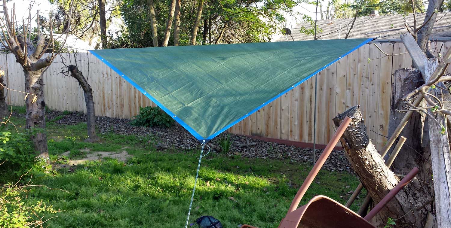
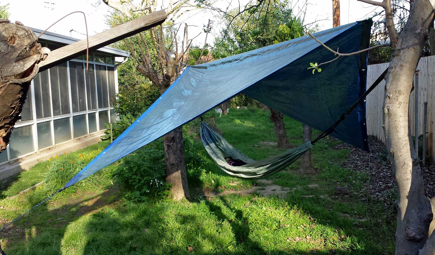
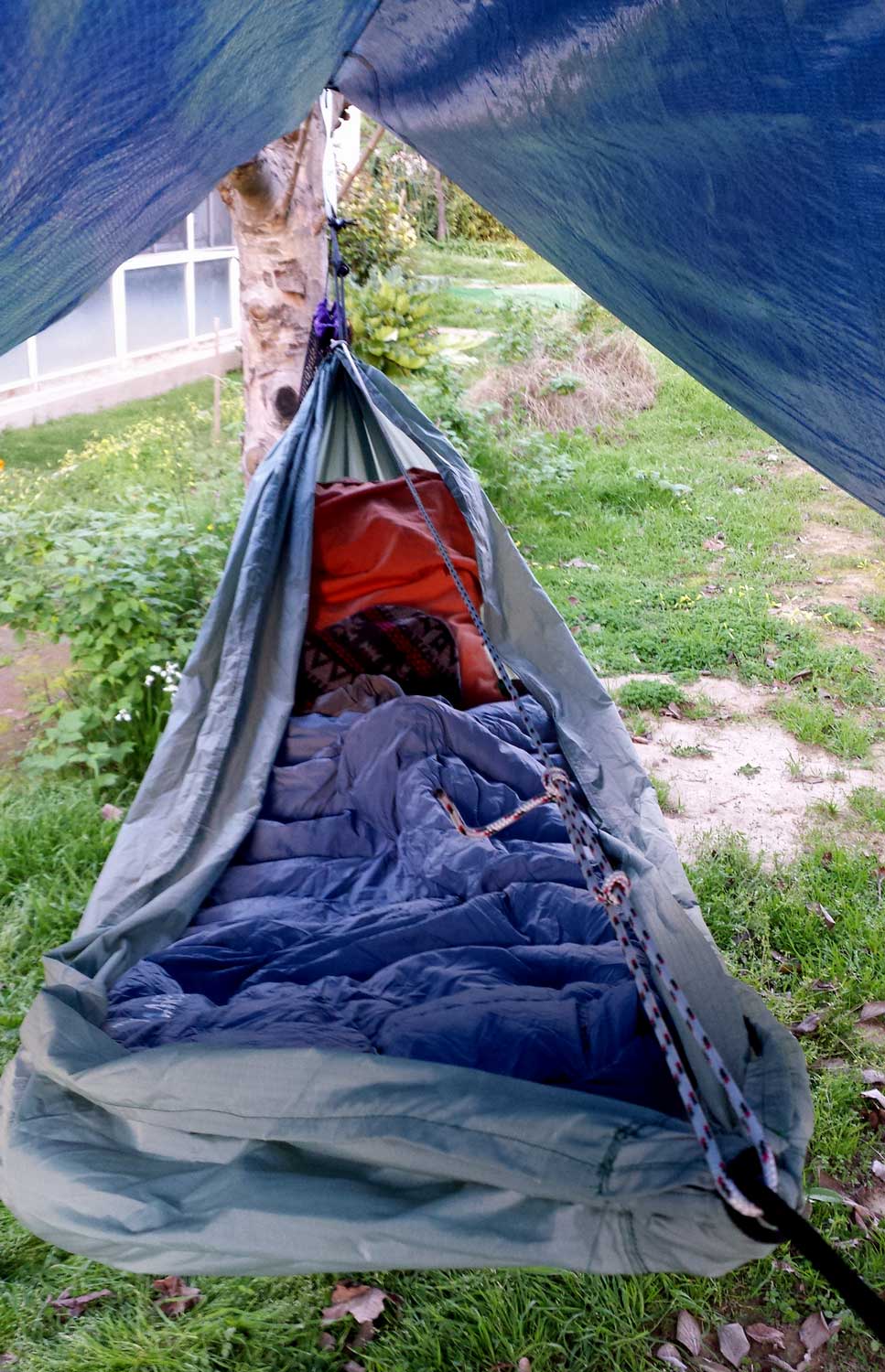

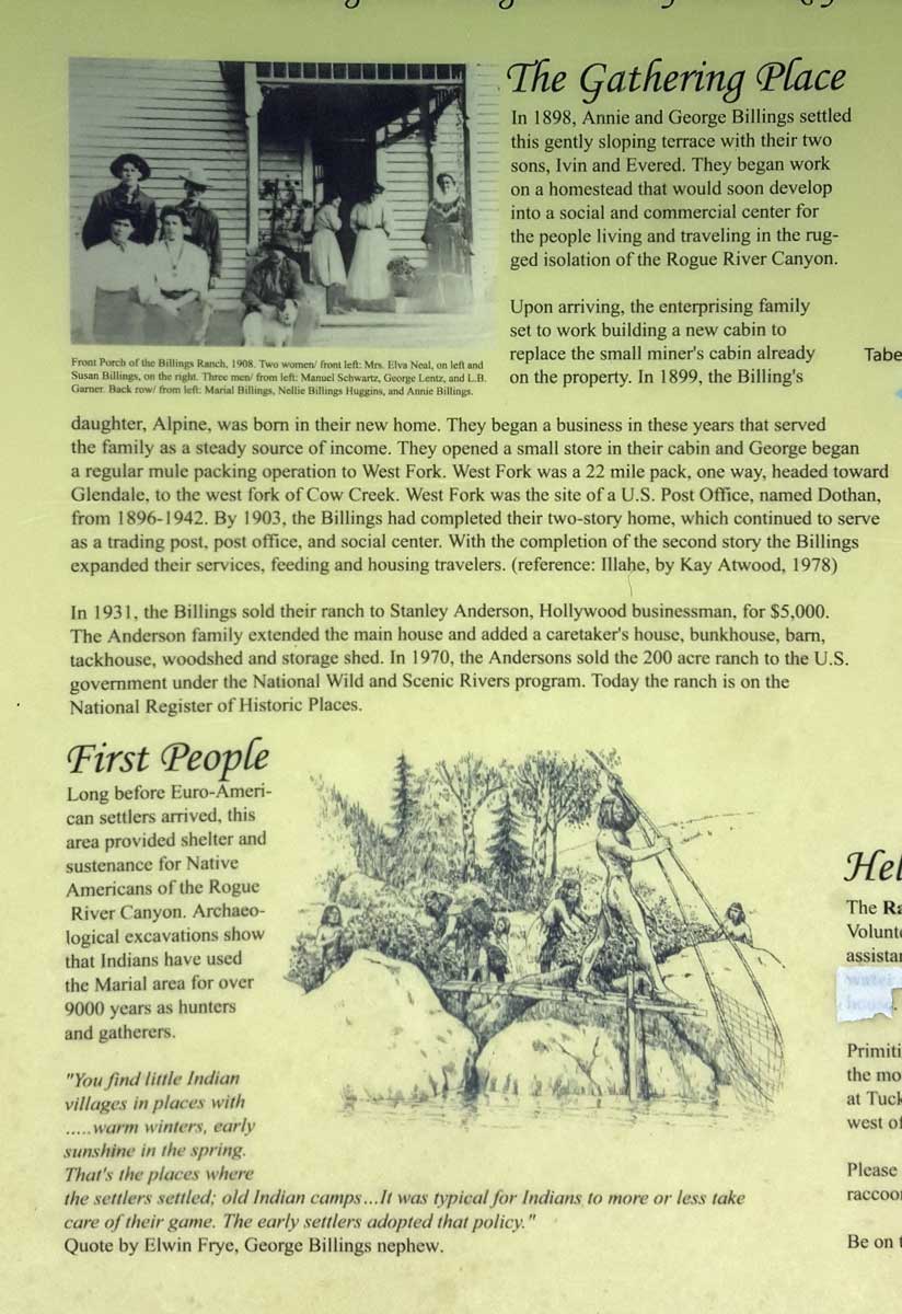
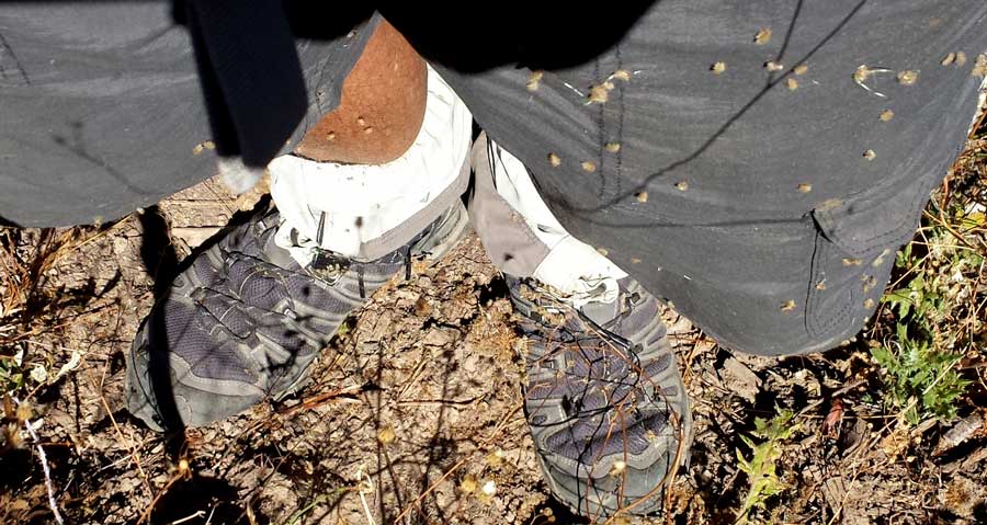
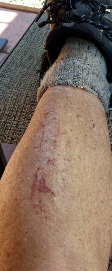
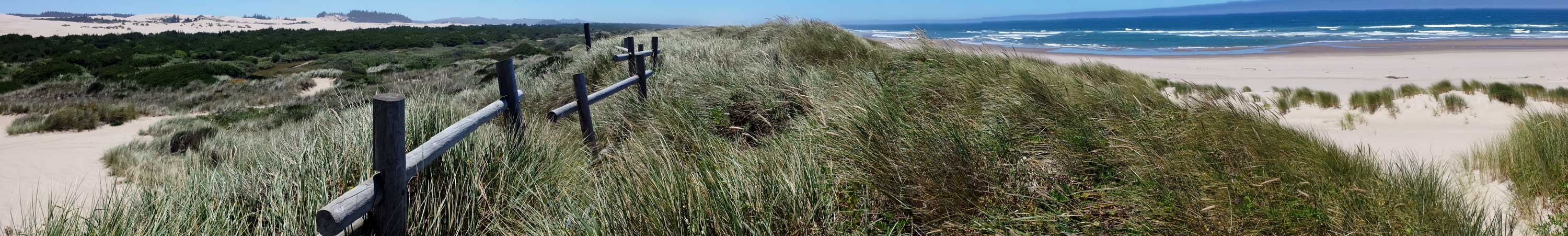
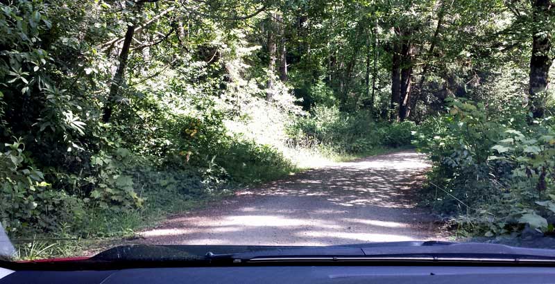
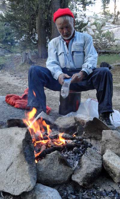
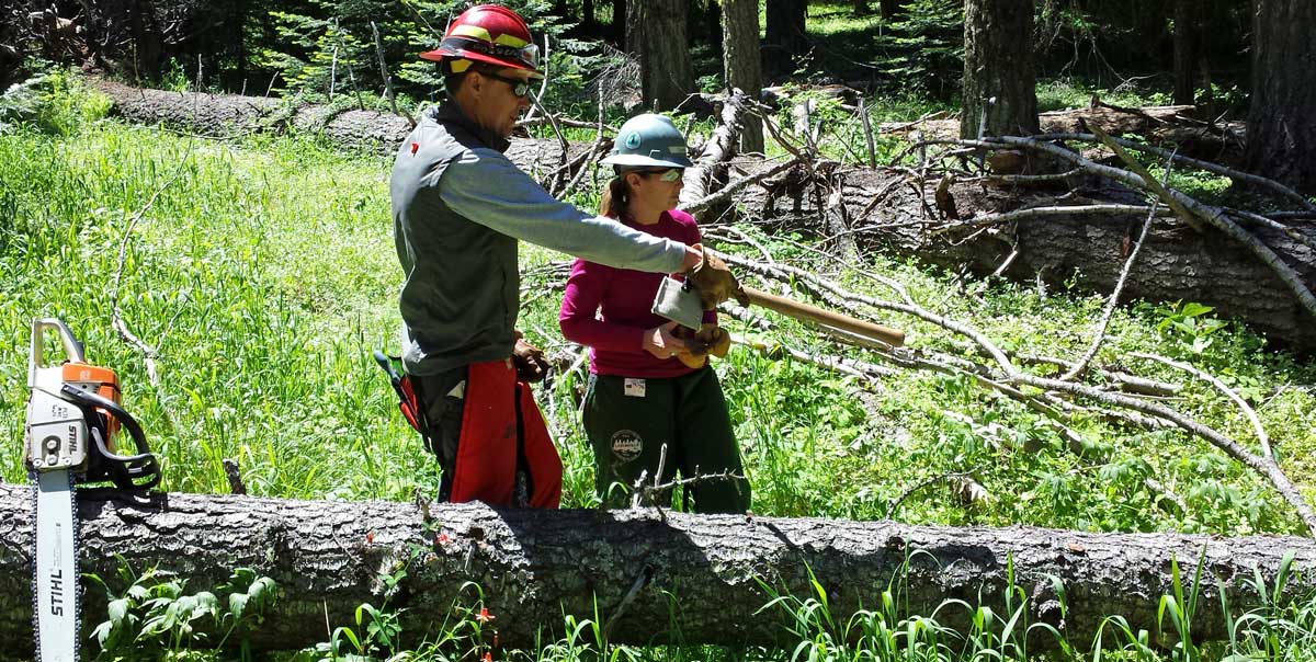
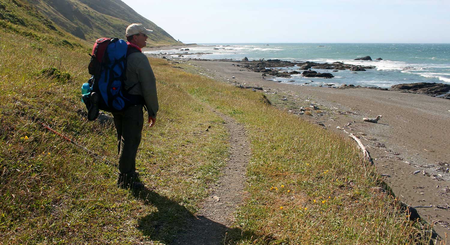
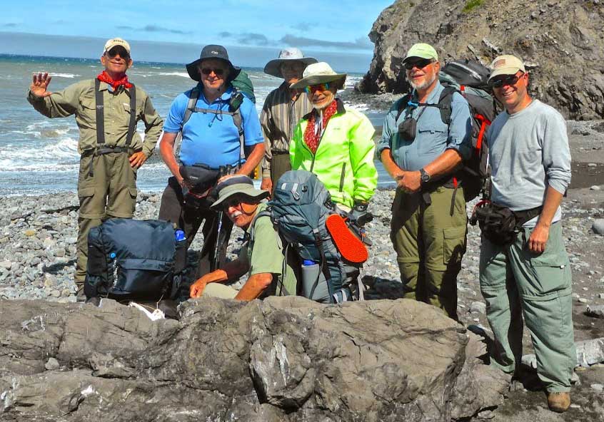
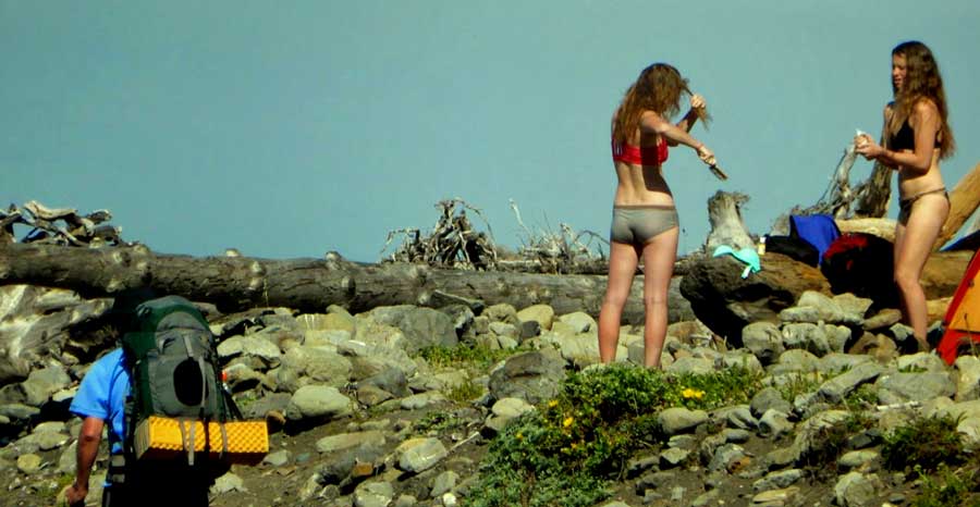
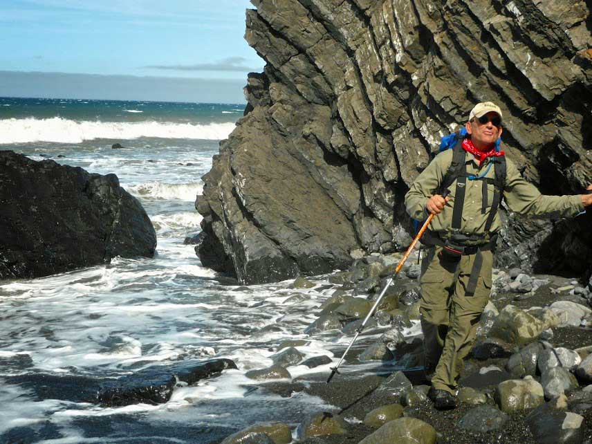
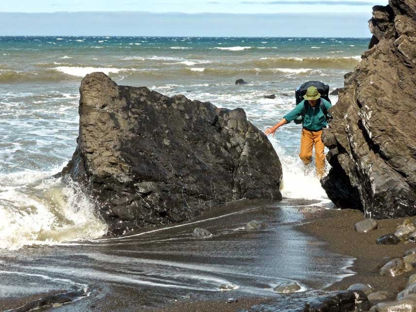
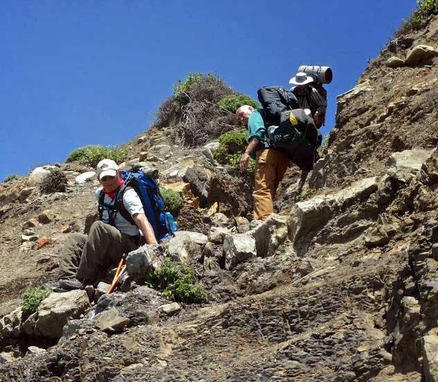
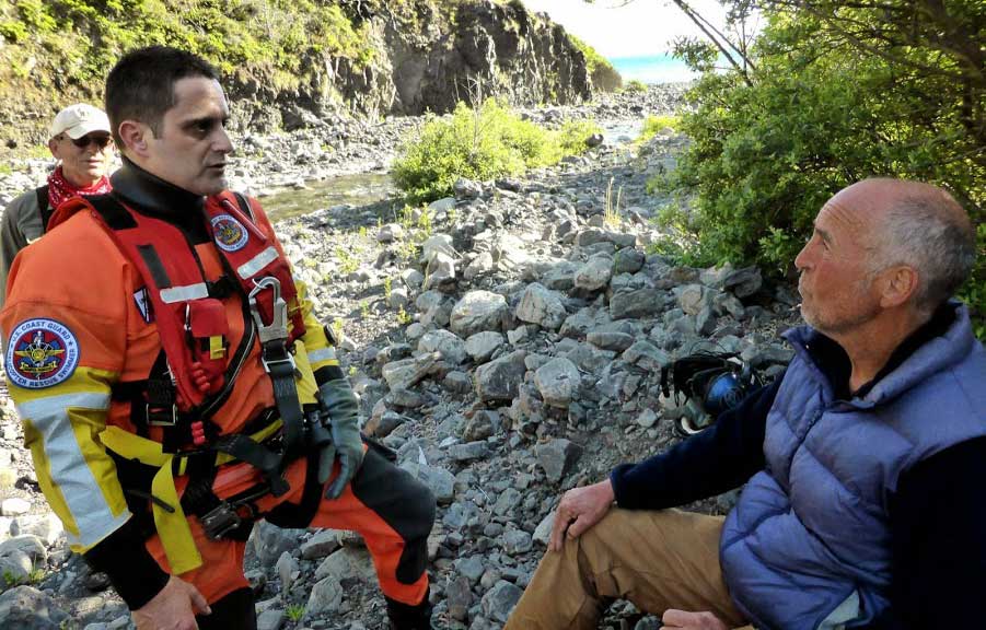
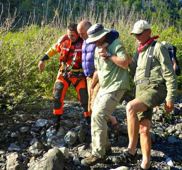
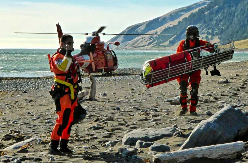
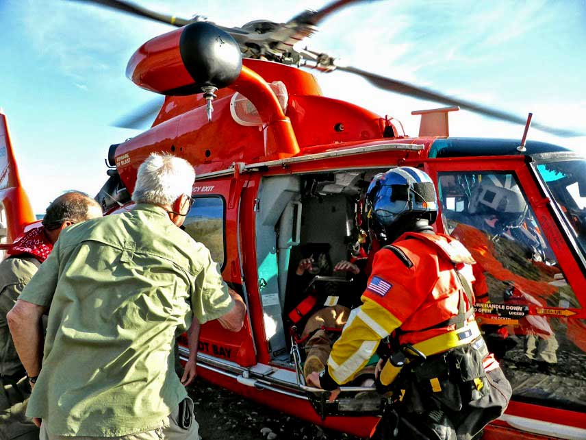
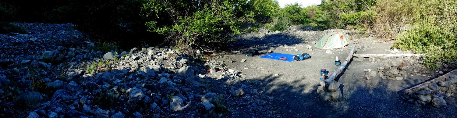
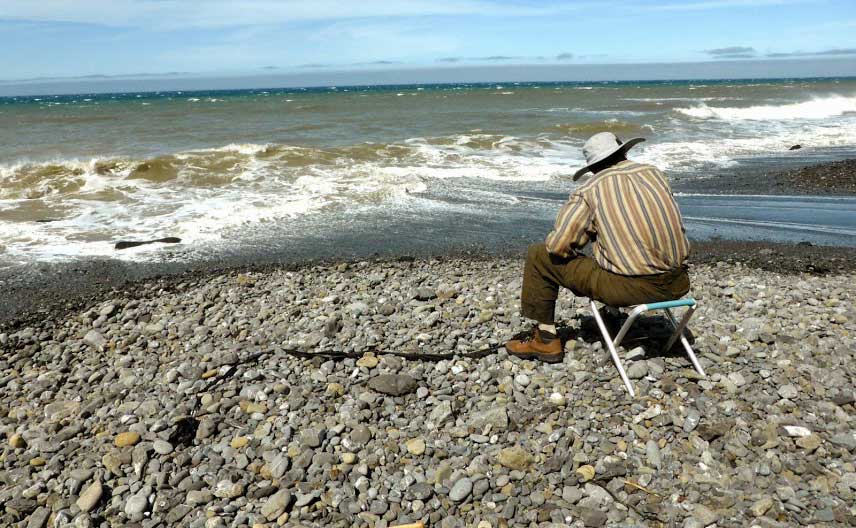
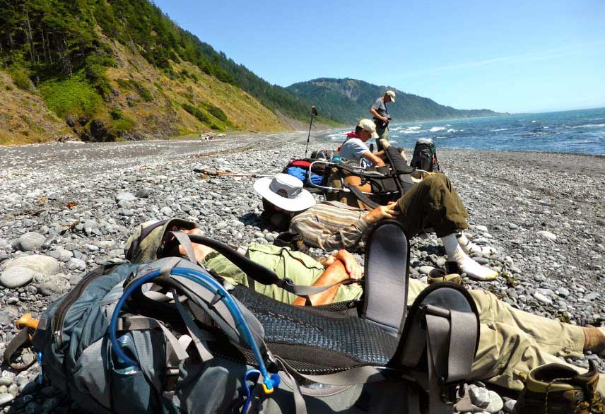
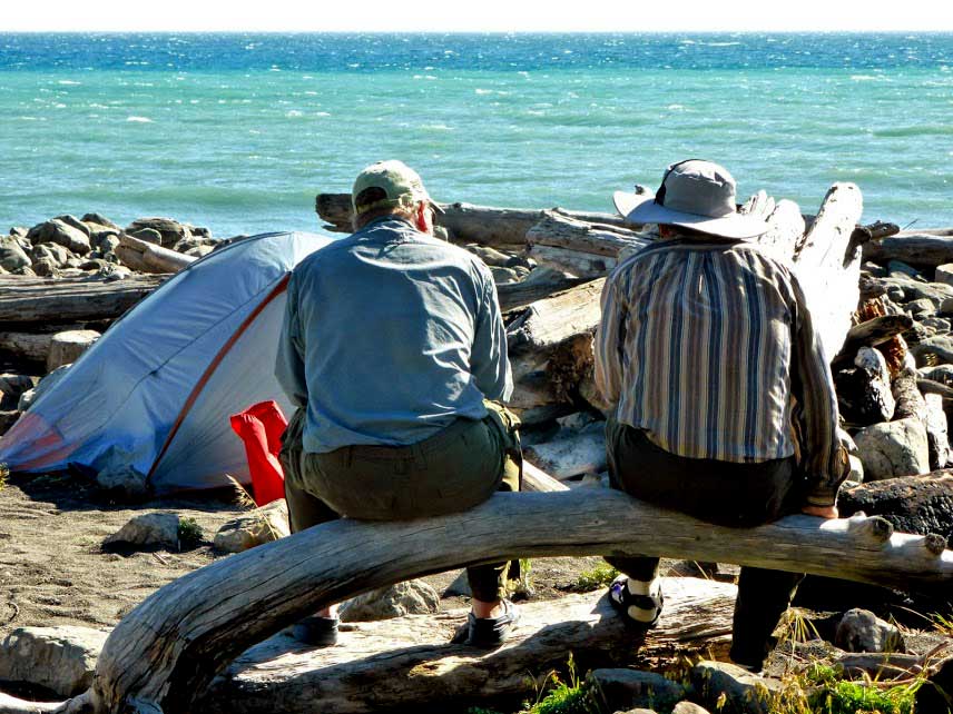
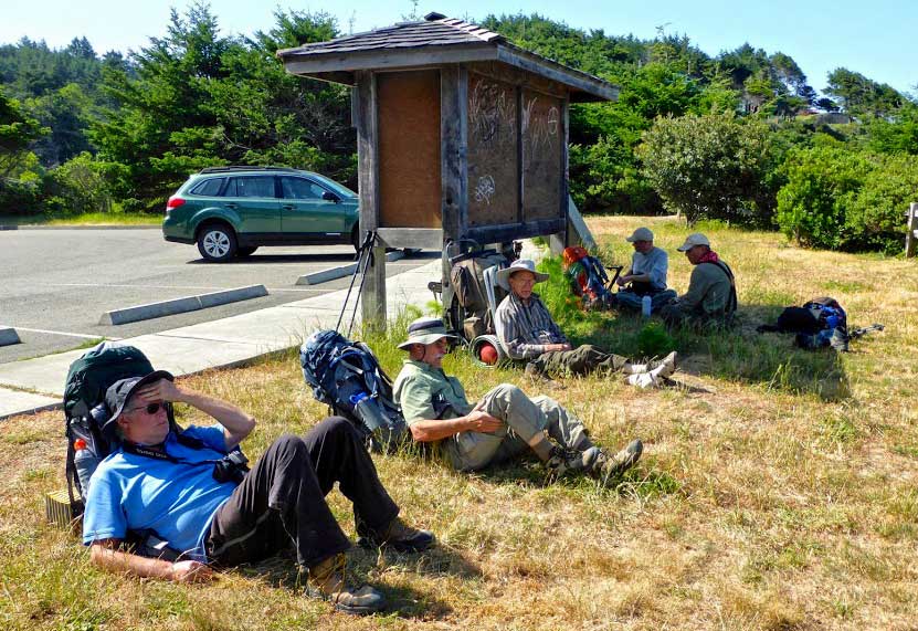
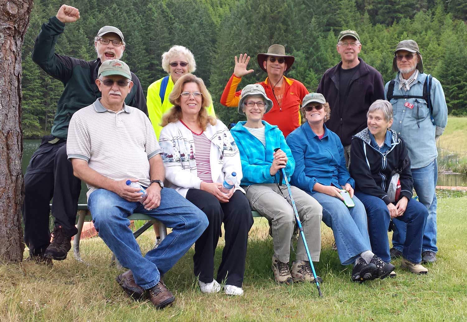
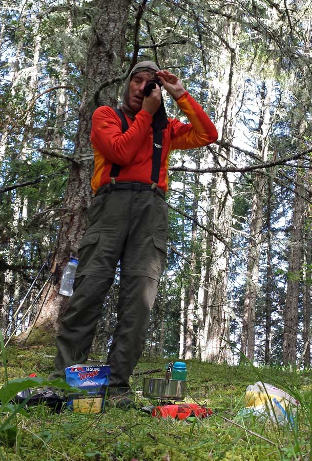
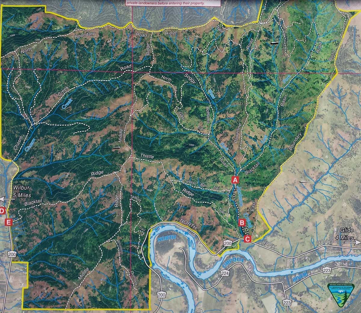